


|
Getting your Trinity Audio player ready...
|
Boulder, Colorado: a hub for outdoor enthusiasts. With world-class activities like rock climbing, biking, hiking, and skiing, it’s the ultimate adventure destination. No wonder it’s been hailed as a top place to live and visit.

Overview:
Elevation 5,328 feet, Population 106,567
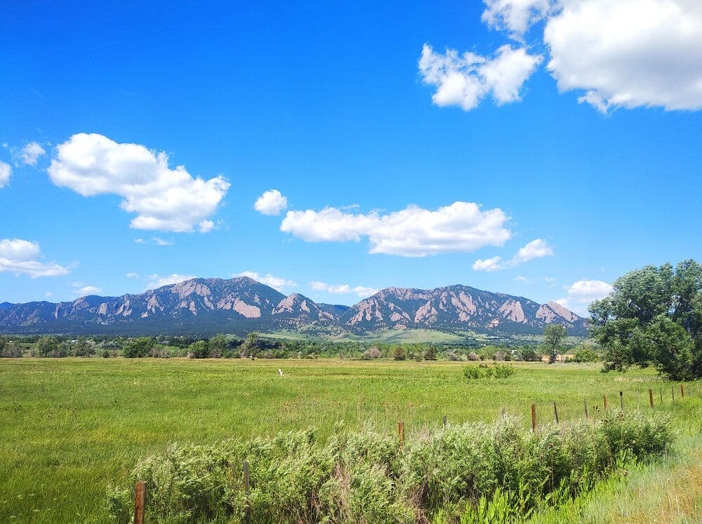
The Rocky Mountains are massive. A fairly obvious statement, but one hewn with more gravitas when you consider the following: the mountain chain is 3000 Miles Long, extending from New Mexico all the way up to northern British Columbia, Canada. Along the way, it passes through six states and two provinces before ceding its mighty geographic dominance to lesser features. Within the range, enough adventure exists to last multiple lifetimes. In fact, if you look at the entirety of the range, it can be fairly daunting. How do you even begin to dissect what the Rockies can provide? The key is to focus on a specific area, a place to dip your toes into opportunity before becoming overwhelmed by it. Boulder, Colorado, is one of those places.
It’s hard to mention Boulder, Colorado, in conversation without someone levying an opinion. Millions have heard of the Front Range city. Boulder has been on every list imaginable, from top adventure town, to best place to live, to best college town. If world-class rock climbing, mountain biking, city biking, creek floating, trail hiking, alpine scrambling, backpacking, backcountry skiing, and mountaineering are words that pump your outdoor adventure heart, then Boulder is where you want to be.
Still unsure? Here are some more points to consider.
- 39,554 acres of publicly accessible open space
- Thousands of rock-climbing routes in iconic locations like the Flatirons and Boulder Canyon
- Extensive regional bike network with 96 miles of bike lanes, 84 miles of multi-use paths, 50 miles of designated bike routes, and 80 pedestrian and bike underpasses to minimize dangerous road crossings
- Boulder Creek for floating through town
- Five, trail-connected peaks frame the city (Mt. Sanitas, Mt. Flagstaff, Green Mt., Bear Pk., and South Boulder Pk.)
- Yearly temperature averages between 22-87 degrees Fahrenheit
- 300 days of Sunshine a year
- Only 45 minutes to Brainard Lake Recreation Area, which provides paved access to the alpine in summer and is the best launch point for gnarly backcountry lines in the winter
- 45 minutes to the Indian Peaks Wilderness, containing endless backcountry opportunities
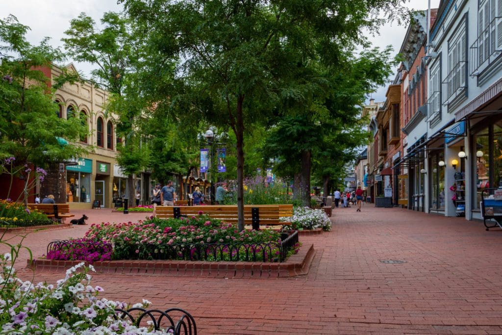
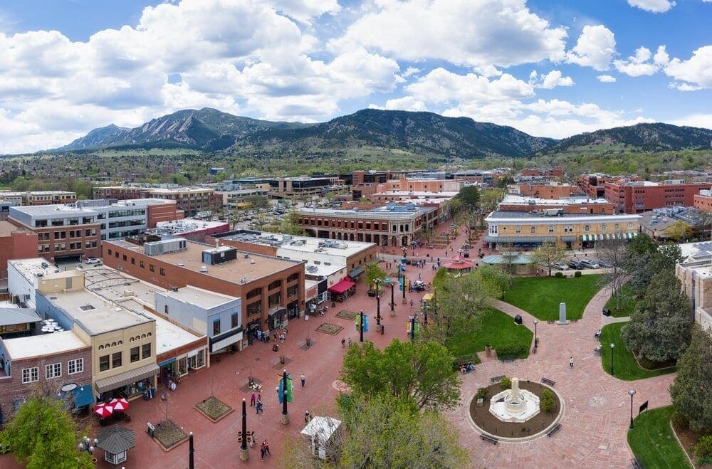
Pearl Street Mall, Boulder Colorado.
Local Adventure Vibe
Let’s dive in; Boulder is a defiant city. Located only 45 minutes from Denver, the city bought and conserved a ring of land around it to block the suburbs from creeping in. It would rather be defined by the outdoors than its proximity to metropolitan areas. The city is also mega-health-conscious and routinely ranks among the top five healthiest places to live in the US, with an average obesity rate of 12.4%. Some of the more iconic events in Boulder include Bolder Boulder, a yearly 10k race that attracts thousands, Boulder Creek Festival (centered on the eponymous creek threading through downtown), Tube to Work Day, where people dress up in work clothes, hop in a tube and float to work on the creek, Boulder Craft Beer Fest (Colorado LOVES craft beer, and Boulder has dozens of tasty breweries to get acquainted with), Frozen Dead Guy Days (not technically in Boulder, but only a half-hour away in Ned) and much more. With Eldora Ski Resort just up the canyon, Boulder is truly a four-season playground. A great way to tap into the local vibe is to join an adventure group; here’s a list of a few options thanks to RootsRated.
Uniquely Boulder
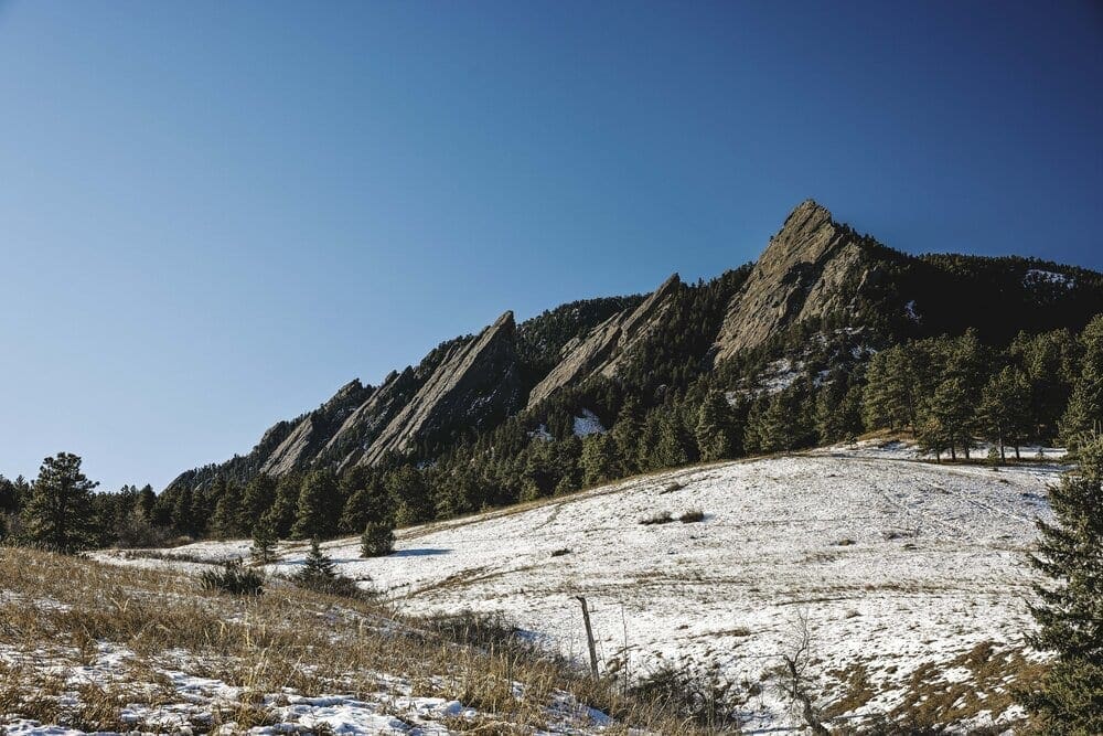
Sunrise hits the Flatirons and Bear Mountain near Boulder, Colorado
Like many unique places, Boulder benefits from a superb location. To the East, rolling grasslands for thousands of miles; to the West, the abrupt and dramatic Front Range of the Rocky Mountains. Nestled at the base of the mountains, the options for outdoor recreation around Boulder are nearly limitless. Additionally, with a large metropolis and international airport nearby, Boulder is not only a perfect adventure gateway, but it’s also easy to get to.
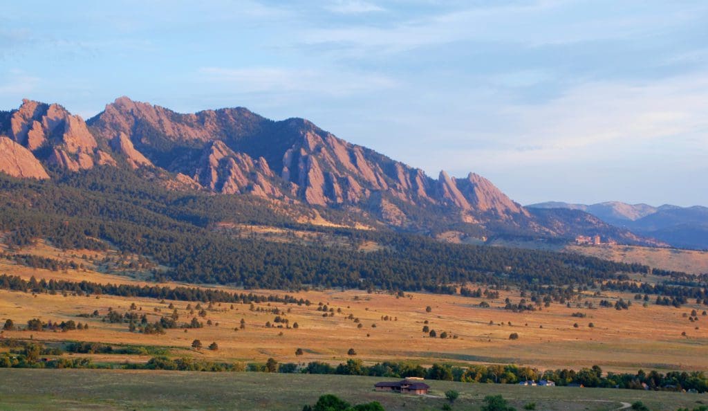
The city’s most unique natural features are the Flatirons: numerous slanted rock protrusions jutting out from the mountains behind them. Five of the most dramatic slabs are numbered, though dozens of other named slabs exist alongside them. These world-famous rocks contain thousands of climbing routes and are far and away the most identifiable symbols of Boulder.
Another unique locational factor not commonly associated with Boulder is glaciers. The state has roughly a dozen glacial remnants, and the largest ones are just west of town. In fact, if you take a drive west down Arapahoe Avenue, you can see the largest remaining glacier in the state, cradled in a high cirque between North and South Arapaho Peaks. The glacier itself is part of the Boulder watershed, meaning tap water in the city comes partially from glaciers.
Arapaho Glacier, along the route to South Arapaho Peak.
While Boulder is most commonly identified as a rock-climbing mecca, the outdoor fun extends far beyond local crags. Within an hour of downtown, there are unique and challenging 4WD trails, mountain bike trails, launch points for paragliding, resort skiing options, backcountry skiing options, alpine scrambling options, and ample backpacking possibilities. Thanks in part to the college students at CU (Colorado University), the city is also young, with an average age of 28.7 years. Boulder’s youthful adventure attitude, health-conscious population, and access to outdoor opportunities make it a unique, top-tier adventure town.
Food and Drink
Boulder has great food options for any occasion.
- Hankering for some brunch? Check out Snooze or Tangerine.
- Burger on the brain? Mountain Sun (they only accept cash but have ATMs on-site).
- Pizza? Boss Lady.
- Classy? Try the Flagstaff House, SALT, Brasserie Ten Ten, and Mateo.
- Looking for ambiance? Rosetta Hall, Avanti, and Rio Grande all have great atmospheres and rooftop seating.
- Java? Head over to Boxcar Coffee Roasters, OZO, or Alpine Modern.
- Beer? Upslope, Avery, and Sanitas Brewing. Whatever your craving, Boulder provides.
Best Places to Stay
From rustic campgrounds to five-star hotels, Boulder meets all accommodation needs. Some of the more well-known places include the Hotel Boulderado, St. Julien Hotel and Spa, Briar Rose Bed and Breakfast, and Basecamp Boulder. Here’s a more complete list.
Campgrounds and Dispersed Camping:
As a general rule, options increase the further west you travel.
Gross Reservoir/Winiger Ridge. This fun campground is located on the west side of Gross Reservoir, accessible via Magnolia Road. Being close to the city, the campground does attract college students and can be loud on occasion.
Rainbow Lake Campground and West Magnolia Campground. Both campgrounds are near the town of Nederland, which is located at the top of Boulder Canyon, 15 miles west of Boulder.
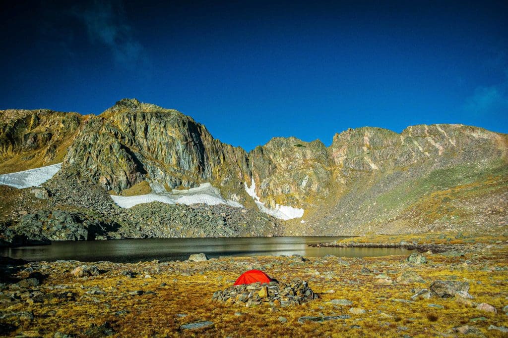
Brainard Lake Recreation Area. Pawnee Campground at Brainard Lake Recreation Area has excellent sites in a wonderful alpine setting. Make sure to book a site ahead of time as they are popular, and please abide by local fire ordinances.
Activities
Rock Climbing:
- The Flatirons: It should come as no surprise that Boulder excels in the rock-climbing world. The Flatirons contain more than 1000 routes ranging from calm 5.0’s to spicy 5.14’s. Additionally, many bouldering routes checker the area as well. The Flatirons are broken down into three classic sections (North, Central, South) and the Sacred Cliffs (a series of rocky points along the summit ridge of Green Mountain). Well-documented and full of fun challenges, the Flatirons continue to inspire year after year.
- Boulder Canyon: Connecting Boulder to Nederland, the Canyon is a 13-mile gash in the front range with ample climbing opportunities. With over 1700 known routes along its stretch, be prepared for an enormous variety of options. Classic areas include Animal World, Castle Rock, and the Dome.
- El Dorado Canyon State Park: Just south of Boulder proper, Eldorado Canyon has hundreds of routes, including many on the iconic Redgarden Wall and the Bastille.
**Warning. Because of close proximity to urban areas, rock climbing routes in Boulder get VERY crowded very quickly on weekends. Leave early and head for climbs that are a bit off the beaten path if you want space to while out. Otherwise, be prepared to share.
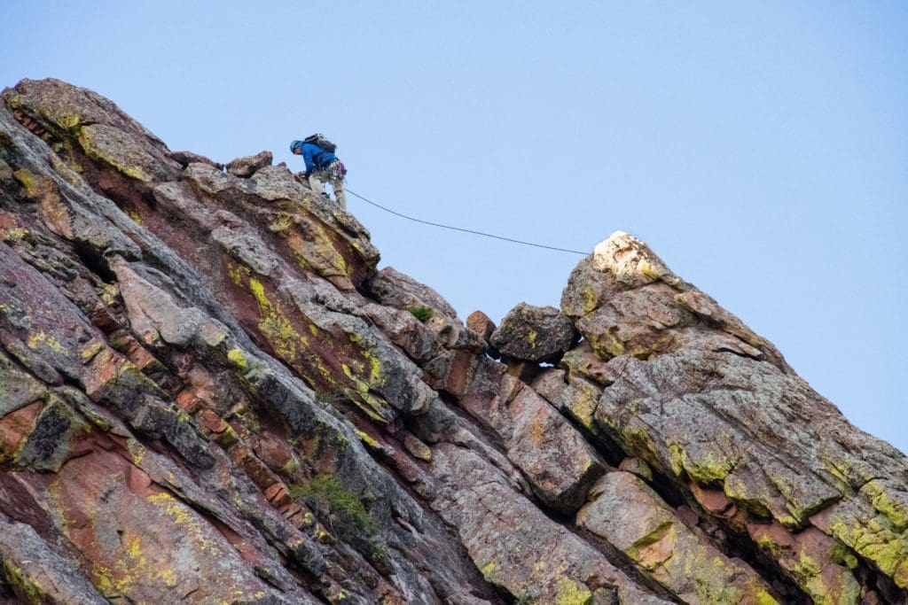
Person climbing up a tall multicolored rock face in Boulder, Colorado.
Guided Rock-Climbing Adventures:
While adventure exists in abundance around Boulder, the outdoor recreation world has some big barriers to entry. This is especially true for rock climbing. Between the exorbitant cost of getting the right gear, the overwhelming set of route options, and the limitations of work, school, and life, it can be hard to commit to an adventure mindset. 57 Hours is here to help. Named for the number of hours between 3 PM Friday and midnight Sunday, 57 Hours makes it easy to own your weekend, connecting you to experienced local guides and untapped adventure potential.
If you’re ready to get into the Boulder rock-climbing world but don’t know where to start, 57 Hours has you covered, offering guided trips to the three iconic destinations listed above: The Flatirons, Eldorado Canyon State Park, and Boulder Canyon. Each trip can launch with a minimum of one participant at any ability level and a starting price of $160. Combining excellent guides and stellar locations, 57 Hours will have you falling in love with Boulder climbing in no time.
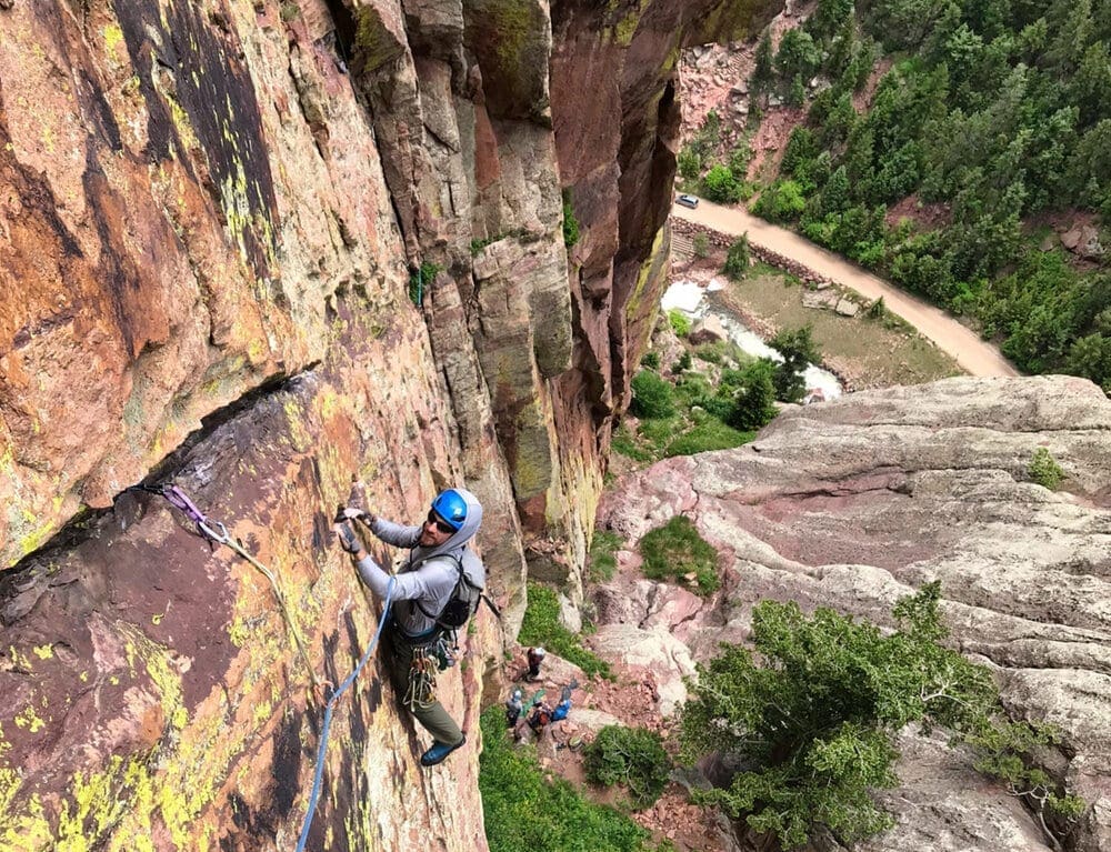
Eldorado Canyon State Park has hundreds of climbing routes including many on the iconic Redgarden Wall and the Bastille.
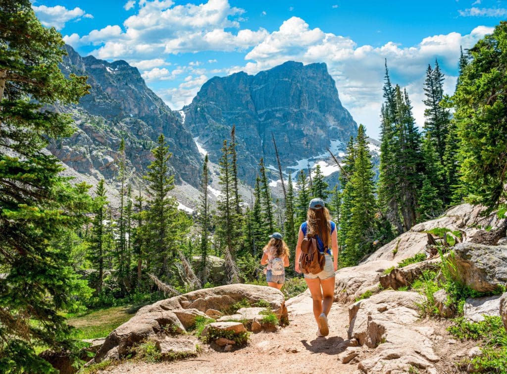
Hiking/Backpacking:
- Boulder Five Peaks Area: Creating a wall against the Boulder skyline are five mountains that make excellent individual hikes or one massive undertaking. From North to South, they are Sanitas, Flagstaff, Green Mountain, Bear Peak, and South Boulder Peak. There are NUMEROUS access points, but the most popular are Gregory Canyon Trailhead, along Flagstaff Mt. Road (potential parking fees), Centennial Trailhead, NCAR trailhead, and South Mesa Trailhead (has a parking fee).
-
- Best of the area: Bear Peak. It is the toughest but also the most rewarding of all five. The top is rocky and bald, requiring a brief, exciting scramble to attain the highest point. Be warned, no matter what way you approach Bear Peak, you’ll be hiking up 2800-3000 feet of elevation.
- EXTRA CREDIT: The Boulder Five Peak Challenge, which you can start from either north (harder) or south (easier). It’s 15.6 miles and a gut-punching 6294 ft of elevation gain, touching all Five Summits along its route. The challenge is a Boulder specialty but requires car positioning, or you’ll have to double the mileage back to your car.
- Hessie Trailhead and 4th of July trailhead. These areas can be combined because they both exist off the same dirt road. Hessie Trailhead is plowed, so access to winter recreation exists, but like its seasonal neighbor further up the road, is INCREDIBLY popular. If you’re going on a weekend, get there before 7 AM. Fourth of July Trailhead opens when the snow melts, usually in July, and stays open until the snow closes it (usually October/November). Both areas provide access to the Continental Divide with easy-to-follow trails and BIG views. As you will be hiking up into the alpine, make sure to bring plenty of water and sunscreen, and familiarize yourself with the signs of altitude sickness. The best times to hike are in September and early October before the snow closes the roads and after summer tourists leave.
Lake Dorothy at Arapaho Pass Colorado.
-
- Best of the Area: the Arapaho Pass Trail, which leads up to the Continental Divide from the Fourth of July trailhead and is the centerpiece in a broad network of trails and summit routes for the intrepid adventurer. Not overly long, the trail spits you out into the alpine with views in every direction and takes you past an old abandoned mine along the way.
- EXTRA CREDIT: Continue beyond Arapaho Pass to Lake Dorothy, which, at over 12,000 feet, is the highest lake in the Indian Peaks wilderness. Still not satisfied? Try heading towards Caribou Pass on the western side of the divide, where you can either head down to Columbine Lake or up a ridge to your right called Satanta. The view north toward Wheeler Basin, Lost Lakes, and Navajo Peak is jaw-dropping.
Hiker on the Arapaho Pass Trail, Boulder County, Colorado.
- Brainard Lake Recreation Area: In the summer, the recreation area provides paved access to the high country, but it costs 12$ to get in. Free parking can be found at Brainard Gateway Trailhead, but it adds a total of five miles roundtrip to any adventure. The price of admission is worth it, however, as the area always impresses. Here, you can cozy up to a dozen alpine lakes, attain tall summits and even walk on Isabelle Glacier.
-
- Best of the Area: Lake Isabelle and Isabelle Glacier. This hike checks many boxes, including stunning alpine vistas, two alpine lakes, and the ability to walk on one of the few glaciers left in Colorado.
- EXTRA CREDIT: Audubon. A lot of the taller peaks in the Indian Peaks require serious alpine scrambling to obtain, which is why Mt. Audubon is such a nice alternative. The mountain breaks 13,000 feet and has a trail almost all the way up to the summit. The last part requires a little bit of talus scrambling but nothing serious. From the top, enjoy unobstructed views of the Indian Peaks and Longs Peak. For the spirited, a ridge connects Audubon to Paiute Peak, though the summit of Paiute requires Class 3 scrambling, which necessitates all four appendages working in tandem. Choose your own adventure but understand that the alpine is far from medical help; plan accordingly.
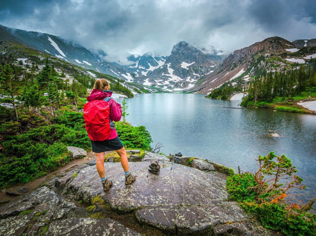
Backpacker looks at Lake Isabelle Brainard Lake Recreation Area in Colorado.
Backcountry Skiing:
Boulder’s position at the base of the mountains means you need to head a bit west to find the best ski lines. Not to worry, the following areas and runs are close by and easy to find. If you go out to ski in the Colorado backcountry, make it a habit to check avalanche conditions with the CAIC, it could save your life.
- St. Vrain Mountain. Tucked away near the tiny town of Allenspark and just south of Rocky Mountain National Park, St. Vrain Mountain offers a great set of runs for the avalanche-wary beginner. Most of the ascent is on an old forest service road with minimal steep bits, and the top is a gentle face poking its head above the tree line. The simplest descent option retraces your ascent route. Warning; the wind can be ferocious up here, so check wind forecasts before heading out. Overall, a great beginner experience with lots of elevation to ski down. Best skied in mid to late spring.
- Pawnee Pass Area/Brainard. Pawnee Pass is a high-elevation break in the Indian Peaks; it is accessible via Brainard Lake Recreation Area, which is plowed to the Brainard Gateway Trailhead in winter. There is a 2.5-mile road section before the official trail begins but when covered in snow, makes for a pleasant skin. The area includes ski descents off the top of Pawnee Peak, Shoshoni Pk. and a set of couloirs between the two known as Pawshoni. Choose your adventure; the longer lines offer more than 2,000 feet of vertical descent.
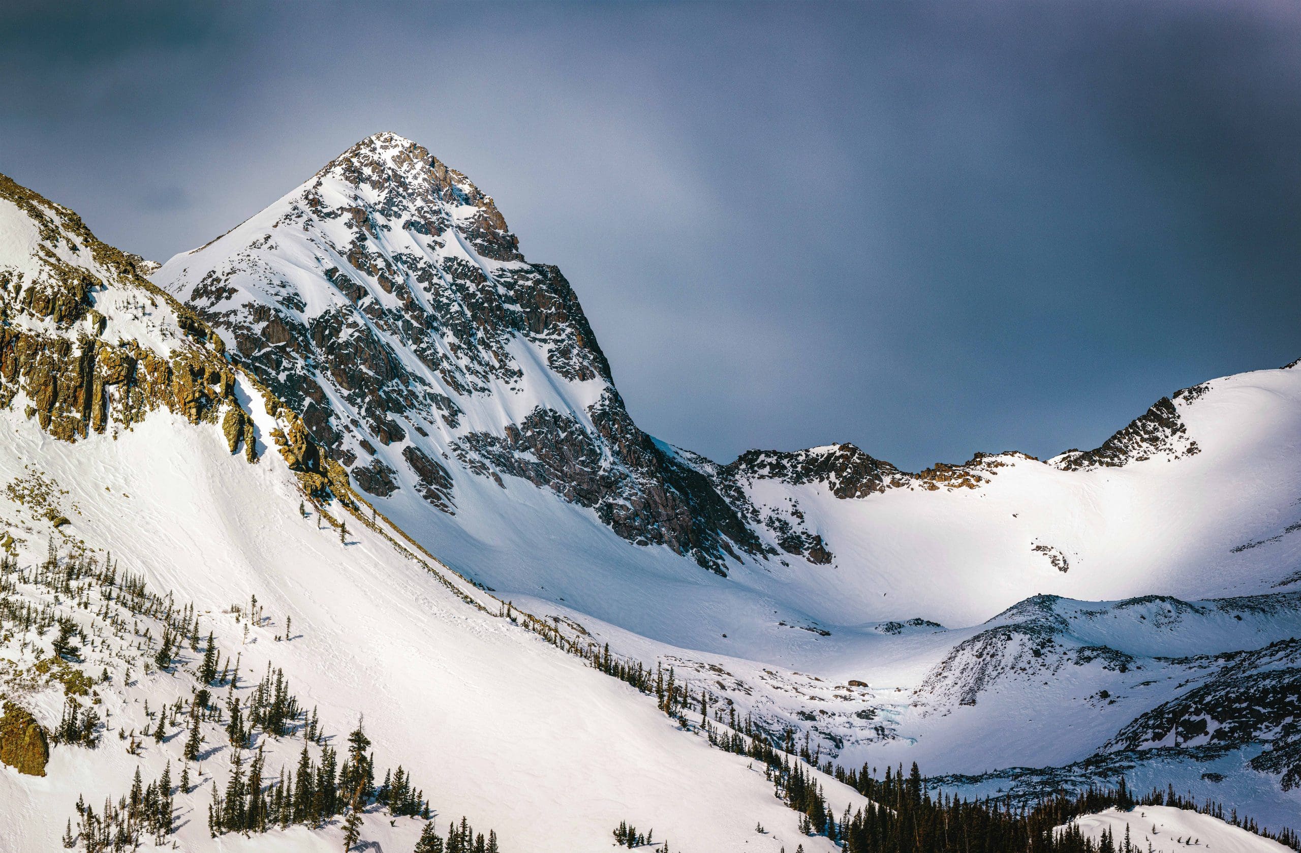
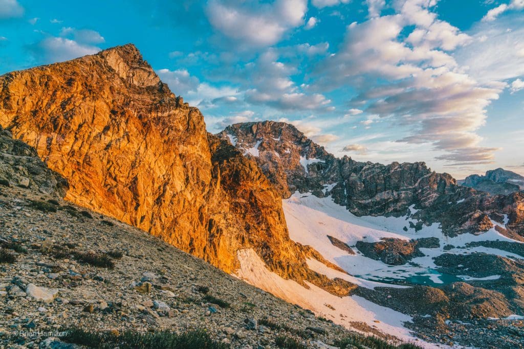
Mount Toll in the snow.
- Mt. Toll Area/Brainard: Toll is a beautiful and stately peak also accessible via Brainard Lake Recreation Area, just one basin to the north of Pawnee Pass. In this basin, there are tough ski lines down the sides of Mt. Audubon, Paiute Peak, Little Pawnee, and Toll. Mt. Toll is arguably the most famous, with a steep and beautiful descent right from the summit that can take a skier all the way back to Lake Mitchell for more than 2,000 feet of vertical descent. Additionally, the snow holds longer on Mt. Toll than on neighboring peaks, offering some fun all the way into summer.
-
- Extra Credit: Queens Way Couloir
- This is one of the more unique skiing experiences around Boulder. Located one basin south of Pawnee Pass and sharing the approach of the summer hike to the Isabelle Glacier, Queens Way is a beautiful and demanding backcountry adventure. The tradeoff for miles earned is a descent off of 13,400-foot Mt. Apache into a wide 35-degree Couloir (The Queens Way) and down off the edge of Isabelle Glacier. The line is best observed from the top of neighboring Mt. Shoshoni. Queens Way holds snow much longer than other areas, so you can usually find some turns through mid-July if you hunt for them.
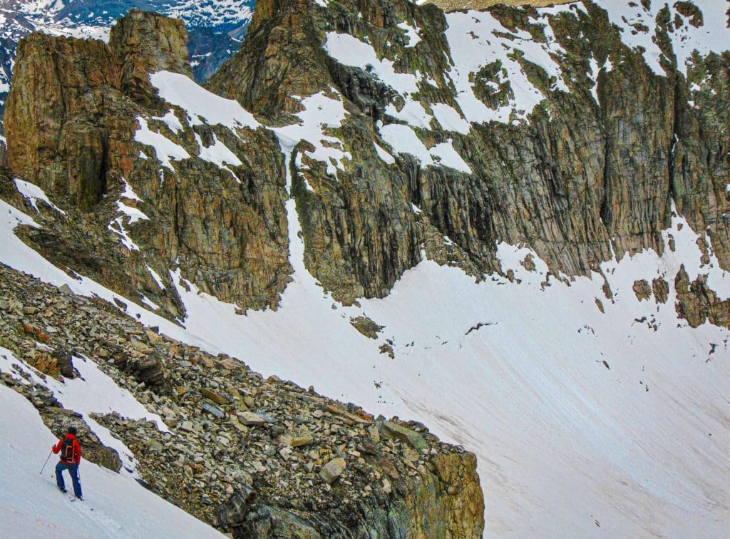
A backcountry skier contemplating their next turns down Queensway Couloir in the Brainard Lake Area.
Trail Running:
The wonderful thing about trail running is that you can do it on hiking trails and many 4WD roads. In fact, Switzerland Trail, Mt. Audubon, the Boulder Five Peak Challenge, and Arapaho Pass are all excellent trail running areas. In addition to those, the three places below highlight the variety of options available for the inspired trail runner.
- Walker Ranch Loop with Myers Homestead Extension. Located off of Flagstaff Mountain Road and on the way to Gross Reservoir, Walker Ranch is an excellent trail-running option close to town. The entire loop is a little longer than seven miles but is served by three separate trailheads and connects to the Myers Homestead trail, which can add another five miles. This is a very popular area with day hikers, nature lovers, fly fishermen, and college kids, so get out early and try for weekdays.
- Arapaho Glacier Trail. This thumper of a trail is an out-and-back that can either start at the 4th of July Trailhead (easier) or the Rainbow Lakes trailhead (harder). Appropriately named, the trail ascends a long ridge with fantastic views of Arapaho Glacier. If starting from Rainbow Lakes Trailhead, the trail is 7.9 miles one way and climbs nearly 2,800 feet before descending down to meet the Arapaho Pass Trail.
- High Lonesome Loop. This decadent loop is located off of Hessie Trailhead and attacks the Continental Divide. Clocking in at 15.7 miles and with a total elevation gain/loss of 6200 feet, this trail will challenge and inspire. Along the route, you’ll pass three alpine lakes, spend three miles atop the Continental Divide with expansive views in all directions, and pass the iconic Devil’s Thumb rock formation. As briefly touched upon before, the trailhead is very popular on summer weekends; get there super early or on weekdays if possible.
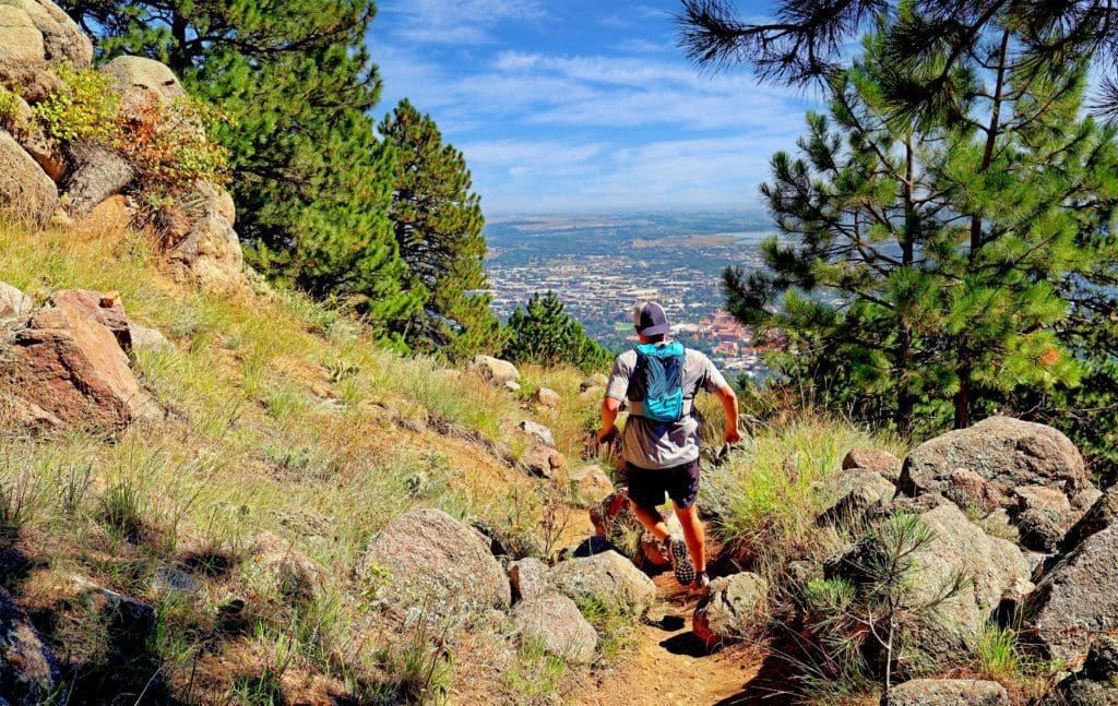
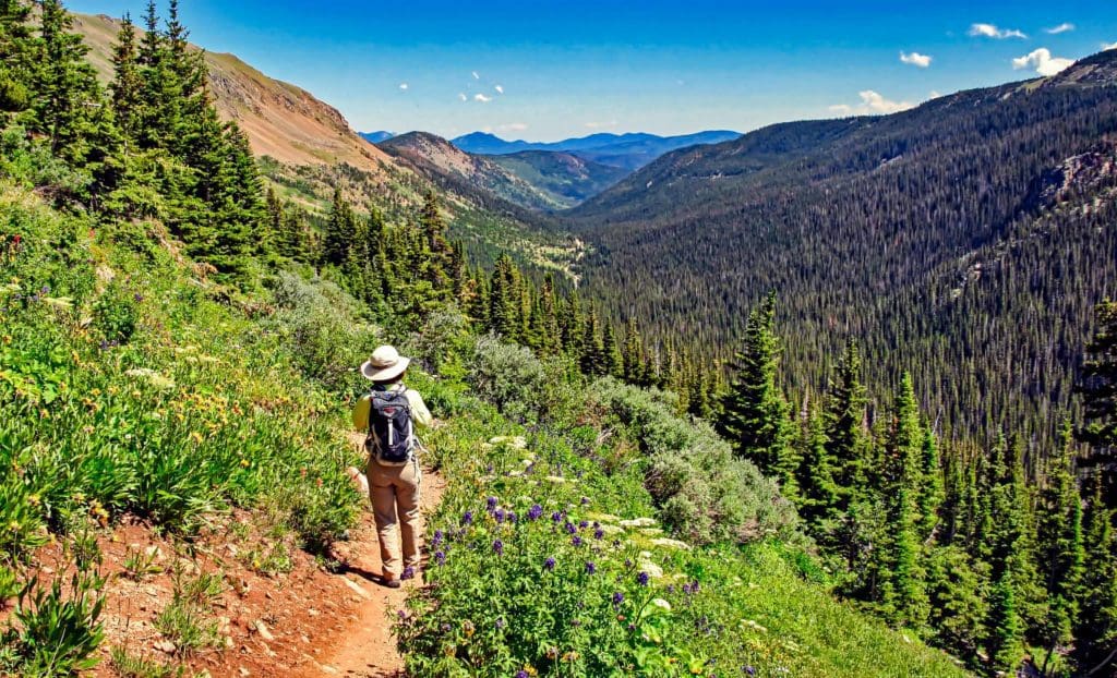
A trail runner jogs down a path on Flagstaff Mountain near Boulder, Colorado.
4WD Touring/Overlanding:
- Switzerland Trail. Just west of Boulder, Switzerland Trail is a 14-mile dirt road offering fantastic scenery, excellent pull-offs, old historic sites, and backcountry camping areas. Easily accessible from many places, the trail is the best introduction to 4WD Touring in the Boulder area. From it, you can also hike Sugarloaf Mt., which provides stunning views of the front range for only 0.7 miles of effort. Additionally, there are many non-maintained, deeply rutted, and very steep forest service roads intersecting Switzerland Trail, like Pennsylvania Gulch, for those who want to take the adventure up a notch.
- County Road 68J. This fun county road ties Flagstaff Mountain Road to Magnolia Gulch and is only 20 minutes from the center of Boulder. It is a point-to-point with no suitable turnaround areas, so treat it like a through drive. The road also borders a lot of private property; please be respectful. All in all, a short but fun trail to get into the off-roading mood. It’s usually driven East to West, though both directions can work. The one technical portion is on the eastern side of the height of land.
- Middle St. Vrain Road. This gnarly 4WD road can be combined with Coney Flats for a 15-mile adventure. The biggest obstacle is a deep river crossing that is impassable in late spring due to snow runoff but should be exciting and manageable by mid-summer in a high-clearance 4WD vehicle. Because of the difficulty of the trail, the road also serves as an often-overlooked trailhead to isolated peaks, alpine lakes, and the beautiful St. Vrain Glaciers.
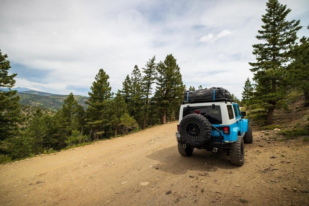
Skyblue Overland on the Switzerland Trail, just west of Boulder, Colorado.
Mountain Biking:
- Betasso Preserve: This intermediate option is close to town and ties two loops together (Canyon and Benjamin) for a total of nearly 7.5 miles. Flowy and fun to ride, Betasso is quite popular. Keep in mind, Mountain Bikes are not allowed on Wednesdays or Saturdays, and the loops are directional. Please follow the signs.
- Dirty Bismark: Just south of Boulder proper, this loop offers a fun, longer ride with stellar views back to the Flatirons. Clocking in at over 15 miles, the ride can also be lengthened with Dowdy Draw, South Mesa and Spring Brook connector trails. The network in this area has a lot of variety but not a lot of tree cover; bring sunscreen.
- Walker Ranch: Making its second appearance, Walker Ranch is a difficult but rewarding loop with two big climbs and two long descents. There are some small technical bits and a walking section down a set of steep stairs, but the ride is a classic Boulder adventure and worth the effort.
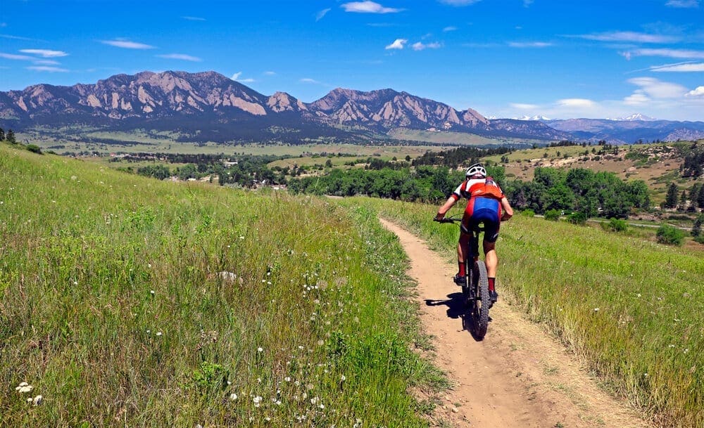
The Dirty Bismark trail is a classic Boulder mountain bike ride with stellar views of the Flatirons.
Rocky Mountain National Park:
If those adventures weren’t enough and you don’t mind traveling a bit more, Boulder is about an hour from the edge of Rocky Mountain National Park. This brilliant mountain park is loaded with adventures! Fees and passes apply, visit the official site here, to figure out what you’ll need.
- Best Hiking Trails
- Best Alpine Scrambles
- Best Lakes
- Best Waterfalls
- Backcountry Skiing: Bear Lake Area, Hidden Valley, Never Summers/Mummy Range, Longs Peak Area
- Mixed Climbing (scrambling and snow climbing): Hallett Peak’s East Ridge
People hiking on Emerald Lake Trail in Rocky Mountain National Park.
Adventure Awaits
While the sheer abundance of outdoor adventures in the Rockies can be intimidating, Boulder manages to distill them down into a manageable load. Whether you’re here for 57 hours or quite a bit longer, the options in this Front-Range adventure city are worth getting after all year long.

Enroll With Global Rescue Prior To Embarking On Your Next Adventure.
When a travel emergency arises, traditional travel insurance may not come to your aid, and a medical evacuation can cost up to $300,000.
The cost when you have a Global Rescue membership? $0. That’s why when the unexpected happens, you want the leader in rescue, evacuation and medical advisory behind you. You want Global Rescue.
Terms of Use: As with each guide published on SKYBLUEOVERLAND.com, should you choose to these routes, do so at your own risk. Prior to setting out check current local weather, conditions, and land/road closures. While taking a trail, obey all public and private land use restrictions and rules, carry proper safety and navigational equipment, and of course, follow the #leavenotrace guidelines. The information found herein is simply a planning resource to be used as a point of inspiration in conjunction with your own due-diligence. In spite of the fact that this route, associated GPS track (GPX and maps), and all route guidelines were prepared under diligent research by the specified contributor and/or contributors, the accuracy of such and judgement of the author is not guaranteed. SKYBLUE OVERLAND LLC, its partners, associates, and contributors are in no way liable for personal injury, damage to personal property, or any other such situation that might happen to individuals following this route.


