


|
Getting your Trinity Audio player ready...
|
Explore stunning alpine lakes on these top trails in Colorado’s Rocky Mountain National Park. From leisurely strolls to challenging hikes, there’s something for every adventurer. Check trail conditions and park alerts before embarking on your journey.
Rocky Mountain National Park sits in northern central Colorado, just outside the city of Estes Park. Featuring rugged terrain, alpine lakes, a scenic highway, and seemingly countless hikes and rock-climbing routes. Here are 23 amazing alpine lakes spanning the four corners of the park.
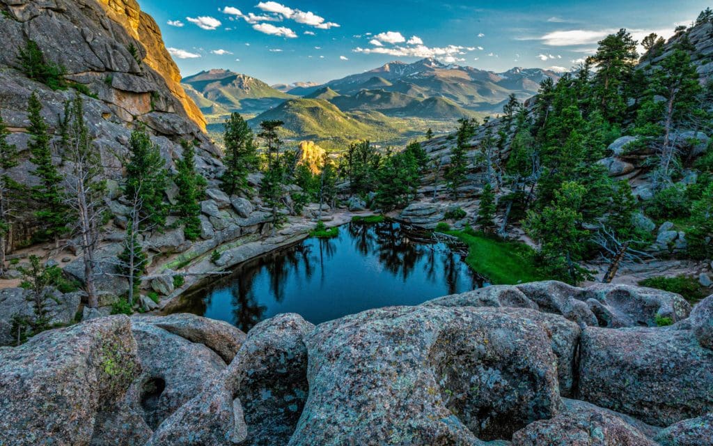
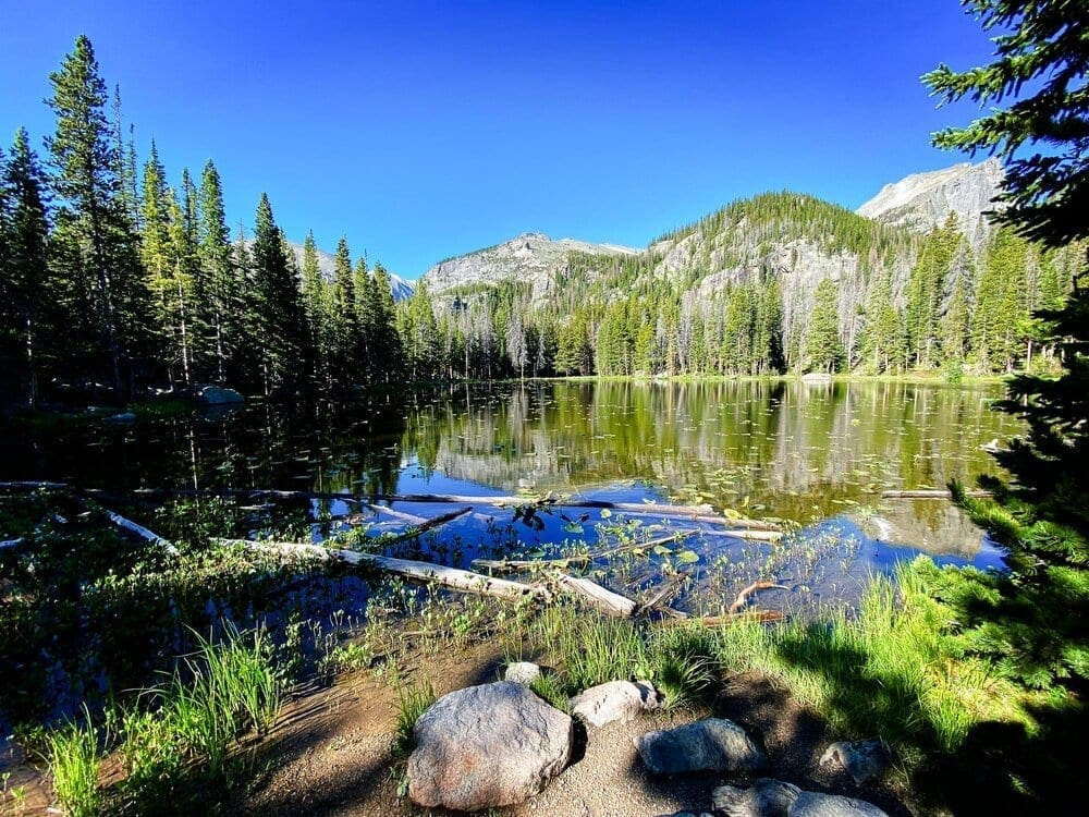
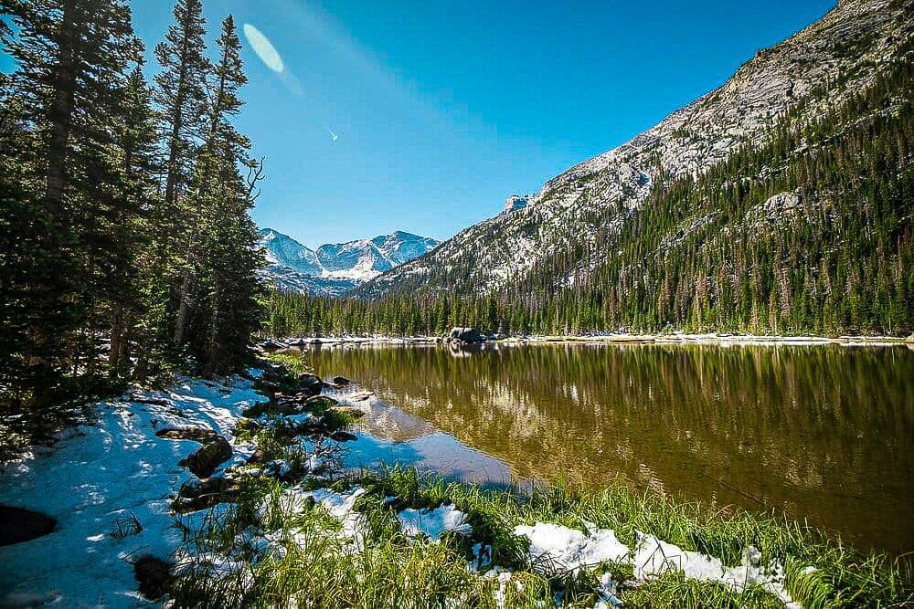
Bear Lake (Easy)
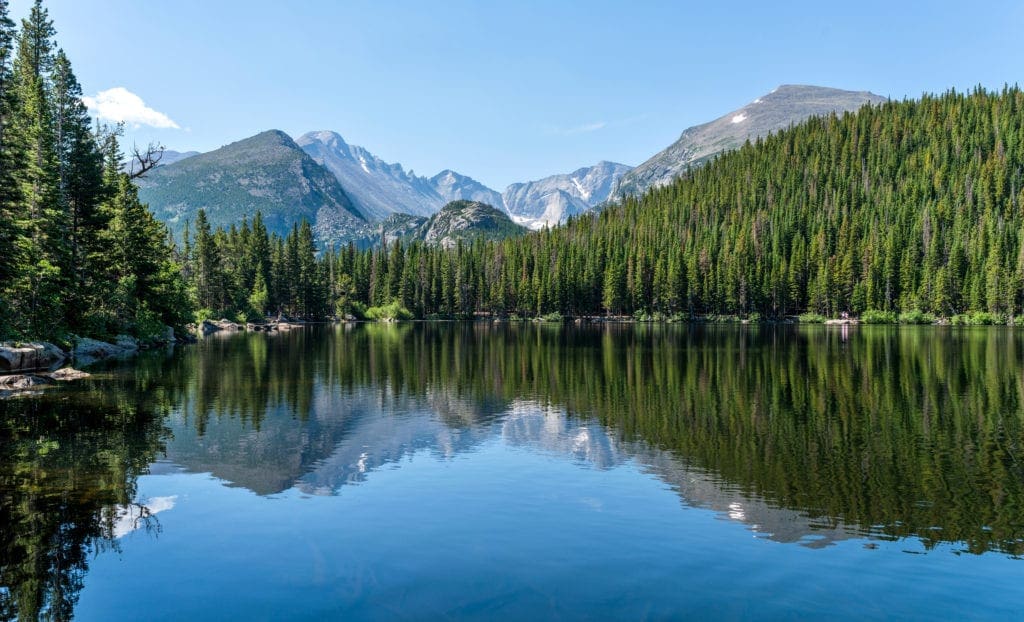
Wonderful views of Longs Peak and Glacier Gorge reflecting in blue Bear Lake on a calm Summer morning, Rocky Mountain National Park, Colorado.
At a Glance: 0.8 mile loop, +49 feet elevation gain.
What makes it special: Bear Lake is one of my absolute favorite, easy hikes! The lake and scenery is just stunning. Bear Lake Nature Trail is just a beautiful, tranquil hike. It is a very easy 0.8 mile loop trail located in Rocky Mountain National Park near Estes Park, Colorado. This nature trail features a lake and spectacular views of the surrounding mountains. It is a good hike for all skill levels and is even wheelchair accessible. The Bear Lake Trail is the a perfect hike for everyone.
Sprague Lake (Easy)
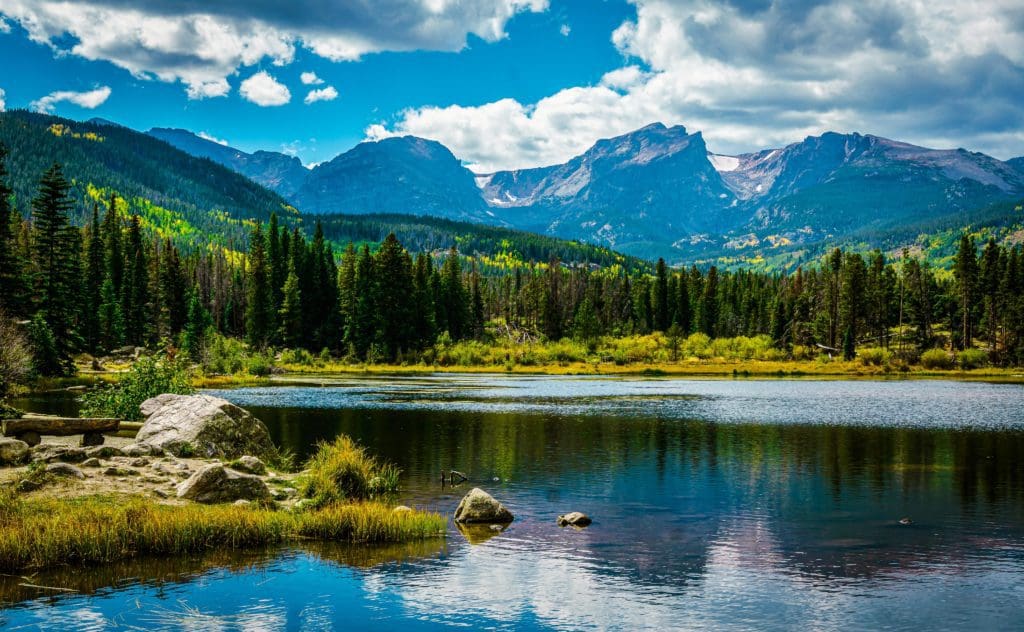
Sprague Lake in Rocky Mountain National Park, Colorado
At a Glance: 0.8 mile loop, +36 feet elevation gain.
What makes it special: Sprague Lake is another awesome, easy hike in Rocky Mountain National Park near Estes Park, Colorado. This nature trail features a lake and spectacular views of the surrounding mountains, including Half Mountain, Thatchtop Mountain, Taylor Peak, Otis Peak, Hallett Peak, Flattop Mountain and Notchtop Mountain. It is a good hike for all skill levels and is even wheelchair accessible. My favorite time to visit is early in the morning, which provides opportunities for amazing reflections of the mountains on the lake. The Sprague Lake Trail is the a perfect hike for everyone.
Lily Lake (Easy)
Longs Peak and Mount Meeker reflect off Lily Lake in the early September morning sunshine within Rocky Mountain National Park, Colorado.
At a Glance: 0.8 mile loop, +36 feet elevation gain.
What makes it special: Lily Lake is another awesome easy hikes in Rocky Mountain National Park near Estes Park, Colorado. It is a good hike for all skill levels and is even wheelchair accessible. For those who are tackling Estes Cone scramble, you can start at Lily Lake and take a much quieter approach, starting with the hike around Lily Lake. The trailhead provides access to the Storm Pass Trail.
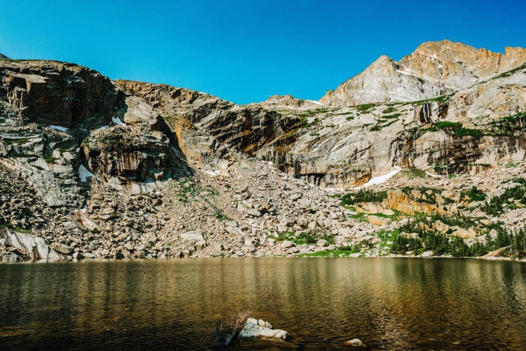
Odessa Lake (Moderate)
Dramatic sky over beautiful Odessa Lake with a stunning view of Notchtop Mountain.
At a Glance: 9 miles roundtrip from Bear Lake, +1900 feet. 9.5 miles roundtrip from Fern Lake Trailhead, +1900 ft.
What makes it special: The view from the shores of Odessa Lake was one of the inspirations for recommending Rocky Mountain as a National Park; it’s simply awesome. With two ways to reach it and a loop hike option to increase the mileage, Odessa is a worthy destination if you’re trying to avoid the Glacier Gorge crowds.
Gem Lake (Moderate)
Weathered rock formations above Gem Lake in Rocky Mountain National Park, Estes Park, Colorado
At a Glance: 3.1 miles out and back from Lumpy Ridge Trailhead, +995 ft.
What makes it special: This moderately difficult trail near Estes Park, Colorado provides views of Estes Park, Mt. Meeker, Longs Peak, and the mountains along the Continental Divide. Gem Lake is found within a huge collection of weathered granite domes near the Lumpy Ridge area. The lake is a shallow pond filled in strictly by trapped snowmelt and rainfall, since it doesn’t have an inlet or outlet stream.
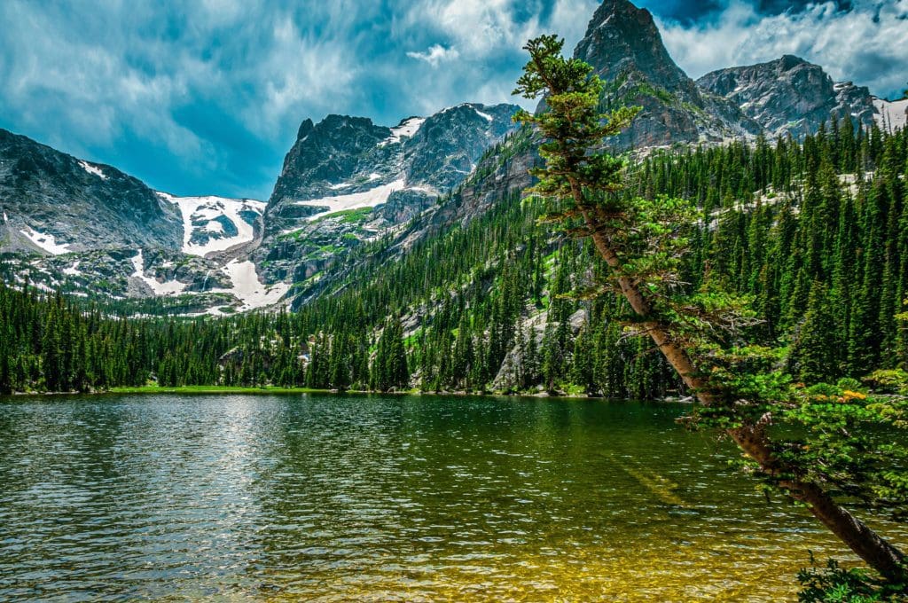
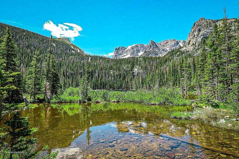
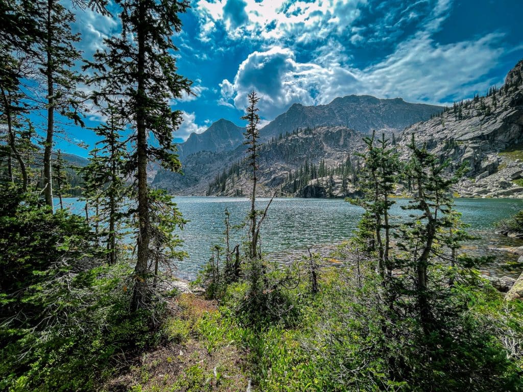
Lake Haiyaha (Moderate)
Lake Haiyaha. Photo by Brian Hamilton on July 5, 2020.
At a Glance: 3.6 miles out and back, moderate hike from the Bear lake Trailhead, +850 ft.
What makes it special: “Haiyaha” is a Native American word that means “rock” or “lake of many rocks”, or “big rocks”, depending on the translation. This trail leads through the appropriately named Chaos Canyon. The Lake Haiyaha Trail features a waterfall and a lake. Don’t get scared off by the big boulders you have to climb to get to the lake. There are lots of steps along the way and incline to make the hike challenging, but manageable. There are some rocks on the path and some really awesome overlooks along the way.
Cub Lake (Moderate)
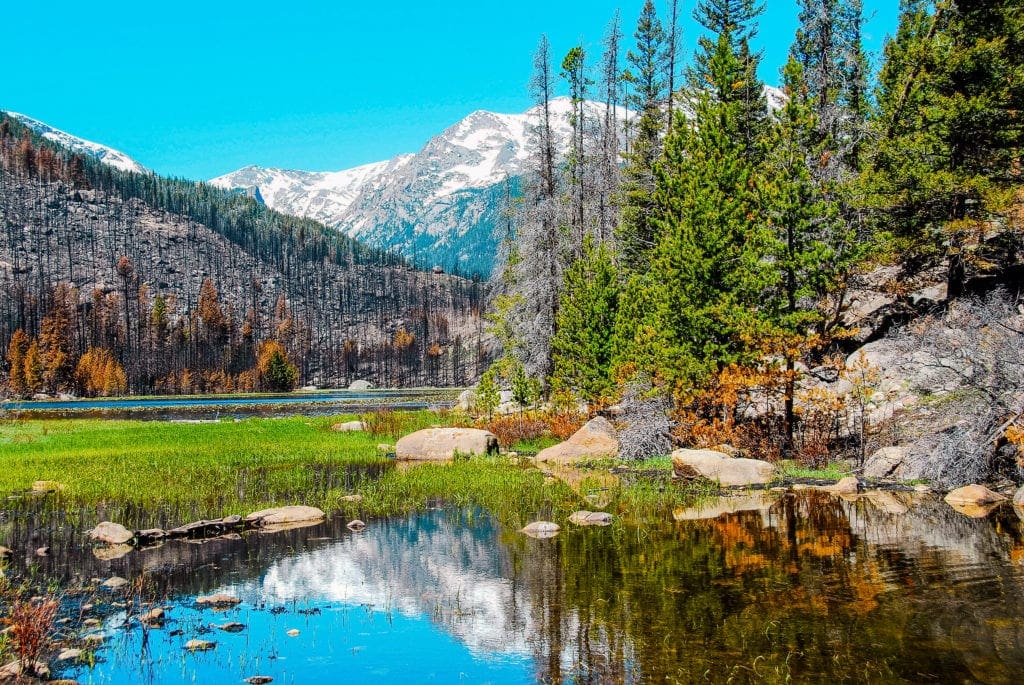
Cub lake, Rocky Mountain National Park.
At a Glance: A 6.4 miles, moderate loop trail from the Cub Lake Trailhead, +630 ft.
What makes it special: Cub Lake Trail Loop is a great hike for those who are looking for a moderate, 3 to 4 hour hike with lots of wildflowers and wildlife. This hike is also an opportunity to see life return and thrive after the devastating Fern Lake Fire in late 2012. Cub Lake has a beautiful pattern of lily pads in it during the summer months.
This hike is a nice opportunity to see wildlife. On June 15, 2020, I saw deer, wild turkey, Wyoming ground squirrel, chipmunks. Other hikers reported seeing a bear near Cub Lake and a few elk in Moraine Park early in the morning. I encountered one hiker with a long telephoto camera lens who reported seeing hummingbirds within the lilies. There were lots of spring wildflowers on the trail too.
Fern Lake Trail (Moderate)
Fern Lake. Photo by Brian Hamilton on June 22, 2020.
At a Glance: A moderately rated, 9 mile out and back trail with an elevation gain of 1,453 feet starting from the Fern Lake Trailhead.
What makes it special: The Fern Lake Trail features several waterfalls and the lake. This well maintained trail meets up with other trails to Cub Lake, Spruce Lake, Odessa Lake and Lake Helene. This moderate trail follows the Big Thompson River and Fern Creek to a heavily wooded lake framed by the Little Matterhorn (11,586′), Knobtob Mountain (12,331′), Gabletop Mountain (11,939′) and Castle Rock.
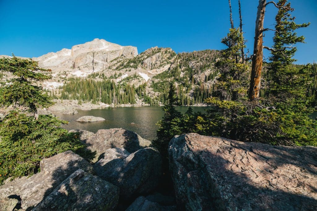
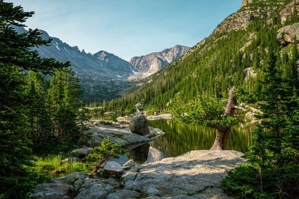
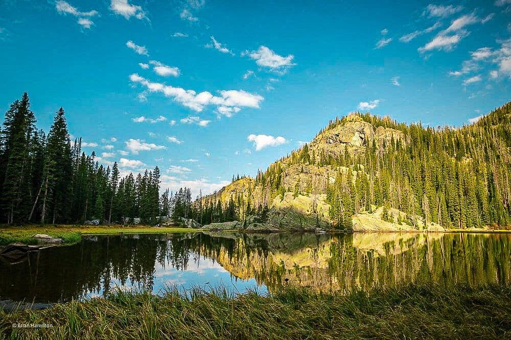
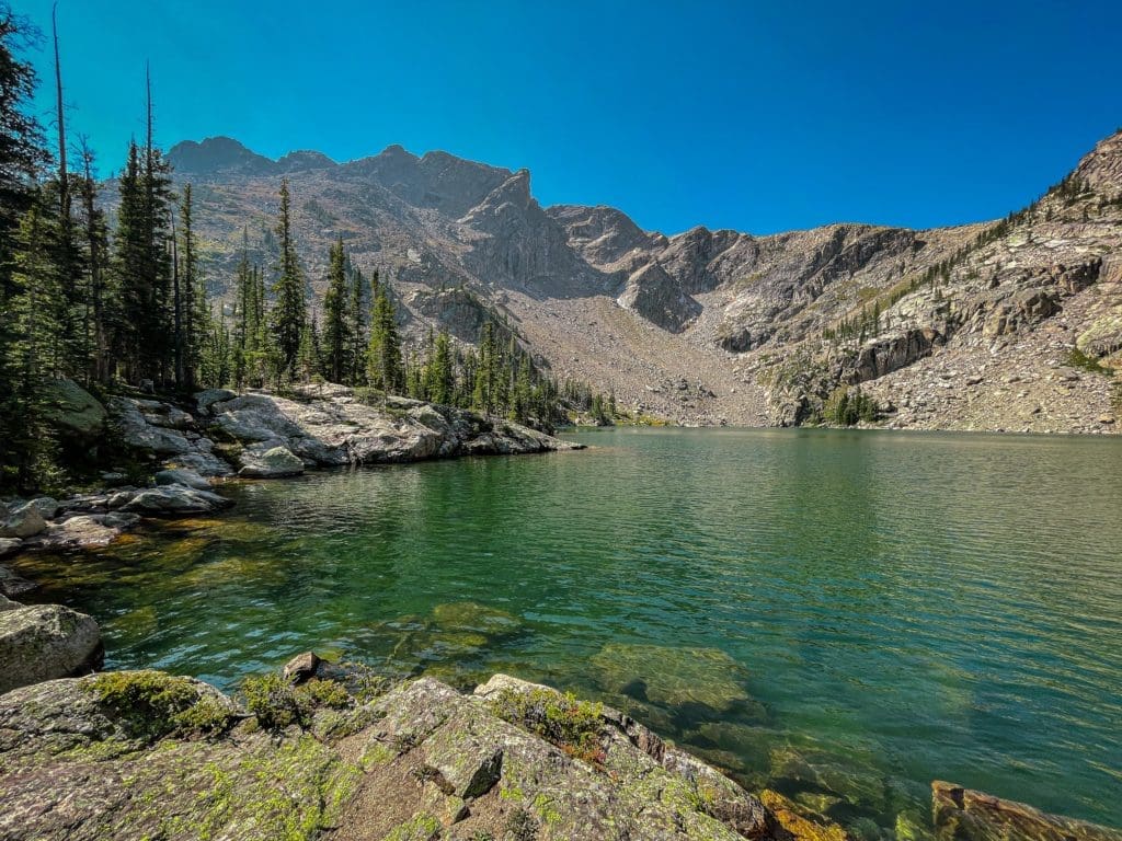
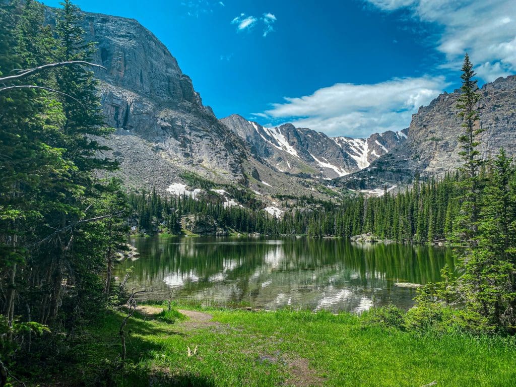
Nymph Lake, Dream Lake and Emerald Lake (Moderate)
Nymph Lake
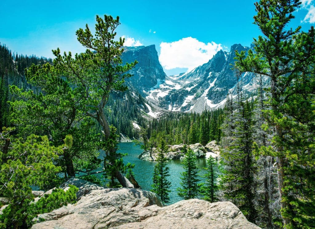
Early summer views of Hallett Peak over Dream Lake, Rocky Mountains National Park, Colorado.
At a Glance: A moderately rated, 3.1 mile out and back trail with an elevation gain of 1,453 feet starting from the Bear Lake Trailhead.
What makes it special: This picturesque hiking trail to Emerald Lake from the Bear Lake Trailhead is a popular trail with beautiful views, including Flattop Mountain, Hallett Peak, and Glacier Gorge. The lake is fed by the Tyndall Glacier, which is one of five active glaciers in Rocky. This trail includes four beautiful alpine lakes – Bear Lake, Nymph Lake, Dream Lake and Emerald Lake, which are all accessible from the Bear Lake Trailhead in Rocky Mountain National Park, Colorado.
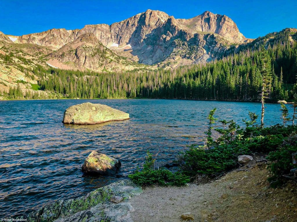
Mills Lake, Jewel Lake and Black Lake (Moderate)
Rocky Edge of Mills Lake in Rocky Mountain National Park
At a Glance: 9.6 miles, + ~1400 feet.
What makes it special: This longer jaunt into Glacier Gorge passes multiple lakes along the way, sheds a lot of the crowds, and provides impressive views of McHenry’s Peak from the shores of this picturesque alpine lake. Prepare for a long day with many photo opportunities. You can read our full trail review of Black Lake here. If you are stopping at Mills Lake, see our trail review here.
Jewel Lake and the high country beyond.
Rocky Cliffs Surrounding Black Lake in Rocky Mountain National Park
Lone Pine Lake and Lake Verna (Difficult)
Lone Pine Lake. Photo by Brian Hamilton on September 20, 2020.
At a Glance: A difficult rated, 13.4 mile out and back trail with an elevation gain of 2.194 feet starting from the East Inlet Trailhead.
What makes it special: This trail in the East Inlet Creek valley near Grand Lake, Colorado has awesome views of Adams Falls, the East Meadow and Lone Pine Lake before reaching Lake Verna. At the East Meadow, you’ll see the beautiful views of East Inlet Creek as it meanders through the valley below Mount Cairns, Mount Craig and Mount Wescott.
I encourage everyone to hike to Lake Verna (or one of the many backcountry campsites along the East Inlet Trail) for the weekend to enjoy life along the peaceful lakeside. These are amazing places to chill out, use as a basecamp for additional day-hikes, photography, or fishing (*with a valid Colorado fishing license).
Lake Verna just after sunrise. Photo by Brian Hamilton on September 20, 2020.
Thunder Lake (Difficult)
Thunder Lake and Mt. Alice.
At a Glance: A difficult, 12.3 mile Out and Back with loop extension to several waterfalls with an elevation gain of 2,234 feet starting from the Wild Basin Trailhead.
What makes it special: Wild Basin is one of the largest protected mountain basins on the eastern side of Rocky Mountain National Park and is, perhaps unsurprisingly, wild. There is only one road that gets into Wild Basin, and even then, it only goes two miles. The rest of the nearly 21,000-acre basin is networked with trails, but many ridges, alpine cirques, and lakes are only accessible via substantial cross-country travel. Wild Basin is also blessed with numerous waterfalls and cascades that add to the natural allure of the area. Combining a trip to Thunder Lake with Copeland Falls, Calypso Cascade, and Ouzel Falls makes for an excellent and well-rounded, albeit long, adventure into Wild Basin.
If you wish to extend your hike, including Bluebird Lake, Eagle and Box Lakes and the Lion Lakes. There are several amazing alpine scrambling routes in Wild Basin including the Eagles Beak and Tanima Peak and the Cleaver.
Bluebird Lake (Difficult)
Bluebird Lake with Ouzel Peak in the background.
At a Glance: A difficult, 12.3 mile (more if exploring the lake) Out and Back with loop extension to several waterfalls with an elevation gain of 2,900 feet starting from the Wild Basin Trailhead.
What makes it special: Bluebird Lake is another gorgeous destination in Wild Basin. The entire basin is chock-full of lakes and peaks to explore, and Bluebird makes for a wonderful outing. The elevation gain and overall mileage are substantial, so budget some time and aim for a good weather day. The lake itself is great for relaxing and soaking up some prime Rocky Mountain majesty; you may even be tempted to jump in if the day is warm enough!
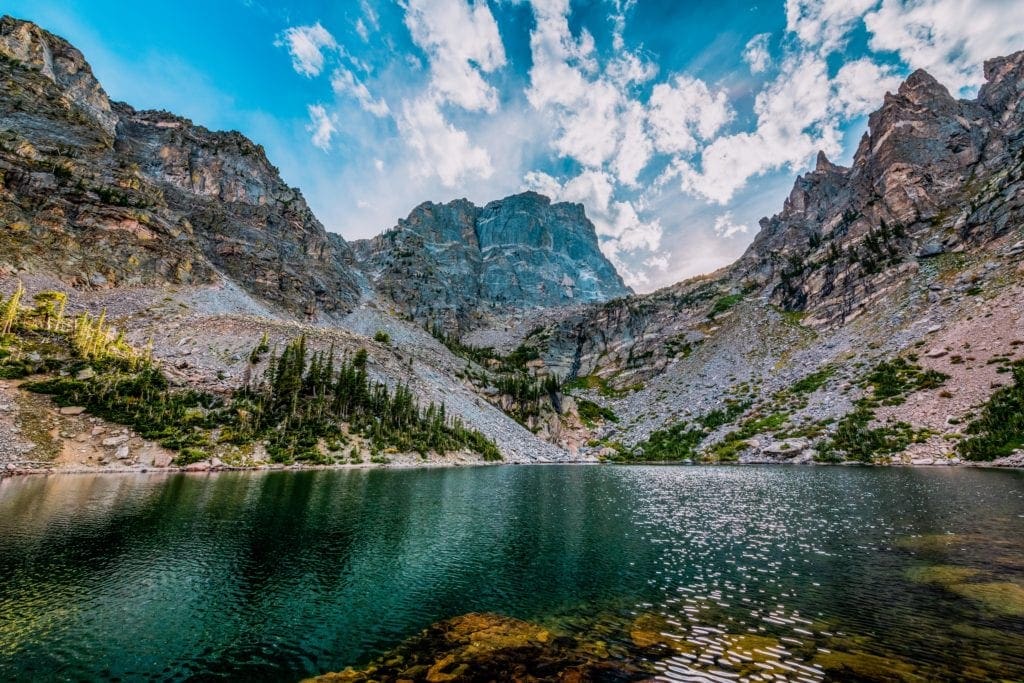
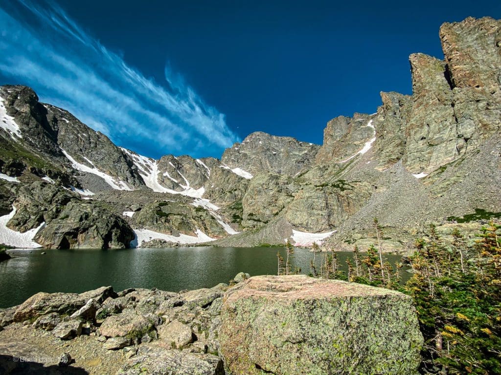
Chasm Lake (Difficult)
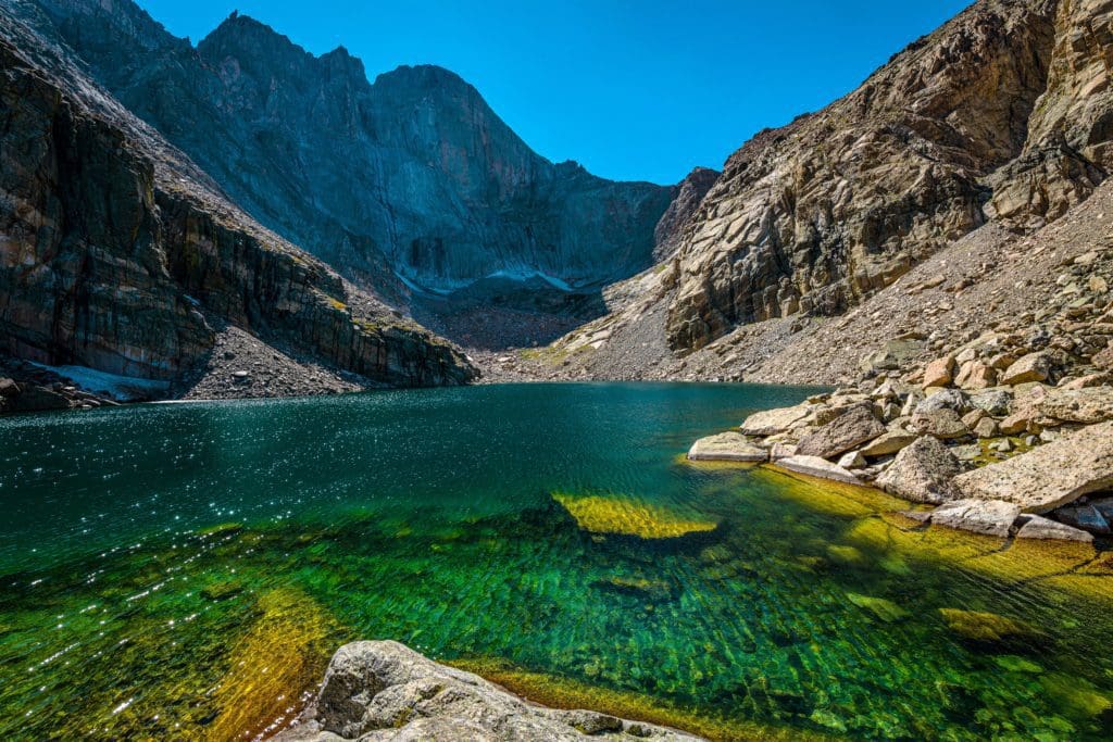
A wide-angle summer afternoon view of Chasm Lake at base of Longs Peak, Rocky Mountain National Park, Colorado.
At a Glance: A difficult, 8.8 mile, Out and Back trail with an elevation gain of 2,542 feet starting from the Longs Peak Trailhead.
What makes it special: Chasm Lake is another one of my most favorite hikes in Rocky Mountain National Park. This beautiful alpine lake is located just below the 14,259-feet high, Long’s Peak, making it a wonderful spot to eat lunch. Due to the common exposure to afternoon thunderstorms, and limited parking, you’ll definitely want to arrive as early in the morning as you can, especially on weekends during the summer months.
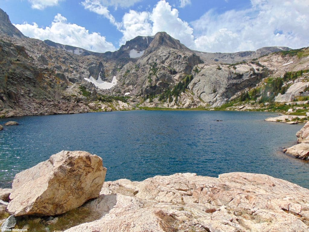
Lake Nokoni, Lake Nanita (Difficult)
Lake Nokoni (10,773′) is located 9.8 miles from North Inlet Trailhead. Photo by Brian Hamilton on September 4, 2021.
At a Glance: A difficult, 19.7 mile, Out and Back trail with an elevation gain of 3,454 feet starting from the North Inlet Trailhead.
What makes it special: Lake Nokoni (10,773′) is located 9.8 miles from North Inlet Trailhead on the west side of Rocky Mountain National Park. It fills a large, steep-walled bowl carved from Ptarmigan Mountain (12,324′) in the upper reaches of an isolated valley.
Lake Nanita. Photo by Brian Hamilton on September 4, 2021.
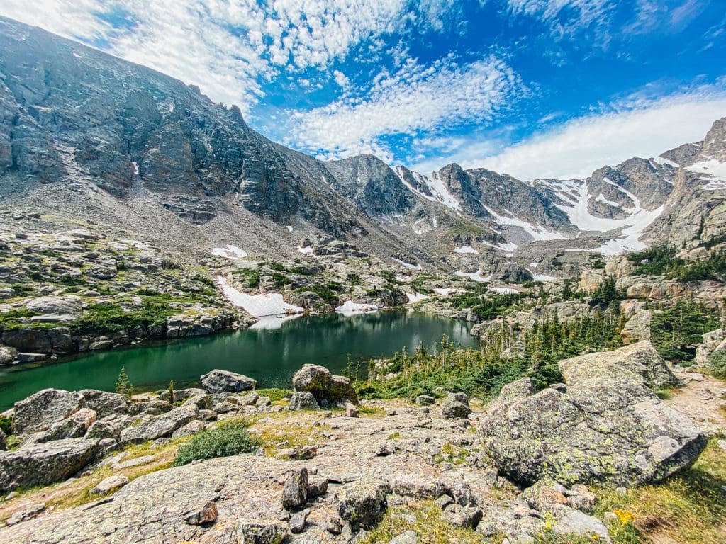
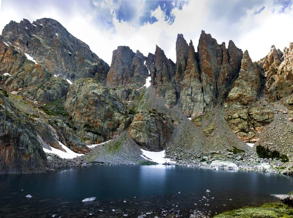
Loch Vale, Lake of Glass and Sky Pond (Difficult)
Sky Pond. Photo by Brian Hamilton on July 12, 2020.
Hike Description
Sky Pond is simply one of Colorado’s most beautiful alpine lakes and is routinely included in lists of the prettiest lakes in Colorado. Soaring peaks and spires like the Petit Grepon and Sharkstooth spike the skyline above the high-altitude lake and Loch Vale, a deep glaciated valley.
You can read our full review of the trail here. It is not a short hike and will require a full day to truly appreciate.
Like many of Rocky’s eastern highlights, this trail is accessible via Bear Lake Road. The Glacier Gorge Trailhead is routinely full by 7 am in the summer, so get there early.
Along the 4.5-mile hike to the lake, you’ll pass Alberta Falls, Loch Vale, and Glass Pond, all of which are beautiful and worthy destinations in their own right. The Glacier Gorge area is so crammed with spectacular destinations that you could spend weeks exploring all the named features in the area. Bring your camera!
Loch Vale. Photo by Brian Hamilton on July 12, 2020.
From the Glacier Gorge Trailhead, head south ~1.6 miles until taking a right onto a small section of the North Longs Peak Trail. 0.4 miles later, continue straight through Mills Junction, eventually arriving at Loch Vale. Enjoy the stunning scenery here and continue south into the increasingly dramatic, glacially carved valley with towering rock spires around you.
While the vast majority of the route is on an established trail, there are a couple of sections that involve some light scrambling. Once you pass the intersection with Andrews Creek trail, (at around 3.6 miles in), you’ll ascend to Timberline Falls. The trail attacks a rocky section to the right of the falls that you’ll need to scramble up. Although short, the section is more demanding than anything you will have encountered so far. Take your time and use your hands to help brace as you carefully ascend.
Lake of Glass. Photo by Brian Hamilton on July 12, 2020.
The next lake is Glass Pond, which, despite its stunning scenery, is not the end of the trail. Work your way around the lake on its western side, ascending to a small bench where Sky Pond lies. Views include Powell Peak, Taylor Peak, Taylor Glacier, and the jagged rock spires of the Sharkstooth. Find a place to sit and soak up this spectacular, dramatic, and otherworldly example of natural beauty.
Sky Pond and the jagged rock spires of the Sharkstooth.
Popular Articles:
Adventurer’s Guide To Rocky Mountain National Park
Best Hiking Trails in Rocky Mountain National Park
Best Waterfall Hikes In Rocky Mountain National Park
Terms of Use:
As with each guide published on SKYBLUEOVERLAND.com, should you choose to this route, do so at your own risk. Prior to setting out check current local weather, conditions, and land/road closures. While taking a trail, obey all public and private land use restrictions and rules, carry proper safety and navigational equipment, and of course, follow the #leavenotrace guidelines. The information found herein is simply a planning resource to be used as a point of inspiration in conjunction with your own due-diligence. In spite of the fact that this route, associated GPS track (GPX and maps), and all route guidelines were prepared under diligent research by the specified contributor and/or contributors, the accuracy of such and judgement of the author is not guaranteed. SKYBLUE OVERLAND LLC, its partners, associates, and contributors are in no way liable for personal injury, damage to personal property, or any other such situation that might happen to individuals following this route.


