


High Point:
8,685 feet

Total Ascent:
630 feet

Difficulty:
Moderately Easy

Distance:
6.4 miles

Waypoints:
40.356217, -105.615817

Route Type:
Loop
:

Overview
Cub Lake Trail Loop is a great hike for those who are looking for a moderately easy, 3 to 4 hour hike with lots of wildflowers and wildlife. This hike is also an opportunity to see life return and thrive after the devastating Fern Lake Fire in late 2012.
This is nice loop hike between the Cub Lake and Fern Lake Trailheads. You can take either direction, but I typically start this adventure at the Cub Lake parking area. I have taken the hike several times and it usually takes me under 3 hours to complete the loop. On June 15, 2020 after making numerous stops for photos, I completed the hike in about 4 hours. Families may enjoy heading up to Cub Lake in a shorter out-and-back approach.
Starting a the Cub Lake Trailhead, follow the Cub Lake Trail to the south on a footbridge that spans the Big Thompson River across Moraine Park. Suggest stopping briefly to enjoy the views of Stones Peak, Sprague Mountain and Gabletop Mountain, which can be seen from the bridge.
Directions from Estes Park: Travel west on US-36W/Moraine Ave past the Beaver Meadows Entrance Station. Turn left (south) onto Bear Lake Road for 1.3 miles. Turn right onto Moraine Park Road for 0.5 miles. Turn left onto Fern Lake Road for 1.3 miles to the Cub Lake Trailhead. A valid backcountry permit is required for overnight parking.
There is limited parking at the Cub Lake Trailhead. Suggest arriving before 9 AM or alternatively use the Park Shuttle Bus’ Moraine Park Route.
Journal:
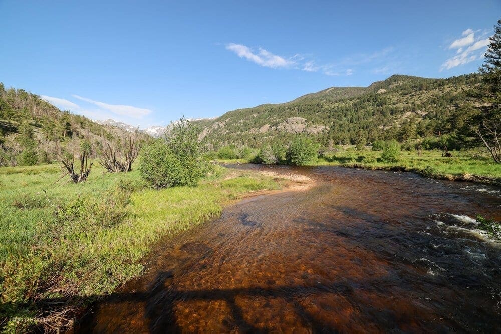
The trail initially heads south over Big Thompson River and undulates gently along the western fringe of Moraine Park. There are some nice views of the higher peaks to the west.
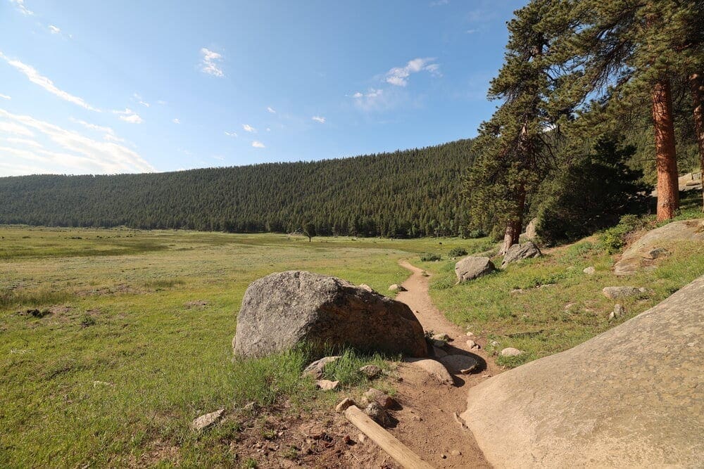
As the trail heads to the south. One can see the expansive meadow of Moraine Park to the east.
The trail initially heads south over Big Thompson River, which undulates gently along the western fringe of Moraine Park. This portion of the trail is flat with abundant summer wildflowers in the marshy grasslands.
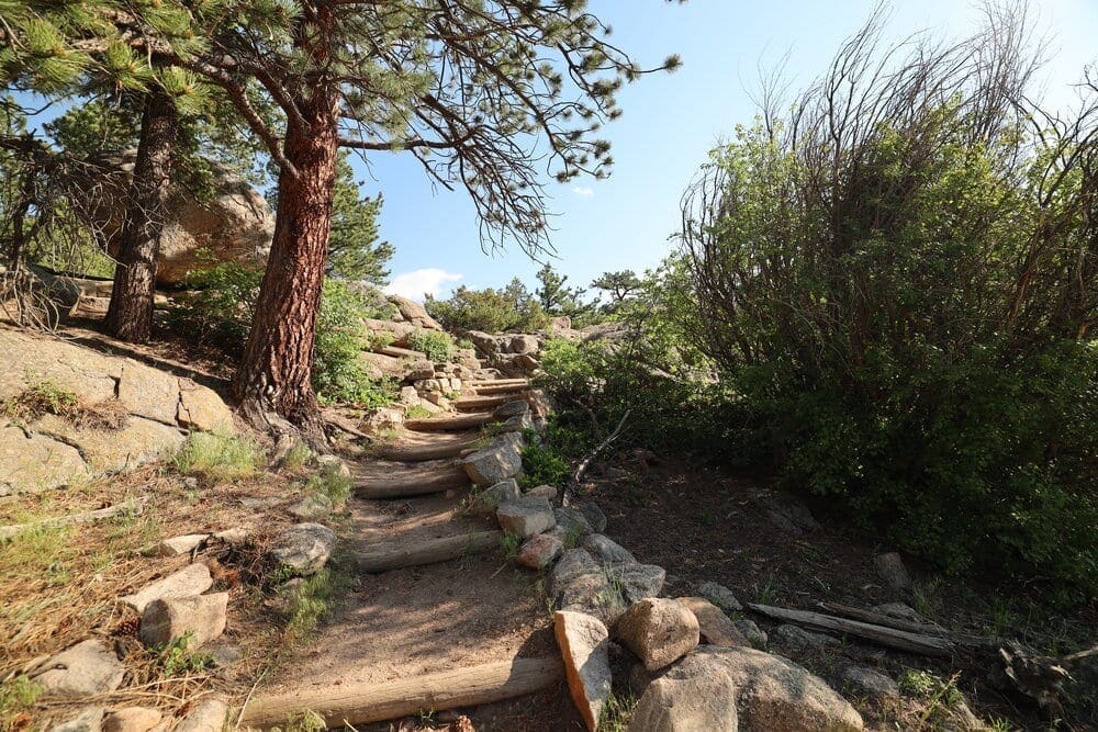
Climbing the small hill before turning to the west along Cub Creek.
The trail climbs a small hill before turning sharply to the west along Cub Creek. Before starting the climb up to Cub Lake, the trail passes a few small beaver dams in a beautiful grassy meadow.
The trail turns westward towards Cub Lake along the marshy grasslands of Cub Creek.
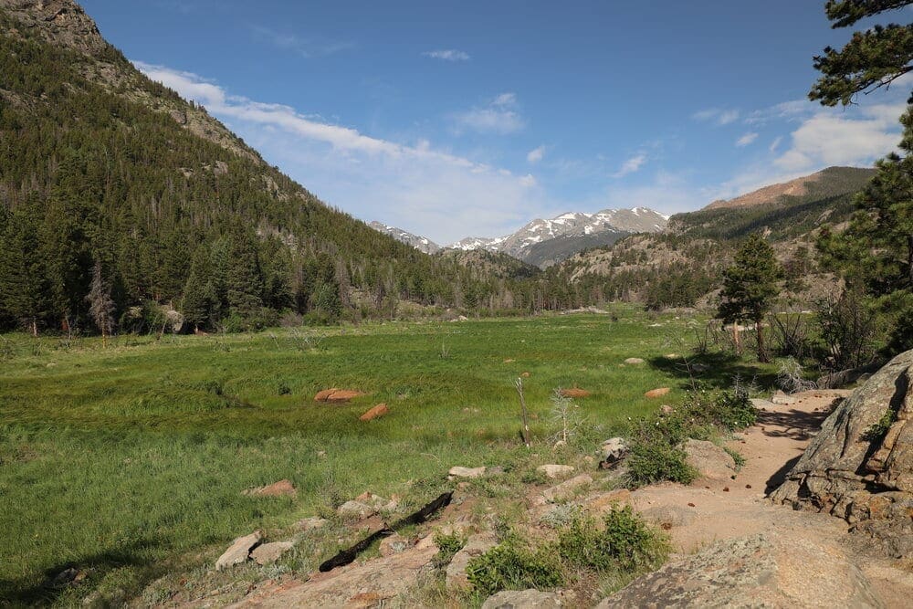
After about a mile from the trailhead, we encounter a series of small beaver dams before making the push up to Cub Lake. Beaver ponds in the Cub Creek valley are a source of water for the meadow grasses, wildflowers and wildlife.
On the south side of the valley lies the South Lateral Moraine, which abuts upward into Steep Mountain. A moraine is any glacially formed accumulation of unconsolidated glacial debris (regolith and rock) that occurs in both currently and formerly glaciated regions on Earth (i.e. a past glacial maximum), through geomorphological processes. Moraines are formed from debris previously carried along by a glacier, and normally consist of somewhat rounded particles ranging in size from large boulders to minute glacial flour. Lateral moraines are formed at the side of the glacial ice flow.
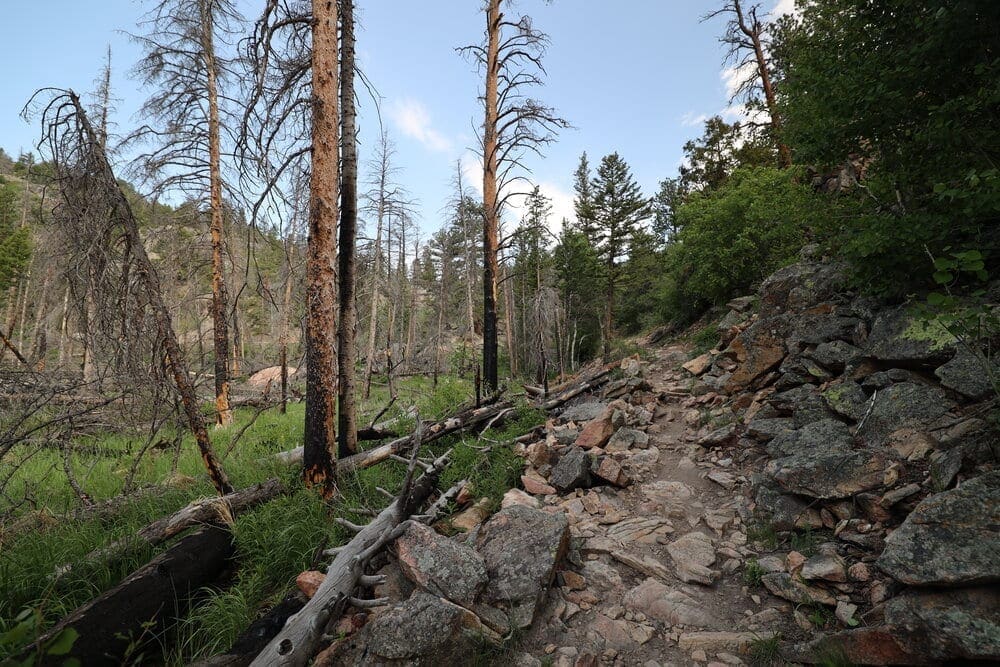
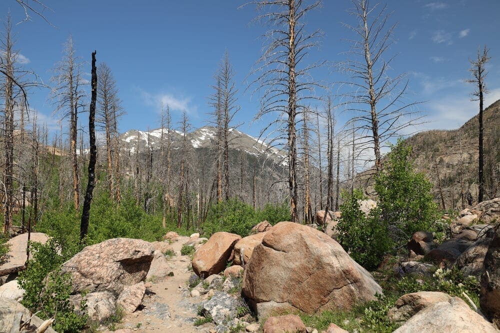
As the trail starts the climb towards Cub Lake, evidence of the 2012 Fern Lake Fire starts to emerge.
The trail starts to climb towards Cub Lake. Some of the trees have been burned, which is our first encounter with the remains of the 2012 Fern Lake Fire.
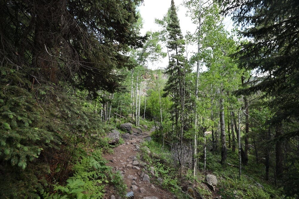
Watch out for the heavy mosquito population in the aspen forest.
The trail becomes slightly steeper, then climbs through aspen trees before entering a dense forest.
The pine forest has been substantially burned by the 2012 Fern Lake Fire. Despite the devastation, life is emerging and thriving.
The trail winds through the pine forest to a short uphill section that tops out at Cub Lake. The area around Cub Lake lies within the remains of the Fern Lake fire of 2012 that burned 3,500 acres. The Fern Lake Fire started in Rocky from an illegal campfire on October 9, 2012, in steep and rugged Forest Canyon. The high winds, steep terrain, and beetle-killed trees posed danger to firefighters, meaning there was limited opportunity to fight the fire from the ground. Firefighters from across the country battled this fire for two months.
According to the National Park Service, this high-elevation winter fire was unprecedented in park history. Large fires at high elevations of the Rocky Mountains are infrequent and have the potential for high consequences. Due to climatic factors and inaccessibility, Forest Canyon had not experienced a fire for at least 800 years before the Fern Lake Fire. A long-term drought had left fuels tinder-dry and, in some areas, the layer of dead and down exceeded twenty-foot depths. Mountain pine beetles had killed half the trees in the canyon, with every compromised tree posing a hazard for firefighters. The typically windy conditions in the canyon only increased the danger.
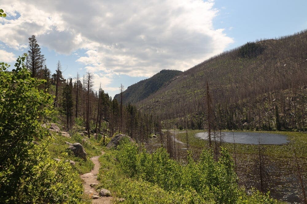
Looking east towards Cub Lake. The lake is nearly covered in lily pads, and the views from the trail as it climbs over the saddle on the west end are beautiful. One hiker with a telephoto camera lens reported seeing hummingbirds within the lilies.
Cub lake is nearly covered in yellow pond lilies that bloom in July and August. The views from the trail as it climbs over the saddle on the northwest end are beautiful. I enjoyed seeing the variety of forest, meadow, rushing creeks and the lake. To me, the fire remains do not lessen the beauty of the lake setting. The beauty of this fire zone is enhanced with the many species of plants that are emerging and thriving after the fire. Fires are an important part of the natural cycle, and many species of plants and animals are thriving in the aftermath.
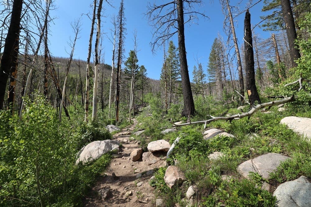
The trail continues upward into the area impacted by the 2012 Fern Lake Fire. This photo was taken west of Cub Lake, looking westward towards Stones Peak.
Views of Stones Peak and Sprague Mountain emerge as the trail heads further west, deeper into the fire zone.
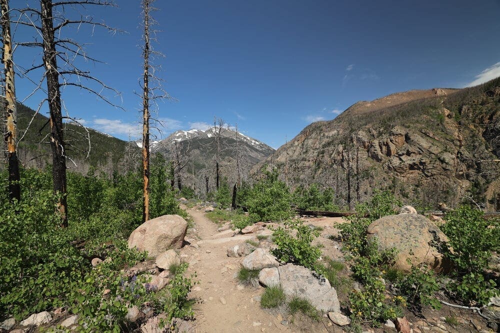
Views of Stones Peak, looking westwards, from the Cub Lake Trail.
There is a steady climb to Cub Lake, then the trail gradually descends to the west for 0.4 mile to the Mill Creek Basin Trail and 1.1 miles down to The Pool on the Fern Lake Trail. The Pool – lively area of falls and cascades below the convergence of Fern Creek, Spruce Creek and Big Thompson – is about one mile from this point downhill from Cub Lake.
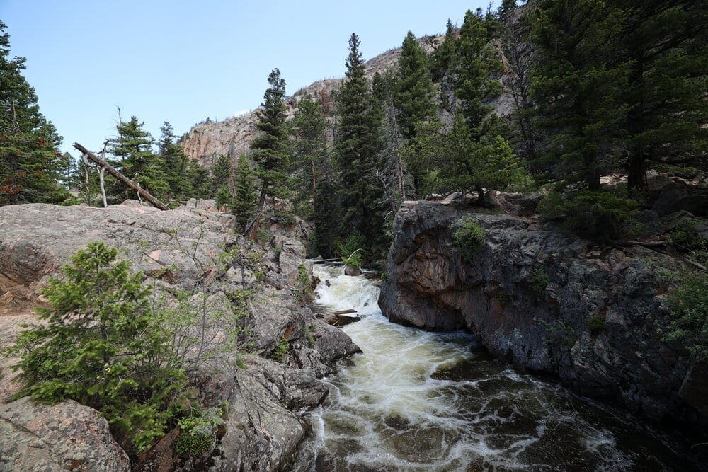
The Pool is a raging portion of the Big Thompson River, which emerges out of the beautiful Forest Canyon.
The rest of the route follows the Big Thompson River to the Fern Lake Trailhead. The last mile of the loop is on Fern Lake Road. I always walk the last mile from the Fern Lake Trailhead, but one might take the Park Shuttle Bus Moraine Park Route back to the Cub Lake Trailhead parking area.
This hike is a nice opportunity to see wildlife. On June 15, 2020, I saw deer, wild turkey, Wyoming ground squirrel, chipmunks. Other hikers reported seeing a bear near Cub Lake and a few elk in Moraine Park early in the morning. Cub Lake has a beautiful pattern of lily pads in it. I encountered one hiker with a long telephoto camera lens who reported seeing hummingbirds within the lilies. There were lots of spring wildflowers on the trail too.
When I did the hike in 2015, I encountered a cow moose and her two calves on the trail. I became fast friends with several other hikers as we waited about 30 minutes until they cleared the area.
Guidebooks, Maps and References:
Rocky Mountain National Park National Geographic Trails Illustrated Map
Popular Articles:
- Guide to the Best Hiking Trails in Rocky Mountain National Park, Colorado
- The Dyrt: The 10 Best Campgrounds In Colorado
- Top Adventure Sports Towns 2021: Boulder, Colorado
- Epic Adventures with the Best Guides In Colorado
- Sky Pond via Glacier Gorge Trail, Rocky Mountain National Park, Colorado
- Scrambling Hallett Peak’s East Ridge, Rocky Mountain National Park, Colorado
- Scrambling Mt. Alice via the Hourglass Ridge, Rocky Mountain National Park, Colorado
- Gorge Lakes Rim Scramble, Rocky Mountain National Park, Colorado
- Black Lake Via Glacier Gorge Trail, Rocky Mountain National Park, Colorado
- Scrambling To The Lake Of The Clouds, Rocky Mountain National Park, Colorado

Skyblue Overland Strongly Recommends That You Enroll With Global Rescue Prior To Embarking On Your Next Adventure.
With more people outside now more than ever, Global Rescue expanded services to include field rescue within 100 miles of home. With Local Field Rescue — automatically included in any travel protection services membership — Global Rescue is there whether you’re hiking, kayaking, snowmobiling, fishing or simply enjoying the outdoors and get ill or injured and you’re unable to get to safety on your own. Purchase a Global Rescue membership for your next adventure and travel with peace of mind. Single trip, annual and family options are available.
Memberships start at $119.
Terms of Use:
As with each guide published on SKYBLUEOVERLAND.com, should you choose to this route, do so at your own risk. Prior to setting out check current local weather, conditions, and land/road closures. While taking a trail, obey all public and private land use restrictions and rules, carry proper safety and navigational equipment, and of course, follow the #leavenotrace guidelines. The information found herein is simply a planning resource to be used as a point of inspiration in conjunction with your own due-diligence. In spite of the fact that this route, associated GPS track (GPX and maps), and all route guidelines were prepared under diligent research by the specified contributor and/or contributors, the accuracy of such and judgement of the author is not guaranteed. SKYBLUE OVERLAND LLC, its partners, associates, and contributors are in no way liable for personal injury, damage to personal property, or any other such situation that might happen to individuals following this route.


