


High Point:
8,148 feet

Total Ascent:
~2,500 feet

Difficulty:
Difficult

Distance:
6 miles

Waypoints:
39.999724, -105.283026

Route Type:
Lollipop loop
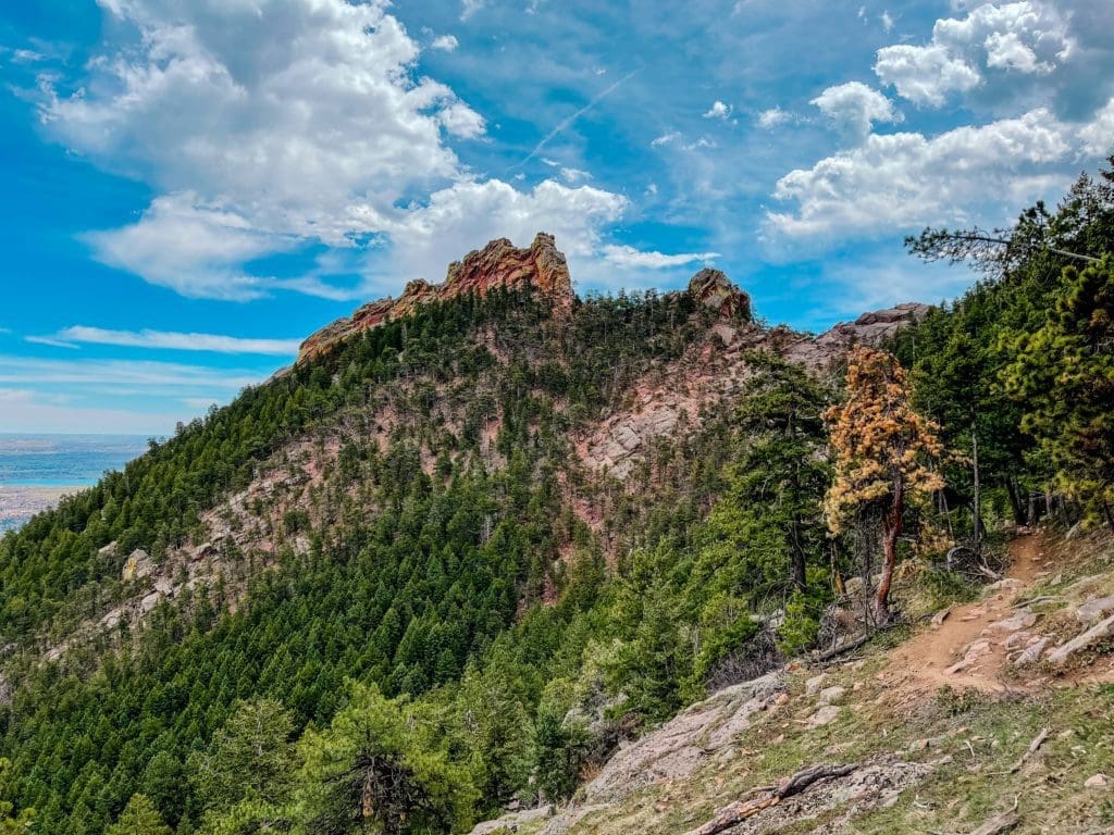
Green Mountain, a peak guarding Boulder’s skyline, rises 2000 ft above the city. Famous for Flatiron rock formations and trails for outdoor activities, it offers hiking, running, and winter adventures on its eastern side.

Overview
Nestled in Boulder, Colorado, the Green Mountain Loop Trail attracts hikers of all levels with its captivating scenery and varied landscape. Spanning 6 miles and ascending approximately 2,500 feet, this trail is considered moderate to strenuous depending on one’s physical abilities. The peak reaches an impressive 8,148 feet, granting hikers panoramic views of Boulder and the surrounding Rocky Mountains.
From the trailhead, adventurers can expect a diverse range of environments, including verdant forests, open meadows, and rugged rock formations. This year-round accessible trail may require some additional preparation for winter hikes due to possible weather challenges. Along the way, hikers can admire the iconic Flatirons – a series of natural rock formations that define the Boulder skyline.
One notable feature of this trail is the ladder installed during its renovation after being damaged by regional flooding in 2013. This unique element adds an extra level of excitement to the journey. With abundant flora and fauna along the route, nature enthusiasts will find themselves immersed in its beauty and diversity.
For those planning to hike the Green Mountain Loop Trail, it’s best to start early in the day to avoid large crowds and allow ample time to complete the route. Don’t forget to pack plenty of water, snacks, and sunscreen, as well as be prepared for potential weather changes. A visit to this stunning trail is a must for anyone seeking an unforgettable outdoor adventure in Boulder.
Rocky outcrops and tree-laden slopes on Green Mountain.
Table of Contents:
Article Navigation: Click on any of the listed items in the table of contents below to jump to that section of the article. Similarly, clicking on any large, white section header will jump you back to the Table of Contents.
Support Skyblue Overland™ on Patreon!
If you’d like to support our efforts for a few dollars a month, please subscribe to our Patreon page. Every donation energizes our team to keep writing detailed trail reviews, gear reviews and adventure guides. Thank you!
The E.M. Greenman Trail, part of the Green Mountain Loop.
Scales and Criteria
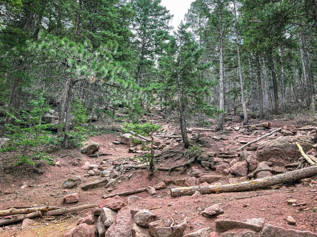
This article uses two metrics, distance and elevation gain, to calculate overall difficulty. The loop takes advantage of existing trails, so there is no scrambling or off-trail navigation required. However, there are quite a few trail junctions to navigate, so make sure you have a map downloaded or take a physical one with you to make sure you take the right trails to complete the loop.
Difficulty Ratings:
- Easy: less than 5 miles, less than 500 ft. of elevation gain
- Moderate: 5-10 miles, 500-2000 ft. of elevation gain
- Difficult: 5-15 miles, more than 2000 ft. of elevation gain
- Very Difficult: 10+ miles, more than 3,500 ft. of elevation gain
Gaining elevation on the way up Green Mountain.
Directions to Trailhead
Chautauqua Park is one of the prime Boulder hiking locations. The park is historic, offers sweeping views of the Flatirons, and is right on the edge of the university hill neighborhood. Due to the ease of access and stunning views, this is also one of the most popular places to recreate outdoors in Boulder and is perennially crowded.
To get to Chautauqua Park, find the intersection of Broadway (Highway 93) and Baseline Road. This will be south of the main downtown and CU campus.
From the intersection, follow Baseline road west as it rises alongside the University hill neighborhood. Only a few minutes up the road, the houses will stop on your left, and you’ll see Chautauqua Park with the Flatirons behind it. Turn into the well-signed parking lot. If it’s completely full, there are multiple street parking spots alongside the left side of Baseline Road. Gregory Canyon Trailhead is a potential backup parking lot, but the lot is much smaller than Chautauqua and tends to fill up first.
Parking fees do apply on weekends and holidays in the summer. Click here to find out more information.
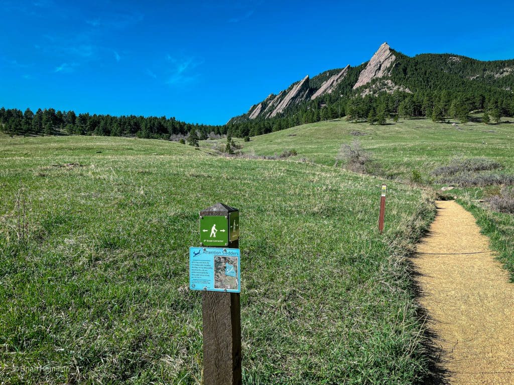
The Flatirons from Chautauqua Park.
Places to Stay
With the city of Boulder at the foot of the trail, there are numerous options for places to stay. The city has a wide variety of Airbnb options as well as hotels. Some of the more well-known options include:
Camping
Camping options are much more limited near town but generally increase the farther west you travel. Gross Reservoir is likely the closest, along with the Boulder County Fairground (one of the rare options to the east of town). West Magnolia, Olive Ridge, and Meeker Park are a little farther.
- Gross Reservoir
- Boulder County Fairground (RV Campground).
- West Magnolia. This area doubles as a great mountain biking location too. It’s also located near the funky town of Nederland.
- Meeker Park
- Olive Ridge
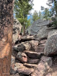
A rock staircase near the top of Green Mountain.
Field Notes
The trailhead is often crowded; make sure to get there on the early side, especially on weekends in the summer. Despite its location right next to Boulder, Green Mountain towers over the city, and its trails can harbor areas of ice through May. If you’re hiking from November-May, Microspikes are always a good thing to bring with you.
Portions of the loop were heavily damaged or destroyed by flooding ten years ago. Some sections of the Ranger Trail are newly constructed, and there is a ladder on the Saddle Rock Trail.
Weather in the Rocky Mountains is notoriously fickle; make sure to check conditions and forecasts before heading out. Boulder’s forecast is good for the lower parts of the trails, while Twin Sister’s Peak (not to be confused with the one in Rocky Mountain National Park) is a good indicator of conditions along the higher portions.
Keep in mind that there are multiple components to the weather; it’s not just about precipitation. The temperature will dictate what layers to bring, and local weather patterns will help you figure out which additional metrics are important. For example, in the Front Range, make sure to check the wind forecast. This part of Colorado is infamous for strong blustery winds and fighting your way up a trail in 50mph gusts is not fun.
Please note that there are no dogs allowed on the upper E.M. Greenman Trail.
Journal
From the parking lot at Chautauqua Park, locate either the Baseline or Meadow Trail and take it west towards the mountains.
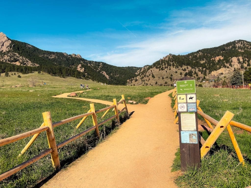
The start of the hike, looking west.
This section is easy and has stupendous views of the Flatirons.
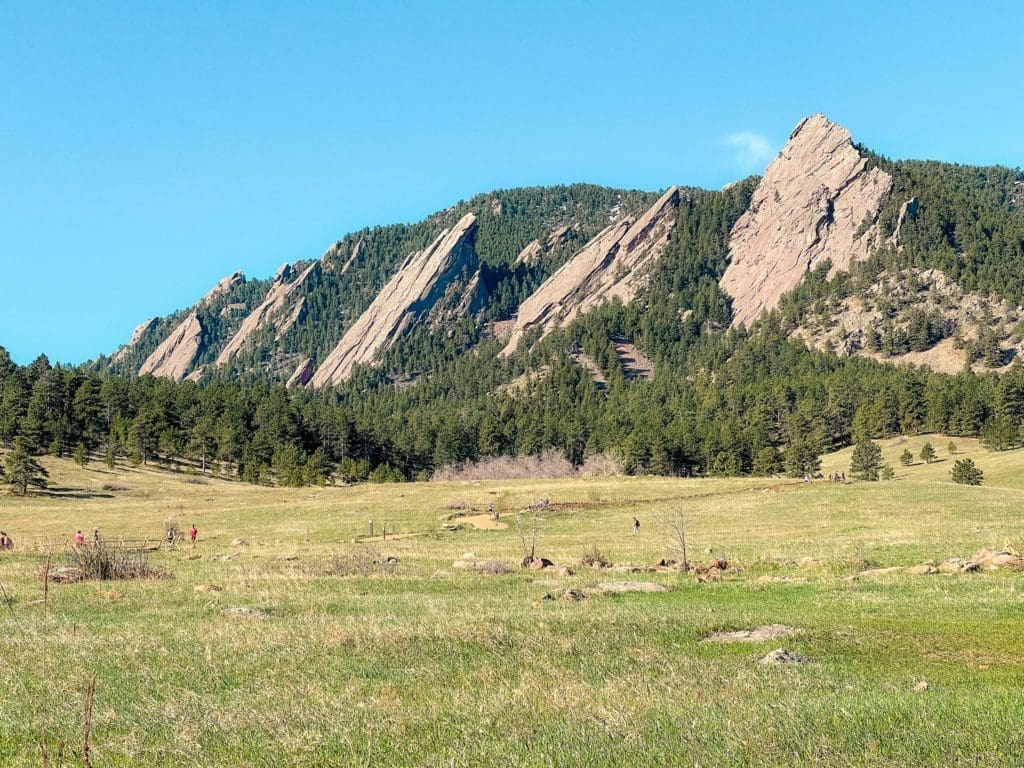
The iconic Flatirons of Boulder.
Continue west, heading towards Gregory Canyon. The wide-open fields will begin to narrow as you reach the Canyon parking lot.
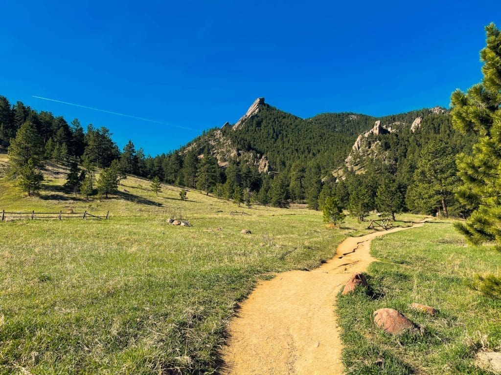
Heading towards Gregory Canyon.
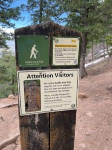
From the Gregory Canyon Trailhead, take the Gregory Canyon Trail west.
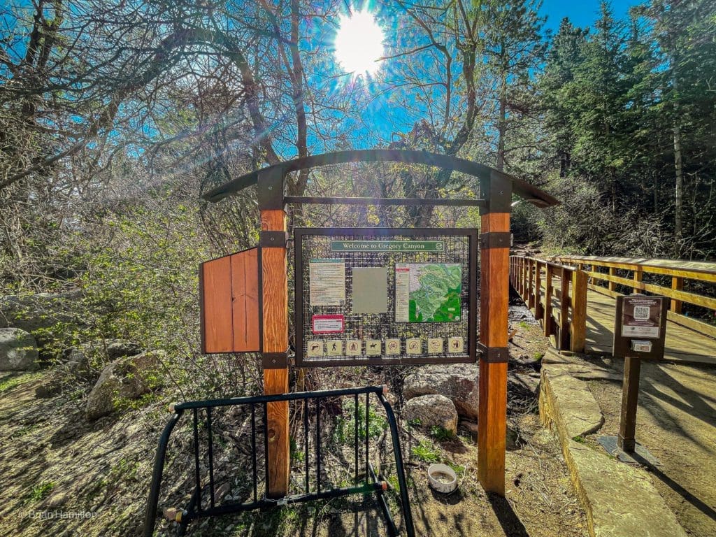
The trail sign at the Gregory Canyon trailhead.
You’ll quickly pass the junction for the Saddle Rock Trail, which you’ll be using on the return journey. For now, continue up Gregory Canyon. You can take the loop in both directions, but the following description describes an ascent up Gregory Canyon first.
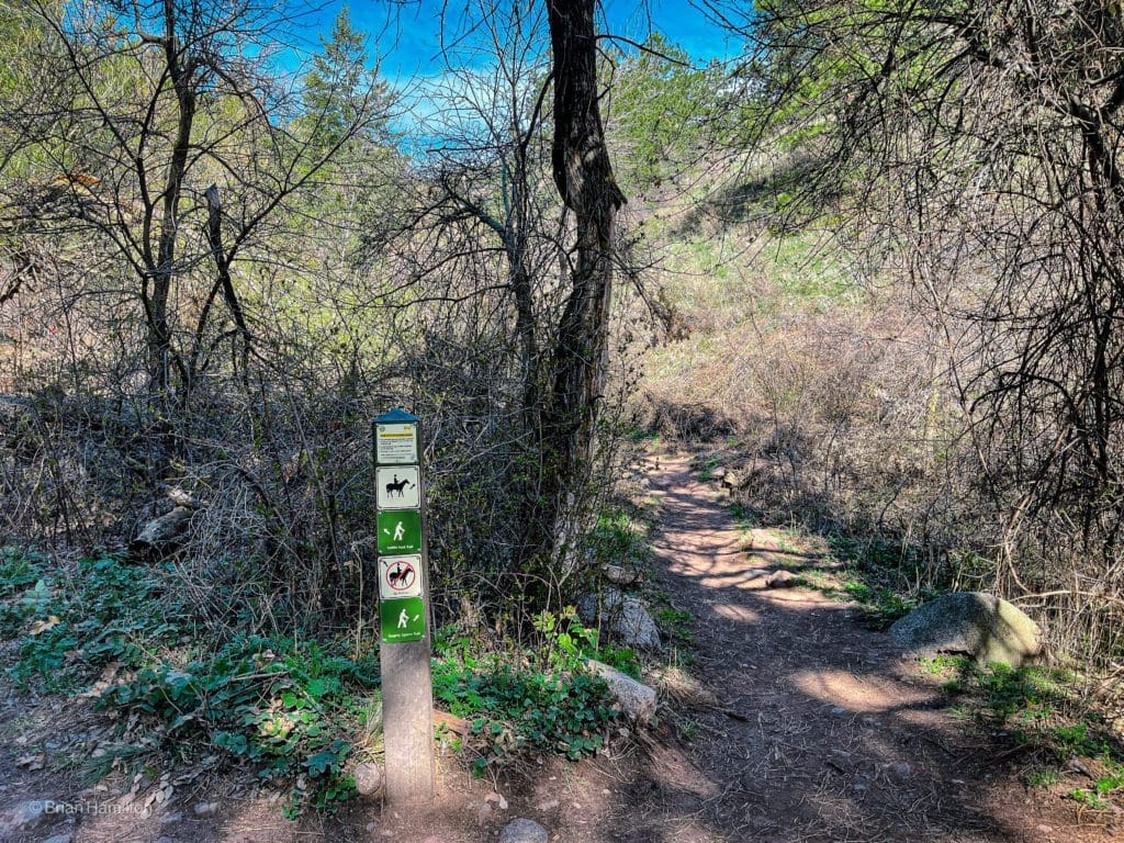
For this loop, continue up Gregory Canyon.
The bottom of the canyon is fairly narrow, and the trail will generally ascend on the righthand (north) side of the drainage.
The lower portion of Gregory Canyon.
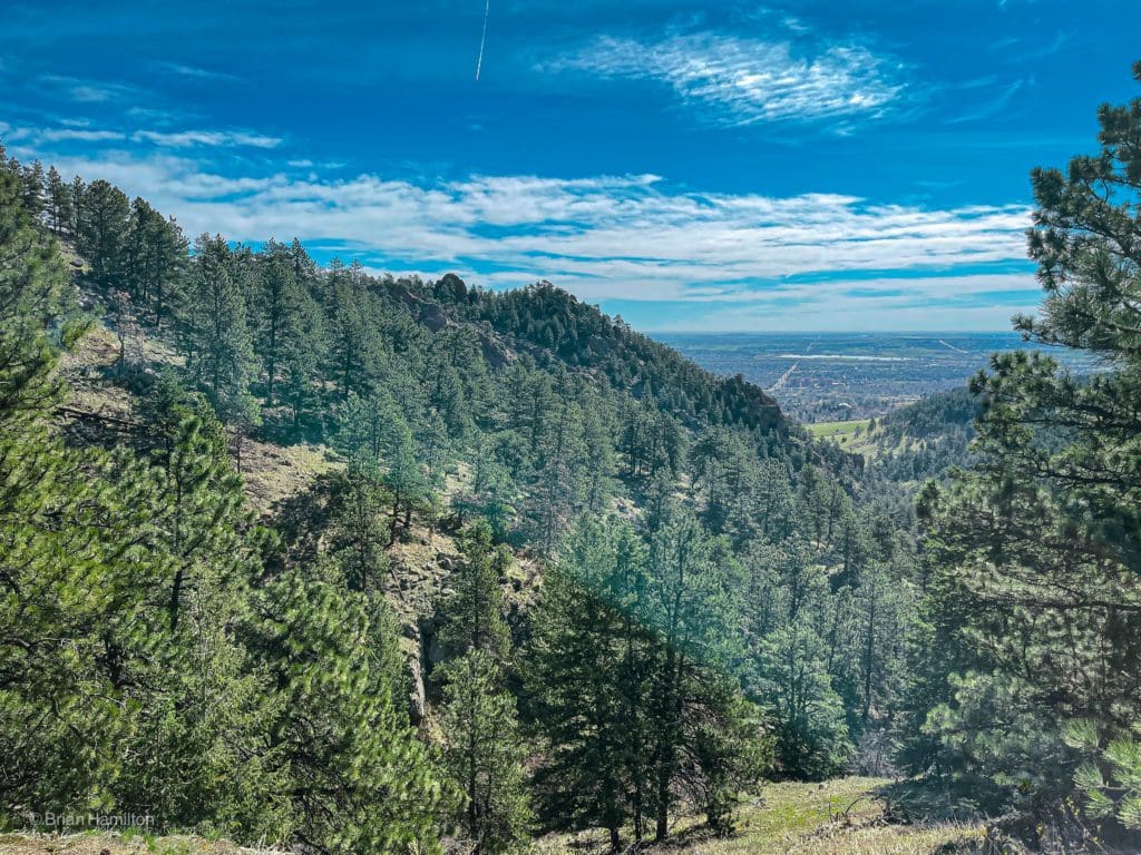
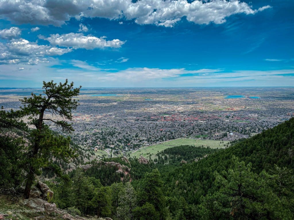
As you gain elevation, views back east toward Boulder start to open up.
Looking down the canyon.
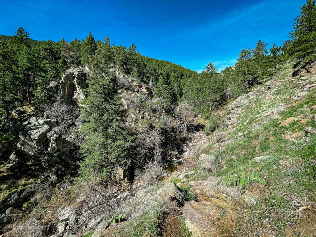
It’ll take a little more than a mile and nearly 1,000 feet of vertical gain to get to the top of the canyon, take your time and enjoy the views as they appear. This area can also get quite hot in the middle of the summer, so make sure you brought a hat and some sunscreen.
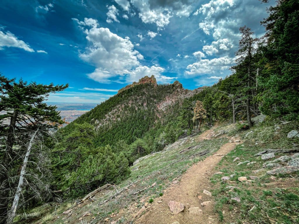
A rockier section of trail as you continue ascending.
Once you begin switchbacking up toward the top of the canyon, the trail will pass along some rockier sections that offer more views back down the canyon and toward Chautauqua Park.
Views increase to the east as you work your way higher.
Eventually, the tree coverage will increase, and in the shoulder seasons, you may see some sneaky patches of snow hiding out in the shade.
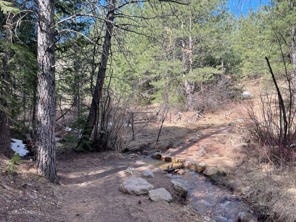
A creek crossing and a few small snow patches hiding out.
At the top of the canyon, you’ll run into a junction with signs pointing to the Ranger Trail; follow these.
At the end of the Gregory Canyon.
The Ranger Trail will take you up the shoulder of Green Mountain and starts off in a heavily forested area. Before long, you’ll pass the Green Mountain Shelter, which was built by the CCC (Civilian Conservation Corp) back in the 1930s as part of FDR’s new deals programs. It’s a cool reminder of a historic initiative that helped bring attention to outdoor recreation and preservation efforts.
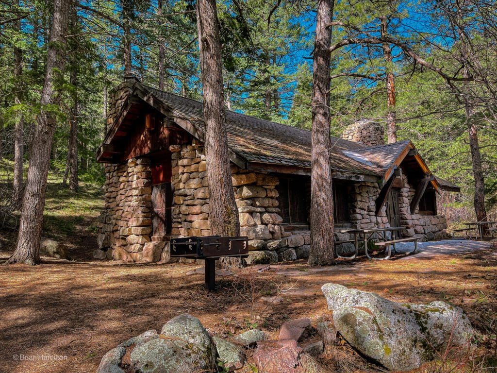
Green Mountain Shelter.
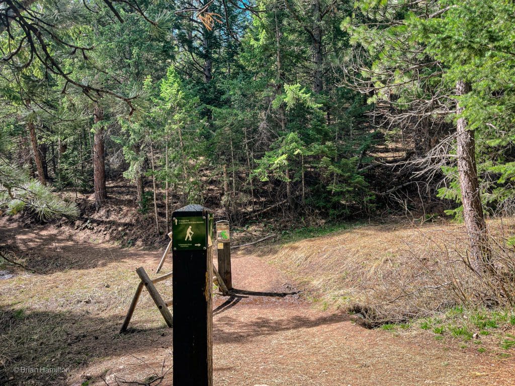
Continue on the Ranger Trail as you pass junctions with the Long Canyon Trail and E.M. Greenman Trail.
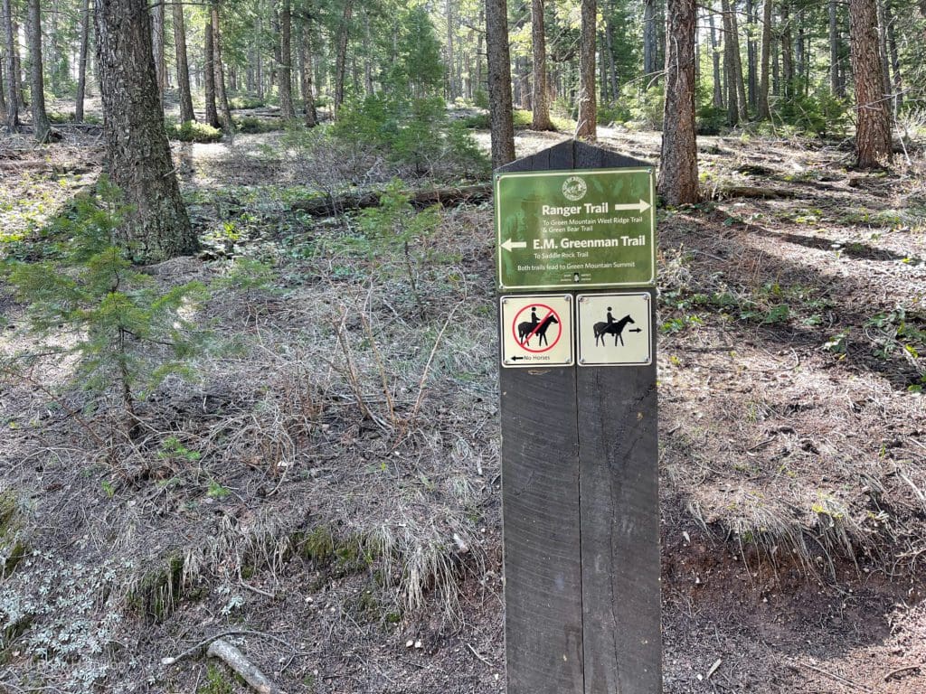
The trail signs are well-marked and easy to read, adding to the appeal of the trail network.
The trail will rise more dramatically, gaining about 550 vertical feet in half a mile.
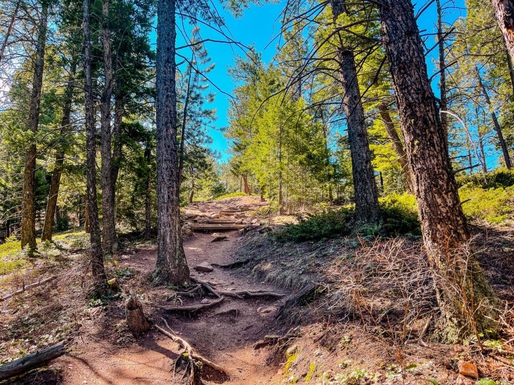
The profile of the trail as you enter a drier area.
During this stretch, you’ll get some stellar views west of the Arapaho Peaks in the Indian Peaks Wilderness.
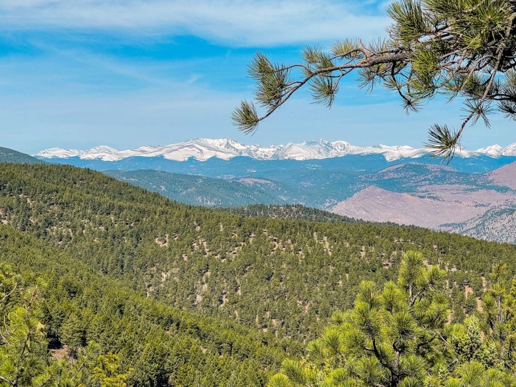
The always stunning Indian Peaks along the Continental Divide.
After this concentrated rise, the Ranger Trail will dead-end into the Green Mountain West Ridge Trail.
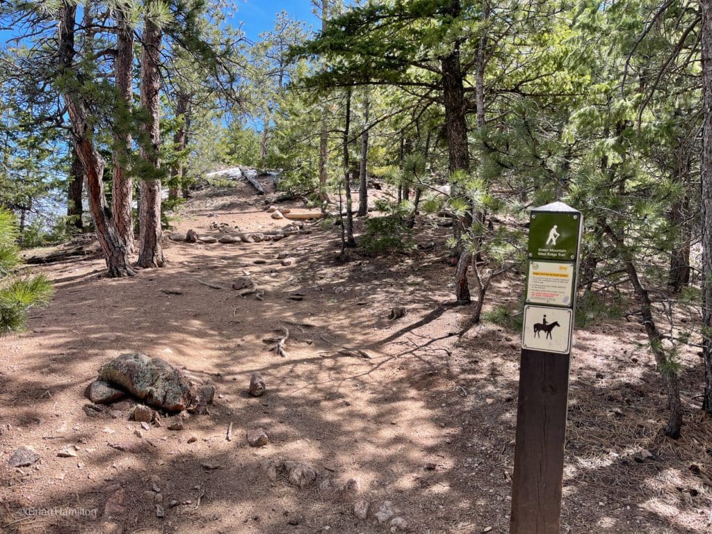
Final junction before the summit push.
Take a left (uphill) on the Green Mountain West Ridge Trail to finish the climb. You’ll gain another 250 feet in 0.2 miles before topping out on the summit. The final push will offer more views toward Rocky Mountain National Park and the large, blocky combination of Longs Peak and Mount Meeker. Looking north, they are the largest visible mountains, and from this angle, stacked one behind the other, so it’s hard to differentiate them.
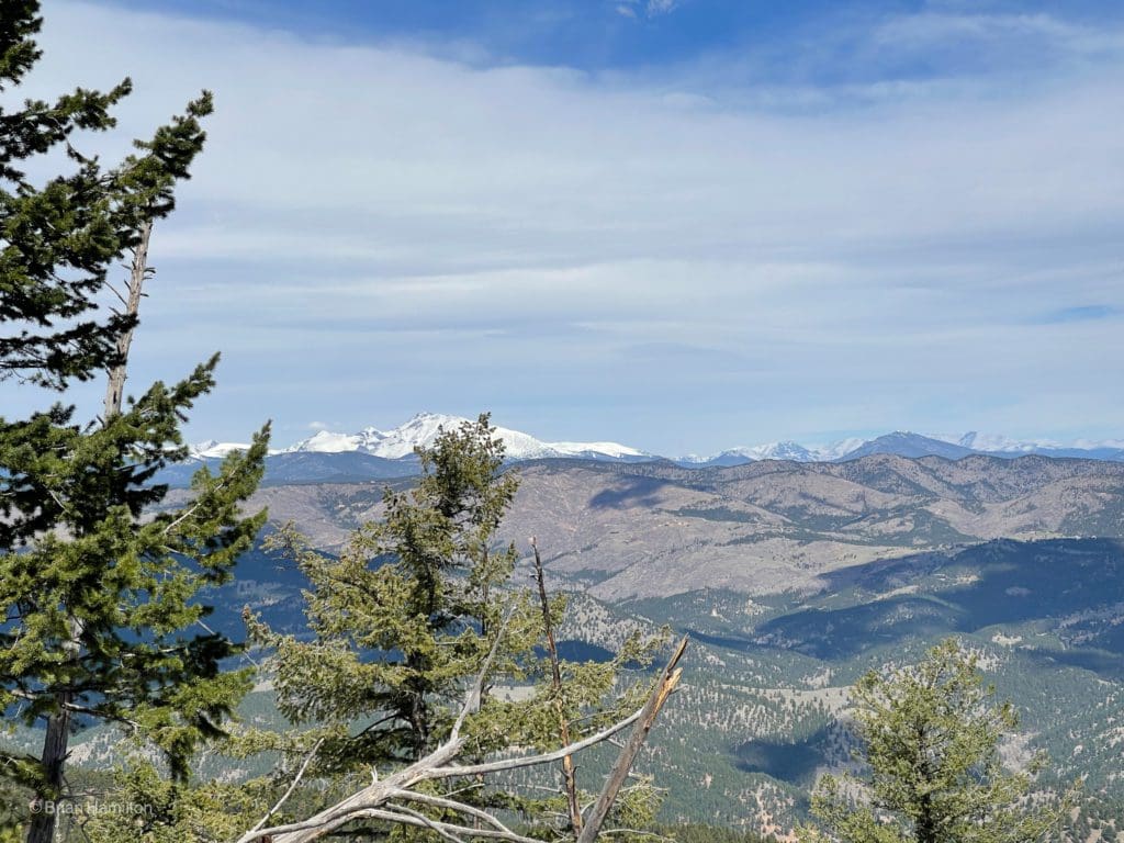
Longs Peak and Mount Meeker are the two largest peaks behind the tree branch to the left of center.
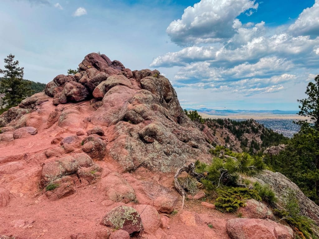
On top of Green Mountain is a dial that shows local mountain landmarks. While the summit is below the treeline, there are still plenty of places to enjoy stunning views of the high peaks to the west.
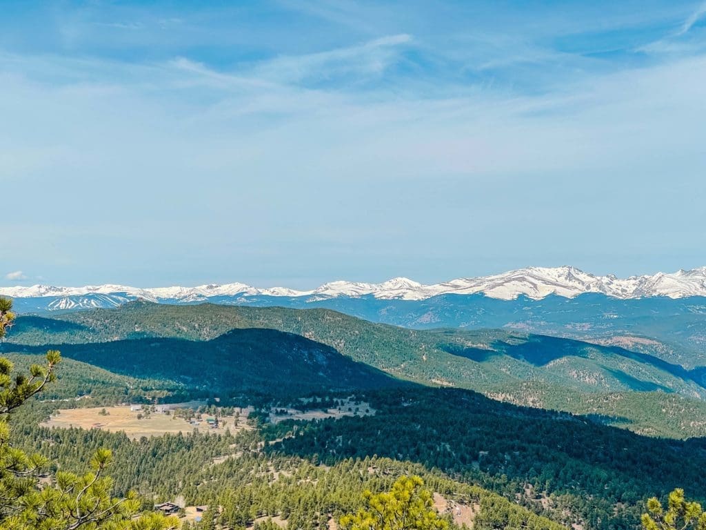
Another view west, Eldora Ski resort is to the left.
After getting your fill of the summit views, continue the loop by picking up the E.M. Greenman trail, which heads downhill and north from the summit.
You’ll lose some quick elevation as you head north, but views continue, with the summit block of Green Mountain acting as a nice frame.
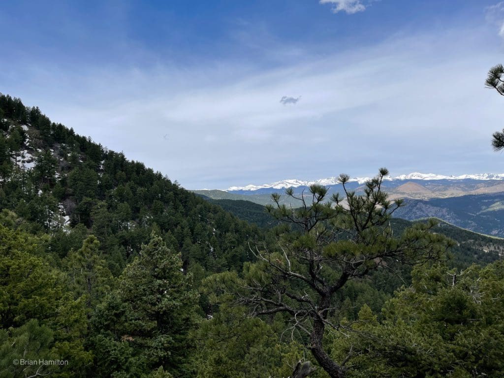
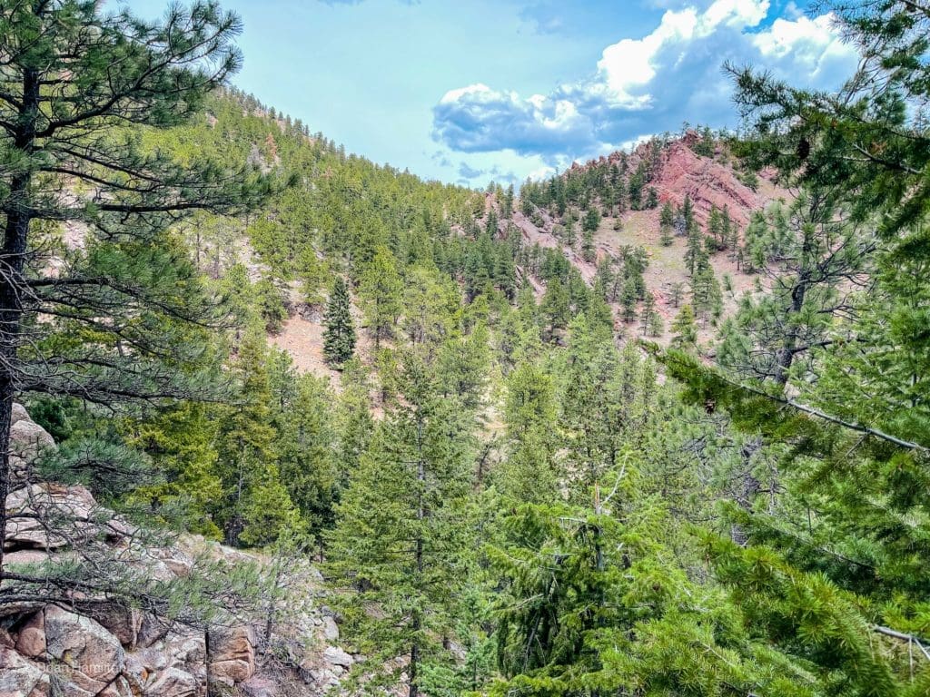
A good example of the rolling nature of the front range foothills with snow-capped peaks in the distance.
Watch for snow patches and ice that can linger on shadier, northern-facing slopes. By early June, this shouldn’t be an issue.
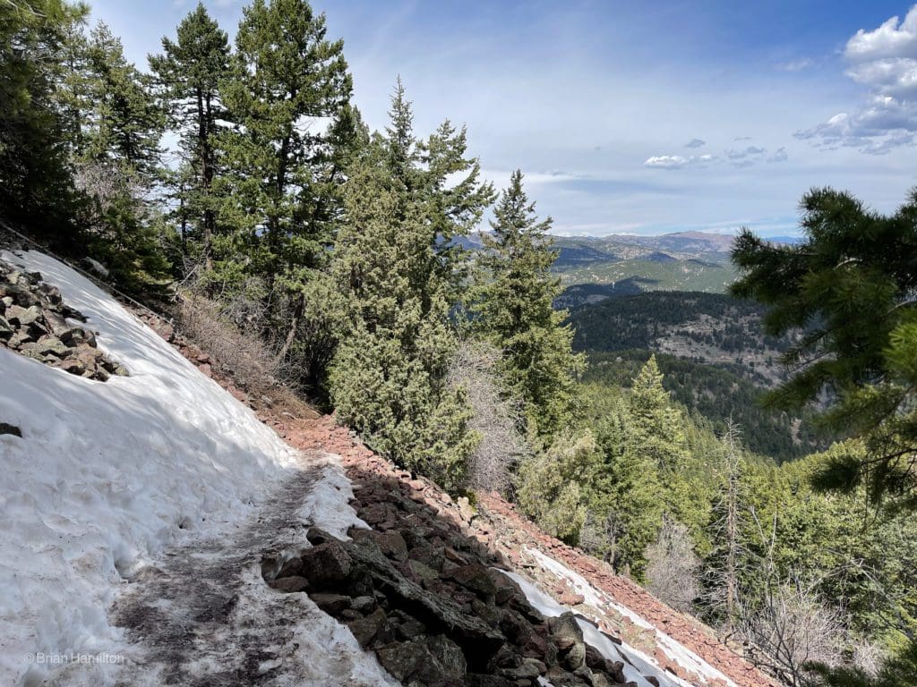
A snowy portion where Microspikes can come in handy between Nov-May.
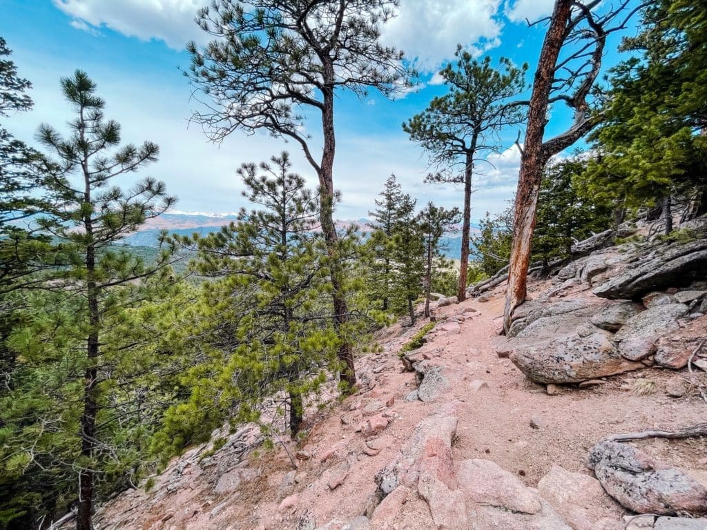
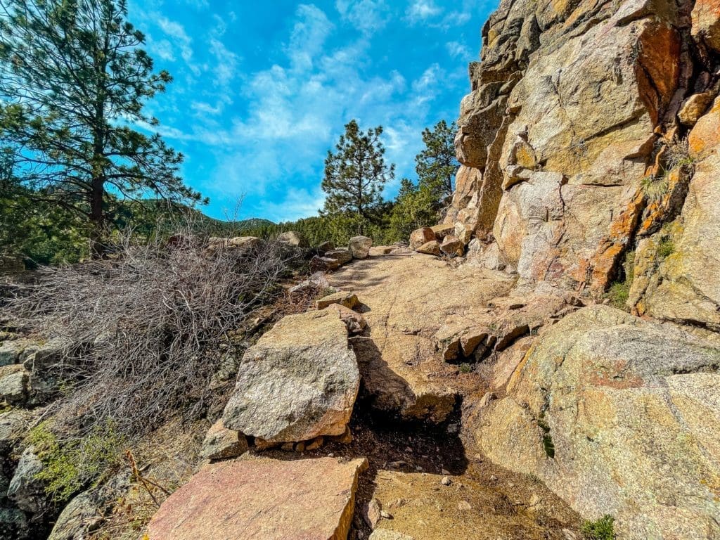
You’ll also get sections of trail that navigate around and through some rock formations, which leads to more sweeping views of the surround.
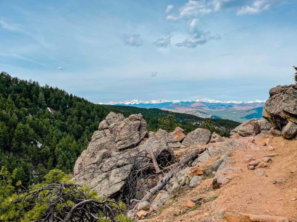
Another rockier section of trail with fantastic long-range views.
Follow the E.M. Greenman trail as it meanders downhill. At the junction with the Saddle Rock Trail, take it.
Junction with Saddle Rock Trail.
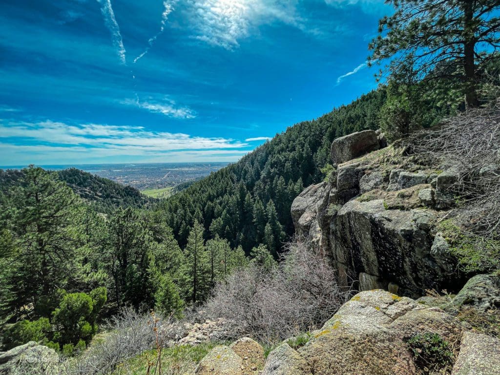
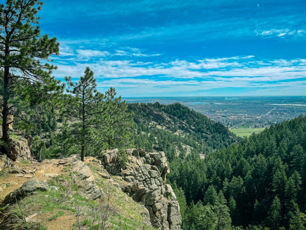
As the trail loses elevation, you’ll start to get views back east, with Boulder nestled at the foot of the mountains.
The edge of the mountains.
As the trail rounds a corner and faces more east, you’ll also be able to see the top of the first Flatiron formation.
The back of the first Flatiron.
One of the highlights of this section of the loop hike is the ladder, built after the regional flooding in 2013.
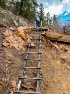
The ladder on the Saddle Rock Trail, an adventure in either direction.
On the other side of the ladder, the trail reenters the forest with intermittent views and occasional rock formations.
A forested and rocky section of trail.
Rock outcrops and views.
The next trail junction is with the Amphitheater Trail. You can use both the Saddle Rock and Amphitheater Trail to complete the loop. For this guide, we recommend taking the Amphitheater Trail.
Scenes along the Amphitheater Trail.
Once you make it back to Gregory Canyon Trailhead, the final portion is taking either the Baseline or Meadow Trails across Chautauqua Park and back to your car. All said and done, the loop hike will net you nearly 2500 vertical feet in about 7 miles. It’s a fantastic workout that starts only a few minutes from downtown and, while popular, should provide enough trail for you to have moments of peace amongst the hills.
Terms of Use:
As with each guide published on SKYBLUEOVERLAND.com, should you choose to this route, do so at your own risk. Prior to setting out check current local weather, conditions, and land/road closures. While taking a trail, obey all public and private land use restrictions and rules, carry proper safety and navigational equipment, and of course, follow the #leavenotrace guidelines. The information found herein is simply a planning resource to be used as a point of inspiration in conjunction with your own due-diligence. In spite of the fact that this route, associated GPS track (GPX and maps), and all route guidelines were prepared under diligent research by the specified contributor and/or contributors, the accuracy of such and judgement of the author is not guaranteed. SKYBLUE OVERLAND LLC, its partners, associates, and contributors are in no way liable for personal injury, damage to personal property, or any other such situation that might happen to individuals following this route.


