


High Point:
12,685 feet

Total Ascent:
~2325 feet

Difficulty:
Difficult

Distance:
6.3 miles

Route Type:
Out and back
Columbine Lake in Colorado is a beautiful hike in the San Juan Mountains. The trail ends with a breathtaking blue lake, surrounded by gorgeous mountain scenery. See our guide for an escape from busier trails like Ice Lake Basin.
Overview
Columbine Lake is a stupendous hike in the central San Juan Mountains that is popular but less crowded than the Ice Lake Basin. The demanding hike begins off a dirt road that connects with US-550 just north of Silverton and leads to a stunningly blue lake in an absolutely gorgeous post-card-worthy setting. There are multiple different Columbine Lakes, so when researching information, make sure to specify the lake in San Juan County.
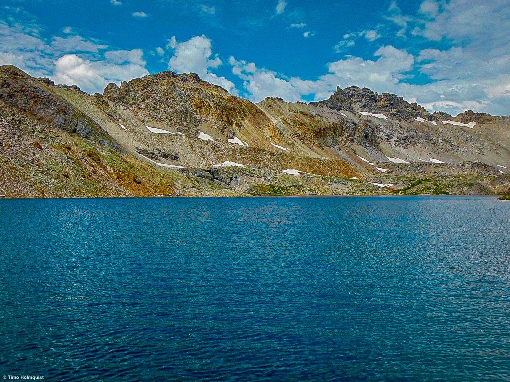
The beautiful Lake Columbine.

Table of Contents
Article Navigation: Click on any of the listed items in the table of contents below to jump to that section of the article. Similarly, clicking on any large, white section header will jump you back to the Table of Contents.
Scales and Criteria
This article uses two metrics to calculate difficulty: overall distance and elevation gain. For winter ascents, a snow rating may be used as well, but the access road is not plowed, and that adds a substantial mileage portion to the overall trip. This review covers the basic ascent and descent to Columbine Lake during snow-free summers and autumn months, so snow shouldn’t be more of a factor than a few isolated patches up high.
Difficulty Ratings:
- Easy: less than 5 miles, less than 500 ft. of elevation gain
- Moderate: 5-10 miles, 500-2000 ft. of elevation gain
- Difficult: 5-15 miles, more than 2000 ft. of elevation gain
- Very Difficult: 10+ miles, more than 3,500 ft. of elevation gain
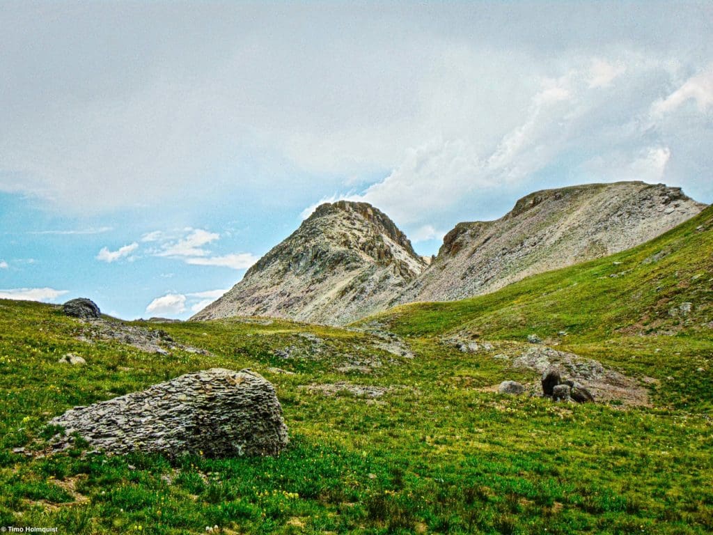
Typical alpine scenery in the San Juan’s.
The Ultimate Offline GPS Hiking & Ski Maps
See why onX Backcountry is the ultimate GPS navigation app for your outdoor pursuits. Try Today for Free. No credit card required.

Directions to Trailhead
This hike is far from Front Range cities. If you approach from the north (through Ridgway and Ouray), you’ll crest Red Mountain Pass and meander down toward Silverton. There’s a half loop made from an old dirt road that grants access. The first entrance is fairly hidden, but the road is numbered 820, takes off on a northerly trajectory, paralleling the stretch of US 550 you just drove, before heading west across a drainage and climbing into the hills. The road passes the old Imogene Mine and enters a stretch of forest. The small trail from Columbine Lake starts here, and there will likely be cars parked alongside the road. If you can’t find a space here, park alongside the road when possible but know that it is a thin area and blocking the road is not an option.
The second and more easily identifiable entrance (from both north and south) is to take the dirt road to Ophir Pass initially. A sign should be obvious on US-550 when you get close, and it will be a left if you’re coming from the north or a right after you pass Silverton, if coming up from the south.
Once on Ophir Pass Road, look for an intersection with road 820 heading to the right. The area where the two dirt roads intersect has room for a handful of cars comfortably. It may be a longer walk from here, but it’s better than driving right up to the trailhead on 820 and realizing there’s no closer parking because its full or there aren’t enough areas on the side of the road to safely park. In all scenarios the trail takes off from near the high point of the 820-dirt road.
Distances and times from major Colorado cities:
- Denver/Boulder: ~320 miles, ~6 hrs. 10 min.
- Colorado Springs: 285 miles, ~5 hrs. 45 min.
- Fort Collins: ~410 miles, ~7 hours
- Grand Junction: 115 miles, 2 hrs. 23 min.
- Durango: ~55 miles, ~1 hr. 15 min.
The intersection of forest road 820 and the Ophir Pass Road.
The Ten Essentials: How to Equip Yourself for the Backcountry
Packing the “Ten Essentials” whenever you step into the backcountry, even on day hikes, is a good habit. When something goes awry, you’ll truly appreciate the value of carrying these items that could be essential to your survival.
Field Notes
The San Juan’s are the most extensive range in Colorado, and weather can be notoriously fickle. For area forecasts, start with Silverton’s extended weather from the national weather service. Opensummit is also a fantastic resource, with its own Silverton weather page and one for OPUS hut off of the Ophir Pass Road. You can also check the forecast for Ulysses S. Grant Peak atop the Ice Lake basin or Red Mountain Pass to round out a local gathering of weather information. The full 5-day details of Opensummits forecasts require a subscription, but the first two days are free to look at. The entirely free, Mountain-forecast.com reports weather conditions from Lookout Mountain, which borders the Columbine Lake Basin and is easily visible from the shoreline of the lake.
The biggest things you want to research are whether or not there’s snow on the trails, the wind speeds, and afternoon thunderstorm chances. While the hike is exceedingly beautiful, once you’re above the trees, there aren’t many places to hide from lightning. Since the area is fairly deep in the backcountry, cell reception may be an issue as well, so make sure you have a small first aid kit and are in reasonably good shape to get to the lake.
Wildflowers along the trail.
Global Rescue has expanded services to include local field rescue within 100 miles of home. Global Rescue is there whether you’re hiking, kayaking, snowmobiling, fishing or simply enjoying the outdoors and get ill or injured and you’re unable to get to safety on your own. Global Rescue is the red button you push in an emergency. Their team of medical and security experts come through for you when it matters most.
Journal
This is a stunning and surprising hike that highlights a lot of what makes the San Juan Mountains so special. Despite a relatively innocuous beginning to the hike, when you find the trail, be prepared for a series of demanding switchbacks up a steep hillside. You gain about 1,500 feet in the first 1.75 miles of trail, so adjust your pace accordingly and keep chugging along. The first mile is in the woods before you break out into a lovely basin.
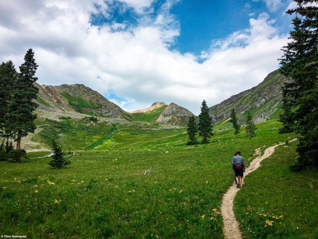
Looking up the trail at treeline.
Once you gain a little elevation, you can look back and spot the Grenadier Range, which contains rock climbing icons like Vestal, Arrow, and the Trinity Peaks.
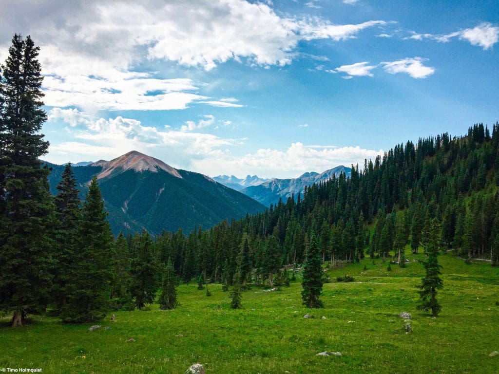
Looking back to higher peaks in the distance as you climb above the trees.
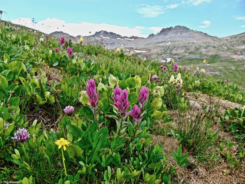
The basin you climb into is not the end of the hike, so despite the relief of being able to see around you in a wonderful alpine area, keep some energy in the tank. As the path meanders up, you’ll pass some fields, and in July, there should be bountiful wildflowers to keep you enthralled. As always, don’t pick any flowers you see; they are rare and best viewed through a camera. Remember, leave places better than you found them, so future generations have a chance to enjoy them.
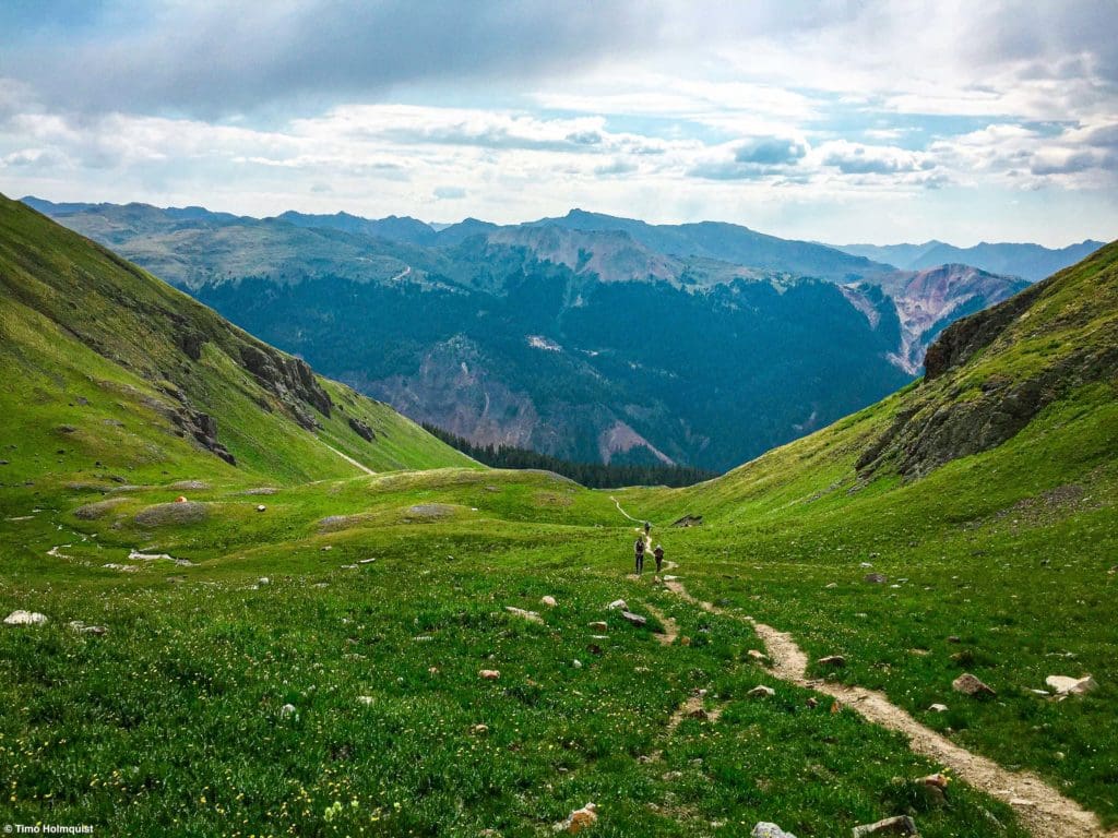
Looking down the basin as you climb higher.
Eventually, you’ll reach the base of the headwall at the top of the basin. The trail switchbacks up and then traverses right (north) across a set of small cliffs before disappearing into another area. This looks like an intimidating section from afar but only requires one or two awkward steps up before the path moderates once more.
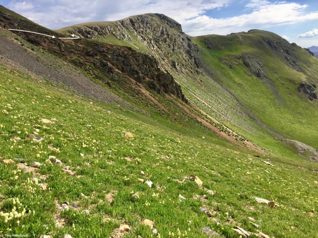
The path follows the white arrows.
From the quick traverse across the cliffs, you can gauge just how far and how high you’ve climbed.
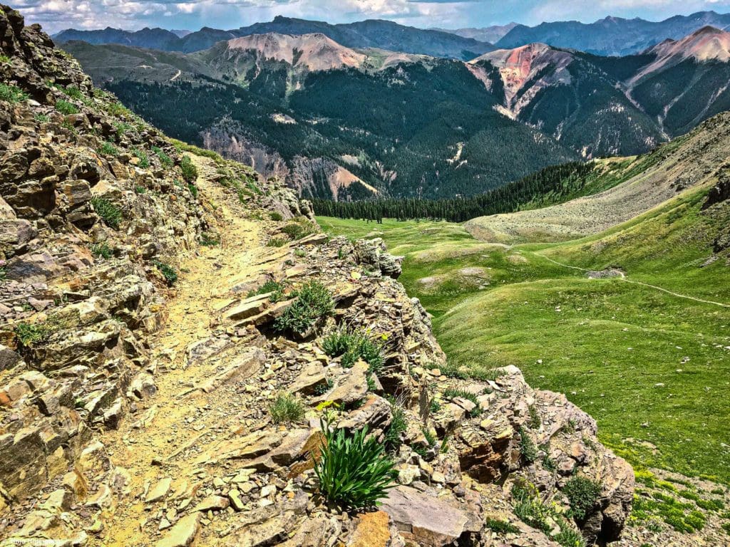
Looking back into the first basin from atop the small cliffs.
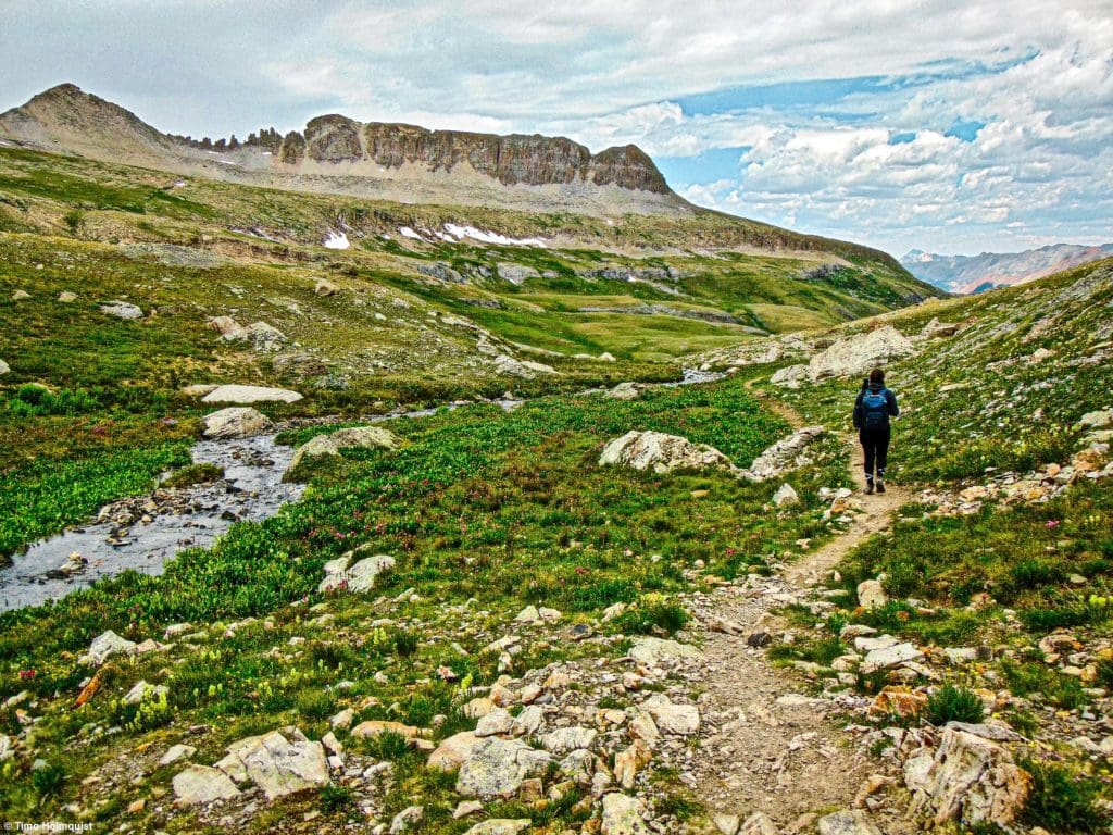
Once you get out of the first basin, the trail turns back west, and you enter the alpine wonderland of the San Juan’s. With such a large upthrust of mountains, it often feels like you’re surrounded by a never-ending sea of pinnacles, snowcaps, cliffs, and wildflower-laden basins.
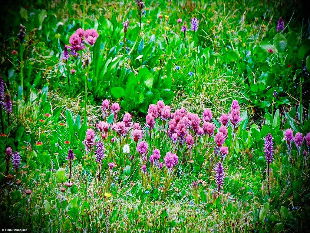
Wildflowers on the approach to Columbine Lake.
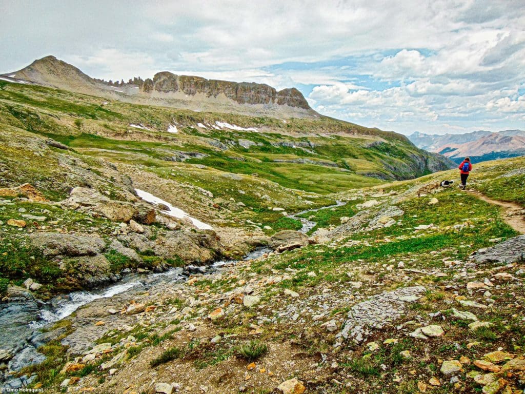
Most of the elevation gain is already behind you, but this stretch of trail is deceptively long. Enjoy the rolling landscape and the views as you work your way toward the stream that flows from the lake.
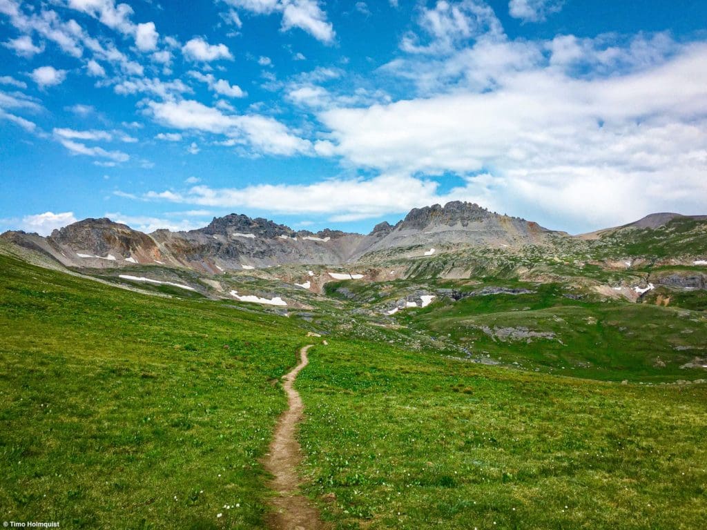
The alpine environment on the second half of the trail.
You’ll know you’re getting close to the end when the trail meets the outflow stream and works up the last elevation rise.
Looking back down the trail from the edge of the lake.
One of the striking things you’ll notice almost immediately about Columbine Lake is how blue it is. The color is quite astounding when the sun reflects off of the surface and, like Ice Lakes Basin, seems otherworldly. The other thing you may notice is how big the lake is, which is surprising for how high you are, but it has a decent size and butts right up against some picturesque ridges up to ~13,700 feet.
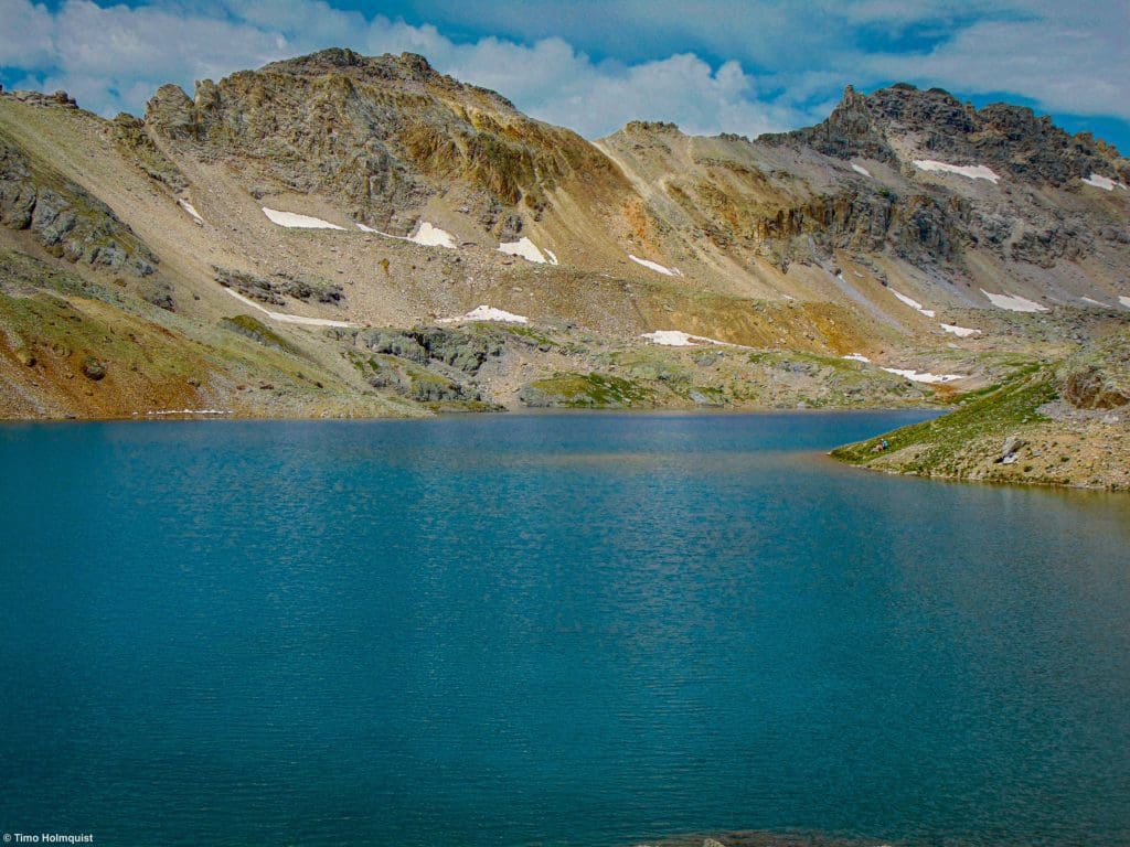
Lake Columbine from its eastern edge.
There are plenty of places along the northern and eastern shore to set up a little camp or get into the water (which is always freezing). In June and July, the wildflowers blanket the surround and the earlier in the summer you go, the higher the likelihood of picturesque snowfields hanging on to the ridges above you.
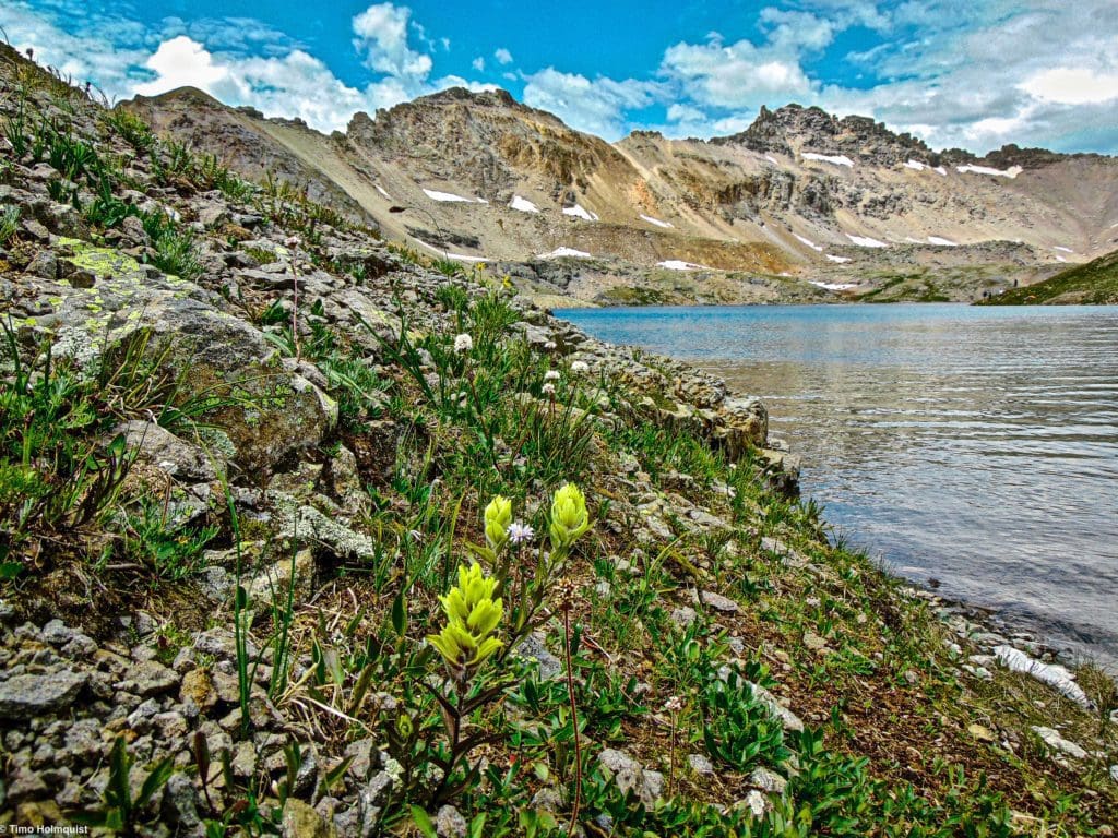
A yellow Indian Paintbrush flower on the shores of the lake.
September is also a great month to go with far fewer people around, and some years early to mid-October can be fantastic as well. Once you get into October, however, the hike may be much harder depending on when the first accumulating snowfall occurs.
Although you’re never more than a few miles from the nearest road, the isolation of the basin feels more profound; once you’re up there, you can’t see any signs of human civilization apart from any other hikers on the trail. Summer weekends are the most popular time for the trail in any given year.
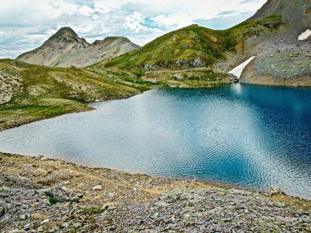
Eastern edge of the lake.
On a good day, it’s nice to start the trail early and spend a few hours at the lake. It is above treeline, so hammocks aren’t practical, but a nice blanket or some foldable chairs are good to bring. Whenever you’re ready, head back to the north side of the lake, where the outflow stream begins to run back down the side of the mountain.
Walking back down from the lake.
Since it is an out and back hike, the scenery will be largely familiar. The weather can be fickle, so if you notice large puffy clouds building, it’s time to head back down. The thunderstorm potential is elevated all through summer. On the lower parts of the trail, your knees will really feel the descent, so take your time and adjust boots or socks as necessary to try to avoid blisters and any extra strain on your legs.
If you’re looking for a place to get a snack or a post-hike drink, Silverton is the closest, but you’ll have more options in either Durango, Ouray, or Montrose.
Terms of Use:
As with each guide published on SKYBLUEOVERLAND.com, should you choose to this route, do so at your own risk. Prior to setting out check current local weather, conditions, and land/road closures. While taking a trail, obey all public and private land use restrictions and rules, carry proper safety and navigational equipment, and of course, follow the #leavenotrace guidelines. The information found herein is simply a planning resource to be used as a point of inspiration in conjunction with your own due-diligence. In spite of the fact that this route, associated GPS track (GPX and maps), and all route guidelines were prepared under diligent research by the specified contributor and/or contributors, the accuracy of such and judgement of the author is not guaranteed. SKYBLUE OVERLAND LLC, its partners, associates, and contributors are in no way liable for personal injury, damage to personal property, or any other such situation that might happen to individuals following this route.


