


|
Getting your Trinity Audio player ready...
|
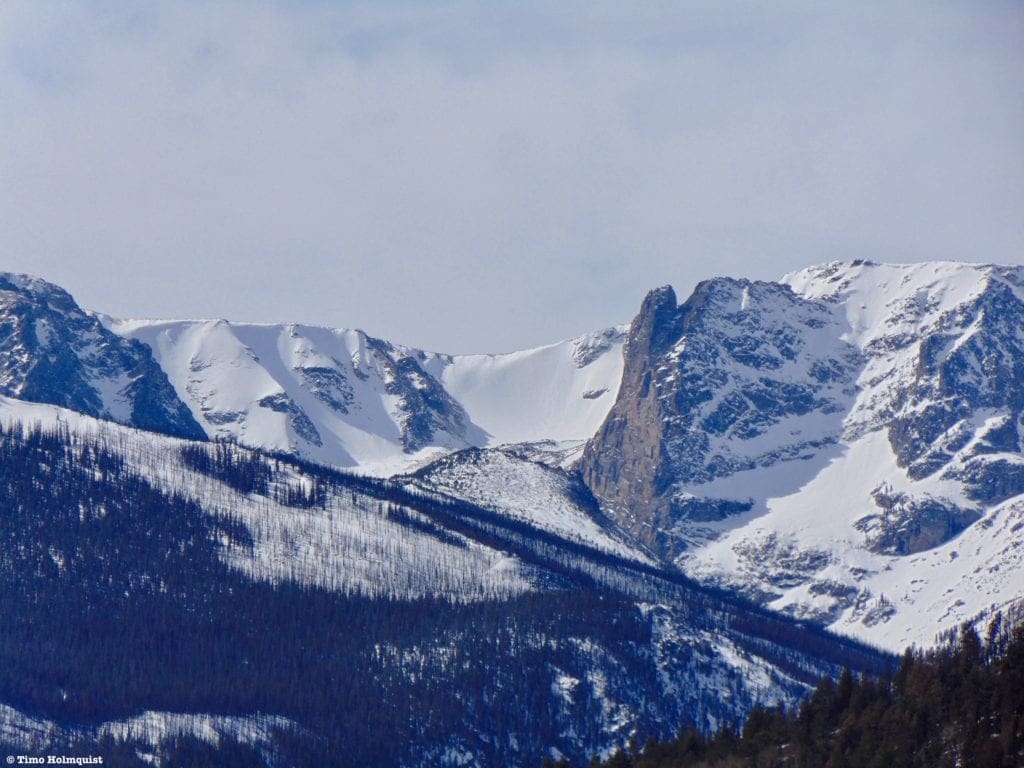
Located in Colorado, Rocky Mountain National Park offers stunning views, diverse landscapes, and wildlife sightings. With over 350 miles of hiking trails and scenic drives like Trail Ridge Road, it’s perfect for nature lovers and adventurers.
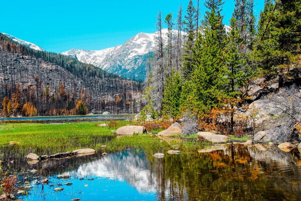
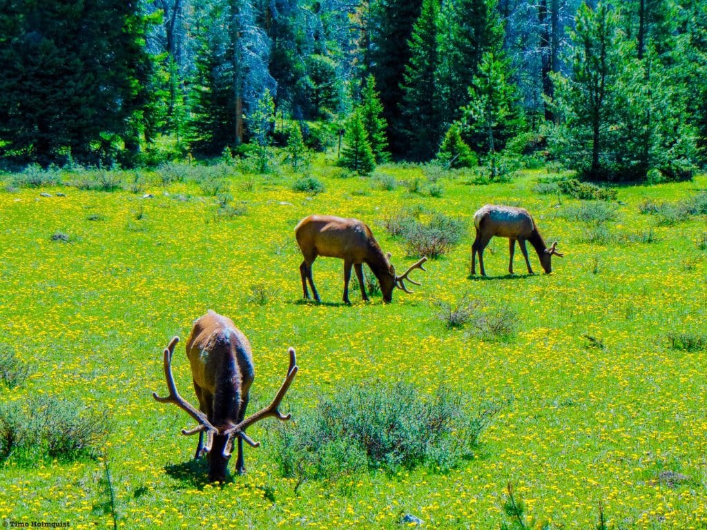
Nestled in the beautiful state of Colorado, USA, lies Rocky Mountain National Park – a breathtaking natural wonder. The expansive park is home to an abundant array of wildlife and boasts over 350 miles of hiking trails, offering unparalleled opportunities for exploration and adventure. Spanning elevations from 7,860 feet to 14,259 feet, the landscape changes drastically from lush forests to rugged alpine tundra and serene lakes. Visitors can often spot majestic elk, bighorn sheep, and moose roaming the park’s grounds, while scenic drives like Trail Ridge Road provide breathtaking views of the diverse terrain.
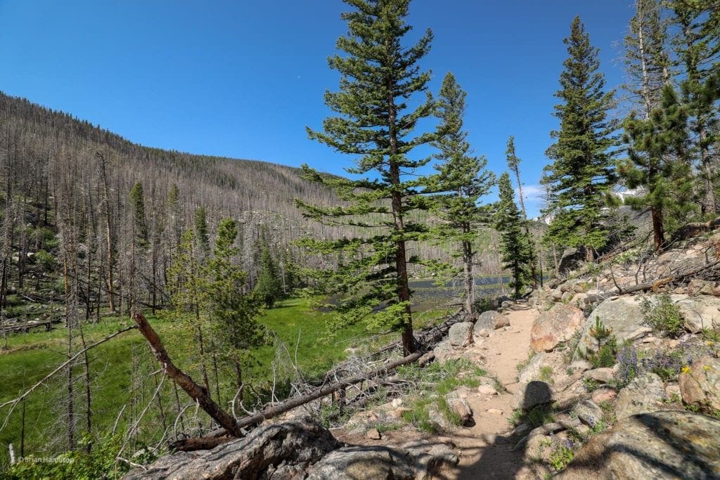
Rocky Mountain National Park offers a wide range of hiking trails and outdoor activities for visitors of all skill levels, making it a popular destination for nature enthusiasts and adventure seekers alike.
We’ve selected 10 jaw-dropping trails in the Park that show off the incredible natural diversity and beauty of this fantastic part of the country.
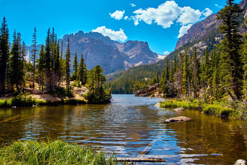
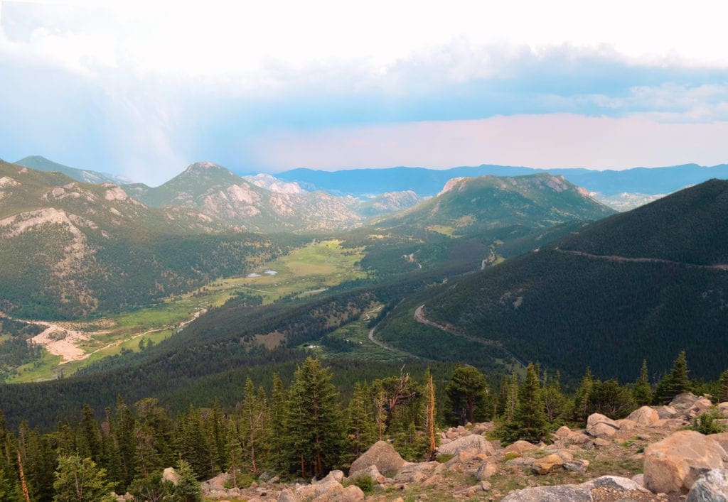
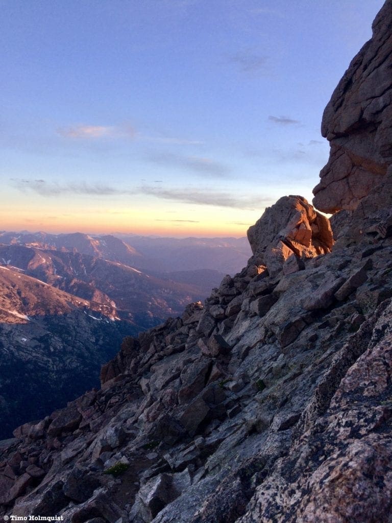
The Loch Lake provides beautiful views on the way to Sky Pond in Rocky Mountain National Park.
Quick Navigation
Article Navigation: Click on any of the listed items in the table of contents below to jump to that section of the article. Similarly, clicking on any large, white section header will jump you back to the Table of Contents.
- Rocky Mountain National Park Overview
- Planning and Prep
- Rocky Mountain Variety Hour: Criteria and Categories
- Trail Ridge Road
- Best Day Hike to a Lake: Sky Pond
- Best Waterfall: Ouzel Falls
- Best Glacier Hike: Andrews Glacier
- Best Flower Hike: Cub Lake
- Best Hike for Wildlife Viewing: Coyote Valley Trail
- Best Winter Hike: Emerald Lake
- Best Alpine Experience: Mt. Alice via the Hourglass Ridge
- Best Multi-day Experience: Continental Divide Loop
- Best Mountaineering Experience: Longs Peak
- Final Thoughts
- Sources
Rocky Mountain National Park Overview
Rocky Mountain National Park was created in 1915 by President Woodrow Wilson, although much of the effort can be contributed to Enos Mills. Mills spent years writing thousands of letters and lobbying congress to create the Park; his inexhaustible drive and energy helped spur the creation of Rocky Mountain (Stansfield, n.d.). His name has been attributed to a few natural features in the Park, including Mills Lake in Glacier Gorge; you can read about that trail here.
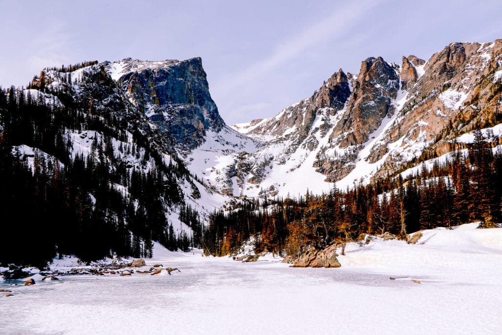
Very generally, Rocky Mountain National Park can be divided into an eastern and western side, traversed by one of the prettiest high alpine paved roads in the country, Trail Ridge. Trail Ridge is an exceptional highlight of the Park but is only a seasonal road, open from roughly Memorial Day through October. With multiple feet of snow falling along the alpine sections of the Park every winter, keeping all of Trail Ridge open and plowed just isn’t possible.
The eastern side of the Park is by far the most popular–roughly 80% of park traffic enters through Estes Park (Peglar, 2020). Geographically this makes sense as the Front Range cities of Denver, Fort Collins, and Boulder are all roughly an hour and change away. The western entrance by Grand Lake is, however, spectacular in its own right.
Mt. Alice from Lion Lake 1.
There are four large and informative visitor centers and multiple historical sites within the Park, which are all fascinating and fun to explore. Trail Ridge also offers dozens of pullouts where you can park and take in the fantastic scenery along the way. If the high-elevation road isn’t your first choice, Rocky is also a hiker’s paradise with over 415 miles of glacially carved mountains to explore. One of the most popular peaks is Longs Peak, the only 14,000-foot mountain in a National Park and a fantastic, albeit crowded and complicated, mountaineering experience.
Longs Peak from Trail Ridge.
With towering peaks, stunning lakes, impressive rock formations, large wildlife, and beautiful wild flowers, Rocky Mountain has something for everyone.
Planning and Prep
Being a high elevation staple of the Colorado mountains, Rocky Mountain National Park sees its fair share of extreme weather. It is important to check multiple forecasts for the Park, especially if your plans include Trail Ridge, which climbs to over 12,000 feet. A good starting point is to look at the weather for Estes Park if approaching from the east or Grand Lake if approaching from the west. Those forecasts will be good for anything below roughly 10,00 feet. If Trail Ridge is a target, look up the weather for the alpine center.
There are some additional resources that could prove helpful, depending on what your Rocky Mountain experience entails. Mountain Forecast is a site that reports weather on many mountains within the Park and at different elevation gradients. It’s beneficial to look at an interactive park map and figure out what area you are going to be in to best utilize individual mountain forecasts. Opensummit also has quite a few mountain weather reports, although their long-range forecast and some features are only available with a membership. Since weather can be wildly different between valleys and mountain peaks, it helps to really round out the forecasting picture.
Spring in Rocky Mountain National Park, the snowpack up high doesn’t melt until mid-June.
The lowest elevations of Rocky Mountain are still quite high when compared to the rest of the US. Colorado is also in a semi-arid climate. Both the elevation and arid climate increase the importance of bringing water. Park visitors should always have a significant amount of water and keep an eye on the signs of altitude sickness, which become more prevalent the higher you travel. For a better idea of what altitude sickness is and how best to combat it, click here.
Winter travel is possible throughout the Park, but additional safety precautions need to come into play. You’ll likely need traction devices or snowshoes and good orientation skills. You’ll also need to double or triple up on layers to deal with temperature variations. The temperature in the Park can often oscillate between 30-40 degrees within a single day. Frigid and blustery winds are also a factor.
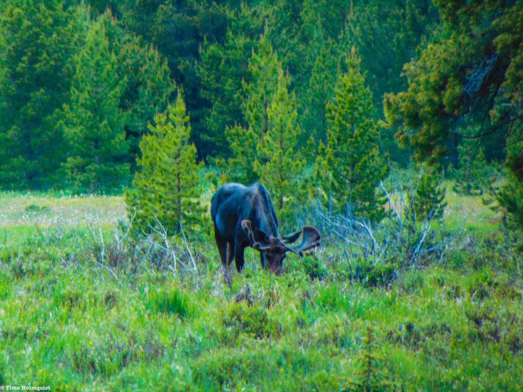
Another aspect of Rocky Mountain to think about, especially if you are camping in the Park, is animals. The Park has a good number of black bears, mountain lions, lynx, moose, elk, and tons of smaller critters. Make sure you are using the provided food storage lockers at established campgrounds or bringing a bear canister for backcountry travel. If you leave food out, chances are it’ll attract animals.
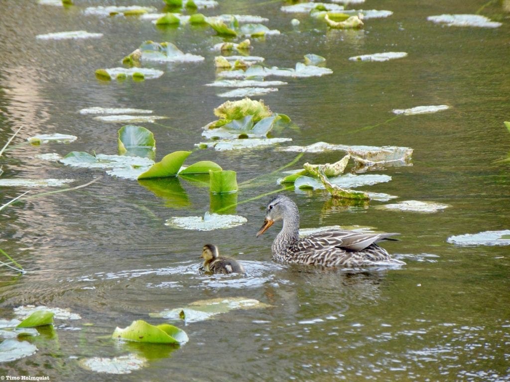
Mama duck and her duckling.
Speaking of camping, the Park has dozens of options ranging from established campsites to remote backcountry spots. Make sure you obtain proper permits and pay appropriate fees; Rangers patrol the Park and will hand out fines if you are illegally camped or haven’t paid for your site. Another big camping consideration is fire. 2020 was the most devastating fire season in recent memory and included three fires that broke the record for most acres burned within Colorado. Unfortunately, two of those fires (Cameron Peak and East Troublesome) burned into the Park, marring the landscape and destroying some structures. If there are fire restrictions in place, follow them. It takes 40+ years for mature trees to establish in a post-fire environment; based on the CDC’s 2018 US average life expectancy of 78.7 years, that’s more than half of your life. Be fire aware; actions have consequences. You can use the same link as the interactive map to scroll down and find comprehensive information on campsites and backcountry sites; click here.
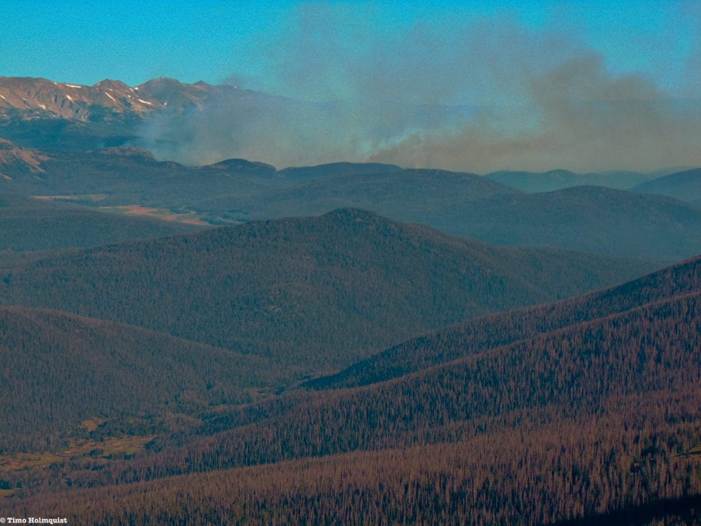
The early stages of the Cameron Peak Fire, which started to the north of Rocky Mountain, before burning south into it.
Popularity and the time of year are also big factors in planning a trip to Rocky Mountain. The most popular months are during the summer when parking lots are usually full by 7 am, and thousands of cars will be pushing up Trail Ridge. Get into the Park early. There are two entrances out of Estes Park, US 34 and US 36. Eventually, the roads merge and continue as US 34. You can also enter through Grand Lake, which doesn’t feature the often-lengthy lines common at the eastern entrances, but will be packed on weekends. Like all National Parks, you have to pay to enter. Visit the Fees section of the National Park website to figure out which pass option suits your needs. There is also a timed entry system the Park put into place in 2020 to help manage visitation in the wake of the Covid-19 virus. That system will be in place from May 28-October 11th of 2021 as well.
Visiting in the shoulder seasons (April-May, Sept-Oct) is a nice way to experience the Park in a more relaxed environment. However, snow will be on the ground through most of May and June, and the first seasonal snow usually drops sometime in early October. Consequently, snow-free July and August are the busiest months. Bear Lake Road is so popular in the summer that the Park has created a free shuttle to ferry people up and down the area. Click here to explore the shuttle options.
Rocky Mountain, while generally snow-free from July-mid Sept, has a ton of alpine environments that come with their own risks as well. If you travel high enough, it can snow any month of the year. Free of trees and sheltered areas, the alpine is particularly susceptible to afternoon thunderstorms as well. These storms can crop up with little to no warning, and lightning strikes are common. The best practice is to be out of the alpine areas (or in a car) by noon to minimize lightning risk. Thunderstorms are most common in July and August when the mountains experience a seasonal monsoon weather pattern.
…wait, what? Monsoon? Aren’t those persistent rains that tend to impact portions of India every year? Yes, but that’s not the whole story; there are actually multiple monsoon patterns that set up across the globe, Colorado benefits from the NAM (North American Monsoon). While not as newsworthy or extreme as the Indian Monsoon season, monsoonal rain brings welcome relief to the typically dry southwestern US, including Colorado. If you’re interested, check out these links, which help explain the NAM and its effects on local Colorado weather. What is the NAM? CSU Climate Center: North American Monsoon.
Mt. Craig, aka Mt. Baldy, from the shores of Grand Lake on the western edge of the National Park.
Rocky Mountain Variety Hour: The Criteria and Categories
With so much to explore and do, it can be a bit overwhelming trying to figure out where to go and what to see. Below, we broke down the various categories we thought best exemplified the unique nature of the Park. Trail Ridge gets its own category because the road has a lot to offer.
- Best of Trail Ridge
- Best Day Hike to a Lake
- Best Waterfall
- Best Glacier Hike
- Best Flower Hike
- Best Hike for Wildlife Viewing
- Best Winter Hike
- Best Alpine Experience
- Best Multi-Day Experience
- Best Mountaineering Experience
Obviously, a lot of these suggestions are up to interpretation, and many frequent visitors will have their own favorite places they elevate over others. The point of our list is to simply illustrate the incredible diversity of the Park so readers will have a better understanding of what there is to see and do. In addition to the criteria above, 8 of the 10 suggested hikes have alternate ‘honorable mention’ hikes listed. We also rate the popularity and difficulty of the hike according to the levels listed below.
Popularity Ratings
-Low: Large sections of trail all to yourself
-Moderate: Sizeable trail sections to yourself, crowding possible on busy summer weekends
-High: You’ll be seeing people, still a chance for solitude in spring/fall/winter.
-Very High: Almost always busy.
Difficulty Ratings:
-Easy: less than 5 miles, less than 500 ft. of elevation gain
-Moderate: 5-10 miles, 500-2000 ft of elevation gain
-Hard: 5-15 miles, more than 2000 ft. of elevation gain
-Very Hard: 10+ miles, more than 3,500 ft. of elevation gain
Please note: scrambling is also mentioned in the article. The act of scrambling involves all four appendages being used to scale slopes that are steeper and more challenging than a simple hike. Scrambling routes are indicated by the Yosemite Decimal System, and split into Class of difficulty from 1-5+. Hikes on established trails are Class 1, for example. Class 5 routes and higher are subdivided into numerous difficulties and often require rock-climbing equipment to scale. You can find out more about the YDS scale here.
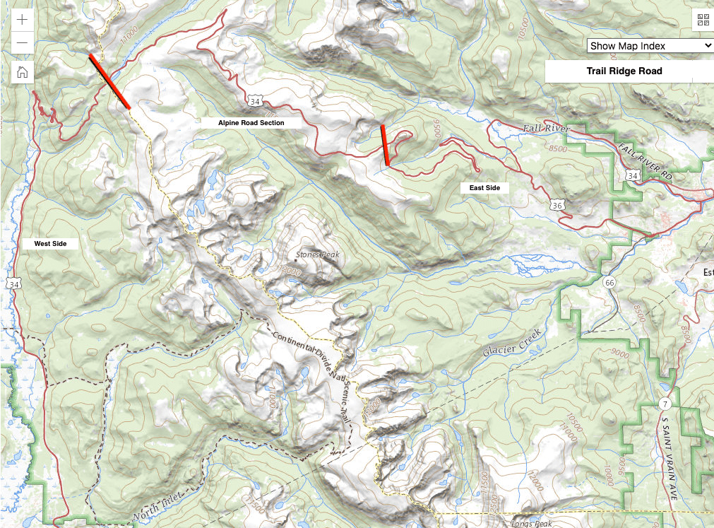
Trail Ridge Map
Trail Ridge Road:
- 48 miles long
- Highest Elevation: 12,183 feet
- time to drive: 2 hours (without traffic)
- Popularity: Very High
Arguably the most well-known area of Rocky Mountain, Trail Ridge is a fantastic way to see the Park in a short amount of time and from the comfort of a car. The road itself was finished as part of FDR’s new deal infrastructure program during the Great Depression and is nothing short of an engineering marvel (NPS, 2016). Since most people enter the Park from the east, we’ll describe the various attractions east to west.
Summer in Rocky Mountain National Park: Alluvial Fan, Hidden Valley, Trail Ridge Road, Horseshoe Park, Sheep Lakes, McGregor Mtn, The Needles, Castle Mtn and Deer Mtn Seen from Rainbow Curve.
The Meadows: Regardless of how you enter from Estes Park (US 34 or US 36), your road of choice will take you alongside either Beaver Meadows or Horseshoe Park, two large subalpine meadows that often attract tons of wildlife. It’s common to spot large deer and elk herds, as well as the occasional moose. Please only utilize established pull-offs as traffic jams occur when overenthusiastic drivers try to pull to the road shoulder whenever they see wildlife.
The Alpine: Once US 34 and 36 intersect, there are quite a few pull-offs that offer some delightful trail options, but if you’re pressed for time, the best thing to do is continue up to the alpine areas. In my opinion, the prettiest part of the road is between Ute Crossing and Medicine Bow Curve. Ute Crossing leads to a high elevation walk along Tombstone Ridge, where you may be able to spot Marmots, Pikas, and Ptarmigans: three unique alpine animals. The views to the southeast of Longs Peak and Glacier Gorge are absolutely stunning. A quick, paved walkway from Forest Canyon is another highlight, along with the Toll Memorial Trail by the Rock Cut. The Alpine Visitor center is yet another fantastic area, complete with a revitalized building and views aplenty. You really can’t go wrong up here; sit back and enjoy the views of the Rocky Mountains stretching in every direction.
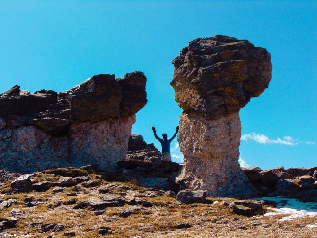
Mushroom Rocks near the Toll Memorial Trail.
The Western Side: If you’re heading back east, use the Alpine Center as a turnaround point. If you’re keen on heading to Grand Lake, continue down to the Kawuneechee Valley on the opposite side. Like the meadows on the east, this area is ripe with wildlife sightings, and grants access to some of the most remote and beautiful parts of the National Park, like the Never Summer Mountains and the Continental Divide Trail. The town of Grand Lake is also quite pretty and located on the shore of the lake it’s named after. Although outside of the Park (so you would need to get another time slot to reenter it), the Grand Lake Lodge is a perfect place to grab some food or drink and sit on the wide-open patio above the lake and the western fringes of the Park. A nice, multi-day option would be to spend a day on the eastern side of the Park, drive across Trail Ridge, and spend a night in Grand Lake.
The Never Summer Range, on the western fringes of the Park, from one of the dozens of Trail Ridge viewing areas.
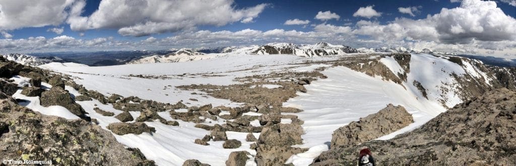
Bear Lake Road Area. The whole numbers indicate destinations in the article. The decimal numbers indicate honorable mentions in their respective categories. As you can see, this one area of the Park contains A LOT.
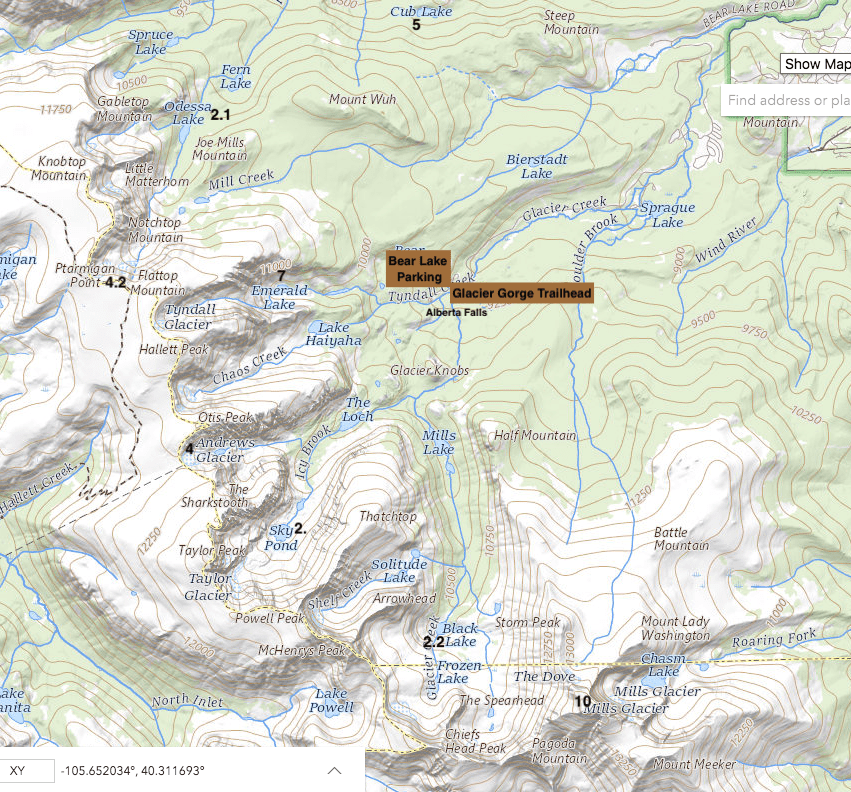
Bear Lake Area Map.
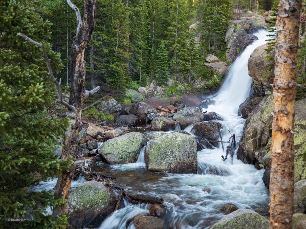
Best Day Hike to a Lake: Sky Pond
- Total Distance: 9 miles
- High Point: 11,014 ft.
- Difficulty: Hard
- Total Ascent: ~2,000 ft.
- Route Type: Out and Back
- Trail Status: Open
- Popularity: High
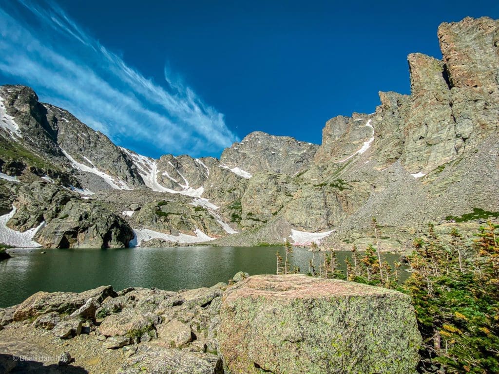
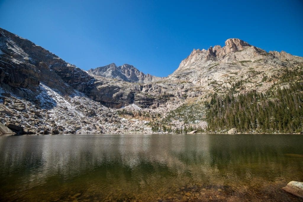
Sky Pond
Hike Description
Sky Pond is routinely included in lists of the prettiest lakes in Colorado. You can read our full review of the trail here. It is not a short hike and will require a full day to truly appreciate.
Like many of Rocky’s eastern highlights, this trail is accessible via Bear Lake Road. The Glacier Gorge Trailhead is routinely full by 7 am in the summer, so get there early. With timed entry into the Park for the summer of 2021, a potential workaround is to arrive before six am, although you will still need an entrance pass to enter the Park.
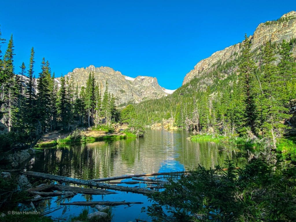
Loch Vale
Along the 4.5-mile hike to the lake, you’ll pass Alberta Falls, Loch Vale, and Glass Pond, all of which are beautiful and worthy destinations in their own right. The Glacier Gorge area is so crammed with spectacular destinations that you could spend weeks exploring all the named features in the area. Bring your camera!
Glass Pond.
From the Glacier Gorge Trailhead, head south ~1.6 miles until taking a right onto a small section of the North Longs Peak Trail. 0.4 miles later, continue straight through Mills Junction, eventually arriving at Loch Vale. Enjoy the stunning scenery here and continue south into the increasingly dramatic, glacially carved valley with towering rock spires around you.
While the vast majority of the route is on an established trail, there are a couple of sections that involve some light scrambling. Once you pass the intersection with Andrews Creek trail, (at around 3.6 miles in), you’ll ascend to Timberline Falls. The trail attacks a rocky section to the right of the falls that you’ll need to scramble up. Although short, the section is more demanding than anything you will have encountered so far. Take your time and use your hands to help brace as you carefully ascend.
The next lake is Glass Pond, which, despite its stunning scenery, is not the end of the trail. Work your way around the lake on its western side, ascending to a small bench where Sky Pond lies. Views include Powell Peak, Taylor Peak, Taylor Glacier, and the jagged rock spires of the Sharkstooth. Find a place to sit and soak up this spectacular, dramatic, and otherworldly example of natural beauty.
Honorable Mentions
Odessa Lake (Moderate) check trail status here, possible fire closure.
At a Glance: 9 miles roundtrip from Bear Lake, +1900 feet. 9.5 miles roundtrip from Fern Lake Trailhead, +1900 ft.
What makes it special: The view from the shores of Odessa Lake was one of the inspirations for recommending Rocky Mountain as a National Park; it’s simply awesome. With two ways to reach it and a loop hike option to increase the mileage, Odessa is a worthy destination if you’re trying to avoid the Glacier Gorge crowds. The Fern Lake Trailhead is temporarily closed due to fire damage from 2020, but you can still use Bear Lake to access the region, respect closures when and where you encounter them.
Odessa Lake.
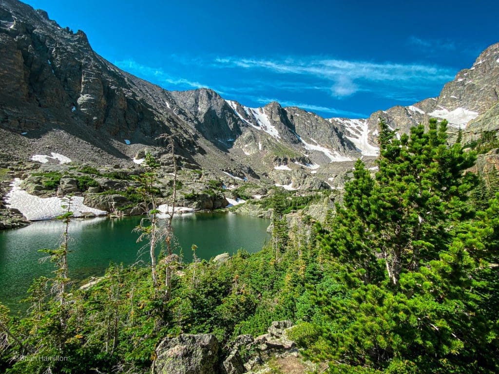
Black Lake (Moderate)
At a Glance: 9.6 miles, + ~1400 feet.
What makes it special: This longer jaunt into Glacier Gorge passes multiple lakes along the way, sheds a lot of the crowds, and provides impressive views of McHenry’s Peak from the shores of this picturesque alpine lake. Prepare for a long day with many photo opportunities. You can read our full trail review of Black Lake here.
Black Lake
Wild Basin Map.
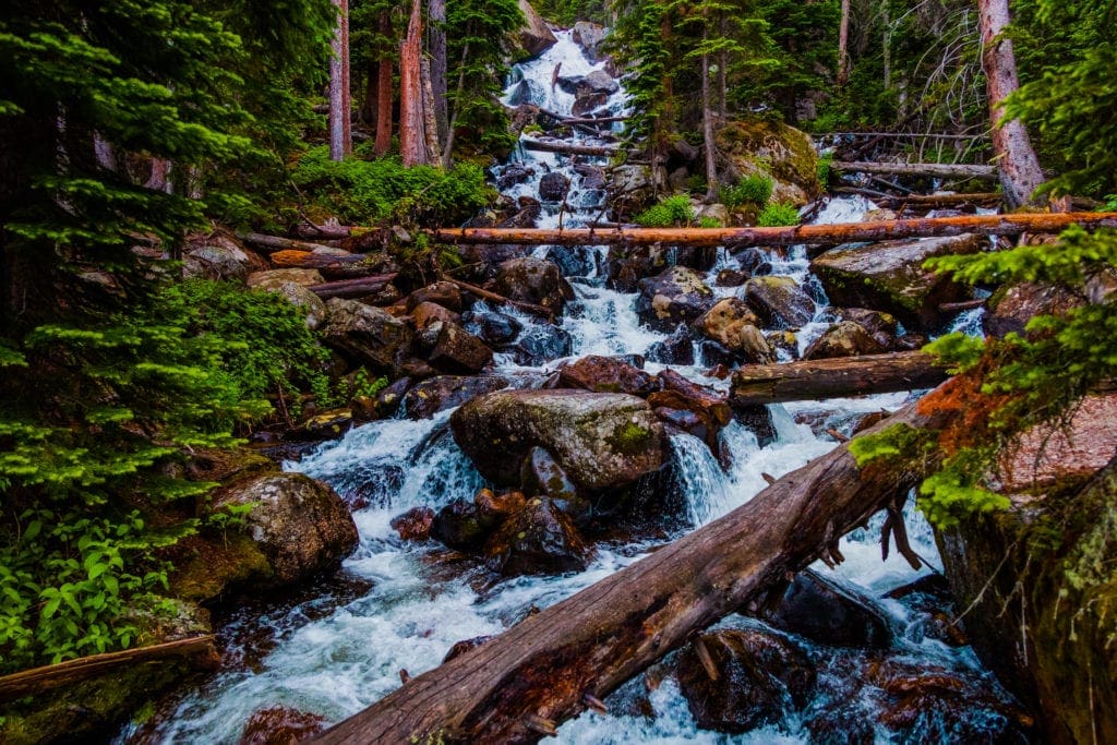
Best Waterfall: Ouzel Falls
- Distance: 5.7 miles roundtrip
- High Point: 9,400 ft.
- Difficulty: Moderate
- Total Ascent: 900 ft.
- Route Type: Out and Back
- Trail Status: Open
- Popularity: High
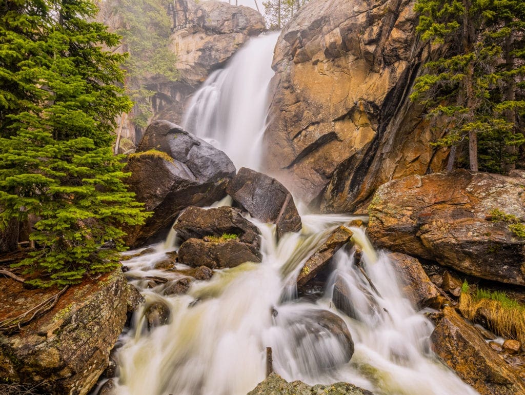
Mist and spray come off Ouzel Falls during high Spring runoff in the Wild Basin area of Rocky Mountain National Park, Colorado.
Hike Description:
Located in the remote and wonderful Wild Basin, the trail to Ouzel Falls passes two other picturesque waterfalls along the way and exemplifies the roaring seasonal snowmelt common from roughly May-July. In the late summer, the waterflow significantly decreases, but in early June, it’s hard to find a more impressive set of flowing water features in the Park. You can read our full trail review of Black Lake here.
The trailhead is located off CO7, about half an hour south of Estes Park. Despite its location away from the two main entrances to Rocky, Wild Basin can also experience heavy traffic. Arrive early, especially on weekends. Keep an eye out for brown signs to your right if coming from the north; the lead-up is down country road 84, which passes by a few houses and the Wild Basin Lodge & Event Center before the Park gate comes into view. From there, it’s a dirt road to the trailhead.
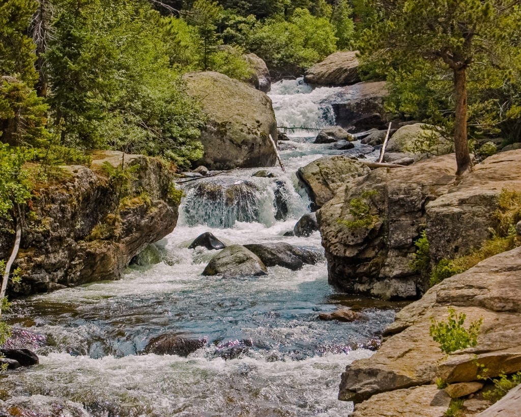
Once you park, head west on the main trail, passing the thundering Copeland Falls after a couple points of a mile (a good, short destination for families). After 1.3 miles, you’ll arrive at a junction with a side trail that visits a series of backcountry campsites, take a left and continue to Calypso Cascade. Beyond Calypso Cascade, the crowds should lessen, but Ouzel is still a popular place; expect to share the trail with others.
Upper Copeland Falls
The well-built trail will rise and hug the steep sides of the hillside until you arrive at the impressive 40-foot falls. There are great views from the trail, though it’s worth poking around in the trees to get better perspectives. Stay away from wet and steep edges as they could lead to nasty falls. It’s clear that many people have been feeding animals here; the squirrels are…shall we say, real friendly. Please respect wildlife; once animals become reliant on humans for food, they gradually forget how to fend for themselves. Wildlife is better wild.
Calypso Cascades, Rocky Mountain National Park, Colorado
Between Copeland Falls, Calypso Cascade, and Ouzel Falls, there are no shortages of photo opportunities. Once you’ve had your fill, turn around and hike back the way you came.
Honorable Mentions
Alberta Falls (Easy)
At a Glance: 1.6 miles roundtrip, +~250 feet.
What makes it special: Big bang for your buck. This short hike is incredibly popular as it takes off from the perennially packed Glacier Gorge Trailhead. Alternatively, you can try to park at Bear Lake, which adds a couple points of a mile, or spring for the Bear Lake free shuttle. Either way, the payoff for the effort is hard to beat, be prepared to share the trail.
Alberta Falls
Adams Falls (Easy)
At a glance: 0.6 miles roundtrip, + >100 ft.
What makes it special: Like Alberta Falls, the bang for your buck is excellent. The only downside is that it’s on the western side of the Park, which is far if you’re coming from the Front Range. The Falls are also located in a part of the Park that only has one entrance (i.e. doesn’t connect with Trail Ridge), which may complicate the timed entry system. A nice upside is that this side of the Park is quieter and no less beautiful. If you want more isolation, continue up the East Inlet Trail. Grand Lake is also a fun town to spend an afternoon in.
Adams Falls
Best Glacier Hike: Andrews Glacier
- Distance: 9 miles
- High Point: ~11,360 ft. at the tarn, ~11,950 ft at the top of the glacier
- Difficulty: Hard
- Total Ascent: ~2200 ft to the tarn, ~2790 ft. to the top of the glacier
- Route Type: Out and Back
- Trail Status: Open
- Popularity: Moderate
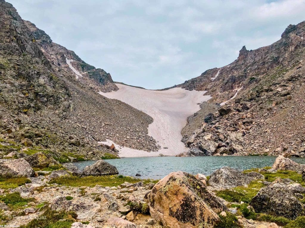
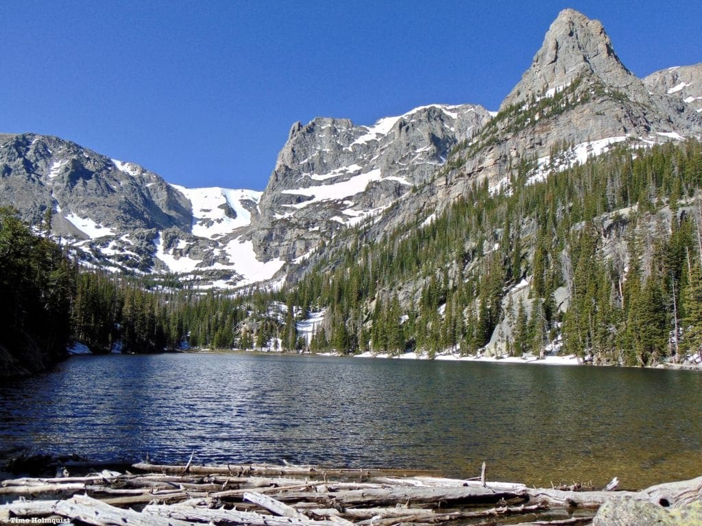
Summer time at Andrews Glacier in Rocky Mountain National Park.
Hike Description
It may surprise some people to find out that Colorado still has a few glaciers. Are they comparable to the absolute behemoths of Patagonia or the Columbia Ice field in Canada? No, but they harken back to a time thousands of years ago when the mountains were shaped and broken by seemingly endless chunks of ice. In fact, many of the dramatic landscapes in Rocky Mountain were formed by glaciers, so it seems fitting to pay homage to these natural architects of change before they disappear from the landscape completely. Andrews Glacier is one of the easiest glaciers to reach and even provides a relatively mellow snow climb, should you decide to climb and/or ski it.
As with many of Rocky Mountains best trails, this one starts at the Glacier Gorge Trailhead and dives south into the Park. Pass Alberta Falls and take a right at the North Longs Peak intersection towards Mills Junction. Like the trail to Sky Pond, head west through mills junction and pass the always beautiful Loch Vale. On the other side of the lake, keep a sharp eye out for the intersection with Andrews Creek (~3.6 miles in). Take a right and begin a stronger ascent. The trail can be faint here, but you want to stick closer to the flanks of Otis Peak (to your right), eventually leaving the base of the valley and performing an ascending traverse west, avoiding a steep terrain trap to your south. The tarn and glacier are hidden for the majority of the hike but will reveal themselves once you crest a large bench near the head of the valley.
From the base of the tarn, you can enjoy fantastic views of the glacial remnant, or, if you have the energy, you can climb the glacier to the saddle behind it. Throughout the summer, this is a fun and low-angle ski descent. If you’d rather climb and glissade down, the lower slope angle makes it an enjoyable and expedient way to exit the alpine. While the chances of cascading into the tarn at the bottom of the glacier are very low, it is worth paying attention to.
The dozen or so glaciers left in Colorado are melting quickly and are only found from the Indian Peaks north into the Park. While it may seem like little more than a snowfield, glaciers are bound by ice and move as one unit, exhibiting characteristics like calving, growth, retreat, and can develop crevasses. If you decide to climb the glacier, make sure to bring appropriate gear and a partner. For information on the ski descent, visit our Bear Lake Area Ski Lines Backcountry Guide.
Honorable Mentions
Rowe Glacier (Very Hard)
At a glance: ~19.5 miles roundtrip, + ~5,200 ft.
What makes it special: Rowe Glacier was the first glacier discovered in Rocky Mountain National Park. The story goes that a grasshopper infestation in the late 1800’s attracted bears to the region, which, in turn, attracted hunters. One of those hunters was Israel Rowe, who first found the glacier. Not only was it the first discovered glacier in the Park, but it is also one of the most complete. There are two well-defined crevasses, a central portion, a perennial ice sheet over a portion of the tarn at its base, and a calving ice block on its northern edge. If glaciers aren’t that interesting, it looks like a bunch of snow and ice in a remote area of alpine Colorado. If glaciers are interesting, Rowe is a worthy destination that can be combined with a tough, Class 4 scramble of Hagues Peak from Lawn Lake or a Class 2 jaunt up and over Mummy Mountain. There are other ways of reaching the glacier from the north, but Lawn Lake is the closest trailhead to Estes Park. Prepare for a long day.
Ptarmigan Glacier (Hard)
At a glance: ~8.8 miles roundtrip, +2450 ft. gain
What makes it special: A little steeper than Andrews, and with some crevasse action near the top, Ptarmigan is one of the more popular areas for skiers and snow climbers. It doesn’t require ice climbing gear but is a moderate snow climb in a gorgeous area. Once you climb to the top, you can take the Flattop Trail back down for a quick loop. The lead-up view from Lake Helene of Notchtop and Little Matterhorn is worth the trip alone, simply stunning. Climbing up into the basin and getting on the glacier is just the cherry on top. If you’re climbing the glacier be aware that it separates into two pieces later in the summer.
Ptarmigan Glacier, the largest snow slope just left of the impressive rock wall on Notchtop.
Best Flower Hike: Cub Lake
- Distance: 6 miles
- High Point: 8750 ft.
- Difficulty: Moderate
- Total Ascent: + ~750 ft.
- Route Type: Loop
- Trail Status: Temporarily closed (fire closure from 2020, check RMNP website)
- Popularity: High
Cub lake, Rocky Mountain National Park
Hike Description
This is the perfect early-season flower hike due to its lower elevation and ease of access. You can read our full review of the trail here. As indicated in the bullet points above, the area was impacted by fires in 2012 and 2020; check the Park website regularly for updates on closures. If the trail opens, the scenery will likely look a lot different from what stood there before. Despite the probably downed trees and charred landscape, many flowers will have survived, and it’s been reported that dozens of varieties exist along the trail. Cub Lake itself is a fine subalpine lake with lily pads covering a lot of its surface area in the early summer. It’s not uncommon to see ducks, deer, squirrels, chipmunks, many different birds, and the occasional moose.
Scattered wildflowers near Cub Lake.
Honorable Mentions
Hidden Valley (Easy)
At a Glance: 0.5 miles, + 75 ft.
What makes it special: This area used to be a ski resort back in the ‘90s, and the trail cuts through the trees are still visible. This is a great family-friendly nature stroll that is absolutely popping with wildflowers from May-June. It is also a fantastic backcountry ski area in the winter.
Trail Ridge: Toll Memorial Trail & Ute Trail (Easy)
At a Glance: 0.5 miles (Toll Memorial Trail), Ute Trail ~4 miles, + 300-400 ft.
What makes it special: Both trails take off from Trail Ridge (make sure it’s open), and do a great job of highlighting alpine flower communities which are on display in July.
Best Hike for Wildlife Viewing: Coyote Valley Trail
- Distance: 1-mile roundtrip
- High Point: 8,800 ft.
- Difficulty: Easy
- Total Ascent: minimal +/- 30 ft.
- Route Type: Loop
- Trail Status: Open
- Popularity: Moderate
Moose along the Colorado River, just off the Coyote Valley Trail.
Hike Description
This family-friendly wildlife mecca is a great way to stretch the legs. Located on the western side of the Park alongside the mighty Kawuneeche Valley (which is the native Arapahoe word for Coyote), this informative and well-designed trail is full of viewing spots, picnic benches, and views of the Colorado River. Every time I’ve been here, I’ve seen either herds of Elk, Moose, or both. It’s not a guarantee, but wildlife viewings are quite common, and for the effort, it’s always worth a quick look.
Elk on the edge of the Kawuneeche Valley.
Honorable Mentions
Upper Beaver Meadows (Easy)
At a Glance: 0-5 miles (you can drive alongside the meadows on US36 or take one of several trails that crisscross the area, many loop options exist)
What makes it special: Wildlife frequents the meadows in the spring and fall, the trails are not that difficult, the views are outstanding, and wildflowers dot the surround. This trail makes for a perfect introduction to the area.
Summerland Park (Easy) check trail status here, possible fire closure
At a Glance: ~3.5 miles, +170 ft.
What makes it special: This lesser-known hike takes off from the North Inlet trailhead outside of Grand Lake and heads to a beautiful meadowed area replete with excellent wildlife viewing minus the crowds of the eastern side of the Park. A great alternative if Coyote Valley is crowded.
Best Winter Hike: Emerald Lake
- Distance: 3.3 miles roundtrip
- High Point: 10125 ft.
- Difficulty: Moderate
- Total Ascent: ~700 ft.
- Route Type: Out and back
- Trail Status: Open
- Popularity: Very High (Moderate in the winter)
Emerald Lake in Winter
Hike Description
This hike is exceptional in all seasons, but with the intense popularity of Bear Lake Road, it’s best to experience the majesty in the less crowded winter season. You can read our review of the trail here. Plan your trip with some backup days in mind in case storms move through. On quiet weather days, the trail is easy to find, and the scenery is mind-blowing. Although Emerald Lake is the end of the trail, it’s the scenery all the way up to it that makes this one a winner. Snowshoeing, cross country skiing, and backcountry skiing are all popular activities in the winter from this trail. You may even get to see skiers exit the twin couloirs of Dragons Tail and Dead Elk from the shores of Emerald Lake. The angled rock buttress of Hallett Peak is mesmerizing. Snowshoes, microspikes, or both are going to be required unless you enjoy post-holing up to your thighs in powdery snow.
If you’re a backcountry skier, options are everywhere, from the Dream Lake Chutes to Hallett Peaks East Couloir and the Tyndall Gorge/Glacier. Check forecasts thoroughly before committing and give a quick look at CAIC, which hands out excellent avalanche forecasts. Although you won’t be climbing any tenuous slopes, high alpine valleys like this one cross many potential avalanche paths. Know before you go.
The Dragon’s Tail Couloir, famous backcountry ski mountaineering destination, from the edge of Emerald Lake.
Honorable Mentions
Deer Mountain (Moderate)
At a glance: 6 miles roundtrip, +1083 ft.
What makes it special: This hike is a nice winter summit along a well-traveled path. It does gain more than a thousand feet, but the trail is well marked, and generally speaking, Deer Mountain doesn’t deal with the heavier snowpack of higher peaks in the Park. Microspikes and snowshoes are a good idea; make sure to check wind forecasts as well because the gusts can be brutal on top. Enjoy fantastic views from the top before retracing your steps back to the car. The trailhead is next to the intersection of US 34 & US 36 on the eastern side of the Park.
Twin Sisters Mountain (Hard)
At a glance: 7.5 miles, +~2500 ft.
What makes it special: The ability to top out on a shapely summit with FANTASTIC views of Longs Peak during the winter. The trail is well-traveled, and if it’s a calm day, you’ll be sharing the trail. Pace yourself, you gain a lot of elevation in a short amount of time. Bring microspikes and/or snowshoes, and make sure to check the weather before heading out.
Best Alpine Experience: Mt. Alice via the Hourglass Ridge
- Distance: 17 miles
- High Point: 13,310 ft.
- Difficulty: Very Hard (Class 2+, options for Class 3 scrambling)
- Total Ascent: 4810 ft.
- Route Type: Lollipop loop
- Trail Status: Open
- Popularity: Low
Mt. Alice from the southeast.
Hike Description
Picking one area of Rocky over another is always a complicated endeavor, and our choice for the best alpine experience is a LONG day. If the mileage and elevation gain are disheartening, there are alternate options below.
Located in the remote and beautiful Wild Basin, Mount Alice via the Hourglass Ridge is an exceptional Rocky Mountain experience. It is a 17-mile lollipop loop with nearly 5000 feet of elevation gain and toes the line between a hike and a scramble. There are multiple reasons why this hike is our favorite.
The leadup is long and remote, diving deep into Wild Basin. You’ll pass Copeland Falls, the side trails to Ouzel Falls, and Calypso Cascades (though you should take the campsite bypass as it’s faster) and eventually find the intersection with the Lion Lakes Trail after roughly four miles. Take a right and begin a two-mile push to the Lion Lake 1, where the trees finally peel back, revealing one of the prettiest lakes in Wild Basin, complete with spectacular views of Mt. Alice. After reveling in the beautiful terrain, get ready for cross-country travel as the trail slowly disappears. Keen eyes will be able to follow established herd paths north to Lion Lake 2 and past Trio Falls. From the western shore of Lion Lake 2, head west up the low ridge to its crest, where you’ll be given a beautiful and intimidating view of Mt. Alice’s eastern ramparts. From here, head north to the ridgeline.
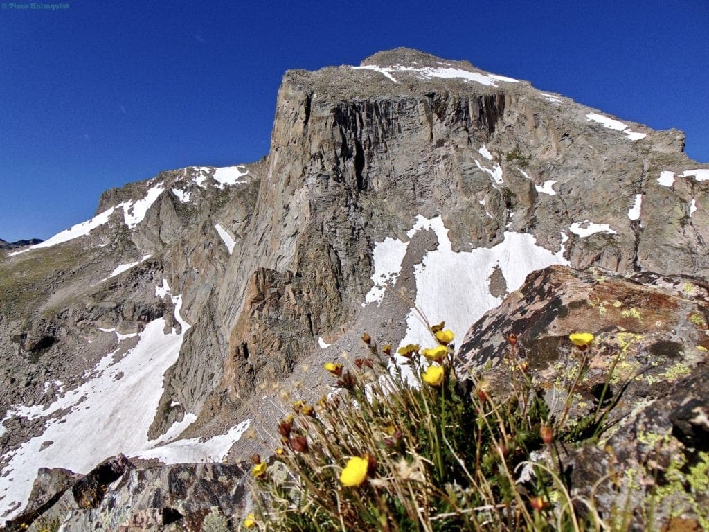
Eastern Ramparts of Mt. Alice with alpine buttercup.
Once you attain the ridgeline, you’ll be able to see the iconic McHenry’s notch to your south and the lopsided cube profile of Mt. Alice’s hourglass ridge. It looks intimidating, but with careful route finding, you can keep the climb at a Class 2+. Generally speaking, you follow the ridge to the base of the summit block and head up the middle of the hourglass. If you hang right, you can increase the difficulty rating to a Class 3 scramble. Enjoy the summit views but know that you are only halfway there.
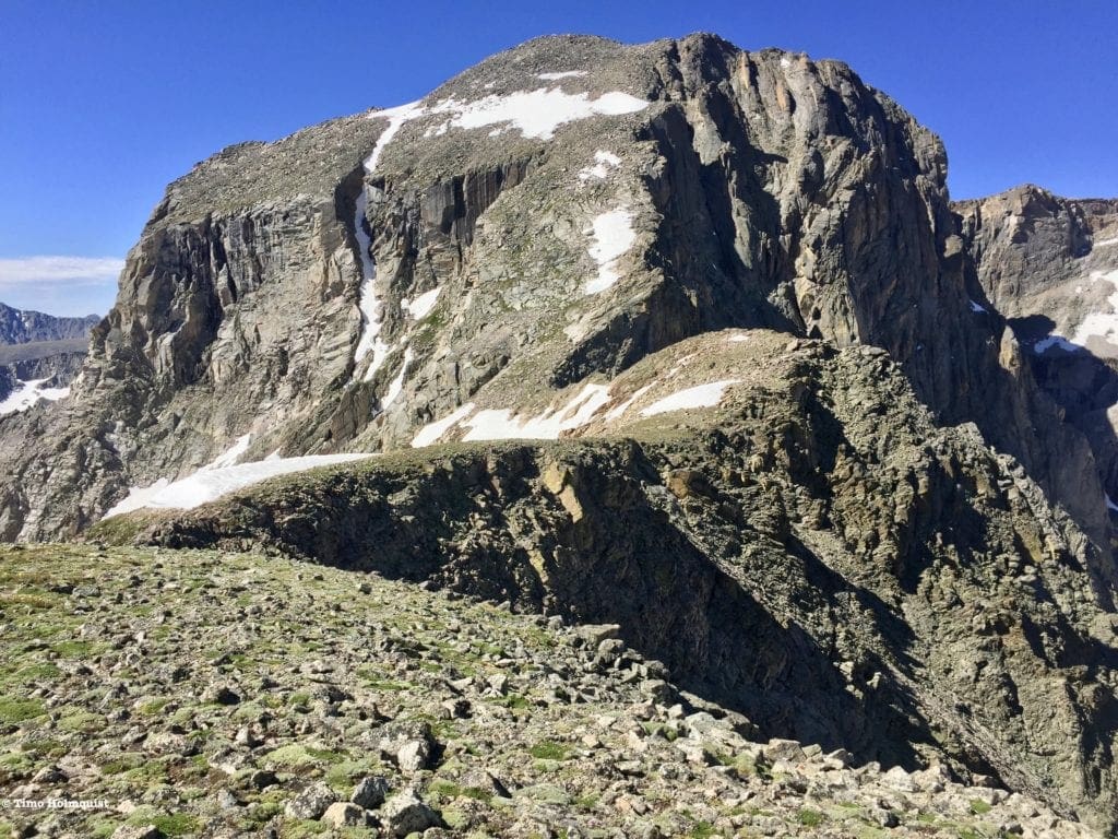
Hourglass Ridge.
From the summit, enjoy a long, downhill alpine stroll through ‘Sound of Music-esque’ scenery atop the Continental Divide. At Boulder-Grand Pass, you’ll descend back east towards treeline. Look for a steep but manageable descent option on the near side of the Pass (north). Snow tends to linger along the other parts of the Pass well into July. Once you’ve picked your way back down to treeline, follow one of many use-trails that lead you down to Thunder Lake for more fantastic views. On the far side of Thunder Lake, pick up the official and easy-to-spot trail, which will take you all the way back to your car.
As mentioned before, this is a hefty, hefty day, but between Lion Lakes, the Hourglass scramble, beautiful alpine strolling, and Thunder Lake, you’d be hard-pressed to find a loop that groups more beautiful features into one cohesive hike. Start early and dispense with the first 4-6 miles before mid-morning to maximize your time above the trees.
Honorable Mentions (Hard, easier options available)
Chapin, Mt. Chiquita and Mt. Ypsilon
At a Glance: 8.5 miles, +3100 ft.
What makes it special: Old Fall River Road is a one-way dirt track that used to take people across the divide before Trail Ridge was built. It’s usually open July-Sept; when it is, Chapin Pass trailhead provides excellent access to the Southern Mummy Range. If you have the energy, bagging all three of these peaks is a long, rewarding day above treeline with panoramic views in every direction. The trail will be open once Old Fall River Road opens; however, the scene to the north may be disheartening as a large section of that terrain was impacted by the Cameron Peak fire. Regardless, this is an easy and dramatic way to get into the alpine while avoiding the traffic jams on Trail Ridge. For an easier alternative, check how you’re feeling atop Chapin or Chiquita and turn around when you’re satisfied. Start early to avoid the chances for afternoon thunderstorms.
Ida (Hard)
At a glance: ~9.5 miles, + 2465 ft.
What makes it special: A non-technical alpine hike to a beautiful summit that is highly visible from Trail Ridge. Make sure Trail Ridge is open before committing as the trailhead is only accessible via the road. You will be above treeline for a long time: bring water, sunscreen, and bail quickly if weather threatens. The last part is over uneven, rocky terrain, and some brief route finding will be required. The grouping of mountains around Ida are highly visible from Trail Ridge but seldom climbed; they offer superlative views and a fantastic alpine experience. Watch those afternoon storms; you do not want to be caught up here when lightning is in play.
-
-
-
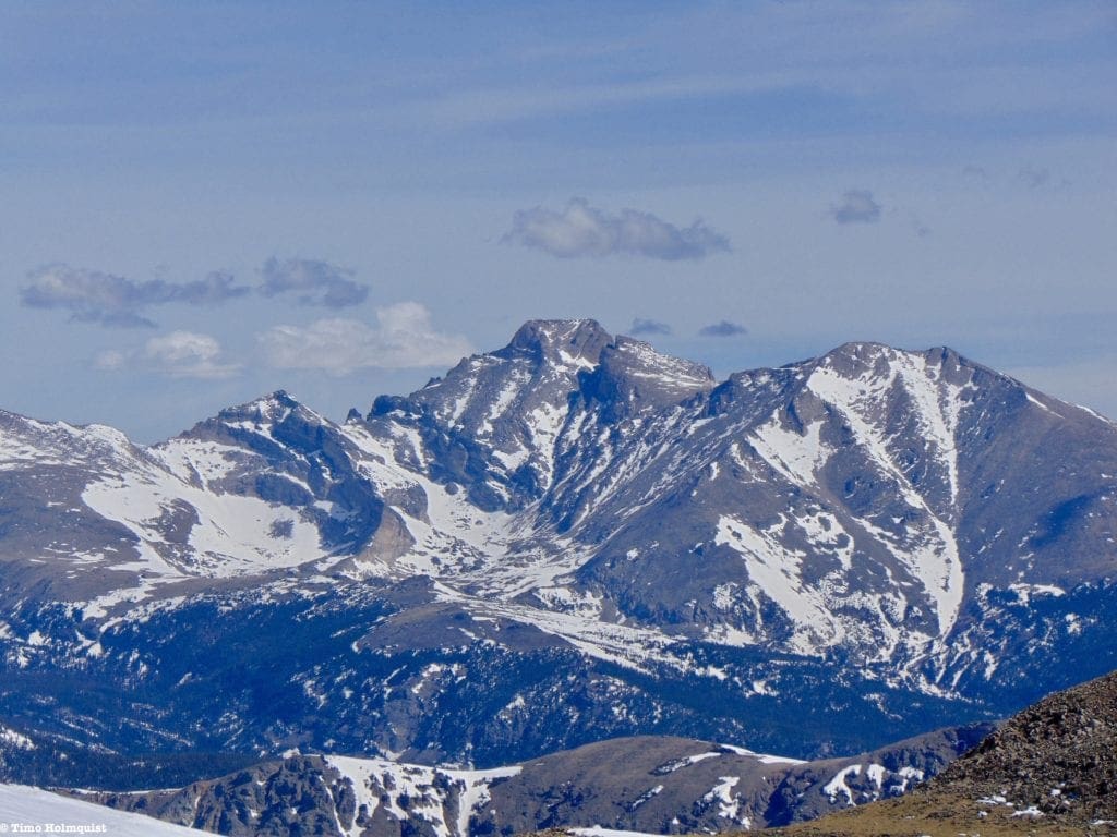
Mt. Ida from Trail Ridge
-
-
Best Multi-Day Experience: Continental Divide Loop
- Distance:
- From Bear lake with no detours: 35. 4 miles
- From Bear Lake with Haynach lakes and Nokoni/Nanita: ~43.5
- From North Inlet with no detours: 26 miles
- From North Inlet with Haynach Lakes and Nokoni/Nanita: 34 miles
- High Point: 12,200-12,334 ft. (depending on whether or not you climb over Flattop Mt.)
- Difficulty: Very Hard
- Total Ascent and Descent:
- Bear Lake no detours: +/-8800 ft
- Bear Lake with Haynach Lakes and Nokoni/Nanita: ~+/- 10,600 ft.
- North Inlet with no detours: ~+/- 6,000 ft.
- North Inlet with Haynach Lakes and Nokoni/Nanita: ~+/- 7,718 ft.
- Route Type: Loop
- Trail Status: Temporarily Closed due to fire damage, check updated status here
- Popularity: Moderate (backcountry permits and campsites fill up QUICKLY, jump on it in mid-March when there is a random drawing and check here for the latest information)
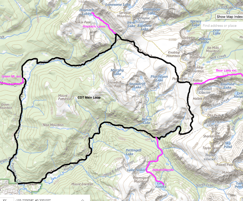
CDT Loop Map w/ extensions.
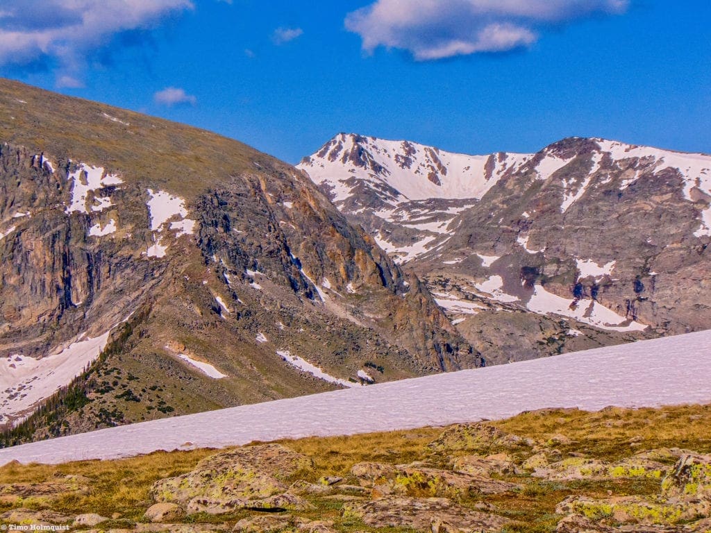
Panorama of Bighorn Flats with late spring snow.
Route Description
Rocky Mountain National Park features roughly 20 miles of the Continental Divide trail, one of the triple crown trails of long-distance hiking in the US (alongside the Pacific Crest Trail and the Appalachian Trail). For the majority of its route, the trail heads in a north-south direction, but in Rocky Mountain, a bowleg feature enables you to construct a 3-5-day loop hike utilizing large portions of the trail. In addition, a few quick side trips will allow you to visit some of the Parks most understated and beautiful areas.
There are three main ways to go about handling the loop. You can start on the western side at North Inlet Trail or Green Mountain Trail, or you can start at the Bear Lake Parking Lot and add a Flattop Mt. extension. The Bear Lake option has more distance and effort attached to it, but the start is hours closer to the main population areas of the Front Range.
In either scenario, you end up walking through wildlife meadows (Summerland Park & Big Meadows), sweeping alpine areas with 360-degree views (Bighorn Flats), and have the option to add a day trip up to Haynach Lakes and Lake Nokoni/Nanita (HIGHLY recommended.) The high elevation portion near Bighorn Flats is long, so make sure you are being cognizant of those afternoon thunderstorms. Backcountry campsites are plentiful, but you will need to book them in advance; use this link. Remember, between the fire closures and popularity of backcountry camping in RMNP–there is a sizable chance you won’t get the campsite you want. Look to the Park website every March to figure out when campsites go on sale; they disappear quickly.
This is the best way to experience the hiking paradise that is Rocky Mountain without needing to employ mountaineering skills. If you’re hesitant about peak bagging, the entire route is on established trails and doesn’t require backcountry navigation. Having said that, many areas can become disorienting in fog or inclement weather, so double check your forecasts and add a buffer day to the trip to account for any cloud/visibility issues. If you are keen to bag some summits, the most accessible peaks from the Bighorn Flats area are Flattop, Hallett, Knobtop, and Otis Peak.
Please stay at established campsites; as indicated before, Rangers patrol the backcountry and will hand out fines for illegal campsites. Campfires are also prohibited and have been since the early 2000s. Some good campsites to choose from are (in no particular order): Big Pool, North Inlet Falls, Pine Marten, Renegade, Tonahutu Meadows, Sunrise, Sunset, and South Meadows.
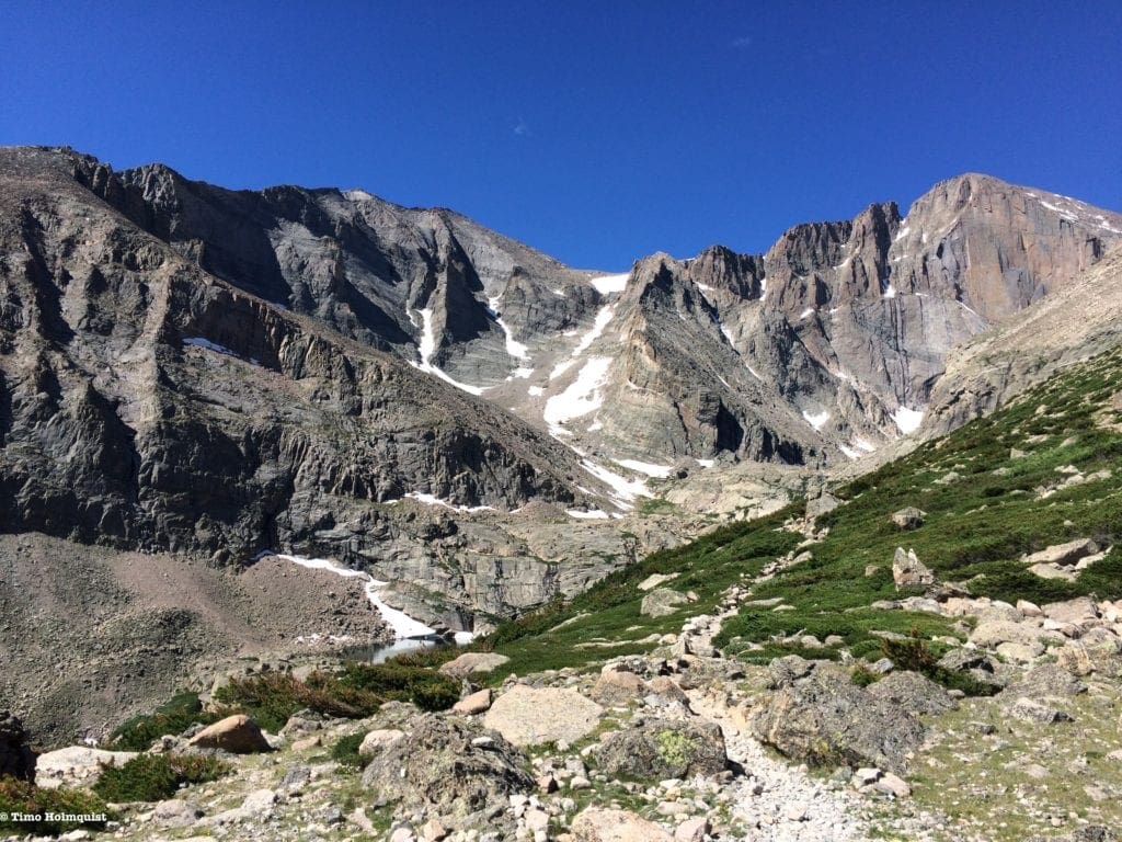
Best Mountaineering Experience: Longs Peak
- Distance: 14.5 miles
- High Point: 14,255 ft.
- Difficulty: Very Hard, Class 3 scrambling
- Total Ascent: 5,100 ft.
- Route Type: Out and Back
- Trail Status: Open (beyond the Keyhole this is a mountaineering route, NOT a trail)
- Popularity: Very High
Longs Peak from the south.
Route Description
No description of Rocky Mountain National Park is complete without mentioning Longs Peak. Not only is Longs Peak the tallest mountain in the Park, but it’s also the toughest 14er in the front range and one of the deadliest summits in the US. Despite its reputation, scaling the mountain is not insurmountable. It’s deadly distinction is more due to its incredible popularity than its technical challenges. Thousands attempt to climb Longs Peak every year, and among those are people who are unprepared for the rigors of alpine mountaineering. DO NOT attempt this mountain if you do not have any scrambling or mountaineering experience. It is a serious endeavor.
Longs Peak from Mt. Alice with the flatlands in the background, some 7000 feet below Longs summit.
The classic ascent route is via the Keyhole, which is a serious and sustained Class 3 scramble. There are quite a few ways to climb the mountain, including a Class 3-4 option via the Loft, a Class 5 option via the Cables route, and rock-climbing options along the dramatic Diamond face. There is no way to climb Longs without at least a Class 3 experience.
If you are unsure of your abilities, you can make it up to the Keyhole rock feature with relatively straightforward trail finding and a little bit of scrambling. The Keyhole is usually the make or break point; if hesitation is creeping up, don’t push your limits.
The Keyhole rock formation on Longs Peak.
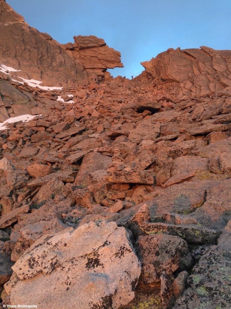
Beyond the Keyhole, it’s all alpine scrambling, with named sections such as The Ledges, The Trough, The Narrows, and the Homestretch, before topping out on the wide, flat summit, known as the Football fields. Despite the colorful names, these are serious sections that feature airy traverses, 1000-foot drops, gullies where rockfall danger is particularly pronounced, and exposed scrambling.
Typical terrain from beyond the Keyhole.
Resources are plentiful, including 14ers.com and trail descriptions on numerous websites including the National Parks website. A helmet is HIGHLY recommended due to the strenuous nature of the climb and the likelihood of other people dislodging rocks above you. The first time I climbed Longs was on a mid-July weekend. I started at 1 am, and the parking lot was already full. I spent the entire hike passing people in various stages of exhaustion, and with minimal supplies. One young hiker was in flip-flops and had a plastic water bottle, a small bag of goldfish and a face towel in a plastic grocery bag. It is both disheartening and alarming to see people so unprepared in such a dangerous environment. Don’t become a statistic, do the research and get in shape before attempting Longs. It remains one of my favorite mountains due to its complex nature and plethora of routes, but it is not a hike; this is a mountaineering route, plan accordingly.
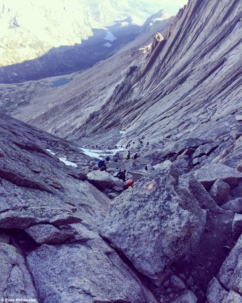
Looking down the trough with hundreds of climbers below, rockfall is a real danger on this congested part of the route.
Honorable Mentions
McHenry’s Peak (Very Hard)
At a Glance: ~14.5 miles, +~4100 ft. Solid and sustained Class 3.
What makes it special: Longs overshadows pretty much everything around it; chances are, if you climb McHenry’s, you’ll have long stretches to yourself. Additionally, it’s a damn pretty mountain. The Class 3 portion from Stone Man Pass to the summit requires patience, careful route finding, and a final gully climb to the top. According to Lisa Foster’s excellent Rocky Mountain guide book, the final gully you want is the second gully northwest of Stone Man Pass. Carefully study each option before committing; there are very few non-technical ways to top out on McHenry’s.
McHenry’s Peak from the southwest. Notice the iconic McHenry’s notch to the left. The standard approach comes in from right to left and tackles the snowy slope in the picture. Choosing the correct gully is the difference between an enjoyable Class 3 scramble and Class 5 technical terrain. Study your route carefully.
Meeker Ridge to Mt. Meeker via the Iron Gates
At a Glance: ~10.2 miles roundtrip, +4671 ft. (Class 3 with a knife-edge traverse)
What makes it special: Like McHenry’s, Meeker ridge is often overshadowed by Longs but provides a stellar scramble fest with arguably the most dramatic views of Longs Peak in the Park. Below the Iron Gates, it’s a scree-fest; watch your step as rocks can shift. Once you ascend to the ridge (light Class 3), you can tag Meeker Ridge and tackle the knife-edge between it and the proper summit of Meeker. This is an exposed and airy section. The actual moves are not super difficult, and a ramp of rocks below the ridgeline provides support should you need it; however, it is NOT a hiking route. Like McHenry’s and Longs, this is a mountaineering route and is NOT for casual hikers. Please see the trip report links included at the bottom of the sources section below to get a better understanding of what this route entails.
Meeker and Longs from Chasm view, the Iron gates are best approached via the long scree slope heading diagonal left from the center of the picture.
Final Thoughts
Rocky Mountain National Park is a gem in so many ways it’s almost hard to keep track. Hopefully, with the list above, you’ll have a better appreciation for the incredible natural diversity that lies within this quarter million-acre slice of mountain majesty. Along with the honorable mentions, this article covers less than thirty of the more than 380 named features in the Park. There’s a TON to explore! For those interested in diving deeper, check out Lisa Foster’s excellent Rocky Mountain National Park: The Complete Hiking Guide, which hits just about every feature that the Park has. Hikingrmnp.org is also a fantastic online resource that details all the features in the Park with informative blogs and pictures aplenty.
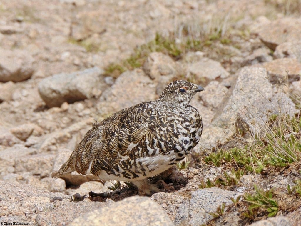
A Ptarmigan, aka an Alpine Chicken, one of the many fascinating animal species that call the Park home.
Sources:
AllTrails (2024).
- Andrews Tarn and Andrews Glacier. Retrieved from https://www.alltrails.com/trail/us/colorado/andrews-tarn-and-andrews-glacier-trail
- Cub Lake Trail Loop. Retrieved from https://www.alltrails.com/trail/us/colorado/cub-lake-trail-loop
- Ouzel Falls via Wild Basin Trail. Retrieved from https://www.alltrails.com/trail/us/colorado/ouzel-falls-via-wild-basin-trail
- Hidden Valley Creek Nature Walk. Retrieved from https://www.alltrails.com/trail/us/colorado/hidden-valley-creek-nature-walk
Backpackers Review. (n.d.) Continental Divide Loop – Rocky Mountain National Park (45 Mile Loop). Retrieved from https://backpackers-review.com/trip-reports/rocky-mountain-national-park/#day-1
Centers for Disease Control and Prevention. (2021). Life Expectancy. Retrieved from https://www.cdc.gov/nchs/fastats/life-expectancy.htm
Climber.org. (n.d.) The Yosemite Decimal System. Retrieved from https://climber.org/data/decimal.html
Colorado Avalanche Information Center. (n.d.) Retrieved from https://www.avalanche.state.co.us/
Colorado State University. (2021) North American Monsoon. Retrieved from https://climate.colostate.edu/co_nam.html
Colorado Department of Transportation. (2021). Trail Ridge Road: Rocky Mountain National Park. Retrieved from https://www.codot.gov/travel/scenic-byways/north-central/trail-ridge-rd
Felman, Adam. (2018, Jan. 30). What’s to know about altitude sickness? Medical News Today. Retrieved from https://www.medicalnewstoday.com/articles/179819
Foster, Lisa. (2013). Rocky Mountain National Park: The Complete Hiking Guide. Renaissance Mountaineering.
Go Grand Lake. (n.d.). RMNP’s Coyote Valley Trail. https://gograndlake.com/explore/rmnp-featured-hike-coyote-valley-trail/
Grand Lake Lodge. (2021). Retrieved from https://www.highwaywestvacations.com/properties/grand-lake-lodge
Hider, Anna. (2015, April 8). Rowe Glacier. Roadtrippers. Retrieved from https://maps.roadtrippers.com/us/co/nature/rowe-glacier
Hiking Rocky Mountain National Park. (2020). The List. Retrieved from http://www.hikingrmnp.org/p/the-big-list.html
Johnson, Kurt. (2006). Ptarmigan Glacier. Mountain Project. Retrieved from
https://www.mountainproject.com/route/105881708/ptarmigan-glacier
Kaisa. (2017). Hiking The Continental Divide Loop In Rocky Mountain National Park. Retrieved fromhttps://www.glamgranolatravel.com/continental-divide-loop-hike-rocky-mountain-national-park/
Krishnamurti, T. (2015, Oct. 12) Indian Monsoon. Encyclopedia Britannica. Retrieved from https://www.britannica.com/science/Indian-monsoon
Makens, Matt. (2020, July 22). What’s the North American Monsoon, and how does it impact Colorado?Weather5280. Retrieved from https://www.weather5280.com/blog/2020/07/22/whats-the-north-american-monsoon-and-how-does-it-impact-colorado
Mountain-forecast.com. (2021). Retrieved from https://www.mountain-forecast.com/
National Geographic: Trails Illustrated Topographic Maps. (n.d.) Rocky Mountain National Park.
National Park Service. (n.d.) Famous Quotes Concerning The National Parks. Retrieved from https://www.nps.gov/parkhistory/hisnps/npsthinking/famousquotes.htm#:~:text=Wallace%20Stegner%2C%201983%3A,best%20rather%20than%20our%20worst.%22
National Park Service. (2020). Retrieved from https://www.nps.gov/romo/index.htm
- Rocky Mountain National Park. (n.d.) Brief Park History. Retrieved from https://www.nps.gov/romo/learn/historyculture/brief.htm
- Rocky Mountain National Park. (n.d.) Fees and Passes. Retrieved from https://www.nps.gov/romo/planyourvisit/fees.htm
- Rocky Mountain National Park. (n.d.) Park Roads. Retrieved from https://www.nps.gov/romo/planyourvisit/road_status.htm
- Rocky Mountain National Park. (n.d.) Maps. Retrieved from https://www.nps.gov/romo/planyourvisit/maps.htm
- Rocky Mountain National Park. (n.d.) Trail Ridge Road. Retrieved from https://www.nps.gov/romo/planyourvisit/trail_ridge_road.htm
- Rocky Mountain National Park. (n.d.) Shuttle Bus Routes. Retrieved from https://www.nps.gov/romo/planyourvisit/shuttle_bus_route.htm
- Rocky Mountain National Park. (n.d.) Things to Do: Hike Deer Mountain. Retrieved from https://www.nps.gov/thingstodo/romo_deermountain.htm
- Rocky Mountain National Park. (n.d.) Wilderness Camping. Retrieved from https://www.nps.gov/romo/planyourvisit/wilderness-camping.htm
National Park Service: U.S. Department of the Interior. (2005). Criteria for New National Parks. Retrieved from http://npshistory.com/brochures/criteria-parklands-2005.pdf
National Weather Service
- Estes Park Extended Forecast. (n.d.) Retrieved from https://forecast.weather.gov/MapClick.php?lat=40.3772059&lon=-105.5216651&site=all&smap=1&searchresult=Estes%20Park%2C%20CO%2C%20USA#.YCbnzxNKjOS
- Grand Lake Extended Forecast. (n.d.) Retrieved from https://forecast.weather.gov/MapClick.php?lat=40.2549&lon=-105.8213#.YKaigZNKhTZ
- Alpine Center/Trail Ridge Extended Forecast. (n.d.) Retrieved from https://forecast.weather.gov/MapClick.php?lon=-105.76022675170898&lat=40.42810400402635#.YCboWRNKjOS
OpenSummit. (2021). Retrieved from https://opensummit.com/
Peglar, Tori. (2020, Jan. 31). Grand Lake at the West Entrance Town to Rocky Mountain National Park.Outside. Retrieved from https://www.mycoloradoparks.com/road-trips/road-trip-stops/colorado-places/grand-lake/#:~:text=But%2080%20percent%20of%20park,natural%20beauty%20and%20understated%20wildness
Rigby, Wendy. (2020, July 15). Hike of the Week: Summerland Park. Estes Park Trail Gazette. https://www.eptrail.com/2020/07/15/hike-of-the-week-summerland-park/
Rocky Mountain Hiking Trails.com. (2021).
- Chapin, Mt. Chiquita & Ypsilon Mountain. Retrieved from http://www.rockymountainhikingtrails.com/ypsilon-mountain.htm
- Odessa Lake. Retrieved from http://www.rockymountainhikingtrails.com/odessa-lake.htm
- Odessa Lake (via Fern Lake Trailhead). Retrieved from http://www.rockymountainhikingtrails.com/odessa-lake-fern-lake.htm
- Ouzel Falls. Retrieved from http://www.rockymountainhikingtrails.com/ouzel-falls.htm
- Twin Sisters Peak. Retrieved from http://www.rockymountainhikingtrails.com/twin-sisters-peak.htm
- Sky Pond. Retrieved from http://www.rockymountainhikingtrails.com/sky-pond.htm
Sintax77 (2018, Oct. 27). Hiking the CDT Loop – Colorado Backpacking & Camping Trip. Retrieved from https://www.sintax77.com/hiking-the-cdt-loop-colorado-backpacking-camping-trip/
Stansfield, John. (n.d.) Enos Mills. Colorado Encyclopedia. Retrieved from https://coloradoencyclopedia.org/article/enos-mills
Summitpost (2021). Rowe Peak. Retrieved from
https://www.summitpost.org/rowe-peak/151278
Visit Estes Park. (2014, June 9). Best Wildflower Viewing Spots in Rocky Mountain National Park. Retrieved from https://www.visitestespark.com/blog/post/best-wildflower-viewing-spots-in-rocky-mountain-national-park/
Wild Basin Lodge. (2021). Retrieved from https://www.wildbasinlodge.com/
14ers.com (2021).
- Longs Peak: Keyhole Route. Retrieved from https://www.14ers.com/route.php?route=long1&peak=Longs+Peak
- Meeker Ridge Trip Reports. Retrieved from

Enroll With Global Rescue Prior To Embarking On Your Next Adventure.
When a travel emergency arises, traditional travel insurance may not come to your aid, and a medical evacuation can cost up to $300,000.
The cost when you have a Global Rescue membership? $0. That’s why when the unexpected happens, you want the leader in rescue, evacuation and medical advisory behind you. You want Global Rescue.
Terms of Use: As with each guide published on SKYBLUEOVERLAND.com, should you choose to this route, do so at your own risk. Prior to setting out check current local weather, conditions, and land/road closures. While taking a trail, obey all public and private land use restrictions and rules, carry proper safety and navigational equipment, and of course, follow the #leavenotrace guidelines. The information found herein is simply a planning resource to be used as a point of inspiration in conjunction with your own due-diligence. In spite of the fact that this route, associated GPS track (GPX and maps), and all route guidelines were prepared under diligent research by the specified contributor and/or contributors, the accuracy of such and judgement of the author is not guaranteed. SKYBLUE OVERLAND LLC, its partners, associates, and contributors are in no way liable for personal injury, damage to personal property, or any other such situation that might happen to individuals following this route.
Popular Articles:
Skiing Guide for Rocky Mountain National Park’s Mummy Range
Ultimate Adventurer’s Guide To Yosemite National Park, California
10 Best Mountain Towns In The USA
Planning The Perfect Adventure Trip To Grand Lake, Colorado
Explorer’s Guide to Going-to-the Sun Road, Glacier National Park, Montana


