


High Point:
10,125 feet

Total Ascent:
750 feet

Difficulty:
Moderate

Distance:
3.3 miles

Waypoints:
40.31194, -105.64562

Route Type:
Out and Back
Overview
This hike is exceptional in all seasons, but with the intense popularity of Bear Lake Road, it’s best to experience the majesty in the less crowded winter season. On quiet weather days, the trail is easy to find, and the scenery is mind-blowing. Although Emerald Lake is the end of the trail, it’s the scenery all the way up to it that makes this one a winner. Snowshoeing, cross country skiing, and backcountry skiing are all popular activities in the winter from this trail. You may even get to see skiers exit the twin couloirs of Dragons Tail and Dead Elk from the shores of Emerald Lake
Directions To Trailhead
The Emerald Lake Trail starts at the Bear Lake Trailhead. From the Estes Park shopping district, head west on Highway 36 for 3.8 miles. Turn left (south) onto Bear Lake Road. The trailhead is located at the end of the road, 9.4 miles from the turn-off at Highway 36.
Bear Lake Road
<img src=”https://www.skyblueoverland.com/wp-content/uploads/2021/02/2_20201122-050A4092.jpg” alt=”Photo Waypoint: 40.35615, -105.58386. Photo taken at a turnout along Bear Lake Road in Rocky Mountain National Park, Colorado. View is looking to the west across Moraine Park towards Stones Peak, which is about 8 miles away. Canon EOS R, Canon RF 15-35mm f/2.8L USM Lens, ISO 100, 35 mm, f/5.0, 1/250 seconds.” />
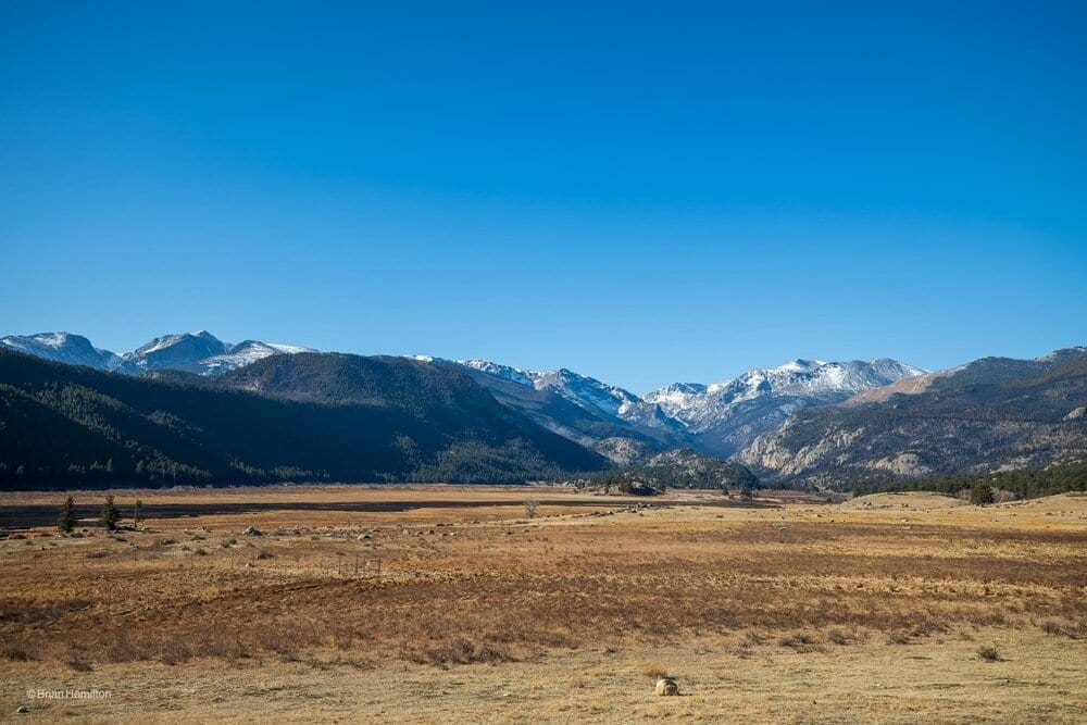
Photo Waypoint: 40.35615, -105.58386. Photo taken at a turnout along Bear Lake Road in Rocky Mountain National Park, Colorado. View is looking to the west across Moraine Park towards Stones Peak, which is about 8 miles away. Canon EOS R, Canon RF 15-35mm f/2.8L USM Lens, ISO 100, 35 mm, f/5.0, 1/250 seconds.
My morning drive on the Bear Lake Road in Rocky Mountain National Park revealed remnants of the East Troublesome fire. The black streak in the Moraine Park grassland is one of the many scorched areas left behind. While the fire was raging to the west, embers blew over the continental divide to the east and into the Spruce Creek Canyon. Eventually, the fire burned portions of the Moraine Park grassland. Those areas of the park remain closed. Two of my favorite trails are in that area, including the Fern Lake and Cub Lake Trails.
When I learned that Bear Lake Road in Rocky Mountain National Park had reopened November 19, 2020 after being closed since October 22, 2020, due to the East Troublesome Fire. I was eager to checkout the remnants of the fire in Moraine Park. On Sunday, November 22, 2020, I drove up to the park on a beautiful, sunny morning. I decided to hike the Emerald Lake Trail, which is a 2.4 mile, out-and-back trail with an elevation gain of about 450 feet. The Emerald Lake Trail features three lakes, Bear, Nymph, Dream and Emerald Lakes plus awesome regional views of the park.
According to the National Park Service, the trails in the Bear Lake area are open. The Flattop Trail is open to the summit of Flattop Mountain but is closed past this point to the west of the Continental Divide. The Odessa/Fern Lake Trail is closed at the Odessa/Flattop Trail junction. The Bierstadt Trail is also closed at the Bear Lake/Bierstadt Trail junction.
The East Troublesome Fire Enters Rocky
On Wednesday, October 21, 2020, the East Troublesome Fire moved into the west side of Rocky Mountain National Park. It was later spotted approximately 1.5 miles from the head of Tonahutu Creek on the west side of the Continental Divide to the headwaters of Spruce Creek on the east side of the Continental Divide. According to news reports, emergency evacuations took place in Grand Lake on October 21. Evacuations for the majority of the Estes Valley were implemented the next day, October 22. The weather forecast predicted high winds on the night of October 23 through October 24. These winds pushed the fire further to the east into Moraine Park. Firefighting actions and a fall snow storm on October 24 and 25, helped halt the major movement of the East Troublesome and Cameron Peak Fires. Approximately 30,000 acres or 9 percent of Rocky Mountain National Park has been impacted by the East Troublesome and Cameron Peak Fires.
Bear Lake Trailhead
I arrived at the Bear Lake Trailhead parking lot around 11 AM. Although I could get a parking spot on a beautiful Sunday morning in November, the parking lot was nearly full. This area is extremely popular during the peak tourist season. It’s difficult to find a parking spot then, even in the early morning. You may want to consider using the free park shuttle to reach the trailhead in the summer months.
The elevation at the trailhead is 9,475 feet. Be prepared for some cold temperatures, even if you are visiting in the summertime. Rest assured, there are plenty of restrooms available at the trailhead.
Just beyond the trailhead the Bear Lake Nature Trail splits off to the right, while the trail to Dream Lake branches off to the left. I head to the right around Bear Lake before taking the trail up to Dream Lake.
Bear Lake Nature Trail
Most hikers will stop at Bear Lake to check out the beautiful scenes from the east shore before proceeding to their ultimate destination. The Bear Lake Nature Trail is the first trail that I’ve ever hiked in Rocky and I rarely miss a chance to pay a visit.
My first such memory of this trail goes back to a family road trip in late July 1972. I was 7 years old and my family had just set up camp at the Moraine Park Campground. After setting up camp, we jumped into my dad’s 1962 Chevy and drove to the Bear Lake Trailhead. Bear Lake immediately became one of my absolute favorite, easy hikes! Read more about my 1972 adventures on the Bear Lake Nature Trail here.
<img src=”https://www.skyblueoverland.com/wp-content/uploads/2021/02/2_20201122-050A4093.jpg” alt=”Photo Waypoint: 40.31365, -105.64684. Photo taken from the East Side of Bear Lake in Rocky Mountain National Park, Colorado. View is looking to the west across Bear Lake towards Hallett Peak, which is about 2.25 miles away. Canon EOS R, Canon RF 15-35mm f/2.8L USM Lens, ISO 100, 15 mm, f/5.6, 1/250 seconds.” />
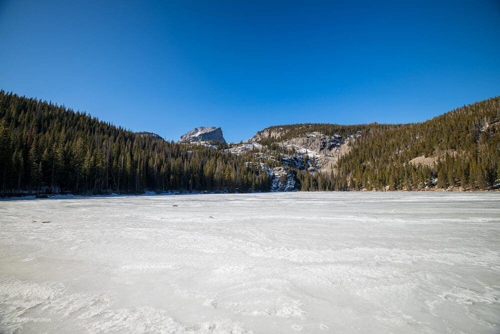
Photo Waypoint: 40.31365, -105.64684. Photo taken from the East Side of Bear Lake in Rocky Mountain National Park, Colorado. View is looking to the west across Bear Lake towards Hallett Peak, which is about 2.25 miles away. Canon EOS R, Canon RF 15-35mm f/2.8L USM Lens, ISO 100, 15 mm, f/5.6, 1/250 seconds.
After about 0.1 mile (going counterclockwise), I take my first photo stop. This view is looking to the west across Bear Lake towards Hallett Peak, which is just about 2.25 miles away. I usually try to take some photos of Hallett Peak reflecting off the water, but that will have to wait until spring. This is the first time I’ve been up to Bear Lake this late in the year. I love the view of the frozen Bear Lake. Unlike a few other hikers, I don’t give into the urge to throw a stick onto the ice…
<img src=”https://www.skyblueoverland.com/wp-content/uploads/2021/02/2_20201122-050A4097.jpg” alt=”Photo Waypoint: 40.31413, -105.64817. Photo taken from the North Side of Bear Lake in Rocky Mountain National Park, Colorado. View is looking to the south across Bear Lake towards the East Glacier Knob, which is just over 1 mile away. Canon EOS R, Canon RF 15-35mm f/2.8L USM Lens, ISO 100, 15 mm, f/4.5, 1/1000 seconds.” />
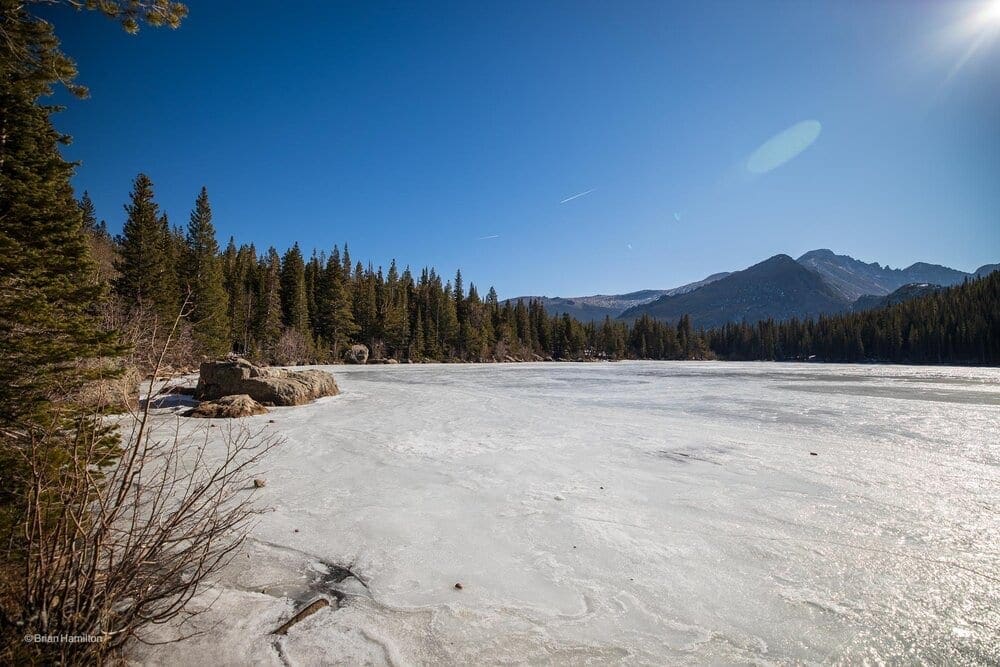
Photo Waypoint: 40.31413, -105.64817. Photo taken from the North Side of Bear Lake in Rocky Mountain National Park, Colorado. View is looking to the south across Bear Lake towards the East Glacier Knob, which is just over 1 mile away. Canon EOS R, Canon RF 15-35mm f/2.8L USM Lens, ISO 100, 15 mm, f/4.5, 1/1000 seconds.
After about 0.2 mile, I take my second photo stop on the north side of Bear Lake. This view is looking to the south across Bear Lake towards the East Glacier Knob, which is just over 1 mile away.
<img src=”https://www.skyblueoverland.com/wp-content/uploads/2021/02/2_20201122-050A4108.jpg” alt=”Photo Waypoint: 40.31286, -105.64998. Photo taken from the west side of Bear Lake in Rocky Mountain National Park, Colorado. View is looking to the east across Bear Lake. Canon EOS R, Canon RF 15-35mm f/2.8L USM Lens, ISO 100, 15 mm, f/6.3, 1/320 seconds.” />
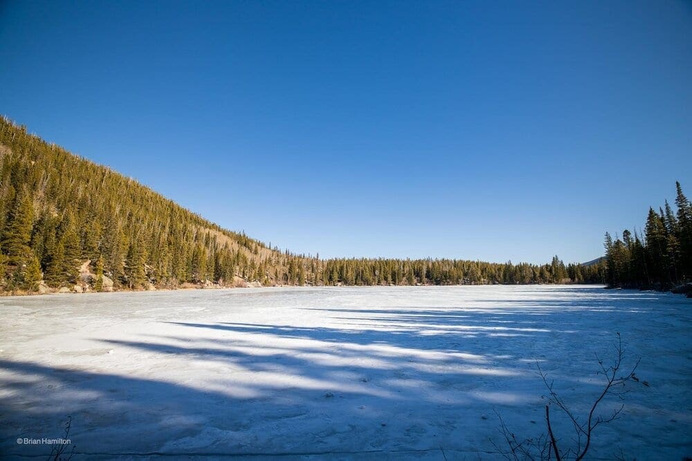
Photo Waypoint: 40.31286, -105.64998. Photo taken from the west side of Bear Lake in Rocky Mountain National Park, Colorado. View is looking to the east across Bear Lake. Canon EOS R, Canon RF 15-35mm f/2.8L USM Lens, ISO 100, 15 mm, f/6.3, 1/320 seconds.
After about 0.4 mile, I take my third photo stop on the west side of Bear Lake. This view is looking to the east across Bear Lake.
Emerald Lake Trail
After finishing my 0.7 mile hike around Bear Lake, I head up the trail towards Emerald Lake. The Bear Lake Nature and Emerald Lake Trails are very icy. I’m so glad that I had my Black Diamond Distance Spike Traction Devices on my boots. Traction devices are essential on these icy mountain trails.
Black Diamond Distance Spike Traction Device
The Distance Spike is Black Diamond’s pinnacle trail running traction device, built for fast mountain travel, whether you’re linking 14’ers or hiking up to an alpine peak.
From Bear Lake the trail makes a steady climb up to Nymph Lake. Views of Longs Peak can be seen periodically through the trees. Due to the heavy amount of foot traffic this area receives, much of this section of trail has been paved. This section of trail is extremely icy. Especially the shady portions of the trail. Paved sections that get sunlight are fine.
<img src=”https://www.skyblueoverland.com/wp-content/uploads/2021/02/2_20201122-050A4111.jpg” alt=”Photo Waypoint: 40.30966, -105.65152. Photo taken from the south side of Nymph Lake, looking north. Canon EOS R, Canon RF 15-35mm f/2.8L USM Lens, ISO 100, 15 mm, f/6.3, 1/250 seconds.” />
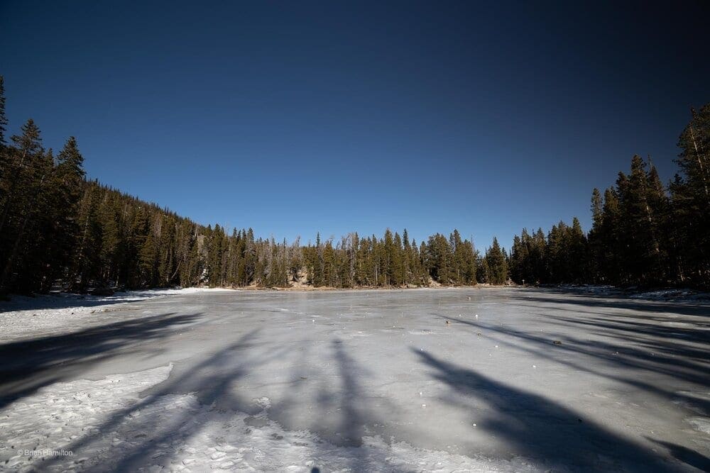
Photo Waypoint: 40.30966, -105.65152. Photo taken from the south side of Nymph Lake, looking north. Canon EOS R, Canon RF 15-35mm f/2.8L USM Lens, ISO 100, 15 mm, f/6.3, 1/250 seconds.
After hiking about 0.55 miles with an elevation gain of 245 feet, I arrive at the south side of Nymph Lake, which is a pleasant lake ringed by pond lilies. See my post on the Emerald Lake Trail to see unfrozen, summertime photos of Nymph Lake. I visited Nymph Lake at sunrise on the morning of June 27, 2020. The reflections of the surrounding landscape on the calm, early morning waters are amazing.
<img src=”https://www.skyblueoverland.com/wp-content/uploads/2021/02/1_20201122-050A4118.jpg” alt=”Photo Waypoint: 40.31028, -105.65081. Photo taken from the northeast side of Nymph Lake, looking west towards Hallett Peak. Hallett Peak is just 1.9 miles away. Canon EOS R, Canon RF 15-35mm f/2.8L USM Lens, ISO 100, 21 mm, f/5.0, 1/200 seconds.” />
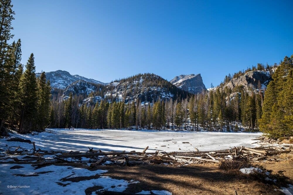
Photo Waypoint: 40.31028, -105.65081. Photo taken from the northeast side of Nymph Lake, looking west towards Hallett Peak. Hallett Peak is just 1.9 miles away. Canon EOS R, Canon RF 15-35mm f/2.8L USM Lens, ISO 100, 21 mm, f/5.0, 1/200 seconds.
It’s on about 310 feet to the northeast side of Nymph Lake to the next photo stop. We’ve traveled about 0.6 miles since starting the Dream Lake Trail. Just an amazing day for a hike.
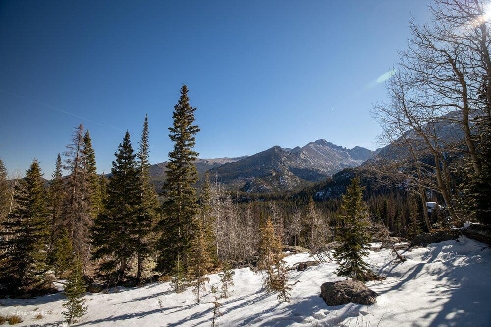
Photo Waypoint: 40.30991, -105.6542. Photo taken about 0.85 miles from the start, looking southeast towards the East Glacier Knob, which is about a mile away. Longs Peak can be seen in the distance, about 4.25 miles away. Canon EOS R, Canon RF 15-35mm f/2.8L USM Lens, ISO 100, 15 mm, f/5.6, 1/320 seconds.
After finishing the hike around the lake, we start the pretty steep, but short climb to Dream Lake. I took another photo stop after about 0.85 miles from the start. This is one of my favorite views on this trail. This is a view looking southeast towards the East Glacier Knob, which is about a mile away. Longs Peak can be seen in the distance, about 4.25 miles away. Continuing higher up the trail provides spectacular views of Hallett Peak as well. This section of trail, between Nymph Lake and Dream Lake, also includes tones of wildflowers during the summertime.
<img src=”https://www.skyblueoverland.com/wp-content/uploads/2021/02/20201122-050A4130.jpg” alt=”Photo Waypoint: 40.30982, -105.65595. Photo taken about 1.1 miles from the start, looking west towards Hallett Peak, which is about 2 miles away. The trail to Lake Lake Haiyaha heads to the left. We take the trail to the right to Dream Lake. Canon EOS R, Canon RF 15-35mm f/2.8L USM Lens, ISO 100, 22 mm, f/3.5, 1/100 seconds.” />
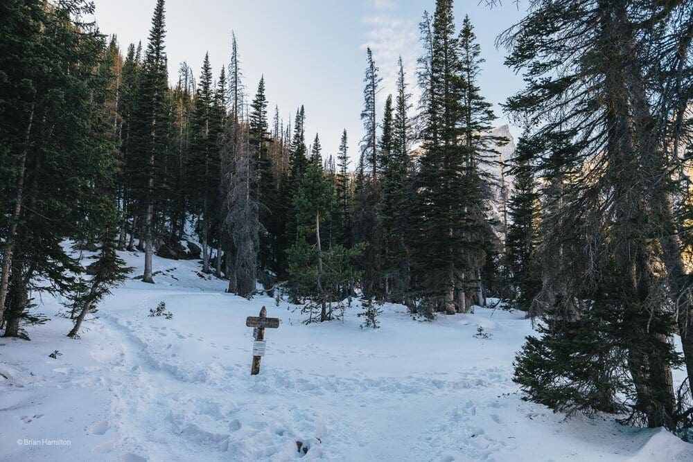
Photo Waypoint: 40.30982, -105.65595. Photo taken about 1.1 miles from the start, looking west towards Hallett Peak, which is about 2 miles away. The trail to Lake Lake Haiyaha heads to the left. We take the trail to the right to Dream Lake. Canon EOS R, Canon RF 15-35mm f/2.8L USM Lens, ISO 100, 22 mm, f/3.5, 1/100 seconds.
At roughly 1.1 miles from the trailhead we encounter the junction for the trail that leads to Lake Haiyaha. We continue to the right towards Dream Lake. We’re getting close to the east end of the Dream Lake, where the views are spectacular.
<img src=”https://www.skyblueoverland.com/wp-content/uploads/2021/02/1_20201122-192B5E0D-3F49-4B61-8397-13CDCD958DB1.jpg” alt=”Photo Waypoint: 40.30963, -105.65691. Photo taken about 1.2 miles from the start, looking west towards Hallett Peak, which is about 1.6 miles away. Apple iPhone 12 Pro Max, ISO 25, 1.54 mm, f/2.4, 1/220 seconds.” />
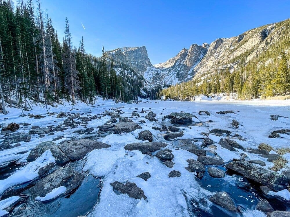
Photo Waypoint: 40.30963, -105.65691. Photo taken about 1.2 miles from the start, looking west towards Hallett Peak, which is about 1.6 miles away. Apple iPhone 12 Pro Max, ISO 25, 1.54 mm, f/2.4, 1/220 seconds.
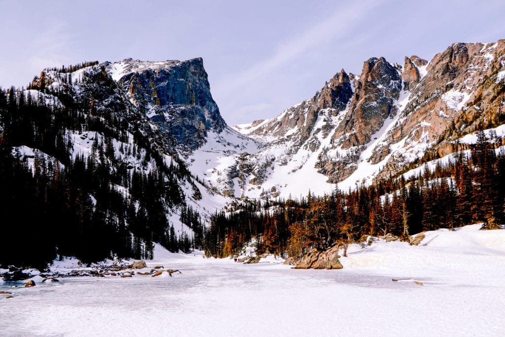
My next photo stop is at the east shore of this beautiful subalpine lake. The views of 12,713-foot Hallett Peak and 12,324-foot Flattop Mountain are phenomenal. The Tyndall Glacier is barely visible in the Tyndall Gorge, which is seen between the two mountains. It’s possible to walk to the west across on the frozen lake.
<img src=”https://www.skyblueoverland.com/wp-content/uploads/2021/02/1_20201122-E6B15E4F-2096-4B69-9E67-63A7FDA64C6B.jpg” alt=”Photo Waypoint: 40.30979, -105.65686. Photo taken about 1.2 miles from the start, looking west towards Hallett Peak, which is about 1.6 miles away. Apple iPhone 12 Pro Max, ISO 25, 1.5 mm, f/2.4, 1/320 seconds.” />
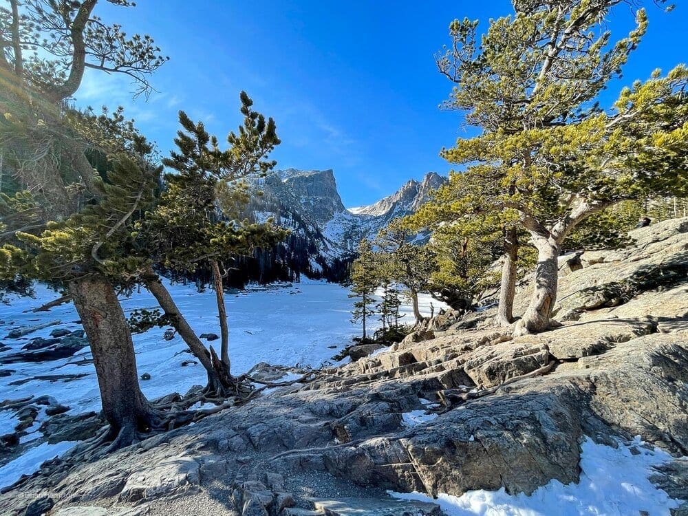
Photo Waypoint: 40.30979, -105.65686. Photo taken about 1.2 miles from the start, looking west towards Hallett Peak, which is about 1.6 miles away. Apple iPhone 12 Pro Max, ISO 25, 1.5 mm, f/2.4, 1/320 seconds.
View from the east end of the Emerald Lake Trail, looking to the west towards Hallett Peak, Tyndall Glacier and Flattop Mountain.
Terms of Use: As with each guide published on SKYBLUE OVERLAND.com, should you choose to this route, do so at your own risk. Prior to setting out check current local weather, conditions, and land/road closures. While taking a trail, obey all public and private land use restrictions and rules, carry proper safety and navigational equipment, and of course, follow the #leavenotrace guidelines. The information found herein is simply a planning resource to be used as a point of inspiration in conjunction with your own due-diligence. In spite of the fact that this route, associated GPS track (GPX and maps), and all route guidelines were prepared under diligent research by the specified contributor and/or contributors, the accuracy of such and judgement of the author is not guaranteed. SKYBLUE OVERLAND LLC, its partners, associates, and contributors are in no way liable for personal injury, damage to personal property, or any other such situation that might happen to individuals following this route.


