


|
Getting your Trinity Audio player ready...
|
Experience the thrilling North Cascades Loop, a wild ride through Washington’s stunning landscape. From fiery volcanic peaks to serene glacial lakes, and from sun-soaked farmlands to mystical coastal islands, this journey will take you on an unforgettable adventure.

The North Cascades Loop, a 440-mile scenic byway, circles through the North Cascades mountain range, offering breathtaking views of glacier-fed Lake Chelan, lush farm valleys, and the rugged beauty of the Cascade Mountains. It includes the North Cascades Scenic Highway (Route 20), which is surrounded by jagged peaks, valleys, and more than 300 glaciers within the North Cascades National Park. Highlights include the massive bulk of Liberty Bell and Early Winters spires, and the chance to spot wildlife like black-tailed deer, elk, black bear, bald eagle, and more.
The loop is accessible from late June to October and offers various events throughout the year, including the Lake Chelan Winterfest and the Manson Apple Blossom Festival. Be sure not to miss the Skagit Valley Tulip Festival in April, located in Burlington, La Conner, and Mount Vernon. Other nearby attractions include a ferry ride from Anacortes to the San Juan Islands or a trip to the Space Needle in Seattle.
Good to Know: Note that the North Cascades Highway shuts down during winter months between Ross Dam Trailhead and Mazama. Keep in mind that there are no gas stations available on the 70-mile stretch of highway between Marblemount and Mazama.
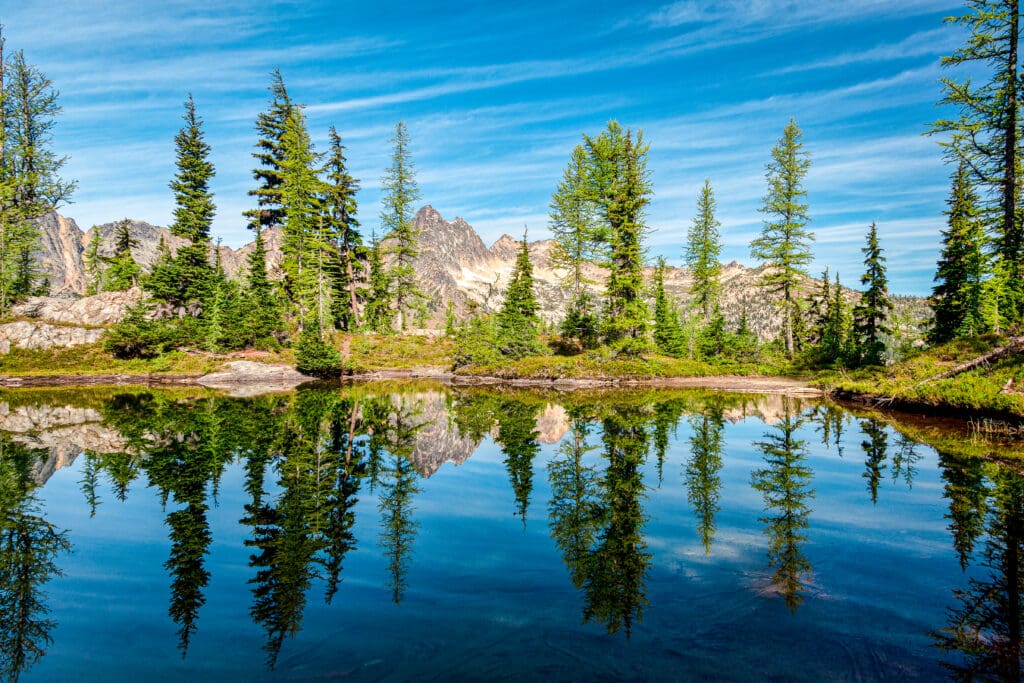
Trees reflecting in a pond near Blue Lake in Winthrop, Washington.
Hit the road and discover USA’s wonders with Skyblue’s Explorer’s Guides. From Olympic Peninsula’s rainforests to Colorado’s majestic peaks, and even Utah’s vibrant desert cliffs, we’ve got the best road trips covered. Buckle up and let’s go!
Stop 1: Sedro-Woolley
Nestled in the midst of a logging town, whose name is a combination of Spanish for cedar and the surname of an early settler. This town acts as a gateway to the North Cascades, also known as America’s Alps. Spanning over 505,000 acres, North Cascades National Park boasts fragrant forests, meadows blooming with flowers, towering mountain peaks, and diverse wildlife such as bears, wolves, cougars, ptarmigan, and more. The park is also home to 318 glaciers, which make up about half of all glaciers in the lower 48 states.
For those looking to explore this stunning region, a Forest Information Center can be found on the western edge of Sedro-Wooley to provide knowledgeable guidance. This information center and HQ building offers exhibits of the park and adjacent national forests. Run by Mt. Baker District and North Cascades Institute with information desk and sales area for books, maps, and videos.
Stop 2: Baker Lake
Head north off of Route 20, also known as the North Cascades Highway, and follow a U.S. Forest Service road to reach Baker Lake. This 9-mile-long body of water is located near Mount Baker, a towering volcano that is still active and occasionally releases clouds of steam. The lake offers various recreational activities such as hiking, sailing, canoeing, and fishing for trout, salmon, and whitefish. During the spring months, it becomes home to the largest gathering of ospreys in the state as they return each year to nest.
Baker Lake offers various pleasant locations for tent camping, including Bayview Campground, Boulder Creek Campground, Horseshoe Cove Campground, Panorama Point Campground, Park Creek Campground, Shannon Creek Campground, and Swift Creek Campground.
The Baker Lake Trail (14.0-mile, moderate, point-to-point trail) is the perfect choice for a relaxed hike with the family. It runs along the eastern shoreline and eventually crosses over the Baker River at the northern tip of the lake.
The Mt. Baker National Recreation Area, nestled in the southeast part of Mt. Baker’s slopes, offers recreational activities all year round. During warmer months, hikers and horseback riders can explore various trails that branch off from Forest Service Road 13 or through the Middle Fork and South Fork Nooksack River areas. In winter, visitors can enjoy activities such as cross-country skiing, snowmobiling, and snowshoeing.
Baker Lake in Washington with Mount Blum rising in setting sunlight. Photo: Kenneth Sponsler/Adobe Stock.
Stop 3: Rockport State Park
Nestled against the foot of Sauk Mountain, Rockport State Park offers a rare ecosystem that features towering, 300-foot old-growth trees, a Discovery Center, and a scenic overlook of the Skagit River.
With its unique landscape, this park is a must-visit for hikers, campers, and picnickers. The park is home to groves of ancient Douglas Fir trees that can reach up to 300 feet in height. There are over five miles of trails to explore, some providing close-up views of wetlands and the forest’s undergrowth while others lead to picturesque overlooks with plenty of sunlight.
Rockport State Park, Photo: Don Paulson / Adobe Stock.
Stop 4: Skagit River Bald Eagle Nature Area
On the stretch of Route 20 between Rockport and Marblemount, lies the Skagit River Bald Eagle Natural Area, the sanctuary is home to hundreds of bald eagles every late fall. Perched on cottonwood trees along the riverbanks, these majestic birds scan the water below before swooping down to catch salmon and steelhead. Visitors can observe them from rafts launched at Marblemount or from designated points along the highway.
Spanning 8,000 acres, the Skagit River Bald Eagle Natural Area is solely used for preserving and conserving wildlife habitats, as well as educating the public on their importance. This unique area serves as an example of collaborative efforts between the Forest Service, Washington Department of Fish & Wildlife, The Nature Conservancy, and other partners to protect natural resources along the river. From late December to early February, visitors can catch a glimpse of majestic bald eagles soaring above. The Eagle Watchers Program, organized by the Forest Service and North Cascades Institute, provides knowledgeable hosts at designated sites along the river to assist in spotting these magnificent creatures. You can also learn more at the annual Upper Skagit Bald Eagle Festival or at the Skagit River Interpretive Center.
Located on Route 20 near milepost 120 and Newhalem, the North Cascades Visitor Center offers school programs by request. Exhibits include a relief map and multimedia displays on the park’s history. Facilities include a theater, interpretive trails, restrooms, and a sales area for books and other items related to the park and surrounding forests.
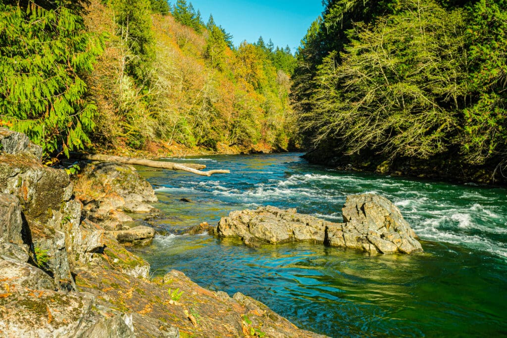
The turquoise water of the Skagit River descending with force near Marblemount, Washington. Photo: By Esteban Martinena / Adobe Stock.
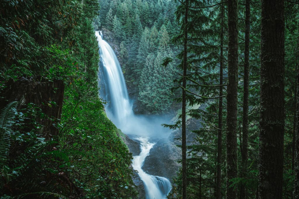
Stop 5: Gorge Creek Falls
After emerging from a long tunnel, Route 20 meets up with the Skagit River once again and quickly arrives at Gorge Creek. The creek’s waters first flow calmly before plunging over ledges and boulders in a dramatic cascade that can be seen for hundreds of feet. For an exhilarating view of the stream, one can stand on the sturdy steel bridge and look through the grating down into the churning water nearly 900 feet below.
Take a stroll along the pedestrian pathway to witness the breathtaking Gorge Creek Falls. The water tumbles down 242 feet from the mountains, eventually reaching Gorge Lake and then flowing through the Gorge Powerhouse into the Skagit River. Despite seasonal variations, the waterfall can be seen all year round, with the highest volume occurring during the spring and early summer snow melt. Continue your journey on an interpretive trail for stunning views of Gorge Lake and Gorge Dam. The first 0.3 miles of this paved path is wheelchair accessible, while the remaining 0.5 miles winds through the forest on an unpaved loop back to the parking area.
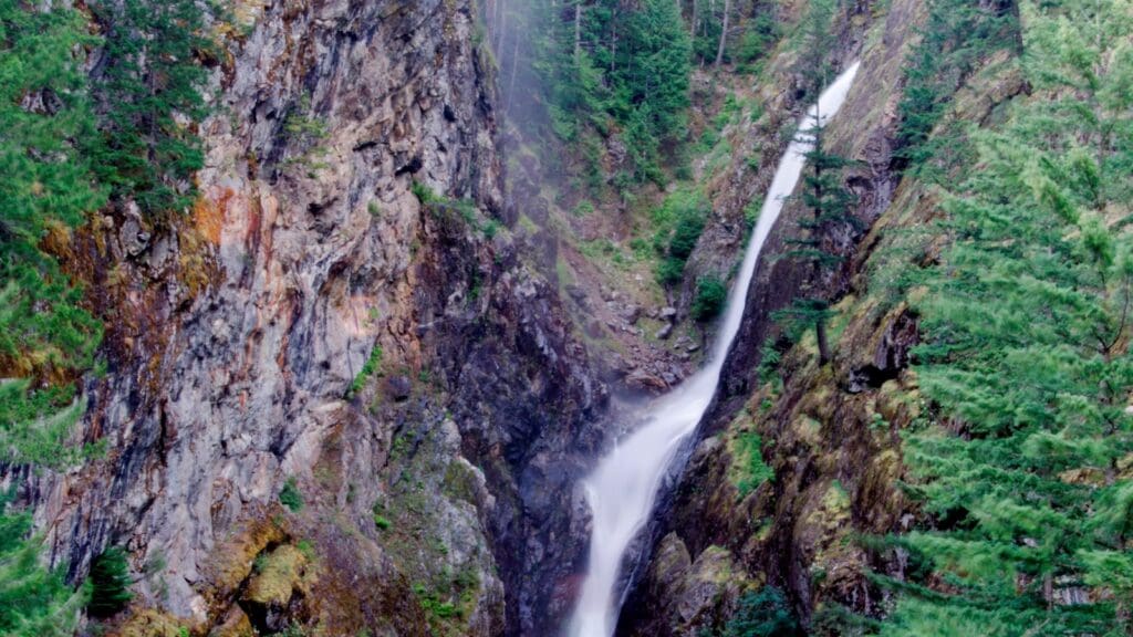
Gorge Creek Falls Photo: Deby Dixon / NPS.
Stop 6: Diablo Lake
Diablo Lake is famous for its stunning emerald hue, caused by suspended rock particles known as glacial flour that reflect light. Tourists can embark on a motorboat tour of the man-made lake as part of an excursion to explore Seattle City Light’s hydroelectric facilities. The journey also includes a thrilling ride up Sourdough Mountain on an incline railway. To fully appreciate the beauty of this gemlike lake, the dam, and the surrounding glacier-carved peaks, visitors can drive to the overlook on the southeastern shore of the lake.
For a more immersive experience, hikers can take the Thunder Creek Trail starting at Colonial Creek Campground, winding through miles of lush forest. Another challenging and scenic hike, the Sourdough Mountain Trail is highly recommended. It begins with a steep ascent of almost 3,000 feet in just 2 miles, with an overall elevation gain of 5,610 feet over a distance of 13.5 miles.
This trail offers breathtaking views of Diablo Lake and the surrounding peaks, making it best hiked during the summer season for optimal visibility. The reward for all the effort comes in the last stretch of the hike: 1.5 miles through subalpine meadows and along the ridge top, with stunning views of Diablo Lake down below. The area is teeming with wildlife such as wildflowers, birds, small mammals, deer, and black bears. At the summit, one can enjoy panoramic views in all directions, including beautiful blue lakes, imposing glaciers, and Mount Baker’s volcanic dome.
The Sourdough summit holds historical significance as one of the first lookout points established by the U.S. Forest Service in 1915. The original lookout was built by Glee Davis in 1917 and is now part of a historic landmark on the neighboring peak named after his family. The current building dates back to 1933 and underwent renovations in 1998-99. It was also chosen by “Bush” Osborne to test his fire locating device, which later became standard equipment for lookouts across the country.
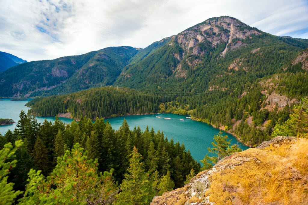
Diablo Lake in North Cascades National Park, Washington.
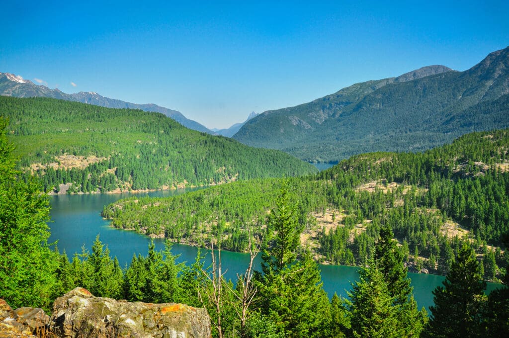
Stop 7: Ross Lake Overlook
A short distance to the east of Diablo Lake, one can spot the southern section of Ross Lake, a vast 12,000-acre expanse of water that winds its way for 25 miles through the mountains until it reaches the border with Canada.
The Ross Lake Overlook offers stunning views and is the perfect starting point for various activities in the area. The North Cascades Highway, which runs through the National Park, allows for easy access to the Overlook. From there, visitors can take in panoramic vistas of Ross Lake and the surrounding peaks.
One of the most popular activities from the Overlook is hiking. A trail leads down to the Ross Lake Dam and connect to a network of trails in the Ross Lake National Recreation Area. A highlight of the hike is crossing over the Ross Dam, providing a unique experience for hikers.
For photography enthusiasts and nature lovers, the Overlook itself is an ideal spot to capture sweeping views of the North Cascades. Other nearby attractions include Diablo Lake Overlook and Happy Creek Forest, both offering great opportunities for photography and leisurely walks.
Those looking to extend their stay can check out the Ross Lake Resort, which offers 15 floating cabins facing the lake. This provides a peaceful and picturesque setting for overnight stays, making it a unique lodging option in the area.
Continuing on Route 20, the road turns towards the southern direction and leads through Okanogan National Forest, where individuals have the opportunity to go horseback riding and trekking on remote trails.
Ross Lake
Stop 8: Rainy Pass
As you travel up Route 20, the elevation gradually increases until you reach Rainy Pass at 4,800 feet. This is an ideal spot for taking in the breathtaking views of the surrounding area. The highway intersects with the Pacific Crest National Scenic Trail, a popular destination for hikers seeking an adventure that stretches from Canada to Mexico. A well-maintained path leads to Rainy Lake, where visitors can admire a stunning waterfall, a glistening glacier, and the majestic peaks surrounding it all. During fall, the vibrant yellow foliage of mountain ash trees reflects beautifully on the calm surface of the lake.
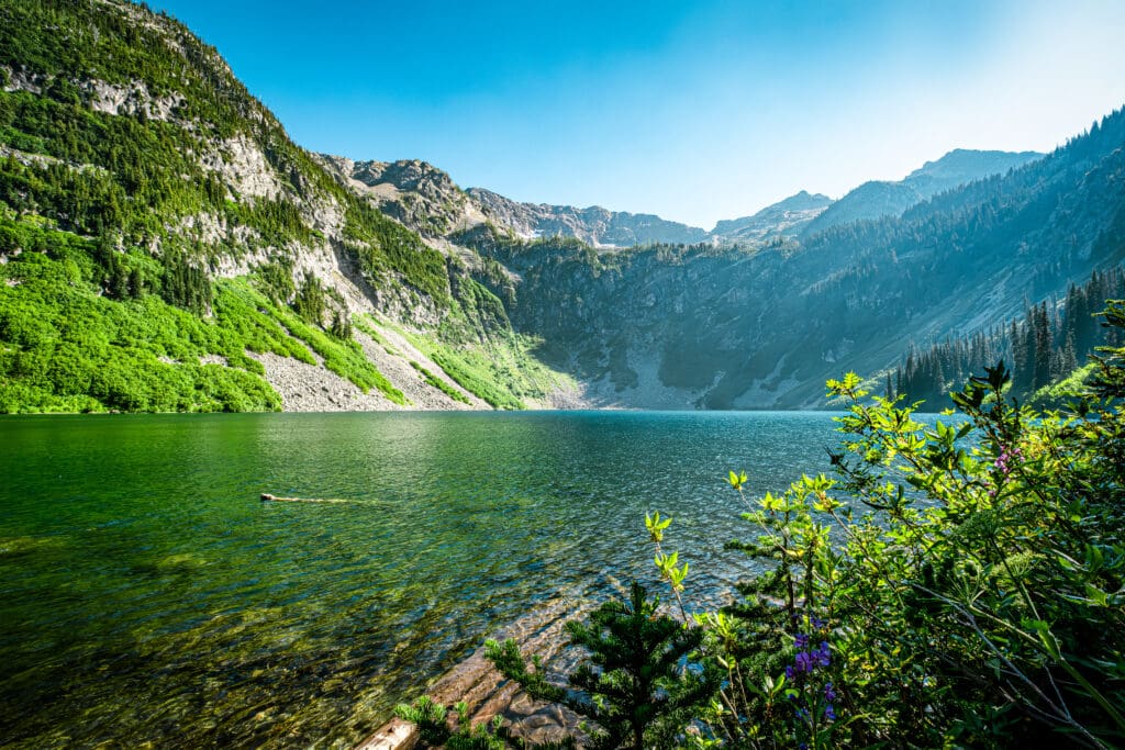
Rainy Lake in North Cascades National Park in Washington.
Stop 9: Whistler Basin Overlook
The North Cascades’ Whistler Basin Overlook offers a plethora of activities to fully experience the region’s stunning beauty. Outdoor enthusiasts can choose from an array of options, while those seeking a more laid-back visit can simply admire the breathtaking views from the overlook. During the summer, the alpine meadow nearby is covered in a vibrant patchwork of wildflowers. Keep an eye out for wildlife like deer, marmots, and pikas, particularly in the early hours of morning or at dusk.
One of the main attractions is hiking the Whistler Basin Trail. This trail is a must-see for adventurers who enjoy off-the-beaten-path routes. It leads up to Billy Goat Pass, offering spectacular vistas of the surrounding peaks. The moderate difficulty level of this trail makes it accessible to a wide range of hikers. As the snow melts on Whistler Mountain in the spring, waterfalls form and rush down the metal slopes into Whistler Basin.
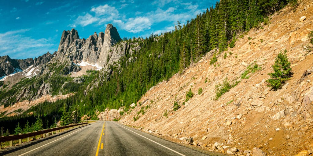
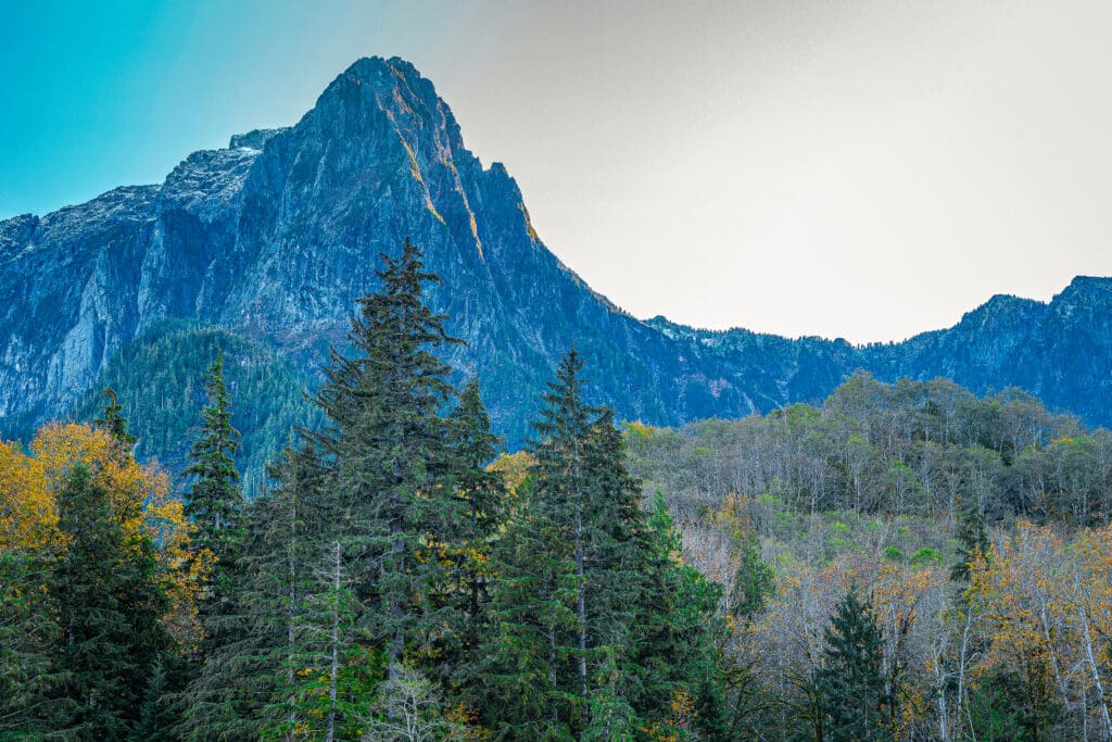
Stop 10: Washington Pass
The mountains above 5,477-foot Washington Pass, the highest point on the North Cascades Highway, are a breathtaking sight to behold. As you traverse this scenic route, you’ll encounter Liberty Bell Mountain, which stands as a majestic sentinel, its rugged peaks soaring high into the sky. The mountain’s sheer walls and distinctive shape make it an iconic landmark along the North Cascades Highway.
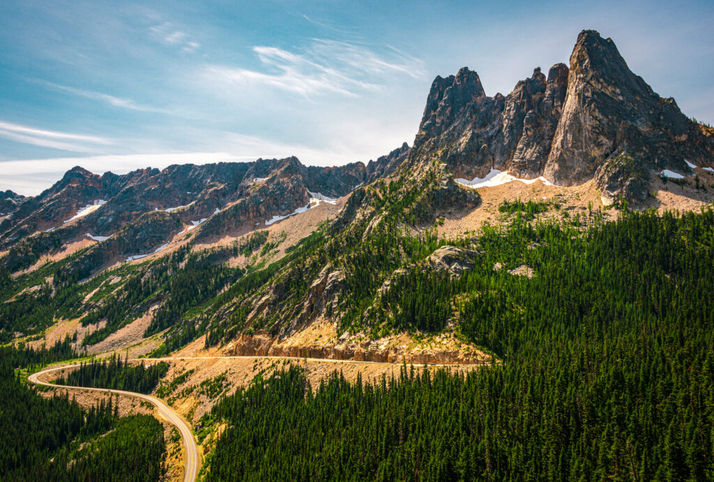
Washington Pass on the North Cascades Highway is dominated by the impressive size of Liberty Bell Mountain.
Further along, you’ll come across Early Winters Spires, another set of dramatic peaks that seem to pierce the sky with their sharp, jagged summits. These spires are a testament to the raw power of nature, their rocky faces sculpted by the relentless forces of wind, rain, and time.
Liberty Bell, Concord, Lexington Tower and Early Winters Spires.
As you journey through this awe-inspiring landscape, don’t forget to look out for the ever-changing views of the surrounding peaks, including the stunning panorama of the Cascade Range. This is truly a place where the grandeur of nature is on full display, offering a visual feast for the eyes and a humbling reminder of our place in the grand scheme of things.
Stop 11: Winthrop
Winthrop, WA is a charming town located in the Methow Valley, offering diverse activities for visitors. Outdoor enthusiasts can enjoy cross-country skiing on groomed trails during winter and hiking in warmer months. The town also serves as a gateway to North Cascades National Park for stunning alpine views. See our adventurer’s guide for more information on the Methow Valley.
Winthrop also has cultural and historical attractions such as the Shafer Historical Museum and an Old West-themed town to explore. Food and drink options include unique handcrafted cocktails at Copper Glance and locally-brewed beer at The Old Schoolhouse Brewery.
The compact town was established in the late 1800s and maintains its frontier appearance with vintage storefronts. With a temperate climate and over 300 days of sunshine per year, the Methow Valley is a popular destination for outdoor activities like camping, mountain biking, and wildlife watching.
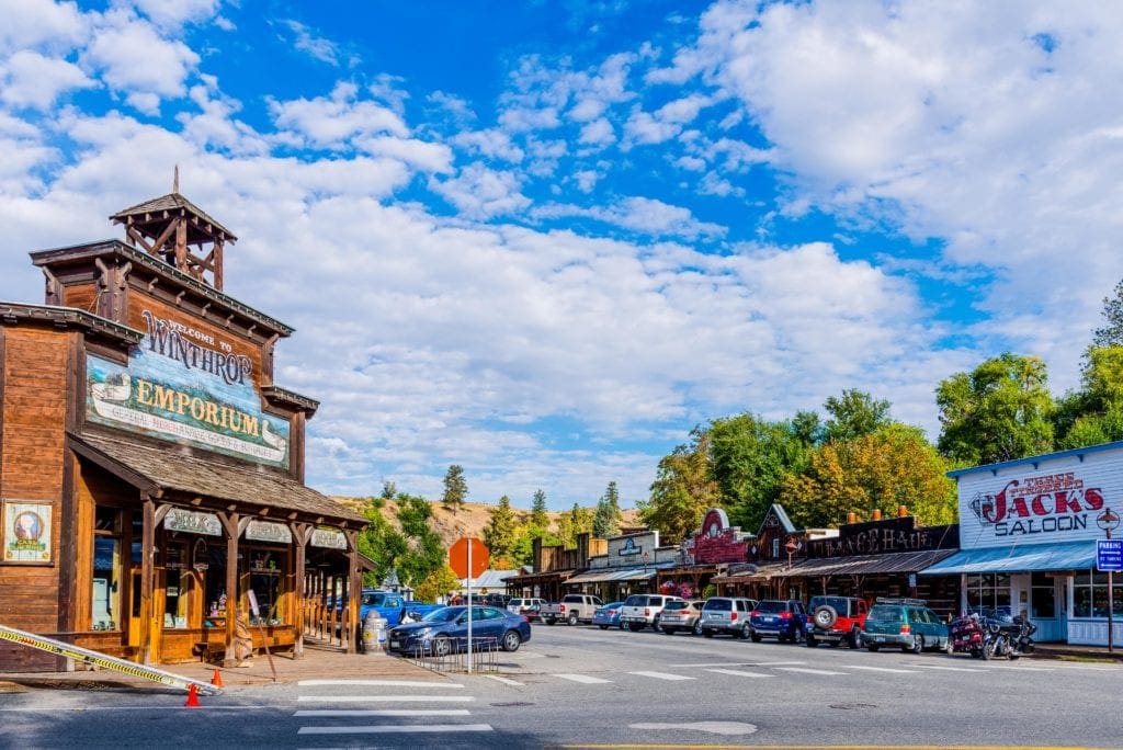
Street view of the traditional western town in Winthrop, Washington.
Nearby attractions include Pearrygin Lake State Park, which has a plethora of outdoor activities to enjoy throughout the year. This expansive park covers 1,186 acres and provides a picturesque backdrop for camping, hiking, swimming, and even snowshoeing and Nordic skiing. It boasts 11,000 feet of shoreline on Pearrygin Lake, making it an ideal spot for boating, fishing, and swimming. Adventurers can explore the Rex Derr Trail – a 3.1-mile loop that winds through the eastern campground and offers scenic views of the shrub-covered hills above Pearrygin Lake – perfect for both hiking and bird-watching.
Sun Mountain Lodge offers a range of activities for all seasons, including skiing, hiking, biking, and horseback riding. It features two restaurants, a spa, and a variety of lodging options from standard rooms to cabins with kitchens.
Planning A Summer Weekend Getaway in Methow Valley, Washington
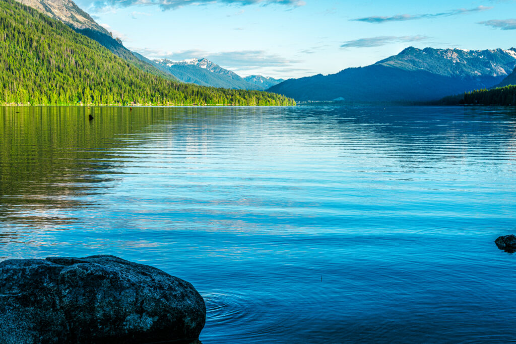
Stop 12: Lake Chelan
The path bends southward, leading down Route 153 through the tranquil scenery of fruit orchards, horse ranches, and hayfields in the Methow River Valley. Eventually, it reaches the breathtaking Lake Chelan, nestled in a narrow valley between the Chelan Mountains and Sawtooth Ridge. This long and slender lake boasts a striking sapphire blue hue and plunges to depths of up to 1,500 feet.
At the southern edge of the lake is the charming town of Chelan, where boats and seaplanes depart for Stehekin, a former mining community that sits 55 miles away and can only be reached by water or air. As you travel along the lower shoreline, private farms give way to forested areas and rugged bluffs teeming with mountain goats. At the northern end lies the Lake Chelan National Recreation Area, a wilderness filled with enchanting hiking trails.

Lake Chelan, Washington
Stop 13: Wenatchee Valley
Wenatchee is proudly known as the Apple Capital of the World, a title that is well-deserved. The region produces more apples annually than any other apple-growing area. In the springtime, endless stretches of orchards are adorned with beautiful pale pink and white blossoms. And in the autumn, the trees are laden with an abundance of red and golden fruits.
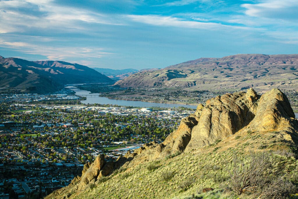
South view of Columbia River basin at Wenatchee from Saddle Rock.
The picturesque Ohme Gardens, located in Wenatchee, was originally established as a private getaway for an orchard owner back in 1929. Nestled on nine acres of rocks and hills, the gardens boast a charming fusion of evergreens, alpine blooms, winding stone walkways, and serene ponds. The sound of chirping birds and frolicking rabbits bring the gardens to life.
Just a short distance away in Cashmere, tourists can explore a museum and perfectly preserved pioneer village from the 1800’s or visit a confectionery to watch the process of making Aplets and Cotlets, famous sweet treats made with apples, apricots, and nuts.
Encompassing more than 13,000 square feet, the museum showcases a diverse collection of objects including Native American artifacts, pioneer belongings, geological specimens, taxidermy displays, and ornithology exhibits. The Pioneer Village cabins are fully furnished with antiques from the late 19th and early 20th centuries for an immersive experience.
Stop 14: Leavenworth
Leavenworth, a small town in the Cascade Mountains that was once on the verge of becoming deserted due to a decline in industry, has successfully reinvented itself. This charming Bavarian-style town welcomes visitors all year round with an array of activities. You can attend Maifest (May) for springtime celebrations or the Washington State Autumn Leaf Festival (September) for delicious food, lively parades, and entertaining performances. Families will enjoy visiting the Nutcracker Museum, the Reindeer Farm, and the new Adventure Park. Don’t forget to catch a show at the Leavenworth Summer Theater’s outdoor venue and savor local cuisine while shopping and taking leisurely walks through the scenic town. With its fusion of German tradition and Pacific Northwest splendor, Leavenworth guarantees unforgettable experiences for everyone.
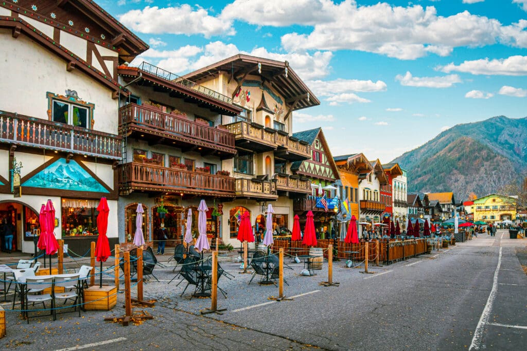
The main street through the Bavarian themed village of Leavenworth with outdoor sidewalk cafes lining up in the late Autumn.
Stop 15: Tumwater Canyon
For a few miles, the road runs alongside the Wenatchee River as it winds through Tumwater Canyon. While these trees are typically vibrant with autumn hues, one-third of them were destroyed in a fire during the summer of ’94.
At Coles Corner, you can take Route 207 to reach Lake Wenatchee, a stunning body of water lined with sandy shores, places to launch boats, and scenic spots for picnicking.
Lake Wenatchee
Stop 16: Stevens Pass
While not often seen, mountain goats can sometimes be spotted from the highway at Stevens Pass, which sits at an elevation of 4,060 feet and is a popular destination for skiers during the winter.
Stevens Pass Ski Resort offers numerous activities for visitors to partake in, especially during the snowy winter season. There are 53 trails available for skiing and snowboarding. No matter what your skill level is, you can find a trail that suits your needs. The resort has 12 ski lifts, gondolas, and trams to provide convenient transportation to the vast 1,125-acre skiable area. This terrain offers a variety of options, including groomed runs, mogul runs, and terrain parks, making it a favorite among visitors to the Cascade Mountains
For those seeking a more exhilarating experience, Cascade Powder Cats at Stevens Pass offers the ultimate backcountry skiing and snowboarding adventure. They provide multi-day trips to yurts, catskiing with up to 10 runs per day, snowmobile skiing, and avalanche training for both adrenaline junkies and those looking to discover the backcountry in a more daring fashion.
Even during the warm months, there is no shortage of activities to enjoy while visiting. At Stevens Pass, you can take advantage of hiking trails, disc golf courses, and scenic rides. The surrounding nature truly shines during this season, with verdant forests and majestic mountain vistas.
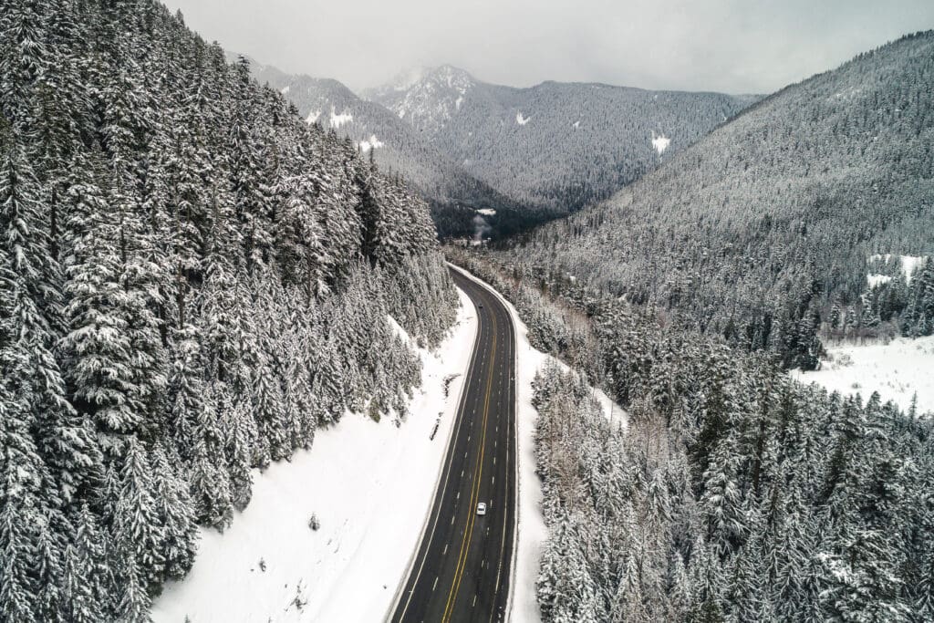
Aerial view of snow covered Pacific Northwest forest with Highway 2 winding through Stevens Pass, Washington.
In addition to skiing and snowboarding, Stevens Pass boasts a fascinating history waiting to be discovered by visitors. The site of the first Cascade Tunnel, Wellington townsite, is infamous for experiencing one of the deadliest avalanches in US history. During the early morning hours of March 1, 1910, an avalanche on Windy Mountain near Stevens Pass caused a massive disaster. It destroyed two Great Northern trains and killed 96 people, making it the worst train accident and natural disaster in the state’s history.
Nowadays, visitors can trace the original route of The Great Northern Railroad along the eastern section of the Iron Goat trail to gain insight into this significant event and the town’s impact on the region’s growth. Check out the Iron Goat trail. This trail follows the path of the old Great Northern Railway for several miles below Stevens Pass. To access the trail, turn north onto the Old Cascade Highway and then take Route 6710 to the trailhead.
About 8 miles east of Stevens Pass is Deception Falls, which offers a stunning nature experience just off Highway 2. The 94-foot waterfall flows from Deception Creek and is accessible via a short ADA-accessible trail. Visitors can marvel at the falls’ dramatic 90-degree turn and explore the surrounding old-growth forest. Managed by the US Forest Service, Deception Falls is part of the Deception Falls National Recreation Area in the Mount Baker-Snoqualmie National Forest. It’s named after early explorers who were deceived by its sharp turn, making it a must-see stop for those passing through the area.
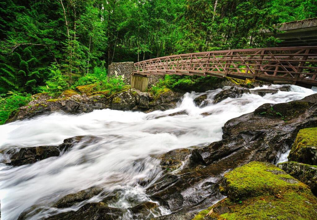
Deception Falls, Washington.
Stop 17: Mount Index
Mount Index in Washington is a majestic sight with its three peaks soaring above the nearby town, offering a range of climbing and hiking opportunities. The main activities include hiking the scenic trails, such as the Mount Index and Lake Serene trail, which provide breathtaking views of the surrounding mountains.
For the more adventurous, there are technical climbs like the North Face and the Norwegian Buttresses, featuring nearly 2000ft big wall climbs. These routes cater to climbers looking for a challenge, with varying degrees of difficulty and rock quality depending on the season. Additionally, the area is a popular spot for photography, with stunning views of the peaks and surrounding landscape.
The Skykomish River, referred to as “the Sky” by locals, presents difficulties for white water rafters in the shadow of the mountain. However, it also offers a serene opportunity for fishermen seeking steelhead.
Mount Index, Washington.
Stop 18: Wallace Falls State Park
Nestled in the timbered foothills near Gold Bar is Wallace Falls State Park, a place that harkens back to the town’s history as a hot spot for prospectors. Following a trail here leads hikers to the top of a towering 265-foot waterfall, where they can bask in breathtaking views of the Skykomish Valley and Mt. Baker-Snoqualmie National Forest.
The beautiful Wallace Falls State Park in Washington.
Stop 19: Everett Waterfront
The Skykomish River serves as a guide for Route 2, leading travelers through the rugged mountains of the Cascade Range towards the rocky coastline of Puget Sound.
In the port town of Everett, one can catch a glimpse of the bustling ferries and boats navigating the waterway, while also hearing the distinct calls of California Sea Lions sunbathing on Everett Jetty Island. The Everett waterfront offers an array of activities for visitors and locals alike. You can explore the scenic views along the waterfront, perhaps taking a stroll along the Grand Avenue Park or the Millwright Loop Trail. These trails not only provide stunning views of the water but also celebrate Everett’s milltown past through interpretive signage.
For those who enjoy water activities, a visit to Jetty Island during the summer months offers a serene beach experience with opportunities for swimming, picnicking, and exploring nature trails.
Mukilteo Lighthouse Park is another great place to visit. The park spans 14.4 acres along the waterfront, is a treasured landmark with a rich history. It offers beach access, cozy fire pits, and is home to the Mukilteo Light Station. This popular spot draws in both locals and tourists alike, who can take in the peaceful surroundings while enjoying breathtaking views of Whidbey Island and Puget Sound.
The park boasts six first-come, first-served fire pits, picnic shelters, a playground, and even a boat launch for those looking to explore the water. Originally built in 1906, the historic lighthouse is now maintained by the US Coast Guard and offers tours and special events. In 2003, the park was officially transferred to the City of Mukilteo and has since undergone renovations to improve accessibility and enhance the overall visitor experience.
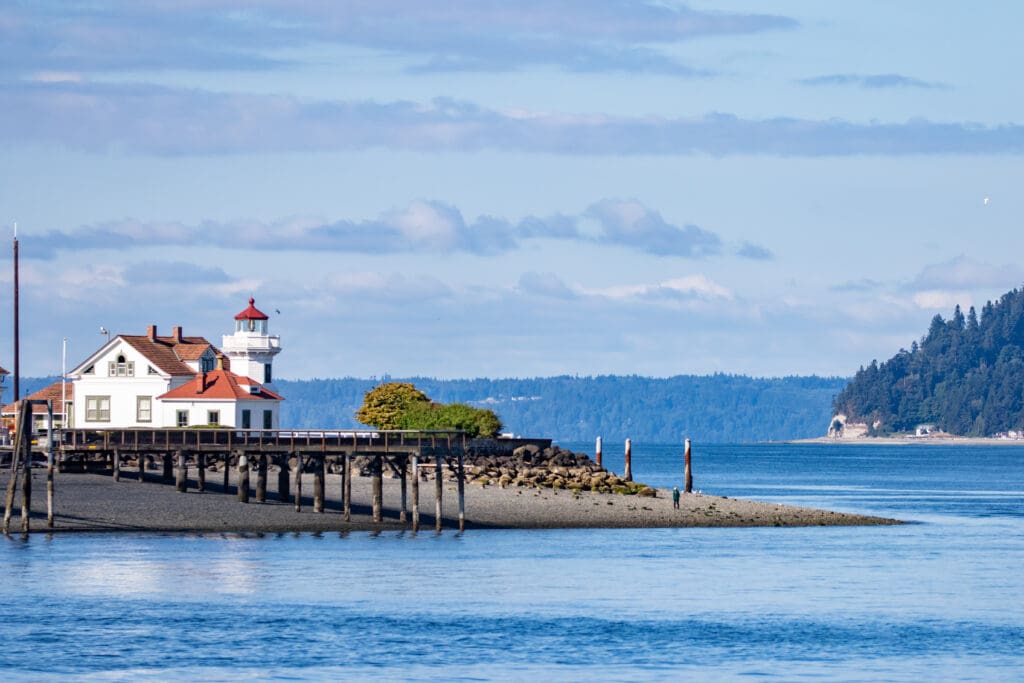
Mukilteo Lighthouse Park from Puget Sound. Photo Jeff Huth / Adobe Stock.
Stop 20: Whidbey Island
As the ferry crosses Possession Sound towards Whidbey Island, the picturesque town of Mukilteo and its century-old lighthouse disappear from sight. Whidbey Island is known for its quaint towns and breathtaking coves nestled among towering cliffs. One popular destination for weekend getaways is Langley, a charming bayside village filled with unique boutiques, antique shops, and art galleries. For those seeking a more rugged experience, South Whidbey State Park offers 340 acres of untouched wilderness, including old-growth Douglas firs, red cedars, and a variety of wildlife such as eagles and black tailed deer.
Continuing further up-island, you’ll find Fort Ebey State Park, home to a fortification that dates back to World War II. This park is also known for housing what many locals consider the most beautiful beach on Whidbey Island: Partridge Point. Along the Ebey’s Landing Loop Trail, you can enjoy breathtaking views of the Olympic Mountains and Mount Rainier framed by lush pine and fir trees. The trail winds along bluffs that are constantly battered by strong winds, and its paths are lined with pieces of driftwood and vibrant wild roses.
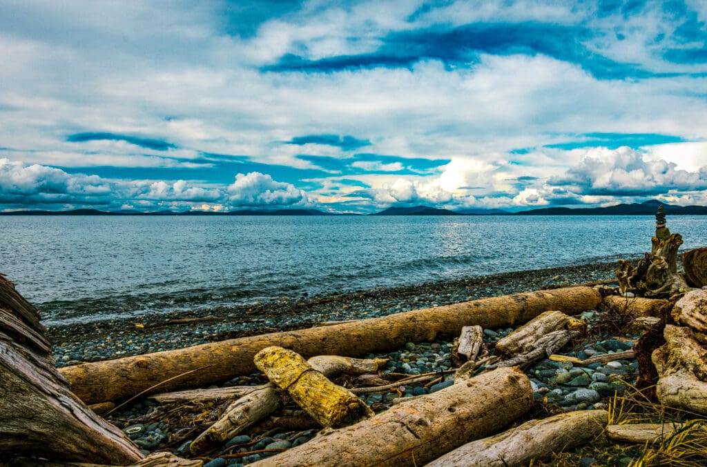
Whidbey Island Beach
Stop 21: Deception Pass Bridge
Connecting Whidbey Island to its neighboring island, Fidalgo, this 1,487-foot steel cantilever bridge towers above a narrow channel where tides constantly ebb and flow around jagged rocks. Beneath it lies a state park spanning over 4,000 acres of lush forests, wetlands, freshwater lakes, and sandy beaches along the Puget Sound. The bridge and park both offer breathtaking views of the sound, home to playful porpoises and otters and scattered with around 200 picturesque islands.
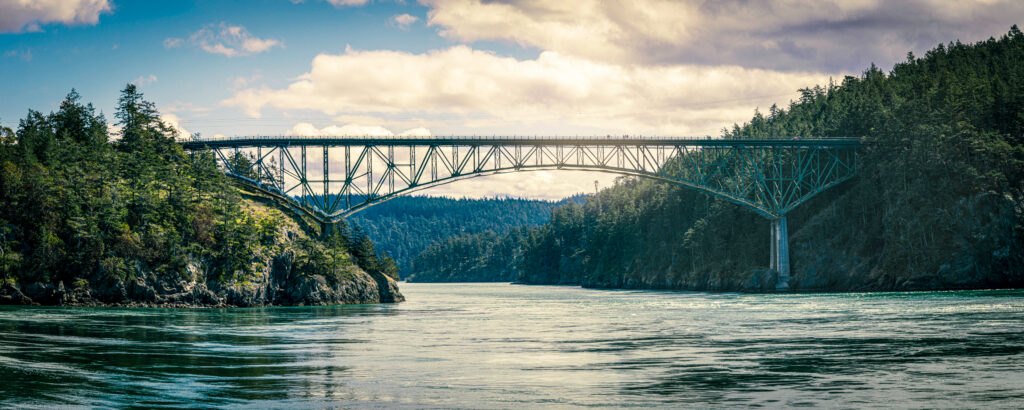
The Deception Pass Bridge connection Fidalgo Island with Whidbey Island.
Stop 22: Fidalgo Island
At the northern edge of Fidalgo Island, the port town of Anacortes throbs with the incessant roar of ferries, charter fleets, and pleasure boats. From the peak of 1,270-foot Mount Erie, the highest vantage point on the island, the bustling maritime scene resembles a miniature world of toy boats chugging across a shimmering azure pond.
Continuing along Route 20 towards the mainland, the Cascade Loop eventually comes full circle in the verdant Skagit River Valley. Here, the damp lowlands overflow with dairy farms and erupt into a kaleidoscope of vibrant colors each spring as fields burst forth with whole swaths of daffodils, irises, and most famously, the world’s largest crop of tulips.

Anacortes, Washington
Stop 23: Mount Vernon
Explore the blooming fields of millions of tulips at the Skagit Valley Tulip Festival held annually in April. Take on the rugged terrain of Little Mountain Park with its 522 acres of hiking, biking, and horseback riding trails. Dive into the rich history and culture of Skagit County at the Skagit County Historical Museum. Immerse yourself in live performances ranging from concerts to classic films at the historic Lincoln Theatre.
Stroll along the scenic Skagit Riverwalk and discover public art installations, local shops, and delicious restaurants. Mount Vernon, Washington is a charming city full of adventure and excitement for everyone to enjoy. From outdoor activities to cultural experiences, there’s always something new to explore in this beautiful Skagit Valley town.

As the sun rises, a Skagit valley tulip field comes into view, with the North Cascade Mountains looming in the distance.

Enroll With Global Rescue Prior To Embarking On Your Next Adventure.
When a travel emergency arises, traditional travel insurance may not come to your aid, and a medical evacuation can cost up to $300,000.
The cost when you have a Global Rescue membership? $0. That’s why when the unexpected happens, you want the leader in rescue, evacuation and medical advisory behind you. You want Global Rescue.
Popular Articles:
Adventurer’s Guide to North Cascades National Park
The Dyrt: The Best Camping Near North Cascades National Park
Best Hiking Trails in Rocky Mountain National Park, Colorado
Adventurer’s Guide to Grand Canyon National Park, Arizona
Best Waterfall Hikes In Rocky Mountain National Park
Adventurer’s Guide to Grand Canyon National Park, Arizona
Terms of Use: As with each guide published on SKYBLUEOVERLAND.com, should you choose to this route, do so at your own risk. Prior to setting out check current local weather, conditions, and land/road closures. While taking a trail, obey all public and private land use restrictions and rules, carry proper safety and navigational equipment, and of course, follow the #leavenotrace guidelines. The information found herein is simply a planning resource to be used as a point of inspiration in conjunction with your own due-diligence. In spite of the fact that this route, associated GPS track (GPX and maps), and all route guidelines were prepared under diligent research by the specified contributor and/or contributors, the accuracy of such and judgement of the author is not guaranteed. SKYBLUE OVERLAND LLC, its partners, associates, and contributors are in no way liable for personal injury, damage to personal property, or any other such situation that might happen to individuals following this route.


