|
Getting your Trinity Audio player ready...
|
The best time to see Rocky Mountain National Park’s waterfalls is during the later spring and early summer months, when they are being fed by the melting snow. There are at least thirty named falls within the park, as well as numerous unnamed cascades. Check out our list of favorite hikes that lead to these spectacular sights.
Alberta Falls (Easy)
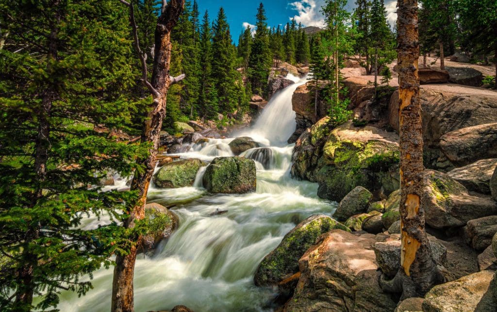
Alberta Falls long exposure in the Rocky Mountain National Park, Colorado. Photo by Adobe Stock.
At a Glance: 1.6 miles roundtrip, +~250 feet.
What makes it special: This short hike is incredibly popular as it takes off from the perennially packed Glacier Gorge Trailhead. Alternatively, you can try to park at Bear Lake, which adds a couple points of a mile, or spring for the Bear Lake free shuttle. Either way, the payoff for the effort is hard to beat, be prepared to share the trail.
If you want more adventure after visiting Alberta Falls, see our trail review of the hike to the amazing Mills Lake, which is just another 3.8 miles up the Glacier Gorge Trail.
Adams Falls (Easy)
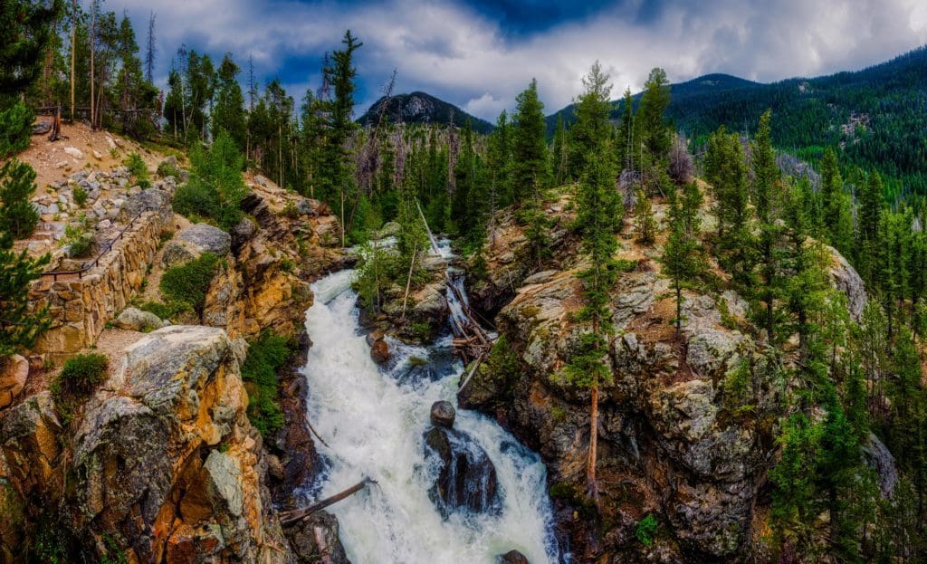
Adams Falls on a cloudy day along the East Inlet Trail of Rocky Mountain National Park, Colorado. Adams Falls is also shown in the hero image above. Photo by Adobe Stock.
At a glance: 0.6 miles roundtrip, + >100 ft.
What makes it special: The only downside is that it’s on the western side of the Park, which is far if you’re coming from the Front Range. The Falls are also located in a part of the Park that only has one entrance (i.e. doesn’t connect with Trail Ridge), which may complicate the timed entry system. A nice upside is that this side of the Park is quieter and no less beautiful.
After stopping at Adams Falls, the trail continues onwards another couple of miles to the beautiful East Meadow. If you want more isolation, continue up the East Inlet Trail, which climbs steadily up 6.9 miles with an elevation gain of more than 2,100 feet through the East Inlet Creek valley to Lone Pine Lake, then Lake Verna.
Bridal Veil Falls (Moderate)
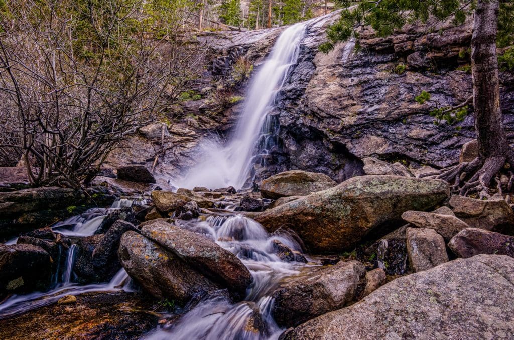
Bridal Veil Falls, Rocky Mountain National Park, Colorado. Photo by Adobe Stock.
At a glance: 6.2 miles roundtrip, + >320 ft.
What makes it special: Enjoy the numerous un-named cascades along the journey from the Crew Creek Trailhead to Bridal Veil Falls. The falls typically flows into the late fall season over the rock outcropping. For the more adventurous, start at the Lumpy Ridge trailhead to pass the beautiful Gem Lake. This alternative route is 12.8 miles on an out-and-back trail.
Calypso Cascade (Easy)
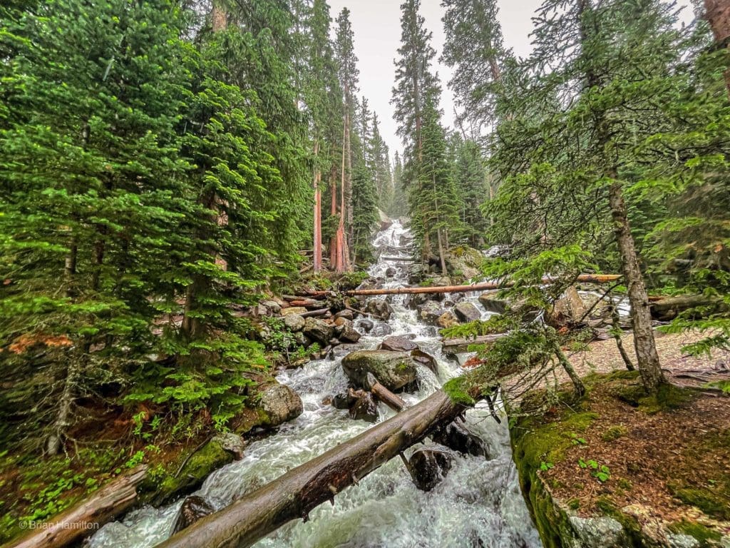
Spring 2021 snowmelt floods Calypso Cascades in the Wild Basin in Spring, Rocky Mountain National Park, Colorado. Photo by Brian Hamilton
At a glance: 3.6 miles roundtrip, + >610 ft.
What makes it special: The hike to Calypso Cascades begins from the Wild Basin Trailhead in the southeastern corner of Rocky Mountain National Park, located near Allenspark, Colorado. Wild Basin is one of the largest protected mountain basins on the eastern side of Rocky Mountain National Park and is, perhaps unsurprisingly, wild. Combining a trip to Thunder Lake with Copeland Falls, Calypso Cascade, and Ouzel Falls makes for an excellent and well-rounded, albeit long, adventure into Wild Basin. See our detailed trail review on hiking to Thunder Lake and the Wild Basin Waterfalls.
In addition to Copeland Falls, Calypso Cascades and Ouzel Falls there are several other scenic attractions in this area if you wish to extend your hike, including Bluebird Lake, Eagle and Box Lakes and the Lion Lakes. There are several amazing alpine scrambling routes in Wild Basin including the Eagles Beak and Tanima Peak and the Cleaver.
Cascade Falls (Moderate)
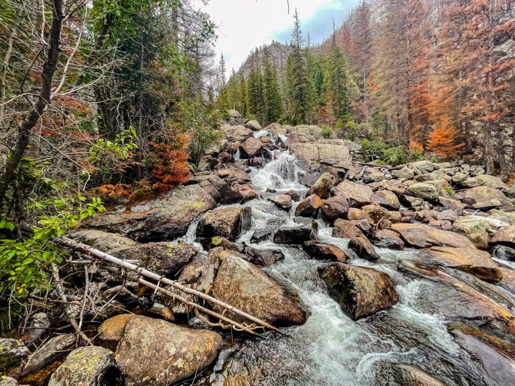
Cascade Falls even looks spectacular in early September 2021. Photo by Brian Hamilton
At a glance: 6.8 miles roundtrip, + >125 ft.
What makes it special: Cascade Falls is a spectacular, multi-tiered cascade that drops roughly 40 or 50 feet through a narrow granite chute. The hike to Cascade Falls begins from the North Inlet Trailhead near the town of Grand Lake on the west side of Rocky Mountain National Park.
Continue up the trail North Inlet Trail to Lake Nokoni (10,773′), which is located 9.8 miles from North Inlet Trailhead. It fills a large, steep-walled bowl carved from Ptarmigan Mountain (12,324′)
Chasm Falls (Easy)
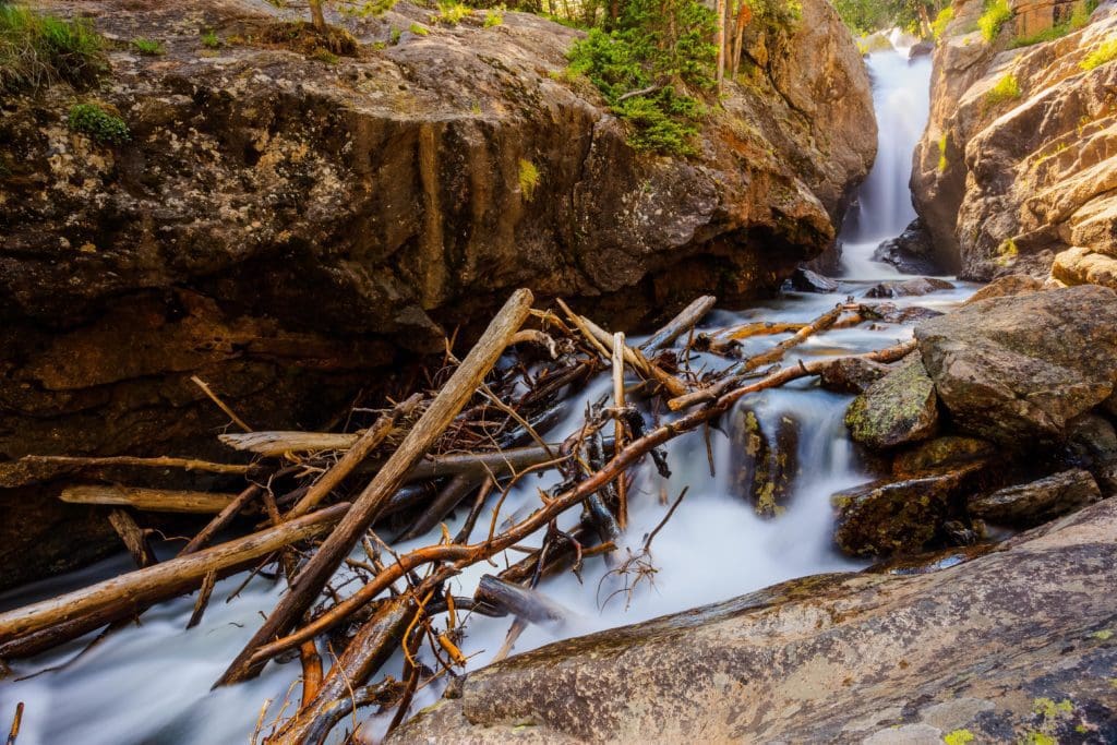
Chasm Falls in Rocky Mountain National Park. Photo by Adobe Stock.
At a glance: 3 miles roundtrip, + >100 ft.
What makes it special: The 25-foot Chasm Falls is right off Old Fall River Road, which is a gravel road that is open typically until mid-October. At that point, you can hike up the trail to the waterfalls. From the Endovally Picnic Area, follow the road to the Chasm Falls trailhead. The trail is just a couple of short switchbacks leading to a viewing area, where you can watch the Fall River flow down a rocky chute and into a small pool. If the road is open, you can drive all the way up to the Visitor Center at Fall River Pass (Elevation: 11,796 ft.) on the Great Continental Divide.
Copeland Falls (Easy)
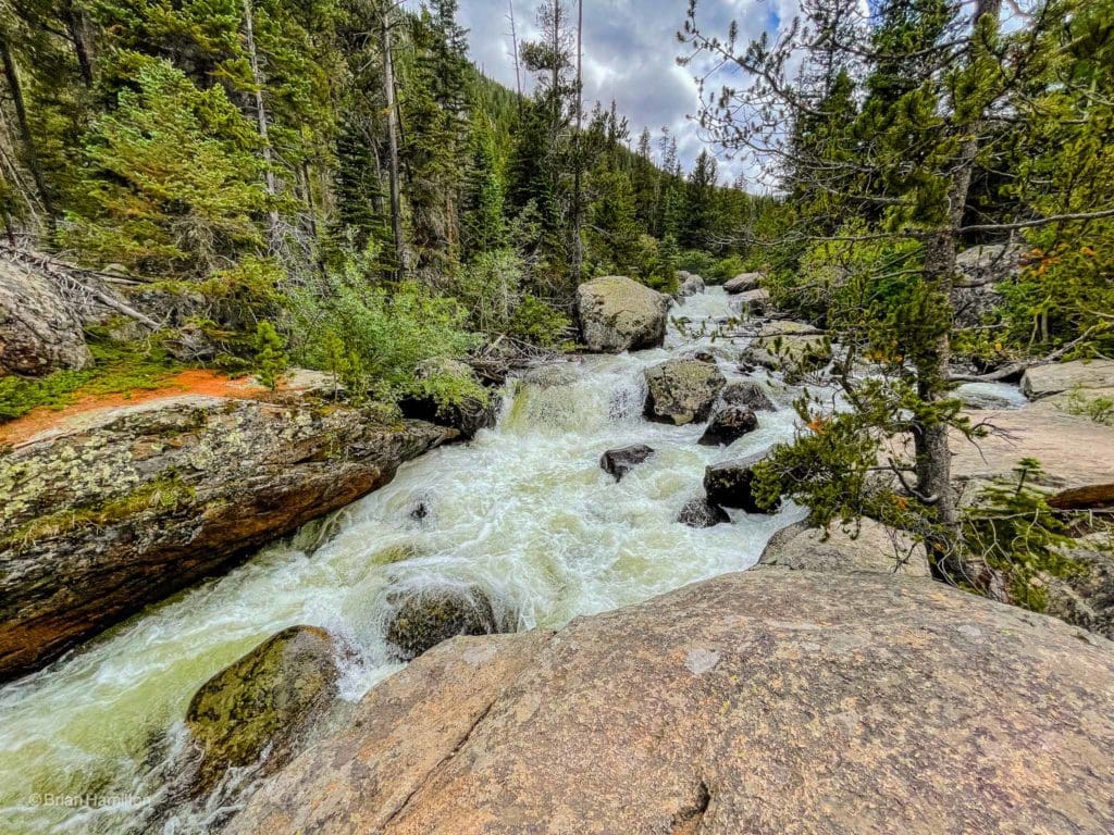
A very saturated Copeland Falls, almost unrecognizable due to rainfall and snowmelt in early June 2021. Photo by Brian Hamilton
At a glance: 0.9 miles roundtrip, + >75 ft.
What makes it special: The hike to Copeland Falls begins from the Wild Basin Trailhead in the southeastern corner of Rocky Mountain National Park, located near Allenspark, Colorado. After leaving the trailhead, the approximately three-foot high Lower Copeland Falls will arrive after a short 0.3 miles. Upper Copeland Falls is located about 0.1 miles further upstream along the North St. Vrain Creek. See our detailed trail review on hiking to Thunder Lake and the Wild Basin Waterfalls.
Fern Falls (Moderate)
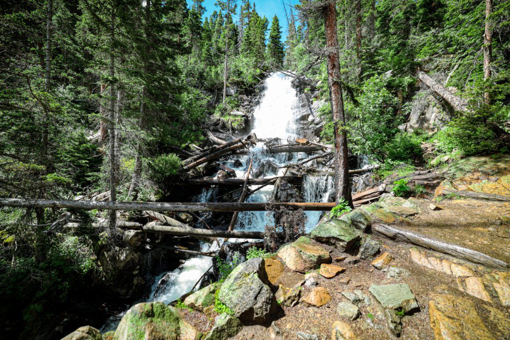
The Fern Falls is a beautiful 60-foot waterfall that plunges down Fern Creek. Shown in mid-summer 2020. Photo by Brian Hamilton
At a glance: 5.2 miles roundtrip, + >700 ft.
What makes it special: The hike to Fern Falls begins from the Fern Lake Trailhead in Moraine Park area of Rocky Mountain National Park, located near Estes Park, Colorado. After 2.6 miles from the trailhead, hikers will arrive at Fern Falls, the beautiful 60-foot waterfall that plunges down Fern Creek. See our detailed trail review on hiking to Fern Lake.
Ouzel Falls (Moderate)
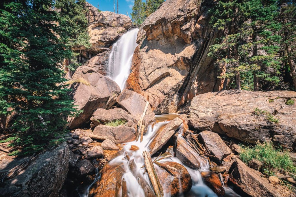
Ouzel Falls in the Wild Basin area of Rocky Mountain National Park, Colorado.
At a glance: 5.7 miles roundtrip, + >900 ft.
What makes it special: Located in the remote and wonderful Wild Basin, the trail to Ouzel Falls passes two other picturesque waterfalls, Copeland Falls and Calypso Cascade, along the way and exemplifies the roaring seasonal snowmelt common from roughly May-July. In the late summer, the waterflow significantly decreases, but in early June, it’s hard to find a more impressive set of flowing water features in Rocky.
The well-built trail will rise and hug the steep sides of the hillside until you arrive at the impressive 40-foot falls. There are great views from the trail, though it’s worth poking around in the trees to get better perspectives. Stay away from wet and steep edges as they could lead to nasty falls.
See our detailed trail review on hiking to Thunder Lake and the Wild Basin Waterfalls.
Ribbon Falls (Difficult)
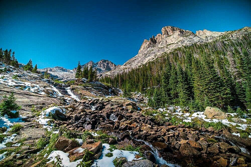
Before the last pitch up to Black Lake, you’ll pass the impressive Ribbon Falls, which flows out of the lake. Shown in late summer 2020 after an early snow storm. Photo by Brian Hamilton
At a glance: 9.6 miles roundtrip, + >1,400 ft.
What makes it special: Ribbon Falls and Black Lake are located in the impressive Glacier Gorge area of Rocky. Formed by the retreat of glaciers, it is deserving of all the praise that has been heaped upon it for the last hundred years. Glacier Gorge is the premier alpine basin in Rocky Mountain National Park. Before the last pitch up to Black Lake, you’ll pass the impressive Ribbon Falls, which flows out of the lake. Black Lake appears quickly above the falls. The roundtrip distance of nearly 10 miles helps the destination stay less crowded than nearby lakes, but you likely won’t find solitude here unless hiking during the winter or early spring. On the way to Black Lake, you’ll pass Alberta Falls, Mills Lake, Jewel Lake, and Ribbon Falls. See our detailed trail review of the hike to Ribbon Falls and Black Lake.
Above Black lake is Upper Glacier Gorge, which is rimmed with giant, serrated mountains, intimidating rock prows more reminiscent of the Canadian Rockies than Colorado, and a string of exquisite high-elevation lakes. For a more ambitious adventure, see our detailed review of alpine scrambling upper Glacier Gorge.
Timberline Falls (Difficult)
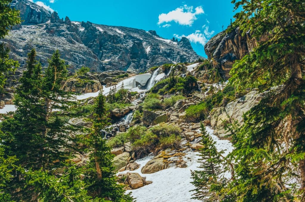
Timberline Falls cascades over a snowy rock face in early summer. Photo by Adobe Stock.
At a glance: 8.1 miles roundtrip, + >1,510 ft.
What makes it special: Often called the prettiest hike in Rocky Mountain National Park, Timberline Falls, The Loch, Lake of Glass and Sky Pond are excellent destinations in a beautiful part of the Rockies. Timberline Falls is located high in an alpine valley, carved by Taylor Glacier, which still lives on, above Sky Pond. The main portion of the Timberline Falls drops roughly 100 feet after being fed by the glacier, and continues cascading down the valley below you. Be sure to look out across the valley for a birds-eye view of The Loch in the far-off distance. Carve out a significant chunk of time for this hike. Because of its stunning beauty, the trail is visited all year long. Plan your trip accordingly and bring a camera.
For more adventure, continue up the trail to the Lake of Glass and Sky Pond. From the base of the waterfall the trail continues up a chute to the right of the falls. This is a fairly challenging scramble that climbs roughly 100 feet, and requires hand holds and the use of all four limbs while ascending. See our detailed trail review of the Timberline Falls and Sky Pond Trail.
Good to know:
To combat overcrowding, Rocky Mountain National Park is implementing a timed-entry reservation system from May 24 to mid-October this year. You’ll need to obtain a permit at recreation.gov for a two-hour admission window in addition to an annual or day pass. It can also be noted that dogs are not allowed in Rocky Mountain National Park’s trails.
Popular articles:
Best Lake Hikes In Rocky Mountain National Park
Best Hiking Trails in Rocky Mountain National Park, Colorado
Adventurer’s Guide To Rocky Mountain National Park, Colorado
Best Hikes Within An Hour Of Boulder, Colorado
Backcountry Skiing During The Alpine Spring
Adventurer’s Guide to North Cascades National Park, Washington


