


High Point:
~10,850 feet

Total Ascent:
~2,831 ft. from Wild Basin Trailhead (~880 ft. from Thunder Lake)

Difficulty:
Hard (Moderate from Thunder Lake due to route finding, thick underbrush and significant up and down over the course of a little more than one mile.)

Distance:
~14 miles from Wild Basin Trailhead (~2.4 miles from Thunder Lake)

Waypoints:
40.20845, -105.56672

Route Type:
Out and Back
Explore the secluded Eagle and Box Lakes trail in Rocky Mountain National Park, Colorado. A 14.7-mile roundtrip, it offers pristine beauty and challenging off-trail navigation. Cairns mark the route to these stunning lakes south of Thunder Lake.
Overview:
These two obscure lakes are far from trailheads and established trails but provide what the mountain inclined adventurer usually hunts for, pristine beauty and solitude. Come prepared for a decent amount of route finding, krummholz, and bugs. The effort is worth the views, but if you’re interested in National Park best-of destinations, this lake combo probably won’t make the list. However, the waters in both lakes are stunningly clear and provide some much-needed nature contemplation. Bring a camp chair, book, or fishing rod and take some time to relax in this exquisite environment.
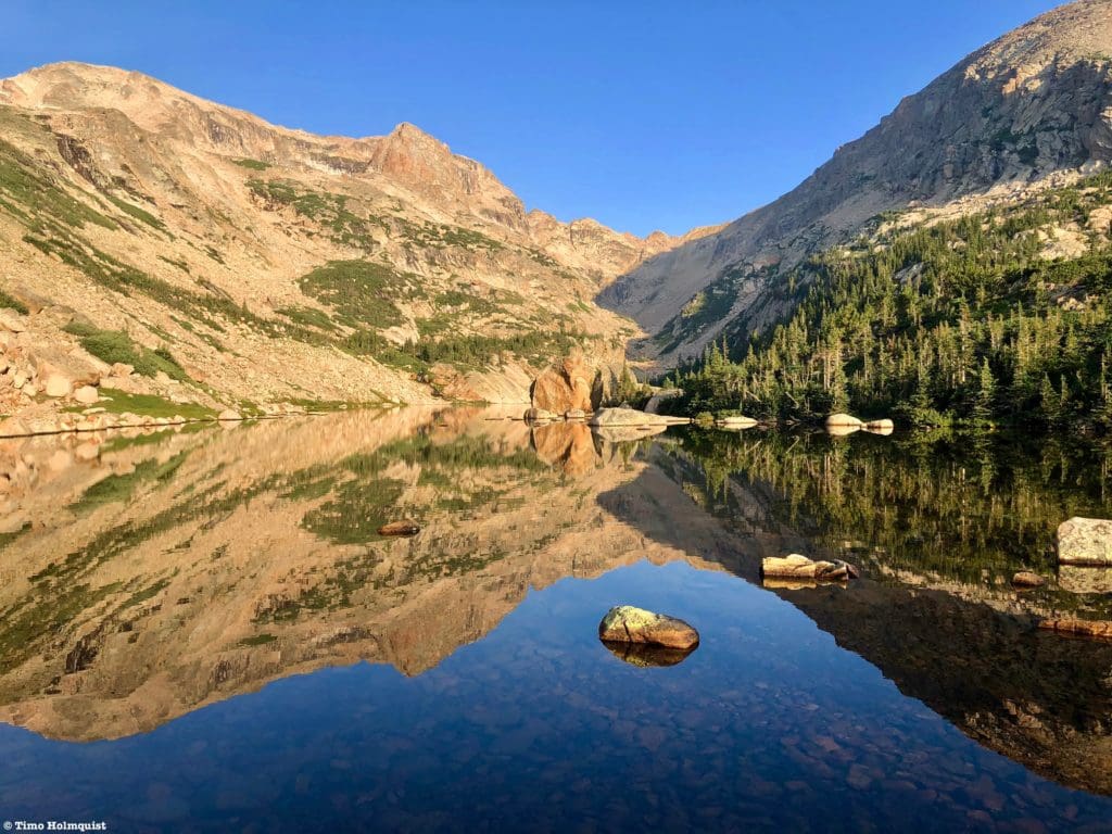
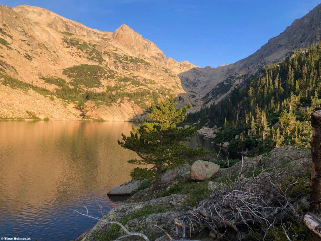
Eagle Lake with Eagles Beak in the background.
Table of Contents:
Article Navigation: Click on any of the listed items in the table of contents below to jump to that section of the article. Similarly, clicking on any large, white section header will jump you back to the Table of Contents.
Looking For An Amazing Adventure? Book A Hiking Tour in Rocky Mountain National Park
The Ultimate Offline GPS Hiking & Ski Maps
See why onX Backcountry is the ultimate GPS navigation app for your outdoor pursuits. Try Today for Free. No credit card required.
Directions to Trailhead:
This hike takes off from the main Wild Basin trailhead. It is located off of US 7, just north of Allenspark. Find US 7 and approach from either the north (Estes area) or the south (Allenspark, Lyons, Boulder, Nederland, etc.). If approaching from the south, make your way through Allenspark and look for a large brown sign for Wild Basin; there is a small left turn lane in the middle of the road. Once you see the sign, slow down, the turn is abrupt. You’ll make a hard left onto a small road and proceed past some houses and the Wild Basin Lodge. The National Park gate is located on the right side of the road and is visible when you approach.
From the north, there will be a large Wild Basin sign on your right after you pass the Meeker Park Overflow Campground. While the sign is large, there is only one, so when you see it, slow down. It’ll be a right-hand turn onto a small road. Proceed until seeing the National Park gate on your right. Approach the gate and drive through to enter into Wild Basin.
Regardless of how you get to the Park gate, you’ll want to drive the dirt road into Wild Basin for its entire length until coming to a parking lot. Make sure to follow the one-way road signs and park where able. The trail takes off from the lower loop portion.
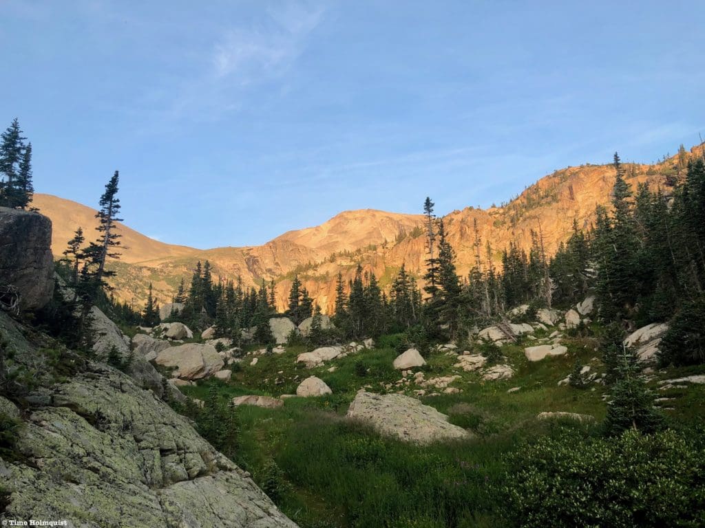
Early morning sun on the way to Box Lake, Mount Meeker is in the background.
Places to Stay:
Find a Hotel in Estes Park, Colorado
Support Skyblue Overland by booking your hotel or cabin through one of our links.
Camping
Camping near Rocky Mountain National Park will cost you. The options for free area camping are limited. On a positive note, there are plenty of options, and the National Park is within driving distance of Fort Collins, Boulder, and Denver.
- Estes Park: Known as the gateway to Rocky Mountain National Park, Estes sees nearly 80% of park traffic as opposed to the much quieter western entrance near Grand Lake. The town has a ton of lodging options.
- Allenspark: A small town near Wild Basin that has a few lodging options, including the Wild Basin Lodgeand the Sunshine Mountain Lodge and Cabins.
- Rocky Mountain National Park Camping
- Moraine Park Campground: $30 per site. $20 in winter. Established campground with perks, facilities, campfire grate, wood for sale in summer, and bear boxes to store food. Only loop B is open in the winter, and it’s first-come, first-serve.
- For summer, a reservation is needed quite a ways in advance to secure a spot.
- Glacier Basin Campground: $30 per site. Established campground with the same perks as Moraine Park. Reservation required.
- Backcountry Campsites: Rocky Mountain National Park has backcountry sites that you could book in advance. There is no open camping in the backcountry; it must be at designated backcountry sites. Please check the park website for more details. Backcountry sites require an overnight permit of $30.
- Camping near Estes Park
- Estes Park Campground at Mary’s Lake: Established campground, pricey $45-55. Good backup if other campgrounds are full.
- Hermit Park Open Space: $30 for a tent site, price increases if towing a trailer or for group spots.
- Estes Park Koa: Rates dependent on what you’re bringing with you but will run more than $50 a night in the busy season.
- Olive Ridge Campground in Roosevelt National Forest. ~$20 for a standard non-electric site.
- Free or close to free: but a little farther (if you’re willing to drive)
- Ceran St. Vrain Trail Dispersed Camping ($1)
- County Road 47. Users have reported trash and ATV noise at this location, but it is free.
- Meeker Park Overflow Campground
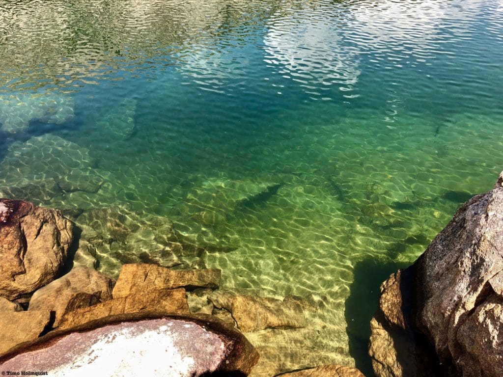
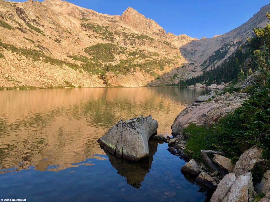
The crystal-clear waters of Eagle Lake.
Field Notes:
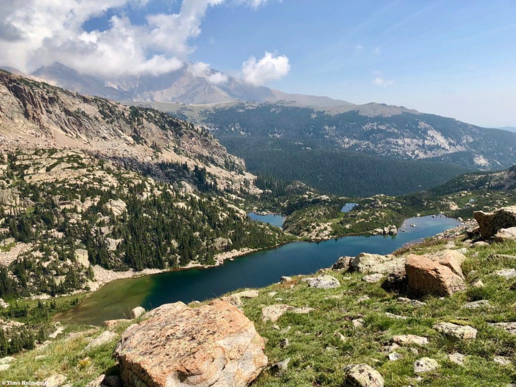
While it is certainly possible to visit both of these lakes in a day, it is a substantial day. The easiest way to include them in an adventure is to book and set up a basecamp near Thunder Lake. From there, you can visit both lakes. You can also visit the following destinations: Lake of Many Winds, Lion Lakes, and any of the peaks around them, including Tanima Peak/The Cleaver, Mt. Alice, Chiefs Head Peak, Mahana Pk. and Isolation Peak.
If you are doing this hike in a day, come ready for variable mountain weather. For your weather needs, start with Allenspark’s extended forecast. The mountain forecast for Mt. Alice is a good option for the higher portions of Wild Basin. Saint Vrain Mountain also has a good forecast. Using the three forecasts above, you should be able to hone in on what the conditions will be like near Box and Eagle Lakes. Remember to check the forecast religiously until the minute you leave for the trailhead, mountain weather changes.
With the elevation of Eagle Lake at more than 10,800 feet, and any of the mountains or ridges around it crossing 12,000 feet, it’s important to be aware of and know how to respond to signs of altitude sickness. If you are coming from a low-lying area and haven’t had a chance to acclimatize, a splitting headache, lethargy, and nausea will almost certainly dampen the mountain spirit.
The National Park has instituted a time slot system in addition to their normal entrance pass system for the summer of 2021. Do yourself a favor and take the time to understand these components by visiting the Park website. If you do not have an entrance pass or time slot, you will be turned back. The short version is that ALL visitors must have an entrance pass. If you arrive in Wild Basin anywhere between 9 AM and 3 PM, you will also be required to produce a timed entry pass. You will be turned around if you do not have a timed entry pass. IF you have an entrance pass, AND you arrive before 9 AM, you are free to park and enjoy your day (make sure your pass is visible on your windshield), hence the “arrive early” mantra. If you exit the park between 9 AM and 3 PM, you will be required to produce a timed entry slot to reenter, or you’ll have to wait until after 3 PM to reenter.
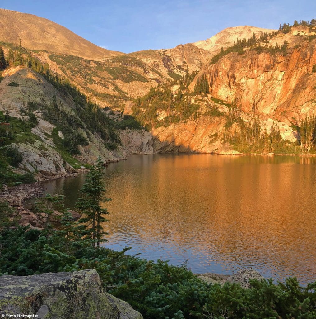
Sun drenched slopes of Box Lake.
Journal:
Box Lake and Eagle Lake are both hidden deep within Wild Basin. The best way to incorporate them into an outing is to secure an overnight site at Thunder Lake. If you’re determined to make this a day hike, be prepared for moderate route finding, plenty of scratchy vegetation, and sore muscles. Please see the Field Notes section to familiarize yourself with the entrance pass system the National Park has put into place for 2021. I’ll begin this review from Thunder Lake; if you want to know what the trail is like to Thunder Lake, click here.
You’ll know you’ve reached Thunder Lake once you sight an old USFS cabin near its eastern end. This is a good place to take a quick break and scout the next part of your route. If you’re sitting on the step in front of the cabin, you’ll be looking south to Tanima Peak. Your goal is to circle around the left (eastern) edge of Tanima Peak and head to the unnamed and untrailed basin housing both Box and Eagle Lakes.

The direction you want to head from Thunder Lake.
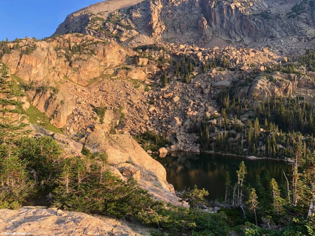
There are a few paths leading south around the end of Thunder Lake. If the water level is normal or low, you can walk along the shoreline, taking in the massive views and avoiding krummholz. If the lake is high and the shoreline gone, thread together a few braided trails, navigating around most treed areas but still fighting through some stubborn vegetation. Eventually, you’ll reach a log jam across the outflow from Thunder Lake (North St. Vrain Creek.)
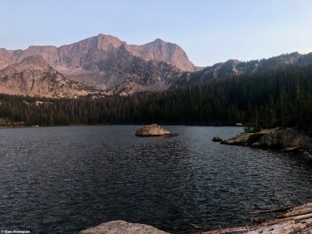
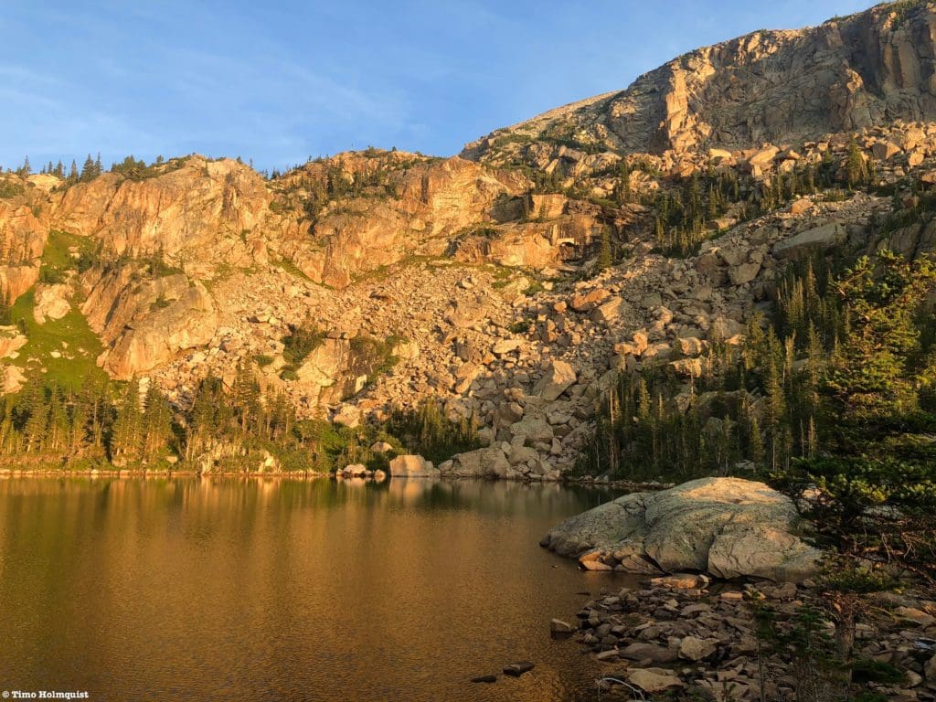
Thunder Lake, Mount Alice, and the log jam in the lower right corner of the photo.
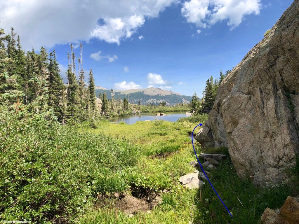
Cross the Log Jam and scramble a few steps up a large boulder. The unofficial path picks up on the other side of the boulder and begins to head east, initially following the creek. If you try to cross downhill from Thunder Lake, you’ll have to navigate a large marshy area that is wet, muddy, and time-consuming.
Looking down North St. Vrain Creek after crossing the log jam.
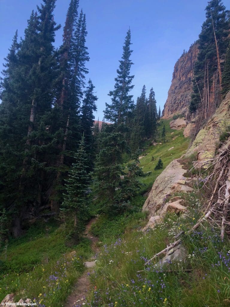
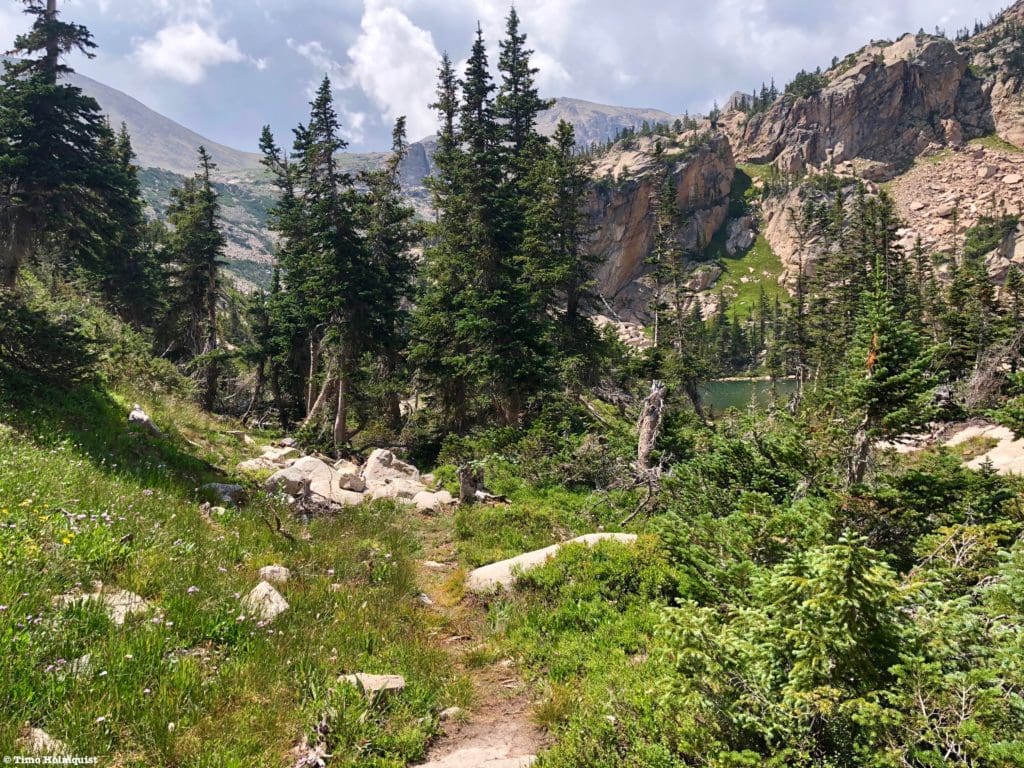
It’s easy to follow the trail at first, which is little more than a streak of dirt and trampled vegetation.
The beginning of the route, looking back to Thunder Lake in the distance.
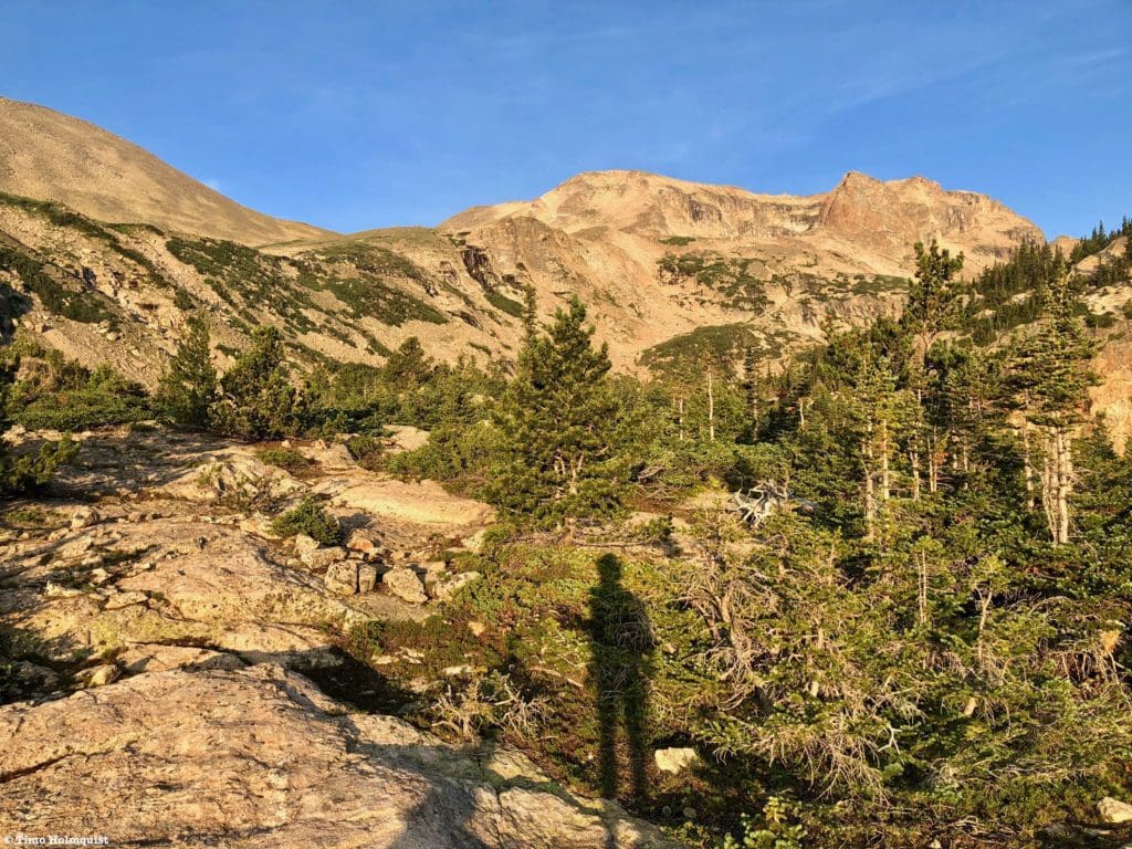
You’ll cross a large meadow with an avalanche chute to the right. The chute is one of a few ways to get to the ridge of Tanima and, ultimately, its summit. You can read our review of that scramble here.
As you cross the meadow, you may lose track of the path. If you do, scout around and make sure to stay in the upper half of the meadow. The trail will once again become obvious on the far eastern side of the meadow and roughly 20 feet higher than the creek.
A more intact trail portion beyond the first meadow.
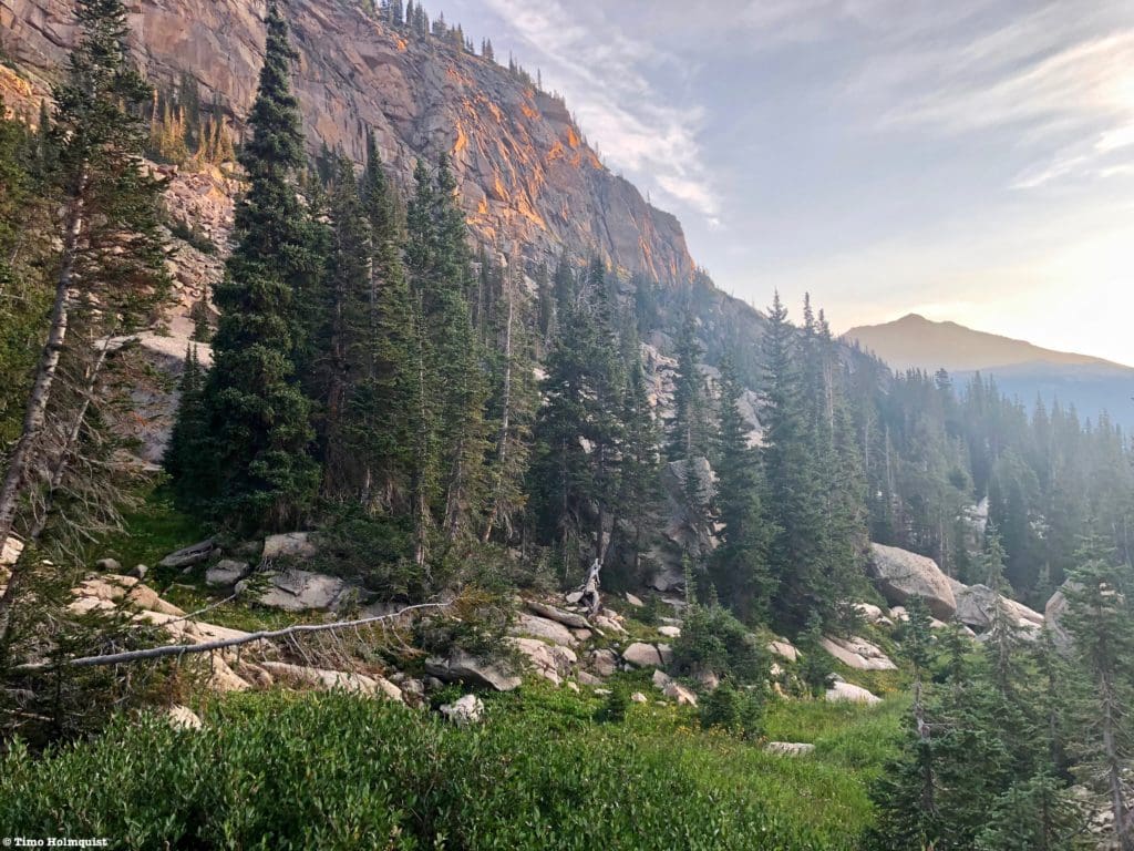
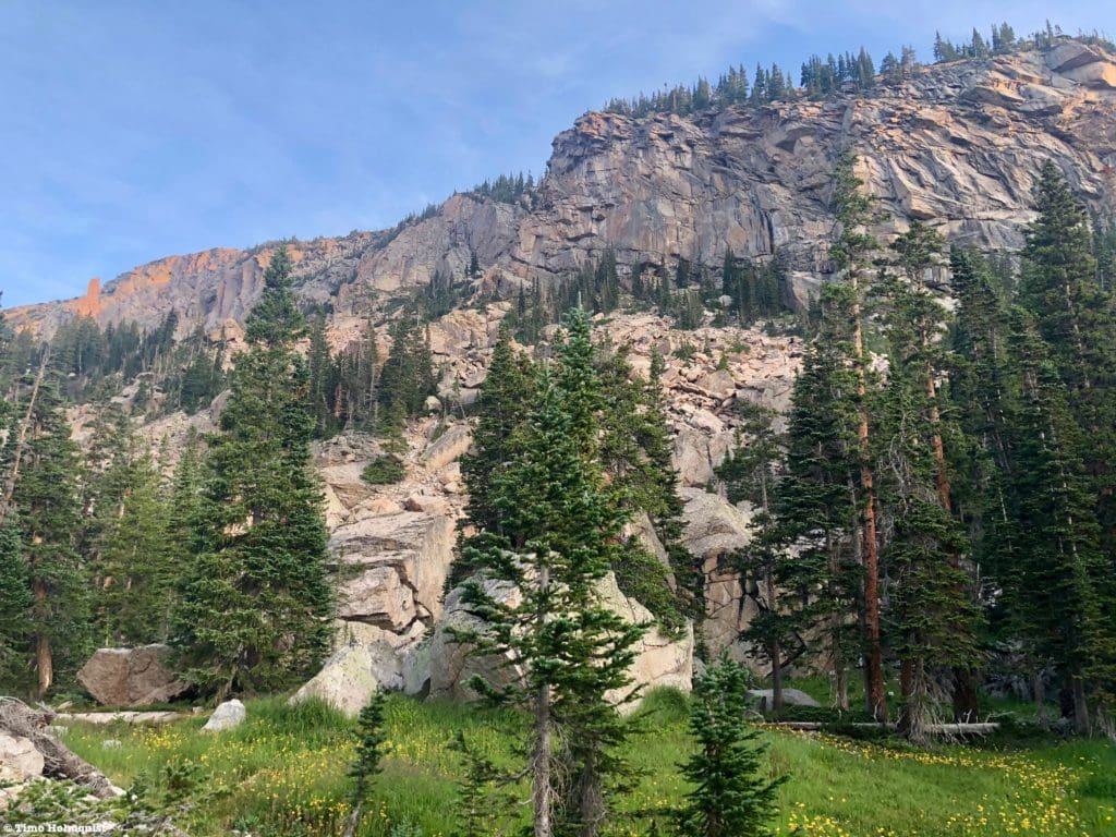
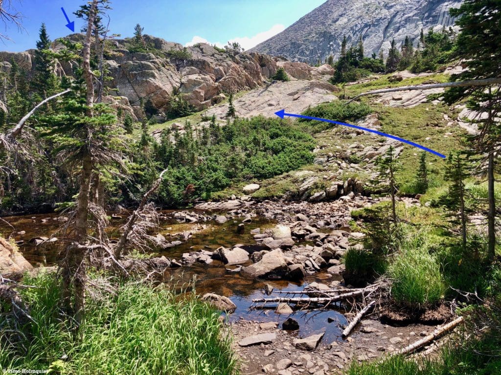
Some of the path is wet and muddy because there are no erosion mitigation features. Again, this is an unofficial trail, so coherent route-finding skills are necessary, and while the path is very clear in some sections, it peters out in others. There are a few fallen trees to cross over, but it isn’t too difficult to get around them. Eventually, you’ll begin to head south around Tanima’s ridge. You’ll know you’re on the right path if you cross beneath some dramatic cliffs to your right.
The path as it winds below some serious cliffs. It took me a little less than 20 minutes to reach this point after crossing the log jam by Thunder Lake.
The trail will undulate across this area, so don’t be surprised if you lose some elevation in the process. The terrain also becomes much rockier, forcing the path to thread around and over some rock faces. Make sure to check for the trail after crossing the rocks.
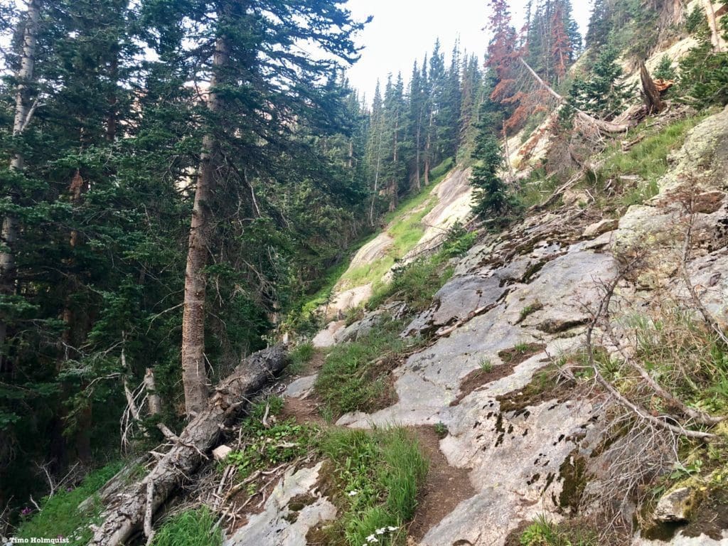
Rockier terrain around Tanima’s east end.
As you traverse, you’ll catch glimpses back east to Saint Vrain Mountain and the lower portions of Wild Basin.
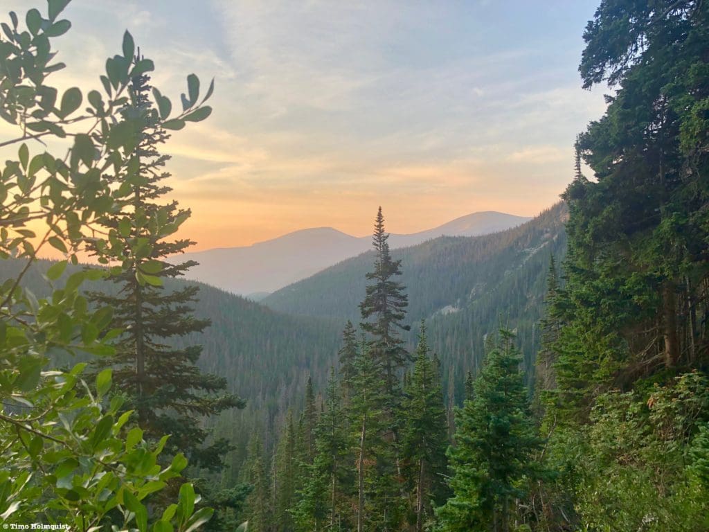
The lower parts of Wild Basin.
The path will begin to rise substantially once you’ve passed below the cliffs. Follow it up a natural gully until cresting the land. From there, the path begins a mellow descent towards the Box Lake area.
The path as it heads to Box Lake.
The path is generally easy to follow here but makes a few interesting directional changes. At first, you follow a broad gully with Tanima Peak’s cliffs to the right.
Cliffs of Tanima Peak.
The path will then divert left, losing a little elevation until crossing an outflow stream from Box Lake. Make sure to stay on the path to avoid stepping on vegetation. After the quick crossing, you’ll head back right before crossing underneath a large boulder overhang.
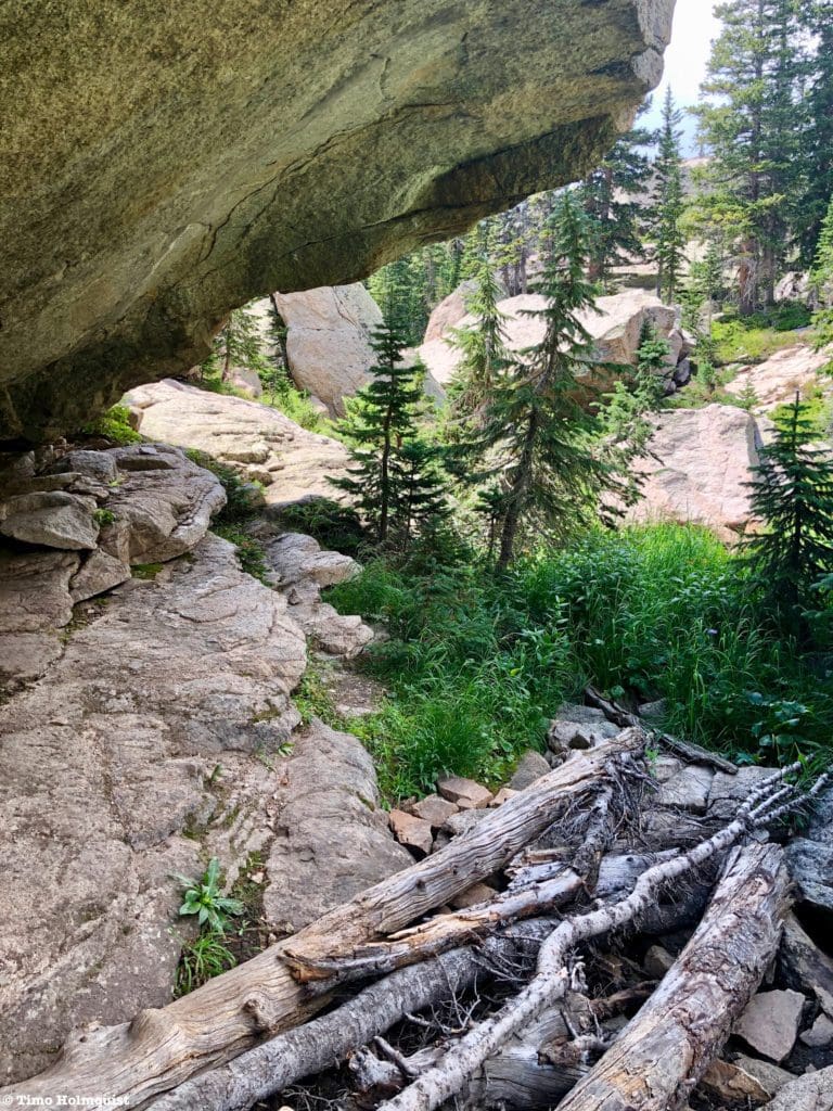
Passing beneath the boulder.
On the other side of the boulder passage, you’ll have a small section of rock traversing before seeing this view.
Nearly to Box Lake.
Continue through the small boulder field, following the path as it heads to the shores of Box Lake. There are multiple ways to get to the rocky shoreline, where you can enjoy quiet waters in a forgotten part of the National Park.
Box Lake reveal.
Take your time and enjoy the scenery around the lake. I didn’t see what type of fish were in the lake, but I saw them taking out some water striders and various bugs, so I can say with reasonable confidence that fish are present in this lake.
Another view of Box Lake.
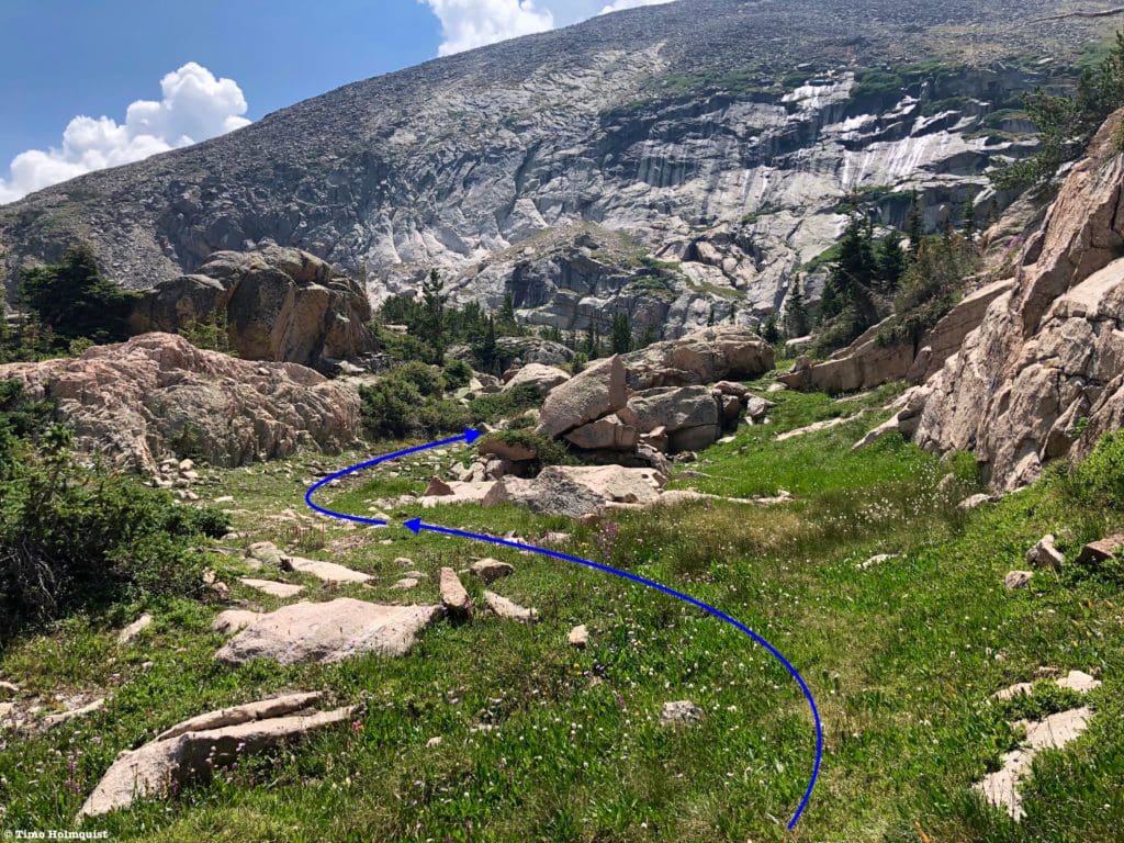
Once you’ve had your fill, and loaded up on bug spray, follow the path south along the lakeshore. Only a few minutes later, the path will take a hard left and veer up a slope above the lake. Take this extension until you top out on some slabby rocks.
Box Lake from above.
The path vanishes a bit here, but keep an eye out for cairns; they offer the best route choice between the two lakes.
Between the two lakes, Mt. Isolation is front and center, with Eagles Beak to the right.
The distance from Box Lake to Eagle Lake is not long, and if you take the path of least resistance by following the cairns, you should arrive at Eagle Lake within 15 minutes.
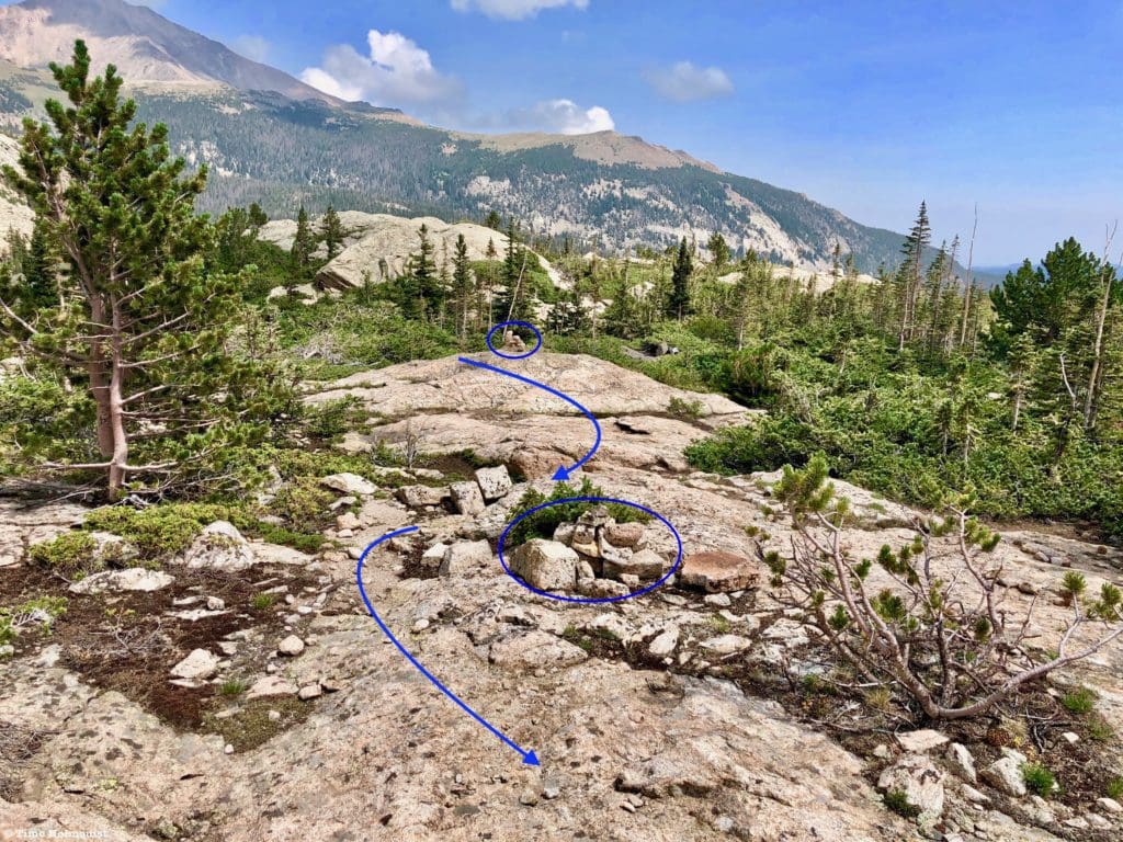
Cairns along the drier ridgetops, Meeker is the large mountain to the back left of the photo.
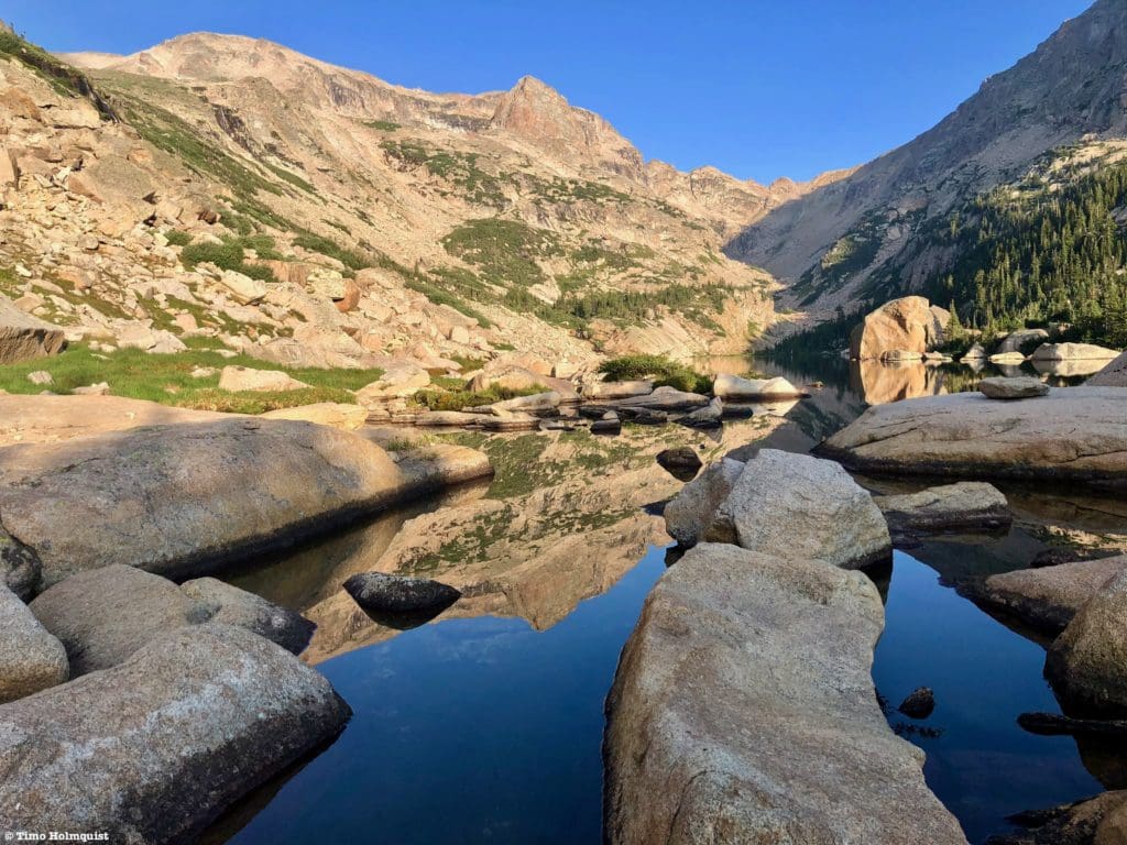
After you crest one last rock step, views of the lake should open up. From there, make your way to the shoreline.
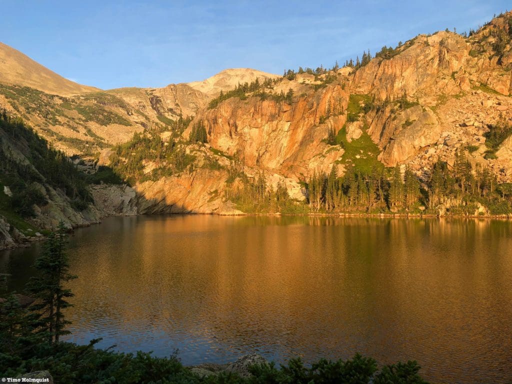
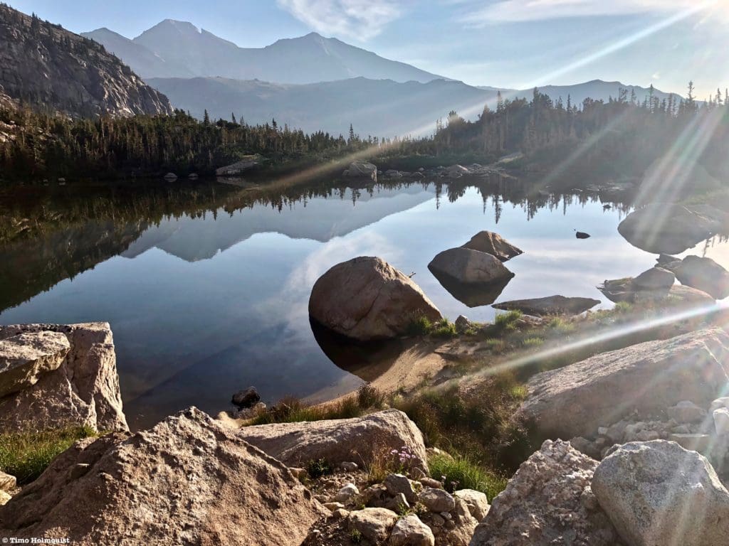
Eagle Lake with Eagles Beak overhead.
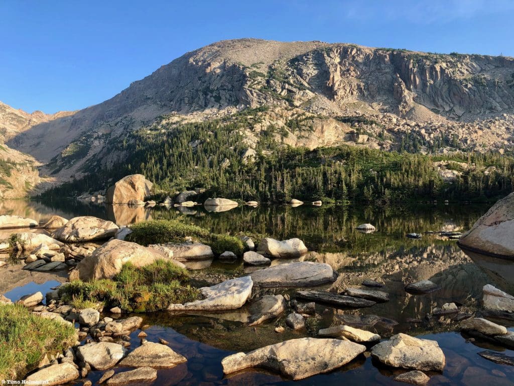
Eagle Lake is large, with a forested northern side and a talus-dominated southern side. The views from the northern edge are dramatic and lovely.
Looking west toward the Continental Divide.
The water here is stunningly clear, and while the shoreline where you end up is as good a place as any to admire the waters, there are ways to explore around the lake. The problem with lake exploration is the presence of nasty, scratchy krummholz. If you want to walk the northern edge of the lake, you’ll have to climb around a rock face and some thick vegetation. Once you do, however, you can continue strolling along the lakeshore with few problems.
The views from the southern side of the lake are also spectacular, but getting there will involve a ton of bushwhacking through tough vegetation if you try traversing the shoreline. The best and most practical way to go around to the southern side of the lake is to backtrack roughly halfway to Box lake. Take a look to the right and try to spot an unnamed tarn beneath the slabby rock ridges.
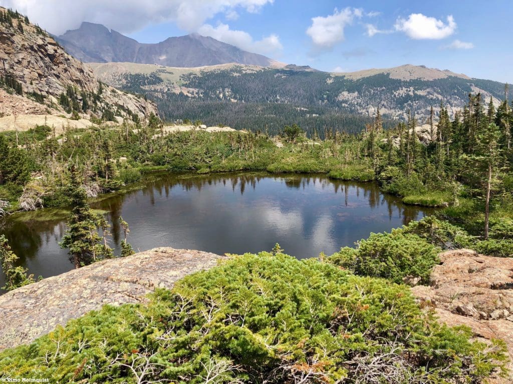
The unnamed tarn.
Your goal is to leave the path and cross the tarn at its western end.
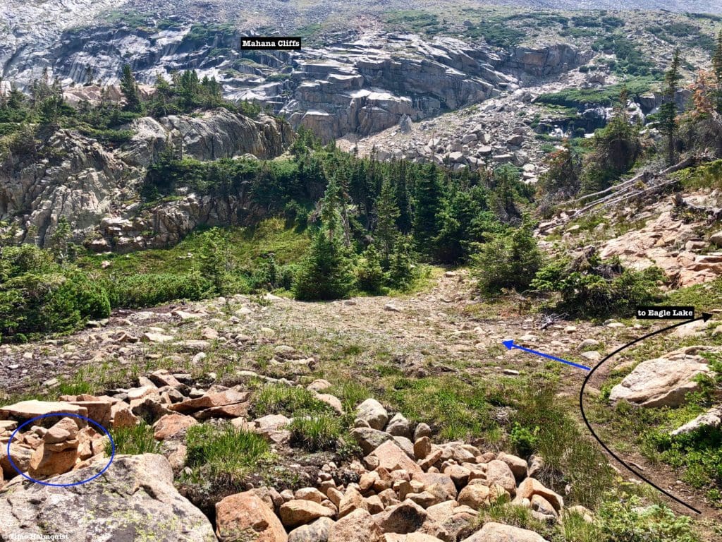
Where to leave the path, follow the blue arrow. Notice the cliffs along the slopes of Mahana Peak.
This is cross-country travel so pay attention to your footfalls to avoid ankle rolling.
Approximate route.
After getting beyond the tarn, locate a large rock rib.
Scramble toward the rock with the arrow.
Climb the rock rib and follow it east until it ends. Then, bank south when you see this view.
Make a beeline to the cliffs on the side of Mahana Peak.
Head south until running into a thicker section of vegetation. This last part will be unavoidable but bushwhack through until you arrive at the outflow stream from Eagle Lake. Cross using a variety of rocks, or, if the stream is high, find the narrowest point and get to the other side.
The outflow crossing.
While the route around the lake may seem circuitous, traversing the shoreline to the south is far more punishing. Can you bulldoze through the vegetation? Yes, and the same endpoint will be reached, but getting stabbed by stubborn pine trees gets very old very quickly. My enthusiastic suggestion is to avoid all that mess.
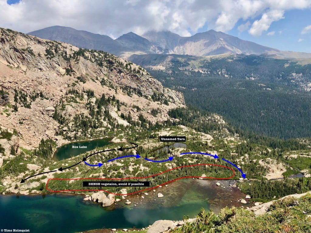
Overview. Black=regular route. Blue=easiest way to get around the end of the lake. Both lines are approximated. Avoid the red outline as much as possible.
So, why would anyone want to reach the southern side? Well, the southern shoreline is open and rocky, providing a ton of opportunities to put down your stuff and take a sun nap. There are also multiple points along the southern shore where you can effectively gauge how deep the water is and jump in. Because the sun hits this side earlier, it’s much easier to tell where good and back rock jump locations are. You’ll also get to look back at the impressive combination of Meeker and Longs, which you can’t see from the northern side of the lake.
Excellent perspective of Longs Peak and Mount Meeker from the southern shoreline of Eagle Lake.
The two keys are to avoid crushing sensitive plants, and more importantly, don’t get crushed by tough, scratchy pine trees. By using the many rocky ridges between Eagle and Box Lakes, you should be able to accomplish that. Because this area does not have official trails, it is up to you to keep it as wild and wonderful as when you arrived. Do not use the restroom within 200 feet of the lake, do not hack through vegetation like you’re on a Tarzan jungle expedition, and look around your area to make sure you didn’t drop any trash or valuables behind. It is not illegal to be here, but the splendor of this area can easily be destroyed by the reckless actions of a few.
Tanima Peak from the southern shore of Eagle Lake.
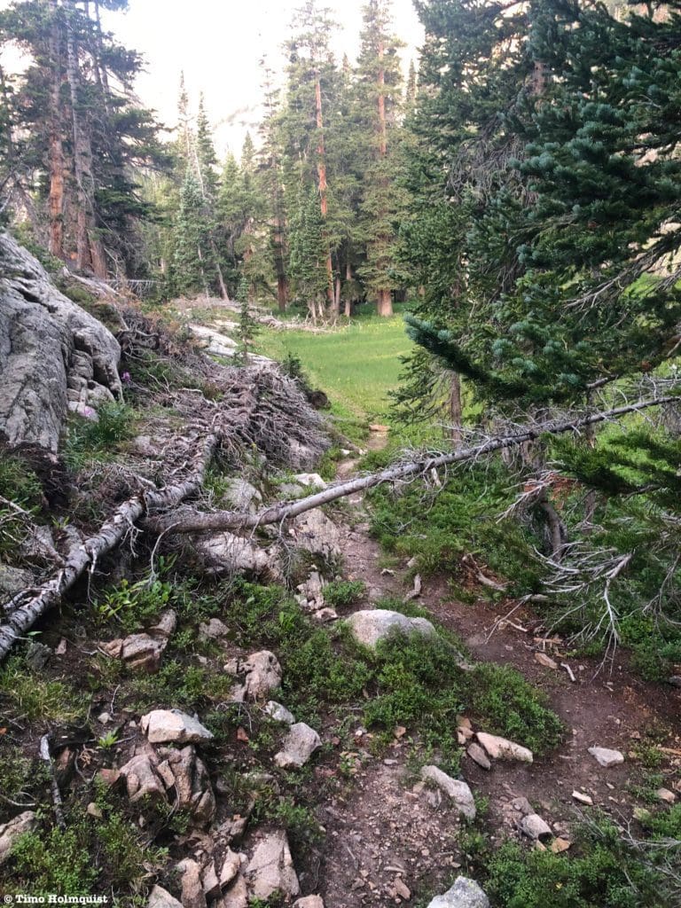
When you’re satisfied, retrace your steps back to Box Lake. From there, take your time and follow the trail braids through the forest until you begin to circle around Tanima Peak once more. There will be an uphill section ahead of you, so don’t get discouraged; it won’t last long. After you find your way back to the Thunder Lake watershed, cross the outflow stream, and make it back to the USFS cabin to call the excursion a success. If you did not camp at Thunder Lake, you still have about six miles of trail to get back to your car.
Eagle Lake, Box Lake, and the unnamed tarn from high on the southern slopes of Mahana Peak.
Final Thoughts:
So close, and yet, so far. Box and Eagle Lake represent some of the best pristine areas left in Wild Basin. They are far from established trails and trailheads, making their inclusion in day hikes a difficult endeavor. Snow lingers between the lakes until July, and because the route is not an official trail, there are several places where route finding skills are mandatory. However, if you are familiar with the area and willing to only leave footprints behind, venturing out here can be a transformative experience. If you’re new to Wild Basin, DO NOT hike to these lakes first. Get comfortable with the basin by hiking to Thunder Lake and the Wild Basin Waterfalls, Lake of Many Winds, Lion Lakes, Bluebird Lake, or Pear Reservoir, each reachable by more straightforward and easily identifiable footpaths. For locals, hiking veterans, and enthusiastic backpackers, this is a tough but very rewarding location to disconnect from society and embrace the natural artistry of Wild Basin.
Approaching Box Lake.
Popular Articles:
- Guide to the Best Hiking Trails in Rocky Mountain National Park, Colorado
- The Dyrt: The 10 Best Campgrounds In Colorado
- Top Adventure Sports Towns 2021: Boulder, Colorado
- Epic Adventures with the Best Guides In Colorado
- Sky Pond via Glacier Gorge Trail, Rocky Mountain National Park, Colorado
- Scrambling Hallett Peak’s East Ridge, Rocky Mountain National Park, Colorado
- Scrambling Mt. Alice via the Hourglass Ridge, Rocky Mountain National Park, Colorado
- Gorge Lakes Rim Scramble, Rocky Mountain National Park, Colorado
- Black Lake Via Glacier Gorge Trail, Rocky Mountain National Park, Colorado
- Scrambling To The Lake Of The Clouds, Rocky Mountain National Park, Colorado

Global Rescue is there for you in an emergency when you’re hiking, kayaking, snowmobiling, fishing or enjoying the outdoors and get injured or ill. Push the red button and their medical and security experts will come to your aid.
Terms of Use:
As with each guide published on SKYBLUEOVERLAND.com, should you choose to this route, do so at your own risk. Prior to setting out check current local weather, conditions, and land/road closures. While taking a trail, obey all public and private land use restrictions and rules, carry proper safety and navigational equipment, and of course, follow the #leavenotrace guidelines. The information found herein is simply a planning resource to be used as a point of inspiration in conjunction with your own due-diligence. In spite of the fact that this route, associated GPS track (GPX and maps), and all route guidelines were prepared under diligent research by the specified contributor and/or contributors, the accuracy of such and judgement of the author is not guaranteed. SKYBLUE OVERLAND LLC, its partners, associates, and contributors are in no way liable for personal injury, damage to personal property, or any other such situation that might happen to individuals following this route.


