


High Point:
~10,980 feet

Total Ascent:
~2,900 feet

Difficulty:
Hard

Distance:
12.3 miles (more if exploring the lake)

Waypoints:
40.20845, -105.56672

Route Type:
Out and Back
Overview:
Bluebird Lake is another gorgeous destination in Wild Basin. The entire basin is chock-full of lakes and peaks to explore, and Bluebird makes for a wonderful outing. The elevation gain and overall mileage are substantial, so budget some time and aim for a good weather day. The lake itself is great for relaxing and soaking up some prime Rocky Mountain majesty; you may even be tempted to jump in if the day is warm enough!
Bluebird Lake with Ouzel Peak in the background.

Table of Contents:
Article Navigation: Click on any of the listed items in the table of contents below to jump to that section of the article. Similarly, clicking on any large, white section header will jump you back to the Table of Contents.
The Ultimate Offline GPS Hiking & Ski Maps
See why onX Backcountry is the ultimate GPS navigation app for your outdoor pursuits. Try Today for Free. No credit card required.
Directions to Trailhead:
This hike takes off from the main Wild Basin trailhead. It is located off of US 7, just north of Allenspark. Find US 7 and approach from either the north (Estes area) or the south (Allenspark, Lyons, Boulder, Nederland, etc.). If approaching from the south, make your way through Allenspark and look for a large brown sign for Wild Basin; there is a small left turn lane in the middle of the road. Once you see the sign, slow down, the turn is abrupt. You’ll make a hard left onto a small road and proceed past some houses and the Wild Basin Lodge. The National Park gate is located on the right side of the road and is visible when you approach.
From the north, there will be a large Wild Basin sign on your right after you pass the Meeker Park Overflow Campground. While the sign is large, there is only one, so when you see it, slow down. It’ll be a right-hand turn onto a small road. Proceed until seeing the National Park gate on your right. Approach the gate and drive through to enter into Wild Basin.
Regardless of how you get to the Park gate, you’ll want to drive the dirt road into Wild Basin for its entire length until coming to a parking lot. Make sure to follow the one-way road signs and park where able. The trail takes off from the lower loop portion.
Mt. Alice from the trail to Bluebird Lake.
Places to Stay:
Camping near Rocky Mountain National Park will cost you. The options for free area camping are limited. On a positive note, there are plenty of options, and the National Park is within driving distance of Fort Collins, Boulder, and Denver.
- Estes Park: Known as the gateway to Rocky Mountain National Park, Estes sees nearly 80% of park traffic as opposed to the much quieter western entrance near Grand Lake. The town has a ton of lodging options.
- Allenspark: A small town near Wild Basin that has a few lodging options, including the Wild Basin Lodgeand the Sunshine Mountain Lodge and Cabins.
- Rocky Mountain National Park Camping
- Moraine Park Campground: $30 per site. $20 in winter. Established campground with perks, facilities, campfire grate, wood for sale in summer, and bear boxes to store food. Only loop B is open in the winter, and it’s first-come, first-serve.
- For summer, a reservation is needed quite a ways in advance to secure a spot.
- Glacier Basin Campground: $30 per site. Established campground with the same perks as Moraine Park. Reservation required.
- Backcountry Campsites: Rocky Mountain National Park has backcountry sites that you could book in advance. There is no open camping in the backcountry; it must be at designated backcountry sites. Please check the park website for more details. Backcountry sites require an overnight permit of $30.
- Camping near Estes Park
- Estes Park Campground at Mary’s Lake: Established campground, pricey $45-55. Good backup if other campgrounds are full.
- Hermit Park Open Space: $30 for a tent site, price increases if towing a trailer or for group spots.
- Estes Park Koa: Rates dependent on what you’re bringing with you but will run more than $50 a night in the busy season.
- Olive Ridge Campground in Roosevelt National Forest is the closest campground to the Lookout Mt. trail. ~$20 for a standard nonelectric site.
- Free or close to free: but a little farther (if you’re willing to drive)
- Ceran St. Vrain Trail Dispersed Camping ($1)
- County Road 47. Users have reported trash and ATV noise at this location, but it is free.
- Meeker Park Overflow Campground
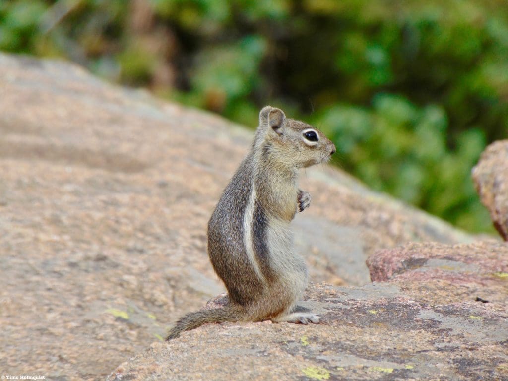
A chipmunk contemplating the finer things in life.
Field Notes:
Bluebird Lake is trailed all the way to its eastern shore. In order to explore around the lake, you’ll have to employ some light scrambling, but routes are marked with cairns, and there’s plenty of space to spread out. The elevation gain is relatively modest until after Ouzel Lake. After Ouzel Lake, however, the difficulty increases dramatically with rockier sections thrown in for good measure. Make sure you’re pacing yourself through this section.
Bluebird Lake is located in the pristine Wild Basin, where a sizable network of trails exists. If the area grabs your interest, check out our trail reviews of Thunder Lake and the Wild Basin Waterfalls, Mt. Alice via the Hourglass Ridge, and our scrambling review of Tanima Pk. and The Cleaver. We’ve also produced a best of Rocky Mountain National Park trails guide that does a great job of highlighting the most unique hikes in the National Park.
For your weather needs, start with Allenspark’s extended forecast. The mountain forecast for Mt. Alice is a good option for the higher portions of Wild Basin. Lake Verna, on the western side of the divide, is near enough to make a good third weather forecasting option. Remember to check the forecast religiously until the minute you leave for the trailhead, mountain weather changes. While Bluebird Lake has some trees around it, the shores are rocky and wide open, making it a bad place to get caught in an alpine thunderstorm. Make sure you are watching the skies.
Your top elevation won’t exceed 11,000 feet unless you’re venturing up to Lake of the Winds or Boulder-Grand Pass. Regardless, familiarize yourself with the signs and symptoms of altitude sickness. If you are coming from a low-lying area and haven’t had a chance to acclimatize, a splitting headache, lethargy, and nausea tend to dampen the mountain spirit.
The National Park has instituted a time slot system in addition to their normal entrance pass system for the summer of 2021. Do yourself a favor and take the time to understand these components by visiting the Park website. If you do not have an entrance pass or time slot, you will be turned back. The short version is that ALL visitors must have an entrance pass. If you arrive in Wild Basin anywhere between 9 AM and 3 PM, you will also be required to produce a timed entry pass. You will be turned around if you do not have a timed entry pass. IF you have an entrance pass, AND you arrive before 9 AM, you are free to park and enjoy your day (make sure your pass is visible on your windshield), hence the “arrive early” mantra. If you exit the park between 9 AM and 3 PM, you will be required to produce a timed entry slot to reenter, or you’ll have to wait until after 3 PM to reenter.
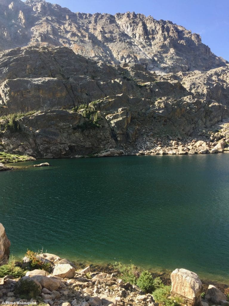
Layers of rocks guard the southern edge of Bluebird Lake.
Journal:
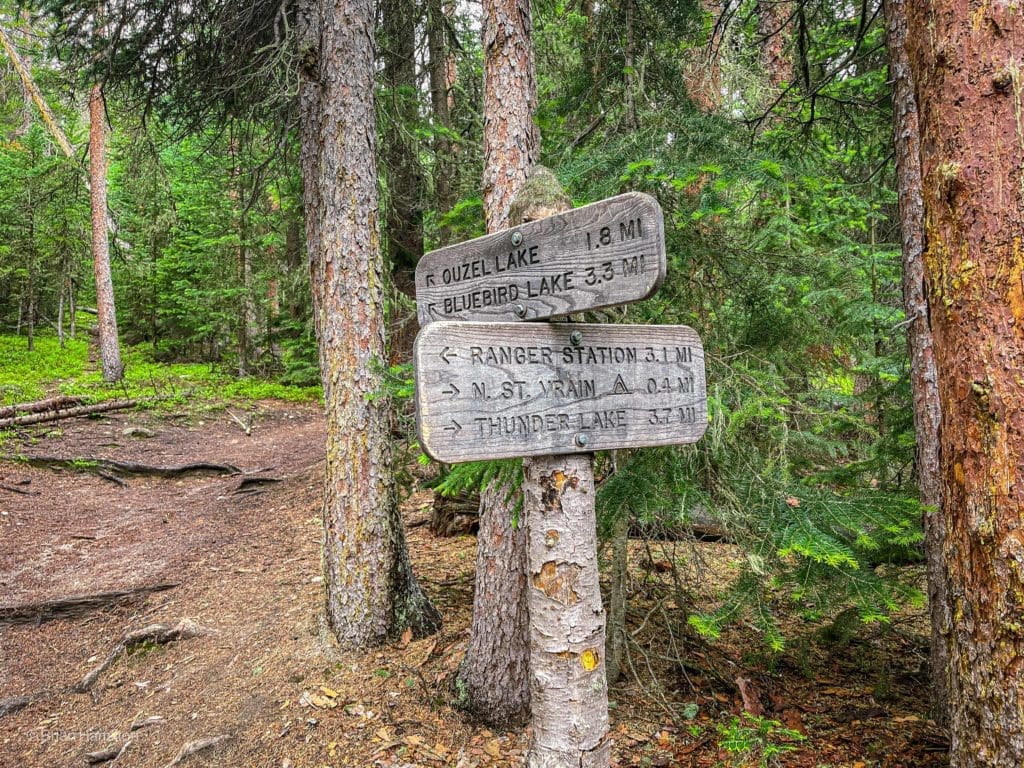
From the main Wild Basin parking lot, proceed west on a wide and obvious trail. You’ll pass Copeland Falls after 0.3 miles. 1.4 miles into your journey, you’ll arrive at a trail junction. If you haven’t checked out Ouzel Falls or Calypso Cascade, take a left and enjoy those beautiful water features. You can read more about them and Thunder Lake by clicking here.
If you’d rather skip the crowds common at the falls, take the Campsites cutoff by heading right. Either variation gets you to the Bluebird Lake trail with comparable distances covered. If you take the waterfalls trail, pay attention after you pass Ouzel Falls. About 0.4 miles beyond the falls, you’ll run into the obvious Ouzel Lake Trail junction, take a left to begin the journey to Bluebird.
Ouzel Lake Trail junction.
If you decide to skip the waterfalls, proceed along the Campsites cutoff trail for 1.3 miles until it merges back with the waterfalls trail. Instead of continuing west, take a left. You’ll cross North St. Vrain Creek and proceed for 0.3 miles until running into the trail junction with Ouzel Lake Trail. Take a right here to begin the journey to Bluebird.
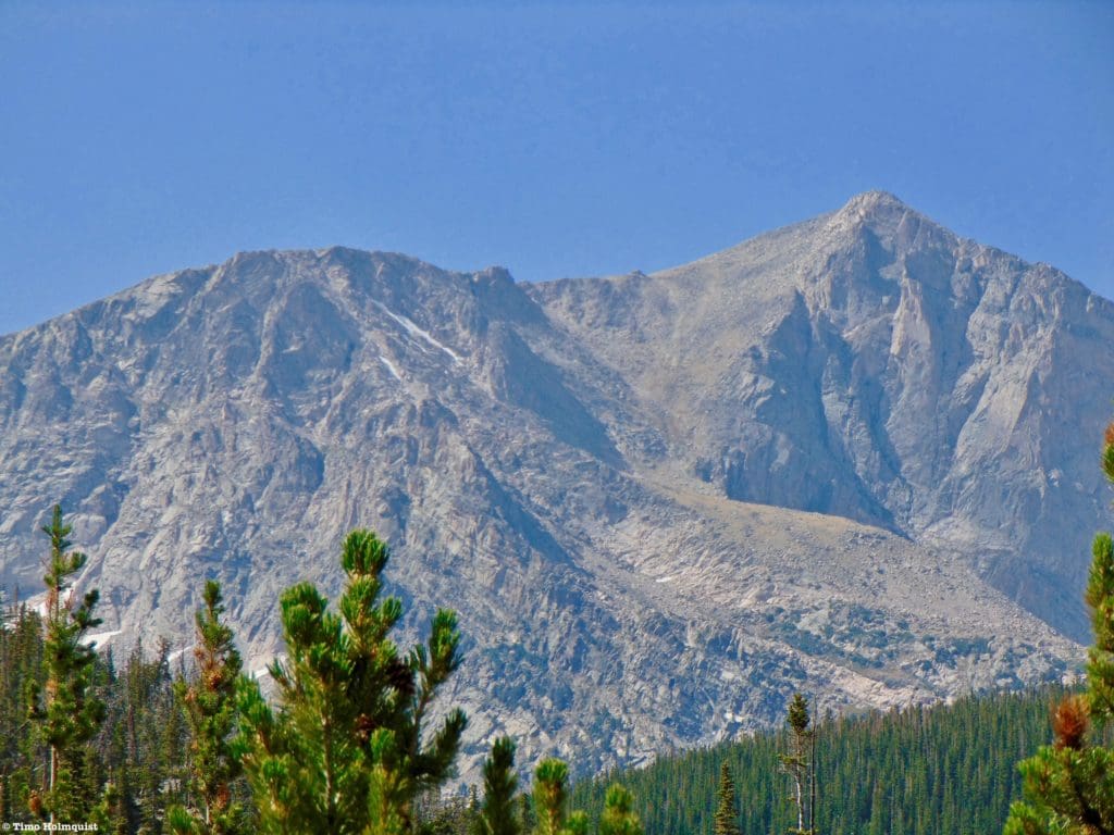
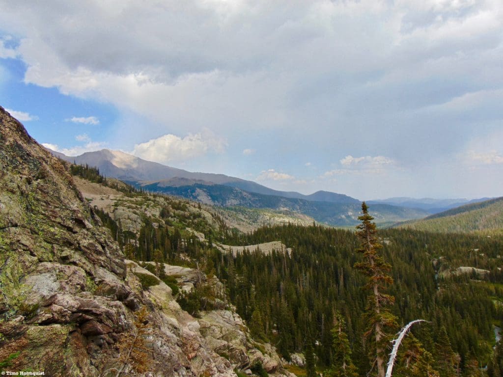
Once on the proper trail, begin a steady ascent up a treed slope that gives way to a drier ridgetop. Your first long-distance views appear here, offering glimpses to Mt. Alice and the high country.
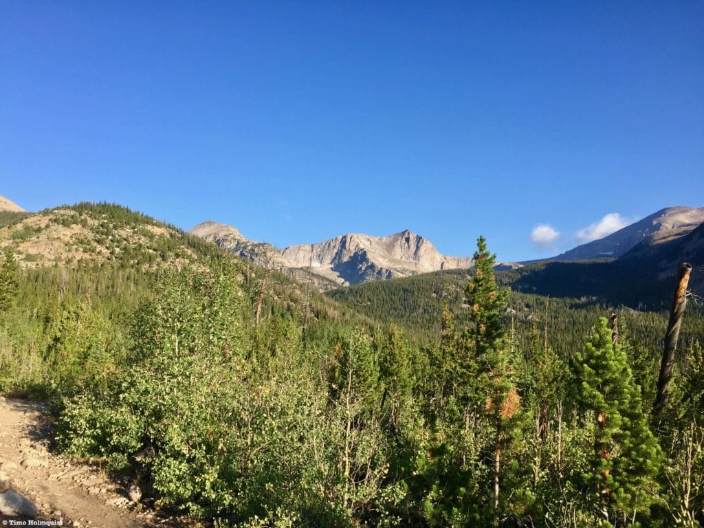
Mt. Alice, with Tanima Peak to its left, and the massive shoulder of Chiefs Head peak on the right.
In the early morning, this section is pleasant with exciting looks at more dramatic terrain. On the return journey, however, it can be hot along this stretch, so make sure to wear a hat or liberally apply sunscreen. The trail continues a steady rise, passing patchy Pines and open sections until arriving at the trail junction for Ouzel Lake. A 0.4-mile spur trail leads to the treed and shallow lake, but the real treat is Bluebird.
Steepening trail beyond Ouzel Lake.
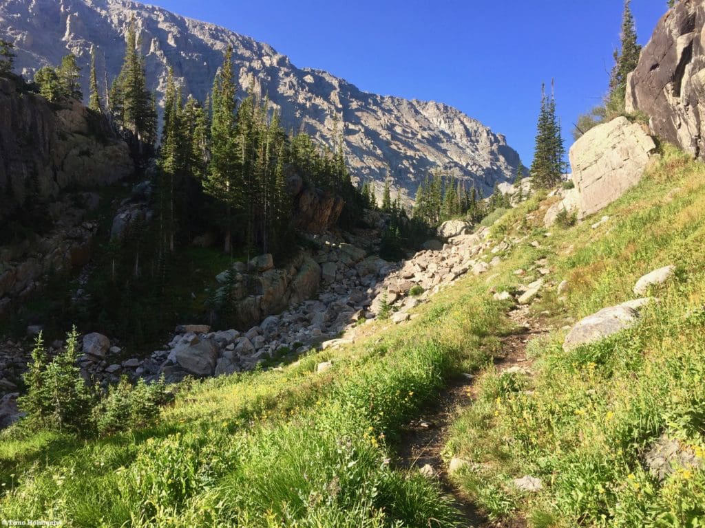
After passing beyond Ouzel Lake, the trail takes on more of a mountainous quality with steeper uphill sections and rockier terrain. The massive slopes of Copeland Mountain also take over the southern horizon. To the north, rock pinnacles guard the summit plateau of Mahana Peak.
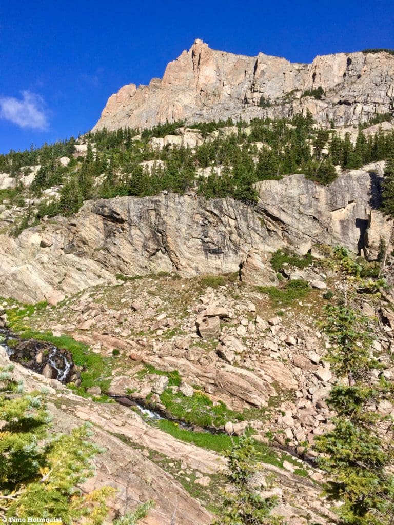
Cliffs guarding Mahana Peak.
Slow your pace down to match the terrain and know that the rise doesn’t last forever, but it is energy-consuming. Back to the east, you’ll be given views towards the massive flank of Mount Meeker.
The view east, bookended by Mount Meeker.
If you take this trail in July, you’ll have a bountiful array of wildflowers to look at, especially right below the bench holding Bluebird Lake. In the photo above, the bump at the end of Meeker’s long ridge is Lookout Mountain. You can read about that trail here.
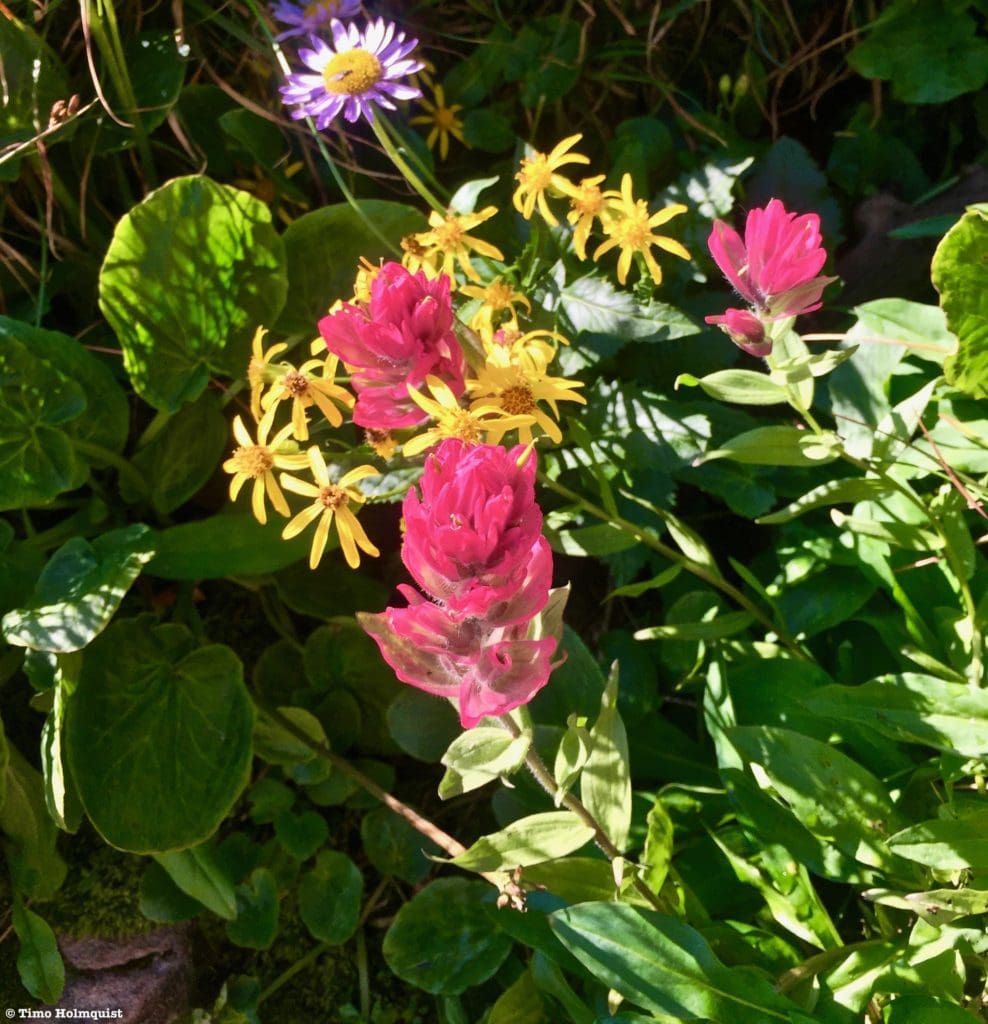
Wildlfowers.
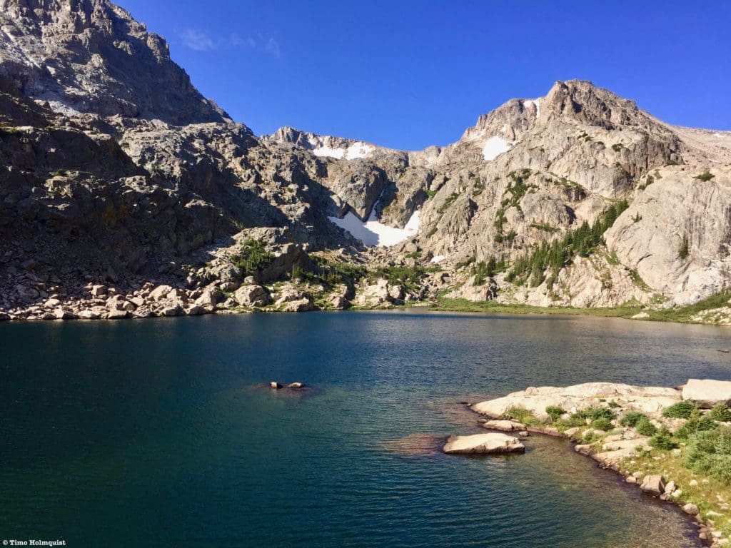
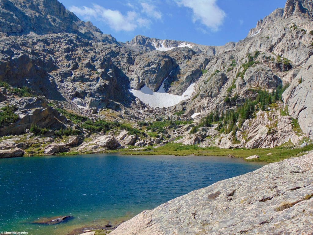
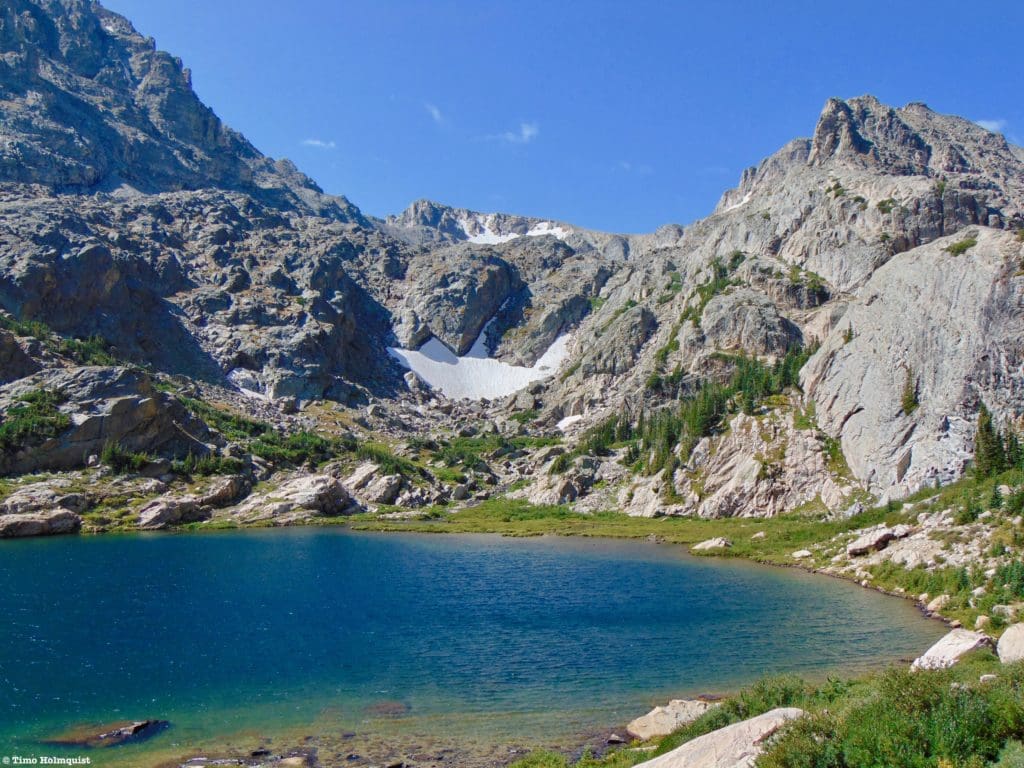
Once you crest the rocky bench you’ve been climbing, the lake reveals itself.
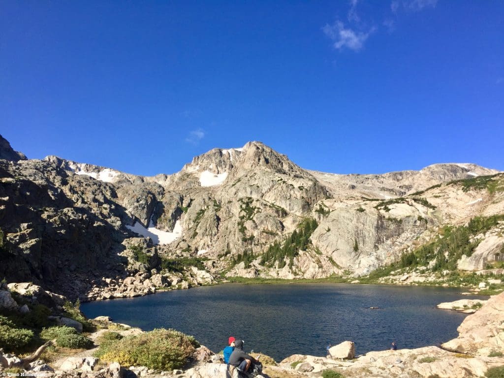
First looks at Bluebird Lake.
Most people opt to stay here and admire the lake, which is easy to do. However, a little exploring will yield additional views and places to set up for a few hours of peaceful mountain contemplation.
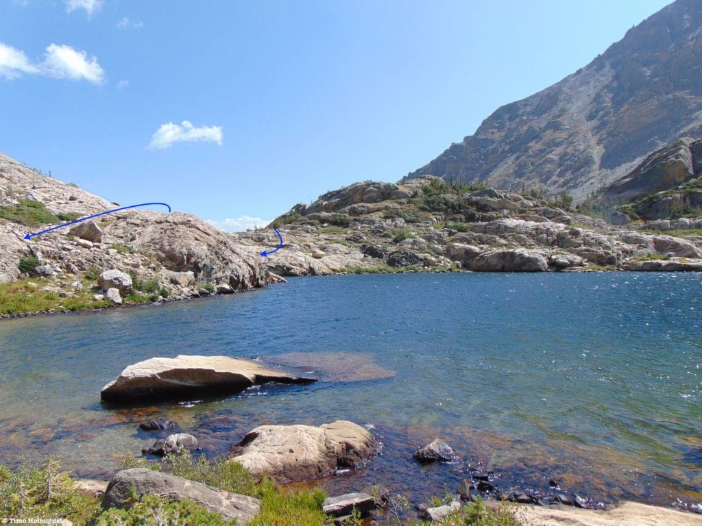
To explore the lakeshore, take a right along the shoreline and work your way towards the outflow stream.
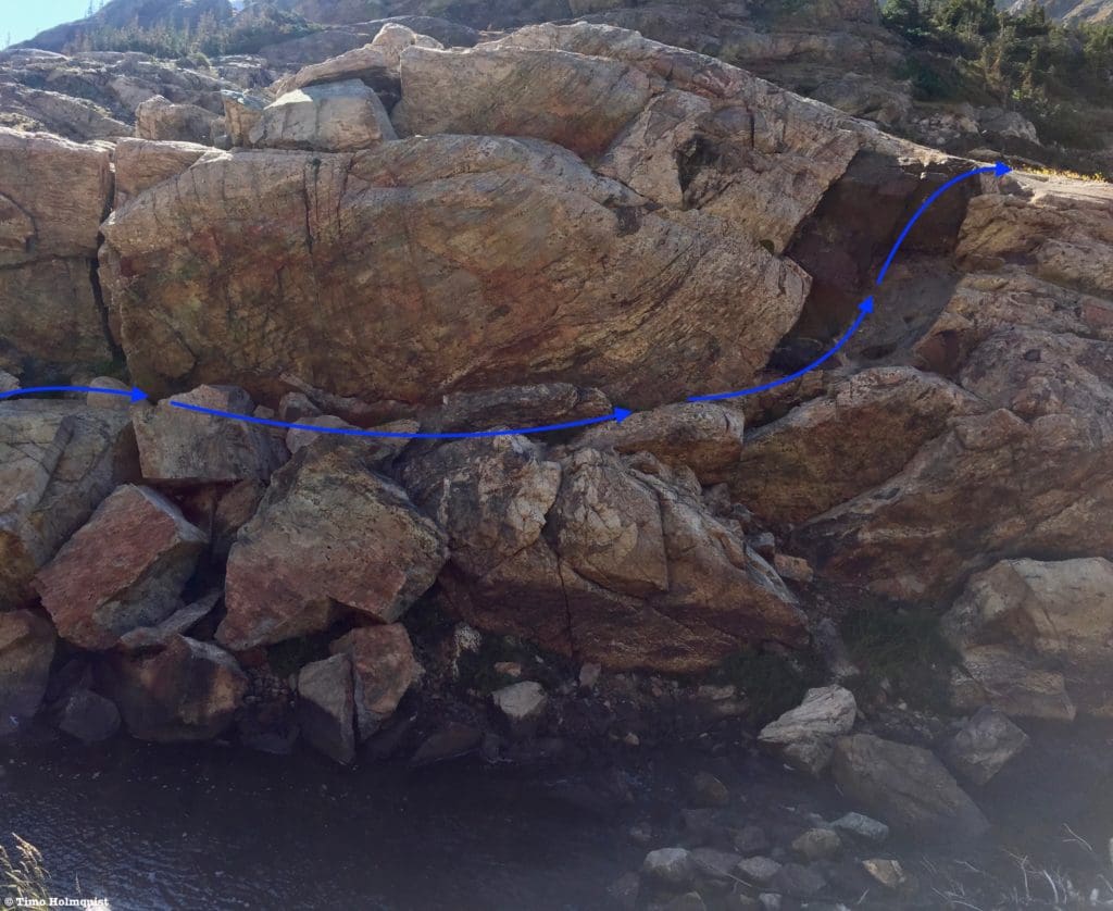
Negotiating rocky terrain by the outflow of the Bluebird Lake.
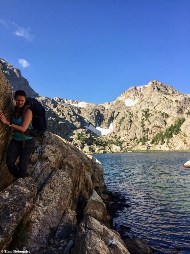
There are a few large rocks you can use to bounce across the outflow stream. Once on the other side, you’ll need to ascend a brief Class 3 chute before you can negotiate west along the shores of the lake.
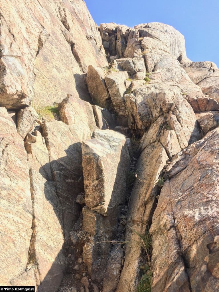
Short scramble up to a rocky plateau.
Once you’ve gotten out of the outflow area, scattered cairns and social trails will lead you west around the shoreline with little navigational trouble.
From left to right: the flank of Mount Copeland, Ogallala Peak and Ouzel Peak.
Trees dot the northern side of the lake, providing the occasional hammock possibility. There are also large, flat rocks along the shoreline that are great to set a picnic blanket on.
Looking back at the path around the lake.
More than a beautiful lake, Bluebird also provides the easiest access to Mahana Peak, Isolation peak, Ouzel Peak, and Cony Pass. This southern part of Wild Basin is far from the well-traveled areas around Longs Peak and Glacier Gorge. Because of its rocky and dramatic shoreline, Bluebird Lake attracts a decent amount of National Park foot traffic, but venturing beyond it grants relative solitude. If you run into people beyond Bluebird Lake, they’re probably serious mountain climbers.
Another stunning perspective of the lake and the mountains around it.
There’s plenty of space along the shoreline to spread out as well, so even if a large crowd makes it up to Bluebird, you can find your own slice of mountain majesty. Whenever you’ve had your fill of the area, retrace your path back to the eastern edge of the lake.
Path back once you cross the outflow stream.
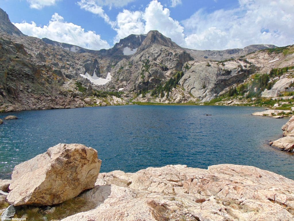
The most common photo of Bluebird Lake is taken from the eastern edge of the shore, with an obvious solitary rock framing the bottom left side of the picture. This shot usually accompanies any trail review or post about the lake, and it’s easy to see why.
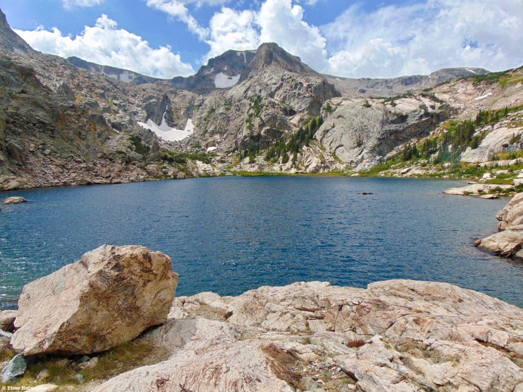
The iconic Bluebird Lake perspective.
Once you’ve descended back to Ouzel Lake, the hardest parts of the hike are over. It is important to note that due to the patchy nature of the forest and the numerous large open spaces around, it’s best to hoof it back to the waterfall trail if the weather is threatening.
Once you make it back to the trail junction, you can take a left and then a right to join the Campsites cutoff trail, or take a right and pass the waterfalls again. Since Calypso Cascade and Ouzel Falls are high-demand destinations, chances are you will be employing some people dodging skills in order to get through that section. If that thought sounds unappealing, the Campsites cutoff trail is always available.
Final Thoughts:
Bluebird Lake is a fantastic destination. While I don’t think it’s the prettiest lake in Rocky Mountain National Park, part of its charm is that it’s a bit understated and demands some stout effort to reach. Its location is also lovely, with dramatic rock formations along three sides of the lake and a distinctly alpine flavor. If you’re looking for a decent workout and a beautiful alpine lake removed from the hotspots of the Park, consider Bluebird Lake a destination worth visiting.
Deep blue waters and rocky mountains.
Popular Articles:
- Guide to the Best Hiking Trails in Rocky Mountain National Park, Colorado
- The Dyrt: The 10 Best Campgrounds In Colorado
- Top Adventure Sports Towns 2021: Boulder, Colorado
- Epic Adventures with the Best Guides In Colorado
- Sky Pond via Glacier Gorge Trail, Rocky Mountain National Park, Colorado
- Scrambling Hallett Peak’s East Ridge, Rocky Mountain National Park, Colorado
- Scrambling Mt. Alice via the Hourglass Ridge, Rocky Mountain National Park, Colorado
- Gorge Lakes Rim Scramble, Rocky Mountain National Park, Colorado
- Black Lake Via Glacier Gorge Trail, Rocky Mountain National Park, Colorado
- Scrambling To The Lake Of The Clouds, Rocky Mountain National Park, Colorado

Skyblue Overland Strongly Recommends That You Enroll With Global Rescue Prior To Embarking On Your Next Adventure.
With more people outside now more than ever, Global Rescue expanded services to include field rescue within 100 miles of home. With Local Field Rescue — automatically included in any travel protection services membership — Global Rescue is there whether you’re hiking, kayaking, snowmobiling, fishing or simply enjoying the outdoors and get ill or injured and you’re unable to get to safety on your own. Purchase a Global Rescue membership for your next adventure and travel with peace of mind. Single trip, annual and family options are available.
Memberships start at $119.
Terms of Use:
As with each guide published on SKYBLUEOVERLAND.com, should you choose to this route, do so at your own risk. Prior to setting out check current local weather, conditions, and land/road closures. While taking a trail, obey all public and private land use restrictions and rules, carry proper safety and navigational equipment, and of course, follow the #leavenotrace guidelines. The information found herein is simply a planning resource to be used as a point of inspiration in conjunction with your own due-diligence. In spite of the fact that this route, associated GPS track (GPX and maps), and all route guidelines were prepared under diligent research by the specified contributor and/or contributors, the accuracy of such and judgement of the author is not guaranteed. SKYBLUE OVERLAND LLC, its partners, associates, and contributors are in no way liable for personal injury, damage to personal property, or any other such situation that might happen to individuals following this route.


