


High Point:
11,610 feet at the lake (~12,070 ft. at Boulder-Grand Pass)

Total Ascent:
~3,395 feet from trailhead (~1100 ft. from Thunder Lake)

Difficulty:
Hard

Distance:
14.2 miles from the trailhead (2.6 miles from Thunder Lake)

Waypoints:
40.20845, -105.56672

Route Type:
Out and back
The Lake of Many Winds is a small alpine lake tucked away beneath the difficult ascent of Boulder-Grand Pass. As with many other lakes in Wild Basin, travelers often pass it on their way to the Continental Divide and nearby mountains.
Overview:
Lake of Many Winds is a small alpine tarn that sits beneath the steep and demanding Boulder-Grand Pass. Like so many other lakes in Wild Basin, it is often passed on the way to the Continental Divide and the peaks around it. However, similar to our reviews of Lion Lakes, Thunder Lake, and Bluebird Lake, Lake of Many Winds makes for a fantastic outing on its own. The best way to rope in a casual ascent to the lake (and perhaps Boulder-Grand Pass) is to secure a campsite at Thunder Lake. However, if you decide to visit in a day, be prepared for a long hike in a remote setting.
Having covered the trails to Thunder Lake in our previous review (click here to visit that article), this review will focus on the journey between Thunder Lake and Lake of Many Winds. The lake’s position under Boulder-Grand Pass allows it to be a part of other regional adventures we’ve covered, including Tanima Peak and the Cleaver and an ascent of, or descent from, Mt. Alice. For the backcountry explorers among us, a combination with the Eagles Beak/Moomaw Glacier trail-less area to the south can also involve Lake of Many Winds. And for the extreme, Lake of Many Winds can serve as the last water source before rock climbing the demanding North Ridge of Isolation Peak.
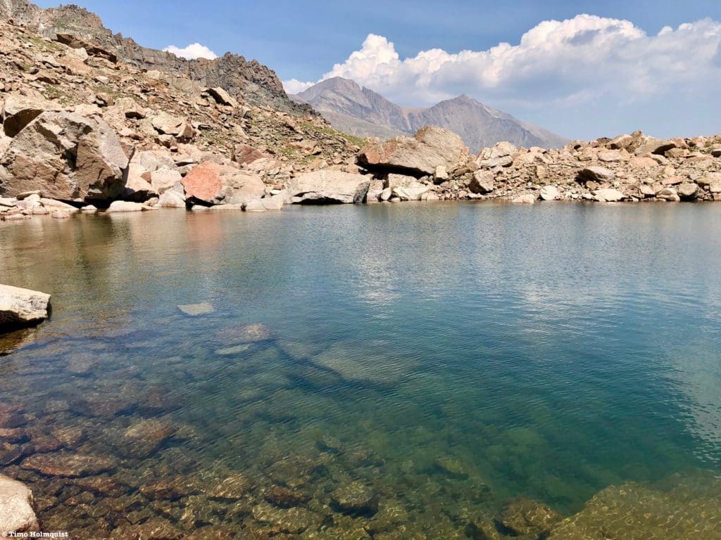
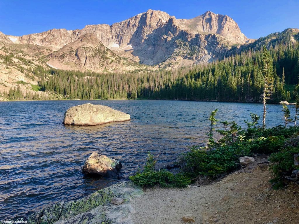
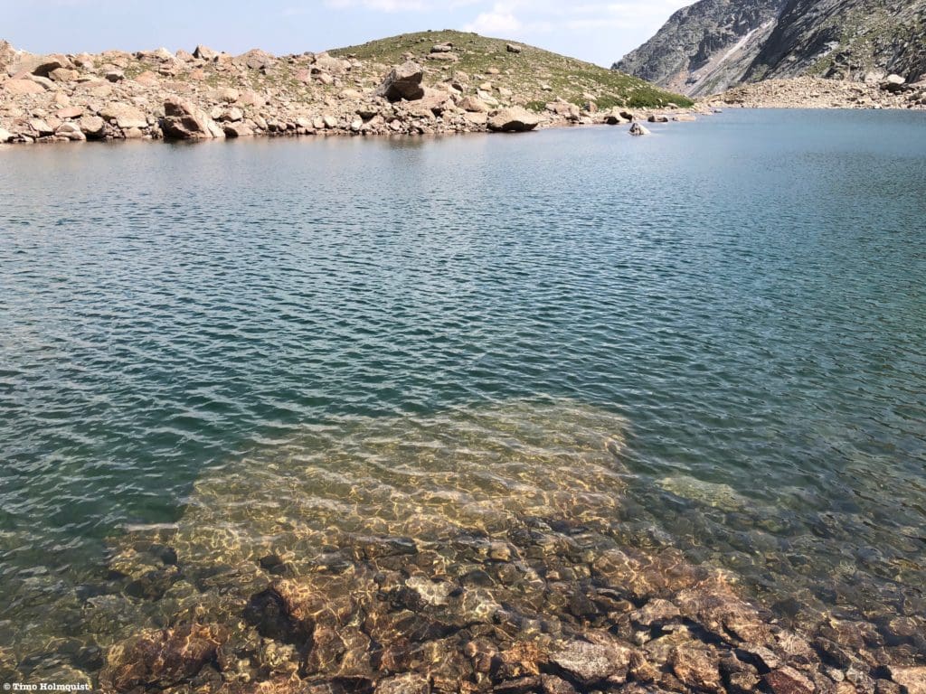
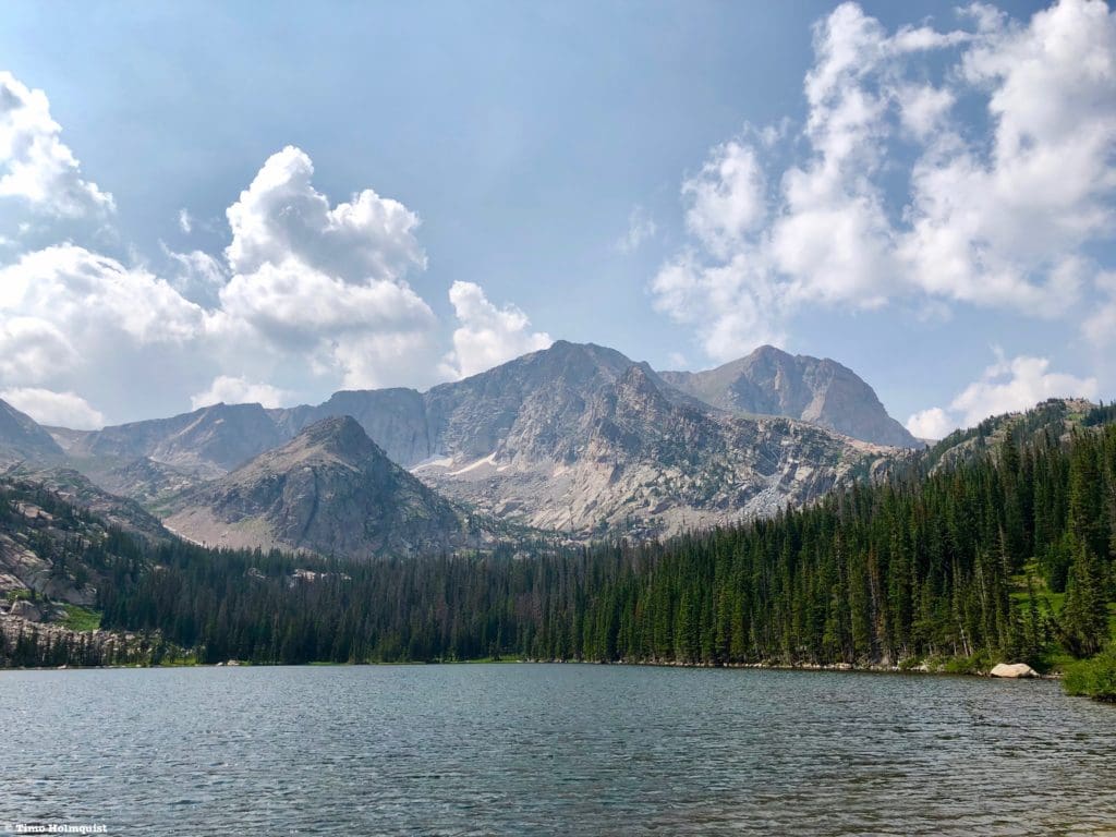
The clear and delightful water of Lake of Many Winds with Longs Peak and Mount Meeker in the background.
Table of Contents:
Article Navigation: Click on any of the listed items in the table of contents below to jump to that section of the article. Similarly, clicking on any large, white section header will jump you back to the Table of Contents.
Looking For An Amazing Adventure? Book A Hiking Tour in Rocky Mountain National Park
Directions to Trailhead:
This hike takes off from the main Wild Basin trailhead. It is located off of US 7, just north of Allenspark. Find US 7 and approach from either the north (Estes area) or the south (Allenspark, Lyons, Boulder, Nederland, etc.). If approaching from the south, make your way through Allenspark and look for a large brown sign for Wild Basin; there is a small left turn lane in the middle of the road. Once you see the sign, slow down, the turn is abrupt. You’ll make a hard left onto a small road and proceed past some houses and the Wild Basin Lodge. The National Park gate is located on the right side of the road and is visible when you approach.
From the north, there will be a large Wild Basin sign on your right after you pass the Meeker Park Overflow Campground. While the sign is large, there is only one, so when you see it, slow down. It’ll be a right-hand turn onto a small road. Proceed until seeing the National Park gate on your right. Approach the gate and drive through to enter into Wild Basin.
Regardless of how you get to the Park gate, you’ll want to drive the dirt road into Wild Basin for its entire length until coming to a parking lot. Make sure to follow the one-way road signs and park where able. The trail takes off from the lower loop portion.
Lake of Many Winds with Boulder-Grand Pass behind.
Places to Stay:
Find a Hotel in Estes Park, Colorado
Support Skyblue Overland by booking your hotel or cabin through one of our links.
Camping
Camping near Rocky Mountain National Park will cost you. The options for free area camping are limited. On a positive note, there are plenty of options, and the National Park is within driving distance of Fort Collins, Boulder, and Denver.
- Estes Park: Known as the gateway to Rocky Mountain National Park, Estes sees nearly 80% of park traffic as opposed to the much quieter western entrance near Grand Lake. The town has a ton of lodging options.
- Allenspark: A small town near Wild Basin that has a few lodging options, including the Wild Basin Lodgeand the Sunshine Mountain Lodge and Cabins.
- Rocky Mountain National Park Camping
- Moraine Park Campground: $30 per site. $20 in winter. Established campground with perks, facilities, campfire grate, wood for sale in summer, and bear boxes to store food. Only loop B is open in the winter, and it’s first-come, first-serve.
- For summer, a reservation is needed quite a ways in advance to secure a spot.
- Glacier Basin Campground: $30 per site. Established campground with the same perks as Moraine Park. Reservation required.
- Backcountry Campsites: Rocky Mountain National Park has backcountry sites that you could book in advance. There is no open camping in the backcountry; it must be at designated backcountry sites. Please check the park website for more details. Backcountry sites require an overnight permit of $30.
- Camping near Estes Park
- Estes Park Campground at Mary’s Lake: Established campground, pricey $45-55. Good backup if other campgrounds are full.
- Hermit Park Open Space: $30 for a tent site, price increases if towing a trailer or for group spots.
- Estes Park Koa: Rates dependent on what you’re bringing with you but will run more than $50 a night in the busy season.
- Olive Ridge Campground in Roosevelt National Forest is the closest campground to the Lookout Mt. trail. ~$20 for a standard non-electric site.
- Free or close to free: but a little farther (if you’re willing to drive)
- Ceran St. Vrain Trail Dispersed Camping ($1)
- County Road 47. Users have reported trash and ATV noise at this location, but it is free.
- Meeker Park Overflow Campground
Looking at the precipitous Class 4 Pilot Mt. from in-between Thunder Lake and Lake of Many Winds.
Field Notes:
Like many destinations in Wild Basin, Lake of Many Winds requires a sizable amount of effort to reach. It is remote and tucked into an alpine bench below Boulder-Grand Pass. While passed often en-route to other destinations, a vibrant green slope on the eastern side of the lake provides a perfect opportunity for alpine contemplation. The path to Lake of Many Winds showcases the best of what Rocky Mountain National Park has to offer: mountain vistas, healthy forests, streams, clear mountain lakes, and a vibrant alpine ecosystem. While Boulder-Grand Pass is regularly used as a descent route for longer adventures, ascending to the large alpine flats beyond the pass is a fantastic optional adventure as well.
For your weather needs, start with Allenspark’s extended forecast. The mountain forecast for Mt. Alice is a good option for the higher portions of Wild Basin. Lake Verna, while located on the western side of Rocky Mountain National Park, also has a good forecast. Using the three forecasts above, you should be able to hone in on what conditions will be like near Lake of Many Winds. Make sure you are watching the skies.
With the elevation of Lake of Many Winds at more than 11,600 feet, and any of the mountains or ridges around it crossing 12,000 feet, it’s important to be aware of and know how to respond to signs of altitude sickness. If you are coming from a low-lying area and haven’t had a chance to acclimatize, a splitting headache, lethargy, and nausea will almost certainly dampen the mountain spirit.
The National Park has instituted a time slot system in addition to their normal entrance pass system for the summer of 2021. Do yourself a favor and take the time to understand these components by visiting the Park website. If you do not have an entrance pass or time slot, you will be turned back. The short version is that ALL visitors must have an entrance pass. If you arrive at the park (excluding Bear Lake Road) anywhere between 9 AM and 3 PM, you will also be required to produce a timed entry pass. You will be turned around if you do not have a timed entry pass. IF you have an entrance pass, AND you arrive before 9 AM, you are free to park and enjoy your day (make sure your pass is visible on your windshield), hence the “arrive early” mantra. If you exit the park between 9 AM and 3 PM, you will be required to produce a timed entry slot to reenter, or you’ll have to wait until after 3 PM to reenter.
Expansive grassy alpine atop Boulder-Grand Pass.
Journal:
This trail review starts from Thunder Lake, which is 5.8 miles from the nearest parking lot at the base of Wild Basin. To read about how to get to the start of this review, please visit our Thunder Lake article.
For beautiful Thunder Lake vistas, explore the southeastern shoreline, which will give you a smashing view of Mt. Alice in the distance. For a full review of a Mt. Alice climb via the Hourglass Ridge, click here.
Thunder Lake and Mt. Alice.
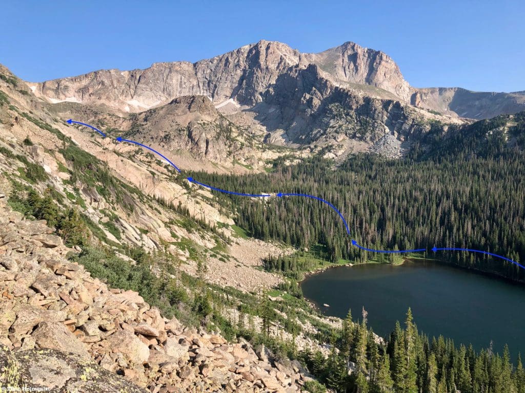
After soaking up the views along Thunder Lake, begin your ascent to Lake of Many Winds by finding the USFS cabin on Thunder Lake’s eastern side. Proceed west and pick up a well-traveled hiker’s path along the shoreline. The lake should be on your left-hand side as you walk. While unofficial, the path is well-traveled and easy to follow.
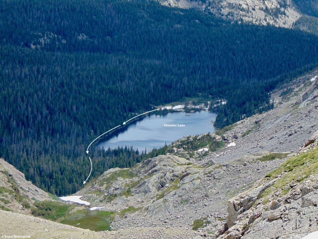
General Path around Thunder Lake from above.
At the head of the lake, you’ll cross over a lovely stream coming down from Falcon lake, another hidden and beautiful water feature of Wild Basin. The trail will cross the stream on some old logs placed there decades ago by the National Park service.
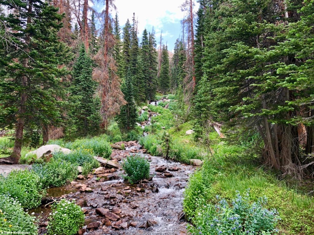
Outflow stream from Falcon lake.
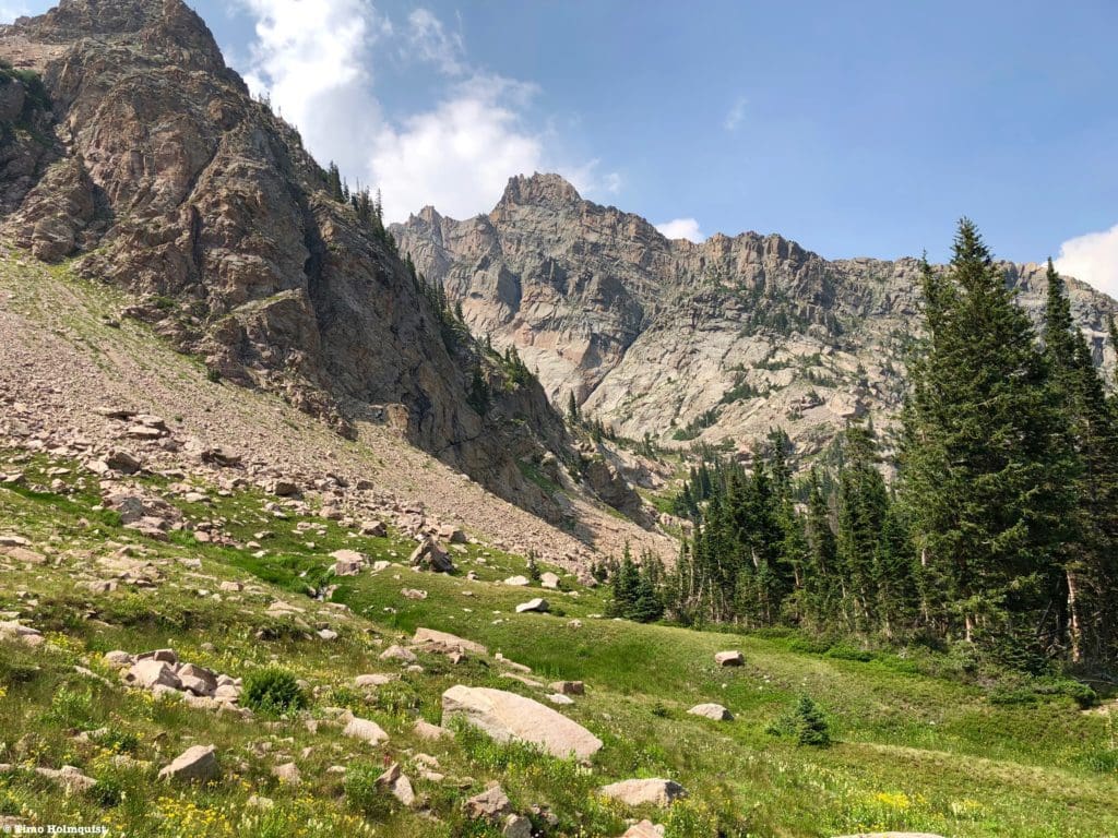
You’ll continue ascending west through a lush forest exploding with wildflowers in July.
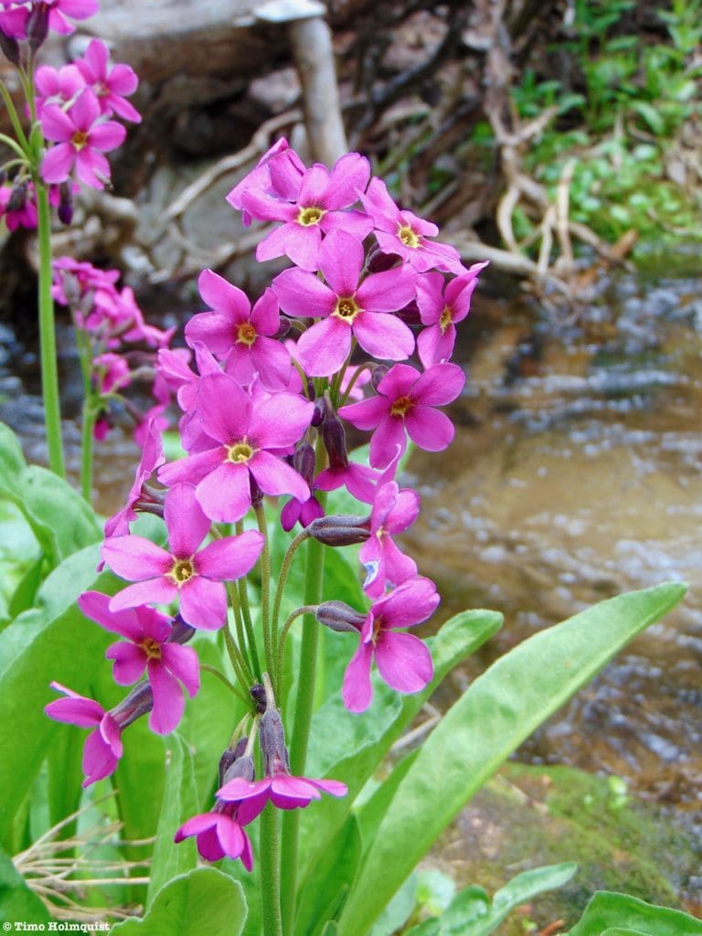
Parry Primrose.
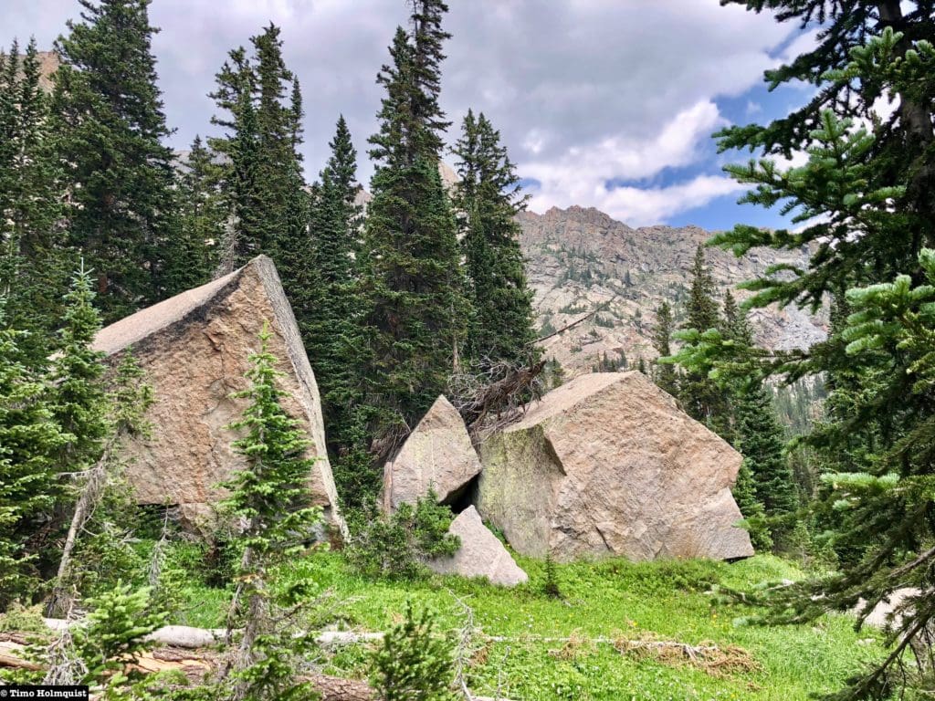
The woods walk portion consists of three pieces. The first is a gentle rise along babbling brooks and healthy trees. The second part is a quick, dramatic rise up a rocky rib where some brief scrambling will be required (Class 2+), and the third piece is through a wooded boulder field until arriving at treeline.
The first bit of scrambling.
Once you pass the rock rib, the forest continues with semi-truck-sized boulders lining each side of the trail. If you take a look to your left, you can see the serrated ridge of Tanima Peak, where the boulders originated from, before tumbling down into the forest and coming to a rest.
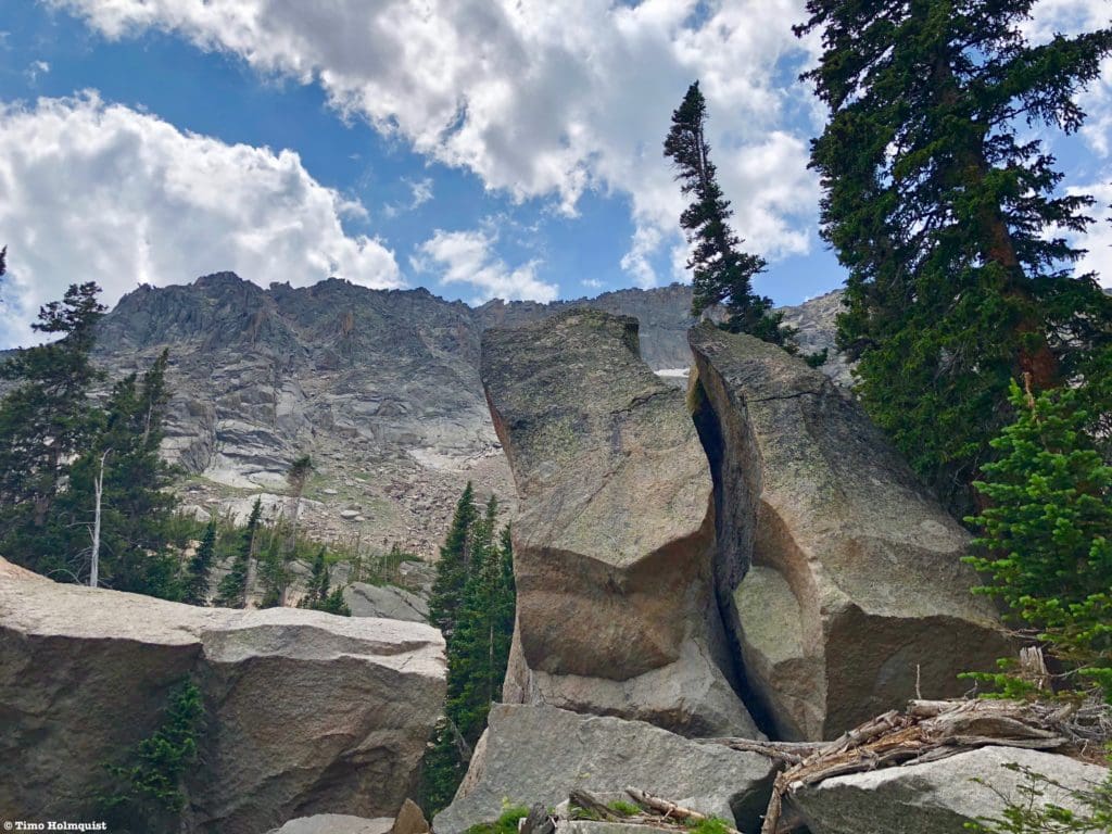
Boulders with Tanima Peak behind.
I’m not a huge rock climber, but these rocks seem like prime candidates for some outdoor bouldering.
Potential for bouldering?
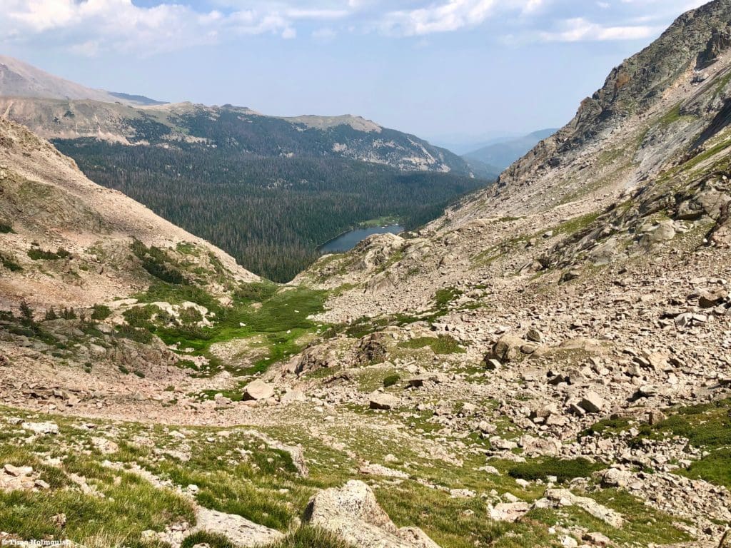
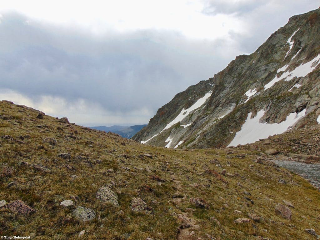
Once you pass the boulders, the trees close in briefly before ending outright, and the alpine takes over. The rest of the climb to Lake of Many Winds can also be broken down into a couple of sections. After the trees, you have a long ascent alongside another stream, which leads to a beautiful meadow. It’s along this rise that you’ll begin to see the group of mountains near Longs Peak to your east. Up until early August, the stream is covered by a dense patch of snow, adding lovely color contrasts to an already beautiful area.
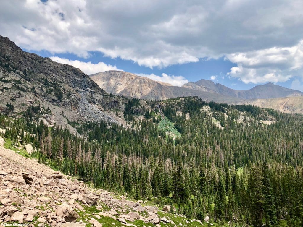
Big mountains begin to get clearer as you break out of the trees.
The meadow you eventually walk alongside is brimming with wildflowers in July. You’ll also be able to see distant cascades and streams running down multiple mountain slopes.
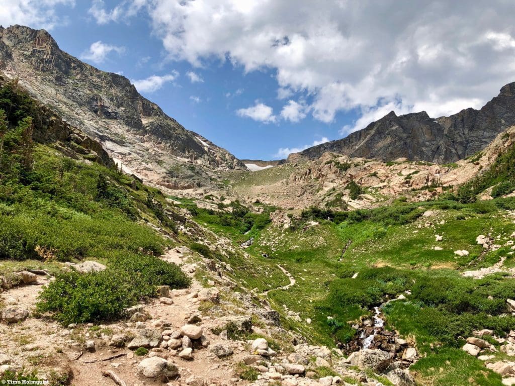
Meadows and streams. The snow patch in the center of the photo is just above Lake of Many Winds.
Here’s a sampling of some of the wildflowers I’ve seen growing between Thunder Lake and Lake of Many Winds. There are likely more varieties in the area.
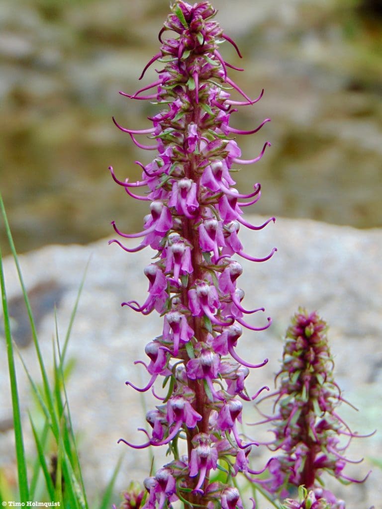
Elephantella.
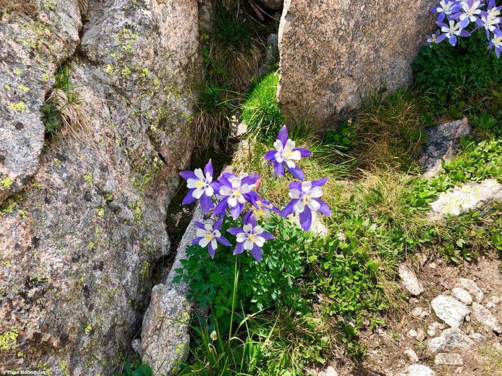
Columbine.
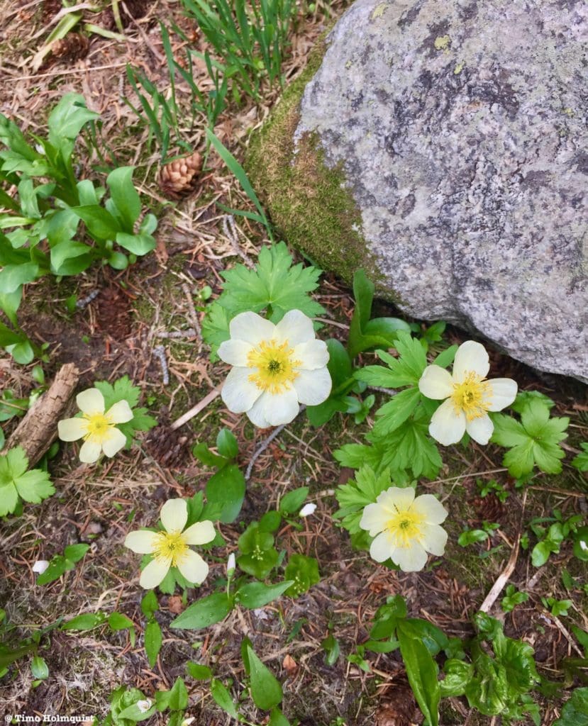
Western Pasque Flower, or Western Anemone.
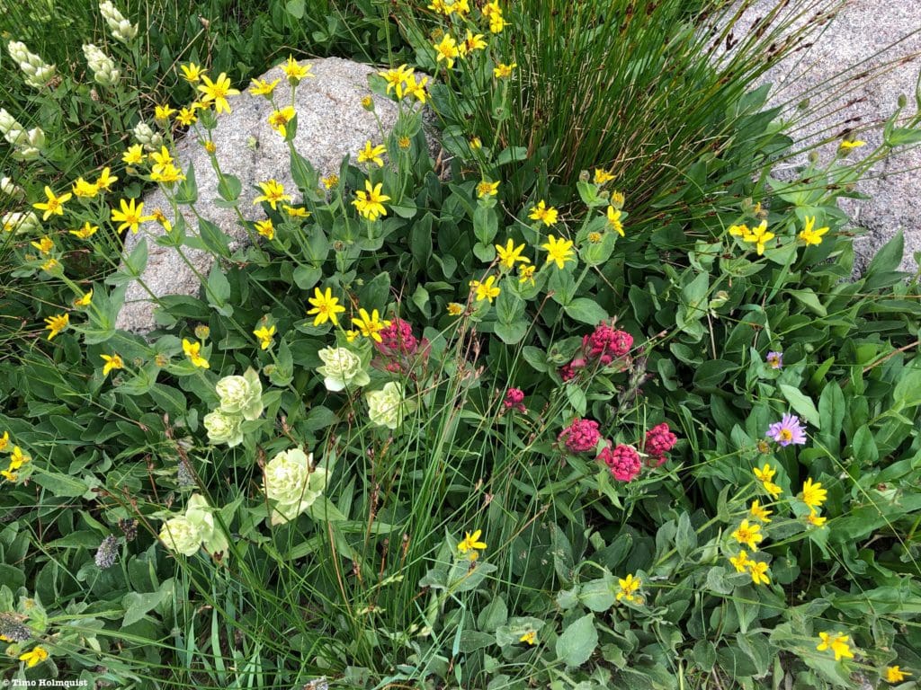
Indian Paintbrush (pink and light green, Heartleaf Arnica, and Aspen Daisy.
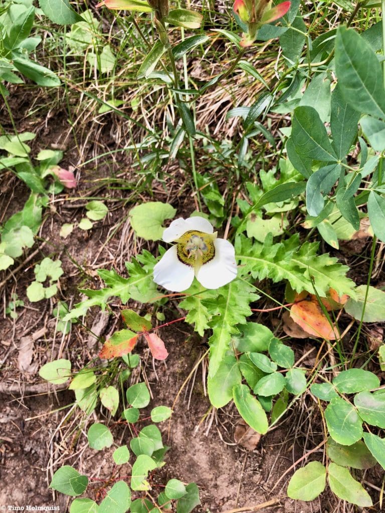
Mariposa Lily.
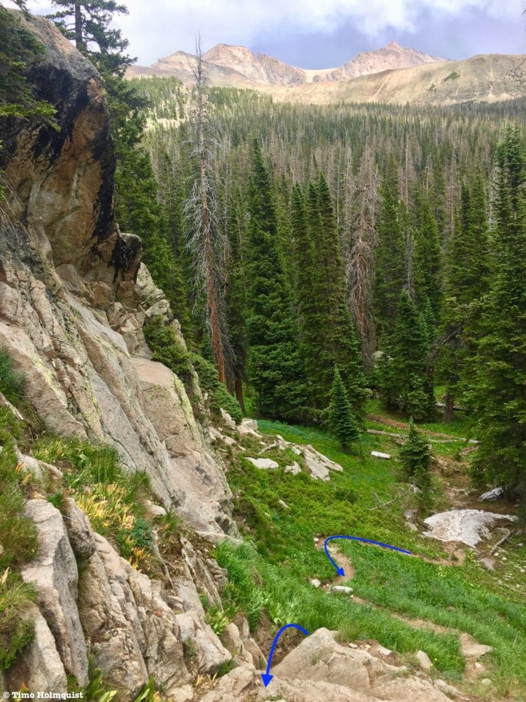
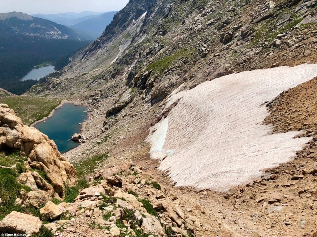
The trail will parallel the stream closely for a while; make sure you’re watching where you plant your feet. Once you pass the meadows, the stream will eventually disappear underneath a steep talus slope. The trail will continue westward, now entering its last and steepest phase.
Looking down the steep section with Thunder Lake barely visible beyond.
While the trail makes navigation easy, it is not maintained by the National Park service. So, instead of a nice, widely graded path with switchbacks, you have to climb up the slope pretty directly. This type of path is very susceptible to yearly erosion, and the sandy composition of the route means that good tread is critical. Take your time and make sure your stepping on stable rocks to minimize the risk of slipping and sliding, especially on the way down.
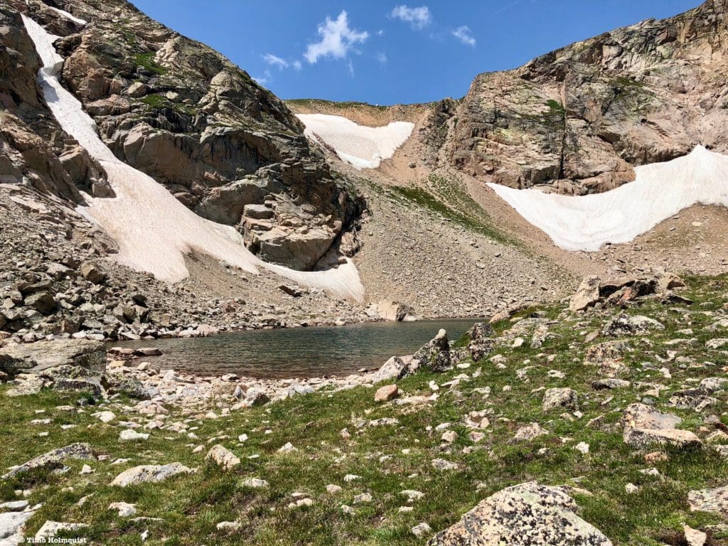
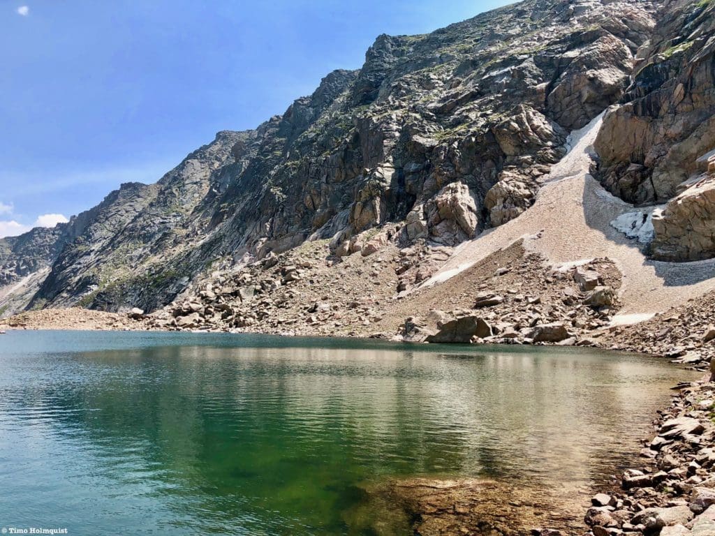
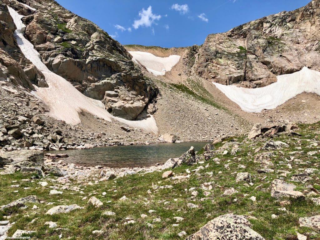
The edge of the lake as it comes into view. Boulder Grand Pass is the low point of the ridge in the background.
After the steep climb, you’ll arrive at the edge of the lake. The path follows the shoreline north before disappearing into a nice grassy slope. This side of the lake is a perfect place to relax and survey the area.
Continue until the trail ends.
It’s much rockier up here, but circling the lake is possible and won’t take very long. Each side of the lake comes with its own set of unique views.
Looking back at the green path where the trail fades into talus.
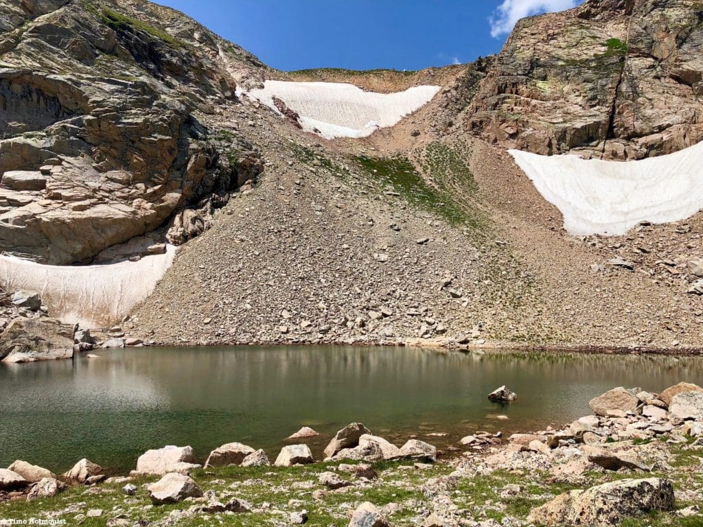
Multiple snowfields last deep into the summer here, with a few patches lasting all year.
The southern edge of the lake with Tanima Pk. behind.
When the tide is low, there are even a few sandy coves along the north side that look like small alpine beaches.
Lake of Many Winds is appropriately named; its high position and location right in front of the Continental Divide allows wind to wrap around it from multiple directions. On hot summer days with low wind, it’s a perfect place to get an alpine lake jump in. The lake is surprisingly deep but make sure you check the wind forecast before planning a jump.
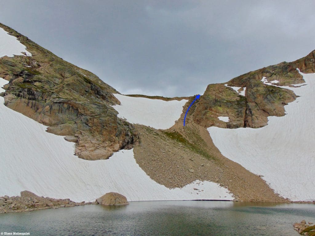
Boulder-Grand Pass lies beyond the lake and can be climbed with relatively forward Class 2+ scrambling. Snow on the pass lingers through July and August, so make sure you pick the farthest north chute to ascend. It is the part of the pass that melts first.
The snowy pass in early July.
Be aware as well that the ground here is loose and sandy. Make sure you are staggering your ascent and wearing helmets if you want to climb the pass; rockfall is a real risk. By early August, the snow will have receded drastically, and your ascent options increase, although the northern chute is clearly the most traveled route and contains the only instance of semi-solid rock.
What the pass looks like by early August.
Committing to the pass unlocks more fantastic perspectives of the area.
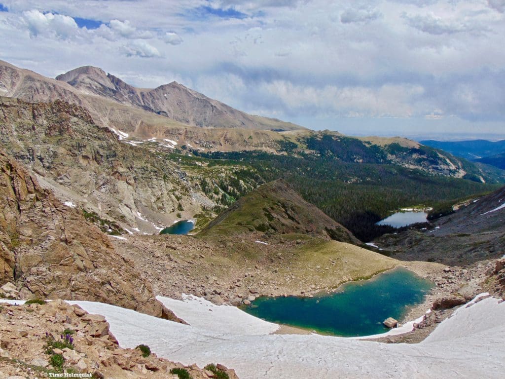
From left to right: Falcon Lake, Lake of Many Winds, and Thunder Lake.
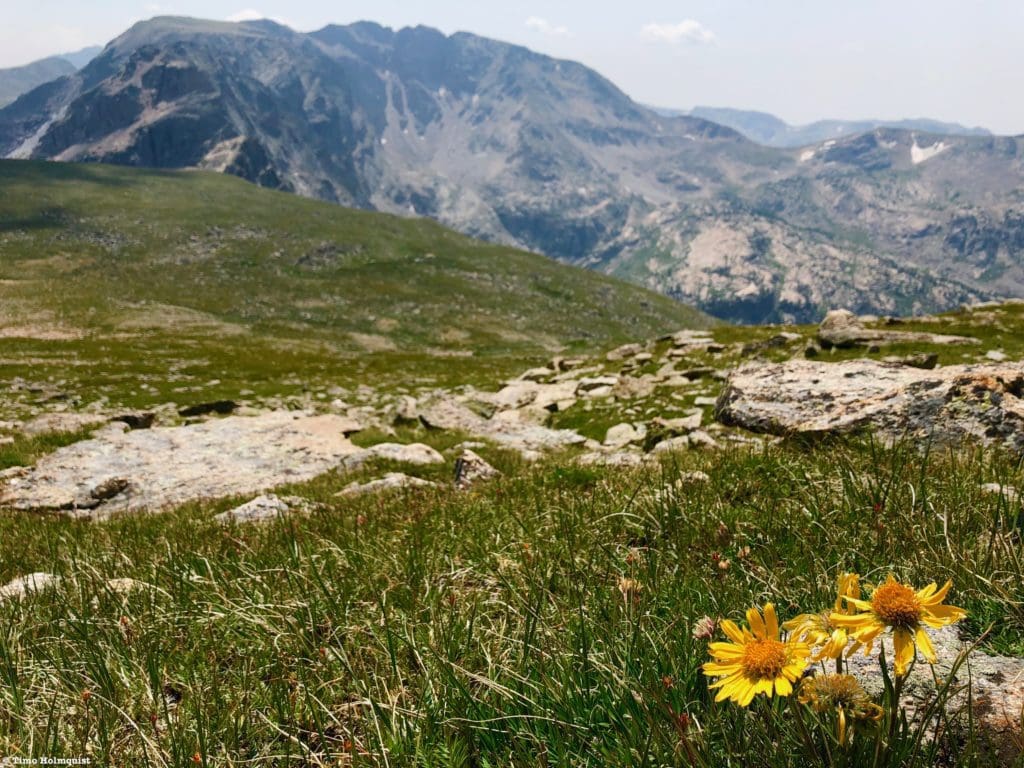
Once you’re on top of the pass, if motivation strikes, you can stroll southwest along the beautiful tundra to tag Tanima Peak or continue south along the Divide until the scramble to the Cleaver takes over. To read more about Tanima and The Cleaver, please visit our article here. If you’re really moving, you can also veer north and ascend the tundra another 1,300 feet to the summit of Mt. Alice.
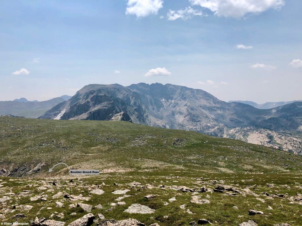
The deceptive “top” of Boulder-Grand Pass from above, which is really a wide-open grassy expanse. Bighorn Sheep have been known to frequent the area.
Whenever you’re ready, descend the same way back to Lake of Many Winds.
Looking down from Boulder-Grand Pass.
Pick up the path on the eastern side of the lake where the green grass is and walk it back to Thunder Lake. Keep in mind, as previously stated, this review description only covers the distance between Lake of Many Winds and Thunder Lake. If you’re looking to day-hike from the Wild Basin Trailhead, it is a substantial endeavor but richly rewarding.
The overall ascent route from the slopes of Tanima Peak with Thunder Lake below.
Final Thoughts:
Lake of Many Winds is a small alpine tarn tucked underneath Boulder-Grand Pass but makes for an excellent Rocky Mountain National Park destination. Whether you’re camping near Thunder Lake or looping it into a day hike, Lake of Many Winds is the perfect destination to experience some alpine splendor. And while the path to the lake is unofficial, it is easily recognizable, making it a great introduction to alpine wandering in this fantastic area of Colorado.
Mt. Alice from Thunder Lake, Boulder-Grand Pass is the lowest point along the ridge to the left.
Popular Articles:
- Guide to the Best Hiking Trails in Rocky Mountain National Park, Colorado
- The Dyrt: The 10 Best Campgrounds In Colorado
- Top Adventure Sports Towns 2021: Boulder, Colorado
- Epic Adventures with the Best Guides In Colorado
- Sky Pond via Glacier Gorge Trail, Rocky Mountain National Park, Colorado
- Scrambling Hallett Peak’s East Ridge, Rocky Mountain National Park, Colorado
- Scrambling Mt. Alice via the Hourglass Ridge, Rocky Mountain National Park, Colorado
- Gorge Lakes Rim Scramble, Rocky Mountain National Park, Colorado
- Black Lake Via Glacier Gorge Trail, Rocky Mountain National Park, Colorado
- Scrambling To The Lake Of The Clouds, Rocky Mountain National Park, Colorado

Skyblue Overland Strongly Recommends That You Enroll With Global Rescue Prior To Embarking On Your Next Adventure.
With more people outside now more than ever, Global Rescue expanded services to include field rescue within 100 miles of home. With Local Field Rescue — automatically included in any travel protection services membership — Global Rescue is there whether you’re hiking, kayaking, snowmobiling, fishing or simply enjoying the outdoors and get ill or injured and you’re unable to get to safety on your own. Purchase a Global Rescue membership for your next adventure and travel with peace of mind. Single trip, annual and family options are available.
Memberships start at $119.
Terms of Use:
As with each guide published on SKYBLUEOVERLAND.com, should you choose to this route, do so at your own risk. Prior to setting out check current local weather, conditions, and land/road closures. While taking a trail, obey all public and private land use restrictions and rules, carry proper safety and navigational equipment, and of course, follow the #leavenotrace guidelines. The information found herein is simply a planning resource to be used as a point of inspiration in conjunction with your own due-diligence. In spite of the fact that this route, associated GPS track (GPX and maps), and all route guidelines were prepared under diligent research by the specified contributor and/or contributors, the accuracy of such and judgement of the author is not guaranteed. SKYBLUE OVERLAND LLC, its partners, associates, and contributors are in no way liable for personal injury, damage to personal property, or any other such situation that might happen to individuals following this route.


