


High Point:
10,128 feet

Total Ascent:
750 feet

Difficulty:
Moderate

Distance:
3.1 miles

Waypoints:
40.312912, -105.646400

Route Type:
Out and Back
On June 27, 2020, I hiked the Emerald Lake Trail in Rocky Mountain National Park. This trail includes four beautiful alpine lakes – Bear Lake, Nymph Lake, Dream Lake and Emerald Lake, which are all accessible from the Bear Lake Trailhead in Rocky Mountain National Park, Colorado. The Emerald Lake Trail is a well maintained 3.1 mile trail, with modest 709 feet elevation gain, leading to Nymph, Dream and Emerald upper-montane lakes in Tyndall Gorge. The Tyndall Glacier is one of five active glaciers in the Rocky.
This picturesque hiking trail to Emerald Lake from the Bear Lake Trailhead is a popular trail with beautiful views, including Flattop Mountain, Hallett Peak, and Glacier Gorge. This is a great hike for photographers to capture spectacular shots of the lakes, nearby waterfalls and the surrounding mountains along the trail. Gorgeous scenery at the top with lovely waterfalls as you ascend.
Take a look at my nearby map, which includes waypoints for the many amazing photo opportunities. The hike took me about 3:00 hours after making numerous stops for photos. My actual moving time was closer to 2:15 hours. I arrived at the Bear Lake Trailhead (Waypoint: 40.312912, -105.646400; elevation: 8,165 feet) on June 27, 2020 around 5:50 AM and the parking lot was already filling up quickly.
After visiting Bear Lake, the Emerald Lake Trail is an easy climb through the scenery and next two lakes, Nymph and Dream Lakes. The trail then takes you to the precipice of the hike, Emerald Lake! It is sight to be seen and taken in on all levels. I suggest you climb around to the right of the path away from most of the tourist hikers and you will find perfect spots to picnic.
This trail is absolutely beautiful. However it is definitely not a secret. Expect large amounts of traffic on the trail. This trail can be very crowded with long queues around photo spots and bad trail etiquette.
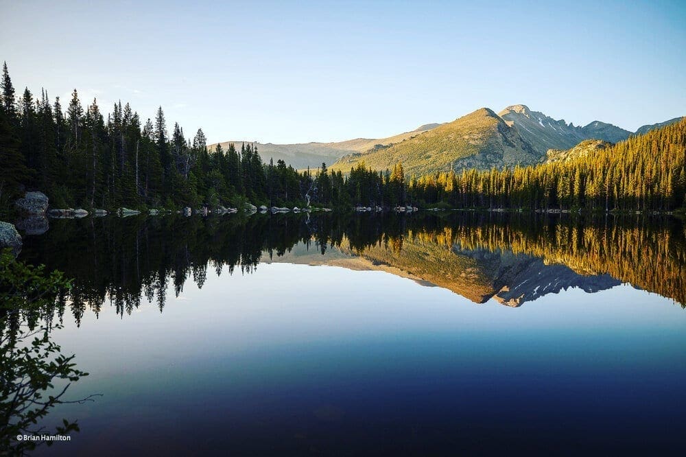
Photo Waypoint: 40.314097,-105.648139. Photo from north side of Bear Lake at sunrise in June 2020. View is looking to the south towards Glacier Gorge. Canon EOS R, Canon RF 15-35mm f/2.8L USM Lens, ISO 100, 24 mm, f/2.8, 1/60 seconds.
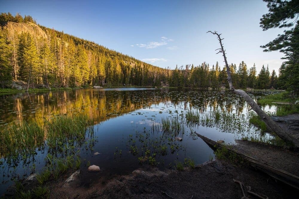
Photo Waypoint: 40.309656, -105.651375. Photo taken from south end of Nymph Lake at sunrise in June 2020. View is looking to the north. Canon EOS R, Canon RF 15-35mm f/2.8L USM Lens, ISO 100, 15 mm, f/2.8, 1/15 seconds.
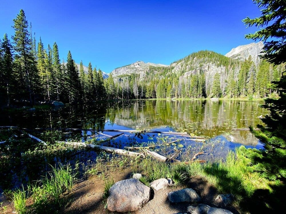
Photo Waypoint: 40.310414, -105.650786; Photo taken from northeast end of Nymph Lake. View is looking to the south towards the Glacier Knobs. iPhone 11 Pro Max, ISO 20, 1.54 mm, f/2.4, 1/280 seconds.
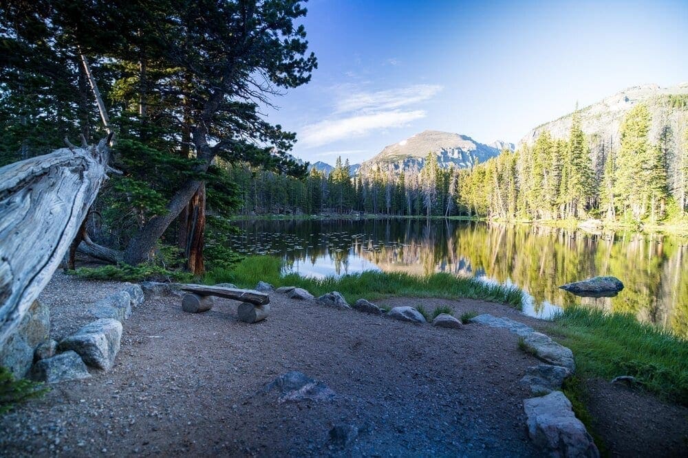
Photo Waypoint: 40.310453, -105.651481. Photo taken from north end of Nymph Lake. View is looking to the south towards the Glacier Knobs. Canon EOS R, Canon RF 15-35mm f/2.8L USM Lens, ISO 100, 15 mm, f/2.8, 1/5 seconds.
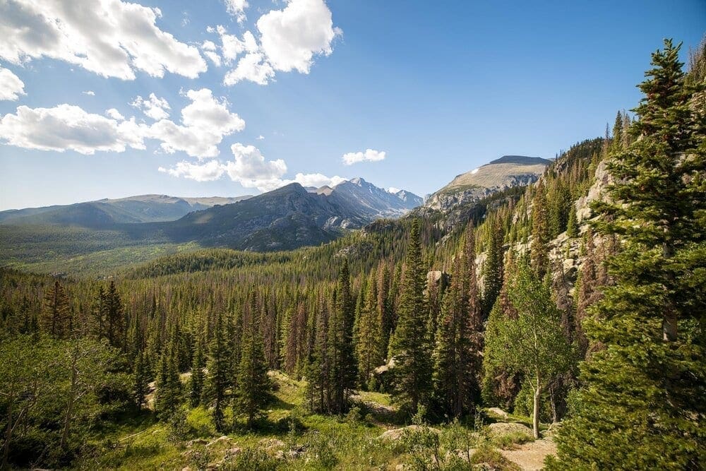
Photo Waypoint: 40.309800, -105.654306; Photo looking south towards Glacier Gorge. There are numerous vistas on the trail as it climbs above Nymph Lake towards Dream Lake. Canon EOS R, Canon RF 15-35mm f/2.8L USM Lens, ISO 100, 15 mm, f/5.0, 1/160 seconds.
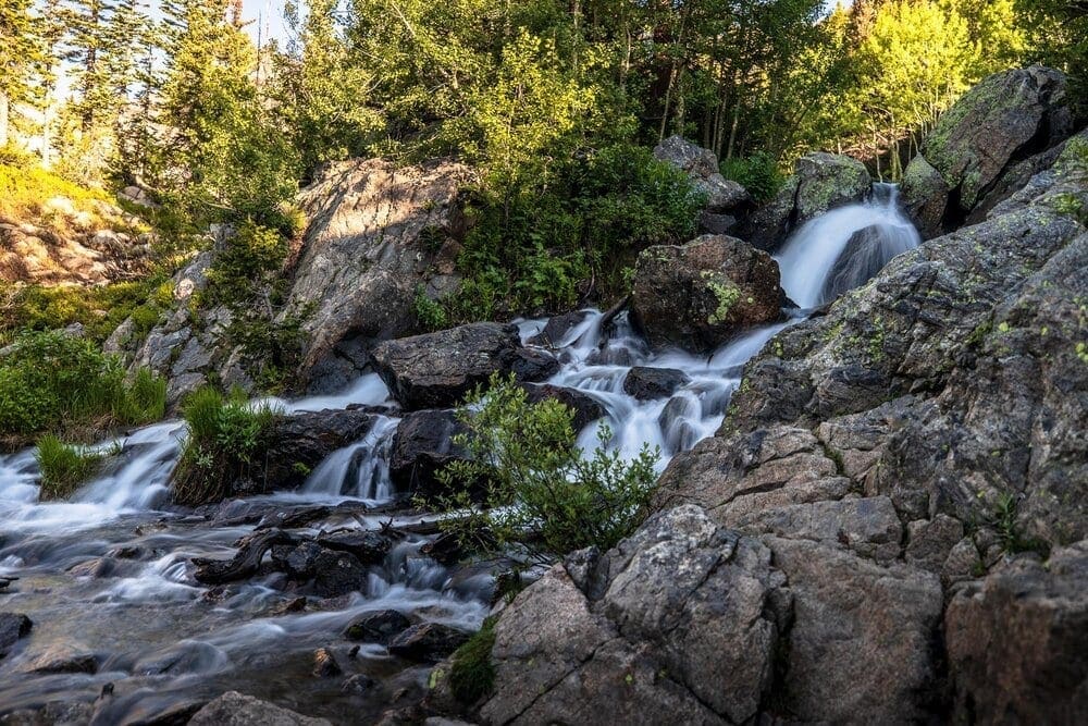
Photo Waypoint: 40.310158,-105.65545. Beautiful waterfalls on Tyndall Creek just below Dream Lake on the Emerald Lake Trail. Canon EOS R, Canon RF 15-35mm f/2.8L USM Lens, ISO 100, 35 mm, f/2.8, 1/2 seconds.
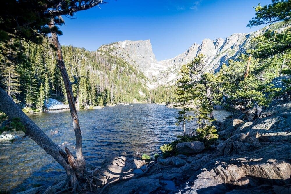
Photo Waypoint: 40.309964, -105.658111; View of Dream Lake, looking to the west towards Hallett Peak, Tyndall Glacier and Flattop Mountain. Canon EOS R, Canon RF 15-35mm f/2.8L USM Lens, ISO 100, 20 mm, f/2.8, 1/13 seconds.
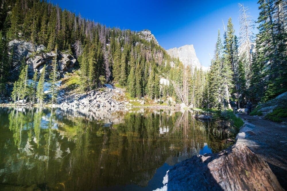
Photo Waypoint: 40.309269,-105.660819; Photo on the west end of Dream Lake. View is looking to the west towards Hallett Peak. Canon EOS R, Canon RF 15-35mm f/2.8L USM Lens, ISO 640, 15 mm, f/2.8, 1/60 seconds.
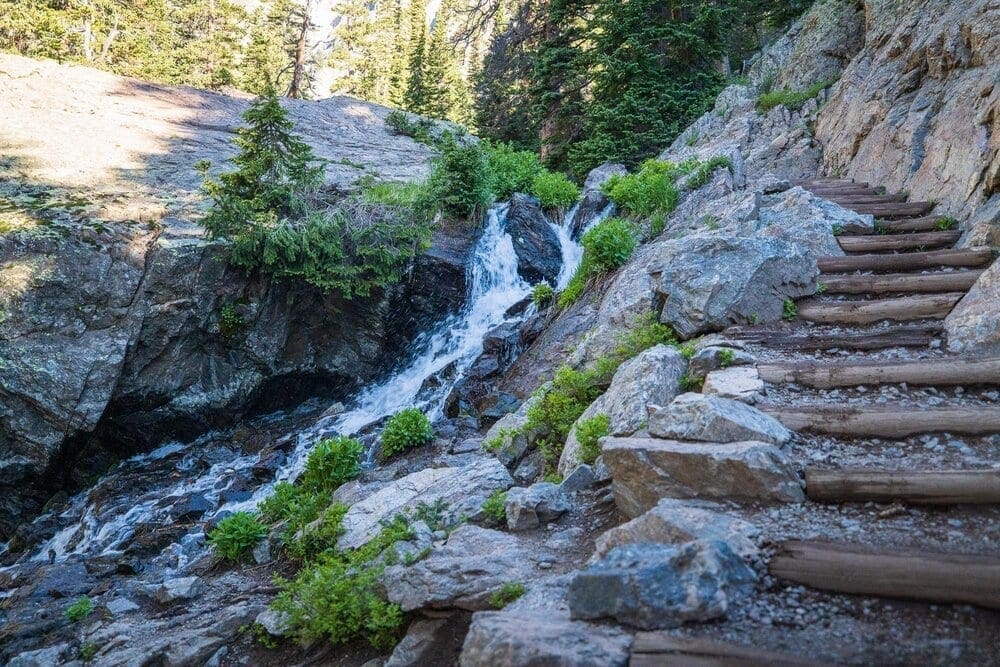
Photo Waypoint: 40.309384, -105.661957; Beautiful Tyndall Creek cascades down towards Dream Lake. Canon EOS R, Canon RF 15-35mm f/2.8L USM Lens, ISO 2500, 35 mm, f/2.8, 1/60 seconds.
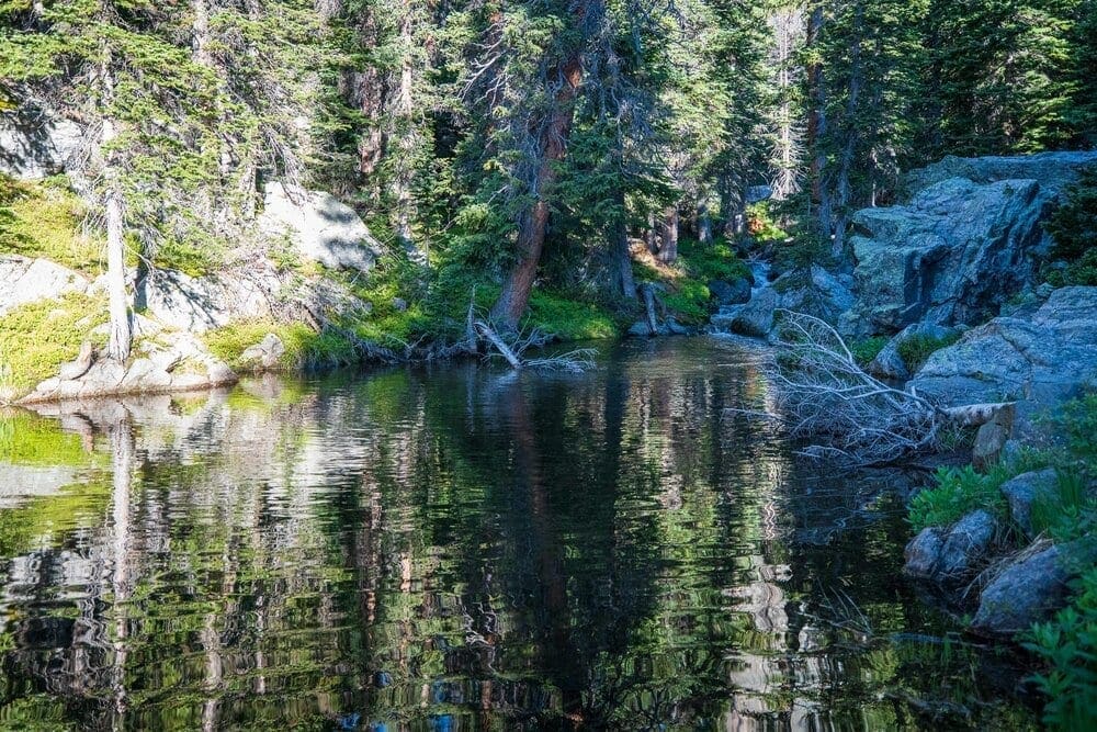
Photo Waypoint: 40.309322, -105.662011. Spring snow run off from Tyndall Creek creates this pool, just below Emerald Lake. Canon EOS R, Canon RF 15-35mm f/2.8L USM Lens, ISO 2500, 35 mm, f/2.8, 1/60 seconds.
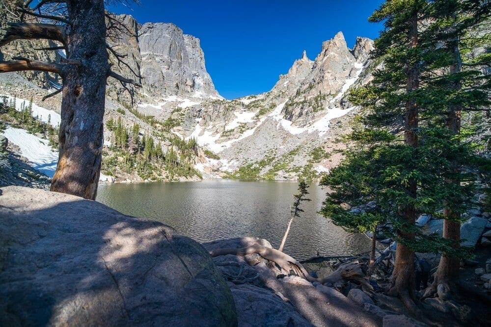
Photo Waypoint: 40.309728, -105.666778. View from the east end of the Emerald Lake Trail, looking to the west towards Hallett Peak, Tyndall Glacier and Flattop Mountain. Canon EOS R, Canon RF 15-35mm f/2.8L USM Lens, ISO 100, 15 mm, f/2.8, 1/60 seconds.

Featured Adventure Partner:
The Leave No Trace Center for Outdoor Ethics
Skyblue Overland is proud to be a Community Partner with the Leave No Trace Center for Outdoor Ethics, which protects the outdoors by teaching and inspiring people to enjoy it responsibly. The Center accomplishes this mission by delivering cutting-edge education and research to millions of people every year.
Enjoy your world. Leave No Trace.
Terms of Use: As with each guide published on SKYBLUEOVERLAND.com, should you choose to this route, do so at your own risk. Prior to setting out check current local weather, conditions, and land/road closures. While taking a trail, obey all public and private land use restrictions and rules, carry proper safety and navigational equipment, and of course, follow the #leavenotrace guidelines. The information found herein is simply a planning resource to be used as a point of inspiration in conjunction with your own due-diligence. In spite of the fact that this route, associated GPS track (GPX and maps), and all route guidelines were prepared under diligent research by the specified contributor and/or contributors, the accuracy of such and judgement of the author is not guaranteed. SKYBLUE OVERLAND LLC, its partners, associates, and contributors are in no way liable for personal injury, damage to personal property, or any other such situation that might happen to individuals following this route.


