


High Point:
6,807 feet

Total Ascent:
~1345 feet

Difficulty:
Moderate

Distance:
3.1 miles

Waypoints:
40.02151, -105.29578

Route Type:
Loop
The Mt Sanitas West Ridge Trail and Sanitas Valley Trail create a challenging loop to the rugged Mount Sanitas summit in Boulder, Colorado. It climbs steeply before moderating on a thin ridge, offering good views of Sunshine Canyon and Chautauqua Park. At the summit (1.2 miles : 6,843′), you can take in panoramas of the foothills, plains and Continental Divide.
Overview:
Boulder has always benefited as a town that embraces outdoor recreation. The miles of trails, bike paths, and rock-climbing areas are a testament to that. Most of the dramatic trails are located just west of downtown and provide stunning natural landscapes on the edge of the Rocky Mountains. Like many areas of the Front Range, trails exist on a patchwork of federal public lands, state parks, and open spaces.
Mt. Sanitas is a quintessential Boulder area hike featuring sustained ascents, rocky outcroppings, meadows, flowers in April/May, and spectacular views. Sanitas is the northern end of a set of five mountains framing the western Boulder skyline. Running in a line from south to north, they are South Boulder Peak, Bear Peak, Green Mountain, Flagstaff Mountain, and Mt. Sanitas. Although smaller than the others, Sanitas features excellent views of the city, the other surrounding peaks and offers a beautiful and rocky loop hike without a ton of driving.
Most people attack the ridge proper, which is fairly relentless and crowded. There are other options that attack different slopes of the mountain, help shed the crowds, and provide a more complete Sanitas experience. All in all, it’s an excellent introductory summit for people new to the region and certainly packs a punch. Remember to bring your camera on this one!
Table of Contents
Article Navigation: Click on any of the listed items in the table of contents below to jump to that section of the article. Similarly, clicking on any large, white section header will jump you back to the Table of Contents.
The Ultimate Offline GPS Hiking & Ski Maps
See why onX Backcountry is the ultimate GPS navigation app for your outdoor pursuits. Try Today for Free. No credit card required.
Directions to Trailhead:
There are a few ways to climb this peak, although the best options start from the Centennial Parking area in Sunshine Canyon. To get there, find Mapleton Avenue just north of downtown Boulder and take it going west. It’s a beautiful street with big trees and older houses. The road will approach the front folds of the mountains and enter into Sunshine Canyon. Almost immediately after, the trailhead will be on your left-hand side.
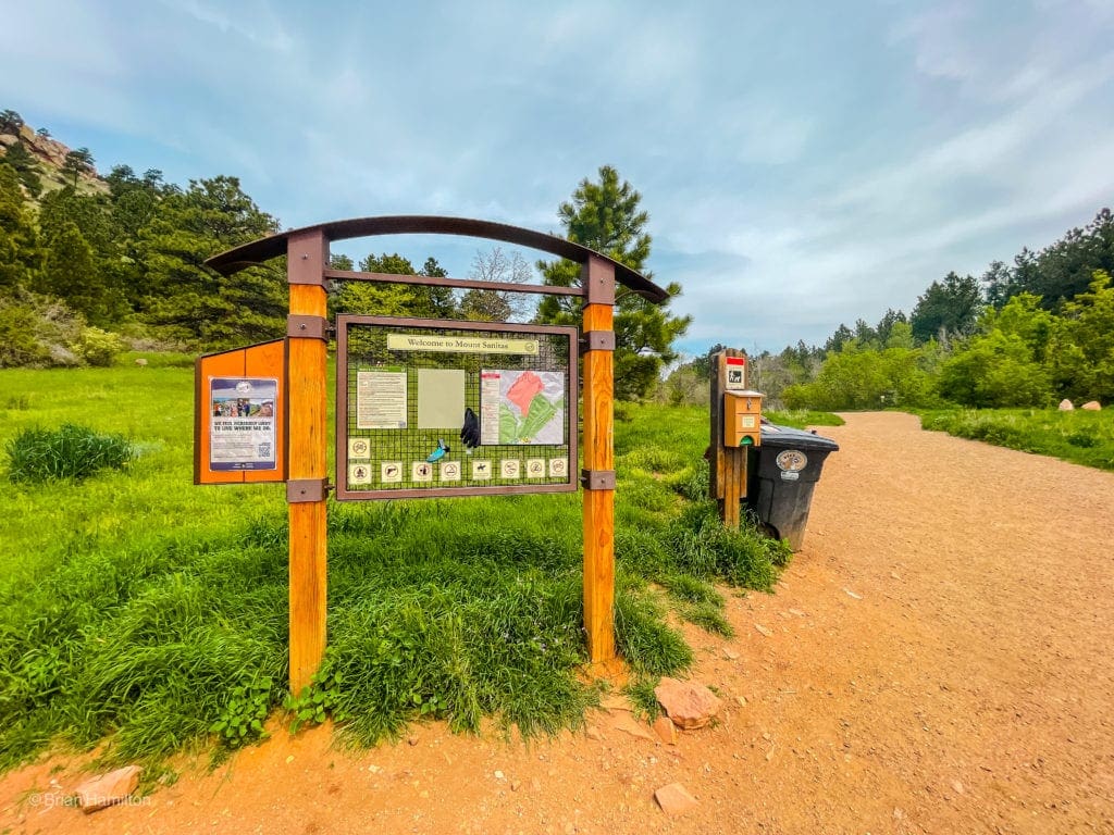
The Info Kiosk at the start of the Loop.
This lot, because it is so close to Boulder, will fill quickly on busy days. You can continue up Sunshine canyon for a couple of extra miles until the first large hairpin turn. At the elbow is a dirt pull-off with space for roughly 6-7 well-parked cars. From there, you can connect with the Sunshine Canyon Trail, which will take you back down to the Centennial Parking Area, or you can utilize the Lion’s Lair trail and climb Sanitas from the western side. This out and back option will net you 4 total miles and provides views to the west towards higher peaks near the Continental Divide.
Field Notes:
Sanitas is often the first mountain Boulder residents and CU college kids climb because it’s short and offers fantastic views. Weekdays and early are preferable, but you will likely encounter people on this trail all year. It’s a great winter snowshoe or microspike hike because its proximity to Boulder limits confusing navigation issues. Having said that–even though the hike is short, it is not flat. You gain over 1300 feet in about a mile and a half; pace yourself.
The best place to look for weather updates is at a Boulder weather forecast. The summit is more than a thousand feet above the downtown area, so you can also look at sites like Opensummit, which will give you a free two-day weather window. The weekly forecast will cost you a membership, however. A third weather option is to check the forecast for NCAR (National Center for Atmospheric Research). A few miles south of Sanitas, the center is on a tall bluff overlooking the city and will have comparable wind and temperature readings.
Places to Stay:
Boulder offers a ton of options from hotels to Airbnb that usually fit any budget type. Sanitas is also within an hour of most of the northern Denver metro area, Longmont, Golden, Lyons, Berthoud, Loveland, and the southern reaches of Fort Collins. Camping is possible in some places near Boulder, but they would all require a bit of a drive. Some OK options include Gross Reservoir sites, Gordon Gulch Dispersed Area, and along forest service roads near Switzerland Trail.
Journal:
Once you’ve found a place to park at Centennial Trailhead, leave the parking lot on a small trail heading east and paralleling the road.
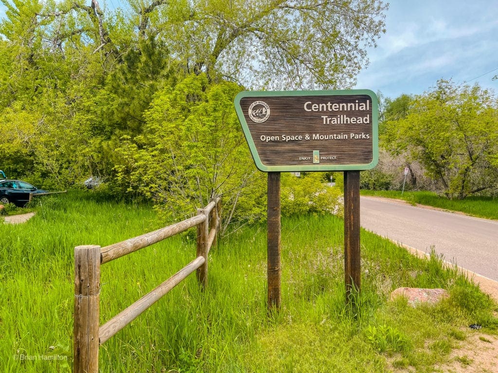
Trailhead sign at the start.
In less than 0.1 miles, you’ll see a place to cross the street.
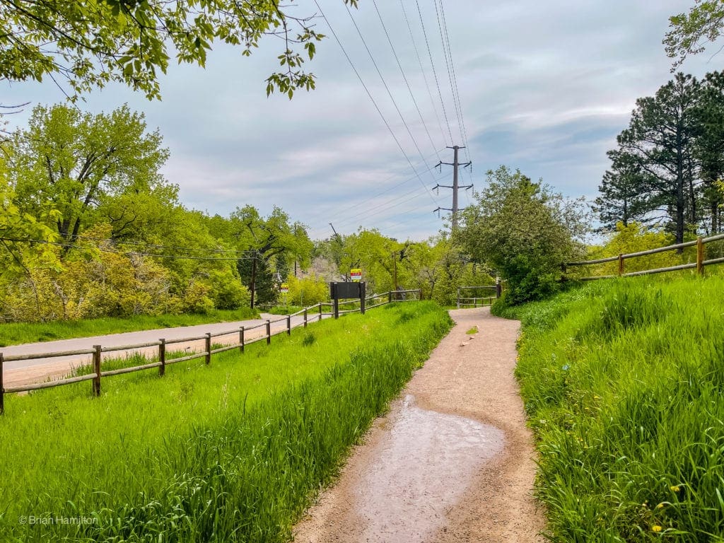
Looking to the road crossing by the Yellow and Red signs.
Once across, you’ll see a pavilion, head towards it, and cross the bridge over Sunshine Creek.
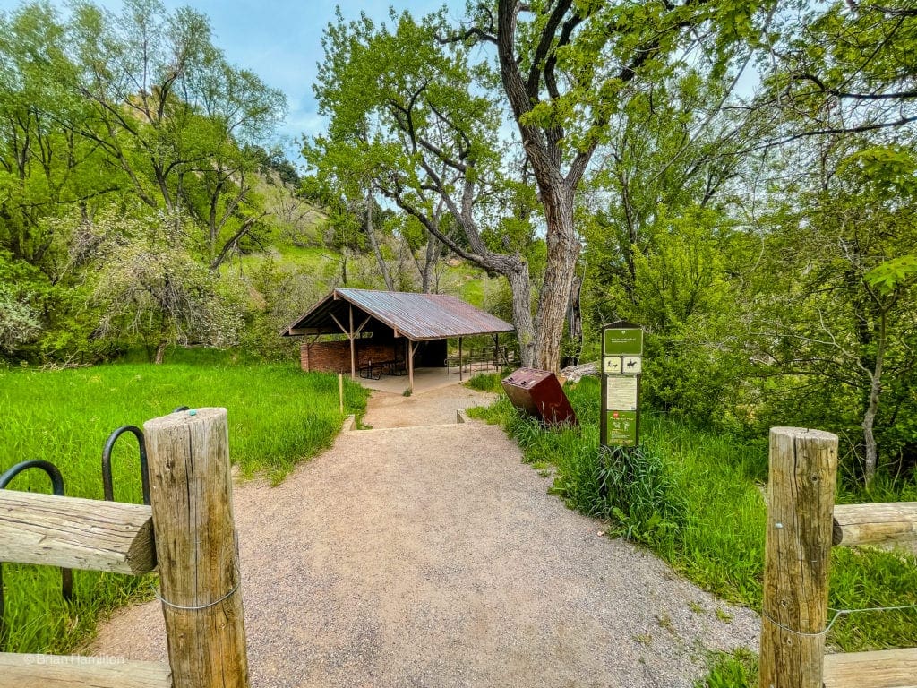
Pavilion.
On the other side of the creek, you’ll reach your first big trail junction. Many people take a left on the Mount Sanitas Trail, which attacks the ridge proper and is a fairly relentless climb up to the top. For the loop approach, take the right-hand option up Sanitas Valley Trail to the East Ridge Trail, climb up to the top, and return via the Mount Sanitas Trail.
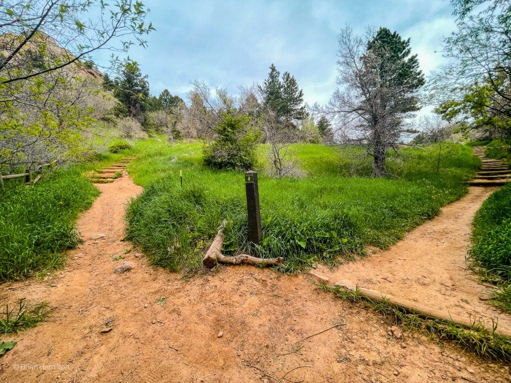
Take a right at this junction.
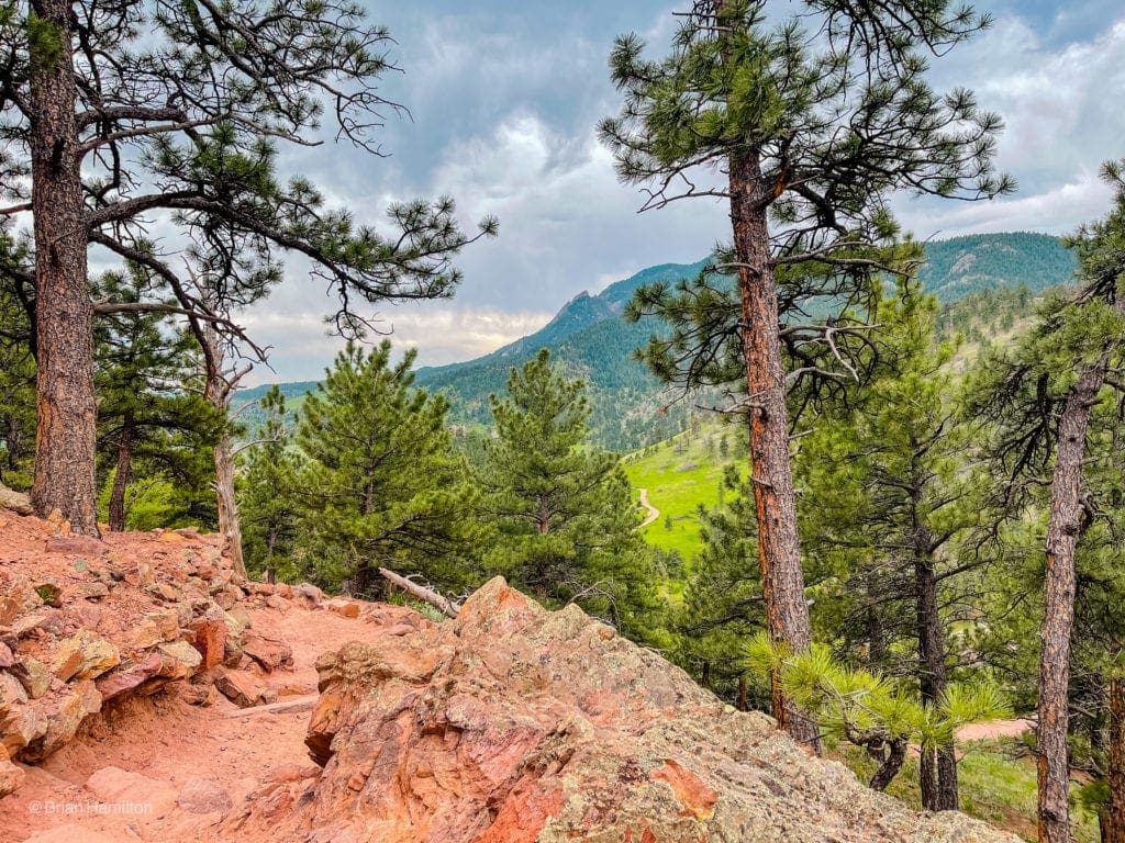
The trail is very wide and easy to follow; take it up the valley for the next mile as views begin to break out in all directions.
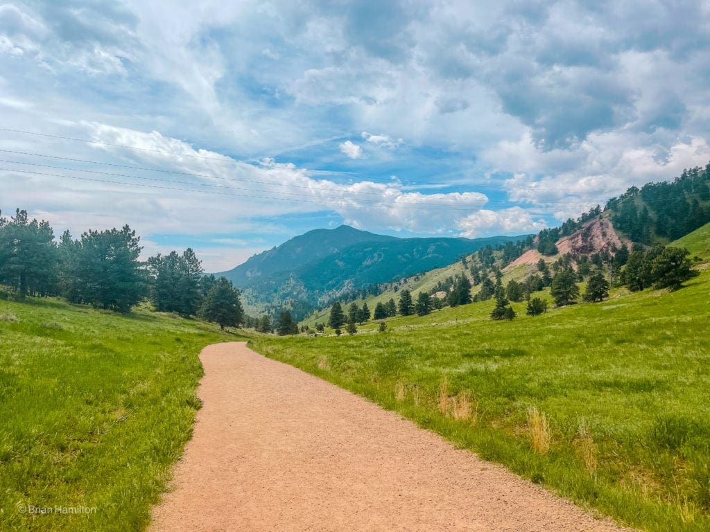
Looking back down what you’ve ascended so far, with the Flatirons and Green Mountain in the background.
Eventually, the trail will intersect with the Goat Trail, in front of a set of large houses.
Looking down the Goat Trail towards the edge of Boulder.
You’ll want to hang a left and begin climbing towards Sanitas.
Up towards rockier terrain.
Once you make that left, the trail begins to get harder; eventually losing its wide grade and turning into the East Ridge.
Narrowing trail as you increase in elevation.
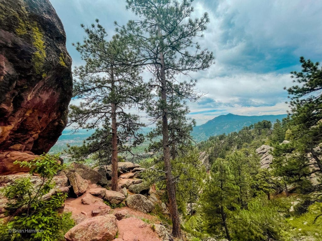
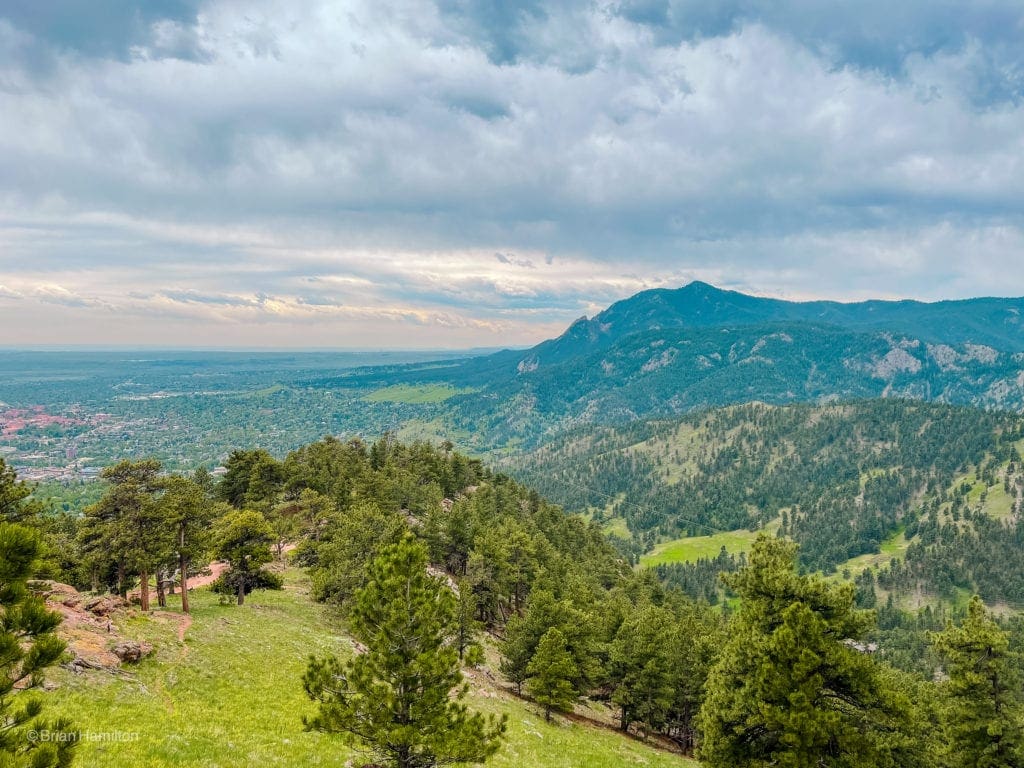
The views get better the higher you go, offering lovely panoramas of Boulder tucked up against the hillside.
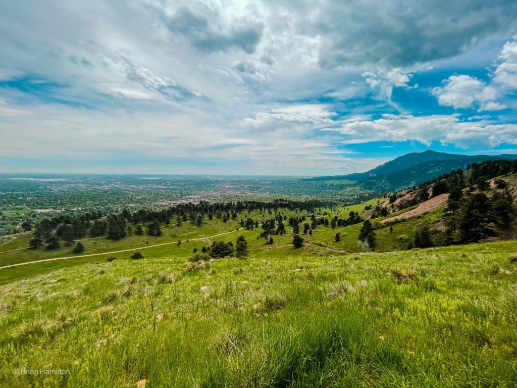
You can see your approach trail as the wide strip in the middle of the valley below.
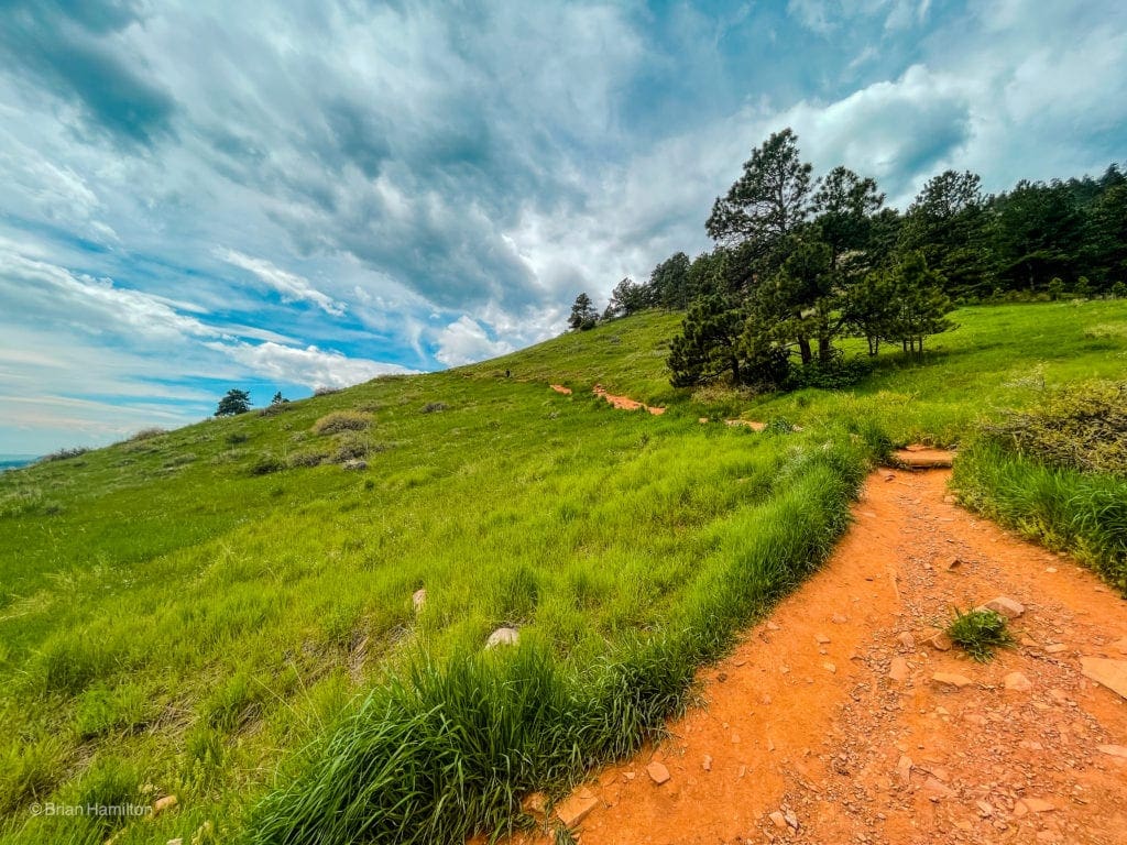
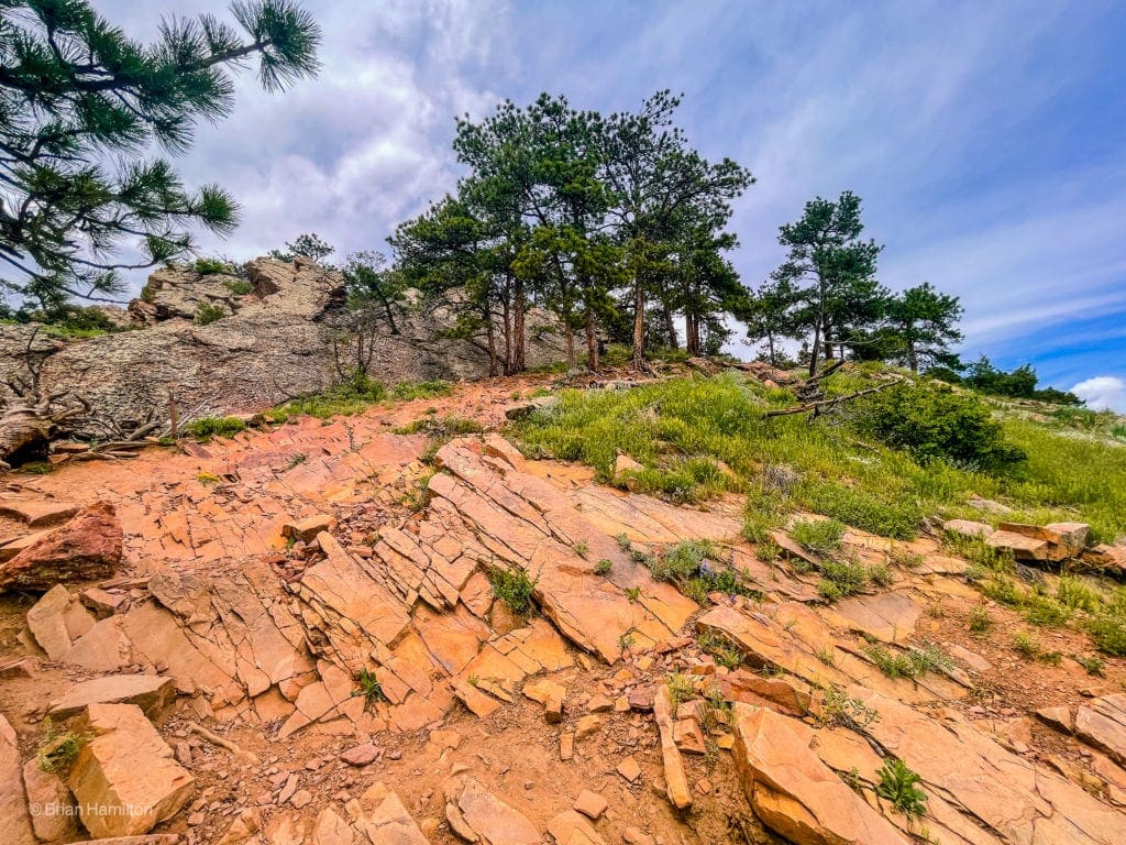
Once you reenter the trees, the trail takes on a much more rugged look and angles towards some prominent rock formations.
Up, up, and more up.
At some points, the trail climbs rocky slopes that don’t seem like part of the route, but there are plenty of signs directing traffic.
Rockier strips as the trail rises.
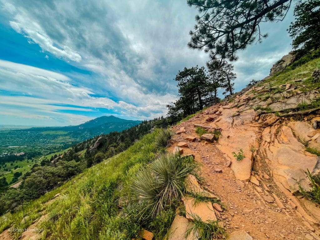
As the East Ridge Trail continues, you’ll be forced to negotiate around some large boulders, giving the trail a distinct, big mountain flavor, despite its proximity to populated areas.
Looking back as the trail navigates around one of the rockier sections.
Beyond the rockier ridge points, the trail continues through a meadowed section.
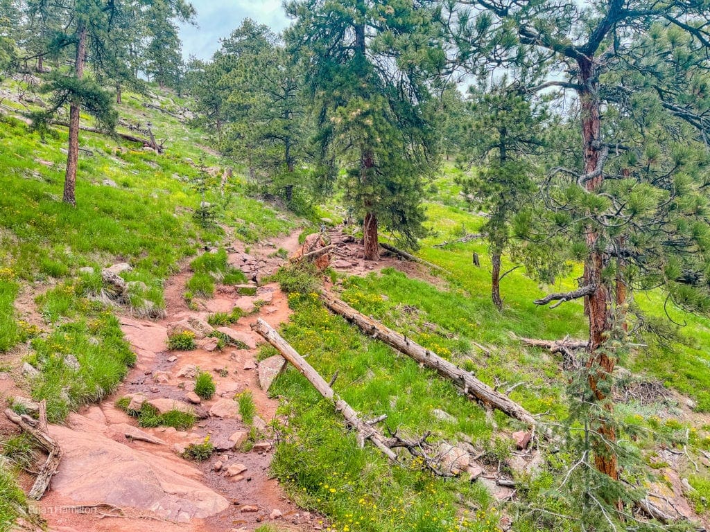
Fields interspersed with large pine trees.
As the trail nears the summit crest, more stunning views present themselves.
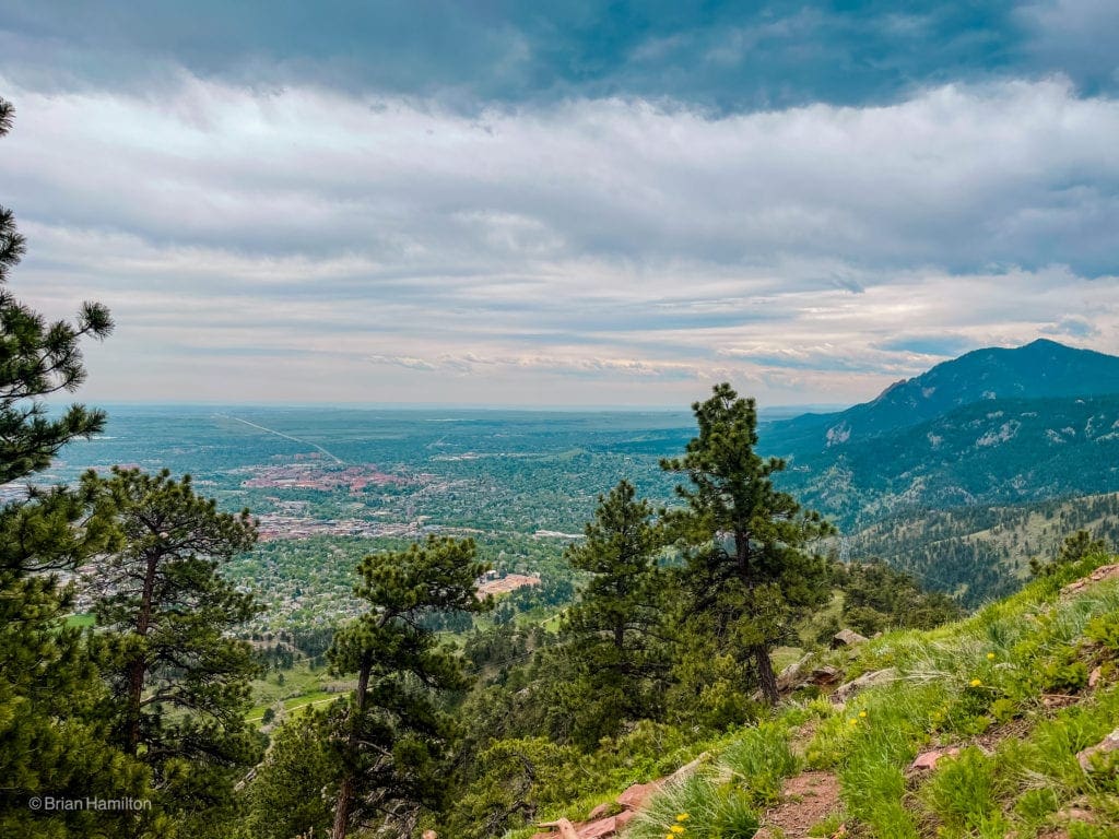
Boulder and the eastern edge of the Rocky Mountains. The collection of red roofs center-left is the main CU college campus.
You’ll know when you’ve finally arrived at the “top,” when you see a plaque installed into one of the rocks at the crest, along with a metal pole a few feet away.
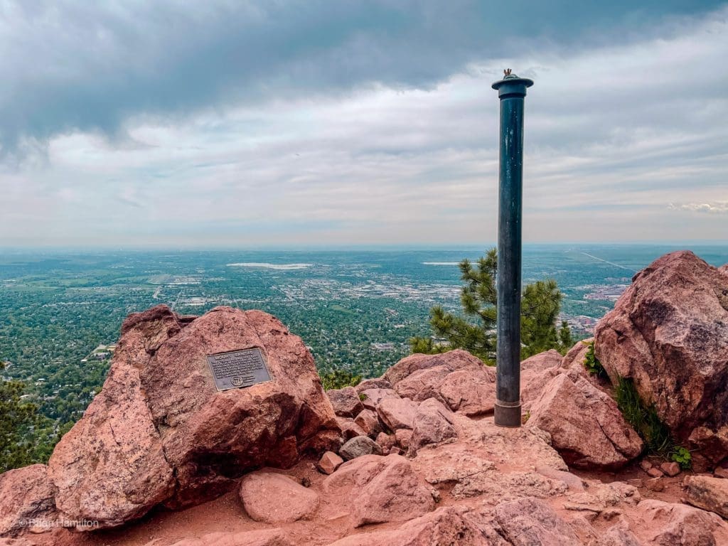
The “top” of Sanitas. The ridge continues to the north, but the true summit lies within private property.
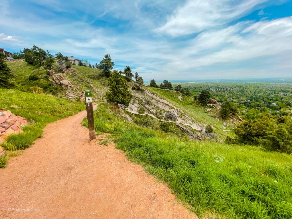
Once you’ve had your fill of the summit, continue west over the top and down the other side. Within a minute, you’ll see an intersection with the Lions Lair Trail. Continue through the junction and begin the descent of Mount Sanitas Trail.
Looking south along your descent ridge.
The trail down this ridge is well-traveled but also a bit rutted out from erosion. Watch your step. Depending on the time of year, you may be able to spot beautiful wildflowers growing out of wherever the roots can find purchase.
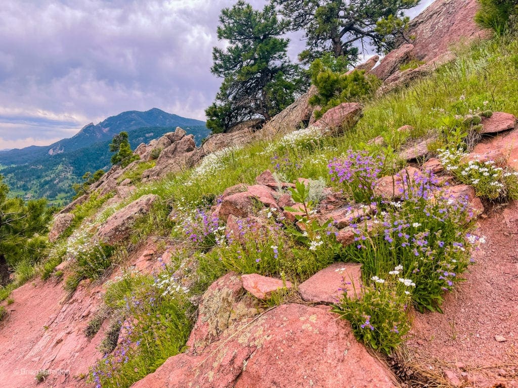
A collection of wildflowers next to the trail. Mouse Ear Chickweed (white) and Penstemon (purple) are visible.
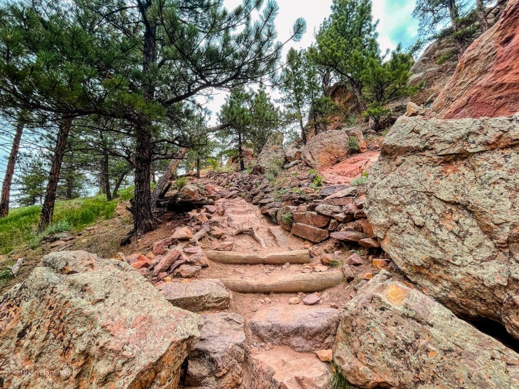
As the trail winds down to the bottom, the slope angle steepens once more, and sharply angled rocks grace the surround. This area is home to some impressive trail work as well.
Erosion mitigation work near the bottom of the trail.
Pretty soon, you’ll be able to see the parking lot you started from, descend to it and finish your hike.
Back to the start.

Final Thoughts:
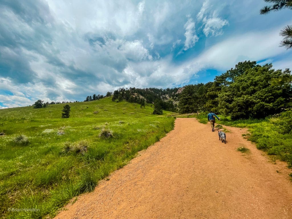
Skyblue Overland founder Brian Hamilton hiked this trail on May 26, 2021. The Mount Sanitas Loop is an awesome and challenging hike that is close to Boulder, Colorado. The scenery was incredibly beautiful on this partly sunny, spring day with TONS of wildflowers.
Photography for this article provided by Brian Hamilton. Skyblue Overland uses SmugMug, a paid image sharing, image hosting service, and online video platform on which users can upload photos and videos. The SmugMug also facilitates the sale of digital and print media for amateur and professional photographers. See Skyblue Overland’s Adventure Photo Galleries from the Best Trails in Colorado at SmugMug.com. Here is the entire Mount Sanitas Loop Trail Gallery:

Skyblue Overland Strongly Recommends That You Enroll With Global Rescue Prior To Embarking On Your Next Adventure.
With more people outside now more than ever, Global Rescue expanded services to include field rescue within 100 miles of home. With Local Field Rescue — automatically included in any travel protection services membership — Global Rescue is there whether you’re hiking, kayaking, snowmobiling, fishing or simply enjoying the outdoors and get ill or injured and you’re unable to get to safety on your own. Purchase a Global Rescue membership for your next adventure and travel with peace of mind. Single trip, annual and family options are available.
Top Adventure Sports Towns 2021: Boulder, Colorado
Guide to the Best Hiking Trails in Rocky Mountain National Park, Colorado
The Dyrt: The 10 Best Campgrounds In Colorado
Epic Adventures with the Best Guides In Colorado
Adventure Guide To Mesa Verde National Park, Colorado
Terms of Use:
As with each guide published on SKYBLUEOVERLAND.com, should you choose to this route, do so at your own risk. Prior to setting out check current local weather, conditions, and land/road closures. While taking a trail, obey all public and private land use restrictions and rules, carry proper safety and navigational equipment, and of course, follow the #leavenotrace guidelines. The information found herein is simply a planning resource to be used as a point of inspiration in conjunction with your own due-diligence. In spite of the fact that this route, associated GPS track (GPX and maps), and all route guidelines were prepared under diligent research by the specified contributor and/or contributors, the accuracy of such and judgement of the author is not guaranteed. SKYBLUE OVERLAND LLC, its partners, associates, and contributors are in no way liable for personal injury, damage to personal property, or any other such situation that might happen to individuals following this route.


