


High Point:
6,970 feet

Total Ascent:
1431 feet

Difficulty:
Moderate

Distance:
5.4 miles

Waypoints:
39.99742, -105.29282

Route Type:
Out and Back
Flagstaff Mountain, Boulder, Colorado’s 4th highest peak at 6,970 feet, offers stunning views of the Continental Divide, the Indian Peaks, and the plains. Rocky outcrops offer bouldering opportunities and the summit is perfect for picnicking. This is a popular trail for both hikers and trail runners.
Overview:
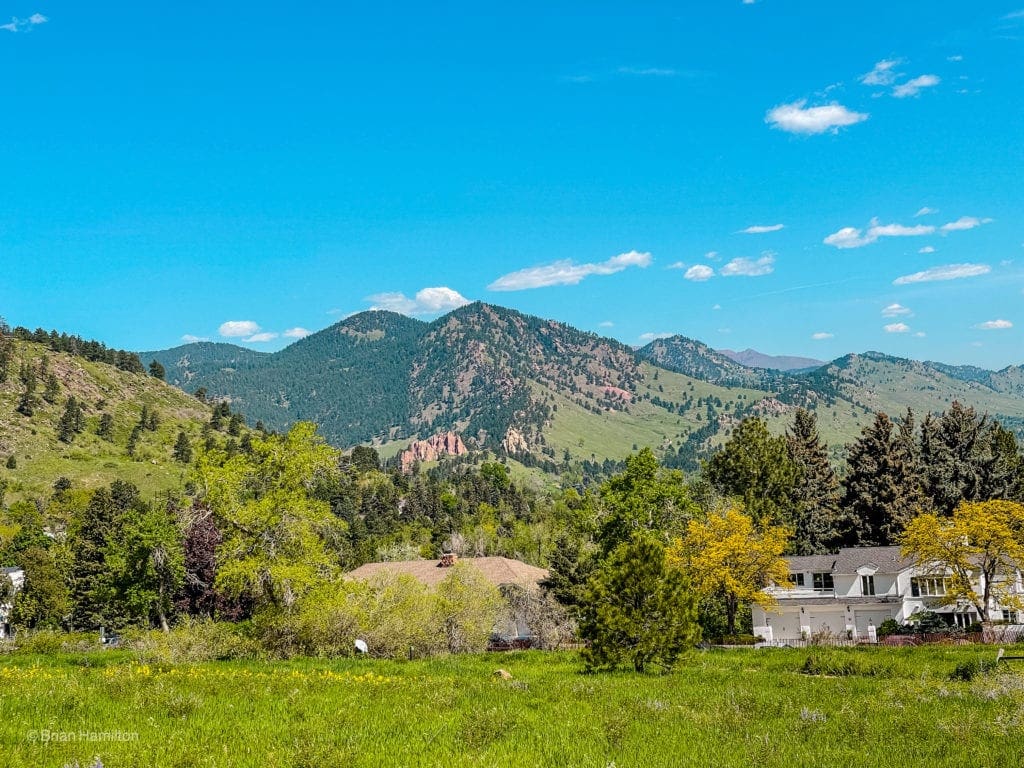
Flagstaff Mountain is a heavily visited area, but most people walk around the summit area after driving up Flagstaff Mountain Road. By tackling this mountain from the base, you get an understated and beautiful hike while avoiding the busy and windy Flagstaff Mountain Road. The variations described near the summit area also guarantee views of Boulder to the east and the often-snow-capped Continental Divide to the west.
Like most of the mountains near Boulder, Flagstaff packs a punch over a short distance, satisfying many training criteria for elevation gained over distance traveled. By utilizing Chautauqua Park and Gregory Canyon, visitors are also in the middle of an extensive trail network that makes dozens of combinations and loop options viable. While the summit area is forested and not as dramatic as Bear Peak or Sanitas, Flagstaff Mountain offers a multitude of ascent options, and well-marked trails near the summit plateau lead to rock outcroppings with stellar views.
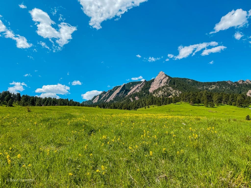
Awesome views of Spring wildflowers and the famous Boulder flatirons in Chautauqua Park. It’s a nice launching point for many classic trails.
The Ultimate Offline GPS Hiking & Ski Maps
See why onX Backcountry is the ultimate GPS navigation app for your outdoor pursuits. Try Today for Free. No credit card required.
Table of Contents:
Article Navigation: Click on any of the listed items in the table of contents below to jump to that section of the article. Similarly, clicking on any large, white section header will jump you back to the Table of Contents.
Directions to Trailhead:
Chautauqua Park is one of the main jumping-off points for hikes near Boulder and features one of the most iconic views of the Flatirons.
To get there, find the intersection of Broadway and Baseline if approaching from either the north, south or east. At the intersection, take Baseline west as it begins climbing towards the foothills. Keep a sharp eye to your left as soon as the buildings end for access to the Chautauqua Park Lot. If you miss it, or it’s full, there are many parallel parking spots along Baseline Road. If you get there early enough, you can park at Gregory Canyon Parking Lot, which will shave a mile roundtrip off your adventure. Chautauqua is free outside of busy summer weekends and holidays; Gregory Canyon is paid parking. You can find out more about that here.
Field Notes:
Chautauqua Park has a fascinating history tied to the Chautauqua education movement and reflects a lot of the pillars of the Boulder community: wellness in body, mind, and spirit. You can find out more about the history of the Park here and the history of the Chautauqua movement here.
For weather reports, use Boulder’s extended forecast to get started. Flagstaff Mountain rises high above the city, but its weather is relatively synonymous with Boulder’s and shouldn’t vary too much unless you hike in the winter or early spring, when snow may impact the higher portions of the hike.
Alpine flowers growing out of the rocks near Mays Point.
Places to Stay:
Boulder offers a ton of options from hotels to Airbnb that usually fit any budget type. Flagstaff is also within an hour of most of the northern Denver metro area, Longmont, Golden, Lyons, Berthoud, Loveland, and the southern reaches of Fort Collins. Camping is possible in some places near Boulder, but they would all require a bit of a drive. Some OK options include Gross Reservoir sites, Gordon Gulch Dispersed Area, and along old forest service roads near the Switzerland Trail.
Journal:
This is an out-and-back hike with many options for extensions. We’ll be describing the approach from Chautauqua Park, although you can start at Gregory Canyon. There is also a trail addition from Flagstaff summit that gets to a lovely overlook of the Continental Divide and is worth the extra effort.
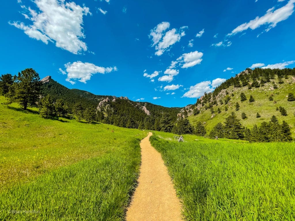
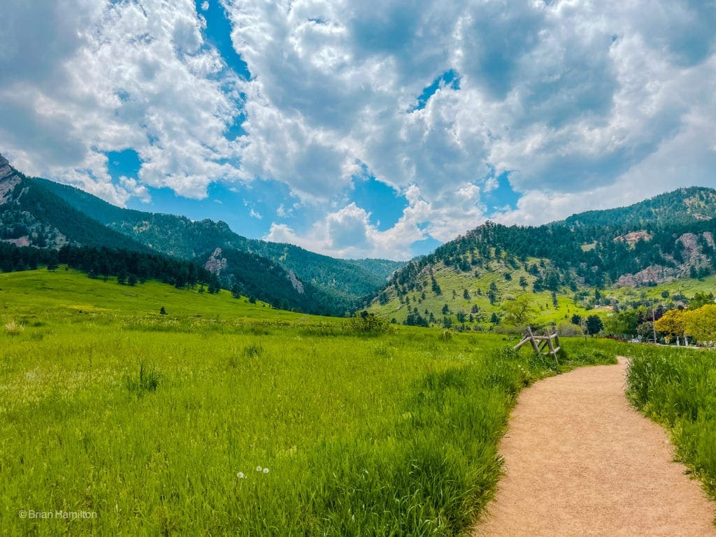
From the parking area, you can take either the Baseline or Meadow Trail west. They both merge together after 0.4 miles. Along this part, you’ll catch wonderful views of the Flatirons to the south and will be able to spot Mt. Sanitas to the north. You can read our Mt. Sanitas loop trail review here.
Mt. Sanitas is the rocky ridge in the center of the photo above the Red Rocks formation.
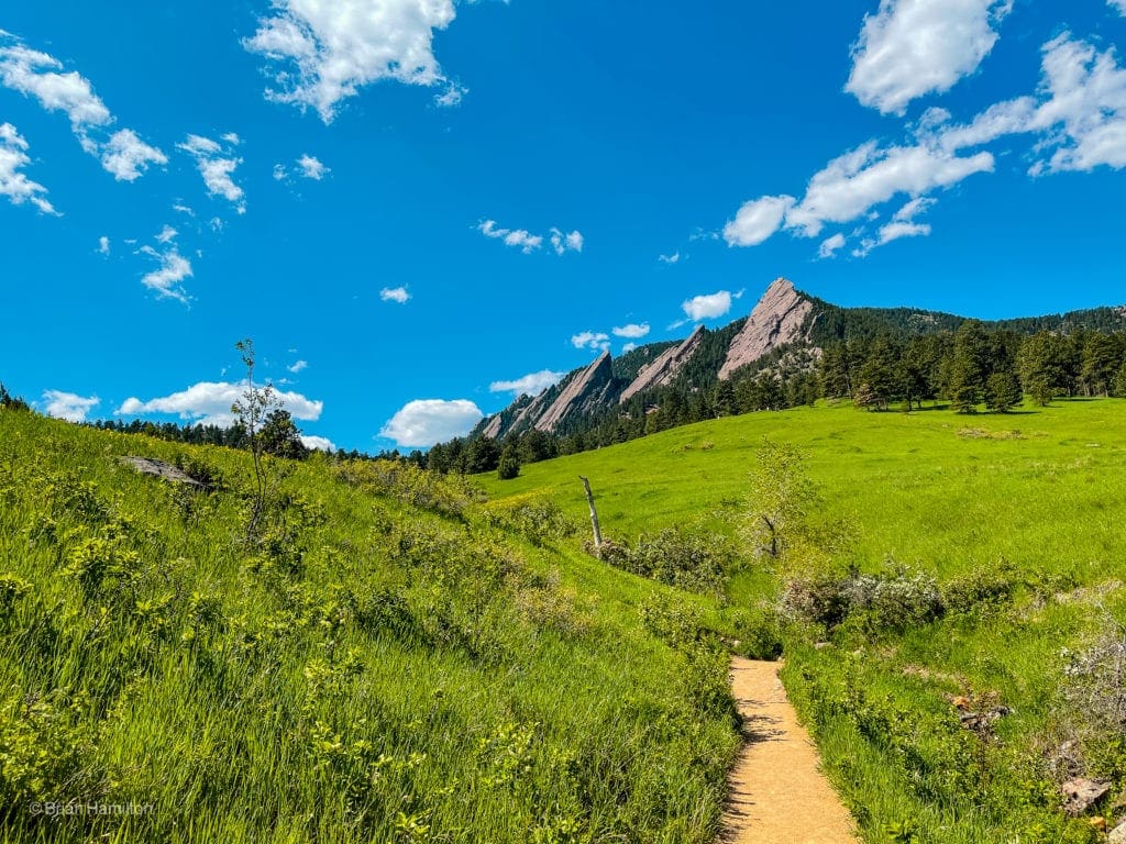
Looking to the Flatirons.
Once the trails merge, you’ll head towards Gregory Canyon, which is in-between the First Flatiron and the bulk of Flagstaff Mountain.
First Flatiron on the left, Saddle Rock formation in the middle, the start of Flagstaff Mountain to the right.
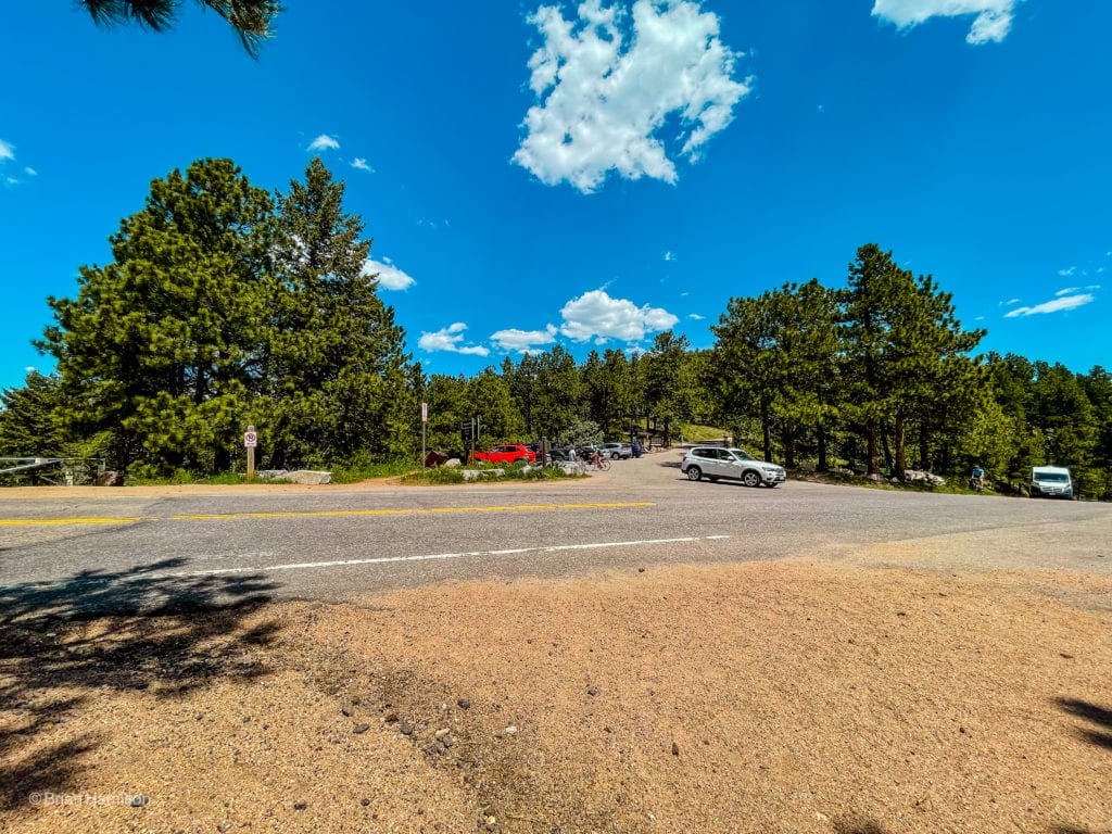
The trail will lead you to the small Gregory Canyon Parking Lot.
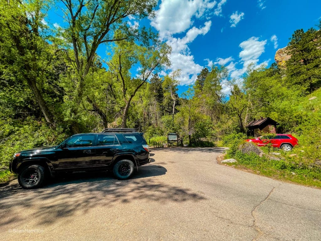
Cars in the lot at the Gregory Canyon Trailhead.
Once you pass through the parking lot, pick up the Gregory Canyon Trail and head west for just over a mile until coming up to a parking area along Flagstaff road. The Canyon trail is lovely and offers beautiful views of the region once you gain some elevation.
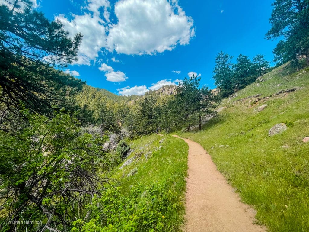
Looking west up Gregory Canyon.
At one point, you cross an arm of the seasonal Gregory Creek.
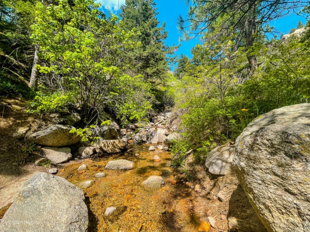
Creek crossing.
As you gain the ridge, there will be some great perspectives back down to Boulder.
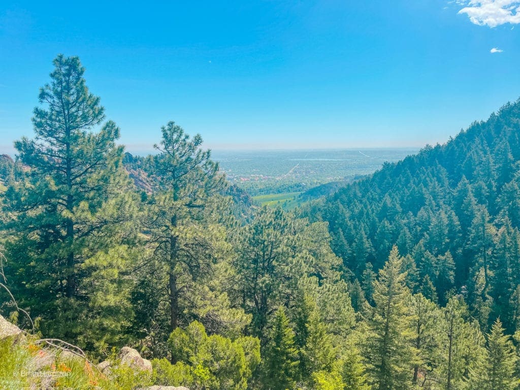
Back east down the canyon to Boulder. The green grass in the center of the photo is the meadow you crossed to start the hike.
Once you dispense with the canyon, you’ll need to cross Flagstaff Road.
The road crossing.
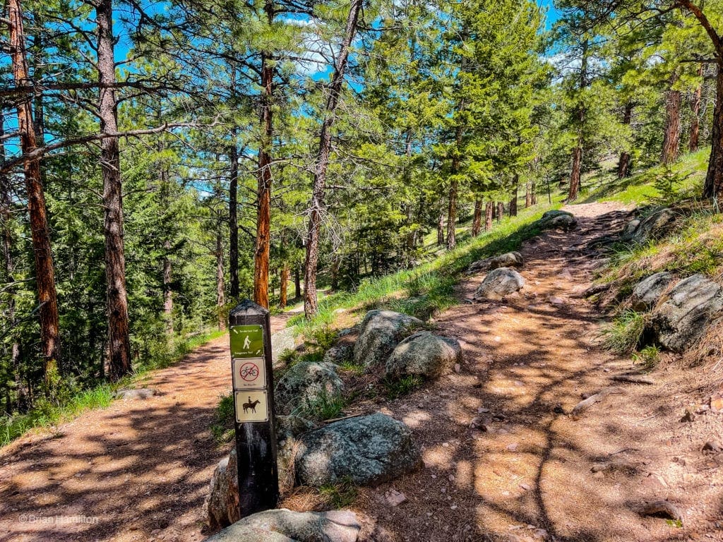
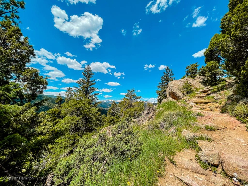
Once safely across, you’re within spitting distance of the top. There are quite a few trail options here to various viewpoints. For this adventure, take the Tenderfoot Trail from the parking area and then an almost immediate right onto the Rangeview trail.
Tenderfoot and Rangeview junction.
This variation leads away from the summit road for a spell and circles the northwestern side of the Flagstaff summit area. You’ll be rewarded with an excellent trail and glimpses west to the Continental Divide.
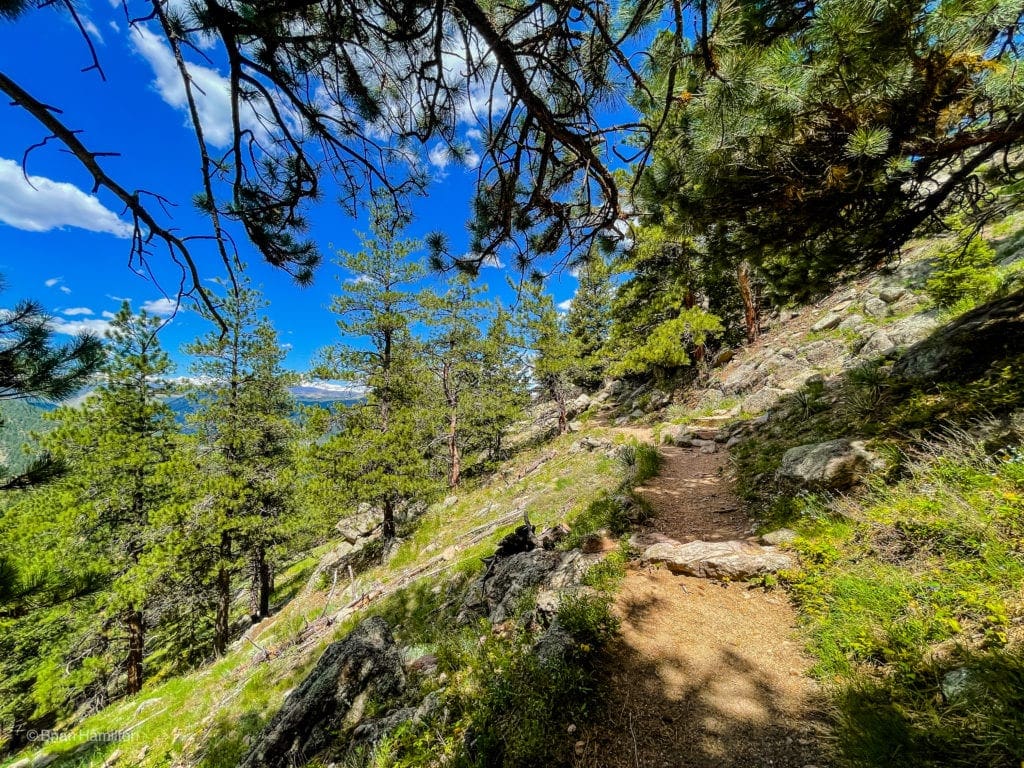
The trail is set nicely into the hillside.
Oscillating trees and open areas.
Enjoy the views as they come.
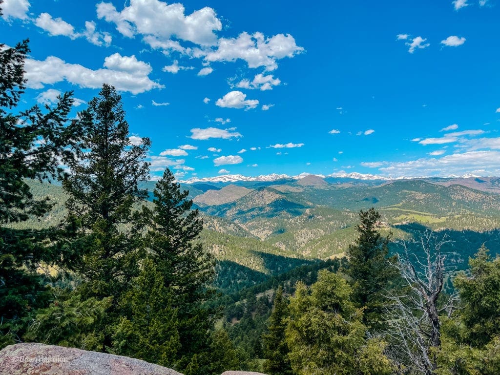
West to the high peaks of the Indian Peaks Wilderness.
Once the trail legs it east, the true summit will be south of you and through the trees. You’ll need to bushwhack to get to it, and the views are non-existence, but for peak baggers, that’s where it is.
After 0.6 miles, the trail intersects with the Ute Trail. Take a left for 0.1 miles until arriving at another junction with the Boy Scout Trail.
Junction with Boy Scout Trail.
Take the boy scout trail as it weaves around the summit plateau, offering views of downtown Boulder to the north.
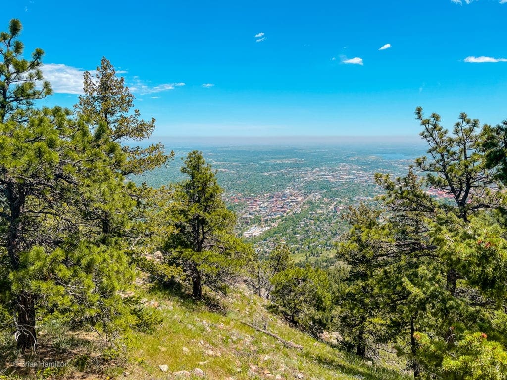
Downtown Boulder.
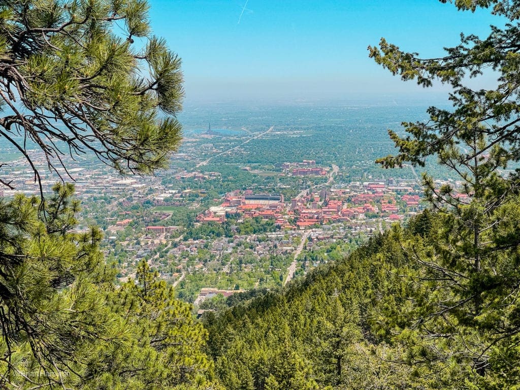
The main campus of CU from above.
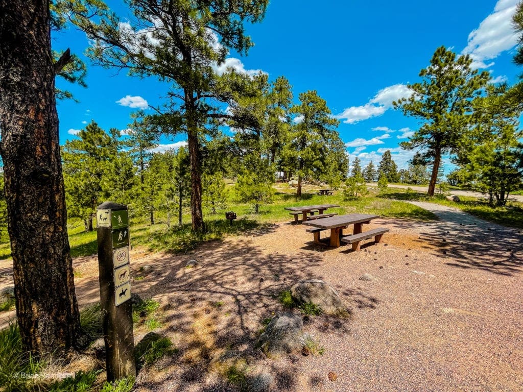
The trail will descend slightly to start before gaining again. You’ll pass a junction with Mays Point Trail, which is a worthy side trip. Continue on the Boy Scout Trail as it heads east. The Boy Scout Trail will end near the Flagstaff Nature Center.
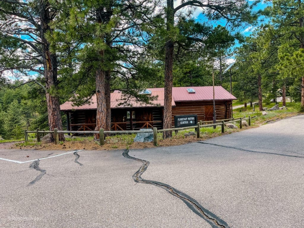
The Flagstaff Nature Center.
This is the logical endpoint of the hike. To your left, you can continue along the road to the Amphitheater, which provides another great perspective of Boulder. Stephen King wrote about the location in his novel: The Stand.
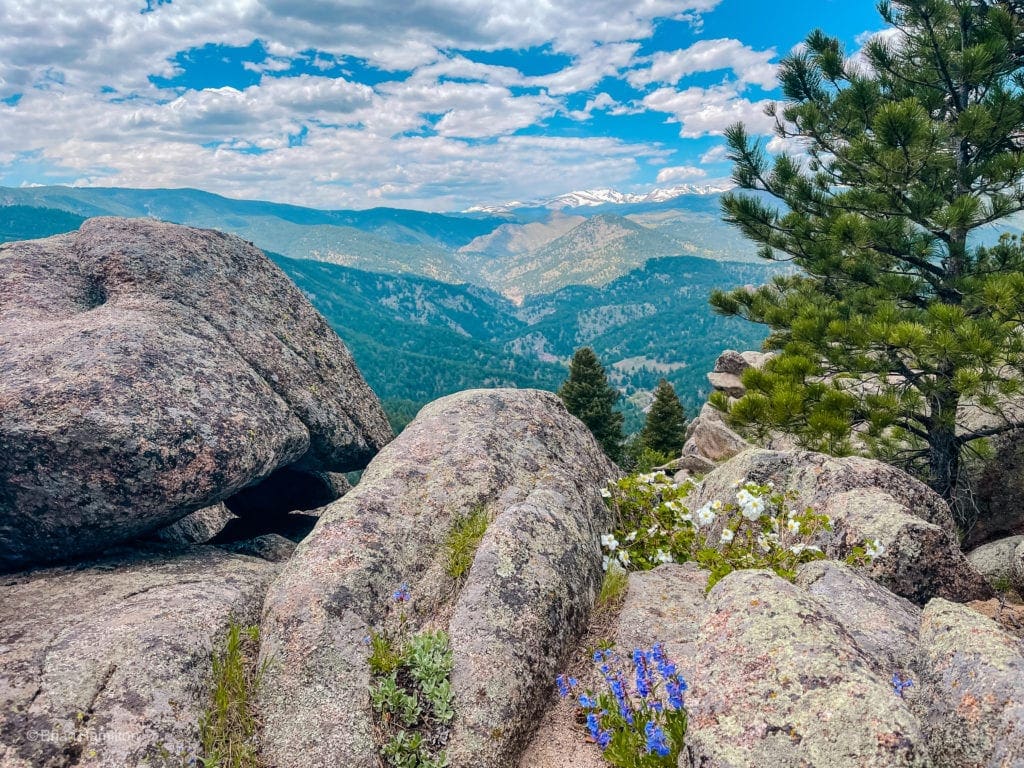
On the way back down the Boy Scout Trail, if you haven’t already done so, take the side trail to Mays Point. The rocky outcrop provides arguably the best view west on this hike.
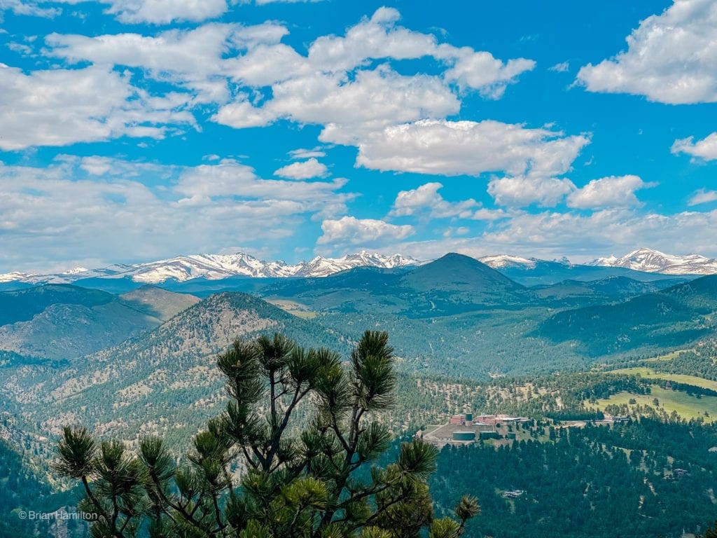
The Indian Peaks.
The rest of the hike follows the same path to the bottom of Gregory Canyon and across Chautauqua Park to your car. Take in the ease of access and bountiful scenery on a well-marked trail system right at the edge of Boulder.
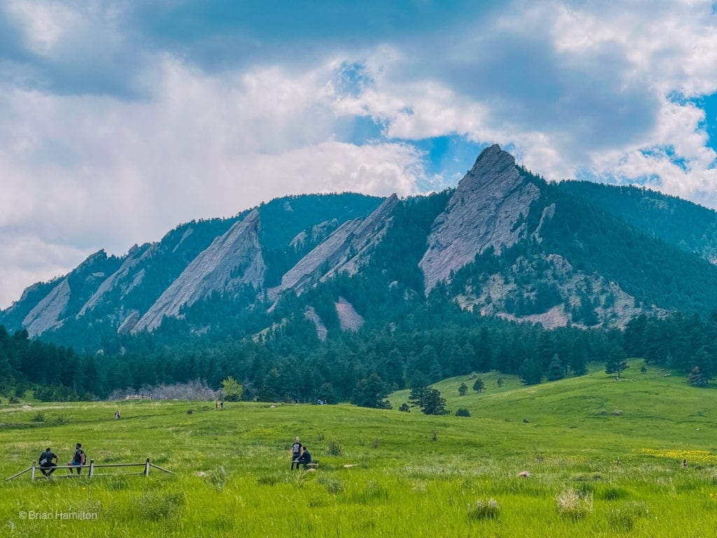
The Flatirons once more.
Looking back at Gregory Canyon and the bulk of Flagstaff Mountain to the right.
Final Thoughts:

Skyblue Overland founder Brian Hamilton hiked this trail on May 28, 2021. This trail is a nice warm up for the hiking season. He suggests taking the trail over to May’s Point. It’s not very far and leads to a beautiful view point of the valley and a the snow capped high country in the Indian Peaks Wilderness.
Photography for this article provided by Brian Hamilton. Skyblue Overland uses SmugMug, a paid image sharing, image hosting service, and online video platform on which users can upload photos and videos. The SmugMug also facilitates the sale of digital and print media for amateur and professional photographers. See Skyblue Overland’s Adventure Photo Galleries from the Best Trails in Colorado at SmugMug.com. Here is the entire Flagstaff Mountain Summit via Gregory Canyon Trail Gallery:
Popular Articles:
- Guide to the Best Hiking Trails in Rocky Mountain National Park, Colorado
- The Dyrt: The 10 Best Campgrounds In Colorado
- Top Adventure Sports Towns 2021: Boulder, Colorado
- Epic Adventures with the Best Guides In Colorado
- Bear Lake Nature Trail, Rocky Mountain National Park, Colorado
- Mills Lake via Glacier Gorge Trail, Rocky Mountain National Park, Colorado
- Black Lake Via Glacier Gorge Trail, Rocky Mountain National Park, Colorado
- Lake Haiyaha Trail, Rocky Mountain National Park, Colorado
- Sky Pond via Glacier Gorge Trail, Rocky Mountain National Park, Colorado

Skyblue Overland Strongly Recommends That You Enroll With Global Rescue Prior To Embarking On Your Next Adventure.
With more people outside now more than ever, Global Rescue expanded services to include field rescue within 100 miles of home. With Local Field Rescue — automatically included in any travel protection services membership — Global Rescue is there whether you’re hiking, kayaking, snowmobiling, fishing or simply enjoying the outdoors and get ill or injured and you’re unable to get to safety on your own. Purchase a Global Rescue membership for your next adventure and travel with peace of mind. Single trip, annual and family options are available.
Memberships start at $119.
Terms of Use:
As with each guide published on SKYBLUEOVERLAND.com, should you choose to this route, do so at your own risk. Prior to setting out check current local weather, conditions, and land/road closures. While taking a trail, obey all public and private land use restrictions and rules, carry proper safety and navigational equipment, and of course, follow the #leavenotrace guidelines. The information found herein is simply a planning resource to be used as a point of inspiration in conjunction with your own due-diligence. In spite of the fact that this route, associated GPS track (GPX and maps), and all route guidelines were prepared under diligent research by the specified contributor and/or contributors, the accuracy of such and judgement of the author is not guaranteed. SKYBLUE OVERLAND LLC, its partners, associates, and contributors are in no way liable for personal injury, damage to personal property, or any other such situation that might happen to individuals following this route.


