


High Point:
~8,460 feet

Total Ascent:
2,600 feet.

Difficulty:
Hard

Distance:
~5 miles

Waypoints:
39.9715, -105.2634

Route Type:
Out and Back

Table of Contents:
Article Navigation: Click on any of the listed items in the table of contents below to jump to that section of the article. Similarly, clicking on any large, white section header will jump you back to the Table of Contents.
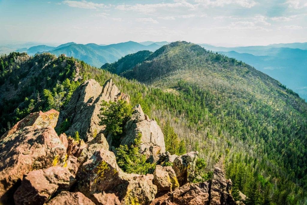
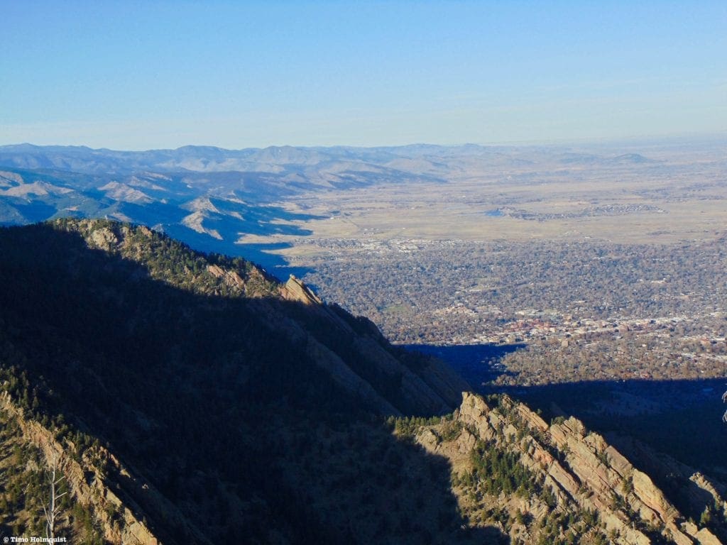
Looking south from the summit of Bear Peak.
Overview:
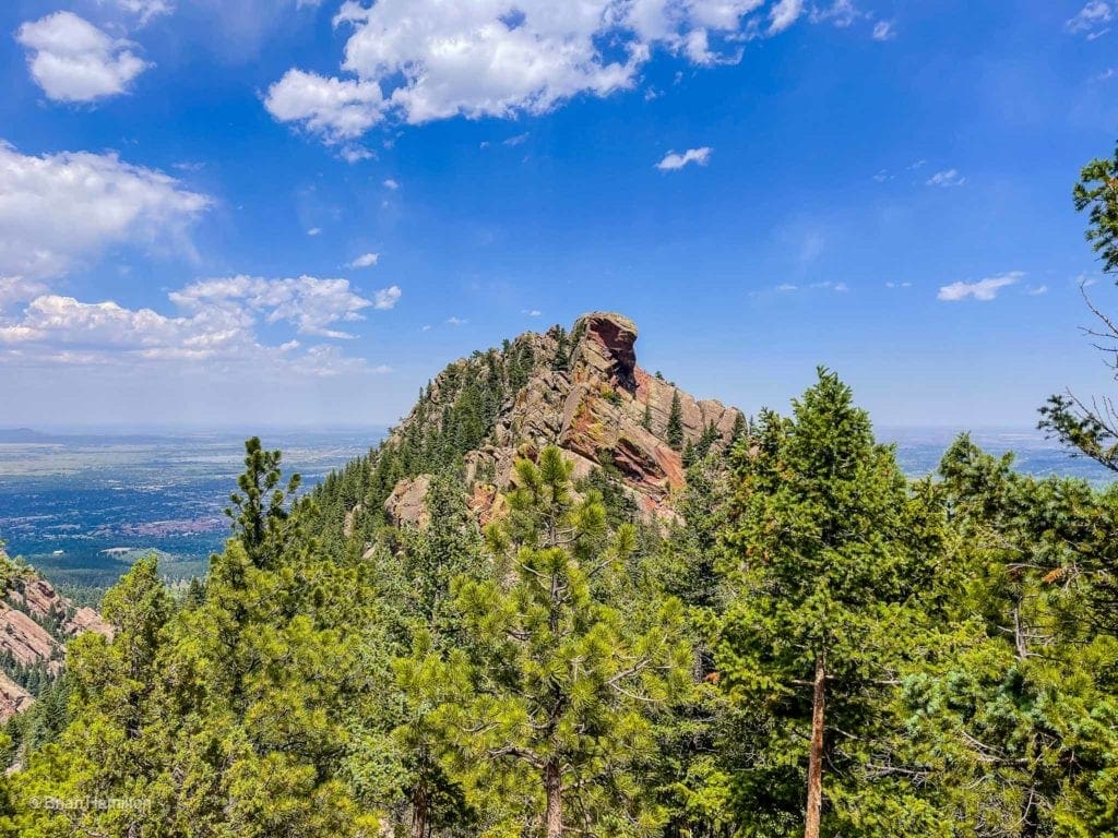
Of the five mountains lining Boulder’s western skyline, Bear Peak is the most spectacular. Only slightly lower than its neighbor South Boulder Peak: Bear Peak demands a committing and tiring hike to its summit no matter which trail you decide to use. Because it is part of the eastern line of the Rocky Mountains, its nearly 3,000-foot vertical relief from the plains gives it a grandiose and imposing profile. Bear Peak also contains many of the lesser-known Flatirons rock formations along its eastern flank and provides hundreds of routes for ambitious climbers. The summit itself is situated atop a thin rib of rock that provides a short, but airy and heart-pumping scramble more in line with the epic summits of Rocky Mountain National Park than the foothills.
Bear Peak belongs on every Boulder hiking list and is a repeat summit in every sense of the word. Budget some time and good weather for this one as the summit rocks are exposed. While relatively low in elevation compared to the behemoths along the Continental Divide, the effort to attain Bear Peak is sizable and shouldn’t be taken lightly. If you’re new to the area or new to hiking, bookmark Bear Peak but train up on some of the other less demanding local favorites before committing to it. Visit our trail reviews on Mount Sanitas, Flagstaff Mountain, Eldorado Canyon, and Walker Ranch to get those legs in shape for this relentless climb to a rocky and memorable summit.
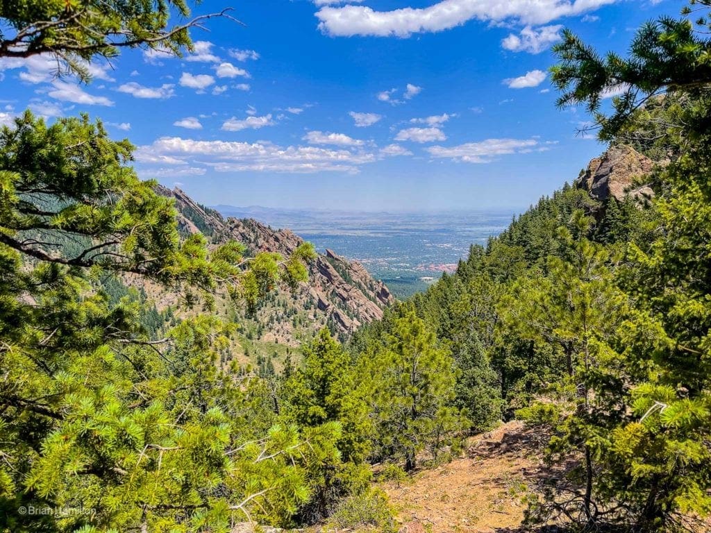
A window to where the plains meet the mountains.
The Ultimate Offline GPS Hiking & Ski Maps
See why onX Backcountry is the ultimate GPS navigation app for your outdoor pursuits. Try Today for Free. No credit card required.
Directions to Trailhead:
There are a few ways to tackle this beast. The least distance is an out and back variation from the end of Cragmoor Street in the Shanahan neighborhood. This trail review will be written from that perspective, although many people start at the easily identifiable NCAR center. Short for the National Center for Atmospheric Research, NCAR is a set of buildings roughly 750 feet higher than Boulder on a ridge extension with fantastic views of the city and Bear Peak rising ominously behind it. The parking lots at Cragmoor and NCAR are free, though, on high use days, the larger lot at NCAR may be a good backup in case Cragmoor is full.
To get to the Cragmoor Trailhead, find CO 93, which turns into Broadway once it enters Boulder. If approaching from the south, take a left on Greenbriar Boulevard right after you enter the city. Follow the road as it loops around the edge of several neighborhoods. Eventually, the road will change names to Lehigh Street and pass the Shanahan Ridge Trailhead on your left. This is your first parking option. To find Cragmoor, continue on Lehigh as it turns north, taking a quick left on Cragmoor Road and finding parallel parking at the end of the road where a trailhead is obvious.
If you are approaching from the north, take Broadway south until hitting the intersection with Table Mesa Drive. Here, take Table Mesa west until the divided road comes together, and you can take a left on Lehigh Street. Take Lehigh south, passing Mesa Elementary School. The next left you can take will be on Cragmoor, which will dead-end at the trailhead.
To get to NCAR, find the intersection between Table Mesa Drive and Broadway. Take Table Mesa Drive west as it gains elevation. When the houses end, the road changes names to NCAR road, and it continues rising into the foothills, eventually reaching the eye-catching NCAR center. Find a space to park in the giant lot head and west toward the NCAR Trail, which begins at a trailhead sign right along NCAR road. Both of these trailheads are less than an hour from most of Denver and north to Fort Collins, meaning easy access for a large swath of the northern Front Range MSA.
An optional method to access Bear Peak is from South Mesa Trailhead. From here, you can ascend via Shadow Canyon and tag South Boulder peak along the way to Bear. This method, while not as punishing as the Fern Canyon approach from Cragmoor and NCAR, will net you more total elevation gain. Check the field notes section below for the parking situation at South Mesa—there may be fees involved.
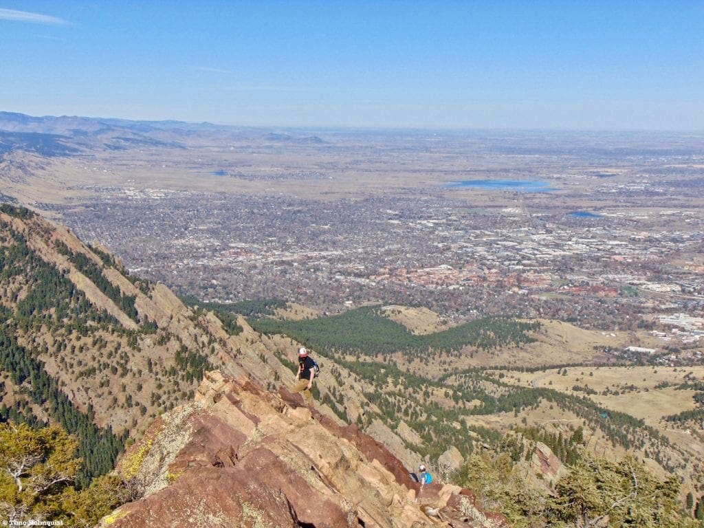
Looking down the summit ridge scramble with Boulder in the background.
Field Notes:
Regardless of how you choose to climb Bear Peak, know that it is a highly trafficked area, and leave no trace practices are strongly encouraged. The city of Boulder has done a great job protecting open spaces, and it’s incumbent upon all future hikers to keep them open and pristine. If you can pack it in, you can pack it out.
Since the hike begins right on the edge of town, Boulder’s extended forecast should be a great weather resource. Keep in mind that Bear Peak is usually 3-5 degrees cooler than the city, and the wind can be a lot stronger up high. Opensummit has a great local forecast for Bear Peak but will only show updates two days out unless you pay for their extended service. Generally, you want to check the weather most frequently in the 24 hours before launching, so that shouldn’t be an issue. Any mountain forecast three or more days out is likely going to change; that’s pretty standard fare for any largely mountainous terrain. Keep refreshing those forecasts until it’s time to go.
Parking at the two Shanahan Ridge trailheads and at NCAR is free, but if you decide to use the South Mesa Trailhead, it’ll be five dollars to park unless your car is registered in Boulder County. There are ways to connect to Bear Peak from other trailheads, although it makes for a long day. Gregory Canyon and points along Flagstaff Road are also pay-to-play unless you have Boulder county car registration. You can find a complete list of paid parking areas here.
A short list of recommended items for this hike includes three liters of water, sunscreen/hat, rain shell/pants, and a decent amount of nutrition.
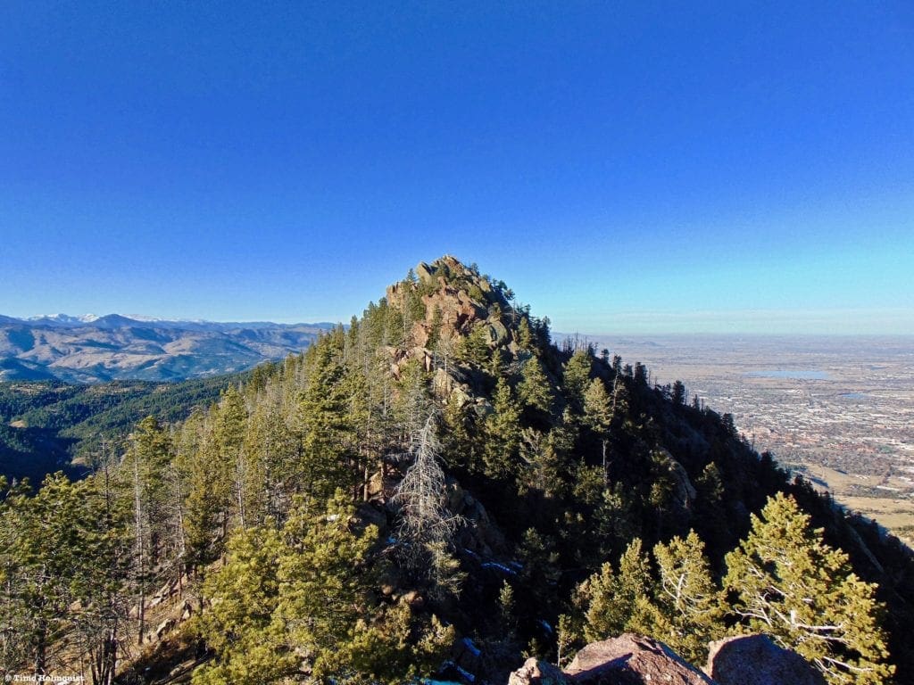
The summit, seen from a connecting ridge to the south.
Places to Stay:
Due to its proximity to major urban areas, there are numerous places to stay within an hour of Bear Peak. Any town along US 36, west of I-25, will work. The city of Boulder also has a ton of fun and interesting lodging options. From the north: Loveland, Longmont, and Fort Collins work as well. Eldorado Springs is also a nice option if you’re planning on visiting the State Park there and doing multiple hikes in the region.
Camping is a bit harder to find, considering Bear Peaks’ location. There are dispersed camping locations off of old forest service roads near Switzerland Trail, but a high clearance vehicle is recommended to access those. Gordon Gulch is a nice option near Nederland but isn’t the closest to your trailhead. A little further to the north is Carter Lake, which sports multiple campgrounds and is on a lakeshore. Gross Reservoiris a bit closer to town and includes a popular set of first-come-first-served sites. The Gross Reservoir area is a favorite amongst college kids from CU and may not be quiet.
If you have friends in the area or are willing to spend on a place to stay the night, that may be the most hassle-free way to set yourself up for Bear Peak.
Shadows reaching out to Boulder in the late afternoon light.
Journal:
How you climb Bear Peak all depends on where you’re coming from. From the north, it’s easier to find NCAR because it is such an obvious landmark. From points east, the Shanahan Ridge/Cragmoor variation is a great alternative that tends to avoid the crowding common at NCAR. If you’re coming in from points south and have five dollars to spare, the South Mesa Trailhead may be the most suitable.
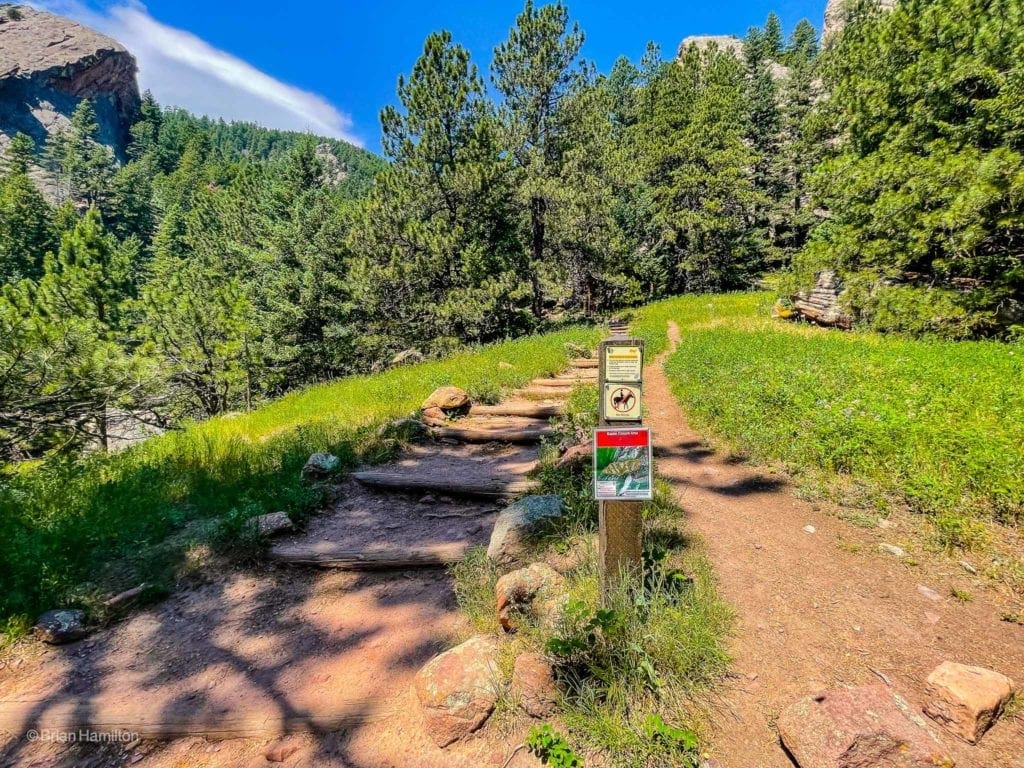
Regardless, once you park, get a good stretch in before you take off; this is a relentless uphill climb. If you start at either of the Shanahan Trailheads, head west, following the well-marked signs. From Cragmoor, you’ll take a spur trail that leads to Shanahan North Fork.
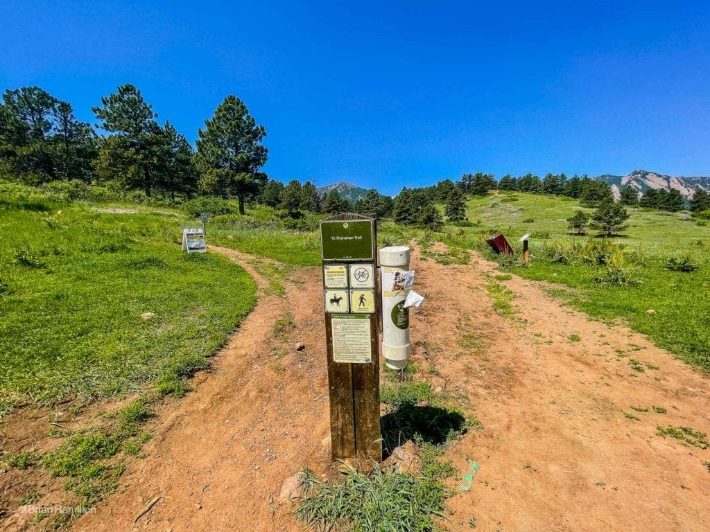
Starting from Cragmoor Trailhead.
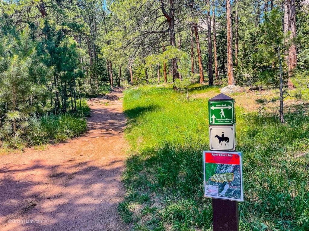
Once on the Shanahan North Fork, ascend at a nice easy slope angle until running into the Mesa Trail. You want to continue west toward Fern Canyon. The junction with Mesa Trail is roughly one mile into your hike. As you continue west, the trail will change names to the Shanahan Mesa Trail.
Full steam ahead.
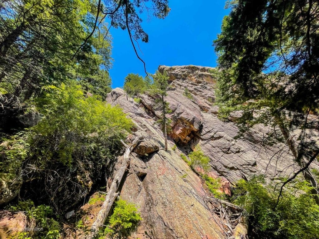
The trail width reduces in size, and you’ll see rocky ridges lining the horizon as the trail weaves around their intimidating bulk.
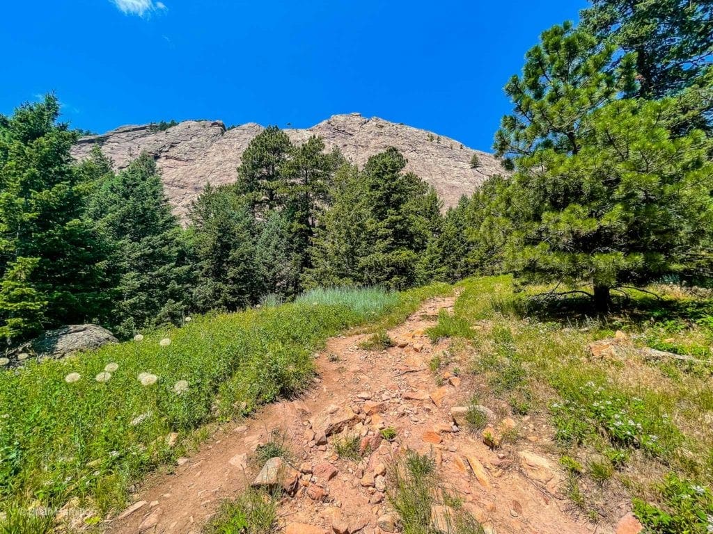
Impressive rock ridges rising up near the entrance to Fern Canyon.
Once you circle to the right of these rock walls, a junction with Fern Canyon will appear; take a left onto it.
The toughest elevation gain begins here.
From NCAR, proceed west from the parking lot on the NCAR trail until it intersects with the Mesa Trail. Take Mesa south until running into the intersection with Fern Canyon, where you’ll take a right. Alternatively (and only when it’s open), you can take the Bear Canyon trail as well, which will lead you on a trail that wraps around the backside of Bear Peak before ascending from the West Ridge.
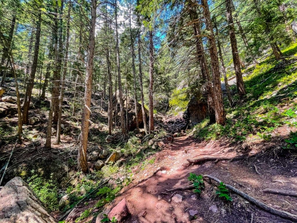
The treed lower portion of Fern Canyon.
Once you’re in Fern Canyon, prepare for a stiff climb up and a shaky knees descent. The trail is fairly rocky and only seems to get rockier the higher you climb, though shade relief should be easy to find initially.
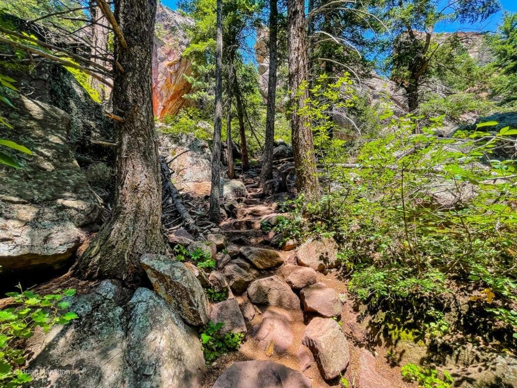
The Rocky Fern Canyon Trail.
Fern Canyon itself is shallow and thin, with many rock formations gracing each side.
One of many rock walls along the trail.
As you ascend, partial views back to the east will open up.
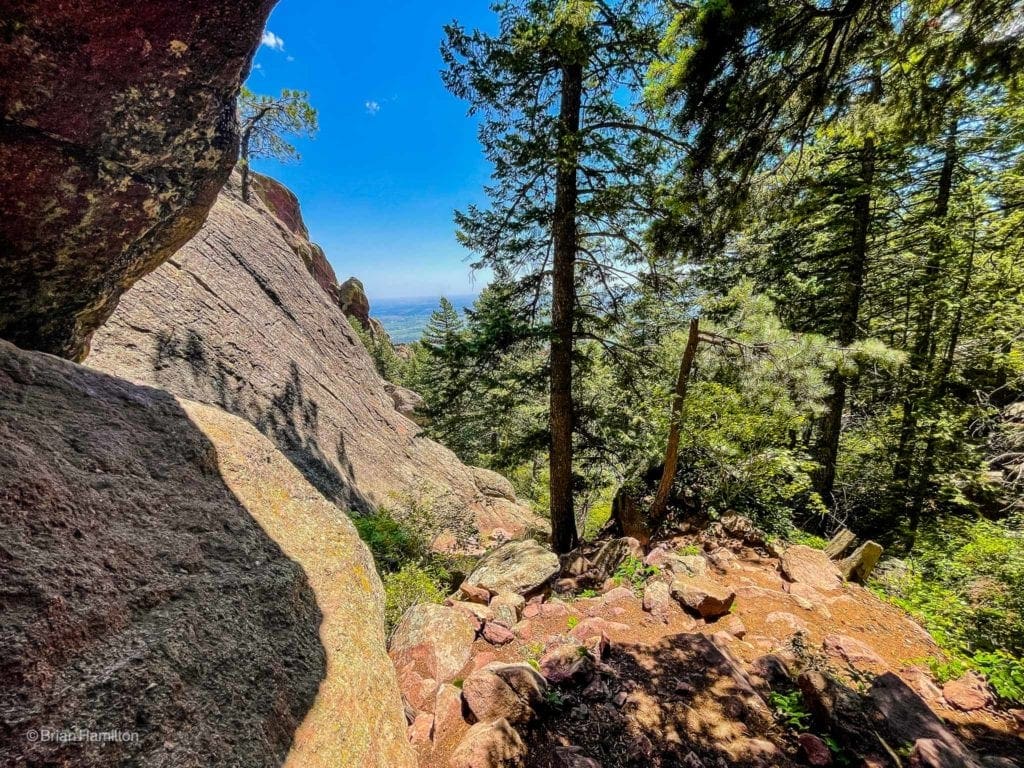
The mesas to the east, visible through a window between rock and tree.
After some more sections of steep trail, you’ll begin to pop out of the canyon and head towards the ridgeline.
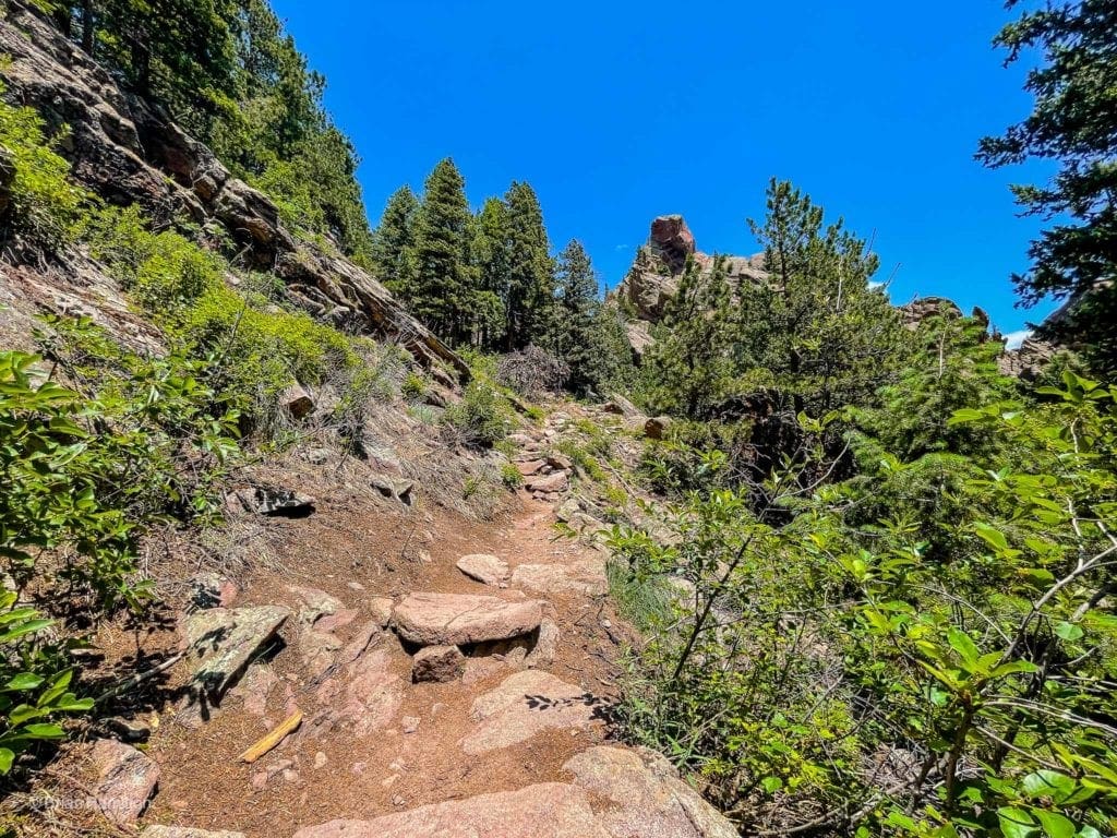
Nearing the ridge.
When the trail meets the ridge, it’ll take a sharp left turn and head south to the summit. This stretch of the journey provides some excellent views of the diagonal bands of rock on Green Mountain to the north.
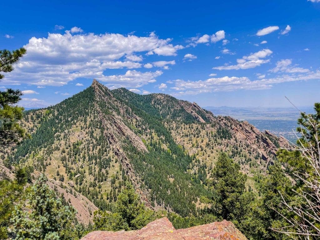
Green Mountain, with Boulder in the flatlands beyond.
Despite the momentary respite of being on a prominent ridge, the trail continues its blistering route uphill.
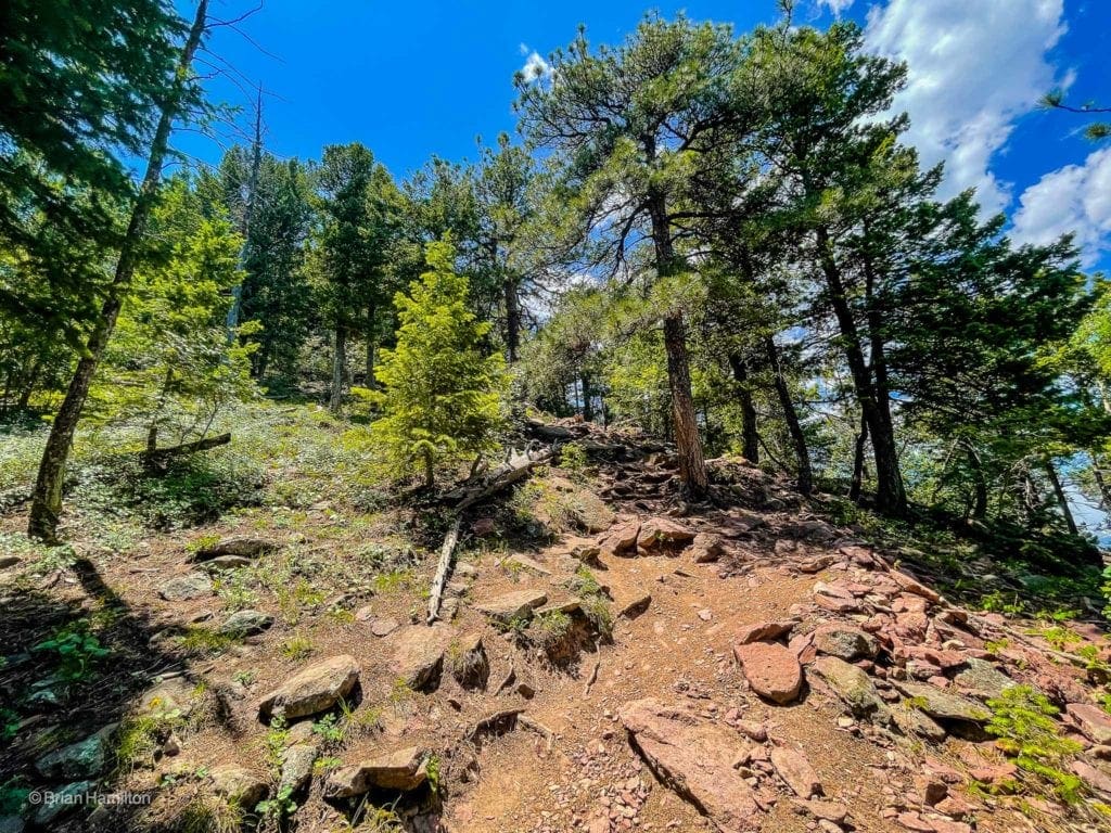
Continuing to rise.
Take your time and take breaks as often as they are needed.
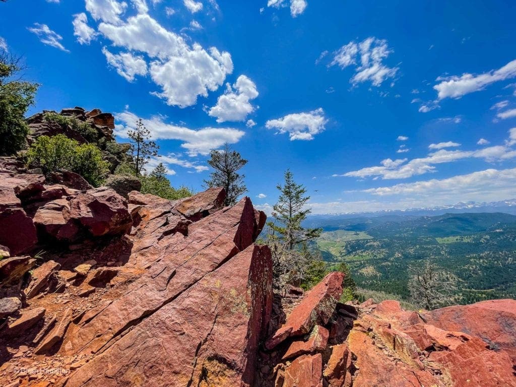
One of the indicators that you are close to the summit is an open area with red rocks where views to both the east and west open up.
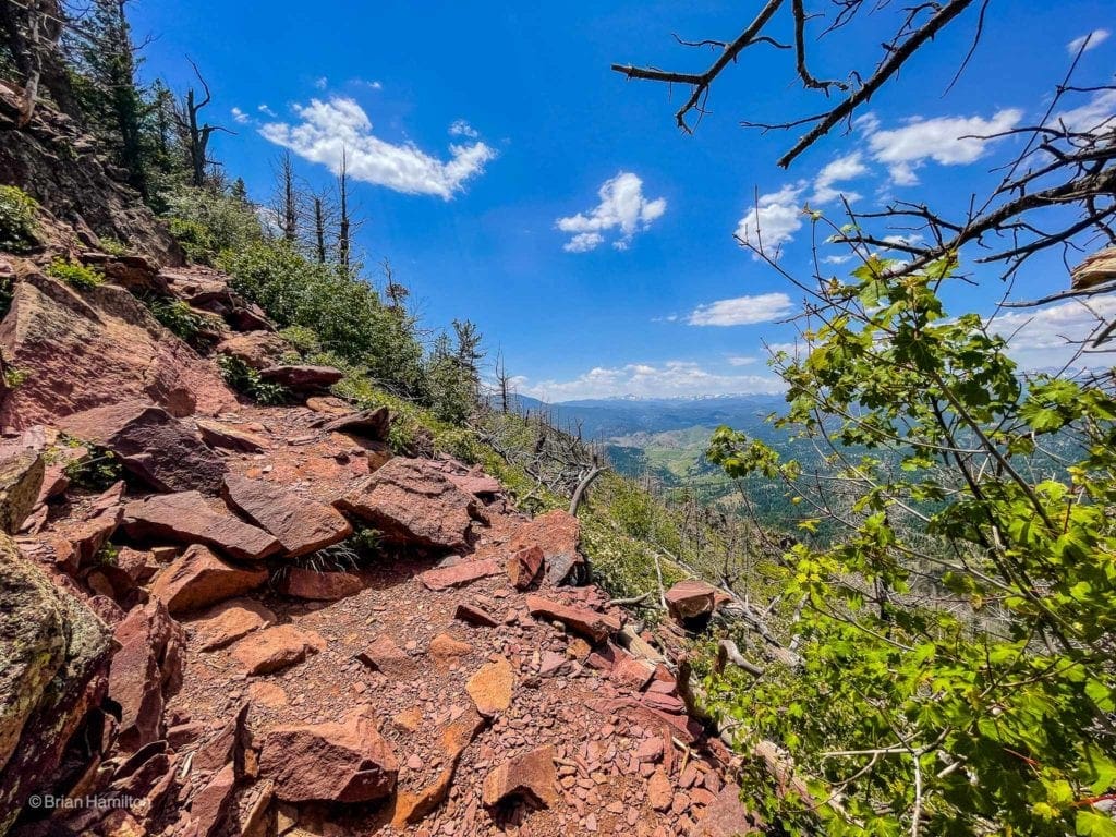
Views to the west.
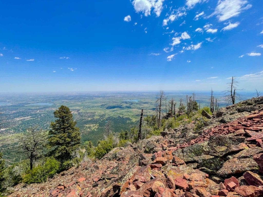
Views to the southeast.
Just below the summit scramble, you’ll connect with a trail coming from the west side of the peak. Many people opt to stop here, as it’s only a hiking journey to this point.
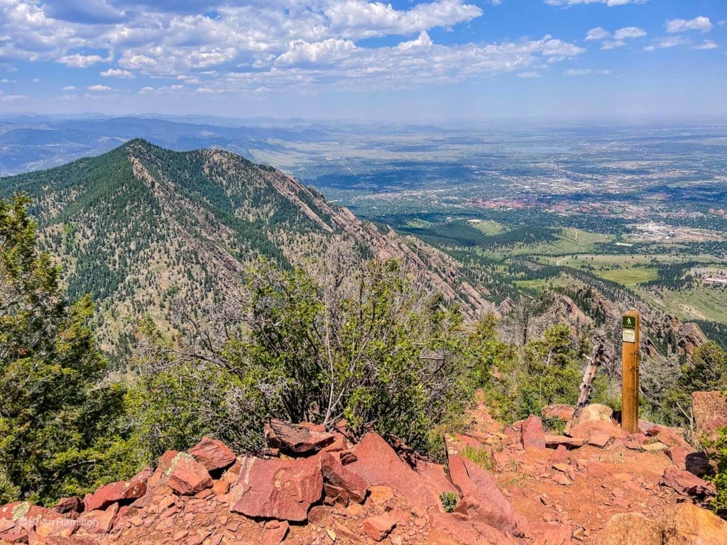
The trail sign right below the rocky crest of Bear Peak.
For those interested in adding some extra spice, continue south along the rocks for a brief Class 3 scramble to Bear Peaks airy and awesome summit. You cannot see the absolute highest point from the trail sign below the scramble. The views from the top, whether or not you choose to scramble, are excellent.
The scramble heads left along the height of land and goes with fairly simple navigation, though the exposure on the west and east sides can feel substantial.
From the top, you have a few choices to consider. You can retrace your steps through Fern Canyon, which is quicker but tough on the knees. You can also loop in the West Ridge trail to Bear Canyon and make a loop out of it as long as both Fern Canyon and Bear Canyon are open. You can also continue south to South Boulder Peak for a quick out and back, or connect with Shadow Canyon and head down that way. Options abound.
The summit rocks of Bear Peak.
If you head down the way you came up, remember that the top is only halfway. Most accidents happen on the descent because we’re tired and aren’t focusing on where we place our feet. Stay sharp, stay hydrated, and watch your step on the way down until you are off the mountain and back to the mesas and grassy ridges below.
Final Thoughts:
Bear Peak is a fun and challenging hike less than six miles from downtown Boulder. Its steep profile, lung-busting ascent, and brief but rocky scramble to the top make it a unique summit in any season. For the fit and motivated, Bear Peak is a prime hiking destination and one of the many reasons the Boulder area is such a sought-after outdoor recreation mecca.
Photography for this article provided by Brian Hamilton, who hiked this trail on June 22, 2021. Skyblue Overland uses SmugMug, a paid image sharing, image hosting service, and online video platform on which users can upload photos and videos. The SmugMug also facilitates the sale of digital and print media for amateur and professional photographers. See Skyblue Overland’s Adventure Photo Galleries from the Best Trails in Colorado at SmugMug.com. Here is the entire Bear Peak via Fern Canyon Trail Gallery:
Popular Articles:
- Guide to the Best Hiking Trails in Rocky Mountain National Park, Colorado
- The Dyrt: The 10 Best Campgrounds In Colorado
- Top Adventure Sports Towns 2021: Boulder, Colorado
- Epic Adventures with the Best Guides In Colorado
- Bear Lake Nature Trail, Rocky Mountain National Park, Colorado
- Mills Lake via Glacier Gorge Trail, Rocky Mountain National Park, Colorado
- Black Lake Via Glacier Gorge Trail, Rocky Mountain National Park, Colorado
- Lake Haiyaha Trail, Rocky Mountain National Park, Colorado
- Sky Pond via Glacier Gorge Trail, Rocky Mountain National Park, Colorado

Skyblue Overland Strongly Recommends That You Enroll With Global Rescue Prior To Embarking On Your Next Adventure.
With more people outside now more than ever, Global Rescue expanded services to include field rescue within 100 miles of home. With Local Field Rescue — automatically included in any travel protection services membership — Global Rescue is there whether you’re hiking, kayaking, snowmobiling, fishing or simply enjoying the outdoors and get ill or injured and you’re unable to get to safety on your own. Purchase a Global Rescue membership for your next adventure and travel with peace of mind. Single trip, annual and family options are available.
Memberships start at $119.
Terms of Use:
As with each guide published on SKYBLUEOVERLAND.com, should you choose to this route, do so at your own risk. Prior to setting out check current local weather, conditions, and land/road closures. While taking a trail, obey all public and private land use restrictions and rules, carry proper safety and navigational equipment, and of course, follow the #leavenotrace guidelines. The information found herein is simply a planning resource to be used as a point of inspiration in conjunction with your own due-diligence. In spite of the fact that this route, associated GPS track (GPX and maps), and all route guidelines were prepared under diligent research by the specified contributor and/or contributors, the accuracy of such and judgement of the author is not guaranteed. SKYBLUE OVERLAND LLC, its partners, associates, and contributors are in no way liable for personal injury, damage to personal property, or any other such situation that might happen to individuals following this route.


