


High Point:
~7340 feet

Total Ascent:
~1800 feet

Difficulty:
Hard

Distance:
7.9 miles

Waypoints:
39.95120, -105.33773

Route Type:
Loop
Walker Ranch is a great four-season loop hike near Boulder, with 7.6-10 miles of trail ideal for training, running, and mountain biking. It offers views, two river crossings, open ridge top walking, meadows, pine forests, rock formations, and access to Gross Reservoir. It’s possible to complete multiple laps for longer distances.

Overview:
Walker Ranch is one of the best four-season loop hikes in the Boulder area, giving users anywhere from 7.6-10 miles of trail. It’s a great training hike, trail run, and mountain biking circuit. The options to extend the loop exist in a few different places by connecting to the Meyers Homestead Trail via the Josie Heath Trail or connecting with the six-mile Eldorado Canyon Trail. Mountain biking is not allowed on the Eldorado Canyon Trail, but hiking is fine.
There are two significant uphills regardless of whatever way you choose to perform the loop. Trail signs are plentiful, and the trail itself is in excellent shape. Walker Ranch also benefits from its location behind the popular magnets of Flagstaff Mountain, Green Mountain, Bear Peak, and South Boulder Peak. The three parking lot options also help spread out the crowds.
If you’re looking for a chance to get outside close to Boulder, Walker Ranch is a great option. The trail features abundant views, two river crossings, open ridge top walking, meadows, pine forests, and interesting rock formations. Because the trail is a well-marked loop, it’s possible to run or hike multiple laps if your goal is to get a certain distance in. The loop is also close to the Gross Reservoir, another highlight of the region.
The Ultimate Offline GPS Hiking & Ski Maps
See why onX Backcountry is the ultimate GPS navigation app for your outdoor pursuits. Try Today for Free. No credit card required.
Table of Contents:
Directions to trailhead:
There are four usable trailheads to access this great loop option near Boulder. The first three are approached via Flagstaff Road, which climbs up the ramparts of Flagstaff Mountain. Start by finding Baseline Road in Boulder and head west. Rise along pretty houses and eventually pass Chautauqua Park on your left. This park, while beautiful, is seemingly always crowded; watch for pedestrians as you pass through this section. From here, it’s 7.6 miles of windy mountain road to the trailhead, which, depending on traffic, can take anywhere from 20-30 minutes. Continue driving up Flagstaff Road, passing multiple trailheads until topping out at the height of land and descending towards Gross Reservoir. Before the road takes a sharp right turn to the reservoir, sight the large parking area directly ahead of you, that’s the main lot. On busy summer weekends, it will fill up early.
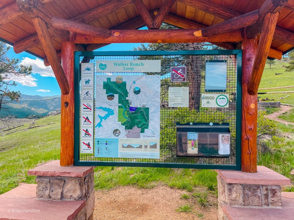
The Info Kiosk at the start of the Loop.
There’s additional parking at two different lots. The first option you’ll pass is before the main lot on the right-hand side of Flagstaff Road. It’s called the Meyers Gulch Trailhead and offers access to the Meyers Homestead Trail and a connection to Walker Ranch Loop via the Josie Heath trail. This trailhead will add approximately 2.2 miles to the loop.
The third option is to take a left onto Pika road before reaching the main parking lot. Drive down for a few minutes until taking a right on Bison road, which leads to the Ethel Harrold Trailhead. This trailhead is usually the next to fill after Walker Ranch, but I’ve had good luck finding parking here. This variation connects to the loop via a 0.55 spur trail, adding 1.1 miles to the overall loop.
If you are approaching from the southeast (i.e. Golden, Denver suburbs, etc.), another option is to find CO72 and take it west up Coal Creek Canyon. From the intersection of CO72 and CO93, it’s a 10 mile, roughly 17-minute drive. Ten minutes west of the intersection with CO93, take a right onto Crescent Park Drive and another right onto Gross Dam Road. From there, you’ll approach the obvious parking area on your right before the road dives down to Gross Reservoir.
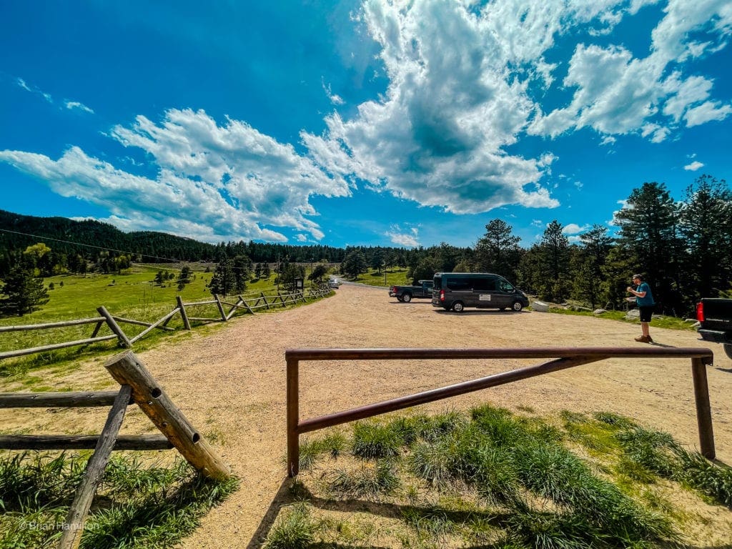
Crescent Meadows Parking Area
The Boulder County Open Spaces website has a great page on the loop and the various parking situations. Use this link.
Field Notes:
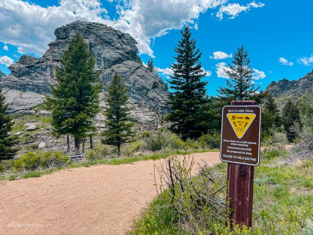
Being close to Boulder and relatively low in elevation, Walker Ranch is fairly busy all year round, with a crescendo of summer traffic between June and September. Weekdays and early are your best bets to find suitable parking. The trail has a multi-use designation and is very popular with mountain bikers. Make sure you aren’t slamming earbuds in your ears, or you won’t hear them coming. CU students frequent the area, and between the two river sections, there are plenty of spots to sunbathe or dip into the water. Because it is a loop, the trail makes an excellent run or training hike while the alpine thaws out.
Use Boulder weather is usually a good forecasting start. The loop is between one and two thousand feet higher than the city, so you can usually subtract a couple of degrees to find the temperature along the higher parts of the trail. Eldorado Springs, just down the drainage from the loop, also has an extended forecast option. Bring sunscreen and a hat because much of the route is in open fields and on treeless slopes.
Places to Stay:
Camping close to Walker Ranch is a bit tricky. You could spring for the Gross Reservoir sites, but they sit on the western side of the lake, and there is no direct way through to the loop in a car unless you off-road down County Road 68j, which will tear holes in the bottom of your car if it’s not an off-roading vehicle. Here is another article featuring Boulder’s hidden gem where you can camp. Don’t be fooled; it’s not a secret gem. This place usually pops off with campers and will likely not be quiet.
The best and most reliable way to do this hike is by staying at a motel/hotel/Airbnb/friend’s house in the Front Range and making it a day hike. The north side of the Denver metro is less than an hour away, so there are hundreds of options. Boulder is a great place to stay as well.
Journal:
If you start from the main Walker Ranch Loop Parking area, you can perform the loop in either direction. Counterclockwise is the most popular method, so we’ll describe it that way.
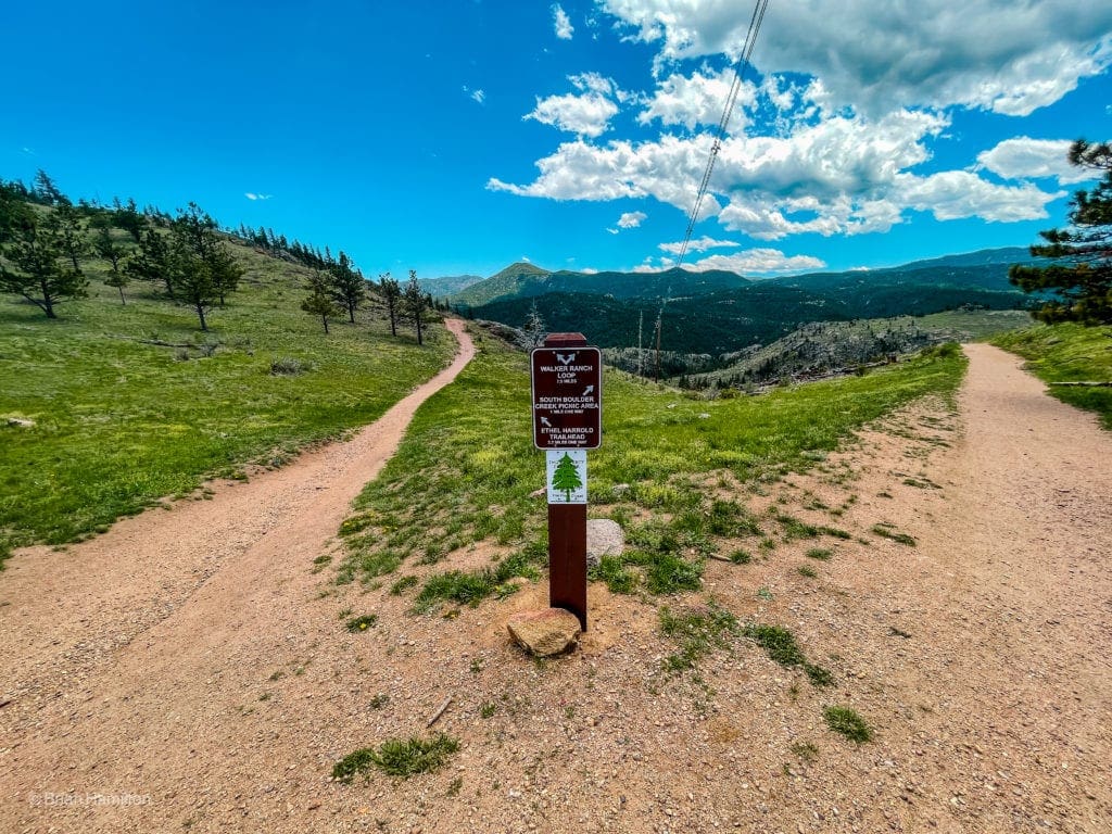
Take a right here to begin the loop in a counterclockwise direction.
Begin by descending a sunbaked slope down to South Boulder Creek and passing by some interesting rock formations.
Descending the well-marked trail.
Passing the Rock Formations.
The trail will follow the creek for a couple of points of a mile before crossing it on a nicely constructed walking bridge. On busy days, you’ll find people hanging out in the river, relaxing, or fishing.
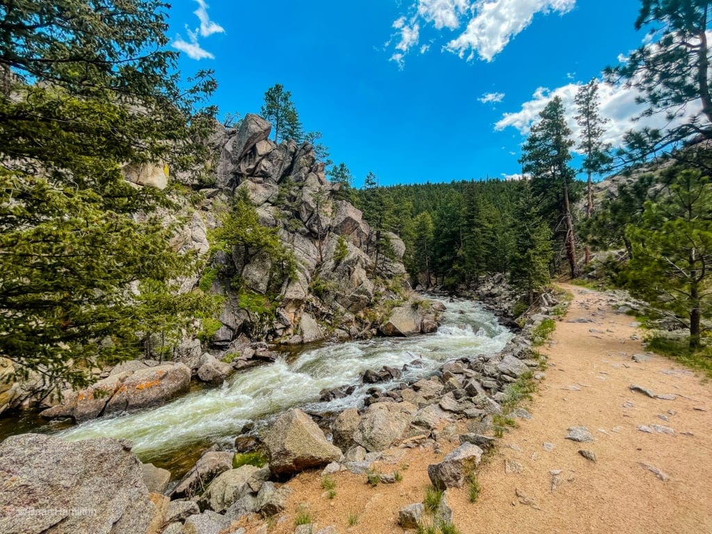
A section alongside the swift creek.
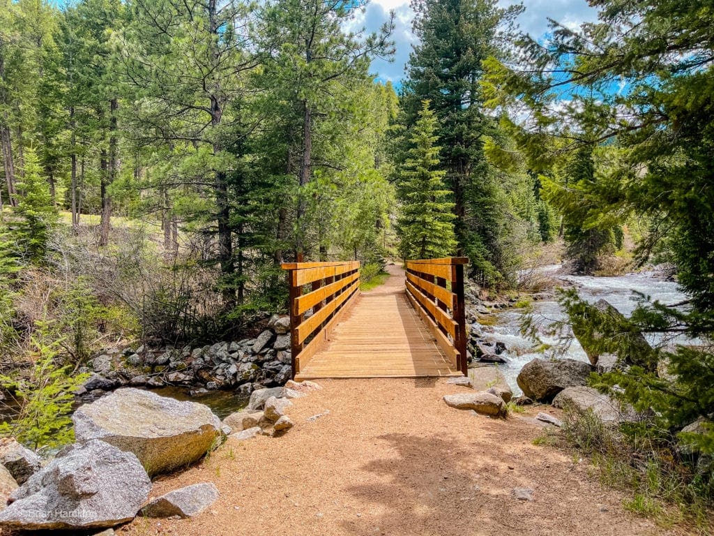
Bridge across South Boulder Creek.
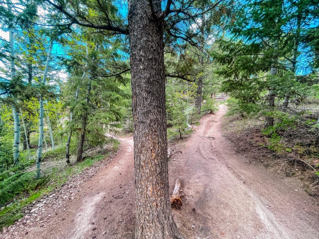
Once you cross the creek, the trail will rise to Crescent Meadows. This is the first big ascent of the day, and it’s fairly committing. The trail is in excellent shape, so there shouldn’t be any navigation issues (unless it’s completely covered in snow).
A switchback on the upper portion of the ascent to Crescent Meadows.
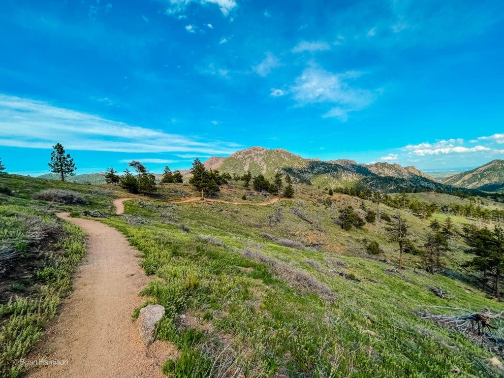
A portion of this climb is tree-covered, but there are open, sunbaked sections as well. You’ll eventually break out into a beautiful meadowed area with a parking area in front of you. There are a couple of interesting boulders and ridge tops around; make sure to check them out for great long-distance views of higher peaks and Gross Reservoir.
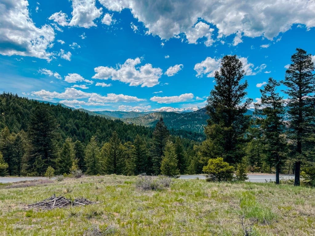
Higher Peaks on the western horizon.
Moving on, you’ll begin a long descent down to a secondary crossing of South Boulder Creek and the lowest point of the trail.
Beginning the long descent back to the creek.
This is a great stretch of trail that oscillates between meadows, pine trees, and rocky sections with views back to the plains in-between the rugged north ridge of South Boulder Peak and Eldorado Mountain
Eyeing the Plains in the far back.
While you never really get the wilderness feeling of other trails in the state, this section feels the most out there. Downstream is Eldorado Canyon State Park, and the ridges on either side of you are protected land, so you’re not staring into someone’s backyard. You may also notice a large cut in Eldorado Mountain where a train line passes on its way to Moffat Tunnel, which burrows under the Continental Divide and pops out near Winter Park.
Before reaching the bottom of the decline, you’ll encounter some nifty trail work and a long staircase that expertly threads through some steep and rocky slopes
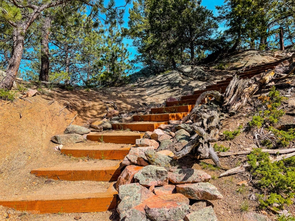
Nicely constructed staircase down to the creek.
Watch your step, twisted ankle risk increases on this last part of the descent.
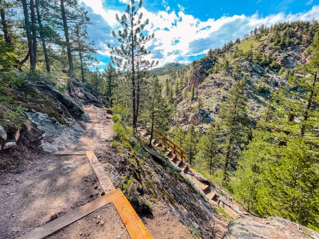
Windy and steep on the way down.
Once you regain the river, walk alongside it for a few hundred yards before crossing it on another well-constructed bridge. This part feels like a mini-gorge, and you can often see birds of prey circling the cliffs above.
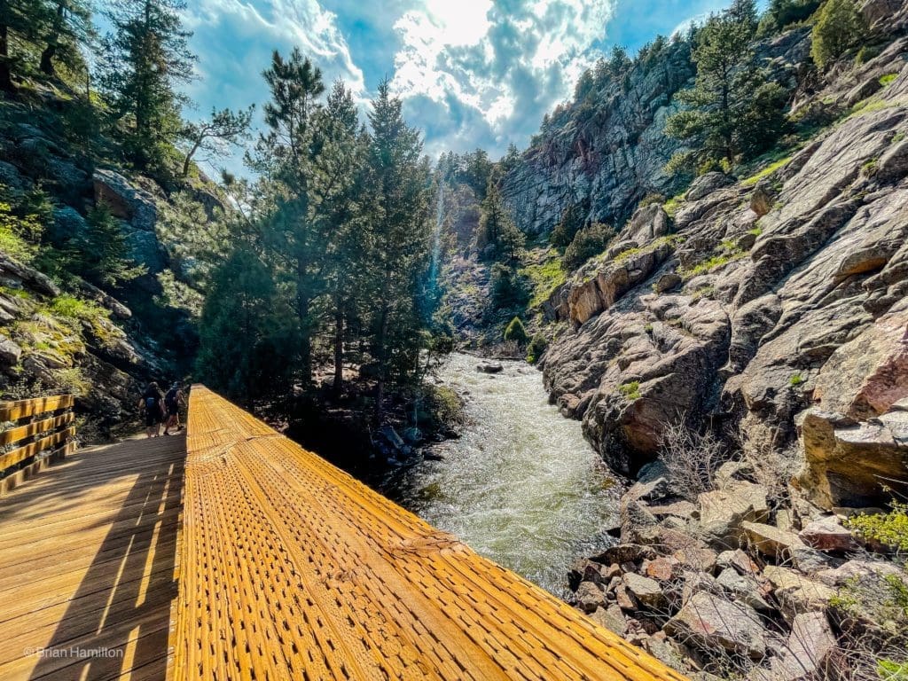
The second stream crossing of the day.
The next part is your second significant rise, and it starts alongside a gated dirt road, mainly used as an access point for EMS. The trail eventually breaks left and rises through a thicker area of forest. If you parked at the Ethel Harrold trailhead, keep an eye out for the spur trail back to the parking lot.
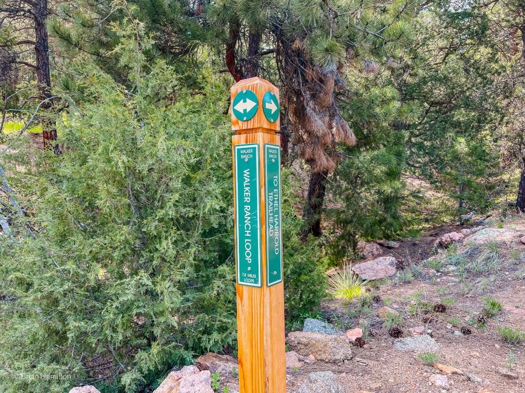
Ethel Harrold spur trail junction.
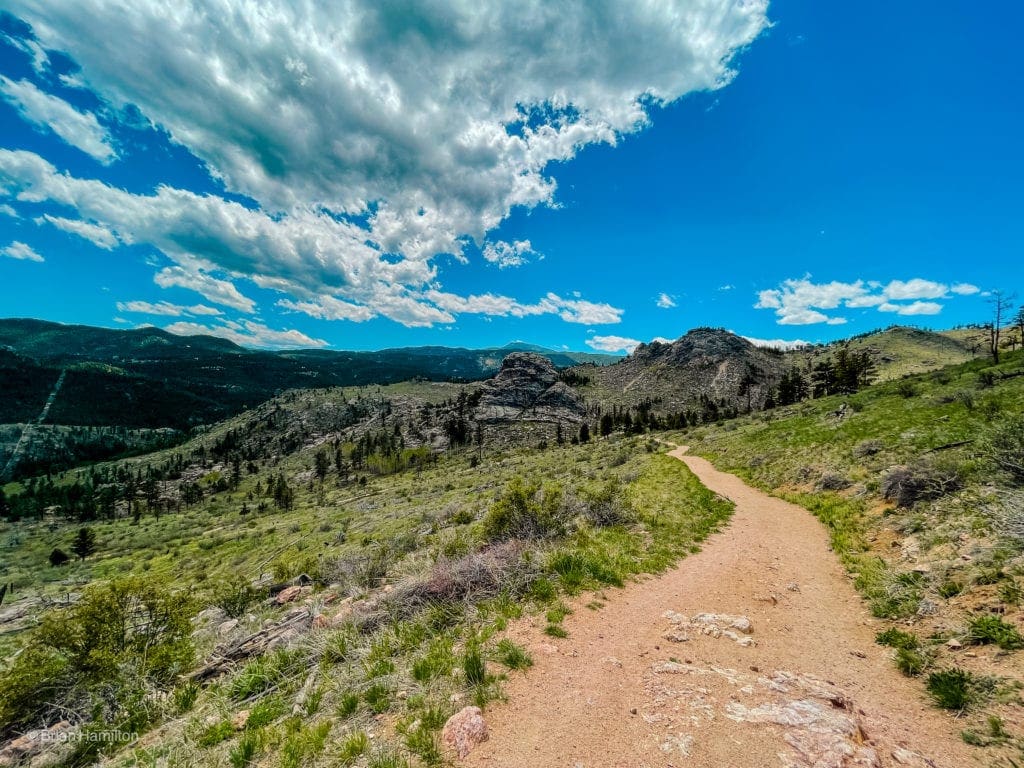
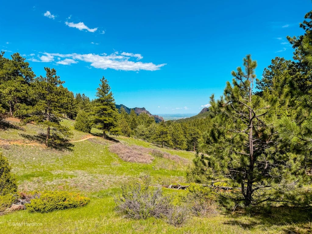
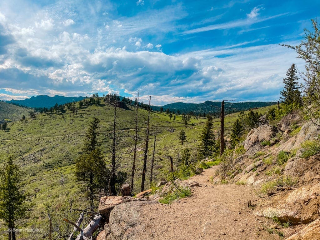
Keep rising amongst the trees until cresting the ridge. The views open up considerably, and this section is arguably the prettiest of the loop, with a nice perspective of the entire drainage and beautiful cliffs on various peaks.
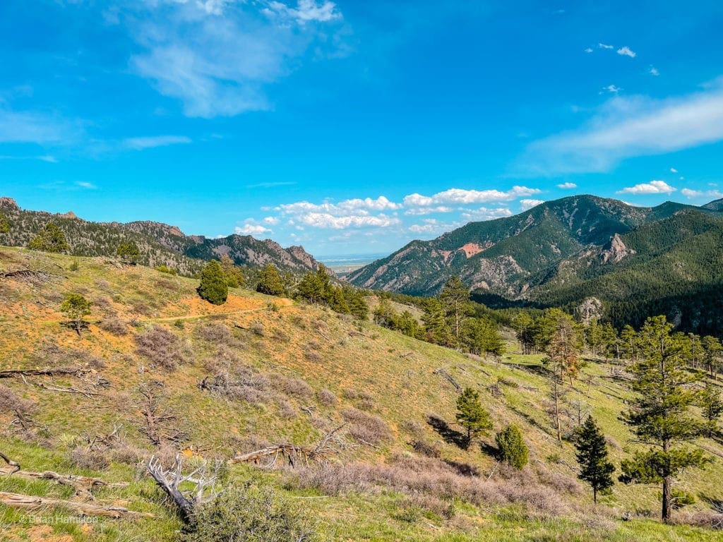
Looking back towards Eldorado Canyon and the Plains behind.
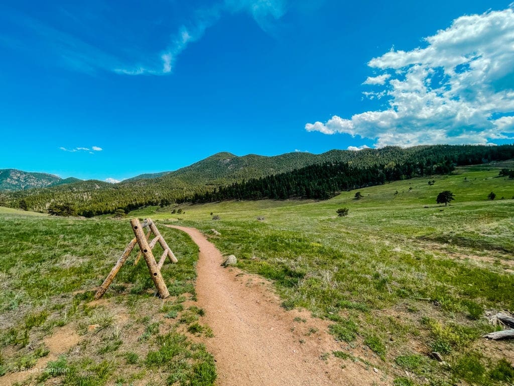
The trail undulates across an open expanse, passing a few benches before eventually winding towards your trailhead.
Beautiful open ridge walking.
Once the trail crests at its highest point, it will turn north, and you’ll lose about 50 feet of elevation until reaching the end of your loop.
You can see the other side of the loop on the green hill in the photo. Where the two sides connect, the loop ends.

Final Thoughts:
Skyblue Overland founder Brian Hamilton hiked this trail on May 25, 2021. The Walker Ranch Loop is an awesome and challenging hike that is close to Boulder, Colorado. The scenery was incredibly beautiful on this partly sunny, spring day with lots of wildflowers.
Photography for this article provided by Brian Hamilton. Skyblue Overland uses SmugMug, a paid image sharing, image hosting service, and online video platform on which users can upload photos and videos. The SmugMug also facilitates the sale of digital and print media for amateur and professional photographers. See Skyblue Overland’s Adventure Photo Galleries from the Best Trails in Colorado at SmugMug.com. Here is the entire Walker Ranch Loop Trail Gallery.

Enroll With Global Rescue Prior To Embarking On Your Next Adventure.
When a travel emergency arises, traditional travel insurance may not come to your aid, and a medical evacuation can cost up to $300,000.
The cost when you have a Global Rescue membership? $0. That’s why when the unexpected happens, you want the leader in rescue, evacuation and medical advisory behind you. You want Global Rescue.
Popular Articles:
- Guide to the Best Hiking Trails in Rocky Mountain National Park, Colorado
- The Dyrt: The 10 Best Campgrounds In Colorado
- Top Adventure Sports Towns 2021: Boulder, Colorado
- Epic Adventures with the Best Guides In Colorado
- Bear Lake Nature Trail, Rocky Mountain National Park, Colorado
- Mills Lake via Glacier Gorge Trail, Rocky Mountain National Park, Colorado
- Black Lake Via Glacier Gorge Trail, Rocky Mountain National Park, Colorado
- Lake Haiyaha Trail, Rocky Mountain National Park, Colorado
- Sky Pond via Glacier Gorge Trail, Rocky Mountain National Park, Colorado
Terms of Use:
As with each guide published on SKYBLUEOVERLAND.com, should you choose to this route, do so at your own risk. Prior to setting out check current local weather, conditions, and land/road closures. While taking a trail, obey all public and private land use restrictions and rules, carry proper safety and navigational equipment, and of course, follow the #leavenotrace guidelines. The information found herein is simply a planning resource to be used as a point of inspiration in conjunction with your own due-diligence. In spite of the fact that this route, associated GPS track (GPX and maps), and all route guidelines were prepared under diligent research by the specified contributor and/or contributors, the accuracy of such and judgement of the author is not guaranteed. SKYBLUE OVERLAND LLC, its partners, associates, and contributors are in no way liable for personal injury, damage to personal property, or any other such situation that might happen to individuals following this route.


