


|
Getting your Trinity Audio player ready...
|
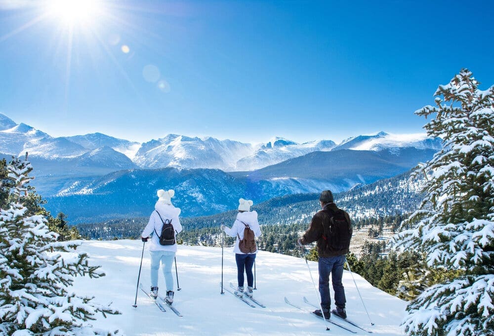
Embark on an epic journey through Rocky Mountain National Park in Colorado. Hidden Valley and Sundance Mountain are perfect training grounds for backcountry skiing. Skiers of all levels can challenge themselves in a rugged playground, build skills, and experience the purest form of skiing.

Overview
Skiing and riding are the backbones of winter recreation in the western US. Last winter, the estimated number of skiers and rider visits hovered over 59 million! With continued gear advancement, resort expansion, and consolidation of tickets into mega season passes like the Epic and Ikon Passes, the vehicle for churning out dedicated winter recreationists is humming along just fine. With millions at least nominally interested in skiing/riding and millions more looking to advance their skill, the desire to backcountry ski has been steadily rising.
Backcountry Skiing comes chock full of benefits and risks, almost in equal measure. It is a discipline that rewards methodical and purposeful learning with a deeper connection to nature. It can also be very dangerous for the uninitiated and seasoned veterans alike; avalanches don’t pick favorites. However, by arming yourself with the right gear and planning knowledge, backcountry skiing can satisfy the outdoor itch for multiple lifetimes.
This is the first of four articles dedicated to skiing the more famous lines in Rocky Mountain National Park, Colorado. We’ll take a look at the Park in general before zeroing in on the areas of Hidden Valley and Sundance Mountain. For those looking to tip-toe into the area backcountry scene, Hidden Valley and Sundance are perfect places to run some laps, build skill and enjoy the possibilities of backcountry.
The beloved Hidden Valley Ski Area, a local favorite, was a mere 45-minute drive away, providing quick access and avoiding the exhausting trek required for other ski resorts along U.S. Interstate 70. But unfortunately, after 36 glorious years of operation, it closed its doors in 1991. Although the ski operation is closed, the location is still available to backcountry skiers in the national park.
The former Hidden Valley ski area boasts a jaw-dropping 2,000-foot vertical drop from 11,400 to 9,400 feet, making it an adrenaline-fueled paradise for skiers of all levels – 30 percent beginner, 30 percent intermediate, and 30 percent expert. Its challenging terrain still draws thrill-seekers from far and wide, eager to conquer its steep slopes and push their limits.
For those brave enough to venture off-piste into the untamed backcountry, Hidden Valley and its neighboring Sundance Mountain are the perfect training grounds. A rugged playground where skiers with all skill levels can navigate through treacherous conditions and emerge victorious – building skill, pushing boundaries, and experiencing the true essence of skiing in its purest form.
Hidden Valley tantalizes skiers with a brief window of opportunity, from March to May, when its slopes offer thrilling runs through pristine snow. But danger lurks beneath the surface as avalanche risks loom large. Courageous skiers brave the treacherous conditions, waiting for snowpack consolidation before taking on the challenge.
Yet, even this daring pursuit loses its allure when Trail Ridge opens and exposes a strip of asphalt cutting through the heart of Hidden Valley. For those who seek true adventure, a trek to the Rock Cut Overlook, 10.6 miles past the entrance, leads to Sundance Mountain where the backcountry offers untamed excitement for early summer thrill-seekers (Mid May-June).
Get ready and come along for an exhilarating journey with this comprehensive skiing guide to Hidden Valley and Sundance Mountain.
Warning: For ANYONE traveling into avalanche territory, consider enrolling in an Avalanche training course by AIARE; it absolutely save lives.
Quick Navigation
Article Navigation: Click on any of the listed items in the table of contents below to jump to that section of the article. Similarly, clicking on any large, white section header will jump you back to the Table of Contents.
- Backcountry Gear
- Backcountry Planning
- Rocky Mountain National Park Overview
- Hidden Valley: History and Overview
- Access
- Places to Stay
- Hidden Valley Deep Dive
- Extra Credit: Sundance Mountain
- Final Thoughts
- Additional Resources
Backcountry Ski Gear
Before we begin, let’s lay out some quick backcountry ski gear knowledge (for a more comprehensive guide, check out our article, Backcountry Gear: Essentials for Human Powered Skiing). The list below is crucial, don’t skimp on gear when avalanches are in play.
-
Skis/Helmet/Gloves/Goggles
-
Winter Clothing: waterproof shells, thick ski socks, layers, puffy, beanie, hand warmers, etc.
-
Skins
-
AT Bindings (Frame or Tech)
-
Avalanche Mitigation Equipment: Beacon, Shovel, Probe, and Radio
-
Backcountry ski pack
-
Food/Water/First-Aid Kit
-
For multi-day adventures: 4-season tent, winter rated sleeping bag, avalanche airbag, orienteering equipment, batteries/rechargeable batteries
Remember, it isn’t enough to simply own gear; take the time to figure out how to use it before heading out. Speed is key, especially in a backcountry avalanche rescue. Visit Backcountry Gear: Essential for Human Powered Skiing to get comfortable with the necessary gear and how to use it.
Backcountry Planning
Once you have the gear and know-how to use it, it’s time to start planning. We’ll briefly break down the central components below, but check out our Guide to Planning a Backcountry Ski Adventure for an in-depth analysis of the planning process. A good plan can separate success from disaster. No outdoor activity is worth your life.
-
1) Pre-Planning
-
-
-
Learn how to Ski at an EXPERT level before heading outside ski resort boundaries. Find a squad. Start backcountry gear research. Hone your craft. Get in shape.
-
-
-
2) Long-Term Planning
-
-
Geographic reduction: where are you skiing? Start big, get small.
-
Weather and snowpack research.
-
Research ski lines using books, online resources, and forums. Key data:
-
Total distance, total climb, and descent, slope angle
-
Local Emergency contacts
-
Unique factors: trees, cornices, couloirs, avalanche history
-
Get into the maps and apps, know the area like the back of your hand.
-
-
-
3) Short-Term Planning
-
Managing Expectations
-
Constantly check weather updates until the morning you leave.
-
Popularity.
-
Tell people where you’re going and who to call if things go wrong.
-
Have a back-up plan.
-
Who’s got the medical training?
-
Go over the plan in detail with your squad. CHECK FOR UNDERSTANDING.
-
-
Packing
-
Make sure everything fits, and you can access your avalanche gear quickly. Time is critical in a burial situation.
-
-
-
4) On-site Planning
-
What do you see when you get there?
-
Watch out for tree-wells, wind-loaded slopes, cornices, bergschrunds, and other topographical considerations.
-
-
Timing and snow surface i.e. environmental factors. Not all snow skis the same.
-
-
5) Post-Planning
-
Analyze
-
What worked well? What didn’t?
-
-
Ease into the harder stuff.
-
The steps listed above are only a skeleton outline; see our Guide to Planning a Backcountry Ski Adventure to iron out the critical details. Remember, you can always take an avalanche safety course through AIARE; it can absolutely save lives.
Rocky Mountain National Park Overview
Rocky Mountain National Park is the third most popular National Park in terms of visitation, right behind The Great Smokey Mountains and the Grand Canyon (nps.gov, 2020). Like the Smokies, Rocky Mountain has a road bisecting the park called Trail Ridge. In the winter, this road is closed to through traffic but remains open on either end of the park.
The eastern part of Trail Ridge is plowed past the parking lot for Hidden Valley, allowing backcountry access to this sheltered region and former ski hill. Bear Lake Road is also plowed through the winter and provides another fantastic access point to backcountry glory. Most of the backcountry skiing in Rocky Mountain National Park takes place around these two areas. However, that doesn’t mean there aren’t tons of other worthwhile places to ski. With Rocky Mountain clocking in at over 415 square miles, it’s easy to find new and exciting places to recreate.
Because it is a National Park, there are many options for weather forecasting. During the planning phase of any backcountry ski trip, it’s important to check the weather using multiple sources. The forecast for Estes Park is a good starting point. Estes sits right outside the eastern park boundary, only twenty minutes from Hidden Valley. There is also a forecasting station at the Alpine Center off of Trail Ridge. Between the forecasts for Estes and the Alpine center, you can usually lock in a good spectrum of possible weather factors. In addition, the mountain weather forecast for Mt. Chiquita is beneficial. Mt. Chiquita is just north of Hidden Valley, and the mountain forecast is chock full of weather details reported from two different elevation gradients.
Keep in mind there are multiple components to the weather; it’s not just about precipitation. The temperature will dictate what layers to bring, and local weather patterns will help you figure out what’s important. For example, in Rocky Mountain and the larger Front Range in general, make sure to check the wind forecast. The Front Range is notorious for strong, blustery winds, and fighting your way up to a ski line in 50mph gusts is not fun.
There are also Snotel weather station sites scattered throughout the backcountry offering snowpack data. It can be a bit confusing to sort through the site, but here is the interactive map option. Use the menu on the right-hand side to create specific condition queries. The linked map will open with a window to Willow Park, the closest weather station to Hidden Valley. Snowpack data is really important for backcountry skiing; not only will it tell you if there is even enough snow to ski on, but it will also show you whether or not the area is experiencing an average winter. Any significant deviation away from average is noteworthy. Deep winters create more pronounced avalanche conditions, but wimpy winters can as well, especially if a storm overloads weak and unstable snow. Snowpack science should be a critical component of planning.
As crucial as snowpack data is, the numbers would be incomplete without an avalanche forecast. This forecast is MANDATORY before heading out. In Colorado, we are lucky to have the CAIC (Colorado Avalanche Information Center). The information is easy to read, the maps are color-coded, and a flurry of explanations gives depth to the forecast. More specifically, Rocky Mountain is in the Front Range Zone; make sure you are checking the right area for the most accurate information. Do not go into the Colorado backcountry without checking CAIC.
Hidden Valley: History and Overview
3D Map Navigation Instructions
On desktop: Hold the ctrl key while you drag to rotate the map. Use your mouse scroll to zoom in and out.
On mobile: Rotate and zoom on mobile by pinching and moving two fingers.
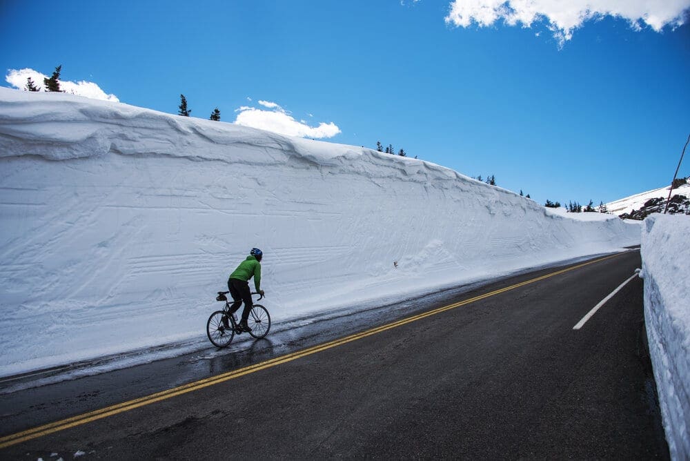
A cyclist takes on the challenge of a fully plowed Trail Ridge Road in Rocky Mountain National Park, Colorado.
This article will focus primarily on Hidden Valley, a great introduction area to Rocky Mountain backcountry skiing. Located on the eastern side of the Park, Hidden Valley used to be a managed ski hill. The ski area opened in 1955 and covered an impressive 2,000 feet of vertical descent (Farnell, 2019). The locals knew the area from even earlier. In the 1930s, the National Park Service began toying with the idea of plowing Trail Ridge Road in the winter, which rises to an elevation over 12,000 feet in the alpine, an ultimately futile task. However, for the years that they did, locals could take a ski shuttle up the plowed portion and ski back down to the base of what would become Hidden Valley (Farnell, 2019). The ski hill was in operation from 1955-1991, finally shutting down due to a string of mediocre winters in the 1980’s and fierce competition from bigger resorts (Coloradoskihistory.com, n.d.).
What does that mean for backcountry skiers? Well, due to Hidden Valley’s lower base elevation, it is consistently open to winter recreationists. Even today, many of the well-trodden backcountry runs follow the approximate path of old ski trails. This unique situation allows for a relatively low-risk environment in which to practice your craft.
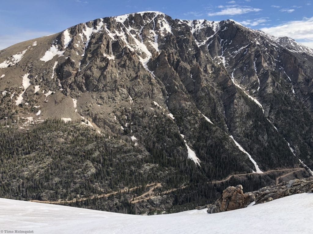
As Trail Ridge winds higher up the ridge, it cuts across the alpine upper portion of the former ski area, roughly 1100 feet above the Hidden Valley base. The bowls above this part of Trail Ridge provide excellent alpine turns and some fun, moderate glade skiing as well. With an average slope angle in the mid-20s, Hidden Valley gives you trees, old ski runs, alpine bowls, and a fairly reliable snowpack in a relatively tame area.
Even if you aren’t interested in backcountry, the area history and active sledding hill near the base should be enticing enough to check out. The sledding hill is open from 9 am-4 pm and has bathrooms. Guests need to bring their own sleds or tubes. There is also a warming hut, but it is only staffed on weekends and holidays (Wadzinski, 2019).
Access
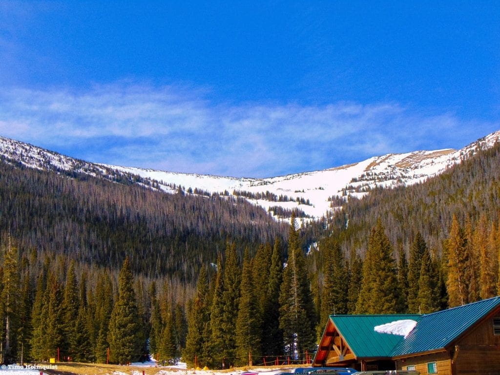
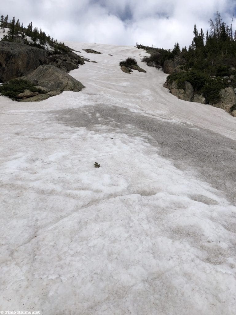
From the parking lot, looking at the Upper Bowls of Hidden Valley.
Hidden valley is best accessed from the east. Enter the National Park on either US 34 or US 36 and drive west. Both roads pass some flat, high elevation grasslands before entering a pine forest. A little less than 2.8 miles from the intersection where US 34 and US 36 link-up, a sharp hairpin turn to the left marks the entrance to Hidden Valley. Signs are plentiful, though they can be obscured in blowing snow or blizzard conditions. Take a right onto the Hidden Valley access road and follow it for 0.4 miles until arriving at the parking area.
Remember, an entrance pass is required to visit Rocky Mountain National Park. These passes can be purchased online. Please visit the official National Park website to ascertain what passes and entrance fees are required. Fines will be administered to those without proper passes.
Even though Hidden Valley is open in the winter, during and right after heavy snowstorms, access may be temporarily closed until roads can be safely plowed. Plan accordingly.
Places to Stay
The best option for accommodations near Hidden Valley is Estes Park. The town is a four-season playground offering myriad lodging opportunities. It is impractical to stay in Grand Lake on the western side of the park because of seasonal closures along Trail Ridge.
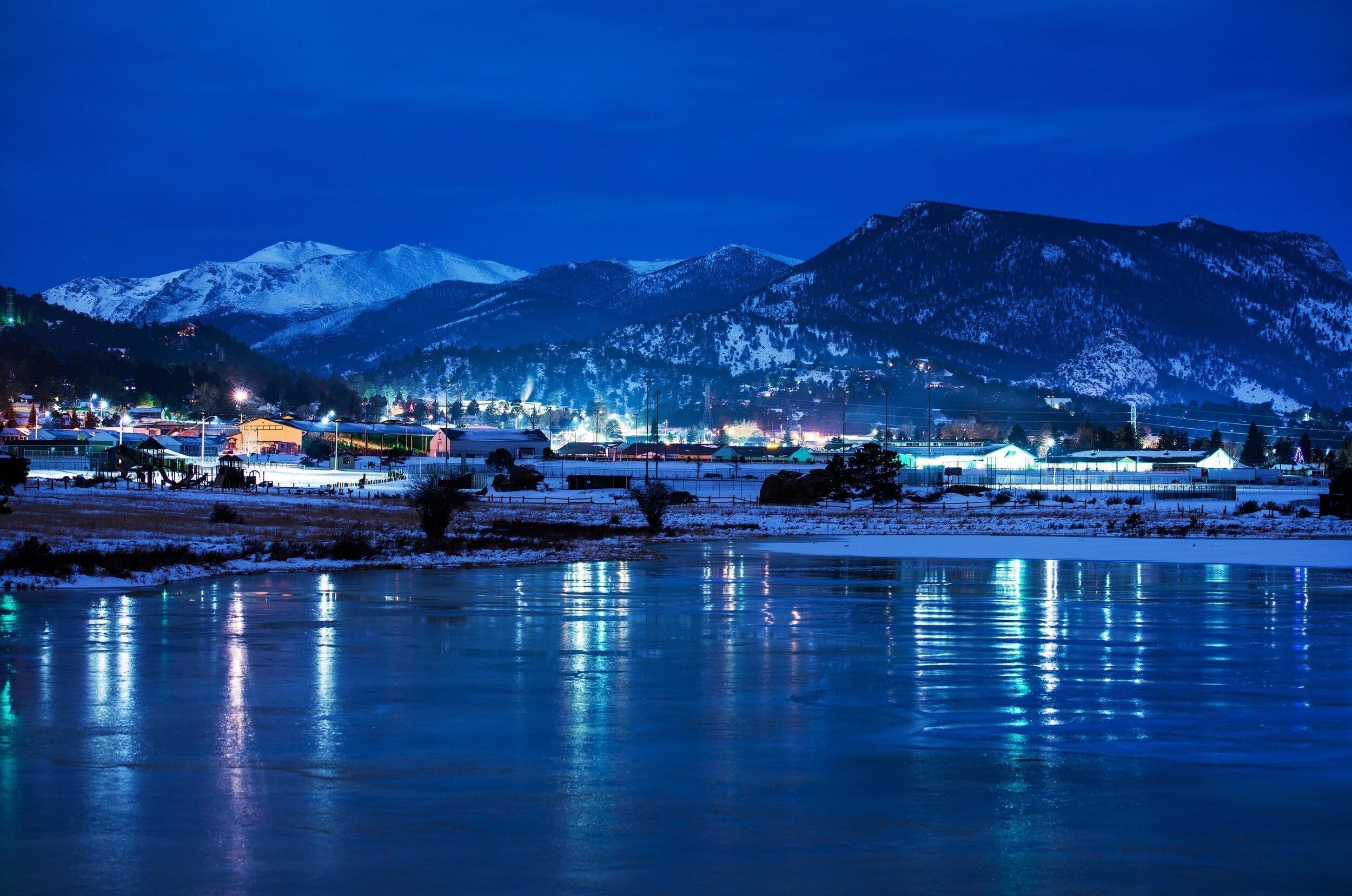
If you’re based in the Front Range, Hidden Valley is only an hour and a half from Boulder and metro Denver. Loveland, the closest major town to Estes Park, is only 45 minutes away with no traffic. Due to the relative proximity of Hidden Valley to major population centers, it may be easier to day-trip up to the ski area.
If you want to stay in Estes, please visit the tourism bureau website here. The search filters on the site will help you narrow down options.
Our Rating System
Below you’ll find route descriptions, maps, and ratings as they pertain to the lines we cover. These articles cover the most reported and referenced lines, not all possible lines you could ski. We utilize a four-tier rating system illustrated as follows:
-
Beginner (Green)
-
Intermediate (Blue)
-
Difficult (Maroon)
-
Very Difficult (Black)
Some areas covered only exhibit a few tiers; others exhibit all of them. Regardless, it is important to understand that each rating does not ONLY correspond to the steepest slope angle skied. Some lower-angle Difficult terrain is simply difficult to access and requires an immense amount of effort to attain, hence the harder rating. Take the ratings seriously as the separation between Difficult and Very Difficult often involves many of the hallmarks of true ski mountaineering, ropes, legitimate ice axes, mountaineering crampons, etc. It is incumbent upon each reader to understand their limits. Always start small.
Hidden Valley Deep Dive
Now that we have the gear, the plan, directions, and accommodation options, it’s time to figure out what Hidden Valley has to offer.
Hidden Valley Map
27-29 degrees 29-31 degrees 31-34 degrees 34-45 degrees 45+ degrees
3D Map Navigation Instructions
On desktop: Hold the ctrl key while you drag to rotate the map. Use your mouse scroll to zoom in and out.
On mobile: Rotate and zoom on mobile by pinching and moving two fingers.
Ascent Lines:
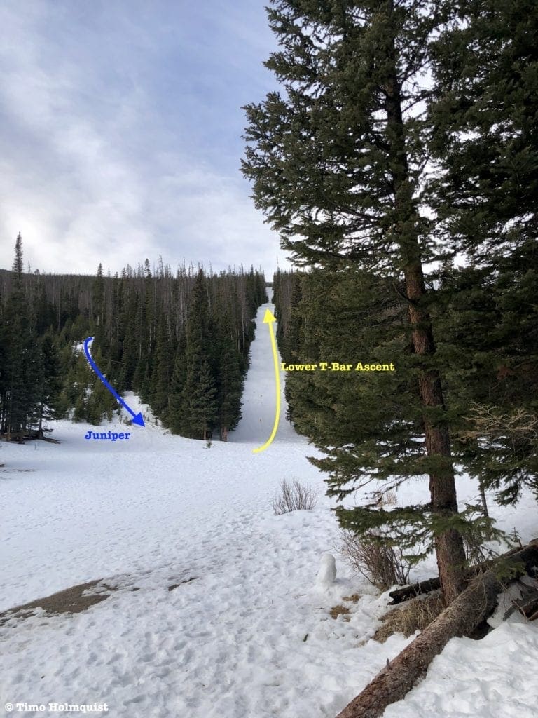
A look up the Lower “T-Bar” Ascent.
Generally speaking, when you arrive at the base of Hidden Valley, there are three ways to skin up that will give you access to the bulk of the runs. For the hesitant, try Ptarmigan, located behind the sledding hill. It used to be an easy bunny hill type run back when the ski area was still in operation and is a great way to get your legs under you. Once you hit the trees at the top, strap in and ski or ride down.
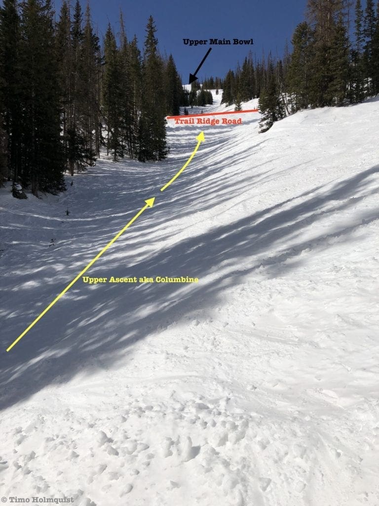
The Lower “T-Bar” Ascent, perhaps unsurprisingly, follows the old T-Bar route. It is the steepest of the three ascent routes. From the parking area, follow the well-established trail towards the sledding hill. Before reaching the bottom, head left, briefly following the Upper Valley Ascent before breaking left again and following the old lift-line through the trees. The ascent will deposit you along Trail Ridge Road, where you can ski down what you climbed or set your sights on a few different intermediate options.
The Upper Valley Ascent gets you to the upper bowls and is the most popular ascent route. After you pass the warming hut, cross Hidden Valley Creek and continue up into the trees following a general west-southwest orientation. The ascent follows the creek drainage to Trail Ridge Road. From here, pick a suitable line and continue up to the ridge for a nice long run all the way back to the bottom or to lap the upper bowls.
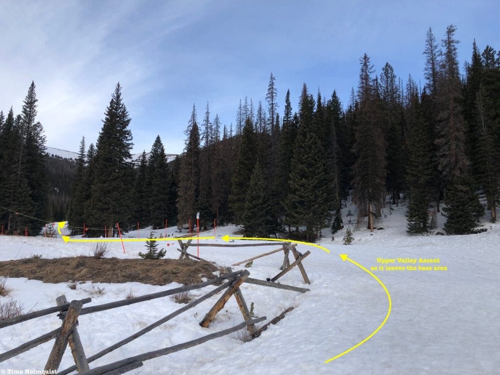
The starting location for the Upper Valley Ascent.
Ski Lines
1. Ptarmigan:
-
Essentials: 0.2 miles, 141-foot vertical.
-
Status: Easy
-
Steepest slope angle: 11 degrees
-
Good for: Beginners and warm-up laps.
-
Accessed via: Ptarmigan ascent route. At the top, strap in and turn around, watch for sledders and tubers.
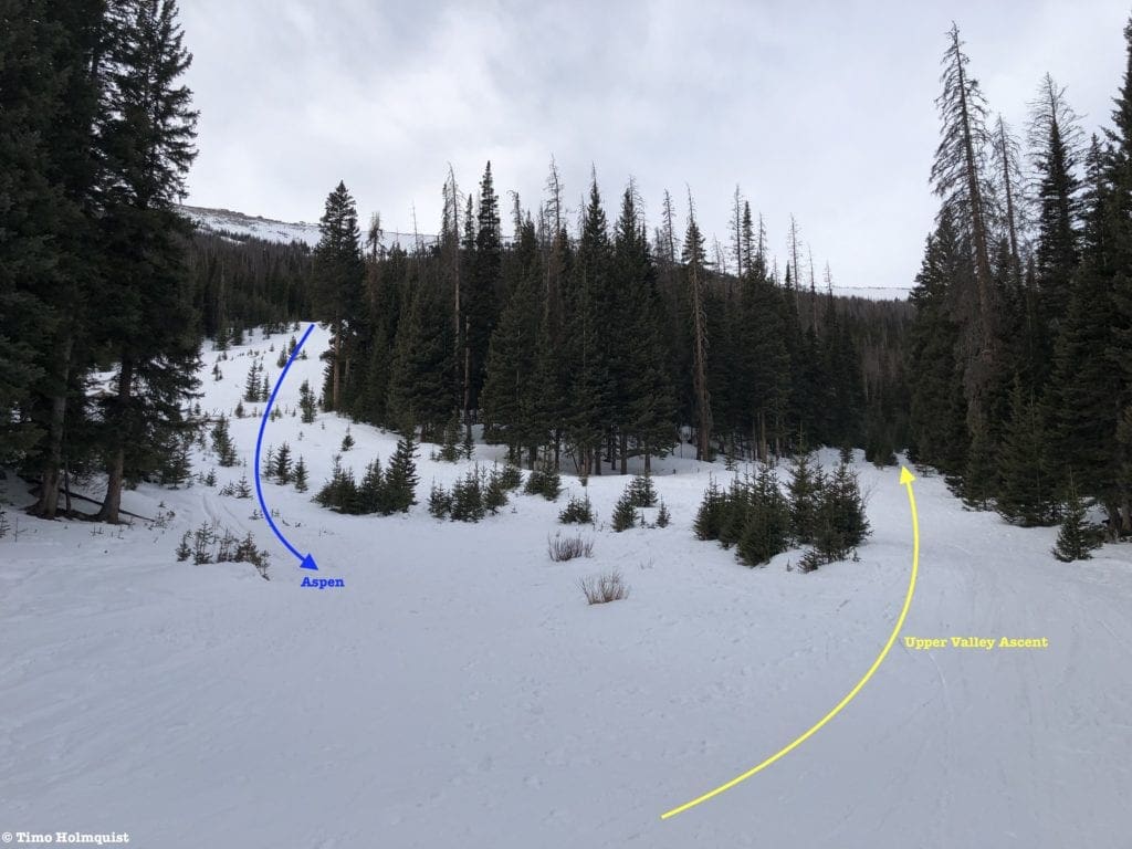
Where the bottom of Aspen and the Upper Ascent meet.
2. Aspen:
-
Essentials: 0.68 miles, 735-foot vertical.
-
Status: Intermediate
-
Steepest slope angle: 19 degrees
-
Good for: Powder turns and laps, tree skiing options.
-
Accessed via: Lower “T-Bar” ascent. At the top of the ascent, Aspen descends to the north (climbers right), following its original ski trail. Roughly half the distance to the bottom, the run intersects with Upper Valley Ascent and follows it down to the base. Watch for people climbing the Upper Valley Ascent Route.
i. Juniper Variation: At the top of the T-Bar ascent, follow Trail Ridge Road to your left (east) until sighting a thin break in the trees zig-zagging north toward the base of Hidden Valley. It’s easy to lose the exact line as trees are filling in the spaces where the run used to be. Pick your best line and ski it down. Alternatively, find the bottom of Juniper to the left (east) of the Lower T-bar Ascent and climb it. This area holds snow better on windy days and avoids the challenges of the upper slopes.
a. At a glance: 0.58 miles, 702-foot vertical
b. Steepest slope angle: 23 degrees
ii. Lower T-Bar Variation: When you climb to the top of the lower T-Bar route, turn around and ski it down. It is a thin run.
a. At a glance: 0.5 miles, 739-foot vertical
b. Steepest slope angle: 19 degrees
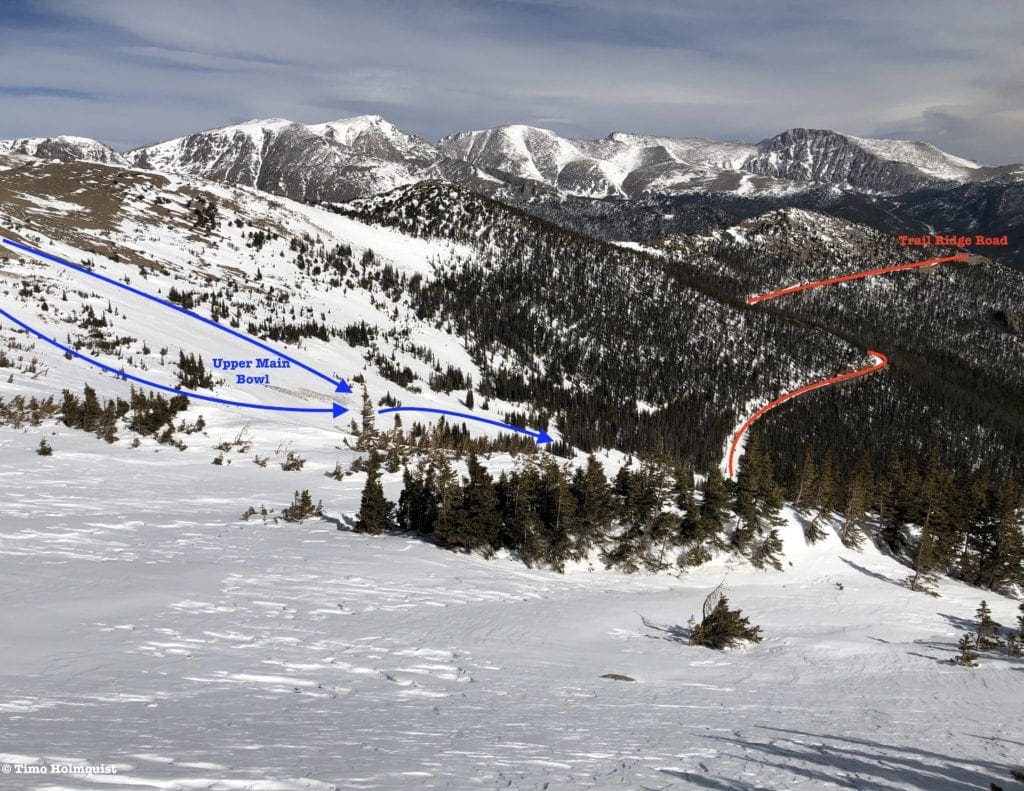
Upper Main ski lines from Upper Main 2.
3. Upper Main Bowl:
Essentials:
o Just the alpine bowl: 0.5 miles, ~1000-foot vertical from top to Trail Ridge
o Combined with Upper Valley Ascent: 1.66 miles, ~2000-foot vertical.
-
Status: Intermediate with alpine conditions.
-
Steepest slope angle: 30 degrees
-
Good for: Lapping the upper areas, combining with Upper Valley Ascent route for longest vertical run in Hidden Valley. Great after powder, miserable in sustained winds.
-
Accessed via: Upper Valley Ascent. Once you break out onto Trail Ridge Road, the Upper Main Bowl is directly in front of you; pick the most agreeable ascent route and lap the area as many times as your heart desires.
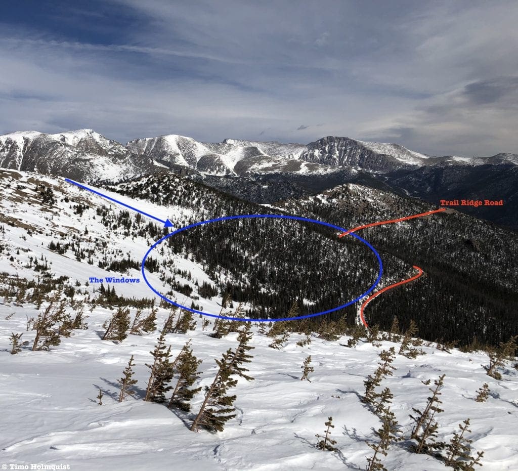
Eyes on the Windows.
i. The Windows Variation: Once you get to Trail Ridge, ascend to your right (North-West), to entering an area known as the Windows. Here, you can enjoy intermediate tree skiing.
a. At a glance: 0.44 miles, 935-foot vertical
b. Steepest slope angle: 30-35 degrees
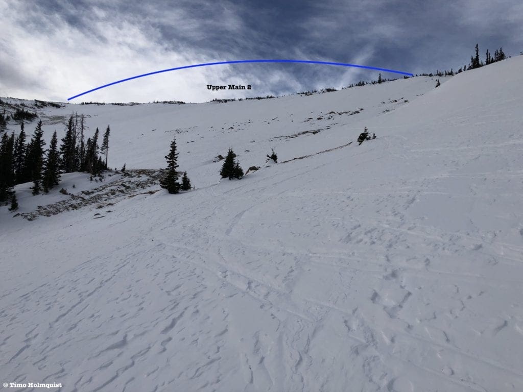
Looking at the top section of Upper Main 2.
ii. Upper Main 2 Variation: From Trail Ridge, look left and ascend in more of a Southwest direction into an adjacent bowl. This Upper Main 2 area gives you a longer ascent and descent with open spaces and sparse trees.
a. At a glance: 0.57 miles, 1047-foot vertical.
b. Steepest slope angle: 30-35 degrees.
Where Upper Valley Ascent meets Trail Ridge.
iii. Halfway Variation: After ascending to Trail Ridge, turn around and ski down.
a. At a glance: 1.16 miles, 1047-foot vertical.
b. Steepest slope angle: 25 degrees.
Things to note: The Upper area of Hidden Valley is special for its alpine characteristics, fantastic views of the Rocky Mountain High Country, and fun terrain. There is not a lot of cover when weather rolls in; keep an eye on the forecast and avoid the Upper Bowls during periods of sustained wind. When visibility is an issue, stay lower.
Extra Credit: The Sundance Lines
Sundance Map
27-29 degrees 29-31 degrees 31-34 degrees 34-45 degrees 45+ degrees
3D Map Navigation Instructions
On desktop: Hold the ctrl key while you drag to rotate the map. Use your mouse scroll to zoom in and out.
On mobile: Rotate and zoom on mobile by pinching and moving two fingers.
The mellow start to Sundance North Face.
Area Overview
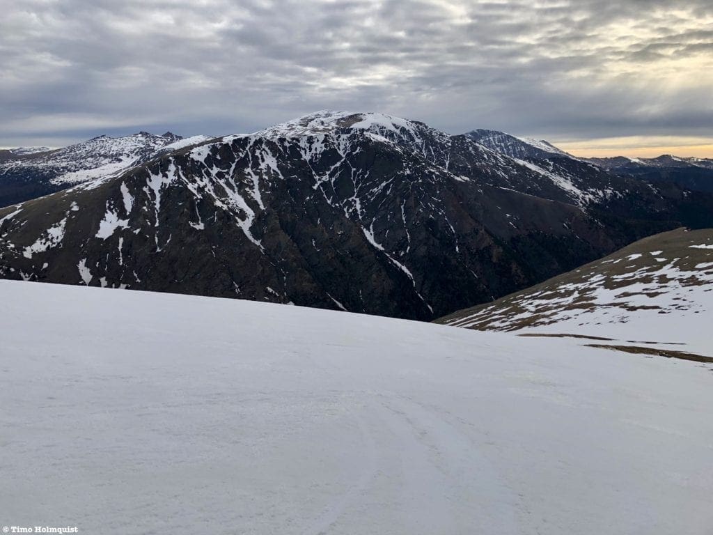
Hidden Valley brings the goods from March-May. It is possible to ski before then, but avalanche danger is noticeably higher. It is always advisable to wait for snowpack consolidation. However, after Trail Ridge opens, Hidden Valley loses some of its allure. It just isn’t fun to ski when a strip of heavily-trafficked asphalt separates the Upper and Lower slopes. In that case, for early summer skiers (Mid May-June), when Trail Ridge opens, drive another 10.6 miles past the Hidden Valley entrance to the Rock Cut Overlook for some backcountry adventures on Sundance Mountain.
The parking here is along both sides of Trail Ridge but is also limited; arrive early. From the parking lot, head north on a paved path called Toll Memorial Trail. It isn’t a long path, but assuming Trail Ridge is open, it may involve carrying your equipment on your back instead of skinning. At the end of the trail is your first skiing option, beginning in a shallow bowl and heading north (left).
If you continue east past the funky looking Mushroom Rocks on your right, you’ll descend into a broad saddle before reclimbing to the ridge crest north of the highest point, called Sundance Mountain. Off the northern and eastern sides of the summit ridge are two couloirs that also provide some early summer fun.
Ski Lines
1. Sundance Mountain North Face
-
Essentials: 0.58 miles, 735-foot descent.
-
Status: Easy
-
Steepest slope angle: 15 degrees
-
Good for: People who don’t want to skin all that much, beginners looking for an alpine run, practice.
-
Accessed via: Toll Memorial Path. At the end of the path, turn left (north). You should be able to see the Mummy Range across the valley from you. Between you and the Mummy range is a wide north-facing bowl. Choose your line into it and begin descending. The upper part of this bowl is easy and enjoyable. However, the further you descend, the tighter and steeper the run becomes. Bail when the difficulty rises past your comfort zone, slap some skins on, and reclimb to the start.
Stop around here to keep the skiing at an easy level. Below this point the slope angle increases to roughly 40 degrees as the run plunges down towards Old Fall River Road.
i. Challenge Variation: For the advanced skier, continue into the difficult lower part of the run. Later in the season, the snow quality dissipates and dictates how far you can ski. If the conditions are great, it is possible to ski all the way down to Old Fall River Road. In ideal conditions, from top to bottom, this line can give you more than 2,000 feet of vertical descent over a little more than a mile. Remember, if you don’t position a car on Old Fall River Road, you will have to re-ascend to your car. The bottom of this line is not skiable without significant snow cover.
a. At a glance: 2,000-foot descent, 1.1 miles
b. Steepest slope angle: ~38-40 degrees
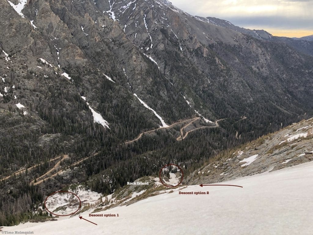
Looking down to the end of the run. There are two descent options separated by a large rock island. This whole area is a slide risk in unstable conditions.
2. Sundance Mountain Couloirs
-
Essentials: 1400 feet of vertical descent over 0.5 miles. ~2000 feet if descending to Fall River Road.
-
Status: Difficult
-
Steepest slope angle: 40 degrees
-
Good for: People looking for a challenge, without pushing into overdrive. Spring skiers who have already mastered Hidden Valley but aren’t ready to commit to longer expeditions.
-
Accessed via: Toll Memorial Path and some alpine walking. Continue East past the North Face lines and up to the shoulder of Sundance Mountain. Between the shoulder and the summit of Sundance, there will be two couloirs separated by the nose of a ridge. Both options are skiable and will begin by heading East before diving North. These lines hold snow later into the season, and like Sundance North, can ski all the way to Old Fall River Road in ideal conditions. Keep in mind, these two lines are steeper than anything in Hidden Valley and should not be skied without proper avalanche mitigation gear.
Old Fall River Road is a dirt road that is only open in one direction (east to west) and only when the snow melts. In some years, it doesn’t open until late June. If it is closed, the car positioning option for Sundance won’t work. Check road updates here.
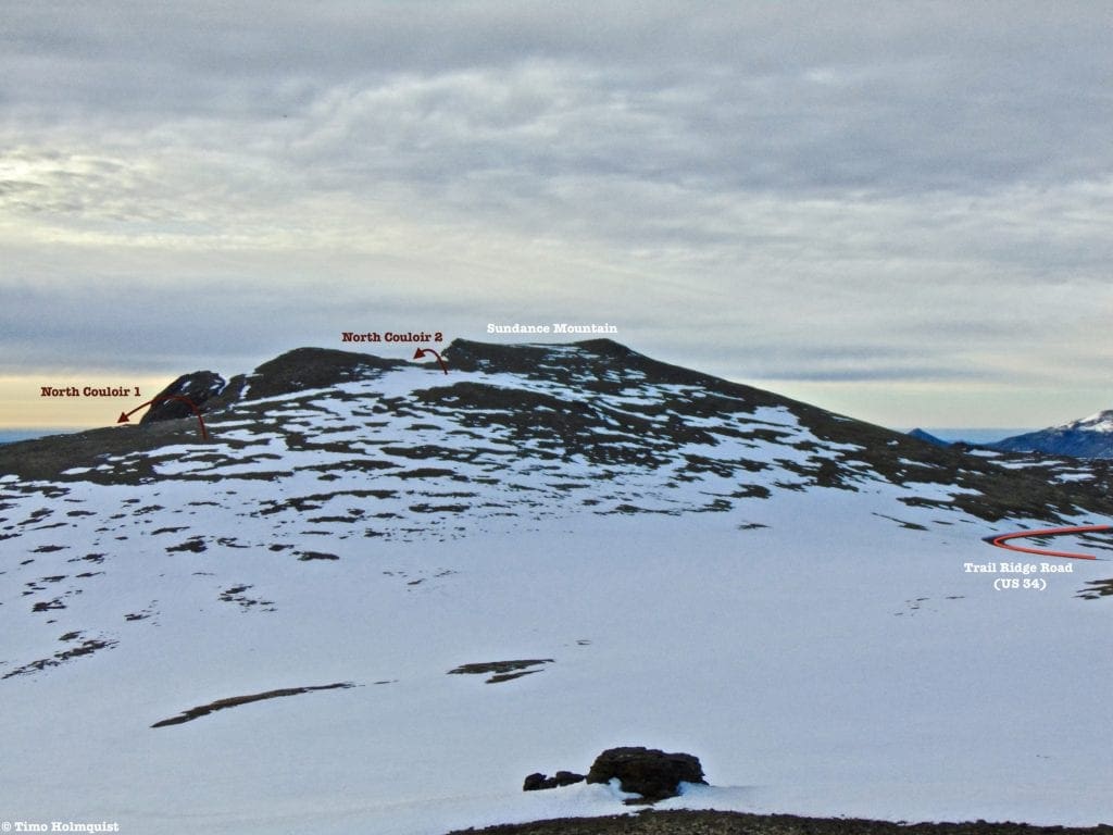
Sundance Mountain from the end of Toll Memorial Trail, with the two couloir entrances shown.
Final Thoughts
Hidden Valley is the best way to get into Rocky Mountain backcountry skiing. However, if you can’t get out until May or June, giving the Sundance North Face a go is also a great way to ramp up backcountry experience. Between these two areas, a properly kitted and coherent squad can get into backcountry skiing without sacrificing safety. Hidden Valley doesn’t usually slide, but it has in the past, so as always, never go into the backcountry without checking weather and avalanche conditions. Happy skiing!
Looking up from the very bottom of the Sundance North Face.
Additional Resources in Alphabetical Order
AIARE, Avalanche Research Education. (n.d.) Retrieved from https://avtraining.org/
Colorado Avalanche Information Center. (n.d.) Retrieved from https://www.avalanche.state.co.us/
Coloradoskihistory.com. (n.d.) Hidden Valley (Ski Estes Park). Retrieved from http://www.coloradoskihistory.com/lost/skiestespark.html
Farnell, Shauna. (2019). Ode to Hidden Valley, Estes Park’s Ghost Town Ski Resort. Retrieved from https://www.visitestespark.com/blog/post/ode-to-hidden-valley-estes-parks-ghost-town-ski-resort/
Lange, David. (n.d.) Estimated number of ski/snowboard visits in the U.S. from 2000/2001 to 2019/2020. Retrieved from https://www.statista.com/statistics/206544/estimated-number-of-skier-visits-in-the-us-since-2000/
Mountain Forecast. (n.d.) Mt. Chiquita Forecast. Retrieved from https://www.mountain-forecast.com/peaks/Mount-Chiquita/forecasts/3983
National Park Service. (2020). Visitation Numbers. Retrieved from https://www.nps.gov/aboutus/visitation-numbers.htm
· Rocky Mountain National Park. (n.d.) Fees and Passes. Retrieved from https://www.nps.gov/romo/planyourvisit/fees.htm
· Rocky Mountain National Park. (n.d.) Park Roads. Retrieved from https://www.nps.gov/romo/planyourvisit/road_status.htm
National Weather Service
· Estes Park Extended Forecast. (n.d.) Retrieved from https://forecast.weather.gov/MapClick.php?lat=40.3772059&lon=-105.5216651&site=all&smap=1&searchresult=Estes%20Park%2C%20CO%2C%20USA#.YCbnzxNKjOS
· Alpine Center/Trail Ridge Extended Forecast. (n.d.) Retrieved from https://forecast.weather.gov/MapClick.php?lon=-105.76022675170898&lat=40.42810400402635#.YCboWRNKjOS
USDA: Natural Resources Conservation Service, National Water and Climate Center. (n.d.) Snotel Interactive Map. Retrieved from
VisitEstesPark.com. (2021). Lodging. Retrieved from https://www.visitestespark.com/lodging/
Wadzinski, Gloria. (2019). Go sledding at Hidden Valley Snow Play Area. Retrieved from https://www.mycoloradoparks.com/things-to-do/winter-in-colorado
-
Backcountry Ski Gear: Essentials for Human Powered Skiing
-
Guide To Planning A Backcountry Ski Adventure
-
Backcountry Skiing in Rocky Mountain National Park: Bear Lake Area Ski Lines
-
Backcountry Skiing in Rocky Mountain National Park: Longs Peak Area Ski Lines
-
Best Places To Backcountry Ski in Rocky Mountain National Park, Colorado: Best of the Rest
-
Remote Backcountry Ski Lodges in British Columbia
Terms of Use: As with each guide published on SKYBLUEOVERLAND.com, should you choose to go backcountry skiing, do so at your own risk. Prior to setting out check current local weather, conditions, and land/road closures. While taking a trail, obey all public and private land use restrictions and rules, carry proper safety and navigational equipment, and of course, follow the #leavenotrace guidelines. The information found herein is simply a planning resource to be used as a point of inspiration in conjunction with your own due-diligence. In spite of the fact that this guide was prepared under diligent research by the specified contributor and/or contributors, the accuracy of such and judgement of the author is not guaranteed. SKYBLUE OVERLAND LLC, its partners, associates, and contributors are in no way liable for personal injury, damage to personal property, or any other such situation that might happen to individuals following this guide.


