


High Point:
13,514 feet on top of Mt. Ypsilon

Total Ascent:
Ypsilon only: ~2,600 feet (Chapin, Chiquita and Ypsilon: ~3,350 ft.)

Difficulty:
Hard

Distance:
Ypsilon only: 7 miles (Chapin, Chiquita, and Ypsilon: 7.53 miles)

Waypoints:
40.4351, -105.73027

Route Type:
Out and Back, small loop options

Table of Contents:
Article Navigation: Click on any of the listed items in the table of contents below to jump to that section of the article. Similarly, clicking on any large, white section header will jump you back to the Table of Contents.
- Overview
- Scales and Criteria
- Directions to Trailhead
- Places to Stay
- Field Notes
- Journal
- Final Thoughts
Looking For An Amazing Adventure? Book A Hiking Tour in Rocky Mountain National Park
Overview:
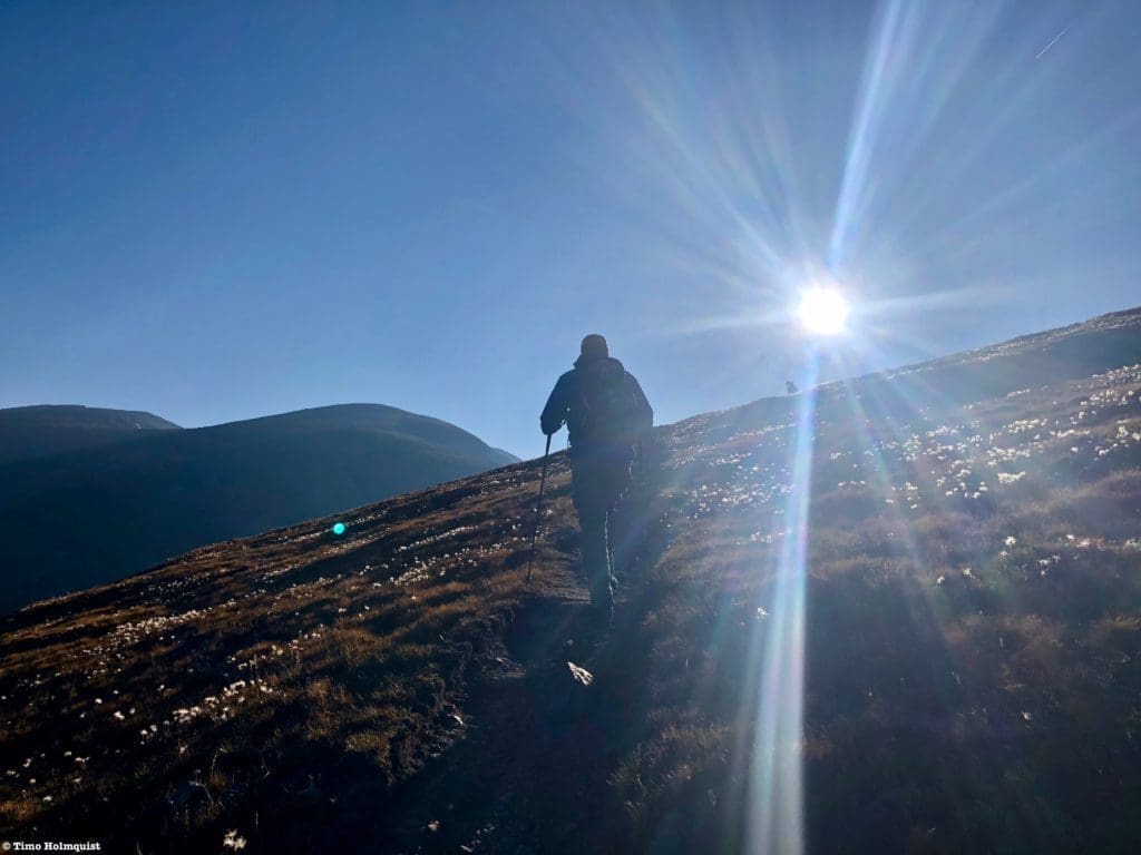
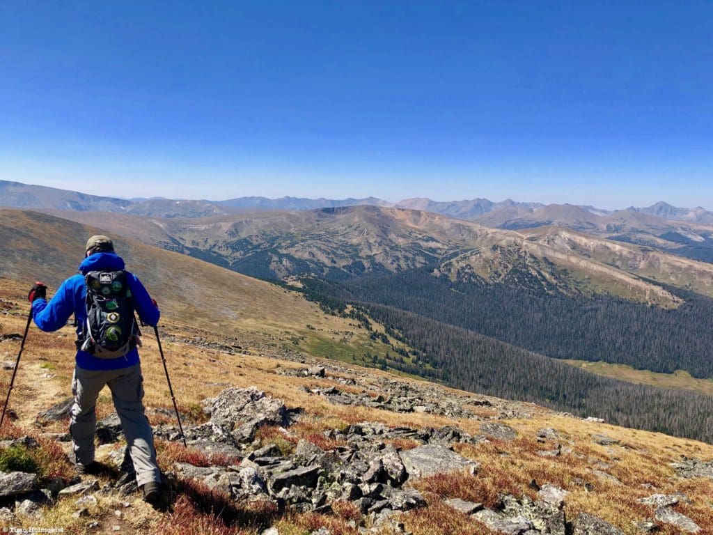
The Mummy Range is a large set of mountains east of the Continental Divide and is visible from multiple places in the Front Range like Loveland and Fort Collins. They run in a general SW to NE direction with exceptions on the north end of the range when the mountains hook back to the northwest before dropping to the Cache La Poudre River. One of the best ways to get a feel for the range and tag a few summits along the way is to walk the Mummy Crest from Chapin Pass Trailhead to the top of Mt. Ypsilon. Despite its modest length, the path is largely above treeline and almost entirely over 12,000 feet so prepare for a long hike at high altitude. Unlike the serrated rock cathedrals of Glacier Gorge, this area of the park offers sweeping 100-mile views and a lumpy, welcoming ridgeline with a healthy alpine ecosystem. A similar hike in profile to this one would be Mt. Ida from Milner Pass.
On the summit of Mount Chapin, with the massive bulk of Chiquita in the background. The Desolation Peaks are off-center to the left.
Scales and Criteria:
This article uses two rating systems. Overall distance and elevation gain make up the difficulty rating, and the Yosemite Decimal System anchors the scramble rating. This review only focuses on views attainable via trail or easily discernable social trails, and the scrambling is minimal; however, some isolated sections of Class 2 talus hopping are worth mentioning. Snow patches linger on the trail into June but should be clear by July. The trail is popular from late June-Labor Day, with a noticeable drop in traffic afterward. Generally speaking, it is less trafficked than the main Wild Basin or Glacier Gorge trails. On shoulder-season weekdays, you may have large sections of the trail to yourself.
Difficulty Ratings:
- Easy: less than 5 miles, less than 500 ft. of elevation gain
- Moderate: 5-10 miles, 500-2000 ft of elevation gain
- Hard: 5-15 miles, more than 2000 ft. of elevation gain
- Very Hard: 10+ miles, more than 3,500 ft. of elevation gain
Scramble Rating:
- Class 1: Established hiking trail the entire length of the adventure. Low chance for injury.
- Class 2: Typically involves cross-country navigation, possibly using hands for balance but not required, steeper than Class 1.
- Class 3: Hands and feet used to scale areas, must use hands to proceed (either for balance or to help pull you up a section), increased exposure, a fall could be fatal. Helmet recommended, along with grippy hikers.
- Class 4: Climbing on very steep terrain just shy of vertical, falls could be fatal, hands employed for grip and balance continuously, ropes advisable but scalable without. Helmets are highly recommended, along with grippy hikers.
- Class 5-5.4: Near vertical and vertical climbing that involves technical rock-climbing moves, exposed, falls likely to be serious or fatal, possible to scale without ropes but only for very experienced veterans. Helmets, grippy hikers, and/or rock-climbing shoes necessary.
- Class 5.5 and up: Not covered as scrambling, full-on rock climbing with ropes, helmets, etc.
Please keep in mind; this trail does not exceed a light Class 2 rating. The other categories are listed simply for reference. Harder scrambles exist in the National Park, so it’s good to get comfortable with the scale most commonly used to categorize them.
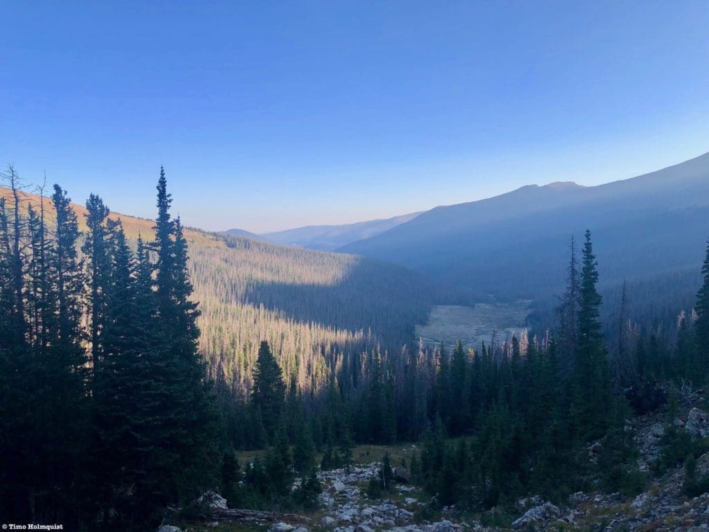
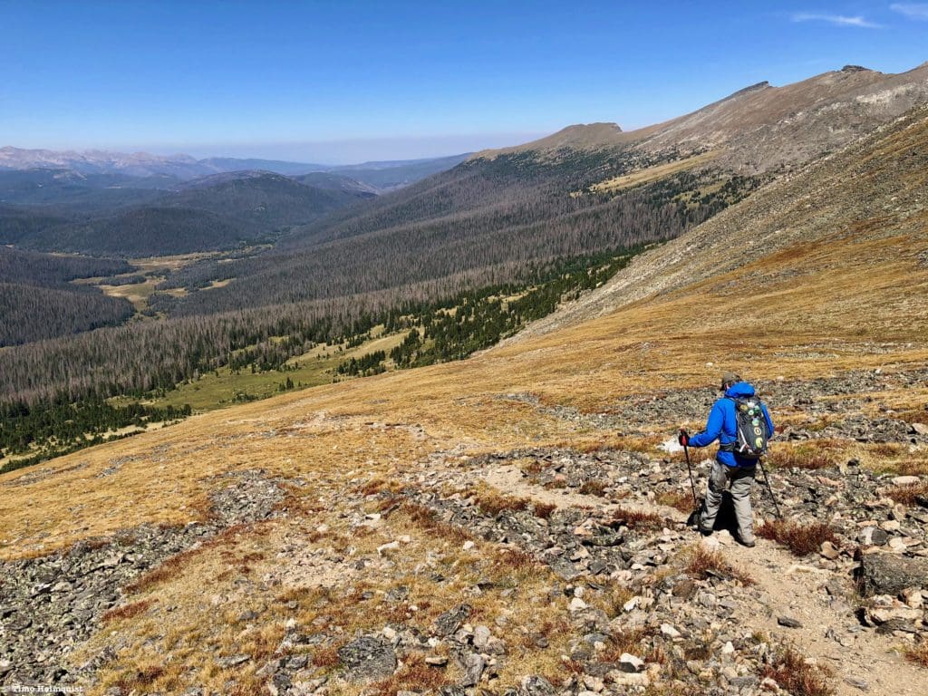
Looking down the valley to Old Fall River Road, the main way to reach Chapin Pass Trailhead.
The Ultimate Offline GPS Hiking & Ski Maps
See why onX Backcountry is the ultimate GPS navigation app for your outdoor pursuits. Try Today for Free. No credit card required.
Directions to Trailhead:
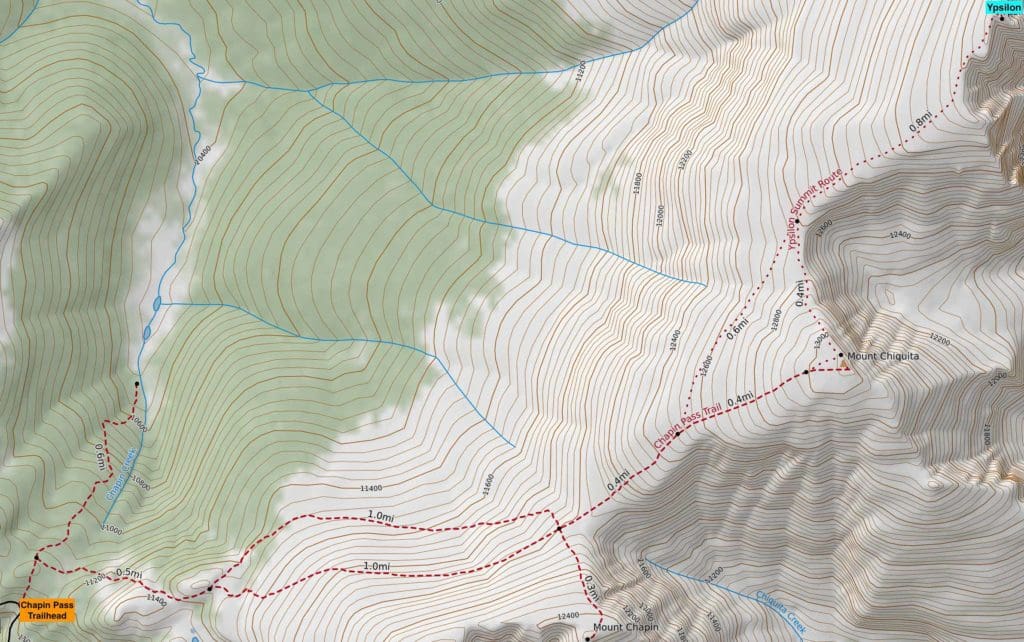
Chapin Pass Trail Map.
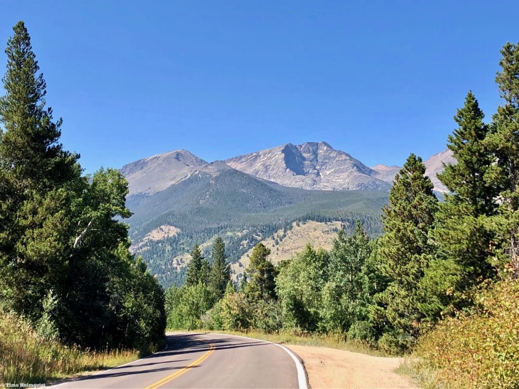
Despite being away from Trail Ridge and Bear Lake, the access for this trail is fairly simple once Old Fall River Road opens. Please note that it usually takes until July every year for Old Fall River Road to open, and it will close after the first heavy snowfall, which frequently occurs between September and mid-October.
From the east, enter the park via US 34, passing the Fall River Visitor Center. It’s possible to enter via US 36 at Beaver Meadows, but it takes a little longer. The key is to make it Horseshoe Park, where, at a large bend in the road surrounded by fields, you’ll notice a road heading west into a deep canyon. Signs will indicate Old Fall River Road and the Endovalley Picnic Area along with Alluvial Fan. Take a right if coming from the Fall River entrance and head west on the long, windy, one-way road. The road turns to gravel after Endovalley, so expect 30 minutes to get to Chapin Pass Trailhead.
From the west, enter the park, and traverse Trail Ridge all the way down to its intersection with US 36 (well past the alpine portions). Take a left on US 34 and make your way down to Horseshoe Park. Take a left on Old Fall River Road after seeing signs for Endovalley and Alluvial Fan. Drive up to Chapin Pass Trailhead.
Chapin Pass is close to the alpine but still below it; if you break out of the trees, you’ve gone too far. If this is your first time in the area, the best practice is to go a little slower. Since it’s a one-way road, there aren’t really opportunities to backtrack. The road will follow Fall River for most of the route with the occasional switchback. From Willow Park (a meadowed area frequented by elk), the road begins a series of switchbacks north up the slope. After the third switchback, start paying attention. The trailhead is on the right side of the road, and there will likely be cars parked alongside the road on the left- and right-hand sides. Carefully find a place to park (there are no guardrails) and find the trailhead leading north to start your journey. There is a large sign by the side of the road to mark the start of the trail. It is about 7.7 miles from Endovalley to Chapin Pass.
The view north from Ypsilon’s high summit, you can see some of the scarring left from the Cameron Peak Fire.
Places to Stay:
Find a Hotel in Estes Park, Colorado
Support Skyblue Overland by booking your hotel or cabin through one of our links.
Camping
Camping near Rocky Mountain National Park will cost you. The options for free area camping are limited. On a positive note, there are plenty of options, and the National Park is within driving distance of Fort Collins, Boulder, and Denver.
- Estes Park: Known as the gateway to Rocky Mountain National Park, Estes sees nearly 80% of park traffic as opposed to the much quieter western entrance near Grand Lake. The town has a ton of lodging options.
- Grand Lake: Located near the sleepier western entrance, Grand Lake sits on the edge of the deepest natural lake in Colorado and within half an hour of two more lakes (Shadow Mountain and Lake Granby).
- Rocky Mountain National Park Camping
- Moraine Park Campground: $30 per site. $20 in winter. Established campground with perks, facilities, campfire grate, wood for sale in summer, and bear boxes to store food. Only loop B is open in the winter, and it’s first-come, first-serve.
- For summer, a reservation is needed quite a ways in advance to secure a spot.
- Glacier Basin Campground: $30 per site. Established campground with the same perks as Moraine Park. Reservation required.
- Backcountry Campsites: Rocky Mountain National Park has backcountry sites that you could book in advance. There is no open camping in the backcountry; it must be at designated backcountry sites. Please check the park website for more details. Backcountry sites require an overnight permit of $30.
- Camping near Estes Park
- Estes Park Campground at Mary’s Lake: Established campground, pricey $45-55. Good backup if other campgrounds are full.
- Hermit Park Open Space: $30 for a tent site, price increases if towing a trailer or for group spots.
- Estes Park Koa: Rates are dependent on what you’re bringing with you but will run more than $50 a night in the busy season.
- Free or close to free: but a little farther (if you’re willing to drive)
- Ceran St. Vrain Trail Dispersed Camping ($1)
- County Road 47. Users have reported trash and ATV noise at this location, but it is free.
- Meeker Park Overflow Campground
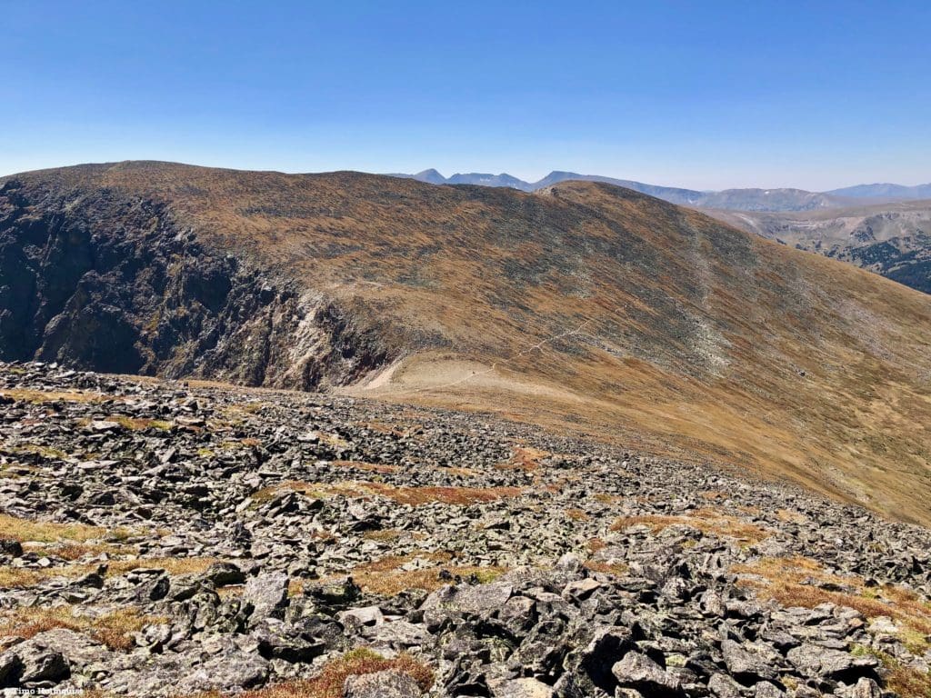
Ypsilon Lake and the striated Donner Ridge of Mt. Ypsilon from the summit of Chiquita.
Field Notes:
Due to the Cameron Peak fire of 2020, areas to the north and west of the main Mummy Range crest are temporarily closed. It is ok to hike along the crest. Please click here to assess the status of the area.
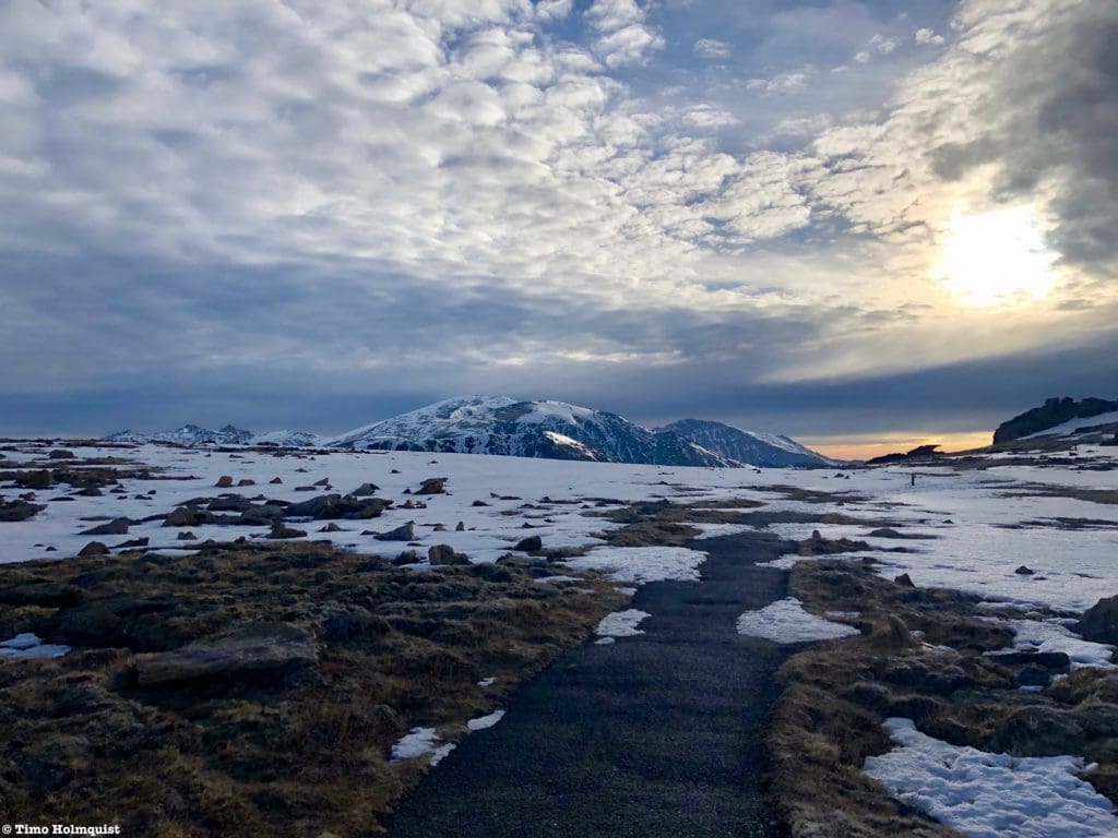
The majority of this hike is above treeline, so you really need a good weather day. From certain points on the trail, it’s possible to bail into the Chapin Creek drainage to find tree cover, but that option fades after you get to Chiquita. Bring sunscreen, lots of water, and know the signs of altitude sickness should they surface.
Since the majority of the hike is above treeline, orientation isn’t very difficult, but in inclement weather, the ability to orient is a must. Take care when traversing across the alpine; the vegetation is very sensitive up here.
While long-range forecasts in the mountains are pretty fickle, checking a few sources up to the minute you leave for the trailhead will help you get the latest and greatest weather predictions. Due to its relative proximity to the Alpine Center, I’d start by checking the weather for Trail Ridge. From there, I’d utilize mountain forecasts for Mt. Chiquita and Ypsilon Mountain. Pay special attention to temperature, thunderstorm chances, and wind speed, as the Front Range alpine is notorious for experiencing persistent and powerful wind gusts.
The Mummy Range from Toll Memorial Trail off Trail Ridge Road in early June. Ypsilon is the highest central mountain with Chiquita and Chapin in front of it; Mummy Mountain is off to the right of the main crest.
Journal:
This hike begins at the Chapin Pass Trailhead off Old Fall River Road. The trailhead kiosk should be visible on the right-hand side of the road but since the road is only one way, make sure you are able to secure a parking spot before passing the trailhead area.
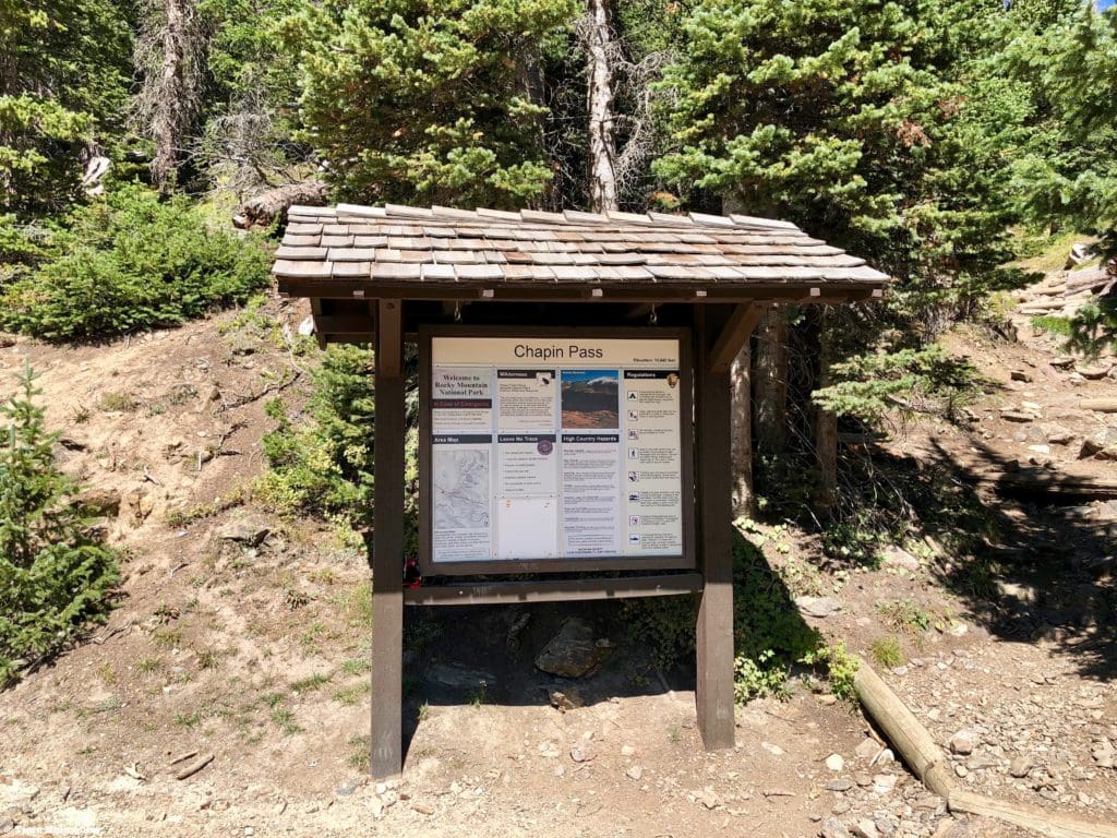
Chapin Pass Trailhead sign.
The trail will start up a drainage with a wide grade for the first 0.1 of a mile. This first ascent will get your blood pumping but stops almost as quickly as it starts. Due to damage from the Cameron Peak Fire, large parts of the National Park are still closed, and you’ll encounter a large, green fence blocking passage west the top of Chapin Pass.
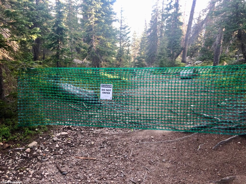
Fence blockage.
Fear not, the trail you want to take ascends to the right, keeping it in line with the main Mummy Range crest.
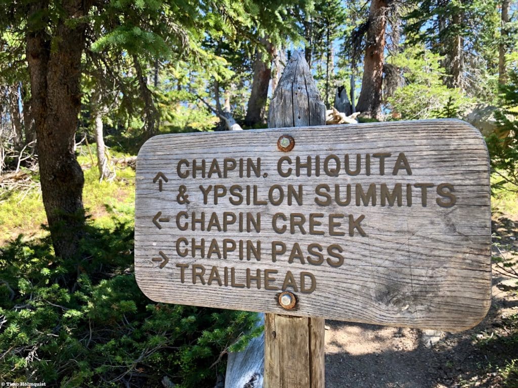
Follow the arrow to Chapin, Chiquita, and Ypsilon.
The trail will undulate along a series of low ridges just below treeline. Occasional fields and views to the north keep this stretch interesting.
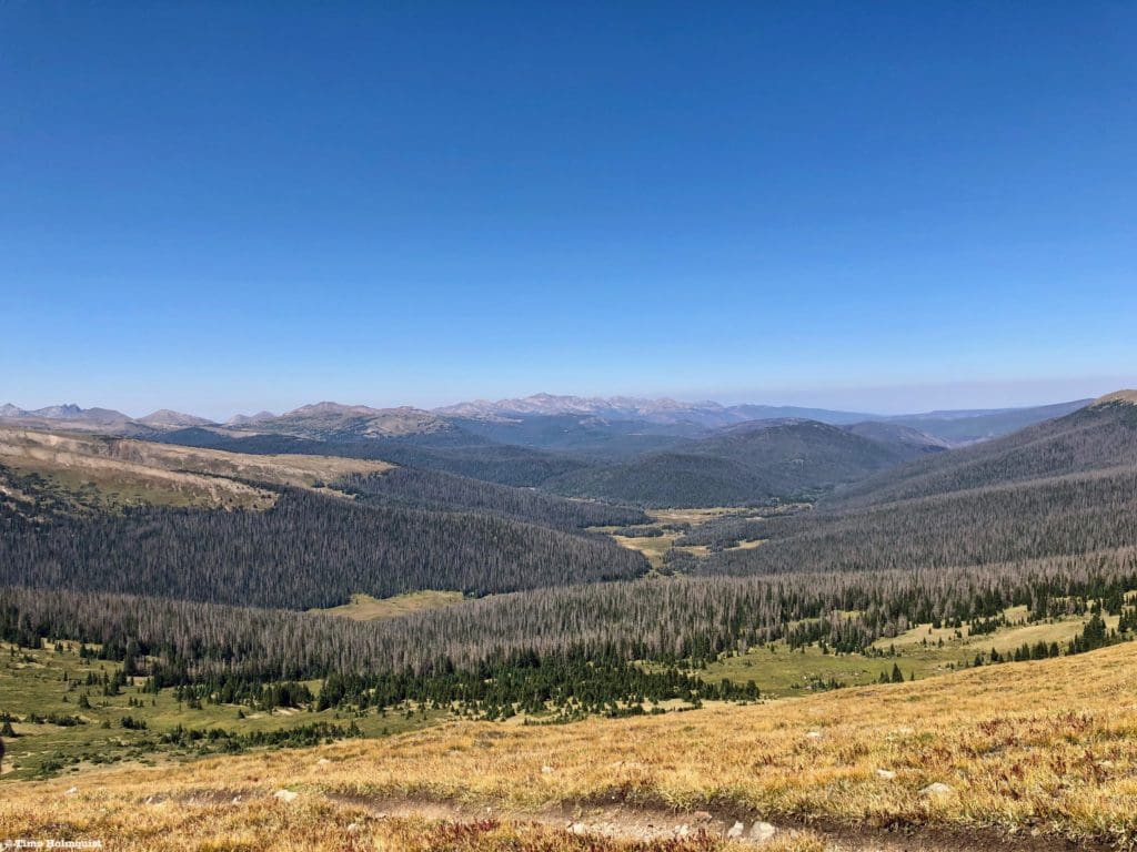
Looking north to the Cache La Poudre watershed.
You’ll pass an unofficial trail junction in this section. There are two paths that traverse Mount Chapin; they rejoin at the saddle between Chapin and Chiquita. If your goal is to peak bag, take the right variation, you can always take the other one on the way down.
The two variations.
After ascending a steep and undercut rock staircase, you’ll see where treeline is and ascend to it. Views will begin to open up behind you, and keen eyes can spot the Alpine Center on Trail Ridge to your west.
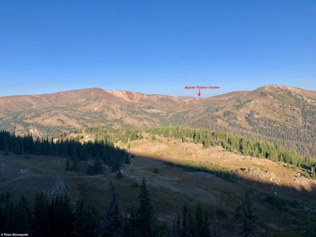
The view west, with the Alpine Center marked.
Once you breach treeline, the path will begin an ascending traverse along the western side of Mount Chapin. This section of trail is enjoyable, view-ridden, and susceptible to strong westerly winds. Make sure you’ve picked a good day to attempt it.
Early morning sun on the side of Chapin.
The double-humped summit of Chapin is most prominent at its southeastern edge, so traversing almost all the way to the saddle with Chiquita is the easiest method. Before you reach the saddle, hunt for cairns and a path leading up to the right.
Marked path for the best ascent up Chapin, taken from the slopes of Chiquita.
Once you pick your path, ascend a few hundred feet up until reaching the summit ridge and bounding up to the highest rock. There are at least two windscreens along the summit ridge to help in blustery conditions.
Looking north to the Desolations from Chapin’s gentle summit. Click here for a review of the Desolations scramble.
Chapin, like Chiquita and Ypsilon, features gentle northwestern slopes and cliffy, precipitous southeastern slopes. The views to the southeast offer great perspectives back to the Estes area. Enjoy your time on the summit and when you’re ready, descend back to the saddle between Chapin and Chiquita Once you reconnect with the main path, take a right and begin a steeper and longer ascent up Chiquita. This ascent is probably the toughest of the day; slow your pace down to match your breath. None of the ascent is particularly difficult, but it is sustained.
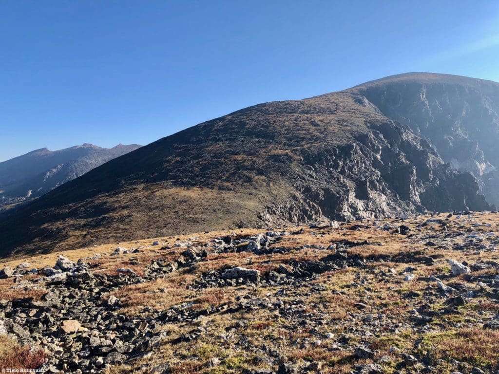
A nice shot of the entire Chiquita incline.
You can generally split the ascent into two components separated by a bench. The slope angle relents on the bench, and you should be able to look back and see that you are taller than Chapin.
After the first pitch up Chiquita.
The majority of the rise is marked by healthy tundra and a fairly defined path, although it is not maintained. When you get close to the summit, the talus finally begins making an appearance.
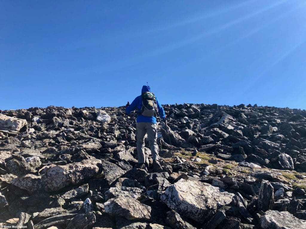
Changing ground composition as you near the summit of Chiquita.
Like Chapin, Chiquita has a gentle, rounded summit marked by steeper cliffs on its southeastern edge. There are two windscreens here as well, though you can usually find a place to hide along the stepper side if the wind is blasting out of the west.
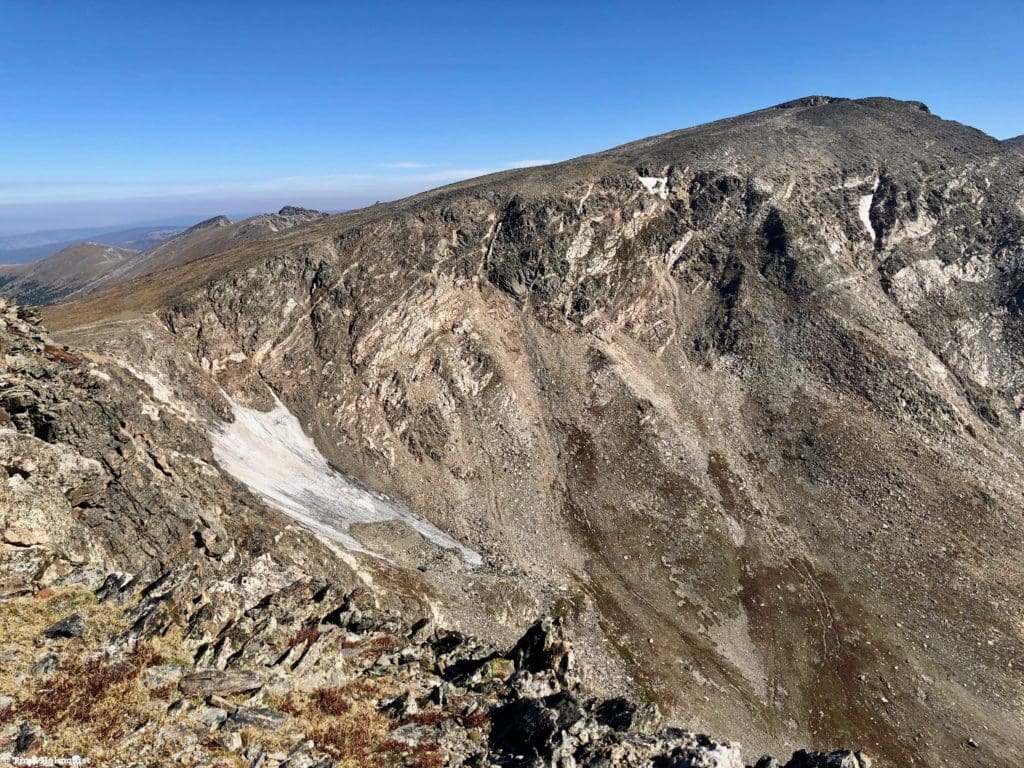
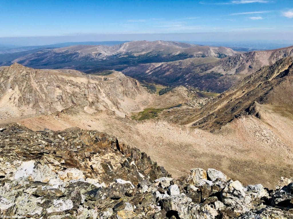
Snow hiding between Chiquita and your highest target of the day, Mt. Ypsilon.
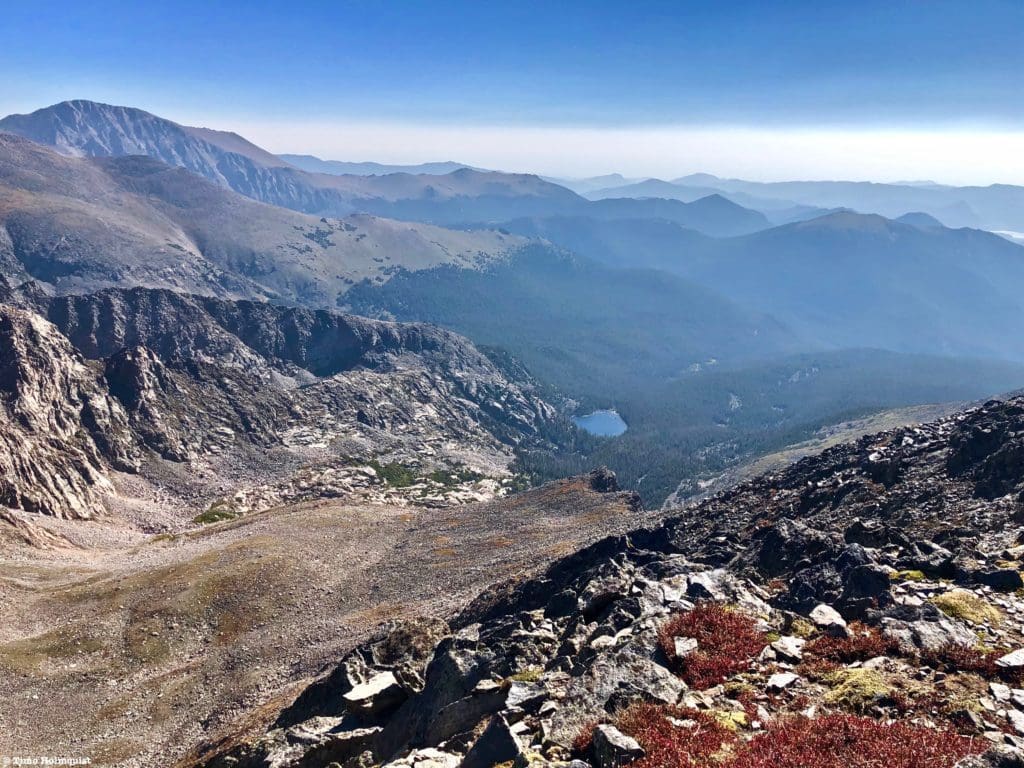
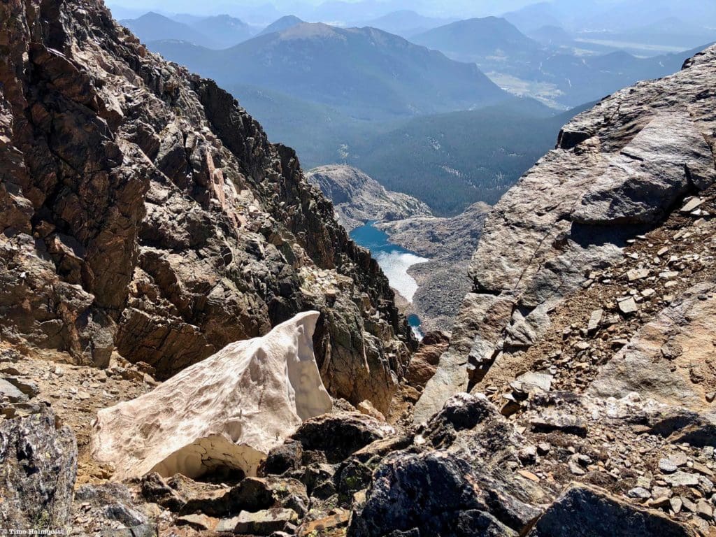
Keen eyes can spot Lake Ypsilon far below the summit and the treed valleys leading down to US 34 and the Alluvial Fan area.
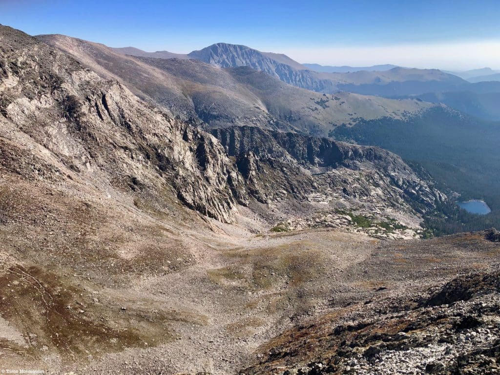
Lake Ypsilon and Mummy Mountain in the background.
As you leave the summit area and descend to the next saddle, take a second to look back at the highest point. Like Chapin, without the windscreen present, it’s tough to figure out which individual rock is the highest.
Such a weird, flat summit.
The simplest way to reach the following saddle is to parallel the steeper side of Chiquita and follow that line down to the low point. Since you’ve been above treeline since before Chapin, orientating should be fairly straightforward unless you’re in white-out conditions.
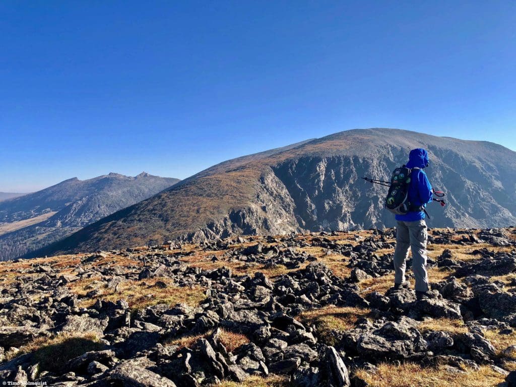
Looking back to Chiquita from the slopes of Ypsilon.
Ypsilon is a fascinating mountain. The mountain profile from your ascent route doesn’t look like much and presents just like a bigger, lumpier cousin of Chiquita. The precipitous eastern side, however, harbors a handful of exquisite scrambling routes, including the legendary Blitzen Ridge (YDS 5.4). Like most of the Mummy Range, Ypsilon is a peak of contrasts, best exemplified from various viewpoints along US34 or when returning from Bear Lake Road.
The mountaineer’s eastern side of Ypsilon.
Don’t worry though, from your path along the crest of the range, Ypsilon barely makes a Class 2 status, and only because the talus near the top means the definable trail disappears, so simple route choices have to come into play. Don’t forget to stay close to the crest so you can peer down each arm of the Y-Chutes, which, in winter, are some of the hardest ice and mixed climbing routes in the park. If you’re lucky, there may even be a bit of snow left in one of the arms.
A small winter holdover after a particularly hot summer.
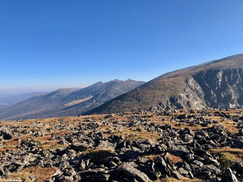
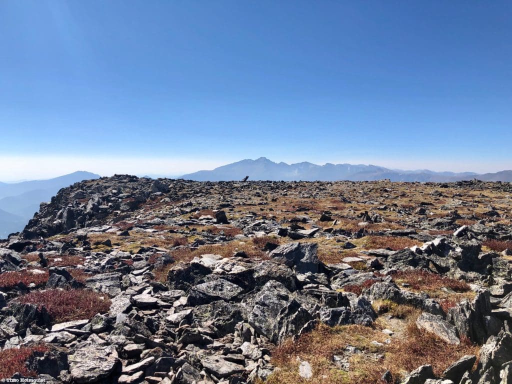
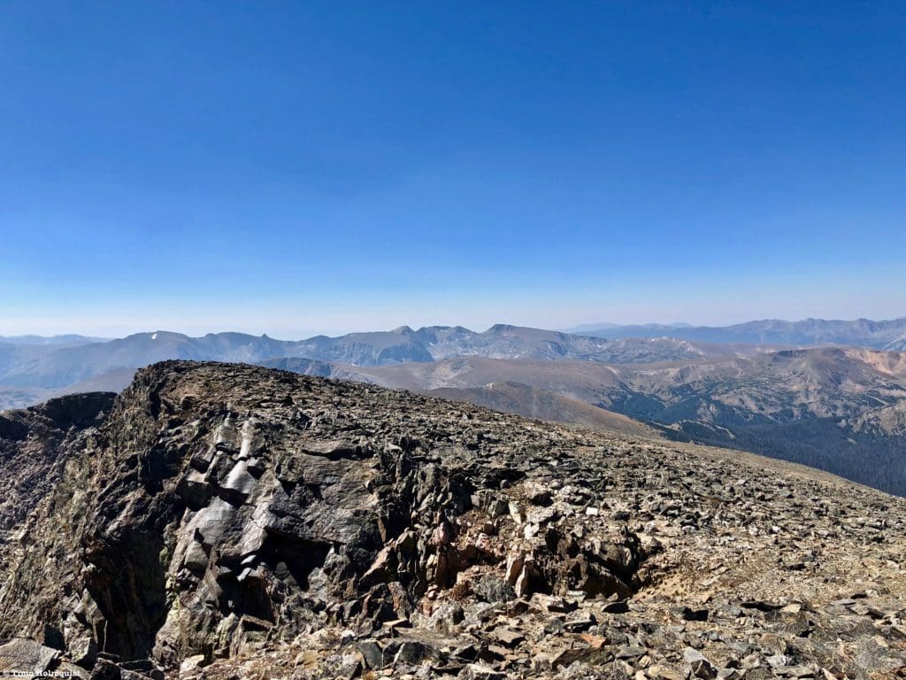
The top is once again quite flat, but a windscreen set up near the top should help you find the highest point. You’ll also be able to stare at the northeastern part of the Mummy Range, which has remained hidden for the majority of your hike. All three major peaks you can see are in the top five highest for the range, including Hagues, which is the tallest.
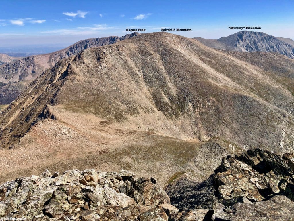
Labeled Mummy Range to the north.
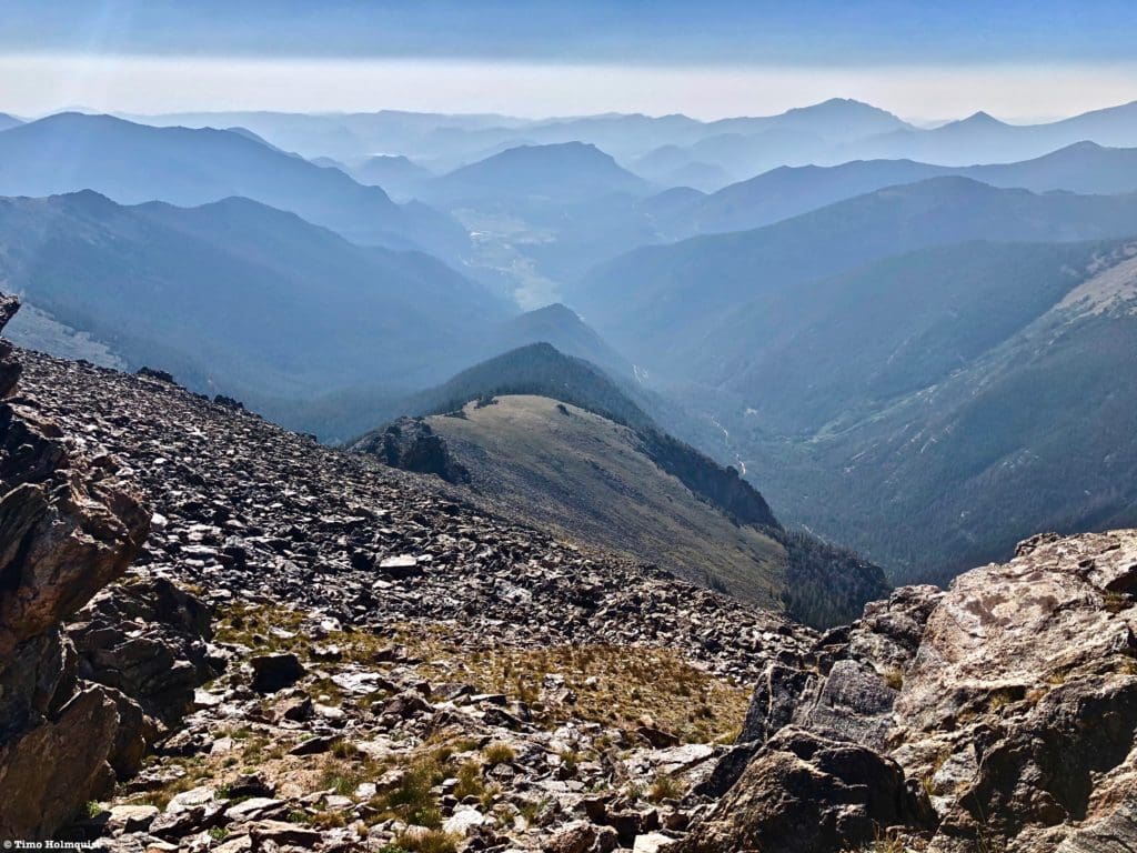
Directly north, you can make out the large valley separating the Ypsilon from the Comanche Peaks (still part of the Mummy Range), whose east-west ridgeline marks the National Park boundary. This vantage point is also interesting because you get a sense of how high the park is compared to the hills near Fort Collins. The entire geography of northern Colorado (save the Medicine Bow Range) takes a big step down until running into Wyoming.
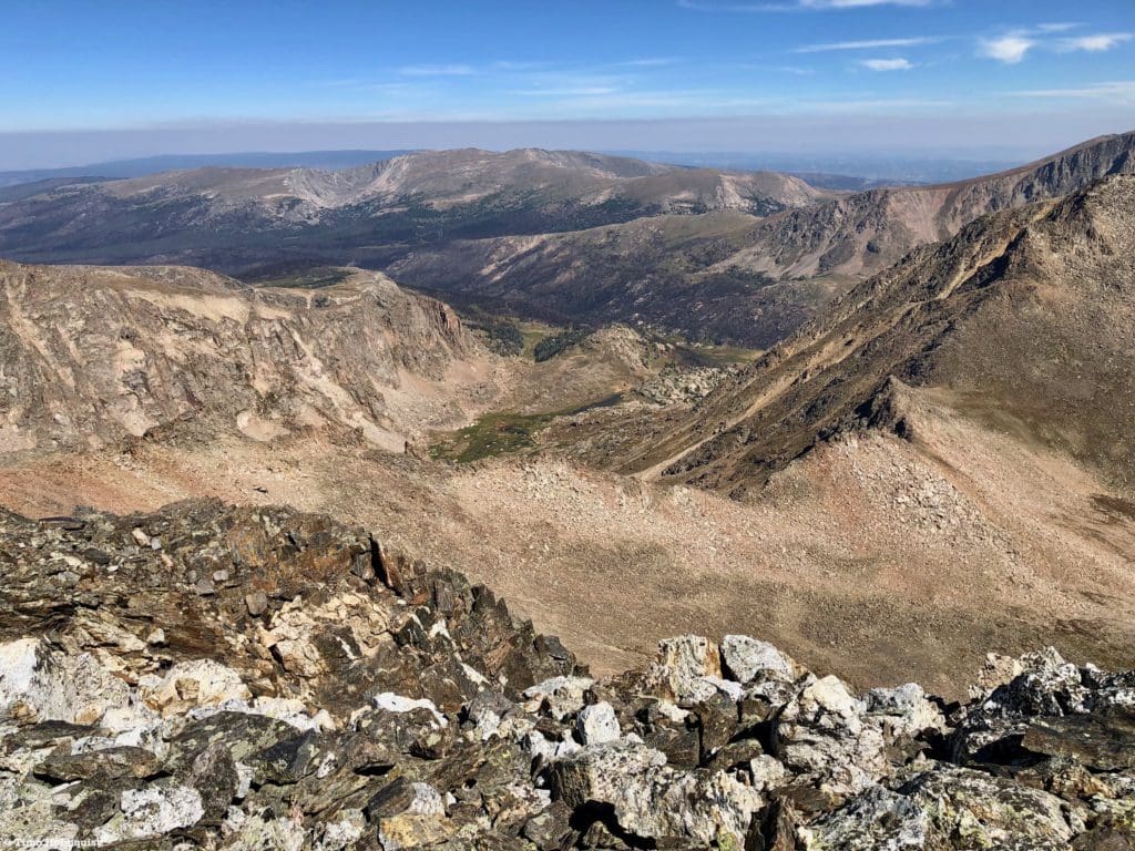
Looking north to the Comanche Peaks and the lower hills beyond. The sick-looking layer of particulates settling over the lower country is from rampant wildfires in California.
The curious bowl housing mirror lake to the left of Comanche Peak also looks like an impact crater from some behemoth space object. For fans of long-range views and strange geography, the summit of Ypsilon is a good place to be.
Twisting west, you’ll also be able to glimpse the thin line of the Never Summer Range as it connects with the Medicine Bow at Cameron Pass. Both ranges are remote and beautiful.
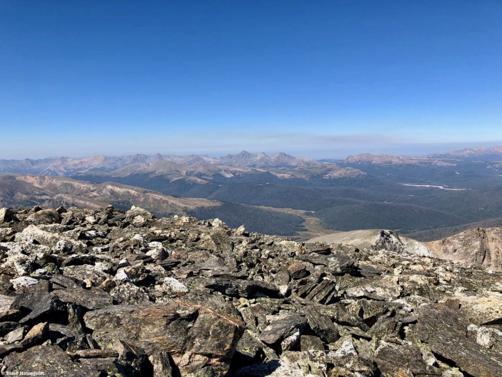
The Never Summer and Medicine Bow Ranges.
If you’re doing Ypsilon as part of the Mummy Mania (or Mummy Kill) challenge, continue off the summit into the deep saddle between Ypsilon and Fairchild. This ridge will have you encounter your first bout of scrambling, which will increase as you get towards Hagues Peak.
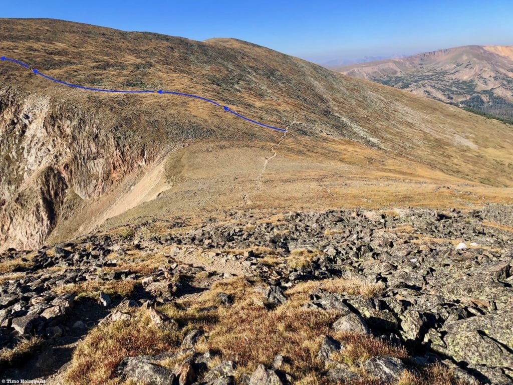
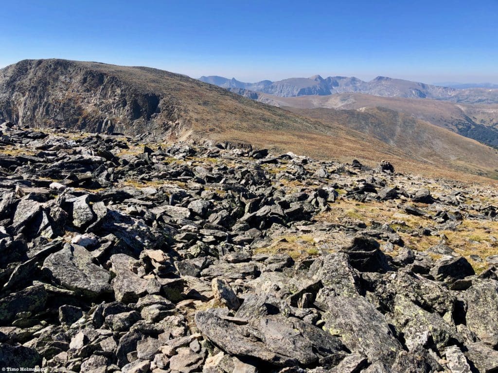
For mere mortals, this is as good a spot to turn around as any. Bid Ypsilon adieu and return the way you came. While the talus slopes are a bit harder to navigate as multiple cairns exist in multiple places, the general orientation is first south along the summit area and then southwest to the saddle with Chiquita. When you near the saddle, you’ll see Chiquita’s obvious summit lump. There are a series of cairns that break to the right of the lump, traversing a healthy stretch of alpine. This bypass saves elevation and time; keep in mind, however, that the “path” is really only marked by cairns, and any dirt path will fade in and out as you traverse, so it does require you to keep your head on a swivel. Having said that, on a clear day, it shouldn’t be a problem.
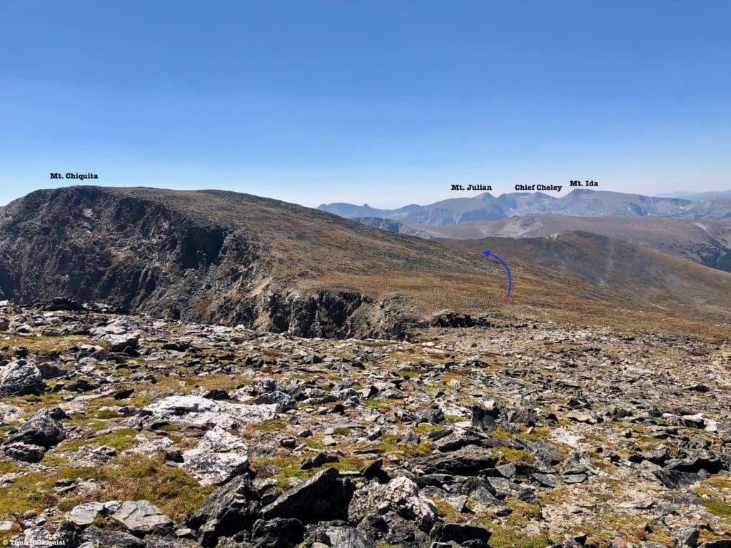
The saddle with Chiquita and the general route of the bypass marked.
Since the wind often blasts out of the west, this side of the mountain can be pretty gusty, but the solitude, extensive views, and less effort make it an attractive option once your summitting goals have been completed.
A more definable stretch of the bypass. Everything you see in this picture is managed by the National Park and adjacent wildernesses, highlighting the size and depth of protected areas in this part of Colorado.
After 10-20 minutes, depending on your pace, you should round Chiquita and be able to see down to Chapin. Descend to the saddle, veering left to rejoin the main path up the crest.
Familiar territory as Chapin comes into view.
Just beyond the saddle with Chapin, you’ll come across the two traverse options. If you took the higher one on the way up, take a right and follow the lower bypass. Since you’re descending, the effort is negligible and this version provides a great and more intimate profile of the steeper sides of the range.
First steps on the lower bypass, West Desolation, point 12795, and Flatiron Mountain, guard the right side.
Because this variation is lower, it feels a bit more welcoming, offering the sweep of Chapin Creek Valley to the north. While gorgeous, you can see why the area was so susceptible to burning with large swaths of dead Pine Trees from the Pine Beetle infestation visible.
Down the valley, Clark Peak, the highest point in the Medicine Bow, is visible just left of center.
Make sure to take a look back at where you came from and the bulky profile of the mountains you’ve climbed.
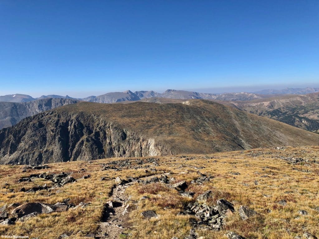
The lumpy profile of Chiquita, with Ypsilon on the left fringe and the pass with Mount Chapin on the right.
You’ll soon reconnect with the higher variation and take the combined trail down to the top of Chapin Pass, where a quick left with lead you down to the trailhead.
Final Thoughts:
This hike is a fun, high-altitude introduction to the Mummy Range and best hiked on a crystal-clear day with 100-mile views. If views are inhibited, the sweep of the impressive local geography ends up being reduced. Similarly, if the skies are impacted by inclement weather, it can be tough to orient yourself up high. Since more than 90% of this hike occurs above treeline, sunscreen and sun protection (hat, layers, etc.) is a must. You can burn really easily in the middle of the summer above 13,000 feet. If you’re in the area and want a hike with fewer people than the often tourists choked Bear Lake area, consider the Mummy Range. Since the effort requires parking at Chapin Pass, you’ll need to finish driving the one-way road up to the Alpine Center and then cruise Trail Ridge back to wherever you arrived from. Despite the occasional traffic, driving Trail Ridge is a nice cap on any high elevation Rocky Mountain National Park adventure.
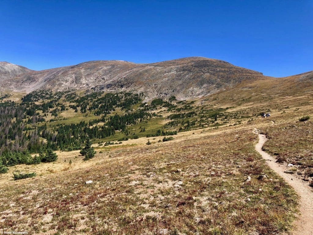
The views are pretty constant once you get up above the trees.
Popular Articles:
- Guide to the Best Hiking Trails in Rocky Mountain National Park, Colorado
- The Dyrt: The 10 Best Campgrounds In Colorado
- Top Adventure Sports Towns 2021: Boulder, Colorado
- Epic Adventures with the Best Guides In Colorado
- Sky Pond via Glacier Gorge Trail, Rocky Mountain National Park, Colorado
- Scrambling Hallett Peak’s East Ridge, Rocky Mountain National Park, Colorado
- Scrambling Mt. Alice via the Hourglass Ridge, Rocky Mountain National Park, Colorado
- Gorge Lakes Rim Scramble, Rocky Mountain National Park, Colorado
- Black Lake Via Glacier Gorge Trail, Rocky Mountain National Park, Colorado
- Scrambling To The Lake Of The Clouds, Rocky Mountain National Park, Colorado

Skyblue Overland Strongly Recommends That You Enroll With Global Rescue Prior To Embarking On Your Next Adventure.
With more people outside now more than ever, Global Rescue expanded services to include field rescue within 100 miles of home. With Local Field Rescue — automatically included in any travel protection services membership — Global Rescue is there whether you’re hiking, kayaking, snowmobiling, fishing or simply enjoying the outdoors and get ill or injured and you’re unable to get to safety on your own. Purchase a Global Rescue membership for your next adventure and travel with peace of mind. Single trip, annual and family options are available.
Memberships start at $119.
Terms of Use:
As with each guide published on SKYBLUEOVERLAND.com, should you choose to this route, do so at your own risk. Prior to setting out check current local weather, conditions, and land/road closures. While taking a trail, obey all public and private land use restrictions and rules, carry proper safety and navigational equipment, and of course, follow the #leavenotrace guidelines. The information found herein is simply a planning resource to be used as a point of inspiration in conjunction with your own due-diligence. In spite of the fact that this route, associated GPS track (GPX and maps), and all route guidelines were prepared under diligent research by the specified contributor and/or contributors, the accuracy of such and judgement of the author is not guaranteed. SKYBLUE OVERLAND LLC, its partners, associates, and contributors are in no way liable for personal injury, damage to personal property, or any other such situation that might happen to individuals following this route.


