


High Point:
10,370 feet

Total Ascent:
~2,711 feet

Difficulty:
Hard

Distance:
14.8 miles

Waypoints:
40.1112, -105.7464

Route Type:
Out and back
Lone Eagle Cirque is a breathtaking set of six peaks that surround Crater Lake in the Indian Peaks Wilderness. Although each peak is breathtaking, it pales in comparison to the view of Lone Eagle Peak from Crater and Mirror Lakes.
Overview:
Crater Lake is one of the most beautiful locations in the Colorado mountains. It is also not a secret location. Despite its distance from the Front Range urban corridor, people pour into the basin all summer to experience the natural splendor of the area. Many opt for the day trip, which from Monarch Lake is an 14.8-mile out-and-back trail, but doable. You can also access Crater Lake from Brainard Lake on the eastern side of the divide, but it requires two crossings of Pawnee Pass. If you’re a good planner and can secure campsite reservations months ahead of time, it’s a brilliant place to spend a few days. There are, however, no campfires allowed and only 12 designated campsites. If you come without a reservation or camp in an unofficial campsite and a ranger sees you, you will be ticketed.
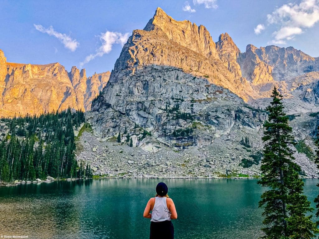
Lone Eagle Peak and Crater Lake.
Table of Contents:
Article Navigation: Click on any of the listed items in the table of contents below to jump to that section of the article. Similarly, clicking on any large, white section header will jump you back to the Table of Contents.
- Overview
- Scales and Criteria
- Directions to Trailhead
- Places to Stay
- Field Notes
- Journal
- Final Thoughts
Scales and Criteria:
This article uses two metrics to calculate difficulty: overall distance and elevation gain. If ascending any mountains from Crater Lake, a scramble rating needs to be included. This review only focuses on views attainable via trail and does not cover scrambling. Keep an eye out for a Lone Eagle Cirque article in the near future that will cover area routes. Snow lingers on the trail into early June but clears by July. The trail is quite popular in July/August, with a noticeable drop in traffic after Labor Day weekend.
Difficulty Ratings:
- Easy: less than 5 miles, less than 500 ft. of elevation gain
- Moderate: 5-10 miles, 500-2000 ft of elevation gain
- Hard: 5-15 miles, more than 2000 ft. of elevation gain
- Very Hard: 10+ miles, more than 3,500 ft. of elevation gain
One of multiple cascades on the trail in from Monarch Lake.
The Ultimate Offline GPS Hiking & Ski Maps
See why onX Backcountry is the ultimate GPS navigation app for your outdoor pursuits. Try Today for Free. No credit card required.
Directions to Trailhead:
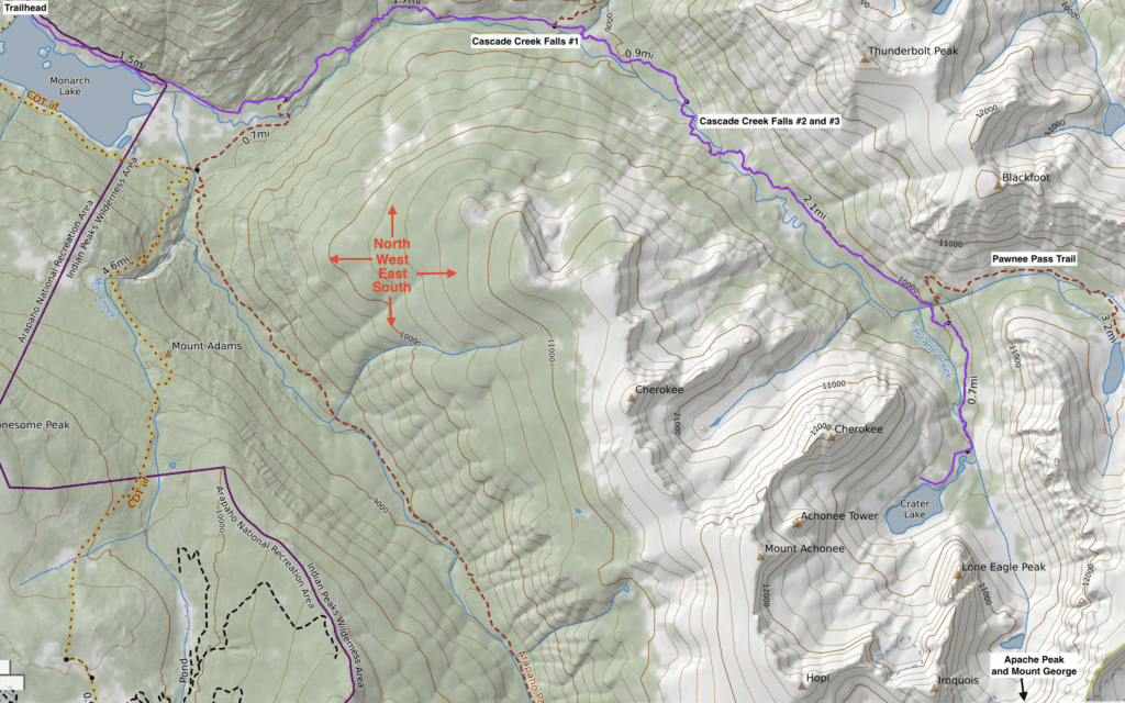
Crater Lake Trail Map.
There are two main ways to access Crater Lake, the first is from Monarch Lake, and the second is from the Brainard Lake Recreation area. The trail from Monarch Lake is easier because you don’t have to deal with an extra up and down journey over Pawnee Pass; the scenery along the trail is also lovely. The downside is that it starts on the western side of the divide, which means a roughly 3-hour drive over Berthoud Pass or Trail Ridge to get to it from the Front Range.
To get to Monarch Lake, take I-70 west from Denver, or take Trail Ridge over Rocky Mountain National Park. If taking Trail Ridge, be aware of restrictions and passes; click here for details. For 2021, there are two pass components, an entrance pass, AND a timed entry permit. Please find out the details of both components before committing to this route. Once in Grand Lake on the western edge of the National Park, continue south towards Granby. You’ll pass Shadow Mountain Lake first, followed by the larger Lake Granby. Take US34 south until sighting CO Rd 6, which should have a large brown sign indicating campgrounds and lake access. Take a left onto it. If you pass the road, US34 will run downhill significantly, and you’ll lose sight of the lake. Find a place to turn around and re-ascend to CO Rd 6.
From I-70, proceed west beyond Idaho Springs until seeing signs for Winter Park and Berthoud Pass. The exit number is 232. Take US40 through the small town of Empire (slowing down as indicated) and then proceed up Berthoud Pass with its numerous hairpin turns. Once you crest the pass, proceed north through Winter Park, Fraser, and eventually the town of Granby. Just beyond Granby, you’ll see a large intersection with US34; take a right onto it. Once on US34, proceed north, rising up a valley until sighting CO Rd 6 on your right. The turnoff is right before your first look at Lake Granby. If you see the lake, you’ve probably passed the turnoff; use a number of pullouts or side streets to turn around.
Once on CO Rd 6, proceed west, where, after a few minutes, the road turns to gravel and passes along the southern edge of the large lake. You’ll be on this road for nearly 10 miles. After passing the lake, you’ll run into some established campgrounds, continue straight through a three-way intersection and drive on the rough but 2-wheel drive passable road until it dead-ends into the Monarch Lake trailhead. There is a $5.00 per day parking fee, although interagency passes like the America the Beautiful Pass will work.
From Boulder and Denver, it’s 2.5 hours to Monarch Lake using Berthoud Pass. From Fort Collins and points north, it’s a little over 3 hours using Trail Ridge road.
The western Indian Peaks Wilderness can get wild.
Places to Stay:
There are a few places to stay in Grand Lake, Granby, and Winter Park. Click here for some options. Below is a list of nearby campgrounds, which may provide even closer access. The trailhead is three hours from major metro areas, which makes it possible to do from Denver in a day, but it is a long day.
- Arapaho Bay Campground: Only five minutes from Monarch Lake Trailhead, walking distance to Lake Granby. Check pricing on website.
- Stillwater Campground: Within half an hour of trailhead. Check pricing on website.
- Green Mountain: Located on Shadow Mountain Reservoir, 30 minutes to Monarch Lake. Check pricing on website.
- Crater Lake Backcountry Sites: Reservations open up in mid-March and fill VERY quickly.
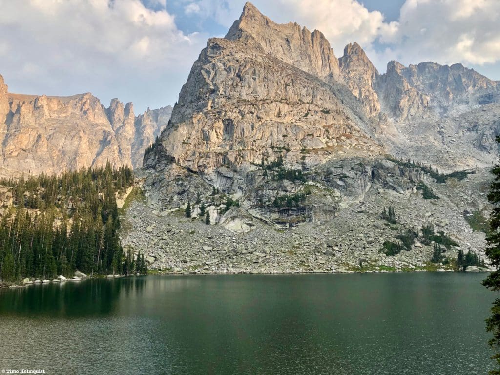
The Crater Lake Basin from a shoulder of “Cherokee” Peak.
Field Notes:
The Indian Peaks Wilderness can be divided into two major sections: east and west. The more accessible eastern side is one of the most popular launch points for alpine hiking in the state because it’s within an hour of large parts of the Denver metro area. The western side is far more remote and retains a wonderful “out there” feeling, both because of the longer approaches and because of the serrated ridges and lush vegetation.
The best way to experience the western IPW is to camp there for multiple days using Crater Lake, Gourd Lake, Hell Canyon, or the Arapaho Pass Trail. Due to its ballooning popularity, this wilderness area comes with nearly the same number of restrictions as the National Park. If camping is your goal, planning is a must. Reservations are required through recreation.gov and tend to go on sale by mid-March of the year in question. There are some passes held in reserve but the race to nab them online is seldom a fun experience. Please visit here for more information.
If you’re in shape and unwilling to navigate the permit system, a one-day approach to the area is doable from both the eastern and western sides of the wilderness. Monarch Lake to Crater lake is 7.4 miles one way with ~2700 feet of gain but is a much gentler and scenic approach. From Long Lake in the Brainard Recreation Area, it is possible to hike up and over Pawnee Pass to get to Crater Lake. This approach is nearly 9 miles long with similar elevation gain; however, you’ll need to climb back up Pawnee Pass on the way out, which can be quite disheartening. The positive side is that the trailhead is only an hour from the Denver metro. To park at Brainard Lake requires some permits as well; please visit here to figure those out.
Look, the permits system is annoying, but it makes sense. This is already a popular area and not a hidden gem. In an effort to keep things wild, limit crowding, and reduce wildfire potential, restrictions were enacted years before COVID first reared its ugly head. Since then, some areas have added additional stipulations like timed entry. It is what it is, the area is only so large, and the number of people interested in visiting keeps increasing. Fires are not permitted anywhere on the eastern side of the divide and are also illegal around Crater Lake. The western US is a tinder box, and punishment will be severe if you’re found to have started a wildfire. It only takes one careless individual to ruin thousands of acres of prime recreation area; please be smart. If you don’t want to deal with restrictions, go somewhere else.
Throughout the article, you’ll notice me using quotes around some mountain names. This is intentional. Mountains with “” around the name do not have official titles. However, since this is a rock-climbing, mountaineering, and scrambling haven, people have, over time, given them names. At this point, calling them by anything else would be more confusing than just sticking with their informal but recognized names. Mountains with official names are listed without quotation marks.
“Limbo” and “Iroquois” from the basin to the west of Crater Lake.
Journal:
The trail to Crater Lake begins at Monarch lake in the Arapaho Recreation Area. Once you park, proceed west through the gate and towards a hut with a check-in station. If you’re camping, have one person in your group write your information down. The information on the check-in sheets helps rangers and forest service personnel keep track of who is out recreating and sound the alarm if someone fails to return from whatever destination they were listed as visiting.
The trail around Monarch Lake is wide and scenic with views aplenty, lots of waterfowl, and, if you’re lucky, chances to spot Moose by the marshes on the western end of the lake.
Once you pass the edge of the lake, the trail will enter a forest and your first trail junction. A right will take you to the other shore of Monarch Lake for a nice loop, but if you want to see Crater Lake, continue west.
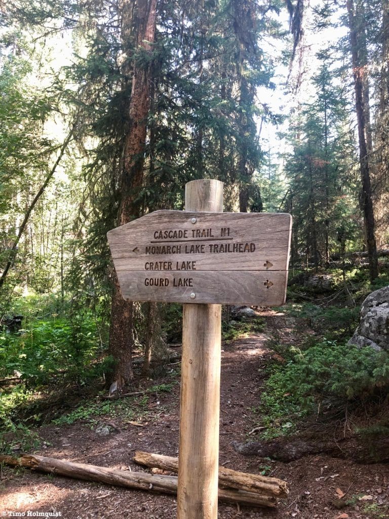
Trail sign around the western edge of Monarch Lake.
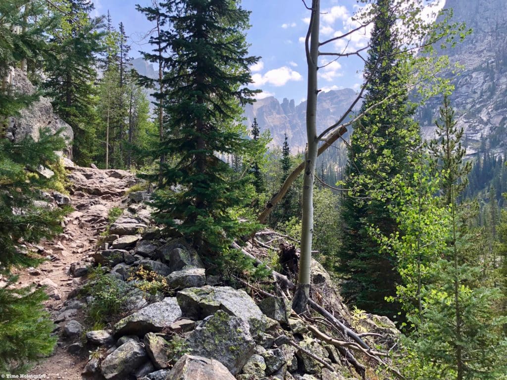
The trail will begin to rise along Buchanan Creek, offering numerous short-range views and a few steady inclines.
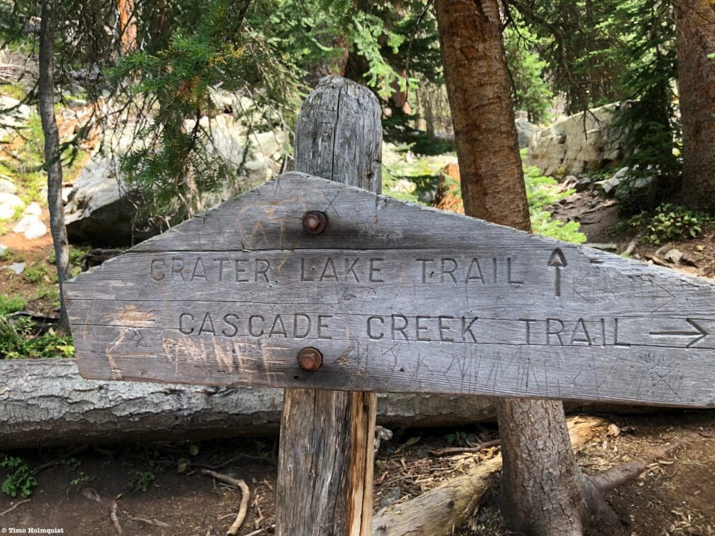
Eventually, after roughly three miles of trail walking, you’ll reach the junction with the Buchannan Pass Trail. Take a right to continue to Crater lake.
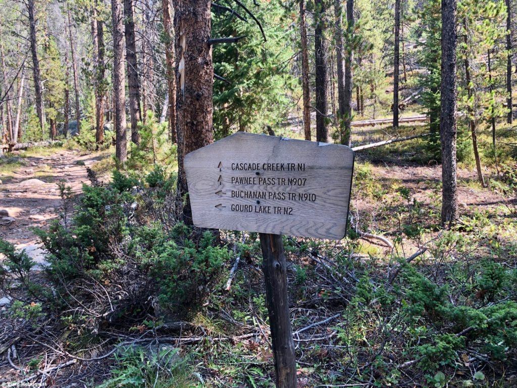
Trail sign
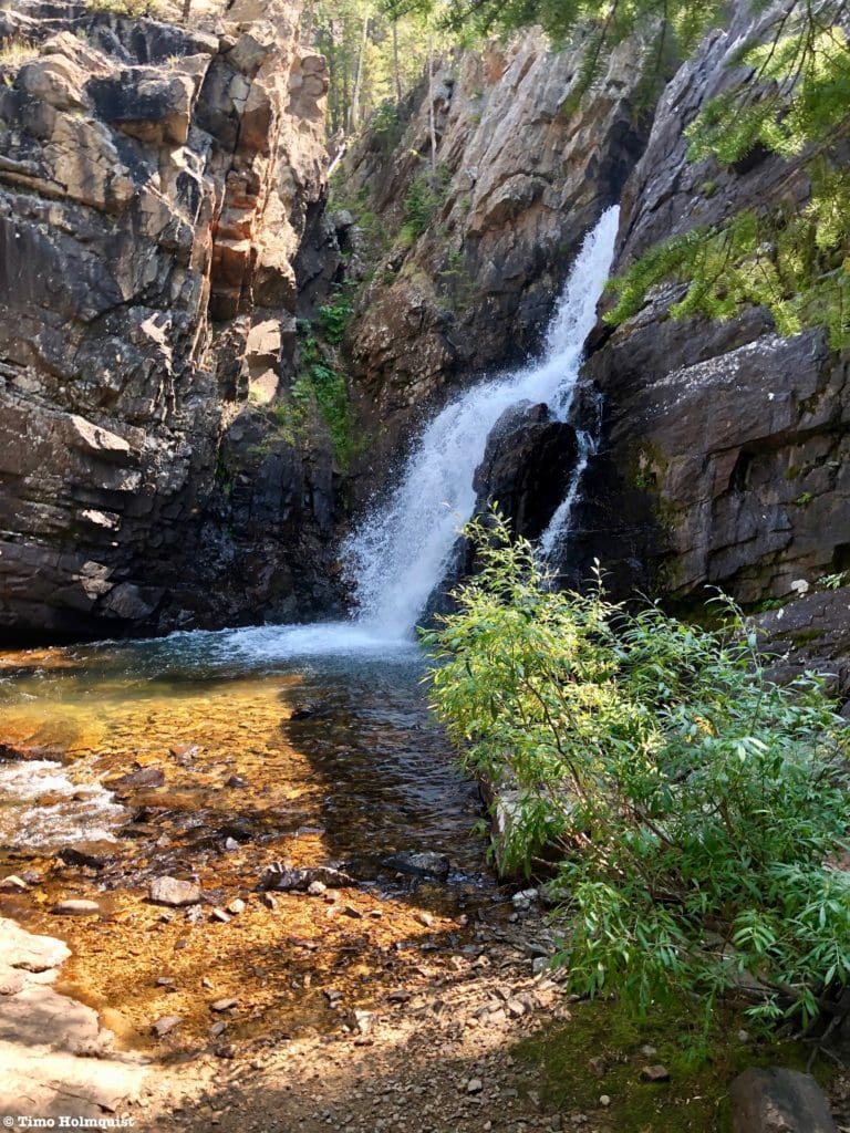
The trail will cross Buchanan Creek and rise to Cascade Creek, which thunders through a rock cleft in a series of scenic cascades. This will be the first of at least three waterfalls you’ll pass. If you’ve been hoofing it since the trailhead, this is also a good break spot.
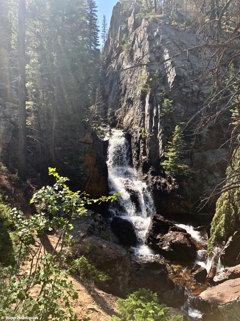
Cascade Creek Falls #1.
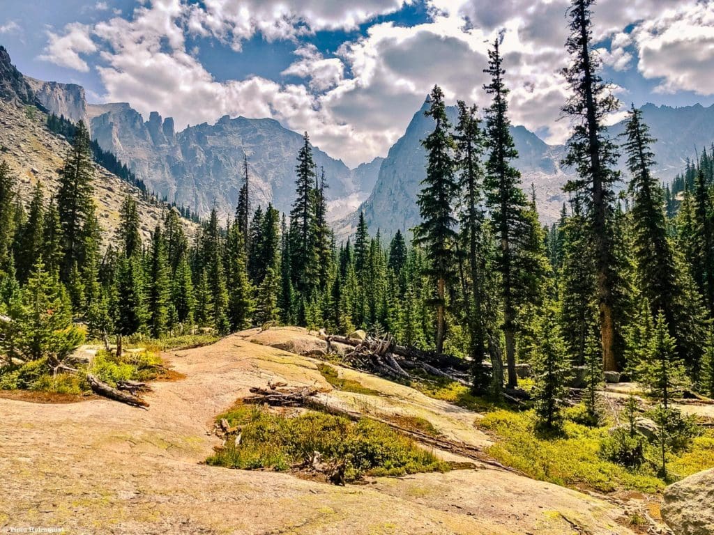
Beyond the falls, the trail tackles a steeper elevation step before flattening out alongside the creek. The rest of the trail is similar to that in profile with shorter, steeper steps, augmented by flatter sections alongside meadows and forests.
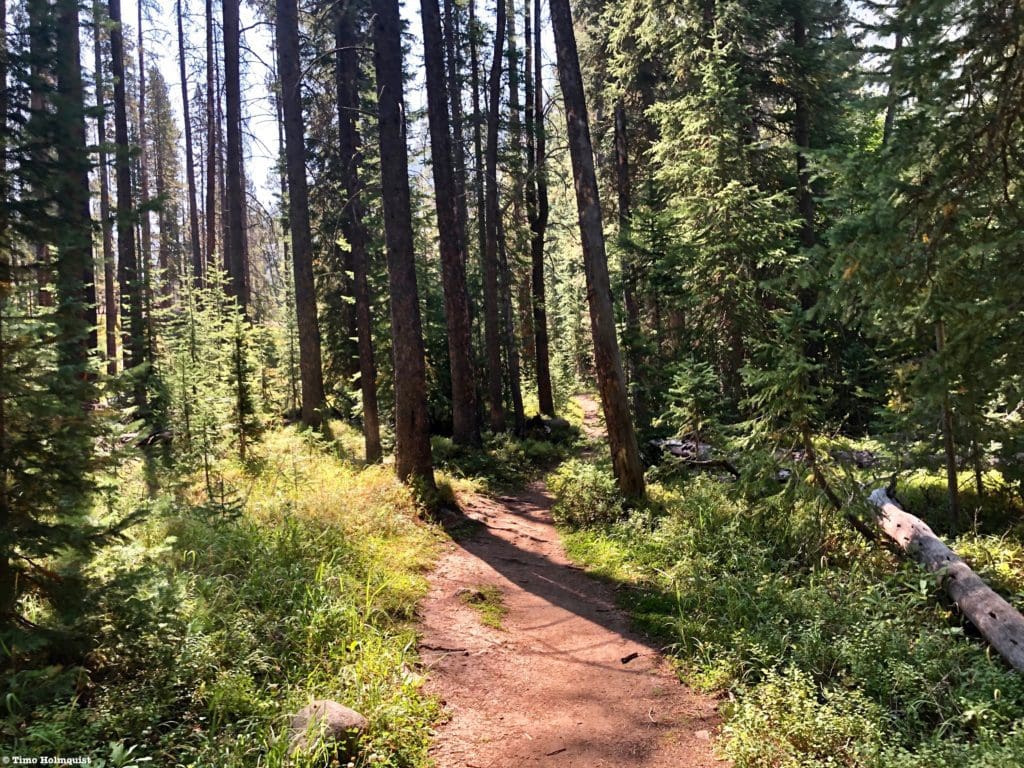
A forested, flatter section above the first waterfall.
You’ll pass numerous fields where moose and elk are common. They also provide a lovely contrast to the forests and allow you to get a better sense of the changing mountainscapes. In the middle of the summer, on a bluebird day, these open meadows receive a lot of rays, so make sure you’ve got sun protection and a hat.
Before long, you’ll reach another elevation step and the second waterfall.
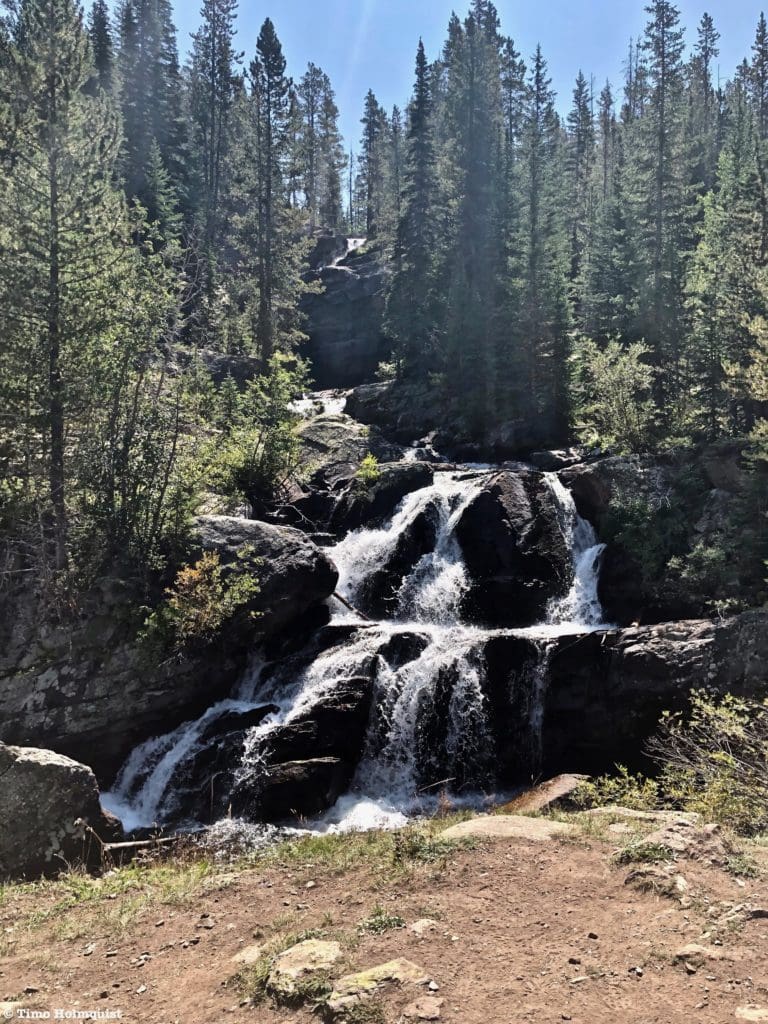
Cascade Creek Falls #2.
A lot of people stop at the second falls, but the third waterfall is only a few minutes higher on the trail and prettier, in my opinion.
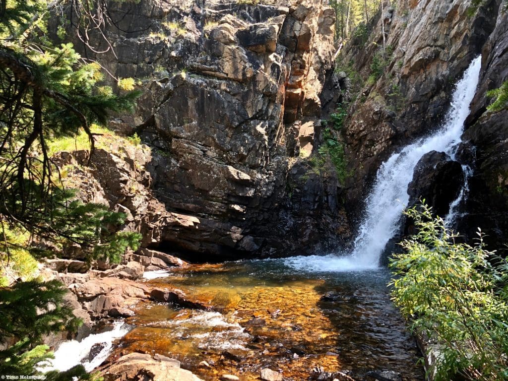
Cascade Creek Falls #3.
The trail will once again flatten before rising up another elevation step. Switchbacks aid the journey, but your legs will be feeling it if you are backpacking.
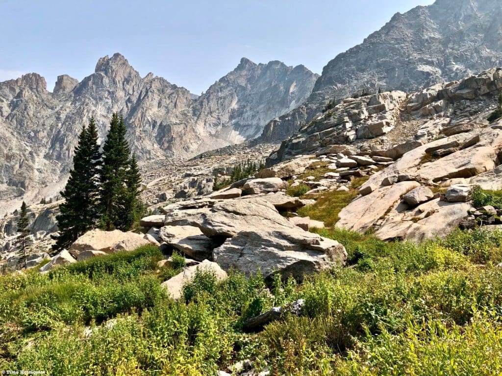
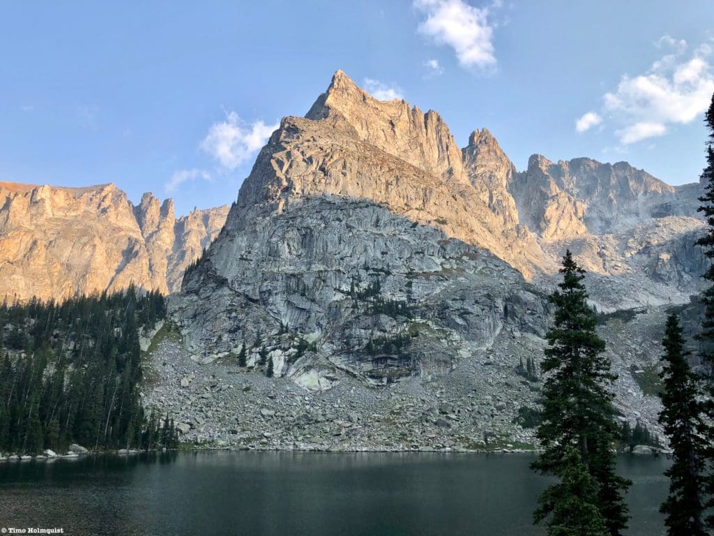
After the second meadow, you should be able to see a wall of mountains in front of you; they rim the Crater Lake area. The tall and imposing summit of “Cherokee” is also quite visible to the right side of the trail. The trail will take you to the left of “Cherokee” and wraps partially around the other side of it before finding Crater Lake.
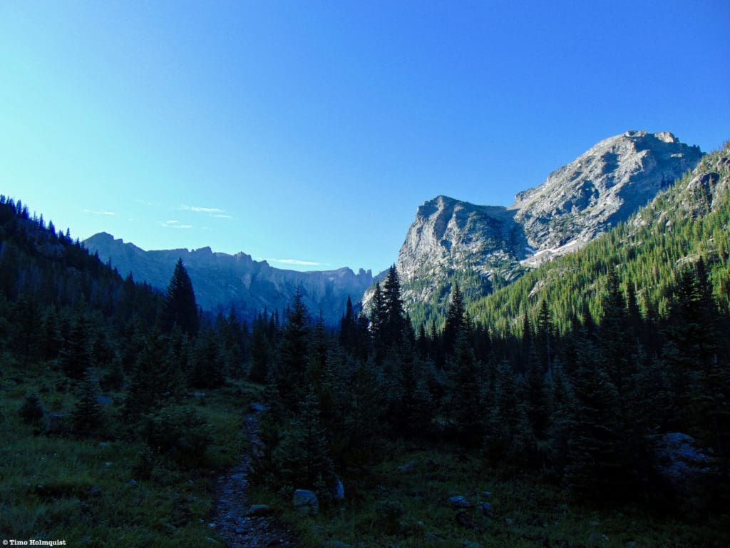
Beyond the meadow is another forested section where enthusiastic backcountry travelers can bushwhack off-trail to an optional route up “Cherokee.” You can also attack the mountain from Crater Lake. To continue, simply follow the trail.
Rockier section beyond the breakoff to “Cherokee”.
As you ascend to the left of “Cherokee,” occasional and dramatic views will open up to your right.
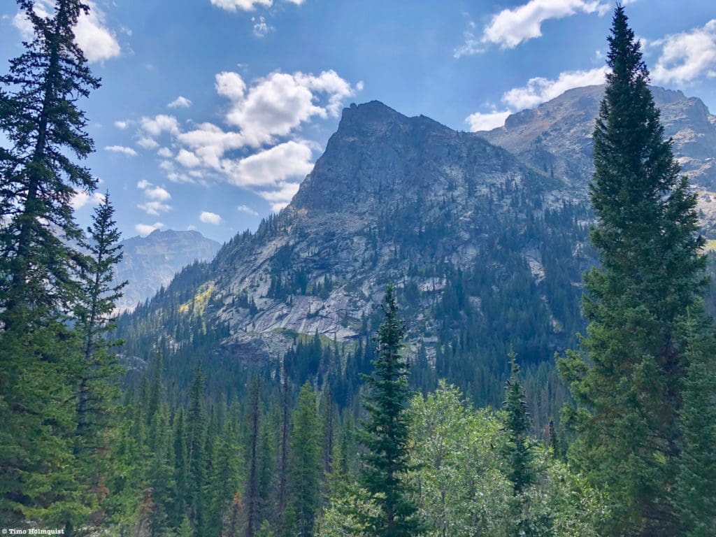
“Cherokee” and its unnamed sub-summit from the Crater Lake trail.
After another elevation step, you’ll run into your last trail junction. If you come over from Brainard on the eastern side of the divide, this is where you’ll connect with the Crater Lake Trail.
Junction with Pawnee Pass Trail.
Not long after this junction, you’ll pass a sign indicating the entrance to the Crater Lake backcountry zone. This is six miles into your hike and three miles beyond the first Cascade waterfall. Beyond this sign, no camping is allowed outside of designated sites. Each designated site has a sign with a no campfire symbol on it. Heed these restrictions.
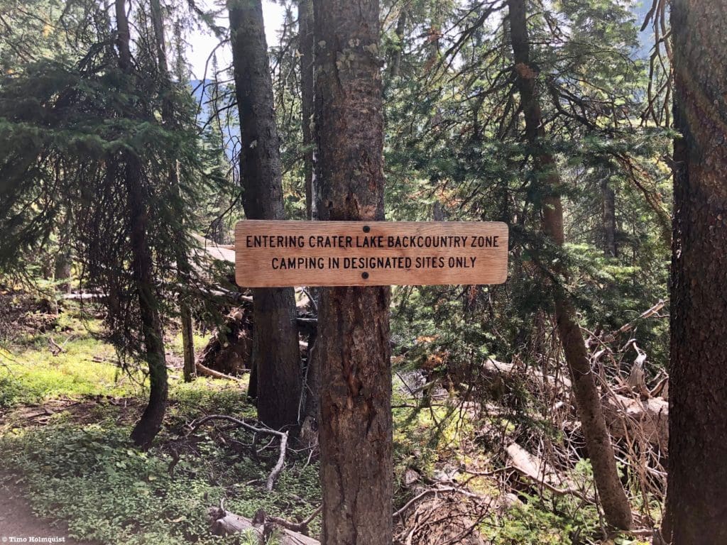
Crater Lake Backcountry Zone.
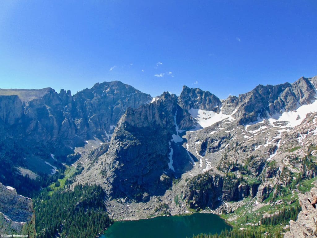
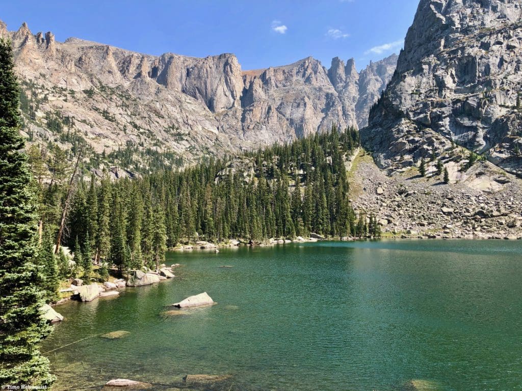
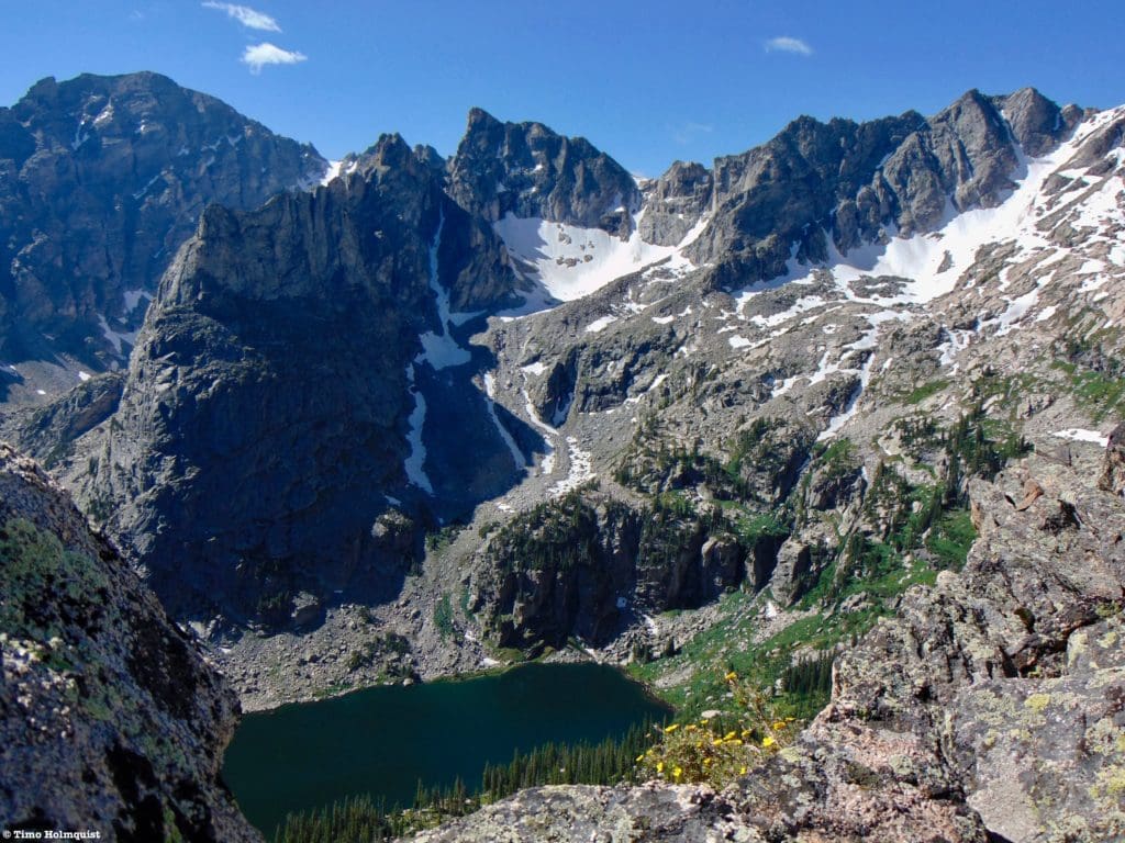
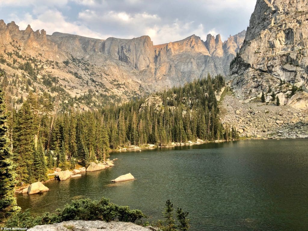
Soon after you pass this sign, the trail will head over a larger area of exposed rock, offering fantastic views to the head of the basin. You’ll be able to see Apache Peak, Fair Glacier, Lone Eagle Peak, and “Hopi” to the right. To the left, a serrated and tower-ridden ridge runs all the way up to the summit of Apache. Some trees may block additional perspectives, but more vistas await.
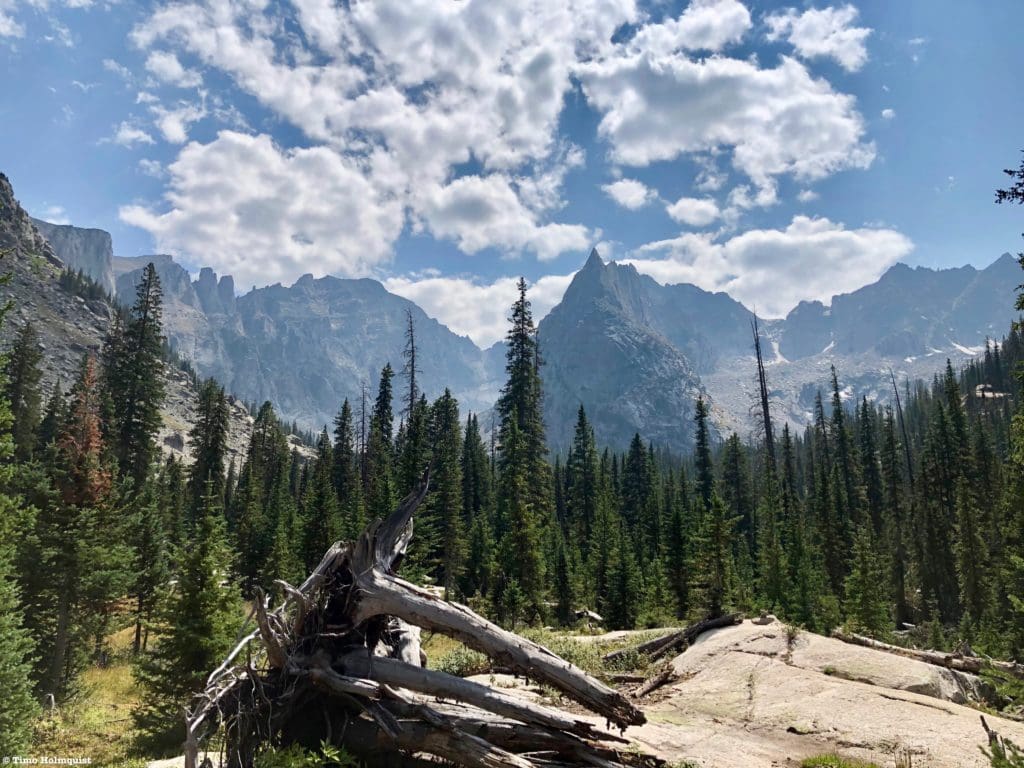
The views up the basin keep getting better and better.
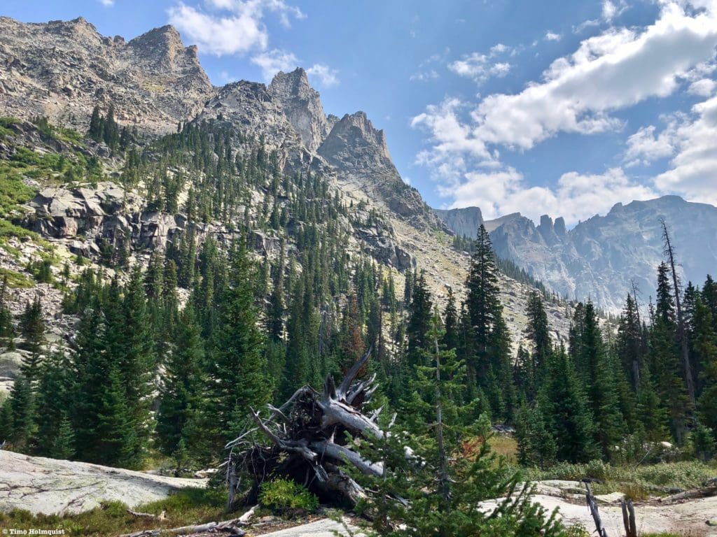
The dramatic sweep of a glacial valley.
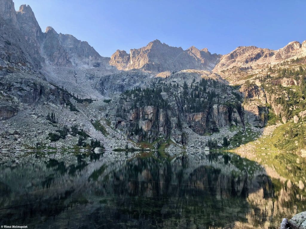
There is still one elevation step separating you from Mirror Lake, which is a small pond maybe .1 of a mile east of the larger and more impressive Crater Lake. Once you top out on the elevation step, passing a few campsites en-route, you’ll be given one of the best views of the improbable-looking Lone Eagle Peak.
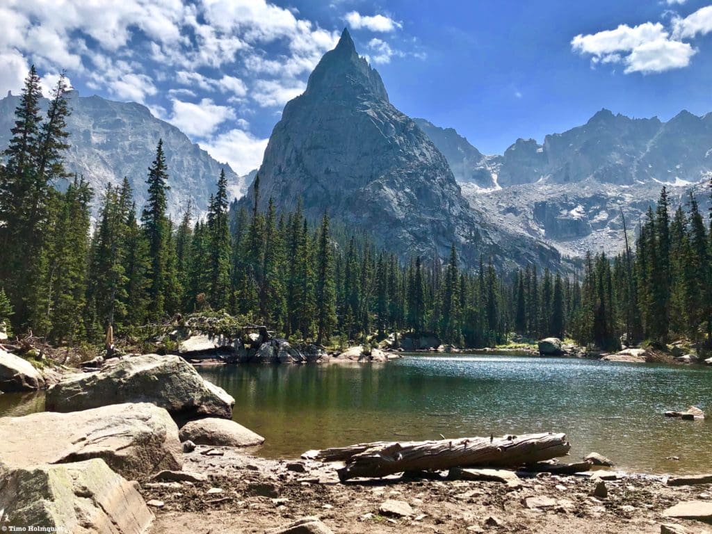
Mirror Lake with Lone Eagle eating up the sky behind it.
This is where a lot of people stop, but with Crater Lake so close, it makes sense to continue on. Follow the trail to the east. It can be a bit confusing here as multiple social trails exist but stay on the most identifiable path and continue past Mirror Lake. You’ll be following signs for Campsites 8-12.
The shoreline of Crater Lake reveals itself around Campsite 10. There are numerous places to sit alongside the eastern shore of the lake and marvel at the surround. There are also a few restoration signs in place where shoreline damage has occurred; please be mindful of these signs.
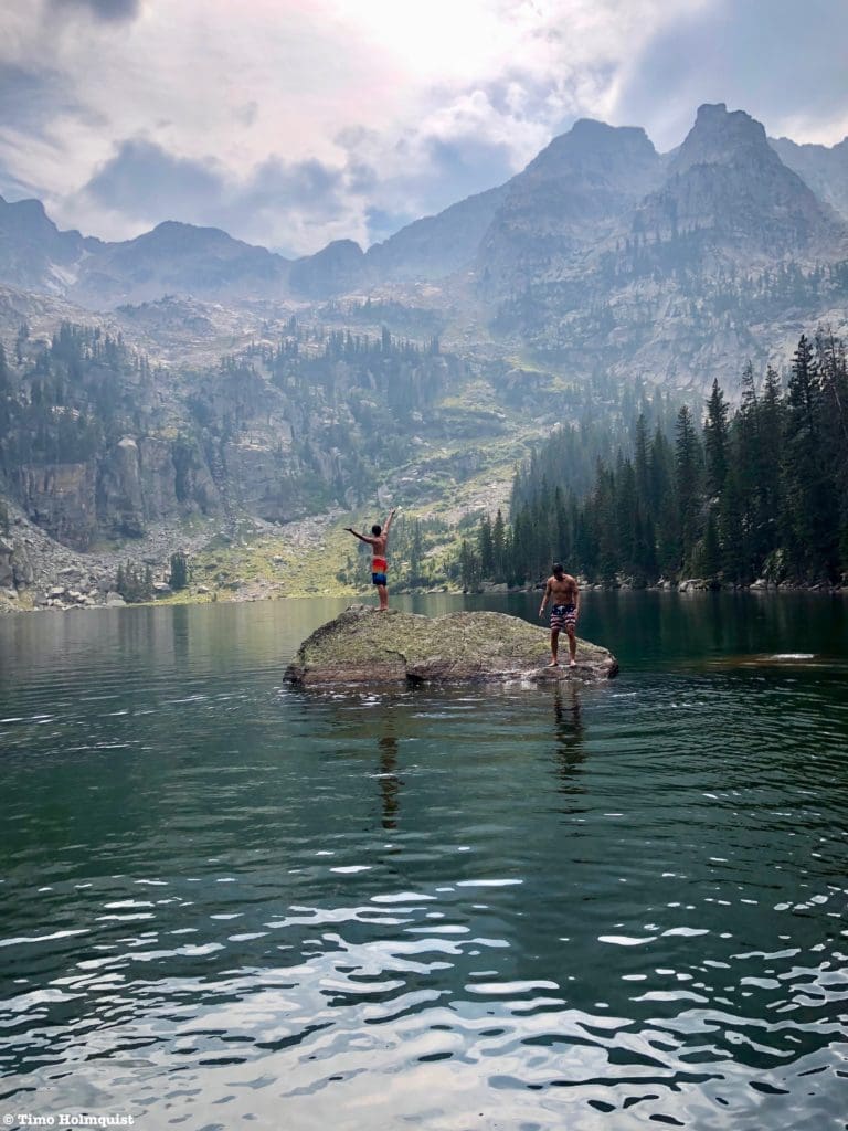
Crater Lake is the perfect place to brave a lake jump.
For the absolute best views, continue east along the northern shoreline. You’ll run into a restoration sign with a few braided trails behind it. Step beyond the sign and continue paralleling the shoreline. Although the start of this braid is behind the restoration sign, it angles away from the battered shoreline. You’ll cross a small outlet stream and encounter a wooded and rocky rib of land. There are a few ways to get up this, pick one and scramble up the ridge. You’ll end up next to campsite 12, which has one of the best views in all of Colorado.
Absolutely epic.
Even if campers are at the campsite, you should be able to get to the rock and the old ruins of a cabin without issue. If you are camping here, keep in mind that day hikers and other campers will try to get to this view, and that’s ok. The campsites are all crisscrossed by various social trails that lead to peaks and overlooks, so be friendly to those exploring the area.
The eastern shore of the lake has a slew of good rocks to sit on as well.
This place is special.
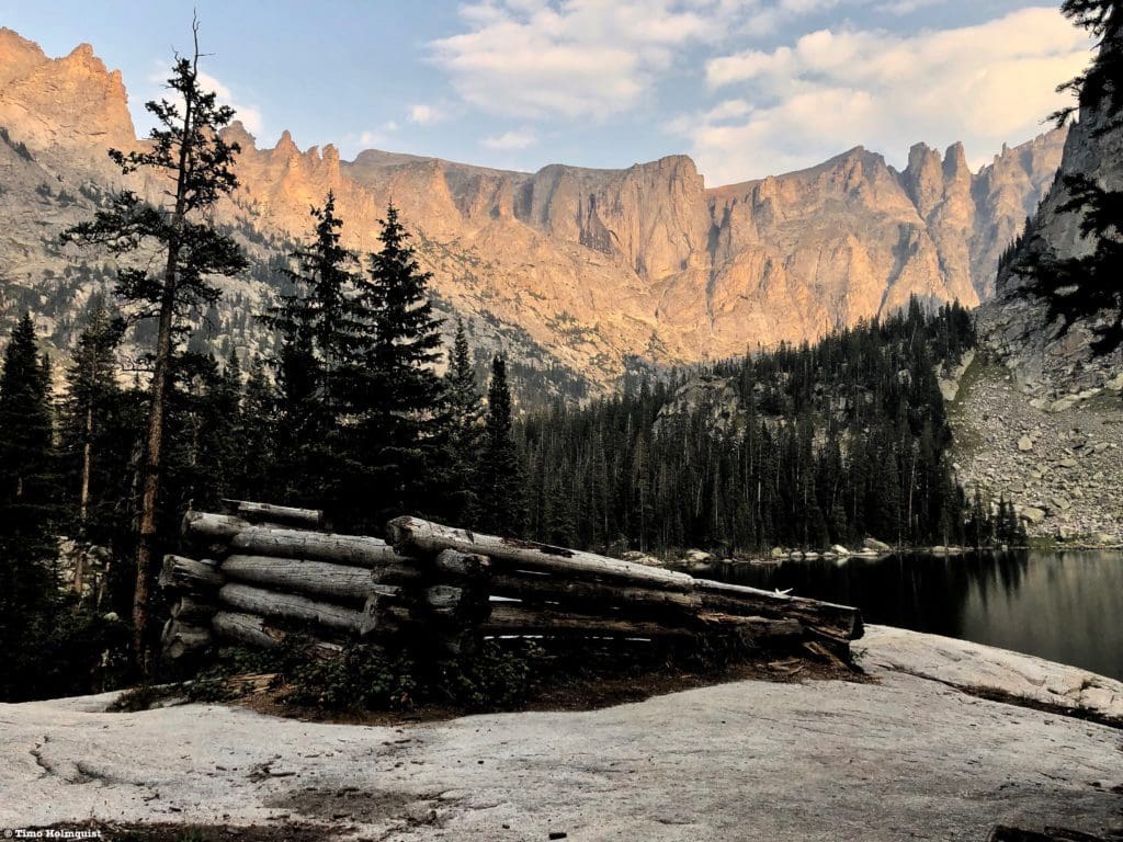
The ruined cabin in the evening.
If you are camping in the area, go for at least two nights, you’ll need some time to explore all the wonderful features in the basin.
The western edge of the lake with glassy water, and the bulk of “Hopi” in front, including its multiple highpoints
You can also access “Cherokee”, “Achonee”, “Achonee Tower”, “Hopi”, Lone Eagle Peak, Mount George, Apache Peak and “Iroquois” from this area. In the early summer, an ascent up the “Hopi” snowfield provides a fantastic mountaineering experience.
Looking down to Crater Lake from a shoulder of “Cherokee.”
If you decide to tackle any of the peaks around Crater Lake, be warned, these are serious mountains with a minimum Class 3 rating and many moderate to steep snow lines throughout the summer. It is possible to avoid all snow areas by mid-August unless your goal is to climb Fair Glacier, but the loose rock and scrambling around the basin rim remain. These are not good ridges for an intro to mountaineering lesson. The peaks and highpoints here are reserved for those who have already tested their limits on similar terrain. For the hiking masochist, a one-day ascent of the area is possible from the Arapaho Pass Trail for a less severe Class 2 rating but requires substantial and arduous bushwhacking to complete.
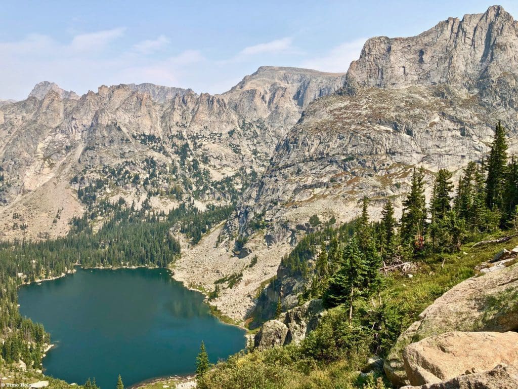
Crater Lake from above its western shore.
When you’ve had your fill, return to Mirror Lake via the campsites and make your way down the Cascade Creek Trail. Remember, there are a few social trails in this area, so take your time and scout the easiest way down. Once you leave the Crater Lake Backcountry Zone, the trail is much easier to follow. It is a 7.4-mile return hike to Monarch Lake Trailhead, but the going is 95% downhill and not very challenging. If you’ve come over from Brainard, at the first junction, take a right up Pawnee Pass and continue over the divide to end up in the Long Lake drainage.
One last view of Lone Eagle Peak.
Final Thoughts:
Despite the campfire ban and general popularity of the area, Crater Lake is worth all the accolades that have been heaped upon it. The Colorado mountains are beautiful, but there are a few areas that stand tall above the rest; Crater Lake Basin is one of these, along with nearby Upper Glacier Gorge. It’s absolutely worth spending some extra time to really soak in the views here because they are some of the most dramatic in the state. When the boundaries of Rocky Mountain National Park were first proposed in the early 20th century, the Indian Peaks were included. While that vision did not come to fruition, in the Crater Lake basin, you’ll see why they were considered.
A dramatic and wonderful place.
Popular Articles:
- Guide to the Best Hiking Trails in Rocky Mountain National Park, Colorado
- The Dyrt: The 10 Best Campgrounds In Colorado
- Top Adventure Sports Towns 2021: Boulder, Colorado
- Epic Adventures with the Best Guides In Colorado
- Sky Pond via Glacier Gorge Trail, Rocky Mountain National Park, Colorado
- Scrambling Hallett Peak’s East Ridge, Rocky Mountain National Park, Colorado
- Scrambling Mt. Alice via the Hourglass Ridge, Rocky Mountain National Park, Colorado
- Gorge Lakes Rim Scramble, Rocky Mountain National Park, Colorado
- Black Lake Via Glacier Gorge Trail, Rocky Mountain National Park, Colorado
- Scrambling To The Lake Of The Clouds, Rocky Mountain National Park, Colorado

Skyblue Overland Strongly Recommends That You Enroll With Global Rescue Prior To Embarking On Your Next Adventure.
With more people outside now more than ever, Global Rescue expanded services to include field rescue within 100 miles of home. With Local Field Rescue — automatically included in any travel protection services membership — Global Rescue is there whether you’re hiking, kayaking, snowmobiling, fishing or simply enjoying the outdoors and get ill or injured and you’re unable to get to safety on your own. Purchase a Global Rescue membership for your next adventure and travel with peace of mind. Single trip, annual and family options are available.
Memberships start at $119.
Terms of Use:
As with each guide published on SKYBLUEOVERLAND.com, should you choose to this route, do so at your own risk. Prior to setting out check current local weather, conditions, and land/road closures. While taking a trail, obey all public and private land use restrictions and rules, carry proper safety and navigational equipment, and of course, follow the #leavenotrace guidelines. The information found herein is simply a planning resource to be used as a point of inspiration in conjunction with your own due-diligence. In spite of the fact that this route, associated GPS track (GPX and maps), and all route guidelines were prepared under diligent research by the specified contributor and/or contributors, the accuracy of such and judgement of the author is not guaranteed. SKYBLUE OVERLAND LLC, its partners, associates, and contributors are in no way liable for personal injury, damage to personal property, or any other such situation that might happen to individuals following this route.


