


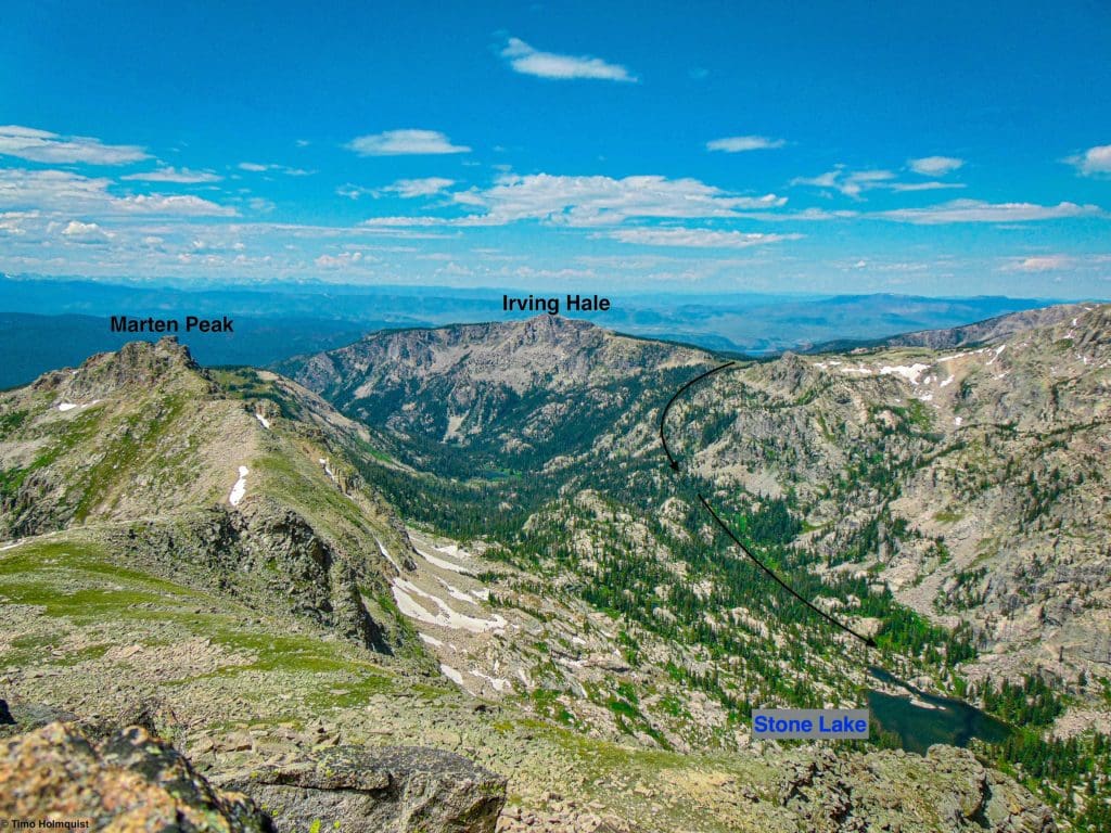
High Point:
Irving Hale Meadows ~11,245 ft.

Total Ascent:
+3,120 ft., -745 ft.

Difficulty:
Difficult

Distance:
5.8 miles to Stone Lake One-way, 6.2 to Upper Lake

Waypoints:
40.12952, -105.76442

Route Type:
Out and Back
Stone Lake and Upper Lake, tucked away in Hell Canyon of the Indian Peaks, are often neglected but can be great depending on what you’re looking for. Unlike some of the more popular spots like Emerald Lake or Hanging Lake, these locations provide a more private experience.

Overview
Tucked into an often-forgotten corner of the Indian Peaks, Stone Lake and Upper Lake, located in isolated Hell Canyon, don’t usually pop up on people’s radars. It’s not as bucket-list worthy as loved-to-death Emerald Lake, the Maroon Bells, or Hanging Lake, but depending on what you’re looking for, that may be a huge positive. Both Stone Lake and Upper Lake are great places to be.
Grand county residents come up fairly often, and the trail has increasingly been used as part of a backcountry loop from Hell Canyon over to Gourd Lake (or vice versa), but during weekdays and shoulder seasons, it’s blessedly quiet. Due to the postcard-worthy brilliance of Lone Eagle Cirque, Navajo Peak, Neva and the Arapahos, this area tends to slip between the cracks. For those looking to avoid big crowds or looking to set up a quiet wilderness camp for a few days, this area provides.
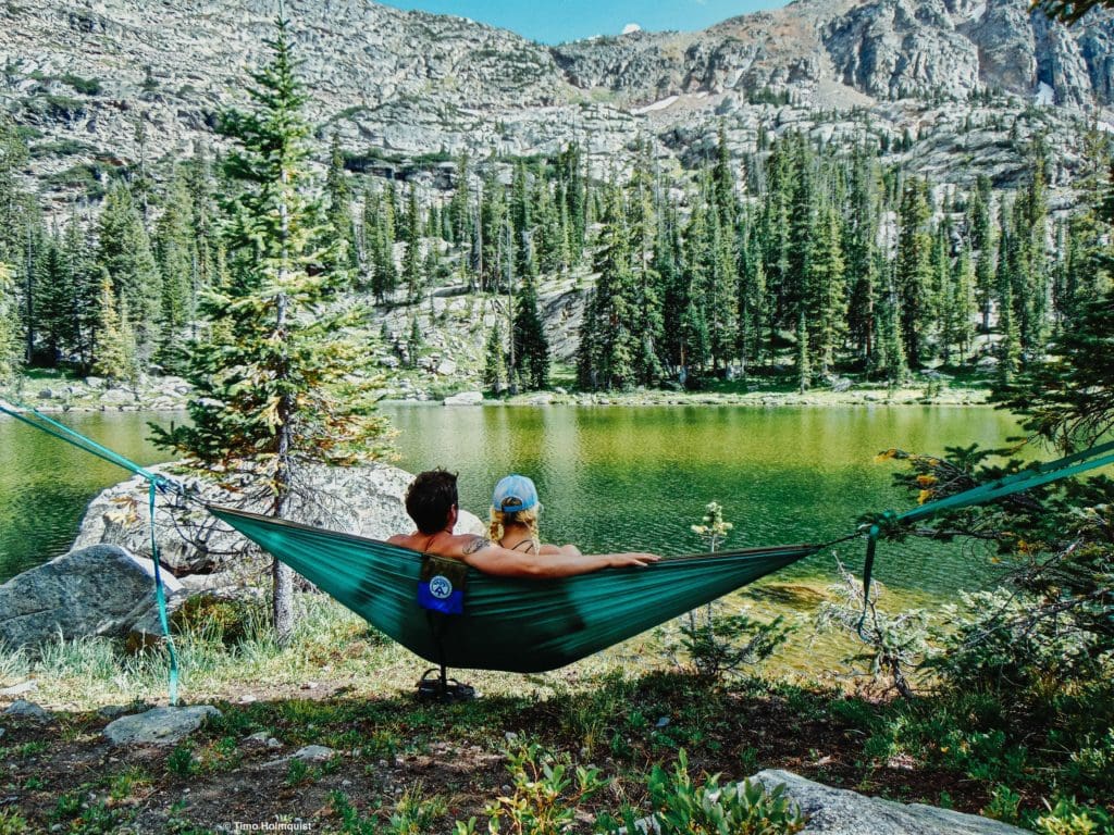
Relaxing by Stone Lake.
Table of Contents
Article Navigation: Click on any of the listed items in the table of contents below to jump to that section of the article. Similarly, clicking on any large, white section header will jump you back to the Table of Contents.
The striking Hiamovi Tower from the shores of Upper Lake.
Global Rescue is there whether you’re hiking, kayaking, snowmobiling, fishing or simply enjoying the outdoors and get ill or injured and you’re unable to get to safety on your own. Global Rescue is the red button you push in an emergency. Their team of medical and security experts come through for you when it matters most
Scales and Criteria
This article uses two metrics to calculate difficulty: overall distance and elevation gain. This review covers snow-free ascents, although you may be dealing with leftover snow through the first half of June. The approach is all trailed, but it’s a long journey with a significant climb and a meandering descent into Hell Canyon. As long as you stay on the trail and make it to the two lakes, there should be no scrambling involved.
If you’re camping for a few days, there are day adventure possibilities that could involve some scrambling (Ogallala Peak, Cooper or Marten), but those destinations require extra research and preparation.
Difficulty Ratings:
- Easy: less than 5 miles, less than 500 ft. of elevation gain
- Moderate: 5-10 miles, 500-2,000 ft. of elevation gain
- Difficult: 5-15 miles, more than 2,000 ft. of elevation gain
- Very Difficult: 10+ miles, more than 3,500 ft. of elevation gain
Marten Peak glowing in the dying light from Stone Lake.
The Ultimate Offline GPS Hiking & Ski Maps
See why onX Backcountry is the ultimate GPS navigation app for your outdoor pursuits. Try Today for Free. No credit card required.

Directions to Trailhead
The best trailhead to use for this hike is the Roaring Fork Trailhead. The Roaring Fork is on the way to Monarch Lake in Grand County. There’s one way to get there with two realistic approaches from the east (i.e. Front Range metro).
Approach 1
- I-70 to exit 232 for Winter Park
- US 40 up and over Berthoud Pass.
- Continue north on US 40 to the town of Granby.
- After passing through town, take a right on US 34.
- US 34 will head north toward Grand Lake. You’ll pass by farmland and rolling hills before the road rises quickly to the shores of Lake Granby. Your turn-off is near the top of the rise on the right. The road is Colorado 6, also known as Arapaho Bay Road and Forest Service Road 125. If you start driving by the shores of Lake Granby, you’ve gone too far.
Approach 2
- Enter RMNP at either Beaver Meadows or Fall River
- Take Trail Ridge (US 34) through Rocky Mountain National Park
- Exit the park near Grand lake (still US 34)
- Head south beyond the town of Grand lake and the shoreline of Shadow Mountain Lake
- US 34 will also round the western shoreline of Lake Granby. At the very ending corner of the lake, take a left on Colorado 6 towards Arapaho Bay Campground.
- A noticeable downhill occurs right after the end of the lake, so if you start going down, you’ve gone too far.
To the Trailhead
Once you’re on Colorado 6 (heading east), you’ll pass a few dams along the lake, and the road surface turns to dirt. It’s almost 10 miles to the trailhead. Once you get beyond the long eastern arm of the lake, you’ll come to a three-way intersection. There are numerous campsites around the intersection. Take a left; continuing straight will take you to the Monarch Lake Trailhead.
The road will pass beyond the campsites near the intersection and head back toward the lake. Soon, you’ll come up to an area where water is on both sides of you. The main lake is to your left, and a smaller pond from Grouse Creek empties on your right. After you pass this, there will be a small turn to the right that leads to a larger parking area and the trailhead. This is before you get into the peninsula with additional Arapaho Bay Campsites.
Floating on Stone Lake with Mt. Irving Hale in the background.
The Ten Essentials: How to Equip Yourself for the Backcountry
Packing the “Ten Essentials” whenever you step into the backcountry, even on day hikes, is a good habit. When something goes awry, you’ll truly appreciate the value of carrying these items that could be essential to your survival.
Field Notes
Due to the more remote nature of this area, checking the weather beforehand is important. There are a few ways to do this. Start with a base location forecast for Granby and Grand Lake. The best forecast for Stone Lake in Hell Canyon is going to be from Sawtooth Mountain, a nearby peak. Sawtooth is two basins away, so the forecast will be generally accurate, but details (like storm timing and position) may be off. There’s always a degree of variability with more remote places.
You can make this a long day adventure (~12 miles roundtrip) or set up camp near one of the lakes. For camping reservations, visit recreation.gov. Despite this area’s relative obscurity compared to other Indian Peaks locations, the whole wilderness is popular. The best strategy for camping is to book in March when they open up reservations for the season. There are still plenty of chances to book as the summer kicks off, but camping slots for weekends fill out first. If you’re not committed to weekends (some remote workers, people with built-up PTO, self-employed etc.), you’re likely to find spots available for weekdays up until your departure date.
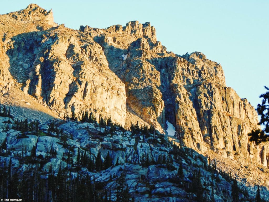
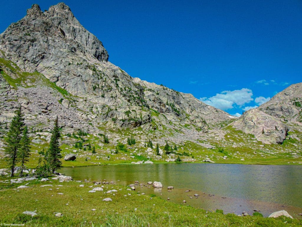
Hiamovi Tower rising behind Stone Lake. Upper Hell Canyon wraps around a corner of the tower so both lakes live in its shadow.
Journal
This trail begins at the Roaring Fork Trailhead near the Arapaho Bay Campground. Once you’ve found the trailhead, follow the one main trail out of the area. The first part of this journey shares the same directions as our review up Mt. Irving Hale.
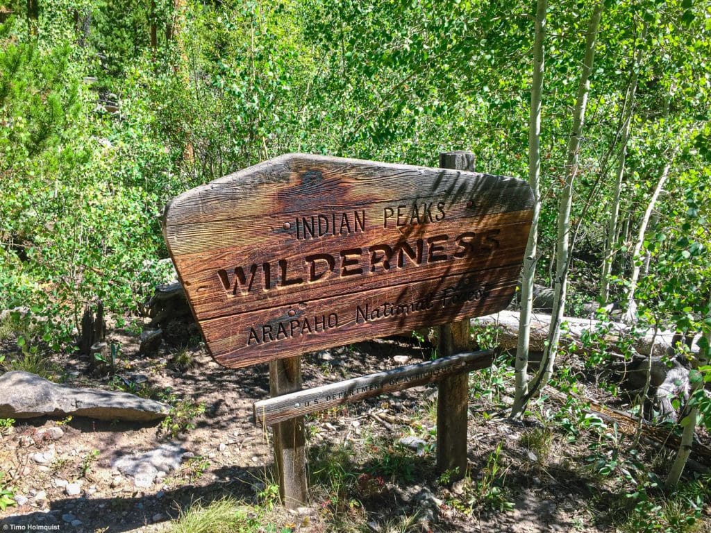
Indian Peaks Wilderness sign near the trailhead.
Simplified, you’ll gain a significant amount of elevation initially as you climb out of the Lake Granby area. This section is not heavily covered by vegetation so bring sunscreen. Eventually, you’ll draw even with the Roaring Fork and cross it. The second section follows the mountain stream through a pleasant and forested valley. Eventually, you’ll cross the stream again and come up to a trail junction (~2.7 miles and ~1600 ft. up from the trailhead).
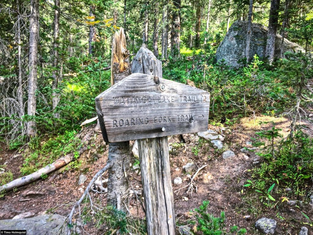
Follow arrows for Roaring Fork. The other direction will get you to Watanga Lake.
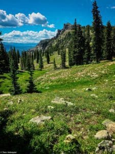
At the junction, take a right and begin your biggest climb of the day (+~1400 ft. in 1.4 miles). If this is just a day trip, the elevation gain isn’t too bad. If you’re camping, take your time and go slow to save energy. There’s a steeper and more treed lower section and a slowly moderating upper section. Towards the top of the rise, meadows being to dot the surround; there are several. At the top is a beautiful meadow on the shoulder of Mt. Irving Hale that shows amphitheater views of the western IPW. It’s a great place to be.
Zoomed in on the Lone Eagle Cirque from the Irving Hale meadows.
Once you’ve had a proper break and enjoyed the views, pick up the trail once more as it continues to head east. You’ll pass the remains of an old cabin and round a corner before starting to lose elevation.
Looking at Irving Hale as the trail continues beyond it.
You’ll slowly drop off the shoulder of Irving Hale and stick to the left (north) side slopes of Hell Canyon, which you’re descending into.
Unnamed pond right before you begin descending.
This canyon has a trailless lower portion that eventually dumps into Buchannan Creek, but that area is so overgrown that there isn’t a good way to climb up the canyon from the bottom. As you lose elevation, the trail becomes markedly steeper, with some rock outcroppings appearing on the right with views of the canyon and Marten Peak across it.
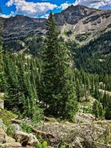
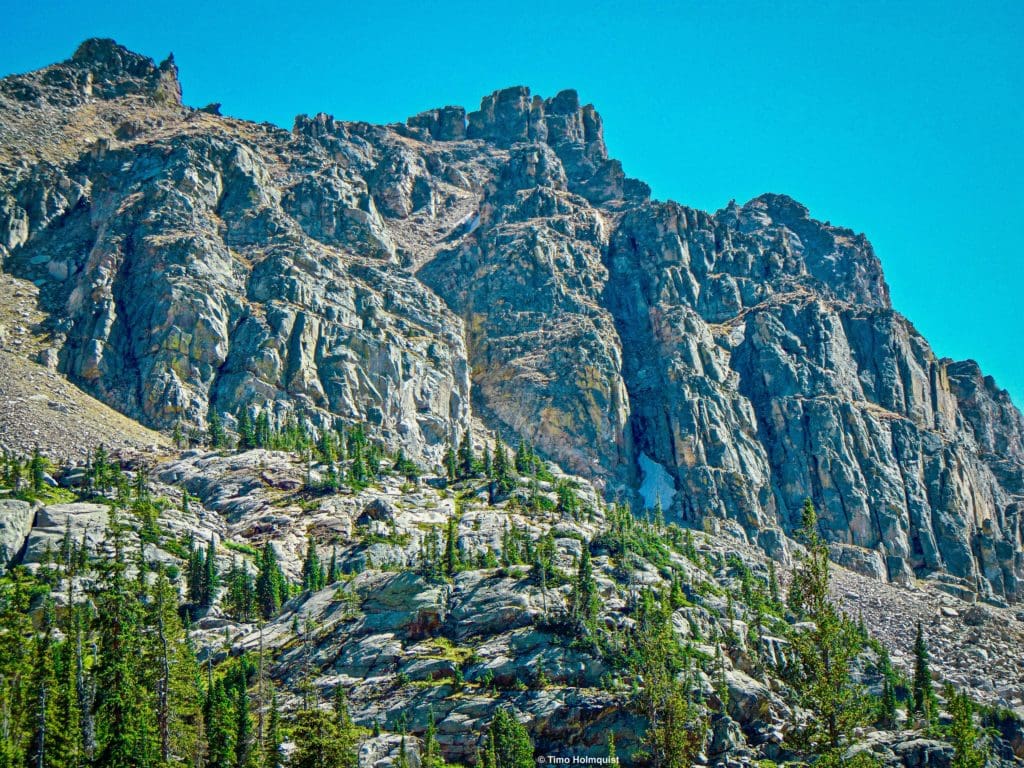
The view to the right of the trail as you descend. Cooper Peak is the high point to the left of the central tree, and the summit of Marten peak is to the right. The canyon below the trail is trailless and wild.
Pay attention as you descend; if you have a big pack, poles help here. The trail can get vague in a few places; your trajectory on this stretch should largely be to the east and northeast. If you start banking west or south, that’ll lead to the lower canyon. For the most part, the trail should be easy to follow, leading east-north-east from the shoulder of Irving Hale to meet the canyon floor. You drop several hundred feet in this section.
In Hell Canyon after your descent.
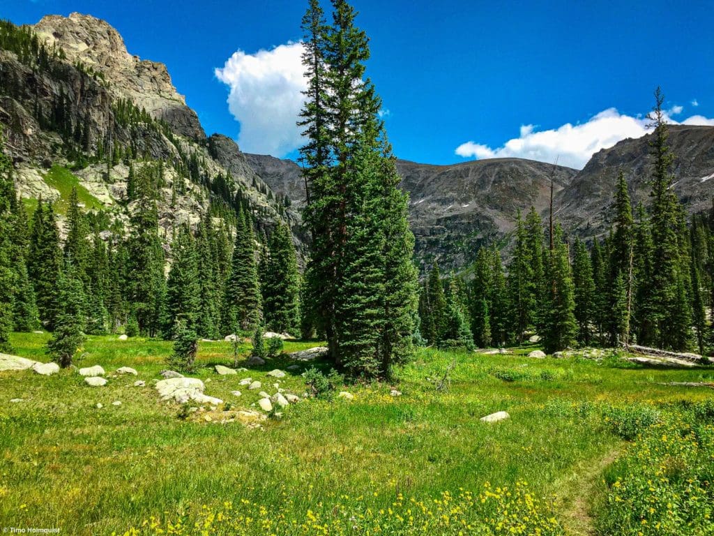
Once you finally make it to the bottom of the canyon, continue through beautiful meadows and next to sharp rock towers. The journey isn’t over right away, however. There are still a few quick rises to contend with. These rises don’t amount to much vertical gain, but with a heavy pack, they can be particularly disheartening.
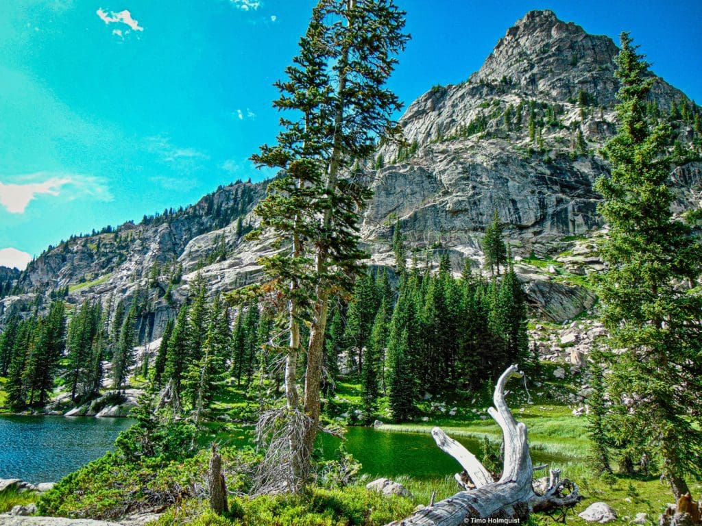
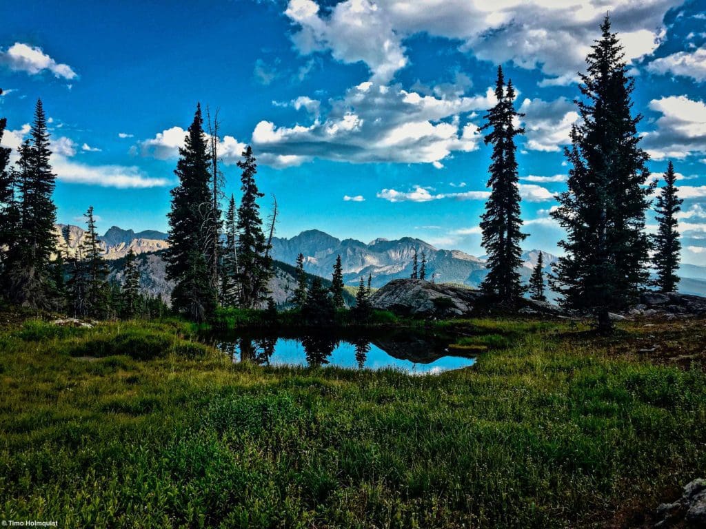
Stone Lake arrives after one of these rises, and it’s a beautiful body of water. The depth of the lake is pretty shallow, but there are a few exception areas. For camping, there are a few spots at the western end of the lake where you first sight it. Campsites exist along the shore and across the outflow stream to the south.
General path from Irving Hale meadows to Stone Lake from near the summit of Cooper Pk.
If you continue around the lake on the still well-defined trail, additional campsites show up on your left and at the eastern head of the lake. As you continue, pay attention to a large, singular rock that’s a short rock hop from connecting to the shore. The main channel of water from the Upper Lake through Stone Lake goes right by this rock.
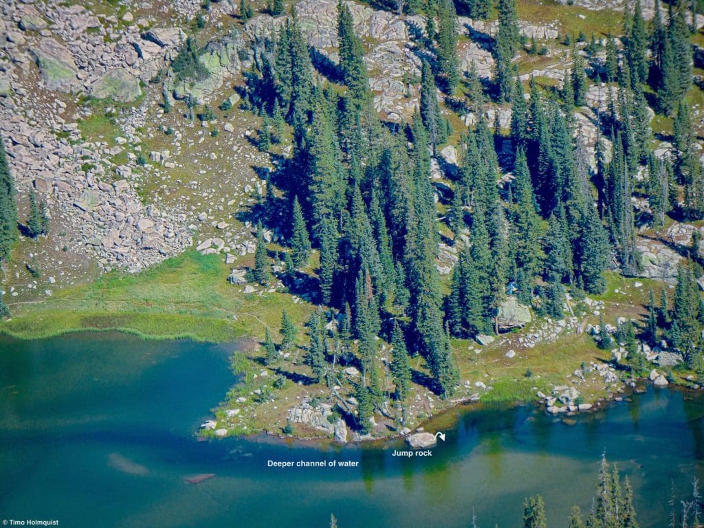
The deeper channel of water seen in Stone Lake from above.
The depth here is substantial enough to let you jump from the rock into the water; you won’t hit bottom unless you pencil dive. This may be one of the only areas at Stone lake where jumping in works. Just in case, swim around the rock and test the depth before committing to anything.
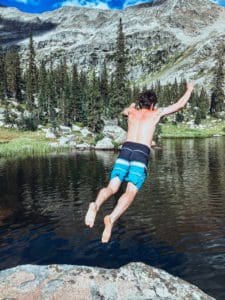
Fun on a warm day.
Once you’ve found a campsite, settle in. Or, if this is a day hike objective, keep some energy for the jaunt up to Upper Lake, which is absolutely worth it. The official trail dies around Stone Lake, but Upper Lake is only a few points of a mile farther. Piece together a path following social trails and game trails until arriving at the southern shore.
The beautiful Upper Lake.
Additional campsites litter the area between the lakes. Once you get to the Upper Lake, there is a clump of trees and a flat-ish bench to the right (east) side of the lake that could function as a fairly protected site. Make sure to check for deadfall and snags before setting up a tent.
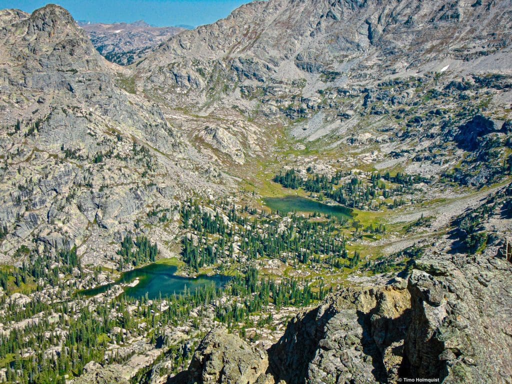
The two lakes from above.
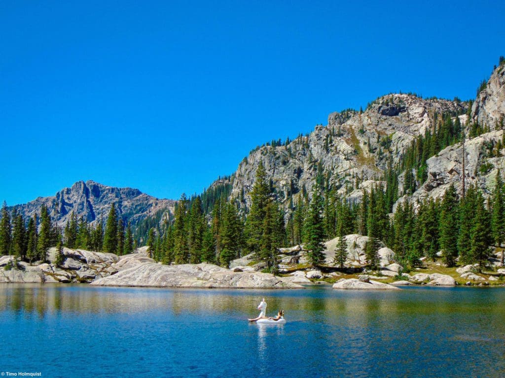
For day hikers, a great additional excursion is to round the Upper Lake. Even if you only go part way around, make it the east side, so you can stare across the water to the iconic and intimidating Hiamovi Tower.
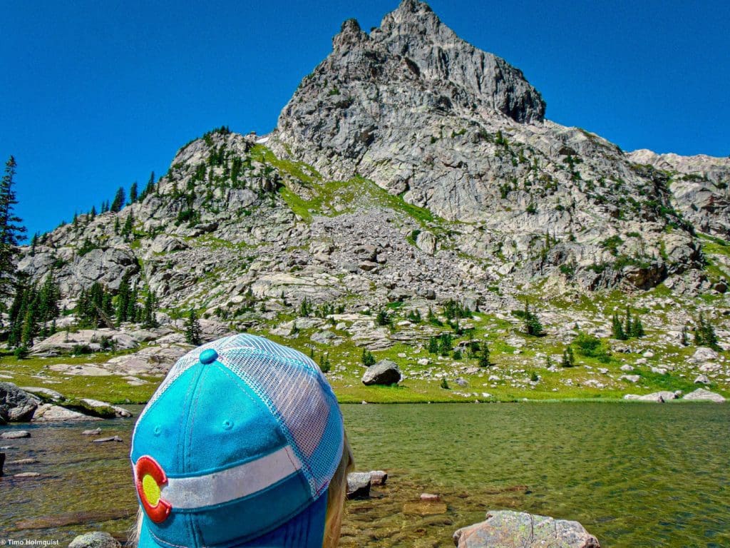
Admiring the tower.
Additional Objectives
If you decide to camp in the area, rest assured there are plenty of excursions around. An easy one is to camp at Stone Lake and visit Upper Lake. If you want more or decide to camp near Upper Lake, circle the lake and continue north into an alpine pocket between Ooh-La-La (to the right as your ascending) and the Hiamovi massif to the left.
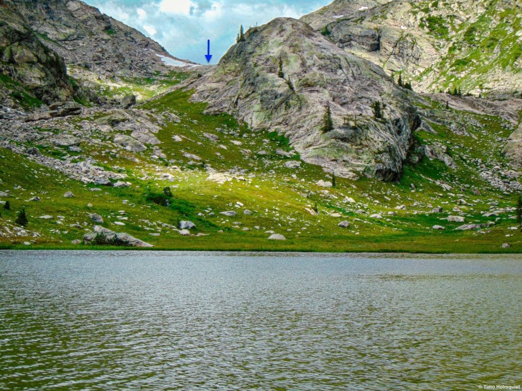
From Upper lake, continue up.
If you make it to the saddle between the two, you can stare north into Paradise Park. This wilderness study area is officially in Rocky Mountain National Park; there are no trails, and no camping is allowed, making it one of the most remote and pristine areas left in the Front Range.
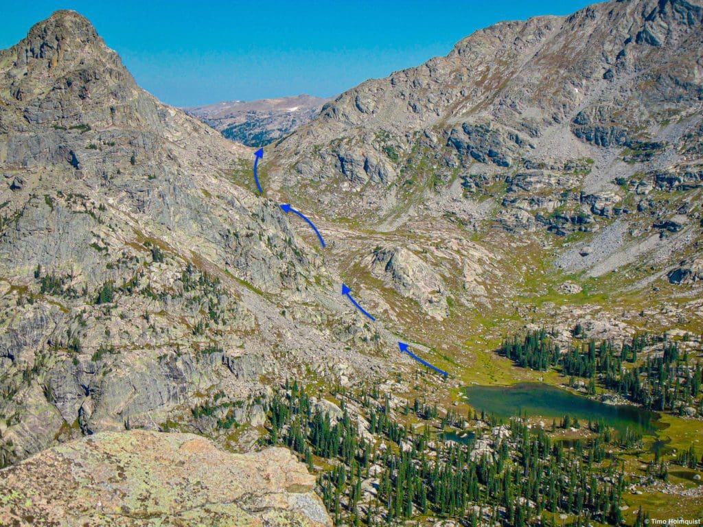
General route to the saddle from above.
From this saddle, you can opt to scramble west up an unnamed point near Hiamovi or head east and scramble up to the divide. From there, you can tag Ogallala Peak and Ooh La La before descending to Cooper Pass. The route back down Cooper Pass is loose and annoying but manageable without a heavy pack.
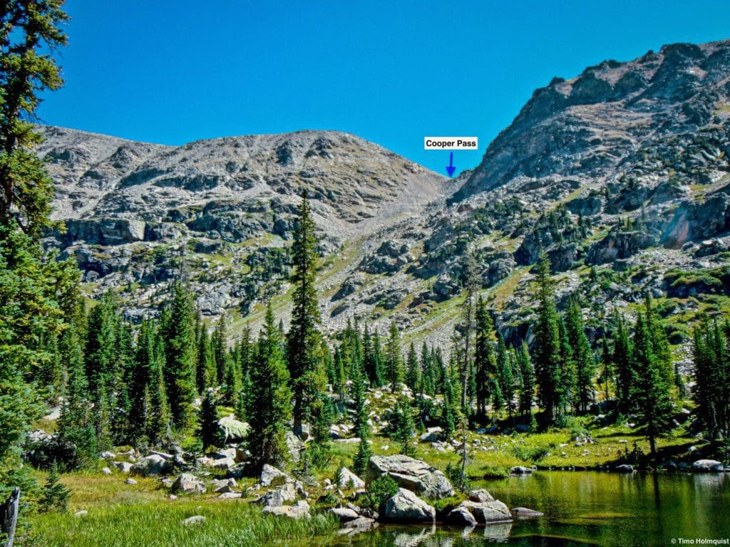
Cooper Pass from Stone Lake
Another great day hike and one that takes added significance if you camp on the northern side of Stone lake is an ascent of the Class 3 Marten Peak. Ascend to the saddle between Cooper and Marten and utilize any number of options to attain the summit. Please note that mandatory Class 3 Scrambling will be required to attain Marten Peak.
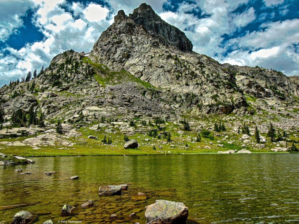
Marten Peak from the northern shore of Stone Lake.
The most relaxing option is to stick around the lakes and enjoy the water. While this area lacks the gravitas of Crater Lake Cirque, its understated beauty makes it a fantastic place to spend a few days. Early September camping is particularly ideal; fewer summer crowds, still warm enough to jump in the water, and cool enough at night to bring comfortable camp clothes and blankets. The stars are also magnificent since the bulk of the Divide blocks light pollution from the Front Range.
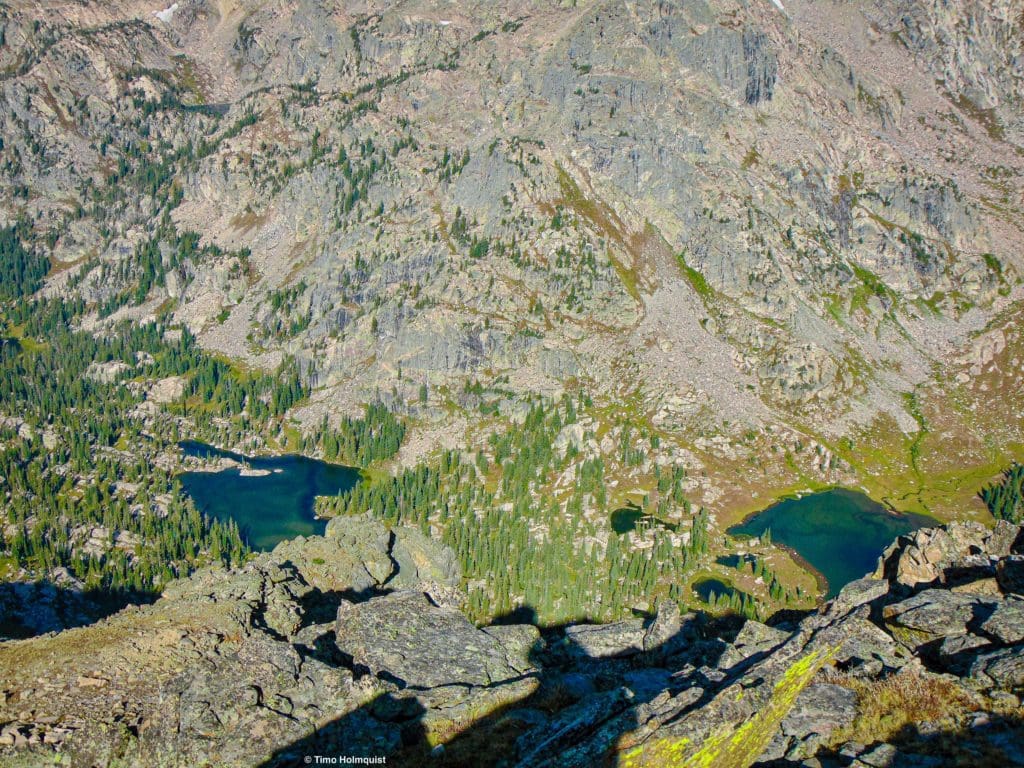
The lakes from above. Stone Lake is to the left, and Upper Lake is to the right.
HEED all fire bans if camping; despite sometimes frequent summer rains, the west is still grappling with drought. Forest fires like the East Troublesome and Cameron Peak Fire have already devastated large portions of northern Colorado. Their impacts will be felt and seen for decades.

Enroll With Global Rescue Prior To Embarking On Your Next Adventure.
When a travel emergency arises, traditional travel insurance may not come to your aid, and a medical evacuation can cost up to $300,000.
The cost when you have a Global Rescue membership? $0. That’s why when the unexpected happens, you want the leader in rescue, evacuation and medical advisory behind you. You want Global Rescue.
Terms of Use:
As with each guide published on SKYBLUEOVERLAND.com, should you choose to this route, do so at your own risk. Prior to setting out check current local weather, conditions, and land/road closures. While taking a trail, obey all public and private land use restrictions and rules, carry proper safety and navigational equipment, and of course, follow the #leavenotrace guidelines. The information found herein is simply a planning resource to be used as a point of inspiration in conjunction with your own due-diligence. In spite of the fact that this route, associated GPS track (GPX and maps), and all route guidelines were prepared under diligent research by the specified contributor and/or contributors, the accuracy of such and judgement of the author is not guaranteed. SKYBLUE OVERLAND LLC, its partners, associates, and contributors are in no way liable for personal injury, damage to personal property, or any other such situation that might happen to individuals following this route.


