


High Point:
~10,820 feet

Total Ascent:
~2,725 feet

Difficulty:
Difficult

Distance:
16.6 miles roundtrip (~8.4 to the lake)

Waypoints:
40.11080, -105.74639

Route Type:
Out and Back
Gourd Lake in Colorado’s Indian Peaks Wilderness is a great spot for a challenging hike, with deep enough water to jump from its multiple rocks. It’s lower than Crater Lake cirque, but still stunning.

Overview
Between Lake Isabel, Crater Lake, Lake Dorothy, Blue Lake, and a handful of others, the Indian Peaks Wilderness has more than enough alpine bodies of water to stare at. As such, Gourd lake may fall a bit to the wayside. It’s not a pure alpine lake, sitting a couple of hundred feet under treeline, and it’s farther north than the spectacular Crater Lake cirque. Nevertheless, for those looking for a challenging hike to a lake with deep enough water to jump into from multiple excellent jumping rocks, Gourd Lake delivers.
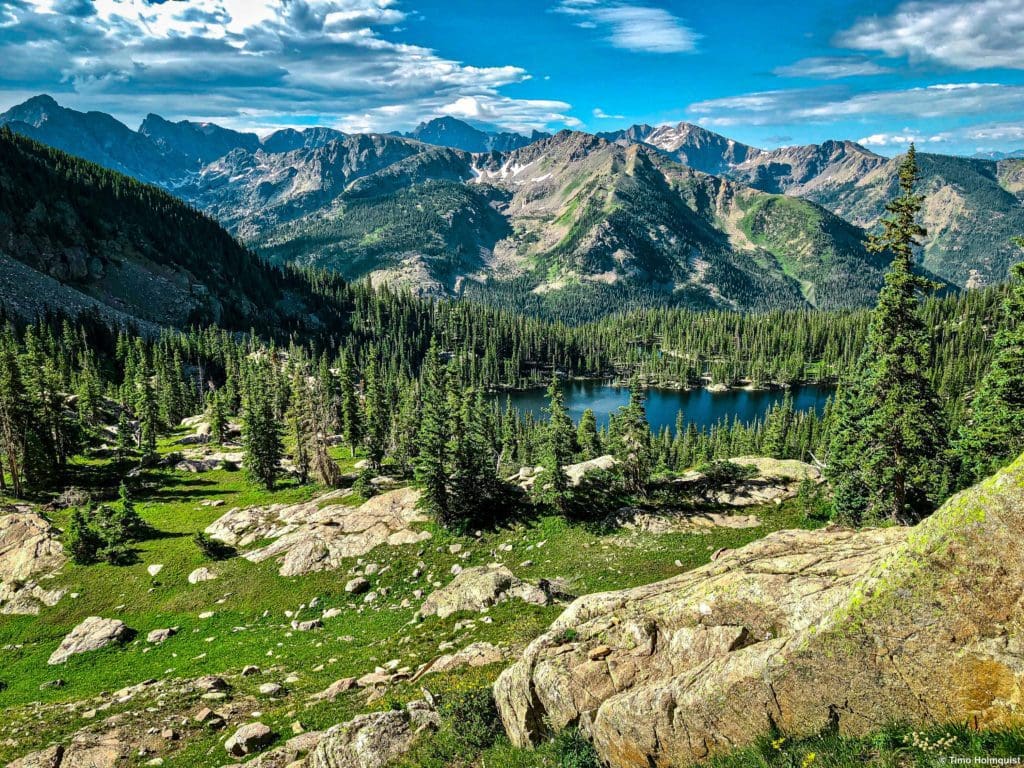
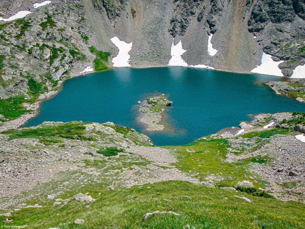
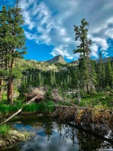
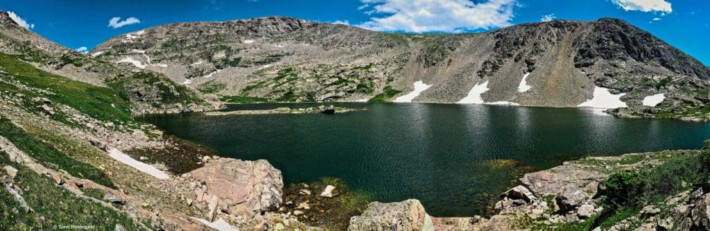
Gourd Lake from above.
Table of Contents
Article Navigation: Click on any of the listed items in the table of contents below to jump to that section of the article. Similarly, clicking on any large, white section header will jump you back to the Table of Contents.
Enroll With Global Rescue Prior To Embarking On Your Next Adventure

Global Rescue is there for you in an emergency when you’re hiking, kayaking, snowmobiling, fishing or enjoying the outdoors and get injured or ill. Push the red button and their medical and security experts will come to your aid.
Scales and Criteria
This article uses two metrics to calculate difficulty: overall distance and elevation gain. The distance of the hike makes it a large undertaking, but the trails are easy to follow and well-maintained when they are free of snow. This review covers snow-free hikes up to Gourd Lake, so no snow rating is used. However, please be aware that large patches of snow exist on this trail through later June.
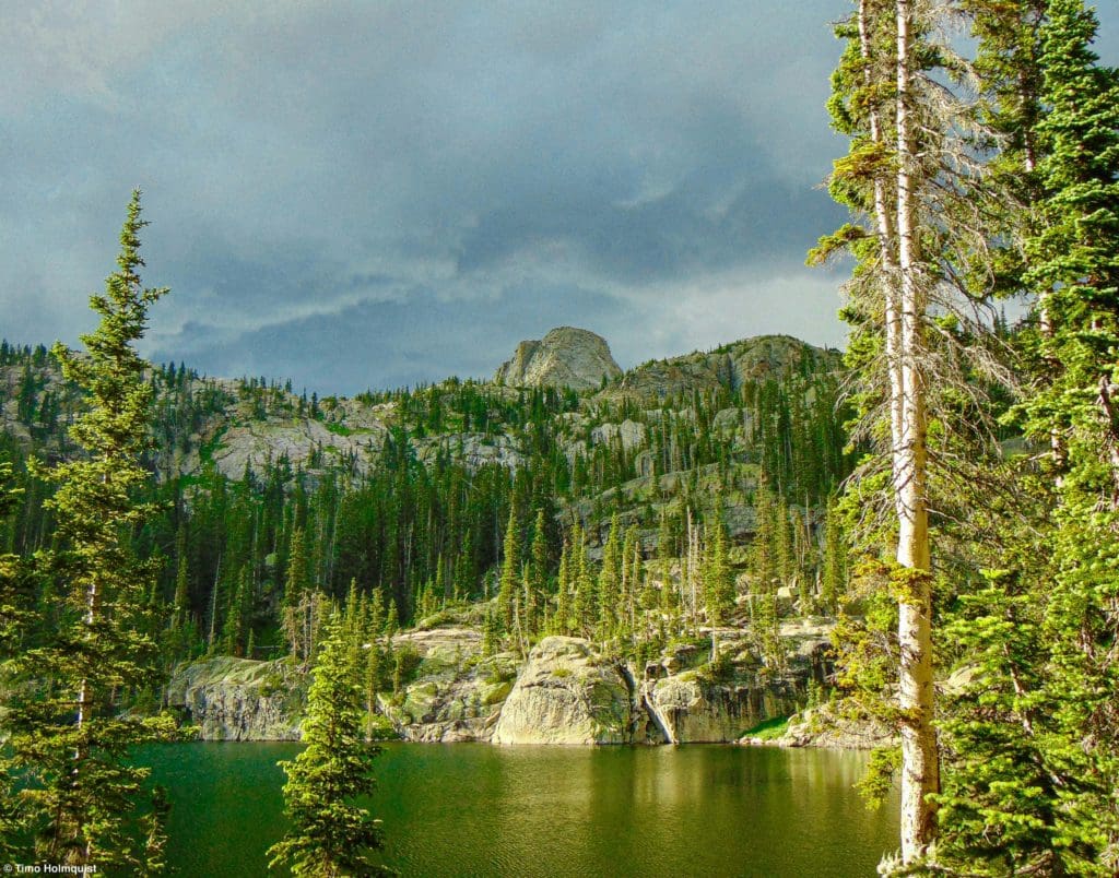
The shores of Gourd Lake at golden hour with storm clouds on the horizon.
Backpacking and camping in the Indian Peaks is reservation based; if you plan on staying at Gourd Lake for one or more nights and your reservation is for mid-late June, expect some snow patches near the lake. The trail to the lake is easy to follow and doesn’t require a scrambling rating; however, the best views of the Gourd Lake area are from above. To access the extra credit locations listed under the Journal section, you’ll need to perform some light off-trail hiking with a small bit of Class 2 scrambling thrown in.
Difficulty Ratings:
- Easy: less than 5 miles, less than 500 ft. of elevation gain
- Moderate: 5-10 miles, 500-2000 ft. of elevation gain
- Difficult: 5-15 miles, more than 2000 ft. of elevation gain
- Very Difficult: 10+ miles, more than 3,500 ft. of elevation gain
Technical Rating:
- Class 1: Established hiking trail the entire length of the adventure. Low chance for injury.
- Class 2: Typically involves cross-country navigation, possibly using hands for balance but not required, steeper than Class 1.
- Class 3: Hands and feet used to scale areas; must use hands to proceed (either for balance or to help pull you up a section), increased exposure, a fall could be fatal. Helmet recommended, along with grippy hikers.
- Class 4: Climbing on very steep terrain just shy of vertical, falls could be fatal, hands employed for grip and balance continuously, ropes advised but scalable without. Helmets are highly recommended, along with grippy hikers.
- Class 5-5.4: Vertical climbing that involves technical rock-climbing moves, exposed, falls likely to be serious or fatal, possible to scale without ropes but only for very experienced veterans. Helmets, grippy hikers, and/or rock-climbing shoes are necessary.
- Class 5.5 and up: Not covered as scrambling, full-on rock climbing with ropes, helmets, etc.
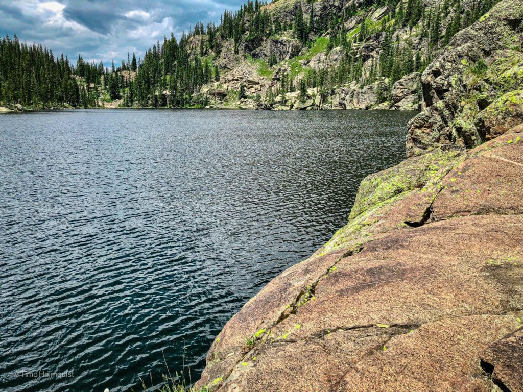
The northern shores of Gourd Lake are perfect for jumping into the water.
The Ultimate Offline GPS Hiking & Ski Maps
See why onX Backcountry is the ultimate GPS navigation app for your outdoor pursuits. Try Today for Free. No credit card required.

Directions To Trailhead
Monarch Lake is the most reasonable starting point to get to Gourd Lake. It is possible to start on the eastern side of the divide, but it is much harder and forces you to climb Buchanan pass (+2,000 feet), descend through Fox Park to the Gourd Lake Trail and then reclimb 1,300 feet to get to the lake. It’s more than 13 miles for any car without a ton of lift (think Subaru Outback or less). For something with lift (Tacoma’s, 4Runners, Jeeps etc.), you can park at Cony Flats, but you’re only saving 3 miles and still going up roughly the same elevation gain.
Parking at Monarch Lake requires a small fee, as it’s in the Arapaho National Recreation Area. You can use an interagency pass to circumvent the fee or pay 5$. Click here for more information.
Monarch lake is a fair distance from The Front Range, but once Trail Ridge opens up, you have two reliable options to get there. The first is to take I-70 to exit 232. Exit and head toward Winter Park on US 40. The road will pass through the small town of Empire before winding its way up and over Berthoud Pass. Drive down the other side and pass through the towns of Winter Park, Frasier, and Tabernash. When you get to the town of Granby, take a right on US 34 to continue north toward Lake Granby. The turn-off for Monarch Lake is at the end of a quick rise and right before you get to your first views of the lake. If you start to pass the shoreline of Lake Granby, you’ve gone too far.
The road you want is Colorado 6; it passes along the southern shoreline of Lake Granby and turns to dirt after a minute. You’ll pass over a few dams and the picturesque shore of Lake Granby until crossing the lake at its eastern mouth. There will be a three-way intersection, where a left will lead to more trails and Arapaho Bay Campground. Keep going straight until the road dead-ends into the Monarch Lake parking area. The approximate time from Denver is anywhere from 2 hours and 15 minutes to nearly 3 hours, depending on traffic.
If Trail Ridge is open (US 34) and you have a Rocky Mountain Pass plus a time slot, you can take that over the divide and pop down to the Monarch Lake Trailhead. Once you get into the park, take US 34 over the divide, get into Grand County and continue south until sighting Colorado 6 on your left. If you go over Trail Ridge, you’ll continue through Rocky Mountain National park, beyond Grand Lake, Shadow Mountain Lake, and all of Lake Granby before finding the turnoff. Fort Collins to Monarch Lake over Trail Ridge takes approximately three to three and a half hours.
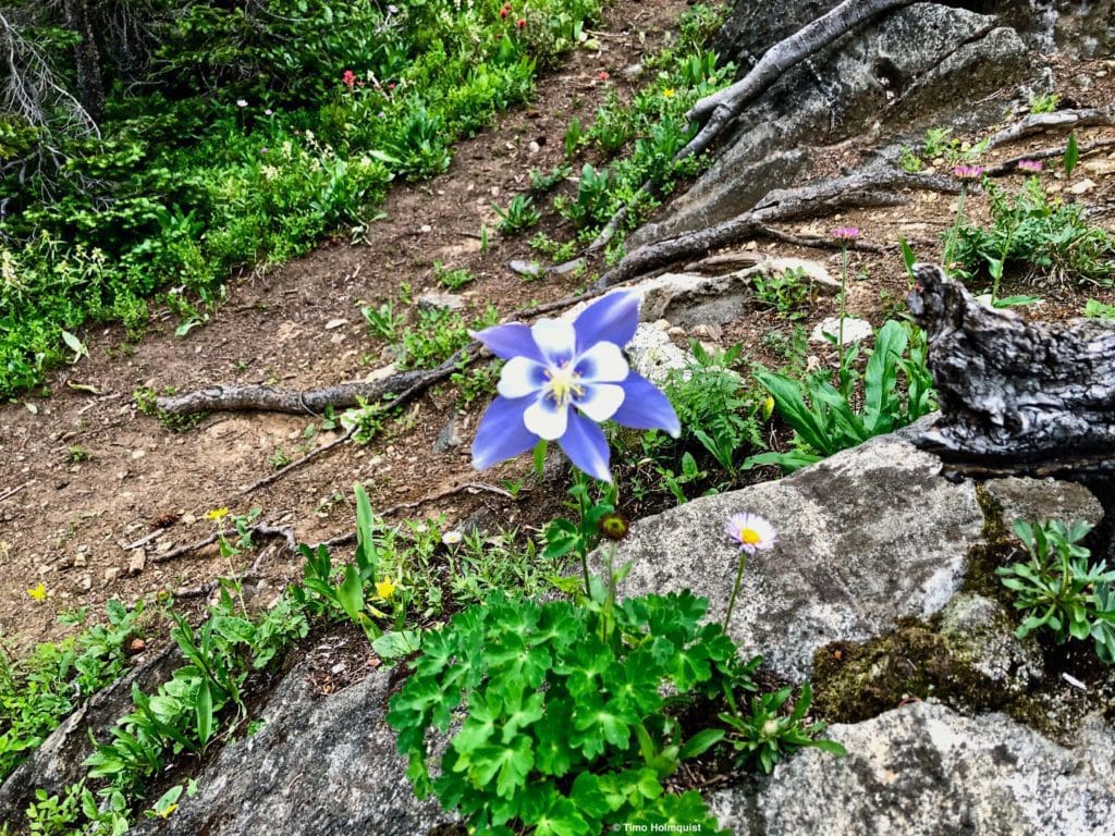
A Columbine flower along the social trail that circles the lake.
The Ten Essentials: How to Equip Yourself for the Backcountry
Packing the “Ten Essentials” whenever you step into the backcountry, even on day hikes, is a good habit. When something goes awry, you’ll truly appreciate the value of carrying these items that could be essential to your survival.
Field Notes
Although it isn’t off-trail and fairly heavily trafficked by backpackers and overnighters, Gourd Lake is in a wild part of the Indian peaks. If you go on a weekend, you’ll see people on the Buchanan Pass Trail and the Gourd lake Trail. Regardless, you can still find mid-week solitude throughout the summer, and the lake is big enough to allow people to spread out along its shorelines. Campsites extend all the way around its circumference.
Camping in the Indian Peaks Wilderness is done by reservation. You can find reservation details at recreation.gov. Please read about reservation type, when reservations open up and wilderness regulations. It’s best to book months ahead of time. If you wait, sites may be taken for the dates you desire. The reservation process is fairly simple but if you are found to camp without a reservation, you risk incuring a fine.
THERE ARE NO FIRES ALLOWED AT GOURD LAKE. For up-to-date overnight information, look at the Indian Peaks backcountry zone map, which explains which areas are open to campfires (not many and all on the western side of the divide) and which areas are not. Please respect these rules, wildfires have devastated northern Colorado since 2020, and many parts of the region (including in neighboring Rocky Mountain National Park) will need decades to fully recover.
Weather information can be very helpful for this part of the wilderness but recognize that it will not have pinpoint accuracy. Not only is Gourd Lake far from reliable weather reporting, but these are the Rocky Mountains; sometimes, the weather forecast gets it wrong. Macro trends are generally right; the specific timing, duration and intensity of some storms may be over or underrepresented. That’s just mountain weather for ya.
Start with the Granby free forecast courtesy of the National Weather Service. If you don’t mind paying for a subscription (really nice if you’re hiking/skiing or out and about in Colorado a lot), I highly recommend OpenSummit. They have the best forecasts, again not perfect, but a lot of metrics to focus on and try to untangle the complicated mountain weather picture. The nearest forecast station on Opensummit is on Sawtooth Mountain. For the freebirds out there, check out mountain-forecast.com and use the station for Lone Eagle Peak. In both cases, these forecasts are close but not next to Gourd Lake, expect the macro trends (chance of rain/t-storms), but the timing may be flexible, and some systems may miss Gourd Lake while hitting nearby basins.
If you’re camping in June-August during an active monsoon or afternoon thunderstorm cycle, prepare for mosquitos. The chance lessens but does not disappear, from later August through September.
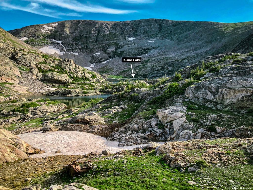
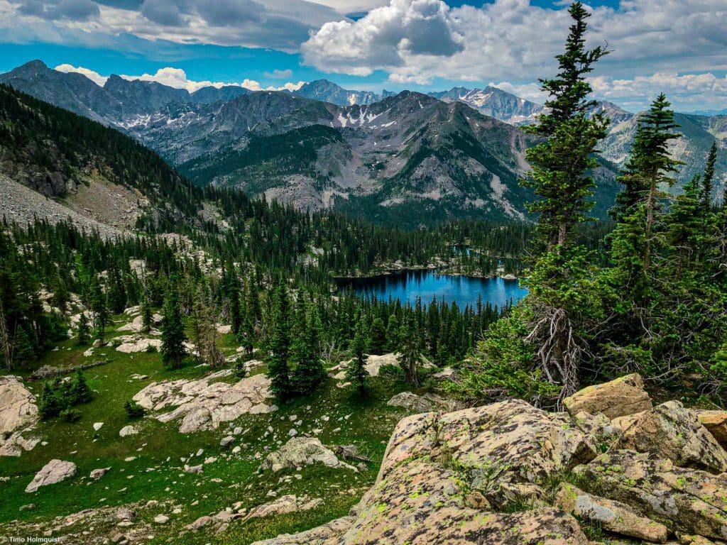
Island Lake, another large alpine lake accessible from a basecamp around Gourd Lake.
Journal
Once you find parking at Monarch Lake, head for the trailhead on the parking lot’s eastern side and pick up a wide and easy-to-follow trail around Monarch Lake. You’ll be travelling around the northern side of the lake. Once you round the shoreline, you’ll encounter your first trail junction. Follow signs for Crater Lake and Gourd Lake.
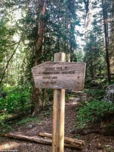
First trail junction.
Roughly 3.25 miles into your journey, after following the thundering Buchanan Creek up some small rises and runs through the forest, you’ll arrive at your second junction. This is where the Cascade Creek Trail breaks off and heads towards Crater Lake and the Pawnee Pass Trail. You want to continue on the Buchanan Pass trail towards Buchanan Pass and Gourd lake.
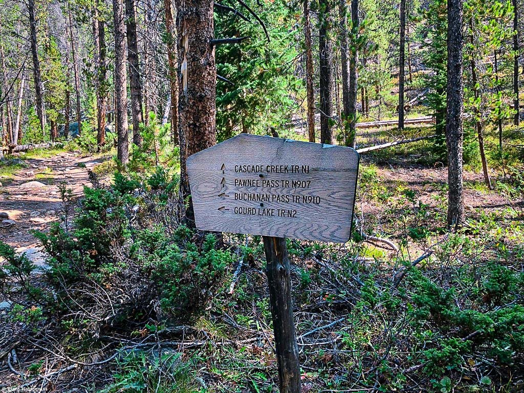
Second trail junction.
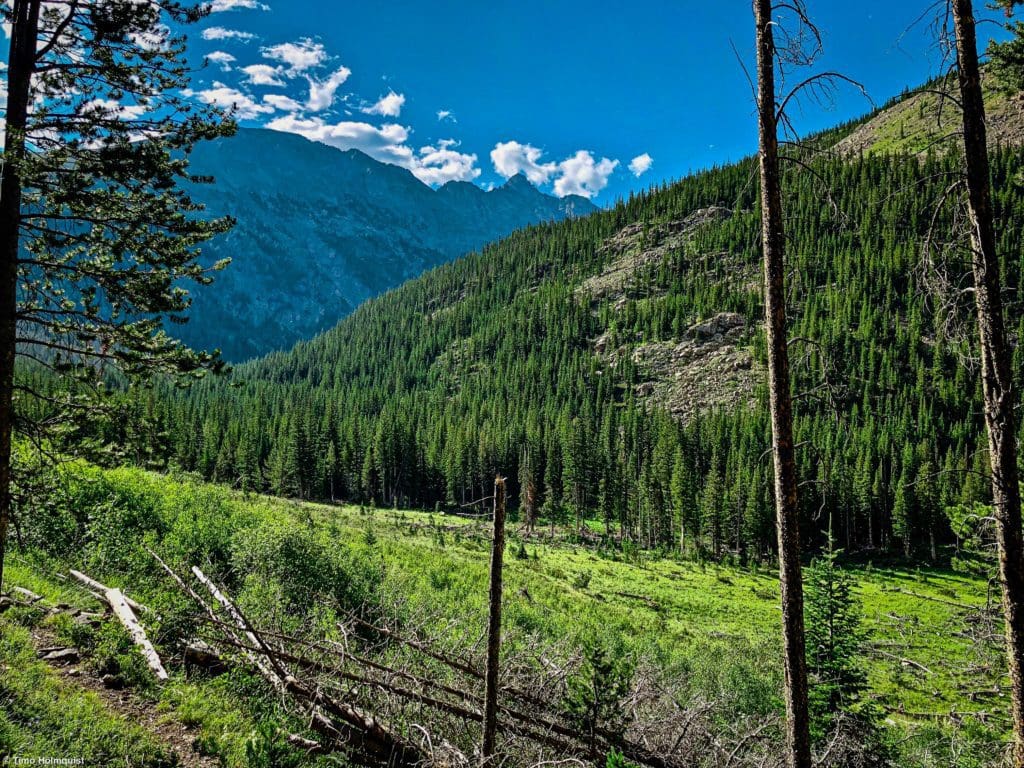
Aside from the views around Monarch Lake, the first part of this trip is fairly wooded, with occasional glimpses of Buchannan Creek as it tumbles down the western side of the IPW. Trail conditions are generally good, and if you are out on a weekend, you’ll likely see other hikers. Many people try to opt for the 50-mile Buchanan Pass-Pawnee Pass Backpacking Loop, so there will also be a decent number of backpackers from late June-September.
After the second trail junction, the well-trodden trail will continue for another 2.2 miles up the Buchanan Creek watershed. This section is still fairly wooded but gains more elevation than anything prior. When you finally get to the Gourd Lake trail after roughly 5.42 miles, you’ll have climbed roughly 1425 feet. Take a long break here because you’re about to nearly double your elevation gain over the next two miles.
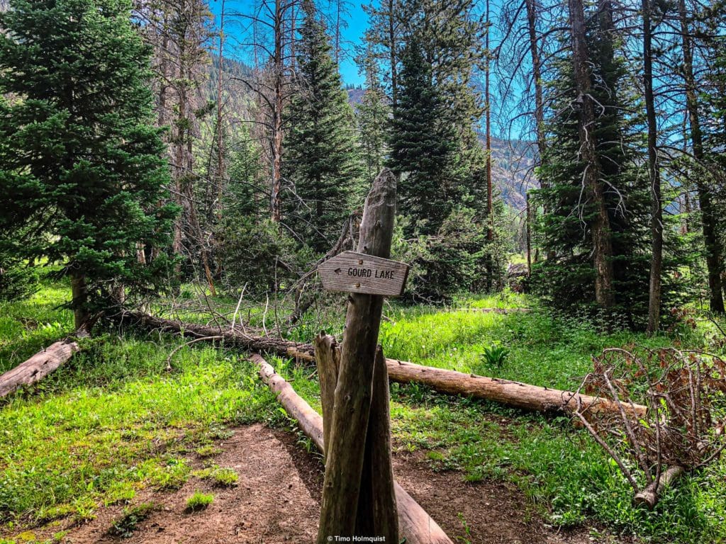
The small sign indicating the Gourd Lake Trail.
If it’s a hot day with little wind, this last section up to Gourd Lake is a real bear, especially if you have an overnight pack with you.
The trail starts out by switchbacking up a slope parallel to a wide avalanche chute, which you can see on occasion.
Gazing beyond the avalanche chute toward the commanding summit of Paiute Peak.
The forested section looks thick at times, but for the first 500 feet of elevation gain, it’s relatively sparse. There’s shade, but there will be sun between the trees, so lather up on sunscreen or wear a hat.
A typical section of trail as you continue ascending.
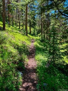
In total, there should be 17 switchbacks, but their frequency varies. Some switchbacks come abruptly, and some are full minutes apart as the trail attempts to match the slope. Along the way, you’ll pass a sign indicating no campfires within half a mile of the lake. Again, please heed these signs, the west is dry, and you can start fires very easily.
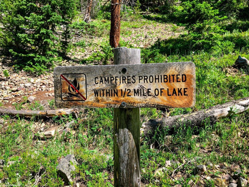
No fire sign on the Gourd Lake trail.
The sign is a bit misleading because it makes you think you’re closer than you are. Again, take your time and take lots of breaks; you’re gaining nearly 1400 feet in a little over 2 miles. One noticeable marker is a great set of open rocks on your right that show views of Thunderbolt Peak across the valley and out to Paiute and Algonquin.
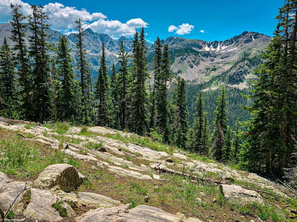
Opening views toward higher peaks.
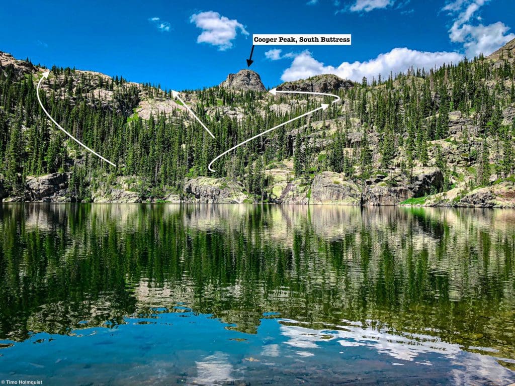
You’ll crest a roll of land and begin to rise alongside a few meadows and a smaller pond area. This is not Gourd Lake; continue on. The next area you’ll pass is the vine of the Gourd, or, a long tail that sticks out from the main lake. Around here, you’ll get your first looks at the South buttress of Cooper Peak, a wonderful Class 4 scramble.
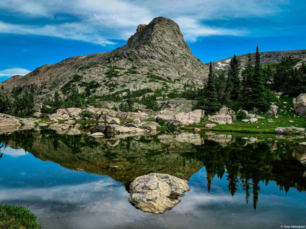
Cooper Peak and its South Buttress as you near the main part of Gourd Lake.
There are multiple ways to get around the shoreline of Gourd Lake. Once you reach the vine, you can opt to stay left and go around the lake that way. There’s also a spit of land that juts out into the middle of the lake that has a few good camping spots. This area is best accessed by finding the left side of the vine and following the shoreline.
Personally, I found the most intuitive way was to continue on the most obvious trail, which heads east (right) and then north (left) in a counterclockwise loop around the lake. You’ll thread around the tail of Gourd Lake first, not quite seeing the full extent of the water. Keep at it; there are prime camping and swimming spots ahead. You’ll know you’re close when you pass a wooden Restoration sign at an old camp spot that is now off-limits. Soon after, the lake opens up.
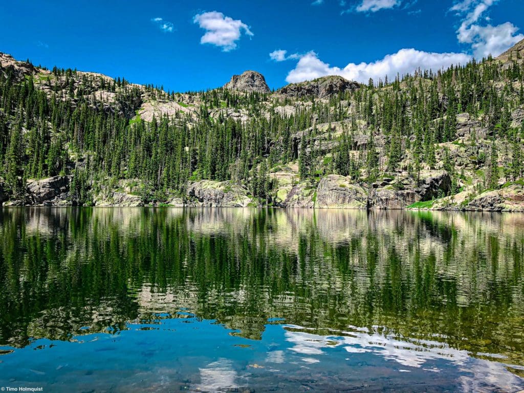
The main lake.
Continue as far as you want to go; there are sporadic campsites around the edge of the lake. If you’re keen on swimming, the farther around to the north side you go, the deeper the water gets. I haven’t jumped off all of the rocks, but I did jump off a few, and you do not touch the bottom.
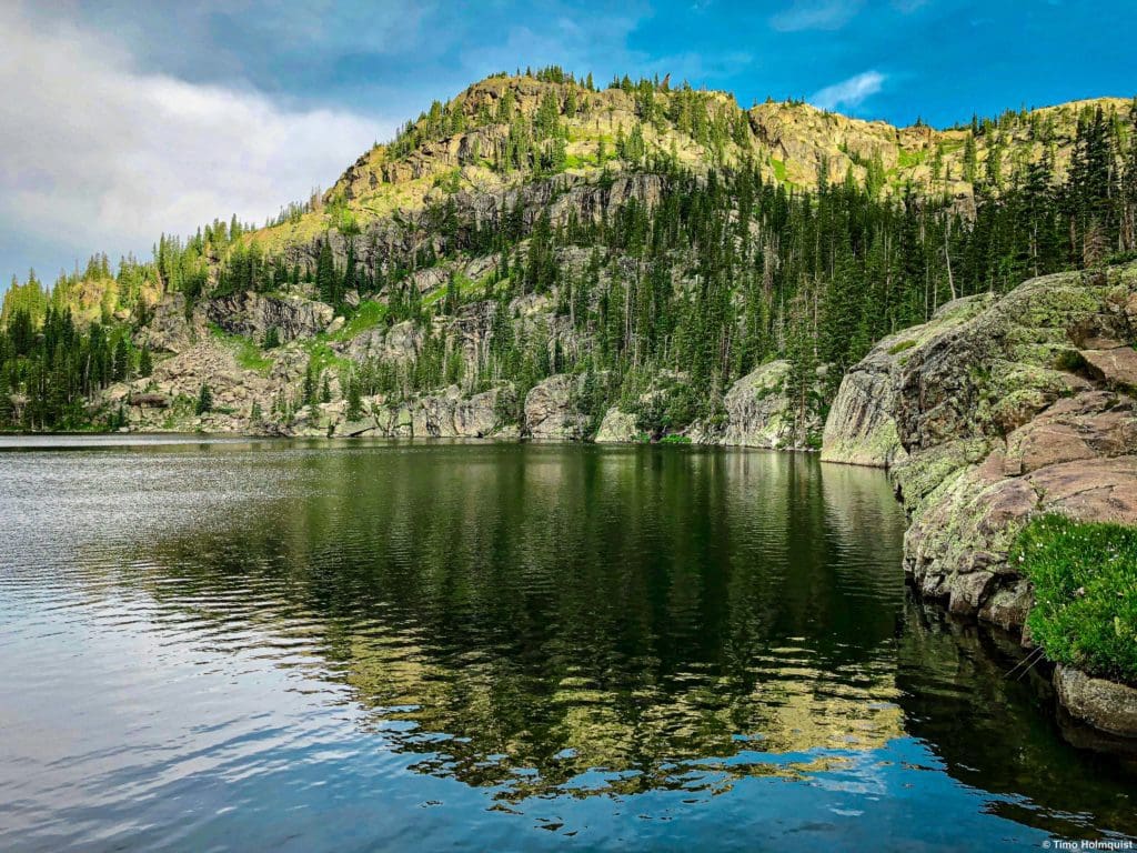
The rocks on the right-hand side of the picture are great jumping rocks.
Take your time and find the ideal spot. Again, if some of the closer ones are taken, there are additional sites farther on. If you arrive later in the day on a busy July/August weekend, many of the sites may be taken. The best strategy is to arrive as early as possible and avoid Saturdays.
If all campsites are taken around the lake, go to the northern edge and follow the stream that flows into Gourd Lake uphill. It’s a couple of hundred feet of gain, but it leads to another unnamed lake with additional space on its left (western) side to set up camp.
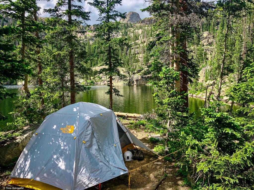
Camping spot attained.
If you’re out on a day hike, find a place to jump in. Or, if you’re keen on exploring, try to thread together the various social trails to loop around the lake; it’s worth the extra bit of up and down.
Extra Credit: Island Lake
There is another lake system above Gourd Lake. Interestingly, this higher lake doesn’t flow into Gourd Lake. The two lakes exist in parallel watersheds that get close to each other but never touch. The higher lake is called Island Lake and is a stunning destination on its own. If you’re camping at Gourd, getting to Island lake is a fun excursion. If you’re day hiking, budget a few extra miles on top of the demanding hike to get to Gourd.
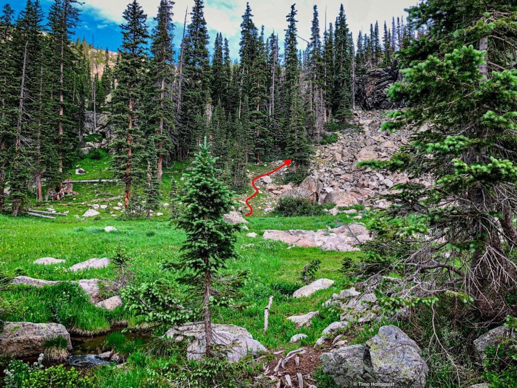
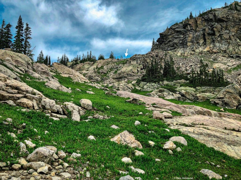
From whatever campsite you’ve managed to snag near Gourd, you want to climb out of the Gourd Lake drainage. This can be accomplished in a few different ways, as illustrated in the picture below.
Various ways out of the Gourd Lake area.
While it is a little longer, the easiest way directionally is to find the stream that flows into Gourd Lake on its northern side and follow it up.
The meadow where you want to head north.
There is a social trail here, although it isn’t completely cohesive. If you get to a spot where you think you’ve lost it, scan ahead a few dozen feet to see if you can find it. Or, if a tree has fallen over your path, find a way over and realign. If all else fails, find the stream and follow it up on its righthand side.
The path gets close to the stream at points, but doesn’t go up any of the wet rocks near the flow of water.
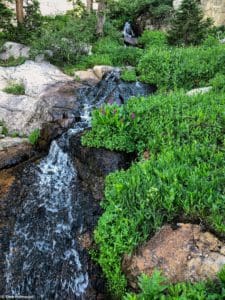
There are a few small rocky sections to negotiate before the terrain mellows. Connect a path until you find the unnamed lake above Gourd. It’s a lovely area and very peaceful. Your next goal is to hop across to the other side of the stream. One of the easiest places to do this is to jump across the stream where it meets the unnamed lake. There’s a convenient rock right in the middle, and you can two hop across.
A good crossing.
On the other side, pick up a series of slanted rock slabs in front and to your left, and rise alongside them. Another potential campsite is up here. The slabs help you stay off of the alpine vegetation and provide great traction when dry. Use them to gain a hundred feet or so until you see the cleft in the ridge you’re shooting for.
The ultimate goal.
The climb up to the cleft has a smattering of Class 2 moves. It’s short and not very difficult but leads to a great set of ponds with stunning views of Cooper Peak.
Very nice views from the easternmost of two unnamed ponds.
These two ponds, as nameless as the one above Gourd Lake, are interesting because they lie on top of the divide between the watersheds. Circle around the pond on either side (being very aware of footfalls and avoiding plants where able). You’ll hop up a short rise and then be able to see down to the stream that flows from Island lake.
Where you need to end up.
How you ultimately get to the shores of Island Lake is up to you. I found that there was an easy path along the watershed divide by sticking to the obvious rocks. Then, I wound down to the outflow stream from Island Lake and crossed it before wrapping around the shoreline toward the namesake Island. It is easier to stay on the right side of the outflow stream, not cross it, and wrap around the lake on its eastern (right) side. The only issue with this approach is the presence of snowfields through early July. The snowfields are not steep, but it’s helpful to have a pair of microspikes to cross them.
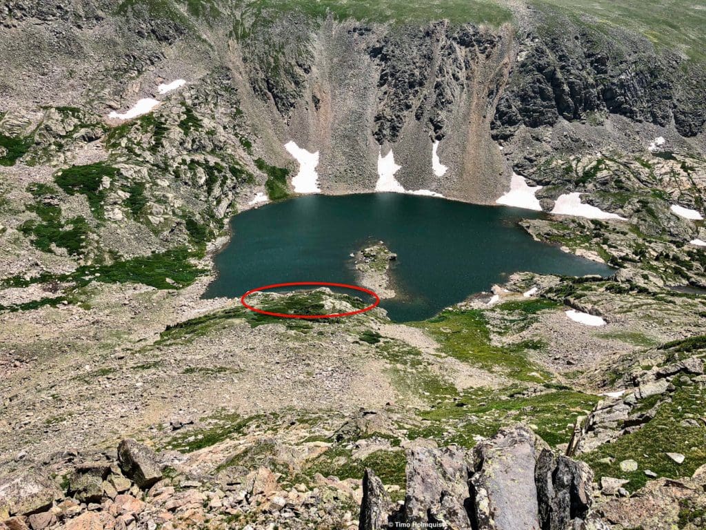
Island Lake from above.
It is possible to circle around the entire lake along its various shorelines barring two obstacles. The first obstacle is the lingering snowfields on the eastern side, which can be negotiated easily by using microspikes or waiting until August for it all to melt. The second obstacle (the red circle in the picture above) is a section of the shoreline that’s quite cliffy. The easiest way is to ascend around the section and pop down the other side to continue your walk.
In all scenarios, if you go off-trail, stick to rocks and bare patches of dirt when able, the alpine is healthy here, and you don’t need to tromp through a field of flowers to get where you want. If you’ve made it this far, you can employ some creative thinking and avoid stepping on sensitive alpine vegetation. It’s also much easier to get to Island Lake and find a place along the shoreline to relax without even needing to go around the lake.
Island Lake from its western shoreline.
When you’ve had your fill of Island Lake, retrace your steps. Once you’re back on the small rocky ridge between the Island Lake drainage and the Gourd Lake Drainage, it should be easy to find your way back into the Gourd Lake area.
Looking down to Gourd Lake from the edge of the bowl that houses it.
Island Lake is generally deep enough to swim around in, although many areas are quite shallow. If you get down to Gourd Lake and the mosquitos aren’t too bad, jump in. The depth of Gourd Lake is unique for this area. As always, make sure you scout the landing zone (i.e. swim out to it and make sure you can’t touch the bottom) before jumping.
This area is teeming with other adventures as well, including a few stellar scrambles and a snow couloir climb on Cooper Peak.

Enroll With Global Rescue Prior To Embarking On Your Next Adventure.
When a travel emergency arises, traditional travel insurance may not come to your aid, and a medical evacuation can cost up to $300,000.
The cost when you have a Global Rescue membership? $0. That’s why when the unexpected happens, you want the leader in rescue, evacuation and medical advisory behind you. You want Global Rescue.


