


High Point:
12,162 feet

Total Ascent:
3,330 feet (~3770 ft. with Meadow Mountain add-on)

Difficulty:
Hard/Very Hard

Distance:
8.6 miles roundtrip (9.4 miles with Meadow Mountain add-on)

Waypoints:
40.20845, -105.56672

Route Type:
Out and back

Table of Contents:
Article Navigation: Click on any of the listed items in the table of contents below to jump to that section of the article. Similarly, clicking on any large, white section header will jump you back to the Table of Contents.
- Overview
- Scales and Criteria
- Directions to Trailhead
- Places to Stay
- Field Notes
- Journal
- Final Thoughts
Looking For An Amazing Adventure? Book A Hiking Tour in Rocky Mountain National Park
Overview:
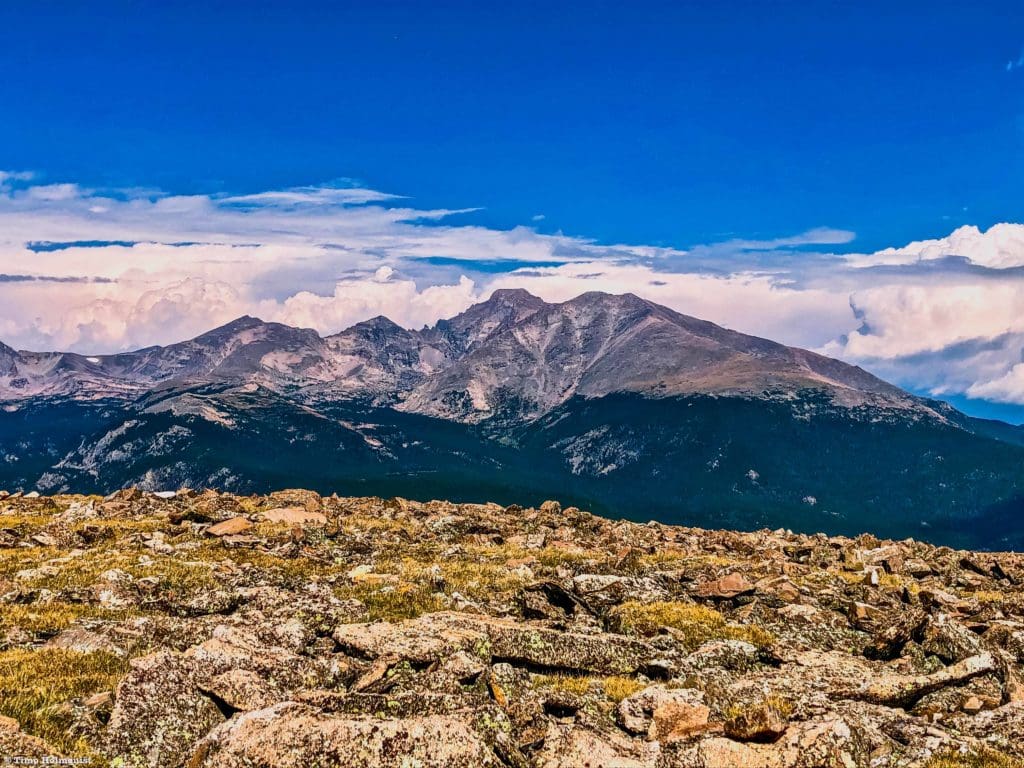
With a trailhead outside of Rocky Mountain National Park and at the end of a long dirt road near Allenspark, Saint Vrain Mountain is often overlooked when considering regional hikes. The parking lot is quite small and does get busy in the middle of the summer, but shoulder-season weekday hikes are a fantastic time to explore the mountain. From the top, you can stare into Wild Basin, the Indian peaks Wilderness, and at the impressive south face of Longs Peak. In the early spring, the area is also a fantastic backcountry ski destination. With a solid trail to the alpine and an easily identifiable and cairned route to the summit, St. Vrain Mountain is a great workout with a huge payoff.
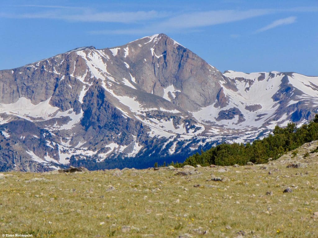
The summit of St. Vrain from near treeline.
Scales and Criteria:
This article uses two metrics to calculate difficulty: overall distance and elevation gain. This review only focuses on views attainable via trail or easily discernable social trails and does not cover scrambling. Snow patches linger on the trail into early June, making the area a great backcountry ski zone but should be clear by July 4th. The trail is popular from late June-Labor Day, with a noticeable drop in traffic afterward. Generally speaking, it is lightly trafficked when compared to the main Wild Basin Trails or Glacier Gorge. On shoulder-season weekdays, you may have the entire trail to yourself.
Difficulty Ratings:
- Easy: less than 5 miles, less than 500 ft. of elevation gain
- Moderate: 5-10 miles, 500-2000 ft of elevation gain
- Hard: 5-15 miles, more than 2000 ft. of elevation gain
- Very Hard: 10+ miles, more than 3,500 ft. of elevation gain
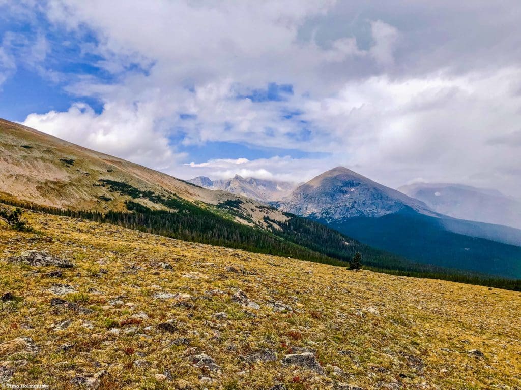
The view south from St. Vrain in late April, Mt. Audubon, is obscured by low-lying clouds.
The Ultimate Offline GPS Hiking & Ski Maps
See why onX Backcountry is the ultimate GPS navigation app for your outdoor pursuits. Try Today for Free. No credit card required.
Directions to Trailhead:
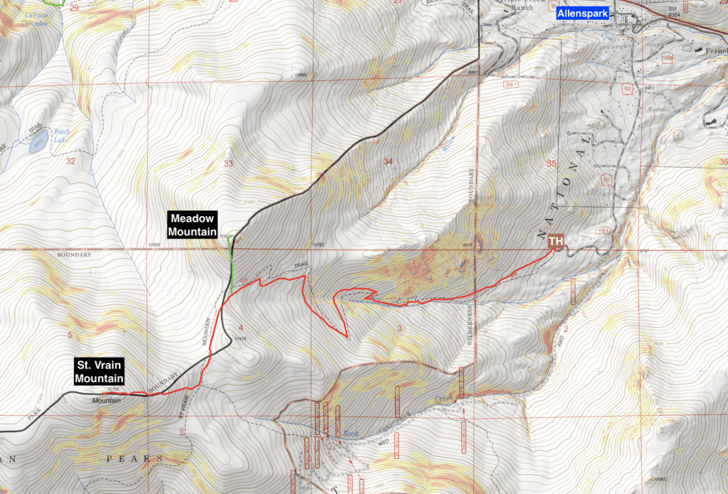
Map of Saint Vrain Mountain and Meadow Mountain
While not as obvious as Brainard Lake Recreation Area or the entrances to the National Park in Estes, St. Vrain Mountain is fairly easy to access from many points along the Front Range. From Denver, Boulder, Colorado Springs, and Fort Collins, you want to make your way to the town of Lyons. This quaint river town is a gateway to Estes Park, Wild Basin, and Allenspark. From the west end of the center street, take a left on CO 7 and work your way up the canyon. After climbing up the slopes of the foothills, the road will pass an intersection with CO 72, a left here would take you to Nederland, but you want to stay straight. The road will continue west towards Allenspark. You’ll know you’re close when you have to ascend a long uphill with views of Mt. Meeker in the distance. As you reach the top of the rise, slow down and look for a left turn lane. You’ll turn off of CO7 onto Ski Road, which will put you in the middle of the small town. The road will hook left initially. After this hook, take a right at an intersection to stay on Ski Road; it will be dirt from here on out. This road passes a lot of houses and private property, SLOW DOWN. It’ll feel like a driveway at times because the houses come up nearly next to the road shoulder, but the road does continue through the town, and with the dirt surface, there isn’t much benefit to going fast unless you want to wreck your undercarriage.
Once you pass the houses, continue into the national forest. It’s only two miles to the trail but because you’re on a dirt road, it’ll take nearly ten minutes. There is one intersection to be aware of, though it is signed. When able, take a right uphill on 1161; the sign for St. Vrain is a little up the hill and not immediately apparent from the intersection. If you miss this intersection, the road will dip down to Rock Creek. There are places to turn around once you cross the creek, but it will waste a few minutes. The parking lot has space for a handful of cars, and the trail starts at a kiosk on the west side of the small lot. As of this article’s publication, there is no entrance permit or fee associated with this trail. The route dips briefly into the National Park at well-signed locations, so whether or not you can take a dog is a bit of a gray area. National Parks do not usually permit furry friends to help offset unintended consequences for natural flora and fauna.
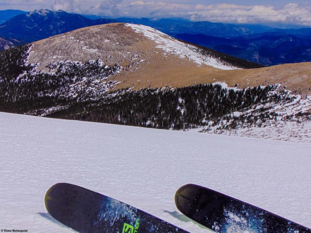
Spring skiing on St. Vrain.
Places to Stay:
Find a Hotel in Estes Park, Colorado
Support Skyblue Overland by booking your hotel or cabin through one of our links.
Camping
Camping near Rocky Mountain National Park will cost you. The options for free area camping are limited. On a positive note, there are plenty of options, and the National Park is within driving distance of most major Front Range cities.
- Estes Park: Known as the gateway to Rocky Mountain National Park, Estes sees nearly 80% of park traffic as opposed to the much quieter western entrance near Grand Lake. The town has a ton of lodging options.
- Allenspark: A small town near Wild Basin that has a few lodging options, including the Wild Basin Lodgeand the Sunshine Mountain Lodge and Cabins.
- Rocky Mountain National Park Camping
- Moraine Park Campground: $30 per site. $20 in winter. Established campground with perks, facilities, campfire grate, wood for sale in summer, and bear boxes to store food. Only loop B is open in the winter, and it’s first-come, first-serve.
- For summer, a reservation is needed quite a ways in advance to secure a spot.
- Glacier Basin Campground: $30 per site. Established campground with the same perks as Moraine Park. Reservation required.
- Backcountry Campsites: Rocky Mountain National Park has backcountry sites that you could book in advance. There is no open camping in the backcountry; it must be at designated backcountry sites. Please check the park website for more details. Backcountry sites require an overnight permit of $30.
- Camping near Estes Park
- Estes Park Campground at Mary’s Lake: Established campground, pricey $45-55. Good backup if other campgrounds are full.
- Hermit Park Open Space: $30 for a tent site, price increases if towing a trailer or for group spots.
- Estes Park Koa: Rates dependent on what you’re bringing with you but will run more than $50 a night in the busy season.
- Olive Ridge Campground in Roosevelt National Forest is the closest campground to the Lookout Mt. trail. ~$20 for a standard nonelectric site.
- Free or close to free:
- Ceran St. Vrain Trail Dispersed Camping ($1)
- County Road 47. Users have reported trash and ATV noise at this location, but it is free.
- Meeker Park Overflow Campground
Once you break through the treeline, the views to Wild Basin and Mt. Alice certainly leave an impression.
Field Notes:
This is a really fantastic area for a few reasons. Being the end cap on an east-west ridge set back from the Continental Divide gives the views on top of Saint Vrain an expansive feel. There is also a well-marked and easy-to-follow trail for the vast majority of the hike. The one part that is not officially trailed is marked with enough cairns to successfully aid orientation, so, assuming a good visibility day, there shouldn’t be any issues getting to the top.
For your weather needs, start with the Allenspark extended forecast. You can also use the Mt. Meeker forecast. Opensummit has a good forecast option for the mountain itself, which you can access here. Keep in mind that Opensummit only provides free forecasts for up to 2 days out; a longer view requires a subscription.
One thing to remember about these exposed ridges of the Front Range is that they attract some blistering alpine winds. Make sure you are looking at windspeed forecasts before committing to an adventure day. Getting blasted by 30-40 mph winds for hours on end is a decidedly negative experience and can fast-track frostbite or windburn depending on the time of year.
Threading the needle between squall lines. Mountain weather can be extreme; come prepared.
Journal:
The trail starts off on the west side of the parking lot and ascends into a pine forest. The first 10-15 minutes of trail are along a drier slope before you work your way towards the creek. The route is a little complicated to follow if snow patches exist lower down. Once the snow melts, it’s quite easy to follow. There isn’t a lot of expansive scenery to the first few miles of trail as the path winds along the creek drainage, but the elevation gain is significant.
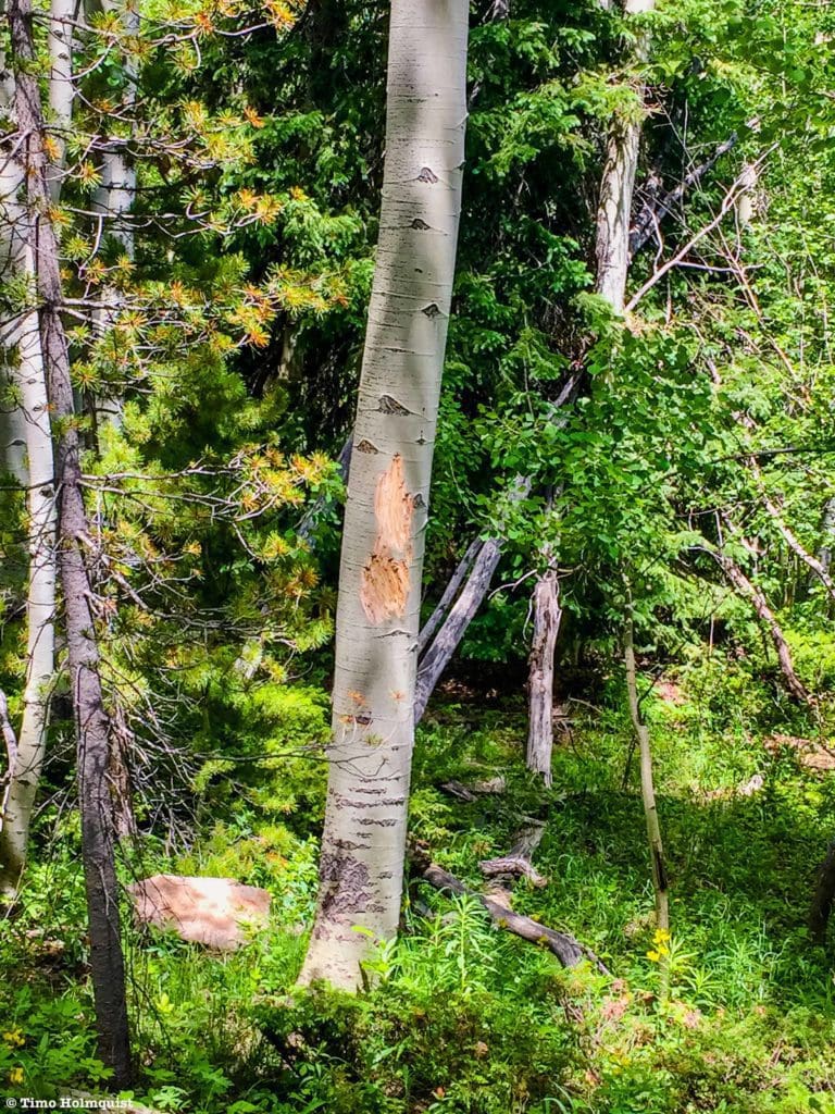
Bear claw marks on a tree next to the trail.
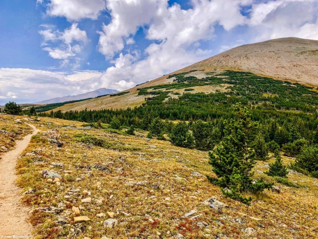
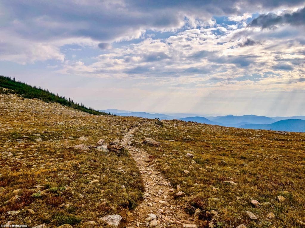
Roughly 2.5 miles into the journey, you’ll notice the vegetation begin to change, and more open meadows present themselves alongside the trail. Not long afterward, you will reach treeline, and big views begin to reveal themselves. While the trail is easy to follow, you will gain nearly 2,000 feet before the views come into the picture, so take your time and ascend at a comfortable pace.
Looking down at where the trail emerges into the alpine from Meadow Mountain.
After the trees stop, the trail will head towards a saddle between Meadow Mountain on your left and the larger St. Vrain Mountain. Once you draw even with the summit lump of Meadow Mountain, you’ll see the entrance sign for Rocky Mountain National Park.
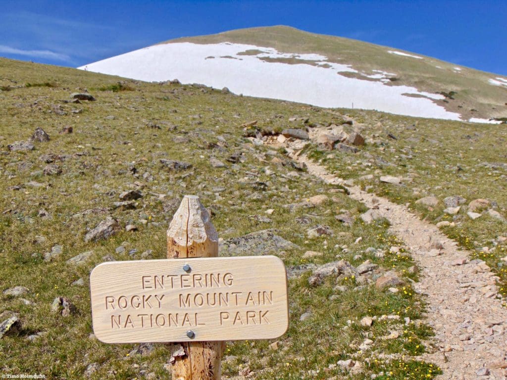
National Park sign with St. Vrain Mountain behind.
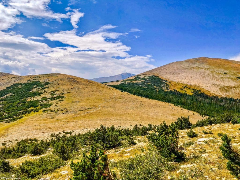
The views here are wonderful and will only increase as you make your way to Saint Vrain Mountain. Once the trail reaches the saddle, it will veer south along the alpine, passing an unnamed high point on its way to the higher St. Vrain.
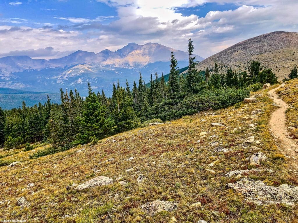
Looking back to Meadow Mountain and Longs Peak behind it.
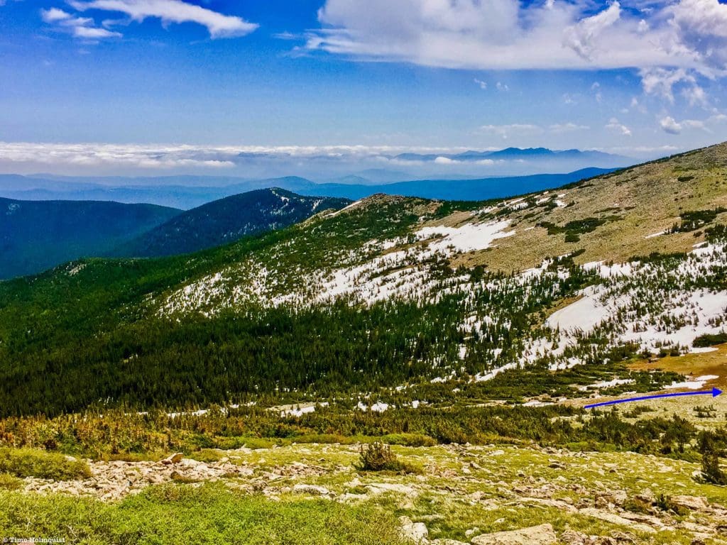
As you approach the bulk of St. Vrain, keep an eye out for a large set of cairns leading into the alpine on your right. If you’re hustling or dealing with adverse weather, it may be easy to miss this spot. The official trail continues to a subsequent shoulder before dropping into another drainage.
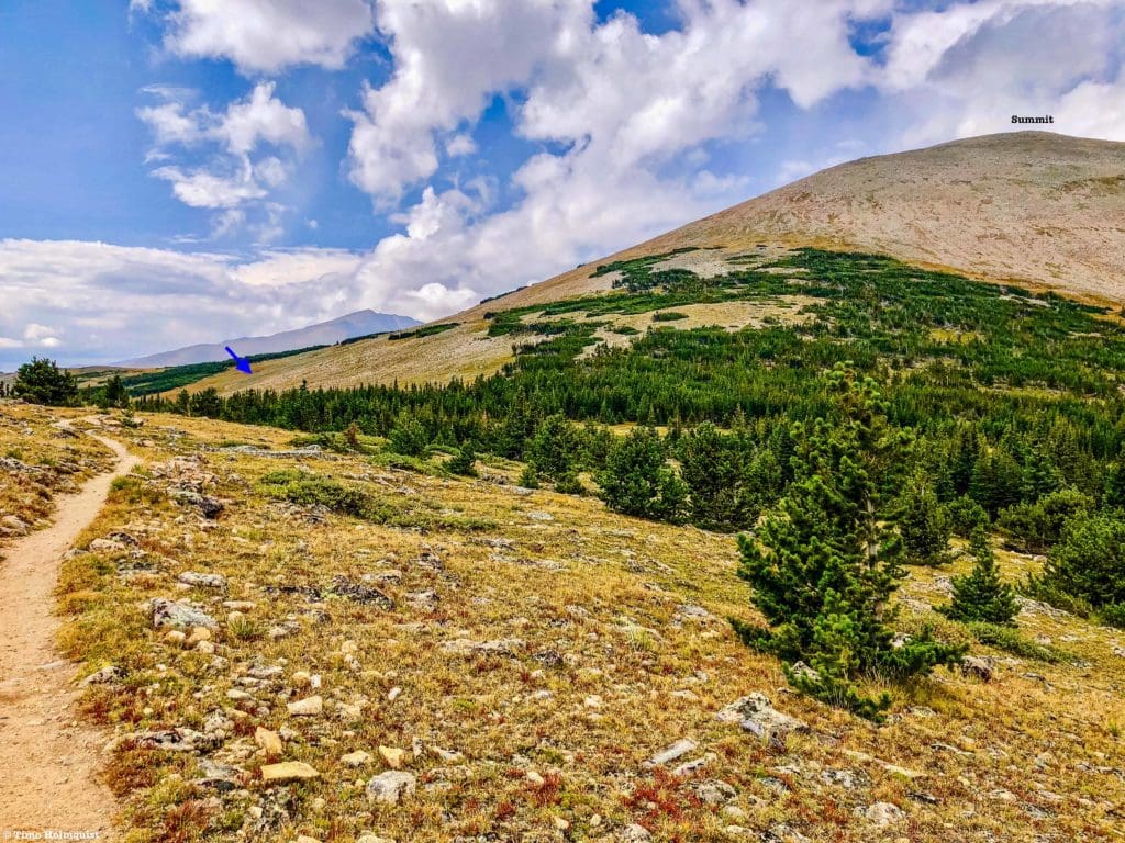
The arrow marks where you want to break from the main trail and head uphill.
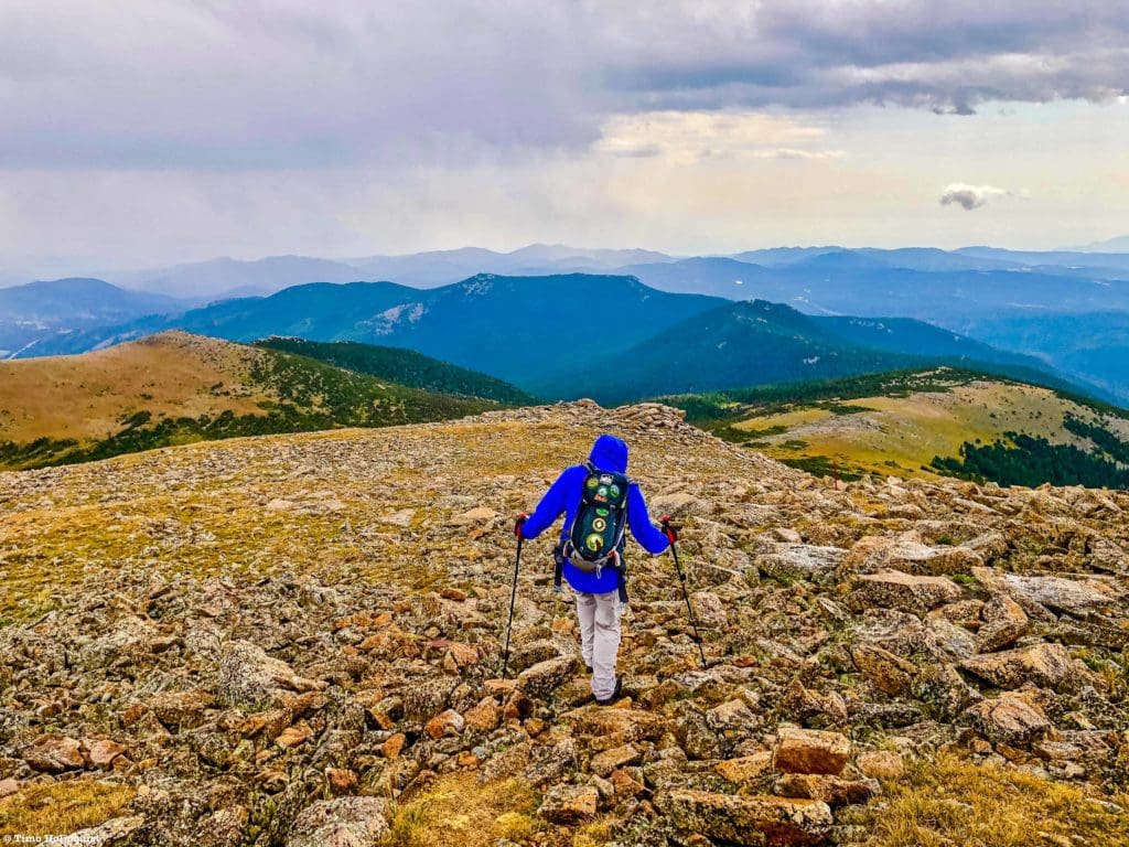
The route to the summit is well cairned but once you break off the main trail, keep in mind that the actual summit is hidden. You’ll ascend through some intermittent krummholz before tackling a steeper pitch. Beyond the steeper pitch, the trail continues to rise before finally making it to the top. It is a deceptively long ascent but not particularly difficult. The summit is marked by a large rock windscreen.
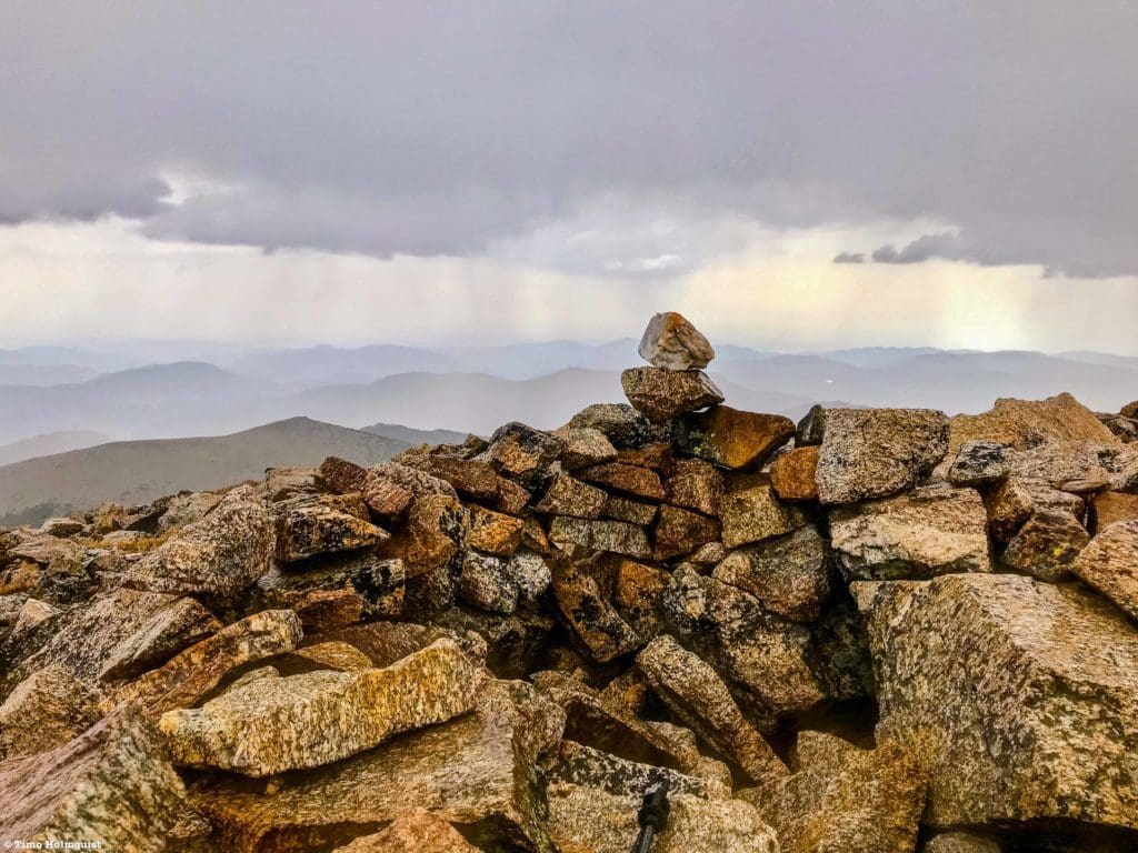
The summit in an early September rainstorm.
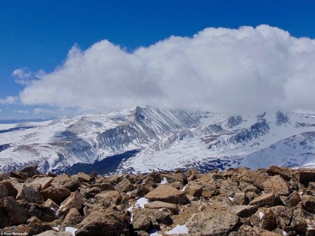
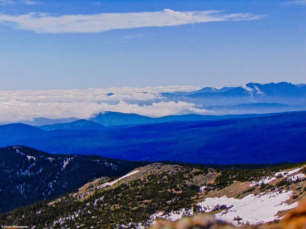
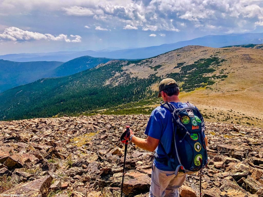
The broad summit cone continues west across welcoming talus and alpine before dropping. Strolling along this section makes for a nice experience and allows for better views towards the craggy Continental Divide.
Looking southwest to Mt. Audubon and Paiute Peak.
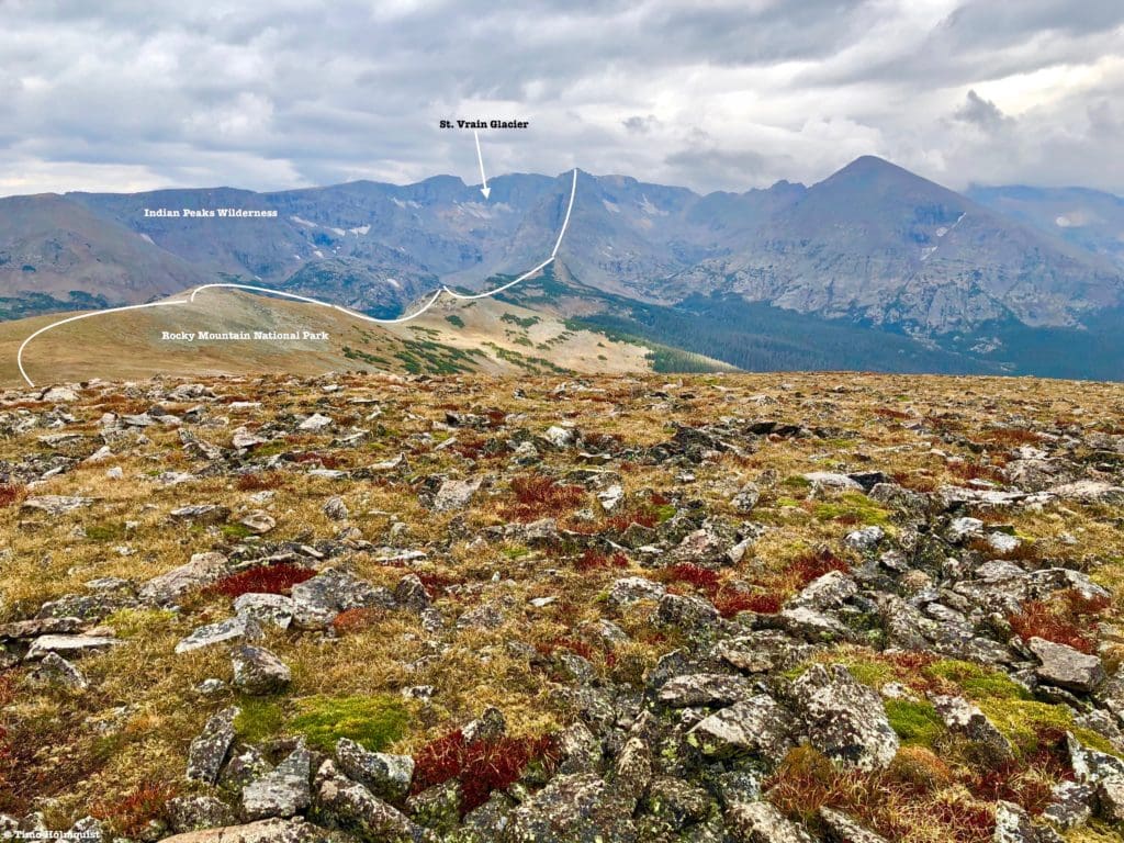
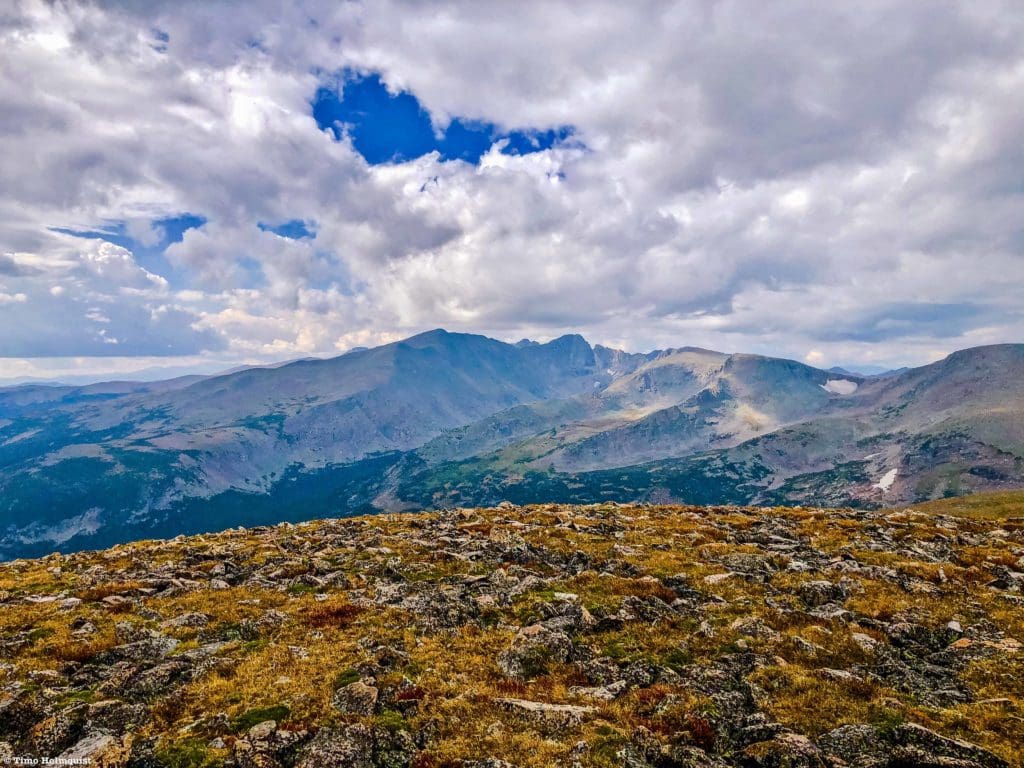
Looking west to the Continental Divide, the largest St. Vrain Glacier is marked.
After soaking in the views, retrace your steps down to the main trail. Keep in mind that you are far above treeline, so any inclement weather could be severe. Come prepared; Colorado deals with extremes and has had daily temperature fluctuations of 60 degrees before.
Descending off the summit cap.
Once you find the official trail, take a left and follow it along a pleasant stretch of alpine with Meadow Mountain front and center.
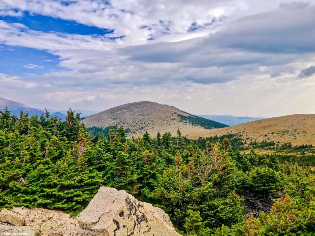
Meadow Mountain from near the main trail.
If you have the energy, Meadow makes a nice additional objective. There is less of a trail up Meadow, although it isn’t difficult to string together a suitable line amongst the alpine and talus. The easiest way to start up the mountain is to look for a large cairn on the left side of the trail near the first Rocky Mountain National Park sign.
The area where you want to consider breaking left if adding Meadow Mountain
Once you start rising, it’ll only take 0.4 miles and 440 feet to reach the summit. In good conditions, the journey up is loaded with great perspectives and lines up the larger St. Vrain Mountain nicely to the south.
On the way up Meadow.
Like St. Vrain, the summit has a large windscreen; there is also a weather station nearby. While the larger St. Vrain is a lovely destination by itself, the views from Meadow are equally as good and offer a closer look at the complicated topography near the iconic Longs Peak.
View of Longs Peak from Meadow Mountain.
Meadow Mountain is also closer to the eastern edge of the alpine, which can, on good visibility days, provide a greater sense of prominence over the plains and Front Range urban corridor.
Looking down to the cloudy flats from Meadow Mountain.
Whenever you’re satisfied, head back the way you came until running into the trail beneath the summit lump of Meadow Mountain. Once you reconnect with the trail, take a left and begin the descent out of the alpine. Once you dip below the trees, weather danger decreases. The rest of the trail is easy to follow (in the absence of snow), and before long, you’ll be back at your car. For the motivated, both summits can be attained in half a day; for the rest, take your time when you get above the trees and soak in the unique perspectives that both summits provide.
The summit windscreen on Meadow Mountain.
Final Thoughts:
Saint Vrain Mountain is a great workout hike that offers fantastic views of Wild Basin and the Indian Peaks Wilderness. The trailhead is a bit obscure and requires a little navigational work, but the trail is often less crowded than neighboring areas. As an added bonus, backcountry skiing in April and early May stretch the usability of the trail and the surrounding Rock Creek drainage. Please drive slowly and respect private property as you pass through Allenspark, people clearly live here. While often less crowded than other areas, the parking lot is small, and weekends in the summer months mean bigger crowds. A hike on a weekday in September may be the best time to stride out and enjoy what the area has to offer.
Descending off of Meadow Mountain.
Popular Articles:
- Guide to the Best Hiking Trails in Rocky Mountain National Park, Colorado
- The Dyrt: The 10 Best Campgrounds In Colorado
- Top Adventure Sports Towns 2021: Boulder, Colorado
- Epic Adventures with the Best Guides In Colorado
- Sky Pond via Glacier Gorge Trail, Rocky Mountain National Park, Colorado
- Scrambling Hallett Peak’s East Ridge, Rocky Mountain National Park, Colorado
- Scrambling Mt. Alice via the Hourglass Ridge, Rocky Mountain National Park, Colorado
- Gorge Lakes Rim Scramble, Rocky Mountain National Park, Colorado
- Black Lake Via Glacier Gorge Trail, Rocky Mountain National Park, Colorado
- Scrambling To The Lake Of The Clouds, Rocky Mountain National Park, Colorado

Skyblue Overland Strongly Recommends That You Enroll With Global Rescue Prior To Embarking On Your Next Adventure.
With more people outside now more than ever, Global Rescue expanded services to include field rescue within 100 miles of home. With Local Field Rescue — automatically included in any travel protection services membership — Global Rescue is there whether you’re hiking, kayaking, snowmobiling, fishing or simply enjoying the outdoors and get ill or injured and you’re unable to get to safety on your own. Purchase a Global Rescue membership for your next adventure and travel with peace of mind. Single trip, annual and family options are available.
Memberships start at $119.
Terms of Use:
As with each guide published on SKYBLUEOVERLAND.com, should you choose to this route, do so at your own risk. Prior to setting out check current local weather, conditions, and land/road closures. While taking a trail, obey all public and private land use restrictions and rules, carry proper safety and navigational equipment, and of course, follow the #leavenotrace guidelines. The information found herein is simply a planning resource to be used as a point of inspiration in conjunction with your own due-diligence. In spite of the fact that this route, associated GPS track (GPX and maps), and all route guidelines were prepared under diligent research by the specified contributor and/or contributors, the accuracy of such and judgement of the author is not guaranteed. SKYBLUE OVERLAND LLC, its partners, associates, and contributors are in no way liable for personal injury, damage to personal property, or any other such situation that might happen to individuals following this route.


