


High Point:
11,062 feet

Total Ascent:
~3,600 feet

Difficulty:
Very Difficult

Distance:
~21 miles

Waypoints:
40.2567, -105.8145

Route Type:
Out and Back, longer loop options available
Lake Nokoni and Lake Nanita in Rocky Mountain National Park are stunning, but you’ll need to hike a few miles to get there. Stick it out for the reward: both lakes are gorgeous.

Overview:
Rocky Mountain National Park is a bit lopsided. More than 80% of visitors enter the park on the eastern side because of its proximity to the Front Range Urban Corridor. While there are plenty of reasons to stick to the eastern side (Glacier Gorge, Thunder Lake, the Mummy Range etc.), the western side of the park feels wilder.
You can still get to stunning destinations, but they’re more set back, the approaches are longer, and the backpacking opportunities are more numerous. Two of the most stunning western park locations are Lake Nokoni and Lake Nanita. They’re accessed by the same trail, but you’ll be logging a lot of miles to get to them. For some, this may be a deterrent, but if you stick it out, I guarantee you’ll feel rewarded. Both lakes are gorgeous and are two of the best lake hikes in Rocky.
Lake Nokoni.
Table of Contents:
Article Navigation: Click on any of the listed items in the table of contents below to jump to that section of the article. Similarly, clicking on any large, white section header will jump you back to the Table of Contents.
Lake Nanita and the Ptarmigan Towers.
Support Skyblue Overland™ on Patreon!
If you’d like to support our efforts for a few dollars a month, please subscribe to our Patreon page. Every donation energizes our team to keep writing detailed trail reviews, gear reviews and adventure guides. Thank you!
Scales and Criteria:
While long, both lakes are accessible via trail, which takes away any concentrated scrambling or off-trail exploration. This review describes a snow-free ascent (typically June-September). When snow is in play, a host of other safety issues become relevant. If you’re planning on hiking this trail in the snow, get ready for a lot of orientation. The trail is long and most popular with summer backpackers. Once a good snowfall covers the trail, it will be very difficult to follow.
Difficulty Ratings:
- Easy: less than 5 miles, less than 500 ft. of elevation gain
- Moderate: 5-10 miles, 500-2000 ft. of elevation gain
- Difficult: 5-15 miles, more than 2000 ft. of elevation gain
- Very Difficult: 10+ miles, more than 3,500 ft. of elevation gain
On the trail to Lake Nokoni and Nanita.
The Ultimate Offline GPS Hiking & Ski Maps
See why onX Backcountry is the ultimate GPS navigation app for your outdoor pursuits. Try Today for Free. No credit card required.

Directions to Trailhead:
From the east:
The easiest way is probably Berthoud Pass. Take I-70 west until you find US40 splitting north to Berthoud Pass (there are even signs for Rocky Mountain National Park). Once you wind up and down the pass and head through Winter Park, continue on US40 to Granby. You’ll head through town and come upon a large intersection with US34. Take a right and continue north to Grand Lake. Depending on your starting location (if you live/are staying in the Front Range Urban Corridor), the drive to the trailhead could take anywhere from 1.5-3.5 hours.
Alternate route through the National Park:
This is the scenic route, but it may take longer depending on your starting location and how many cars are on Trail Ridge. Enter Rocky Mountain National Park. The most popular entrance is US36 at the Beaver Meadows Entrance. US34, entering at Fall River, can often provide a faster entrance experience. When US34 intersects with US36 at a three-way junction, take a right to continue up Trail Ridge Road.
You’ll travel through the exceptionally popular alpine section of the road before dipping down to the divide at Milner Pass. Continue driving, dropping elevation consistently until the road runs parallel to the Colorado River. You’ll actually drive all the way through the western entrance of the park, exit, and take a left into Grand Lake.
Remember, if you go through the park, you’ll need a valid entrance pass and potentially a time slot (the park service has been doing the time slot system since COVID in 2020, we’ll see if they fire it up again for 2023). With or without a time slot, you’ll still need an entrance pass.
From the west/south:
From the west, there are a few options. From the Steamboat area, take US40 to Kremmling, then east to Granby, and north on US34 to Grand Lake. From the Vail/Summit county and west along the I-70 corridor, make your way to US9, take it north at Silverthorne to Kremmling, then take a right on US40 to Granby. From there, take a left to go north on US34 until you reach Grand Lake. In all cases, an alternative is to take Berthoud Pass.
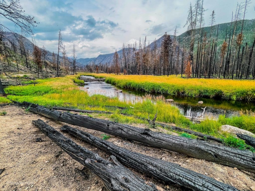
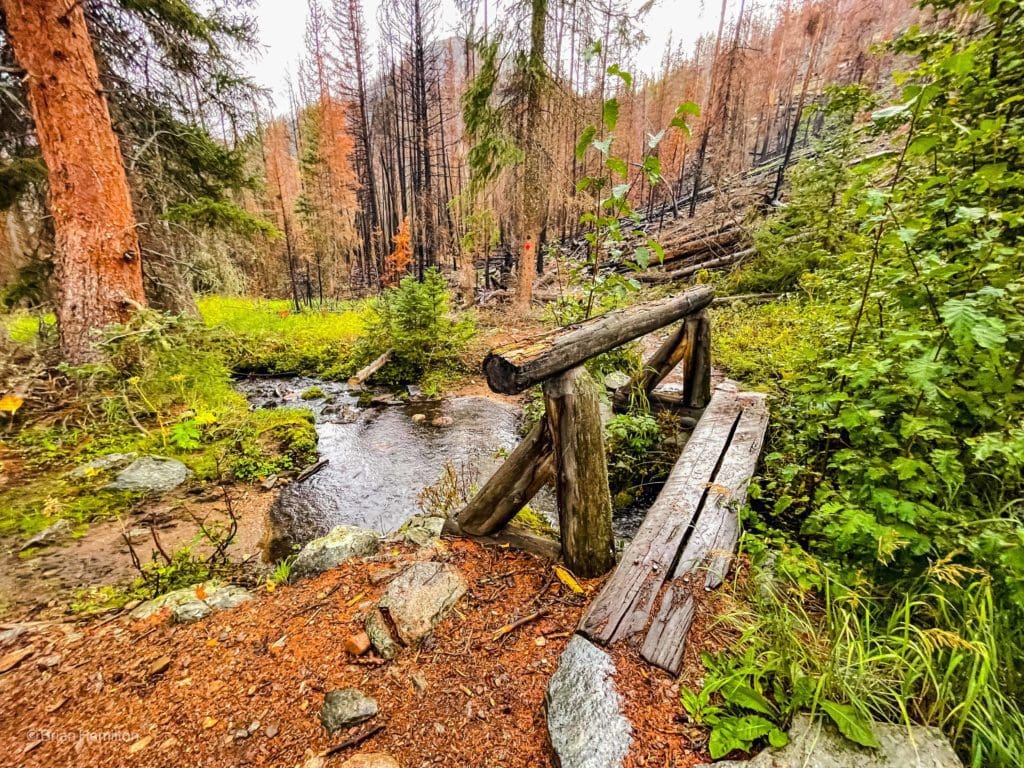
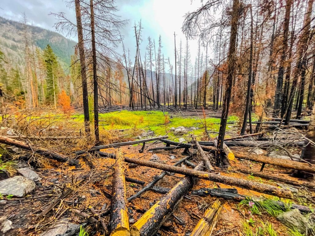
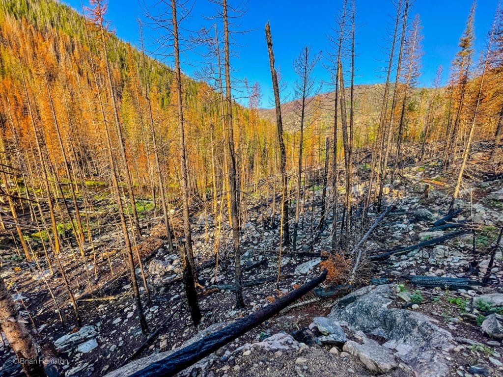
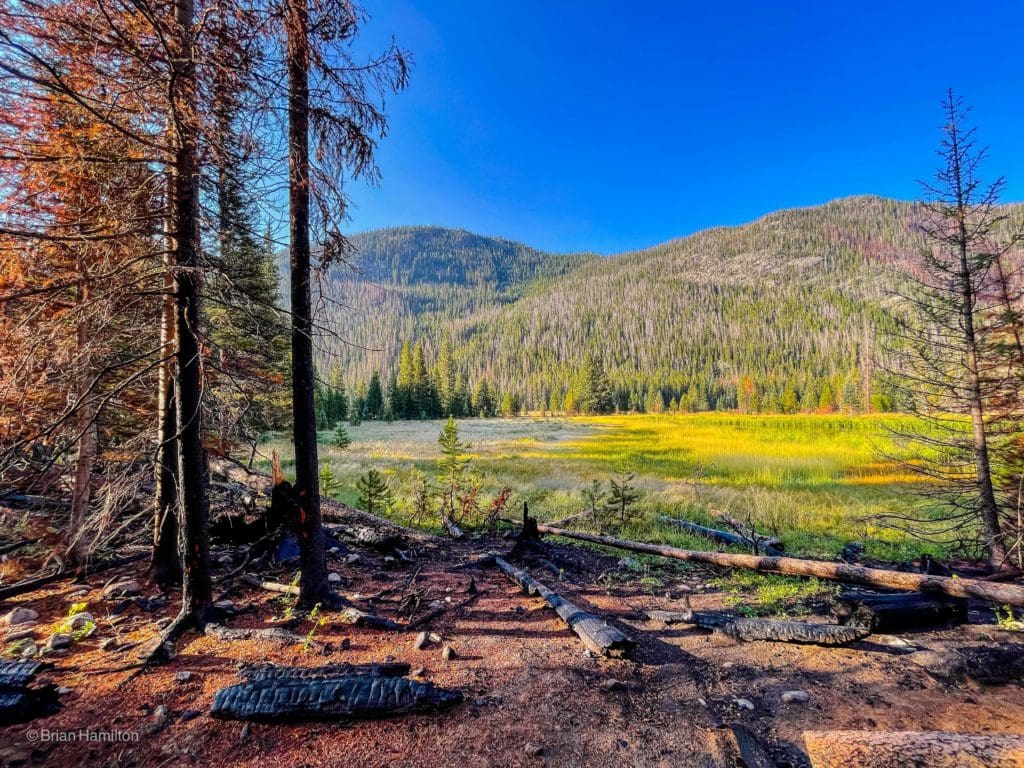
Fire damage in Summerland Park on the North Inlet Trail.
From the north:
From the north (Walden, or Laramie, Wyoming), find 125 and take it south, crossing the Rabbit Ears Range at Willow Creek Pass. When you get down the other side, take a left on Us 40 toward Granby and another left (north) on US34 until reaching Grand Lake.
Final Directions from Grand Lake: ALL APPROACHES
In Grand Lake, take the west portal road around town until you come to county road 663 (there should be signs for Tonahutu Creek Trail). Take a left onto county road 663 and follow the road for ~0.3 miles until you get to the trailhead. The North Inlet trailhead is well-signed and beyond the Tonahutu Creek Trailhead. It’s right at the national park border.
One of many creek crossings on the approach.
Best Hikes Within An Hour Of Boulder, Colorado
Highlighting the best hiking options within an hour of Boulder, Colorado.
Places to Stay:
There are a few places to stay in the region, with your best local bets coming from Grand Lake and Granby.
If you don’t mind camping, there are several good options to consider.
- Arapaho Bay Campground
- Sunset Point Campground
- Cutthroat Bay Group Campground
- Green Ridge Campground
If you’re making this trip a backcountry camping opportunity, there are quite a few campsites near the lakes. There are none next to the lakes to preserve their wilderness quality, but the available sites aren’t very far. Remember, all campsites, including backcountry ones, require a backcountry permit. You can find out more information here.
- Grouseberry
- North Inlet Junction
- Pine Marten
- North Inlet Falls
A tranquil section of the North Inlet.
The Ten Essentials: How to Equip Yourself for the Backcountry
Packing the “Ten Essentials” whenever you step into the backcountry, even on day hikes, is a good habit. When something goes awry, you’ll truly appreciate the value of carrying these items that could be essential to your survival.
Field Notes:
Despite its location within one of the most popular national parks in the country, Rocky stands out for its hidden corners. There are boundless opportunities to ditch the crowds, and this is one of them. While it’s certainly possible you’ll see larger crowds closer to the trailhead, not many people will have the one-day motivation to hike nearly 21 miles. The exception, of course, are very fit people and backpackers, who often use a combination of the North Inlet and Tonahutu creek trails for a 2-4-day backpacking adventure.
Remember, all campsites, including backcountry ones, require a backcountry permit. You can find out more information here.
Another important aspect to consider is the weather. Snow lingers around the lakes into June, and alpine storms are common in the warmer months. For area resources, check out the following weather links:
- Grand Lake 7-day forecast: Good for the lower elevations of the trail
- Taylor Peak: Located one basin to the east, this 13,500 ft. mountain will be a good indicator of regional weather
- Alpine Visitor Center: This one is located off of trail ridge, so it’s a little farther north but still has a reliable regional forecast and at an elevation gradient similar to the highest stretches of trail around Lakes Nokoni and Nanita.
If you’re ok paying for a subscription, I can’t recommend Opensummit enough. They have good forecasts, a lot of resources and tons of maps to really scratch the meteorological itch.
Summer thunderstorms, heat, wildfires, smoke, hail, wild temperature fluctuations and lingering snow should all be considerations you take into account when looking up the weather for any destination that’s far from the nearest road or town.
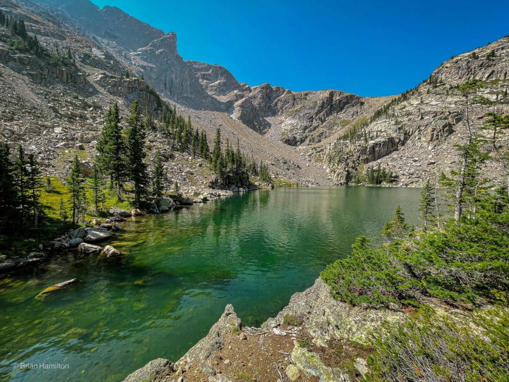
Stunning ridges and clear water in Lake Nokoni.
Journal:
Once you find the trailhead, park and head to the large trail kiosk.
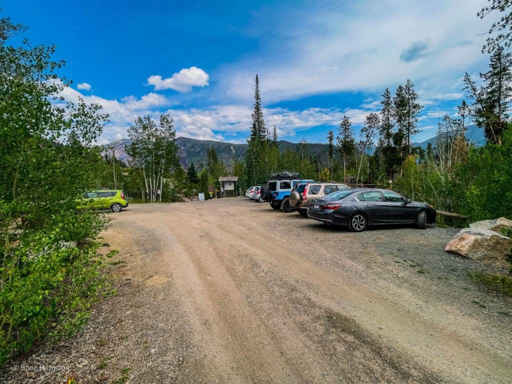
North Inlet Trailhead.
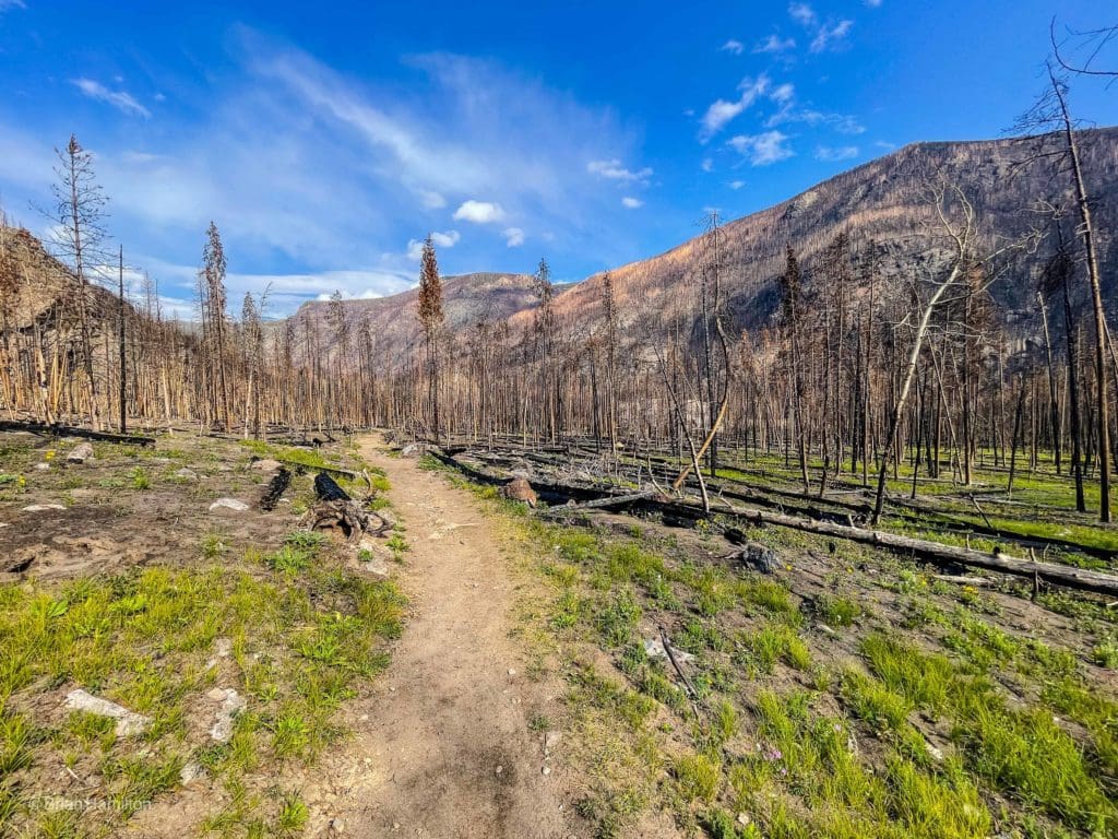
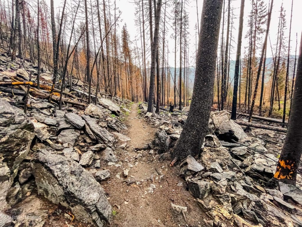
The trail starts off very wide and heads through an area of burned trees before descending into Summerland Park. This was part of the East Troublesome Fire that devastated portions of the National Park in 2020.
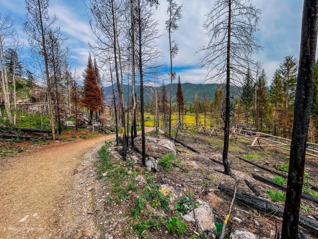
Heading into Summerland park along the North Inlet Trail.
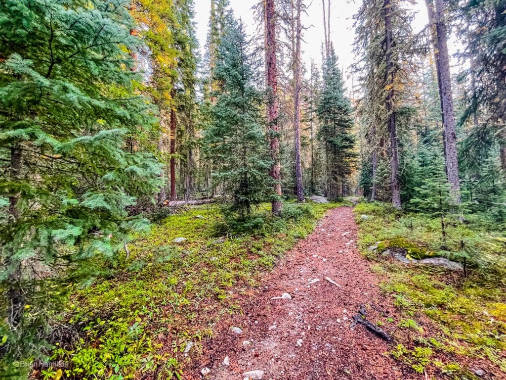
The wider section of trail continues alongside vibrant meadows as it threads through Summerland Park.
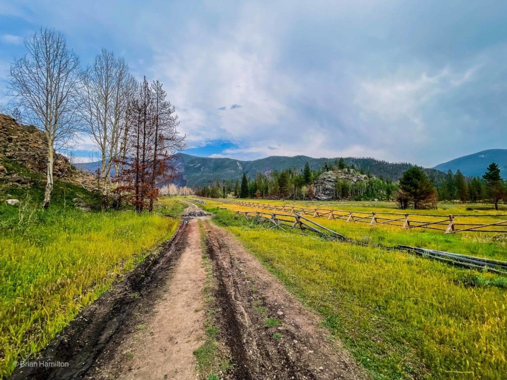
The wide and easy-to-follow trail as it passes through the meadows of Summerland Park.
In places like this, it’s important to remember how one small event can impact a wide swathe of terrain. There are NO backcountry fires in Rocky Mountain because of this reason, and while the East Troublesome fire didn’t start inside the park, the wind hustled it in with devastating speed. Please heed all fire restrictions to Colorado colorful.
The trail winds through the Summerland park area, following the banks of the meandering North Inlet for a few delightful minutes before passing along the northwestern side of the meadowed terrain.
Fire damage, new growth and the North Inlet.
In the distance, you’ll start to see ridges growing taller, but the dramatics are subdued for now.
The trail stays mostly to the left (western) side of the meadows.
At the head of Summerland park, you’ll enter a burnt forest, contrasting starkly with new undergrowth.
While forest fires are naturally occurring, they are often caused by human mismanagement. The East Troublesome fire belongs in the latter category.
This area is very sobering, as you can see the rampant devastation that singed entire mountainsides.
Big thanks to the trail crews for opening this section of the park back up!
Unfortunately, you’ll be following the burnt forest for some time as the trail works its way out of the Summerland Park area. If it’s a warm, bright day, wear sunscreen, there’s not a lot of shade out there anymore!
The trail will begin to gain elevation up some small glacial knobs at around ~1.75 miles before finally reconnecting with the North Inlet.
Hillier terrain at the head of the meadows.
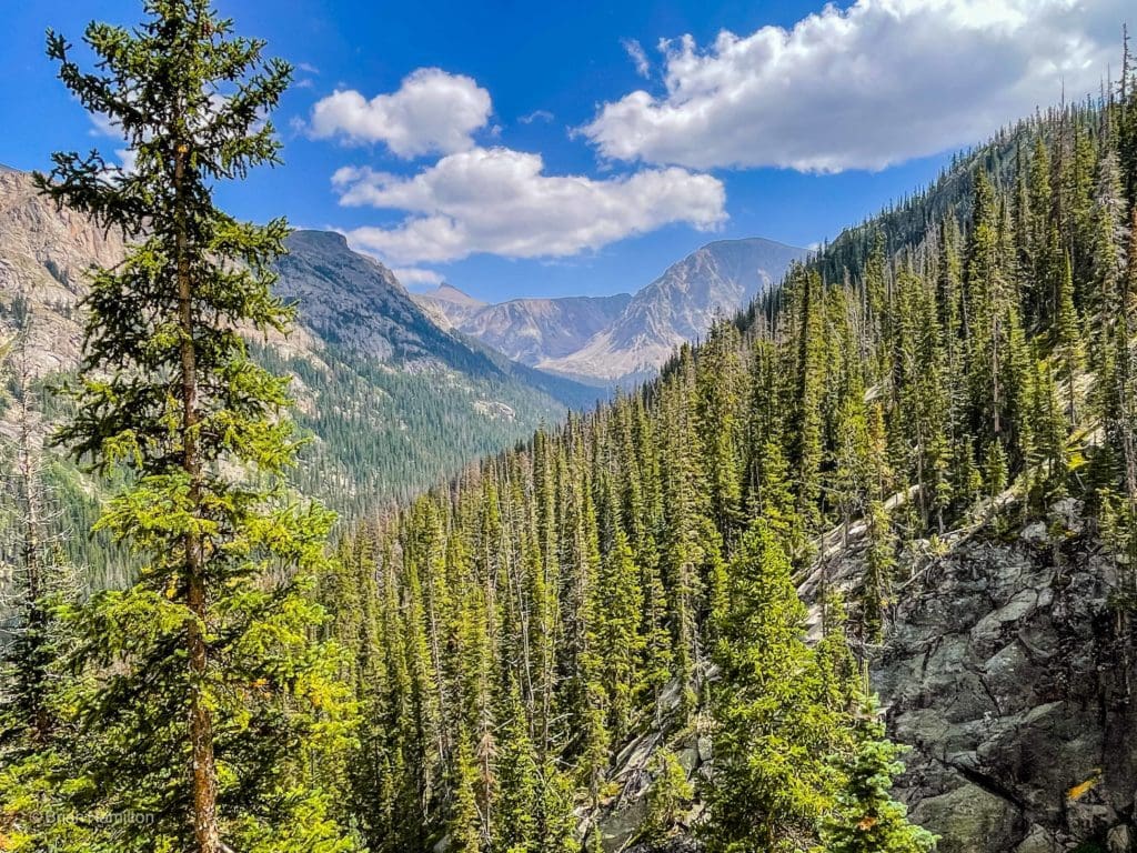
As the valley begins to sharpen up into a mountain gulch, you’ll finally start to see larger pockets of live-growth trees again (~2.6 miles from the trailhead).
Steepening terrain and a livelier mix of vegetation.
By the time you reach the sign for Cascade Falls, a semi-reliable area of tree cover takes shape over the trail, and exposed rocks add to the diverse scene.
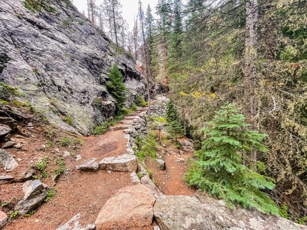
Rock steps on a well-built section of trail.
Cascade Falls is a series of small falls in a cascading section of the river. It doesn’t have the visual punch of something like Alberta Falls, but it’s a lovely spot to sit and reflect.
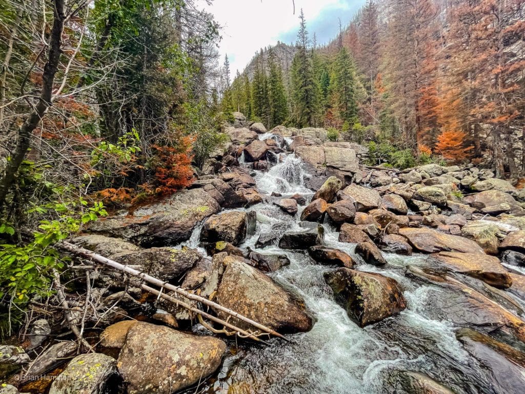
Cascade Falls.
While the forest looks more vibrant on this stretch, you’ll still be confronted with burnt areas. It was a particularly devastating fire.
Another burnt section.
Beyond Cascade Falls, the trail climbs to another meadow and passes by it on the western side.
More meadows.
The next marker you’ll notice is the campsite around Big Pool. This is a great option to pitch a tent if you want a more leisurely first day.
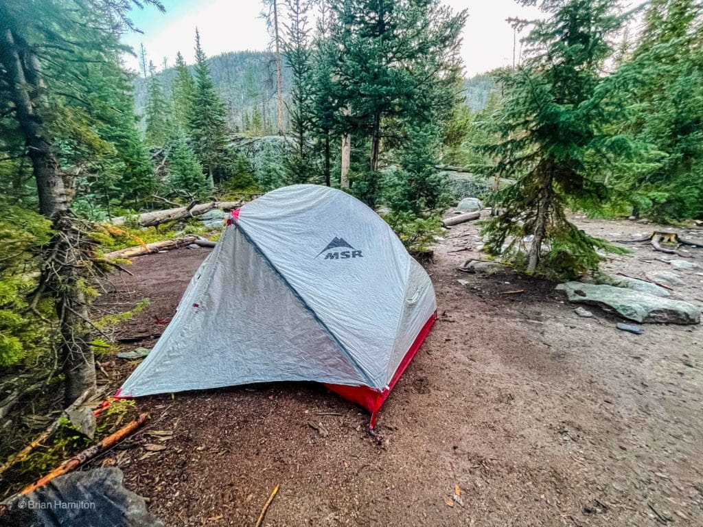
Flat ground at the Big Pool campsite.
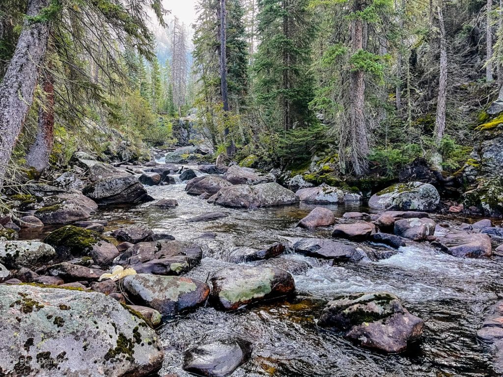
The main attraction on this stretch is the North Inlet, scattered with boulders and offering many scenic resting spots. For the adventurous, there is a “big pool” between two sharp rocks where one can take a refreshing dip. The trail leads to a bridge that crosses over the pool. A small granite passage directs the rushing waters of North Inlet into the pool below, creating a picturesque scene that is perfect for a break before continuing on to the lakes ahead.
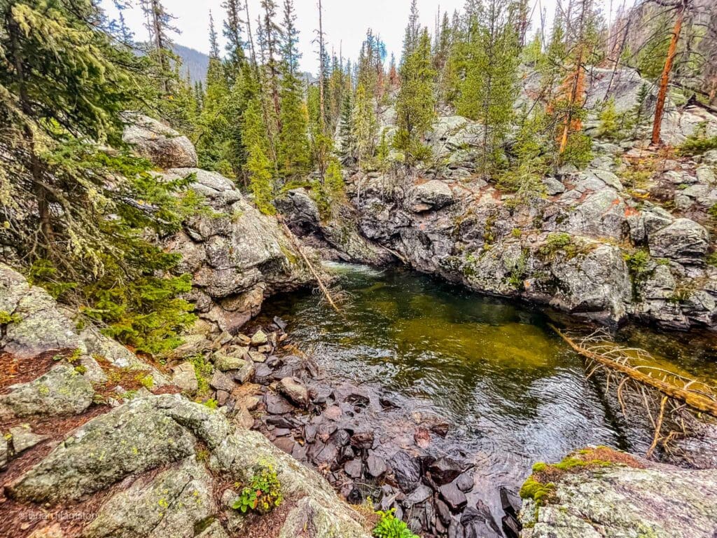
North Inlet Creek at Big Pool
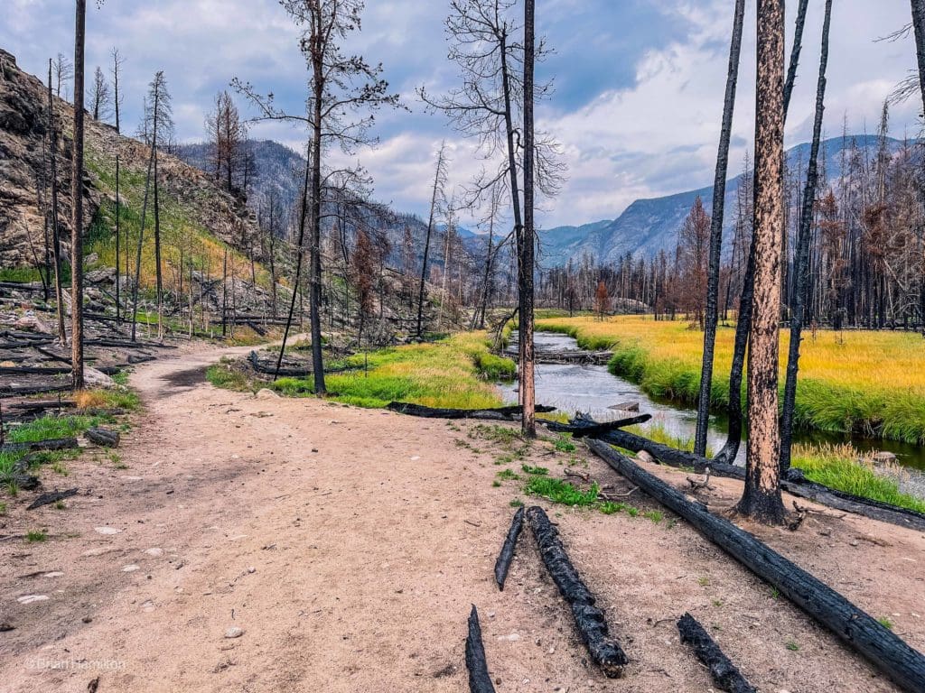
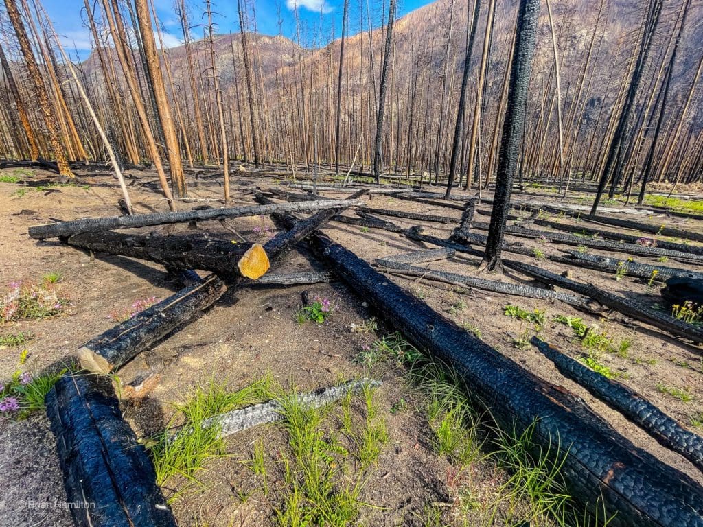
Continuing on, the trail does its now typical dance between areas of supreme natural beauty and forest fire devastation.
A healthy stretch of subalpine forest.
The burnt sections continue sporadically.
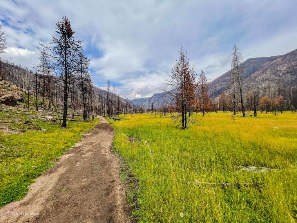
The trail will continue its eastward march (and even head a little southeast) as it skirts yet another meadow, which is the third on the trek.
Passing by the third meadow.
The next campsite option you’ll pass is Grouseberry. The site is located a little way beyond the third meadow as the valley tightens up again and you gain some quick elevation.
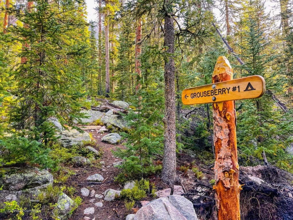
Sign for Grouseberry site #1.
There are more opportunities along this stretch to take in the always beautiful flow of the North Inlet.
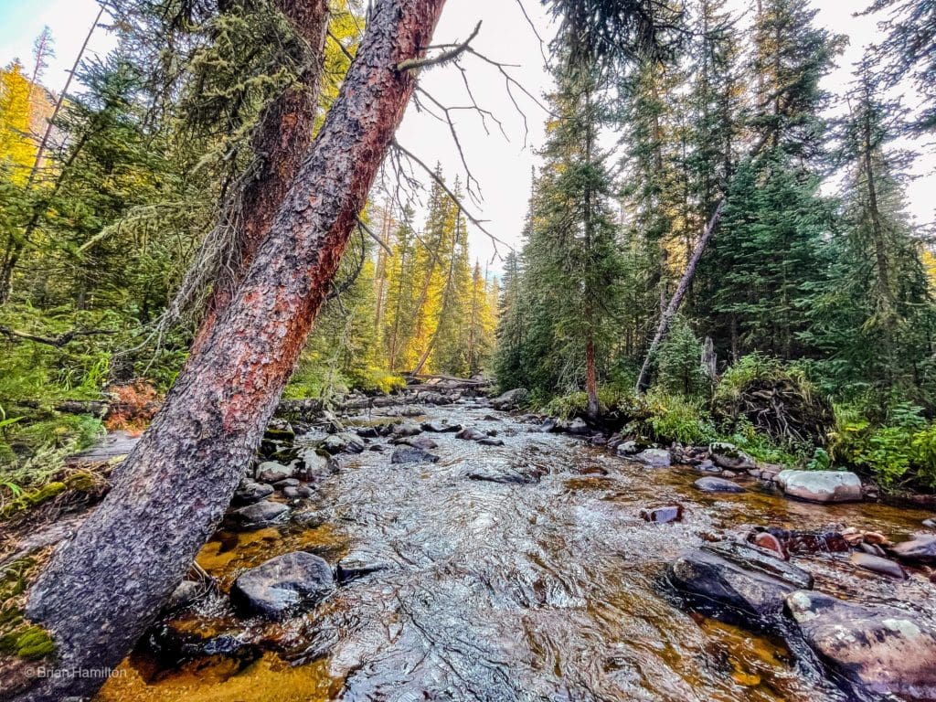
A clear and beautiful North Inlet.
More campsites exist along this stretch, including Porcupine, North Inlet Junction, North Inlet Falls and Pine marten. Between these options, you should have a great launch point for adventures up to the lake. If you’re a day hiking warrior, seeing the signs for these campsites means you’re within 3 miles of the lakes. A lot of elevation gain is left, however.
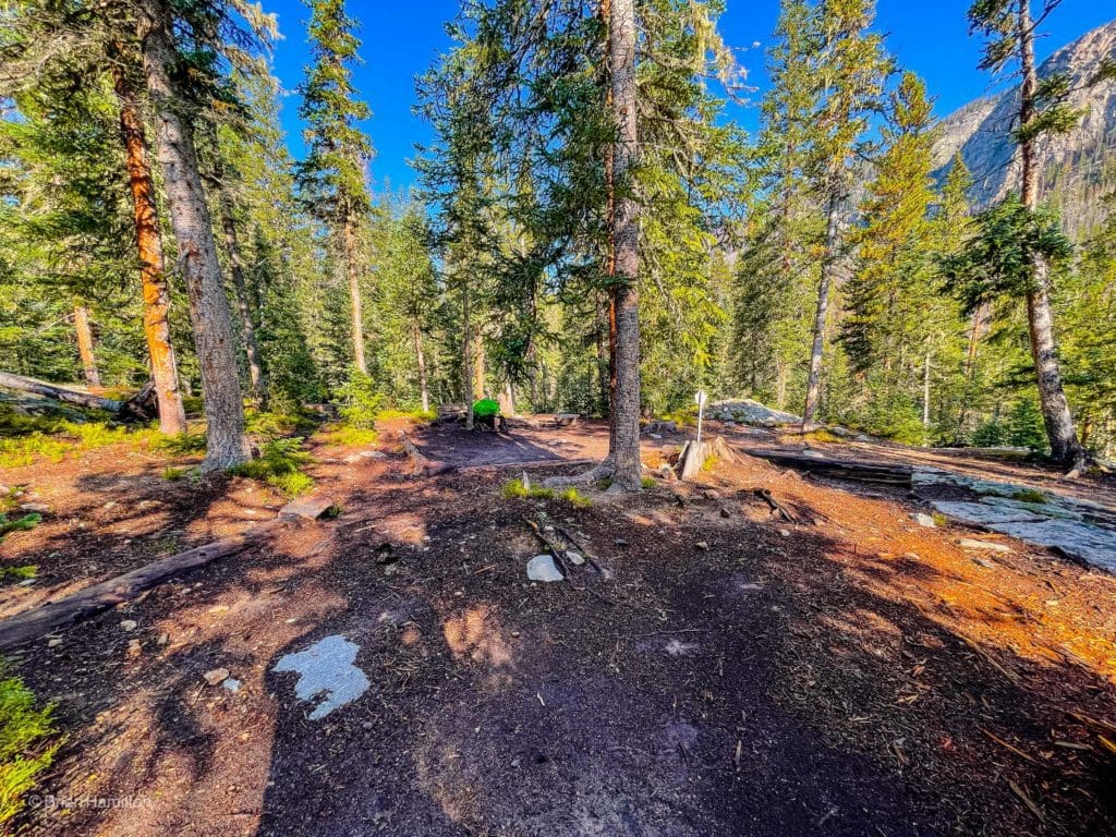
Porcupine Campsite.
If you camp below the trail junction, make sure to find it and take a right toward the lakes. This part of the trail heads south, southwest up switchbacks, and then southeast between the lakes.
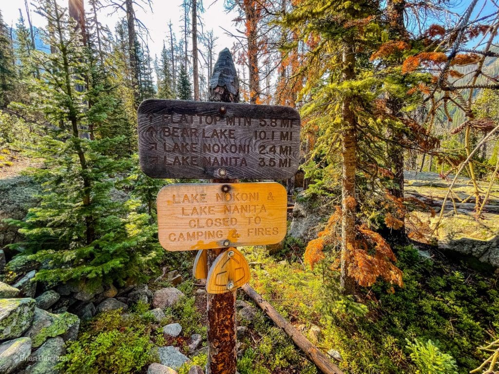
The trail junction between the North Inlet Trail and the Lake Nanita trail.
You’ll cross the North Inlet again and pass a mini rock-walled canyon, which makes for a nice photo at North Inlet Falls.
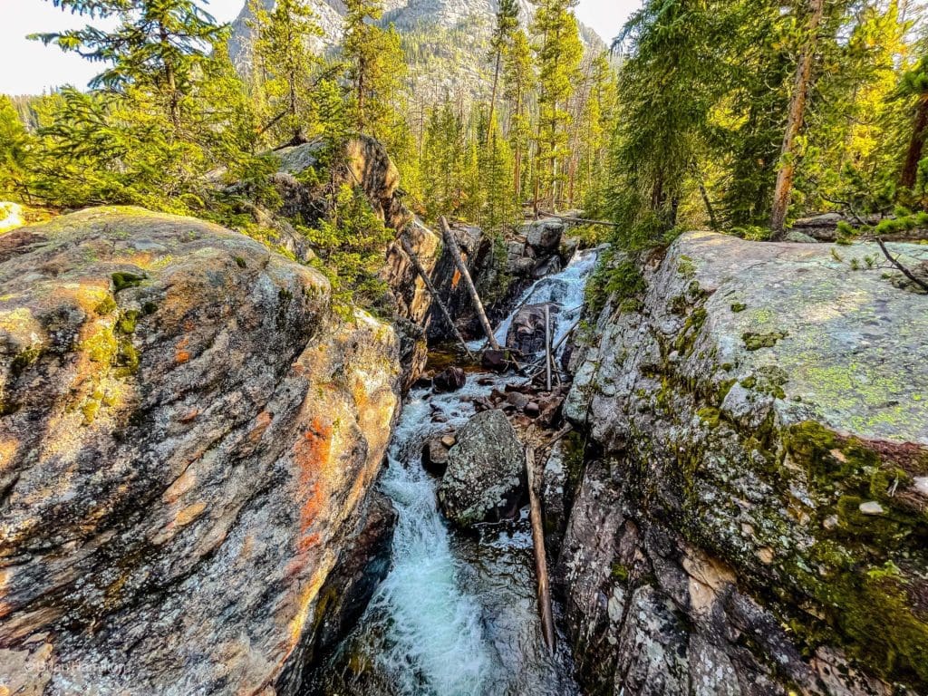
North Inlet Falls is a dramatic split in the rock where mountain streams flow.
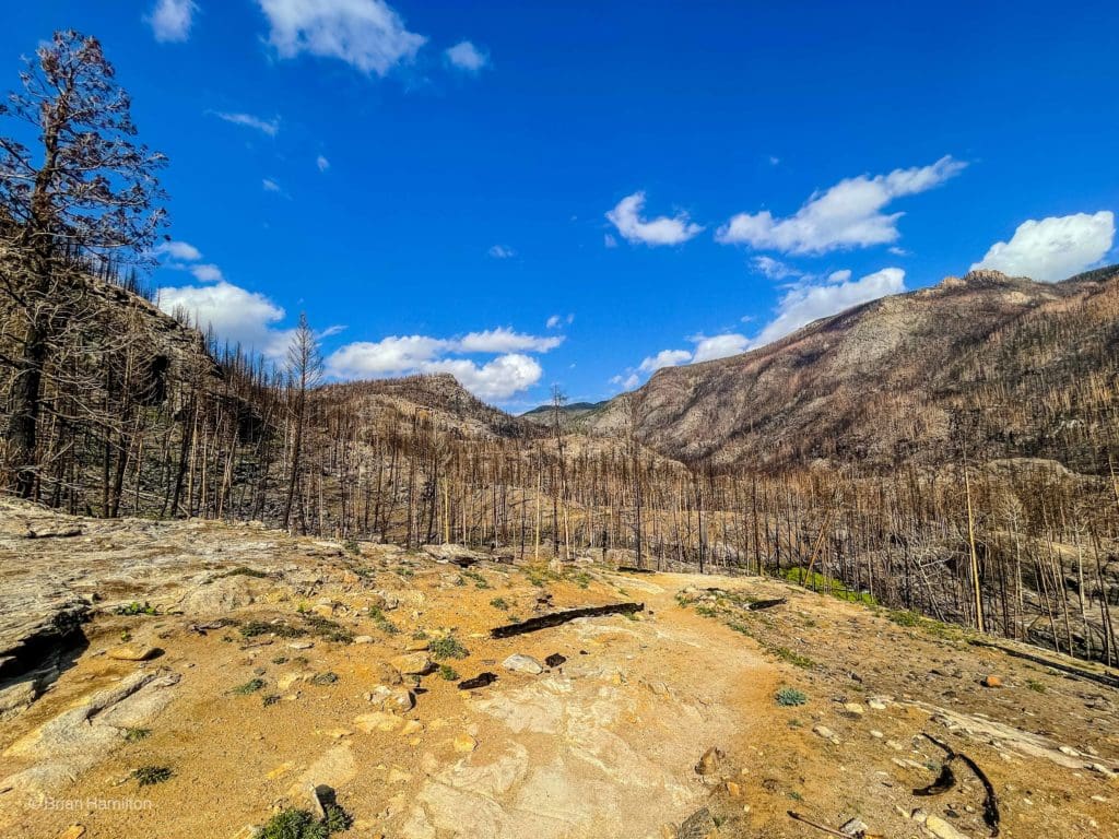
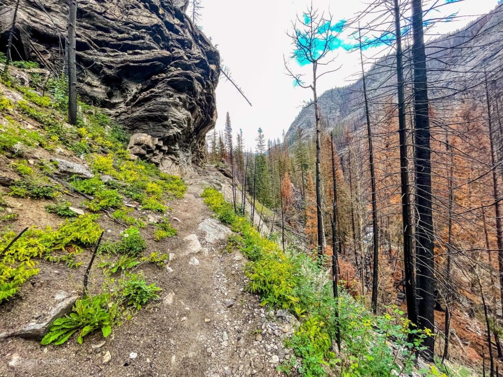
Once you pass the last campsite (Pine Marten), the trail goes skyward. This is the most concentrated elevation rise of the hike, so pace yourself. The burnt areas also stop impacting the scenery.
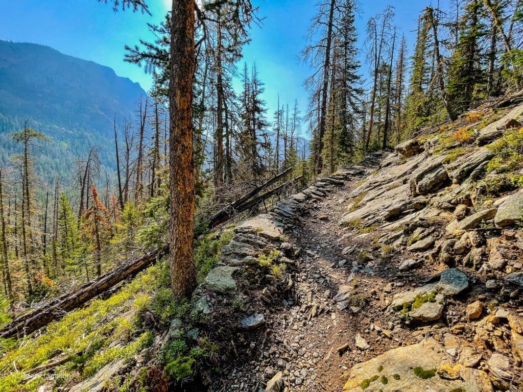
Gaining elevation on the way to the lakes.
As you switchback your way higher, the views become more dramatic. Keep in mind it’s ~1300 feet of gain between the trail junction and Lake Nokoni.
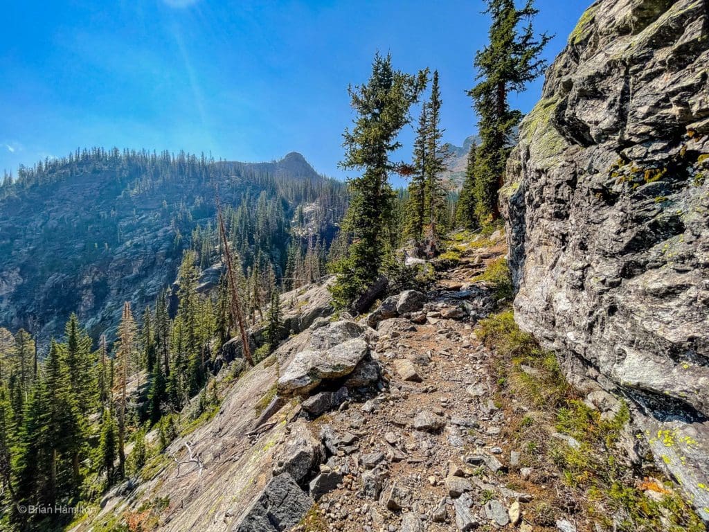
As you climb, you’ll notice more intact slabs of rock hidden between lines of pine trees.
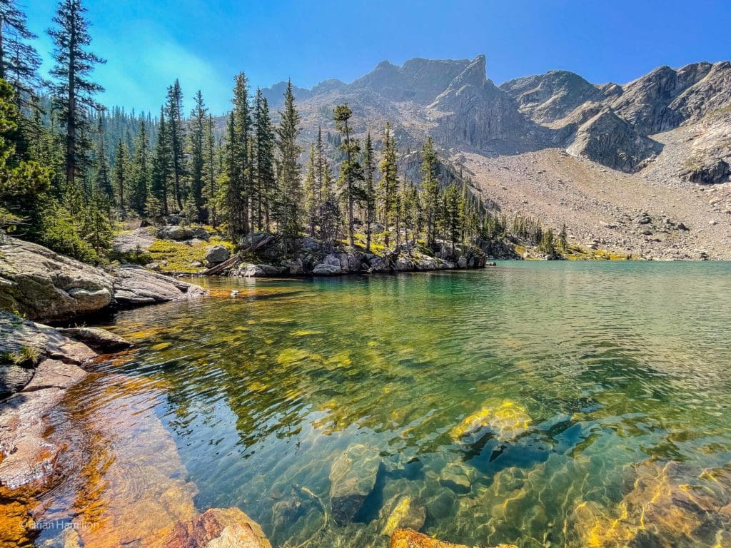
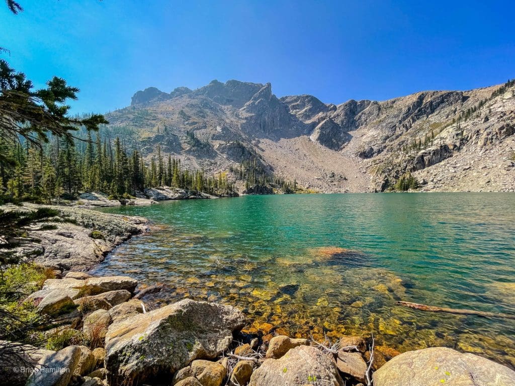
When you finally draw up to the lake, you’ll see why all the effort was one hundred percent worth it.
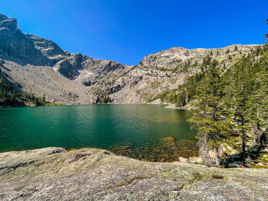
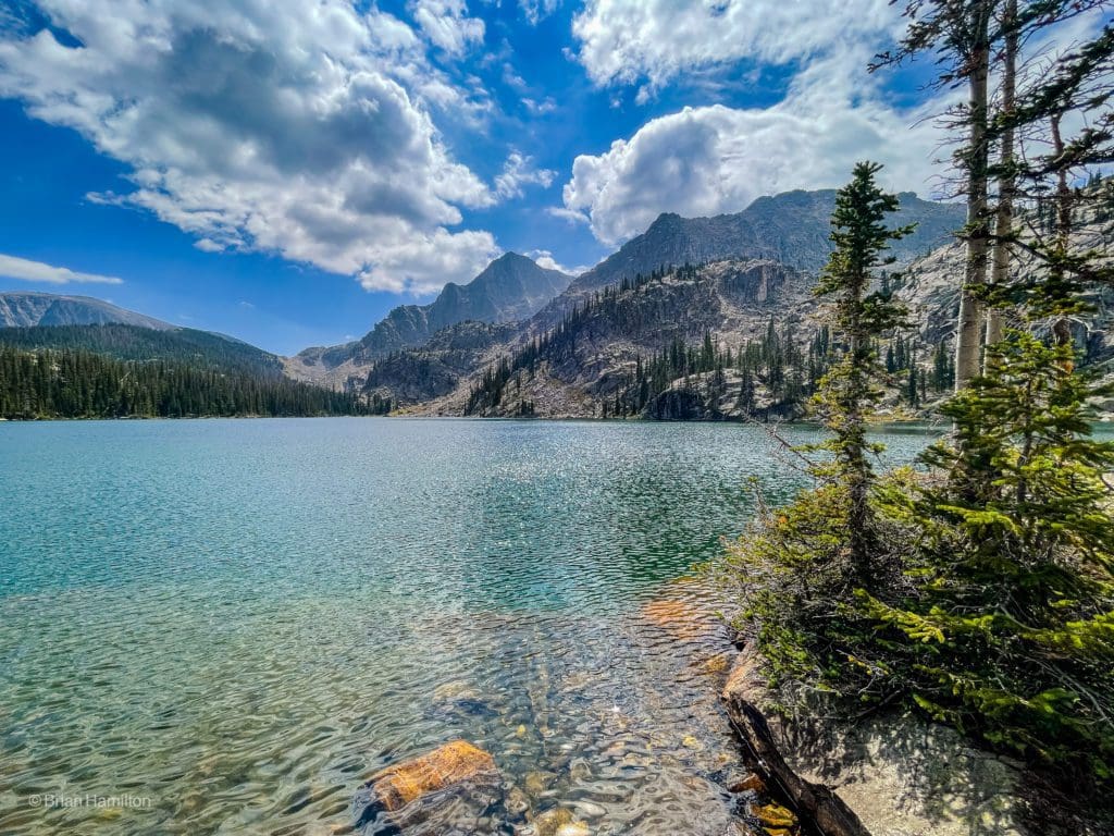
Lake Nokoni looking west.
Ptarmigan Mountain and Lake Nokoni, looking south.
Take a second to soak in the beauty of this surprisingly large and stunningly clear alpine lake.
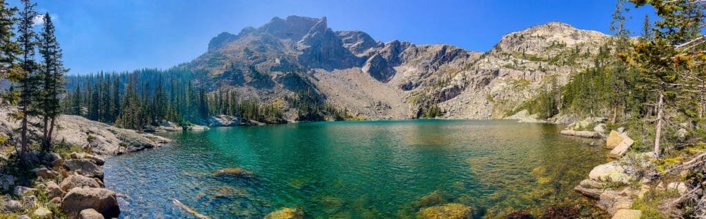
Lake Nokoni panorama.
Make sure to save a little energy in the tank; another lake awaits. Lake Nanita is over a shoulder to your southeast. You’ll have to add another 300-foot rise to your gain on the day, but it’s worth it for various reasons.
First, you get views back to lake Nokoni from above it.
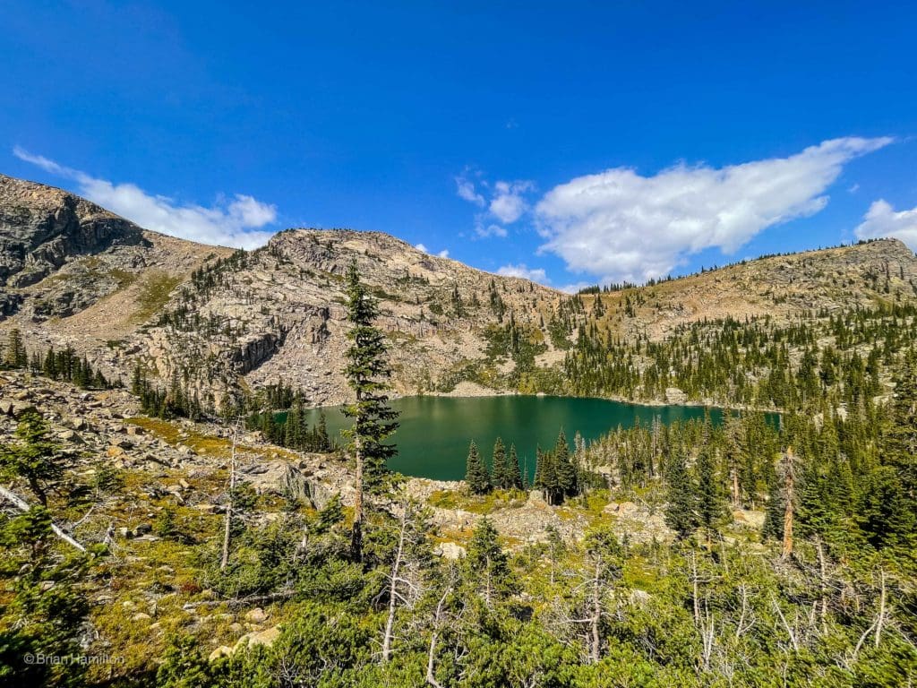
Looking down at Lake Nokoni.
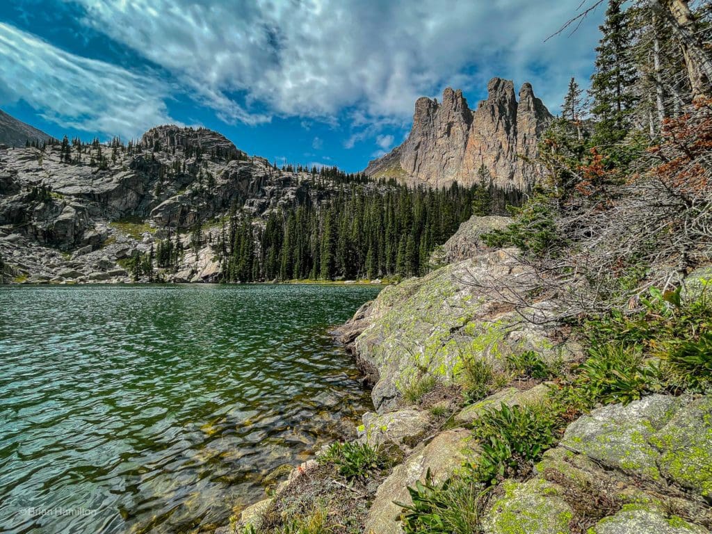
You also get stunning views of the east-facing Ptarmigan Towers.
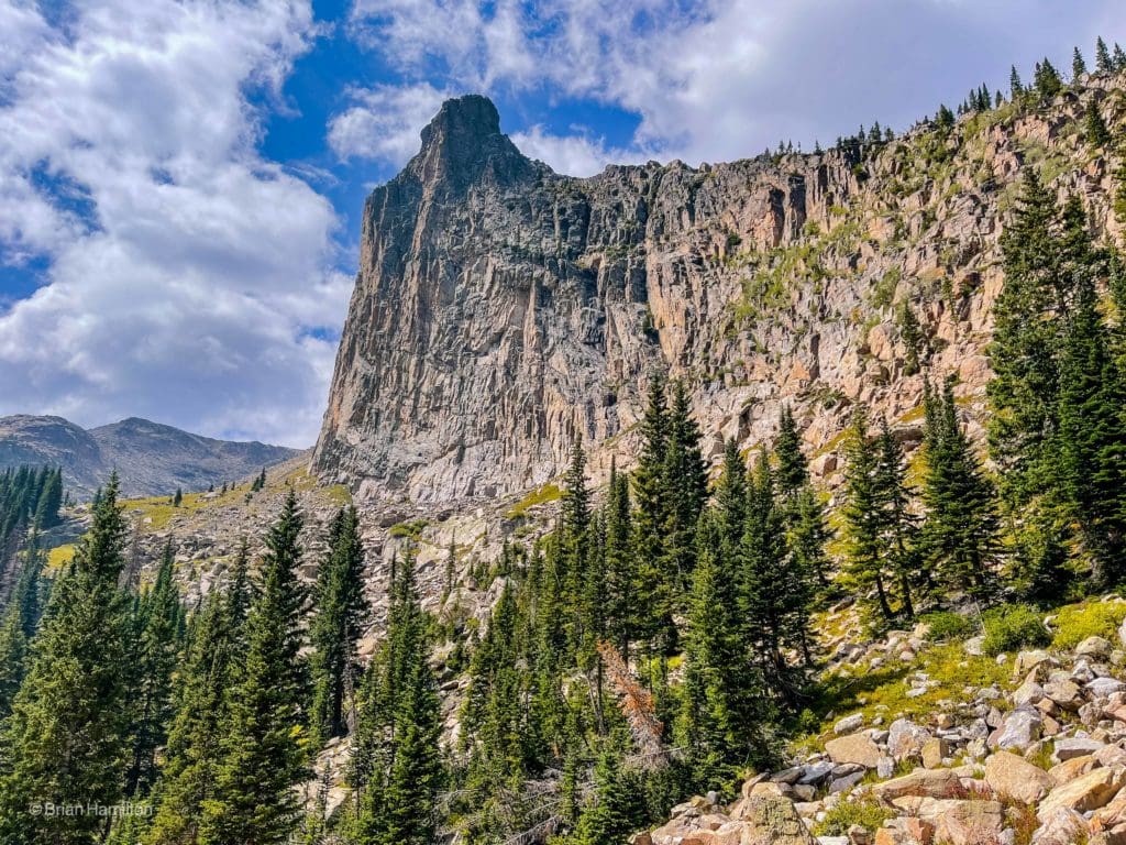
An impressive wall of rock that looks completely different from Lake Nanita.
The main attraction, though, is the lake itself. From the various points along the shore of Lake Nanita, you get stunning views of Andrews Peak, the Ptarmigan Towers and even Mt. Alice way in the distance.
The large and impressive Lake Nanita.
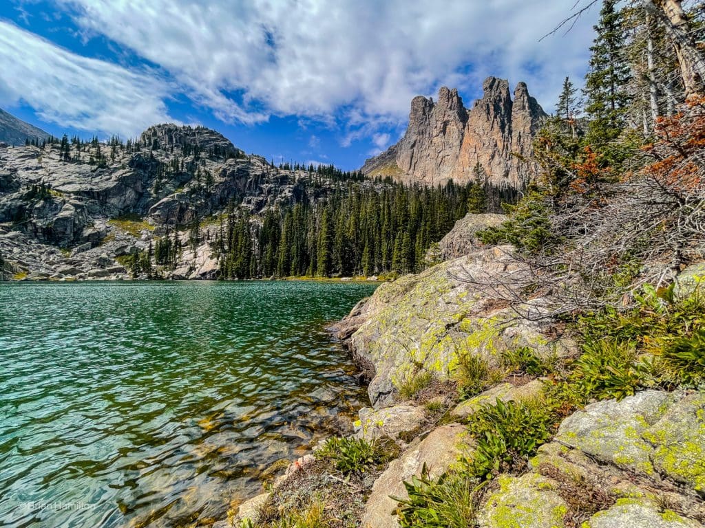
The Ptarmigan Towers from the shoreline.
This is a special place, and while it may be frustrating that you can’t camp close to the lake, seeing its excellently preserved wilderness character is reason enough to keep it the way it is.
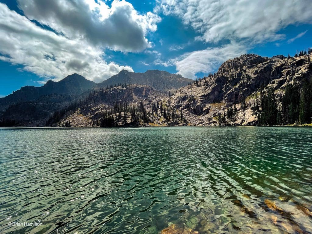
Water, blue sky, and mountains.
Once you’ve had your fill, it’s time to turn around and head back down. If you camped close, the descent is only a few miles. If you’re planning on getting back to the trailhead in one day, you’ll have a little more than 10 miles left in your journey.
However, if you choose to experience this wonderful slice of national park magic, make sure to stay on the trail when able and leave no trace. For those seeking the rewards of destinations off the beaten path, this is a winner. Just make sure you can hike either more than 20 miles a day or set yourself up with a few backcountry permits to really enjoy the area.

Enroll With Global Rescue Prior To Embarking On Your Next Adventure.
When a travel emergency arises, traditional travel insurance may not come to your aid, and a medical evacuation can cost up to $300,000.
The cost when you have a Global Rescue membership? $0. That’s why when the unexpected happens, you want the leader in rescue, evacuation and medical advisory behind you. You want Global Rescue.

Photography for this article provided by Brian Hamilton, who hiked this trail on a weekend backpacking outing on September 3 to 5, 2021. Skyblue Overland uses SmugMug, a paid image sharing, image hosting service, and online video platform on which users can upload photos and videos. The SmugMug also facilitates the sale of digital and print media for amateur and professional photographers. See Skyblue Overland’s Adventure Photo Galleries from the Best Trails in Colorado at SmugMug.com. To see even more photos from my adventure see our North Inlet Trail Gallery.
Terms of Use:
As with each guide published on SKYBLUEOVERLAND.com, should you choose to this route, do so at your own risk. Prior to setting out check current local weather, conditions, and land/road closures. While taking a trail, obey all public and private land use restrictions and rules, carry proper safety and navigational equipment, and of course, follow the #leavenotrace guidelines. The information found herein is simply a planning resource to be used as a point of inspiration in conjunction with your own due-diligence. In spite of the fact that this route, associated GPS track (GPX and maps), and all route guidelines were prepared under diligent research by the specified contributor and/or contributors, the accuracy of such and judgement of the author is not guaranteed. SKYBLUE OVERLAND LLC, its partners, associates, and contributors are in no way liable for personal injury, damage to personal property, or any other such situation that might happen to individuals following this route.


