


High Point:
13,085 ft. at the shelter (surrounding ridges are higher)

Total Ascent:
~2,820 feet

Difficulty:
Difficult

Distance:
~10 miles

Waypoints:
39.50065, -106.4332

Route Type:
Out and back
Hike Notch Mountain for breathtaking views of Mount of the Holy Cross and a unique experience. Stop at the Notch Mountain Shelter for the best vantage point. Located in the northern Sawatch region, this 13er offers stunning views of the surrounding landscape.
Overview
The most famous mountain of the northern Sawatch region is Mount of the Holy Cross; it’s a 14er, highly visible from Vail Ski Resort and a great workout. From that hike, however, you never really get a view of the cross couloir that gives the mountain its name. For the best views of Holy Cross, you want to tackle Notch Mountain. This lower 13,000-foot mountain is a great workout, has stupendous views and is normally much less crowded than Holy Cross.
Long and snaky, the top ridge of the mountain is cut in half by its namesake, a deep mountainous notch. The tallest point of Notch Mountain is actually to the north of the notch and attainable via a side path on the Holy Cross Trail; however, the best place to be is around the Notch Mountain Shelter, which is situated on the other side of the notch. This review describes the trailed approach to the Notch Mountain Shelter. From there, you can explore the alpine areas around, including a few smaller sub-summits or the larger Pt. 13,248 south of Notch Mountain Shelter.
The view of Mount of the Holy Cross from near Notch Mountain Shelter.
Table of Contents
Article Navigation: Click on any of the listed items in the table of contents below to jump to that section of the article. Similarly, clicking on any large, white section header will jump you back to the Table of Contents.
Enroll With Global Rescue Prior To Embarking On Your Next Adventure

Global Rescue is there for you in an emergency when you’re hiking, kayaking, snowmobiling, fishing or enjoying the outdoors and get injured or ill. Push the red button and their medical and security experts will come to your aid.
Scales and Criteria
This article uses two metrics to calculate difficulty: overall distance and elevation gain. For winter ascents, a snow rating may be used as well, but the access road is not plowed, and that adds a substantial mileage portion to the overall trip. This review covers the basic ascent and descent to and from Notch Mountain’s shelter during snow-free summer and autumn months, so snow shouldn’t be more of a factor than a few isolated patches up high.
Difficulty Ratings:
- Easy: less than 5 miles, less than 500 ft. of elevation gain
- Moderate: 5-10 miles, 500-2000 ft. of elevation gain
- Difficult: 5-15 miles, more than 2000 ft. of elevation gain
- Very Difficult: 10+ miles, more than 3,500 ft. of elevation gain
Green fields at treeline on the Notch Mountain Trail.
The Ultimate Offline GPS Hiking & Ski Maps
See why onX Backcountry is the ultimate GPS navigation app for your outdoor pursuits. Try Today for Free. No credit card required.

Directions to Trailhead
The Half Moon Trailhead south of Minturn is the best way to access this wonderful area. Big mountain climbers will note that this is the same trailhead used for Mount of the Holy Cross and the Halo Ridge Traverse. This means the trailhead can get full very quickly from July onward. Please also note that the road up the trailhead does not open until mid/late June every year. If you want to access the trailhead before then, you’ll need to hike or bike the eight miles up the road from the winter gate.
If you’re approaching from Colorado Springs and all points north in the Front Range, you’re going to want to make your way to Vail Pass and continue on I-70 west to the Minturn exit. From Walsenburg down to Trinidad and the state line, it’s best to take US 50 north to US 24 and over Tennessee Pass.
From the northern route, once you sight the exit for Minturn, head south on US 24 as it threads through town. On the southern edge of town, keep an eye out for signs for Half Moon Trailhead or Tigiwon Road. It’s a dirt road on the right-hand side of US 24 and appears just before a bridge over the Eagle River and the first of many switchbacks as US 24 climbs Battle Mountain. If you start rising along the switchbacks, you’ve gone too far.
From points south, once you cross Tennessee Pass, continue beyond Red Cliff almost all the way down to Minturn, watching for the last bridge across the Eagle and a dirt road on your left before you get to town. Once houses start popping up, you’ve gone too far.
When open, the dirt road is fairly simple to navigate for most two-wheel drive cars; it’s just long and bumpy.
Distance and Times (assuming little to no traffic):
- Denver: 2.5 hours
- Boulder: ~2 hrs. 50 min.
- Fort Collins: 3 hrs. 21 min.
- Colorado Springs: 3 hrs. 22 min.
- Grand Junction: 2 hrs. 56 min.
- Vail: 55 min.
Talus slopes dominate the top portion of the hike but the trail is well-maintained and threads through them with little navigational issue.
The Ten Essentials: How to Equip Yourself for the Backcountry
Packing the “Ten Essentials” whenever you step into the backcountry, even on day hikes, is a good habit. When something goes awry, you’ll truly appreciate the value of carrying these items that could be essential to your survival.
Field Notes
The northern Sawatch range is affected by numerous weather concerns, including snow, cold temperatures, wind, and thunderstorms. It’s best to start by checking local forecasts for Minturn, Red Cliff, and Leadville. This will give you a good baseline for area conditions. For specifics, head over to Opensummit and check the Notch Mountain Forecast. If you don’t want to pay for the all-access, which gives you extended forecasts and loads of details, try this link. There are a ton of things to consider when trying to pinpoint what the weather is going to do in Colorado, and even reliable forecasts can get the details wrong. This doesn’t mean you shouldn’t use them, but be prepared to fine-tune the details when you’re out there. Mountain weather always has an air of unpredictability to it, and that’s something you need to understand and prepare for.
Since this is a longer hike into the wilderness, make sure you have orientation equipment or downloaded maps, a small first aid kit, and a good weather window before attempting this hike. It’s also helpful to look at sites like Alltrails, where users often report new areas of downed trees or other impediments that change year after year. From July-October, thunderstorms are common, and a large portion of the trail is above treeline. In a pinch, you can hide in the Notch Mountain Shelter, but the best moves are to get lower before any puffy clouds turn into storms.
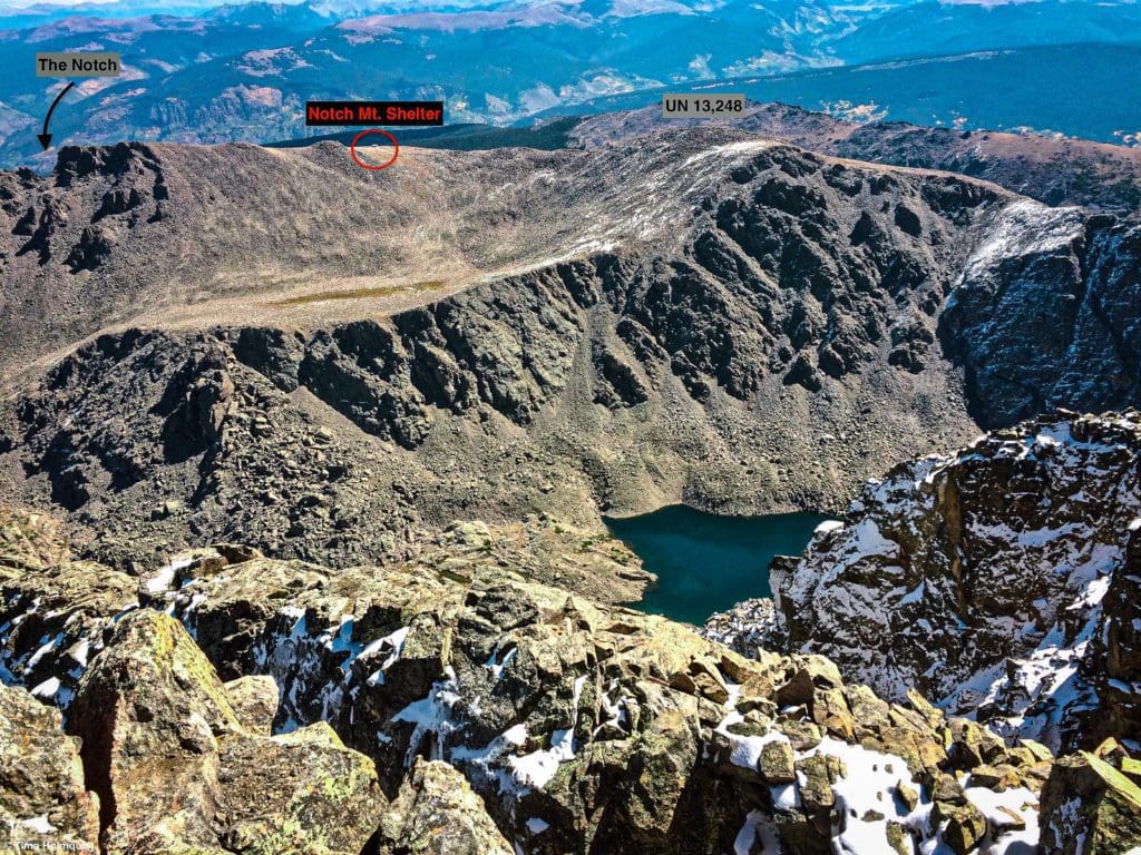
Notch Mountain Shelter seen from the summit of Mount of the Holy Cross.
Global Rescue has expanded services to include local field rescue within 100 miles of home. Global Rescue is there whether you’re hiking, kayaking, snowmobiling, fishing or simply enjoying the outdoors and get ill or injured and you’re unable to get to safety on your own. Global Rescue is the red button you push in an emergency. Their team of medical and security experts come through for you when it matters most.
Journal
Once you’ve found parking at Half Moon Trailhead, head toward the large kiosk and find the beginning of the trail. The first trail you’re looking for is Fall Creek, which will begin at the southern end of the parking area and continue south while the trail to Holy Cross heads west.
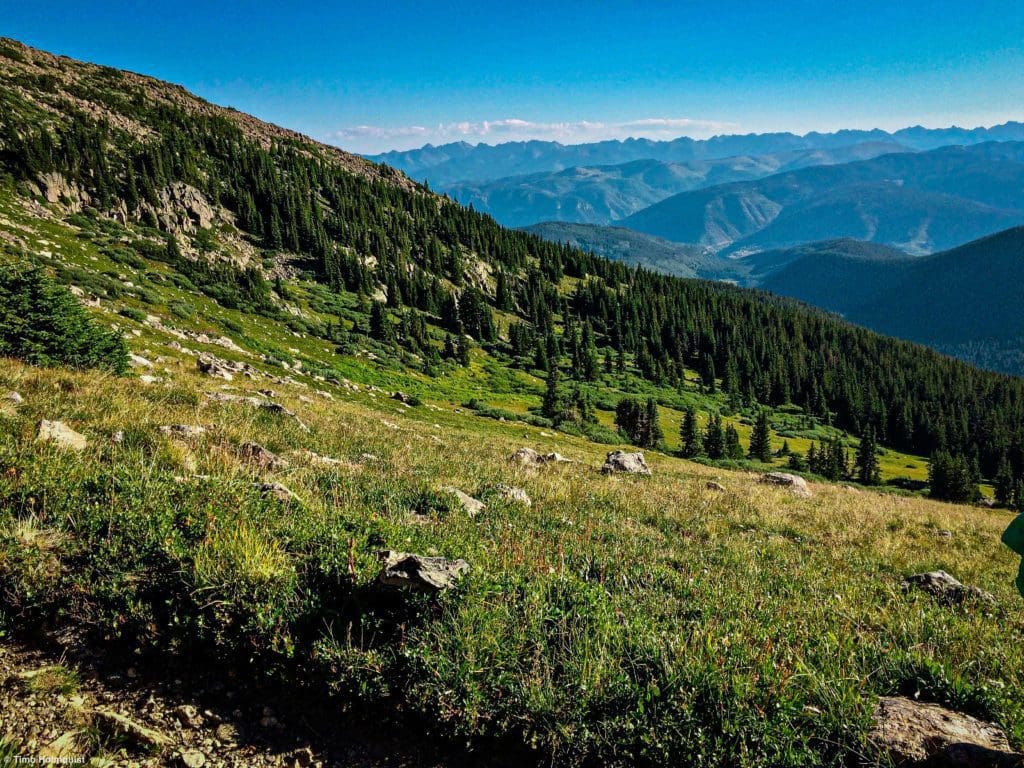
You’ll be following this trail for the next 2.3ish miles as it meanders around steep coves dug by avalanches and mudslides. The general elevation gain in this section is not severe, and you can usually stride out for sections to put some distance behind you. Occasional views break out to the south and east, but by in large, you’ll be in a forested area.
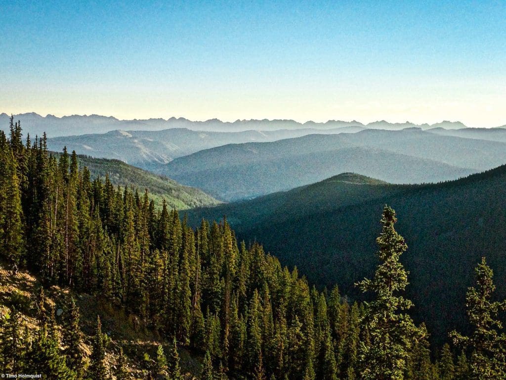
Views out to the Gore Range from the lower part of the journey.
When you reach the signed junction with North Mountain Trail, take a right and being climbing. You’ll pop out of treeline quite quickly. The views will begin to take shape all around you, but the elevation gain becomes tougher.
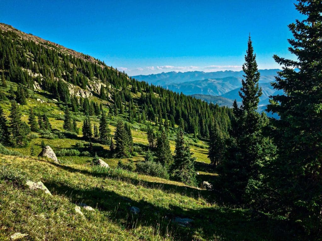
More scenery awaits as you break treeline.
There are a ton of useful switchbacks to tease the hike up, but this is where you’ll be gaining the most.
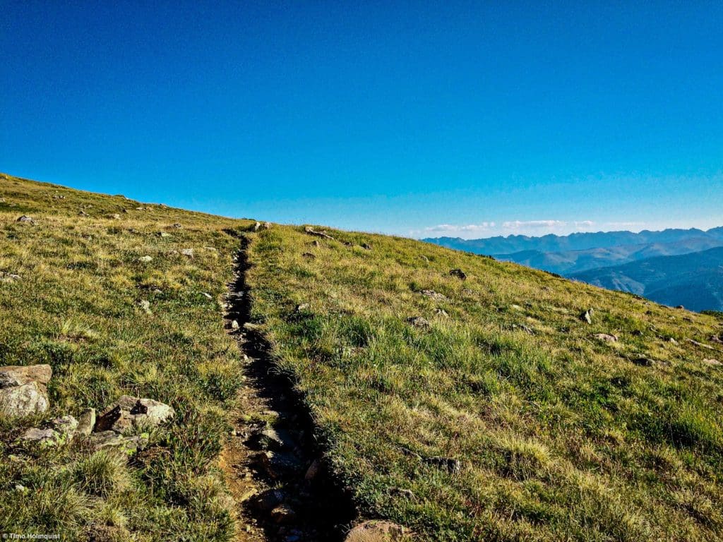
Beautiful alpine portion of the trail.
The overall elevation gain on this section is substantial, but it never really feels like one section is much harder than the others. It’s really a slow grind up the side of Notch, where any trailside break is rewarded with phenomenal views.
Looking south from the side of the trail.
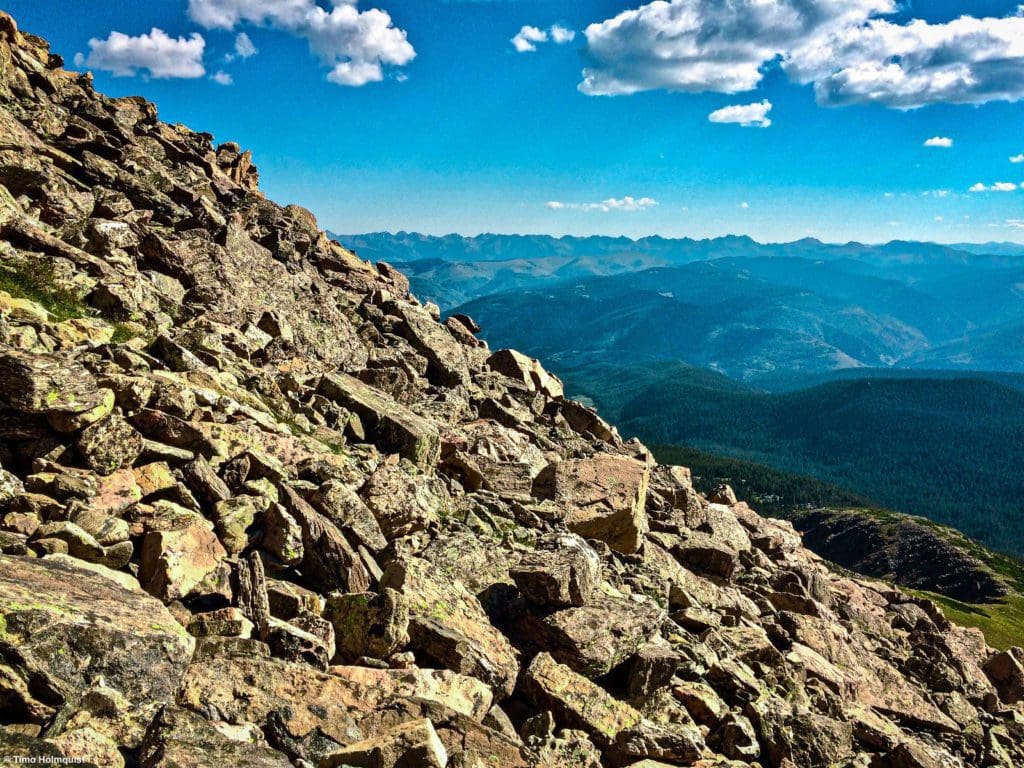
As you near the top, talus begins to dominate most of the surround, so watch your footing. Several large switchbacks carry you higher still.
The trail surrounded by talus and scree as you approach the final push.
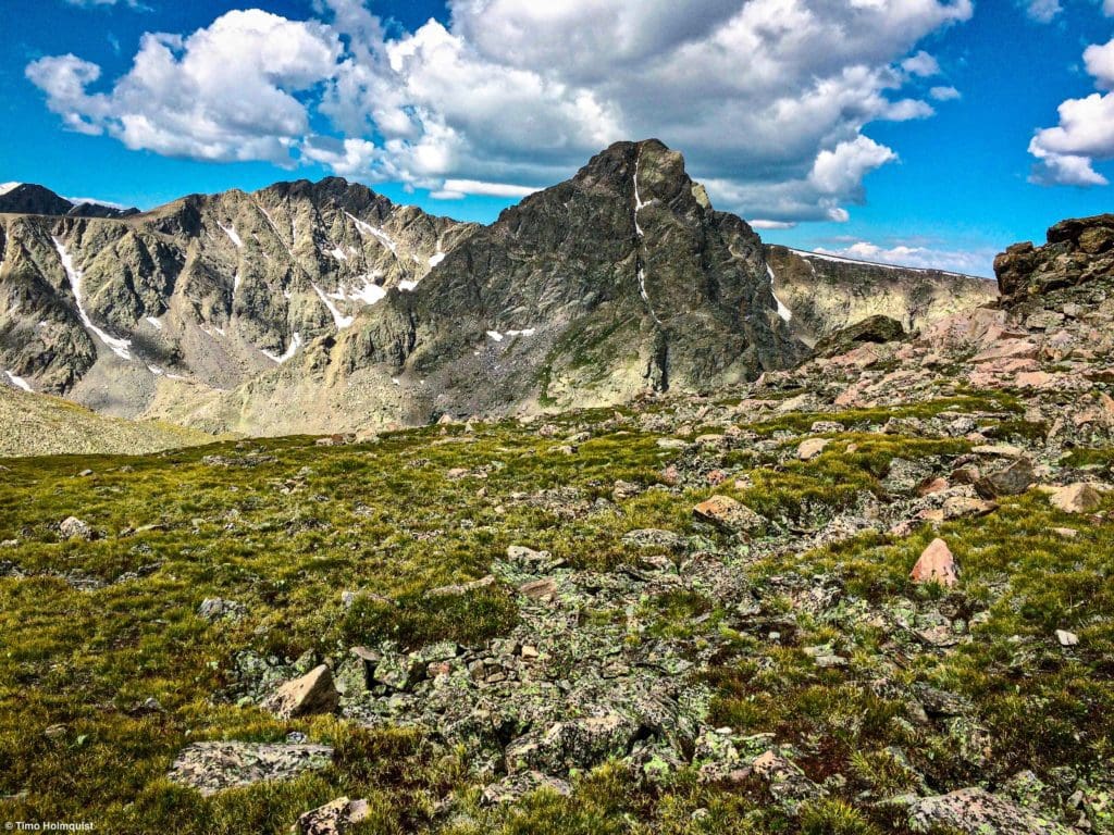
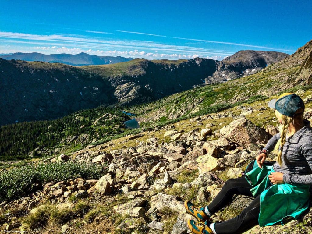
When you finally near the shelter, the trail will pop you up on a bench between two summits. The larger summit to the left (south) is UN 13,248, which is actually taller than Notch Mountain, whose summit lies to the north and across the namesake notch. Getting into and climbing out the notch is an additional endeavor not covered in this trip report. If you’re feeling keen, UN 13,248 is only a quick jaunt away from the shelter.
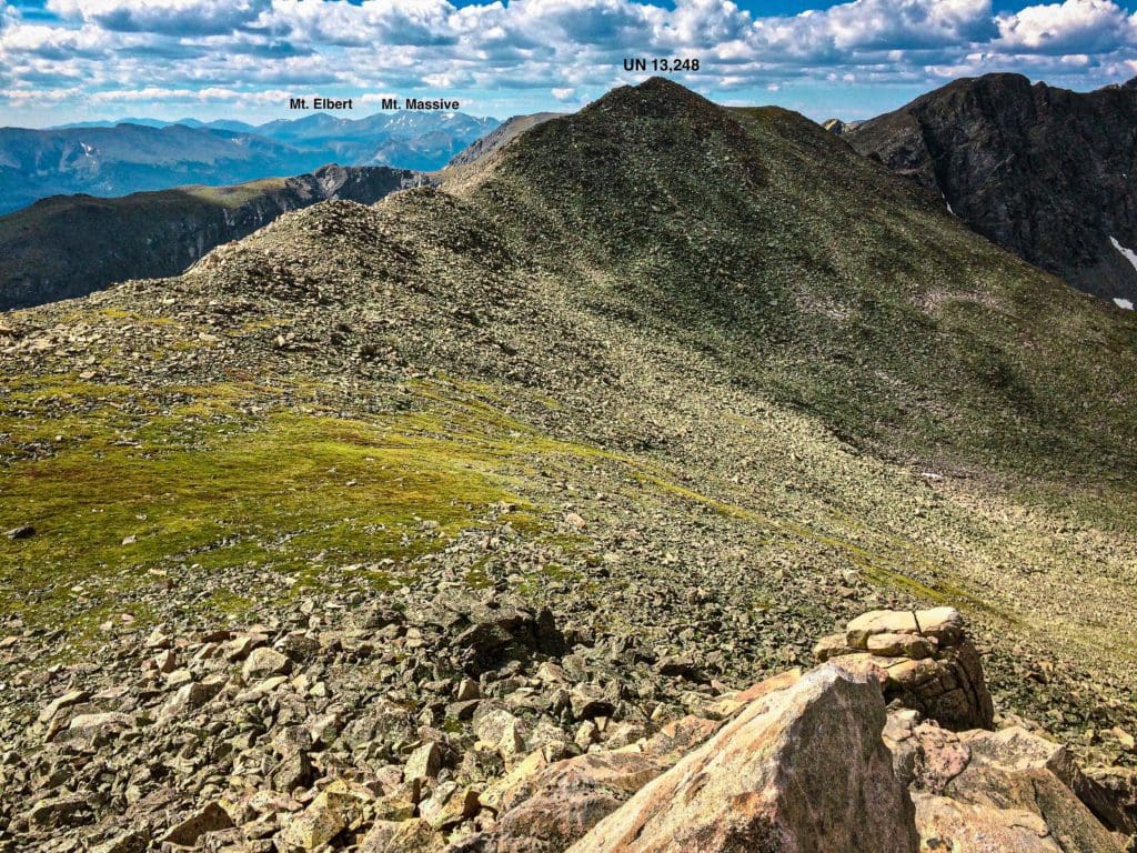
Un 13,248 and mountains to the south.
There’s also a smaller but still prominent ridge to the north that has some good sitting rocks on it. No matter where you explore up here, the views are phenomenal.
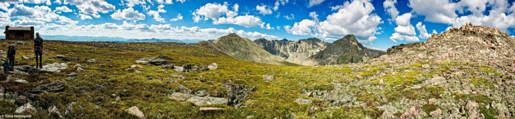
Panorama of the area around Notch Mountain Shelter.
The Notch Mountain Shelter was originally built by the Civilian Conservation Corps in 1933 as a shelter for pilgrims coming to see Mount of the Holy Cross. You can enter the shelter, but you are not allowed to overnight there. Please try to keep off the sensitive alpine vegetation as well.
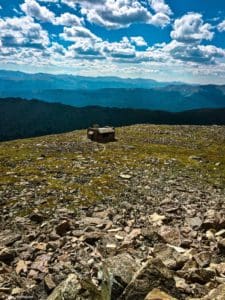
The Notch Mountain Shelter from a small unnamed highpoint to the north.
From the shelter and either of the highpoints on either side, beautiful views of Holy Cross open up to the west. Earlier in the summer, you may be able to identify the telltale Cross Couloir, although the couloir diminishes by late August.

Mount of the Holy Cross in August.
If the weather is good, spend some time in the area checking out the brilliant views and mountain scenery. While a fairly popular hike, Notch Mountain pales in comparison to Mount of the Holy Cross in terms of volume, so it’s likely you’ll have stretches of the trail to yourself. Additionally, if you manage to get up there between July and August, there will be fields upon fields of alpine wildflowers to stare at while you climb.
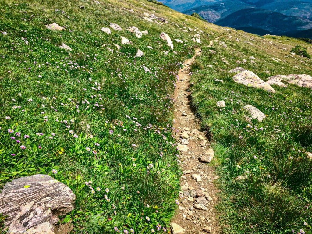
Wildflowers on the side of the trail.
When you’ve had your fill of the monumental views, turn around and back down the Notch Mountain Trail. At the junction with Fall Creek below treeline, take a left and hike the remaining couple of miles back to the parking lot. Although not necessarily as convenient as other Colorado hiking locations, it’s hard to pass up the stellar views, historic shelter and alpine majesty atop Notch Mountain.
Colorado’s Most Legendary Backcountry Ski Run: The Minturn Mile
The Minturn Mile is a sidecountry classic and a Vail Valley special, although the name is a bit of a misnomer. The run itself is more than three miles long and descends from a high point of 11,000 feet to just below 8,000 feet for a total vertical descent of 3,000 feet.
Popular Articles:
Hiking To Gourd Lake, Indian Peaks Wilderness, Colorado
Hiking To The Lake of Many Winds, Rocky Mountain National Park, Colorado
Take your Hiking Game to the Next Level with the Best Trails in Colorado
Hiking to Grays and Torreys Peaks, Arapaho National Forest, Colorado
Best Hiking Trails in Rocky Mountain National Park, Colorado
Terms of Use:
As with each guide published on SKYBLUEOVERLAND.com, should you choose to this route, do so at your own risk. Prior to setting out check current local weather, conditions, and land/road closures. While taking a trail, obey all public and private land use restrictions and rules, carry proper safety and navigational equipment, and of course, follow the #leavenotrace guidelines. The information found herein is simply a planning resource to be used as a point of inspiration in conjunction with your own due-diligence. In spite of the fact that this route, associated GPS track (GPX and maps), and all route guidelines were prepared under diligent research by the specified contributor and/or contributors, the accuracy of such and judgement of the author is not guaranteed. SKYBLUE OVERLAND LLC, its partners, associates, and contributors are in no way liable for personal injury, damage to personal property, or any other such situation that might happen to individuals following this route.


