


|
Getting your Trinity Audio player ready...
|
Overview
In mid-June 2021, I went on a very late Spring four-day-weekend road trip to Rocky Mountain National Park, Black Canyon of the Gunnison National Park and the Uncompahgre National Forest. Looking back on this weekend, it’s amazing to see how much I accomplished in such a short period of time.
It’s probably in my nature. After all, some of my earliest memories include riding shotgun in my dad’s 1962 Chevy Impala while crisscrossing the U.S. on family summer trips. We’d drive through some national park that we spent several days driving to and my dad would say “take a good look kids…” as we’d drive through without stopping. Thankfully, my mom was there to put a stop to that craziness.
I had just bought a new 2021 Antero Longs Peak adventure van the week before my trip. Like any proper new toy, I needed to get out for my first vanlife adventure. I’ve been looking longingly at all the vanlife photos on Instagram for several years and finally made the deal.
Not only was trip is the start of my vanlife journey. I visited two national parks, a national forest, hiked several trails, while photographing the entire journey. This is my photo essay and trip report of these many adventures.
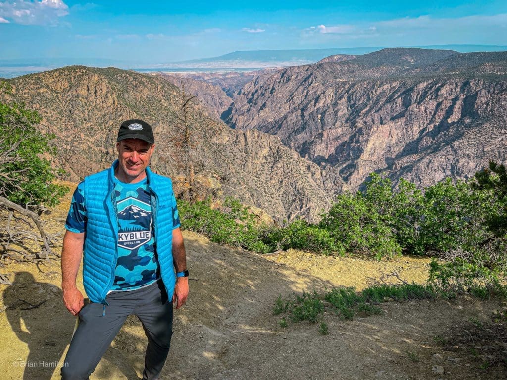
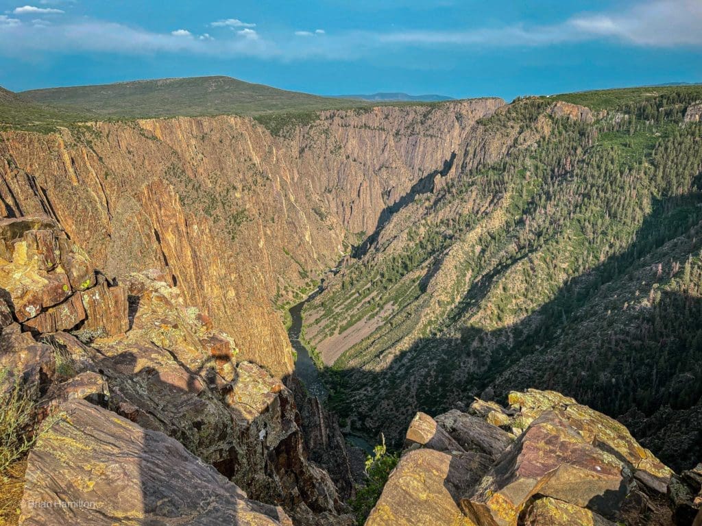
Hiking on the 1.5 mile Warner Point Nature Trail in Black Canyon National Park, Colorado.
Table of Contents:
Article Navigation: Click on any of the listed items in the table of contents below to jump to that section of the article. Similarly, clicking on any large, white section header will jump you back to the Table of Contents.
- Overview
- Things to Note
- My Overall Plan
- Day 1: Driving to Moraine Park Campground
- Day 2: Hiking the Alpine, driving to the South Rim
- Day 3: Hiking the South Rim, driving to Ridgeway
- Day 4: Hiking Courthouse Mountain, driving home to Boulder
Things to Note
After relocating from Colorado to Philadelphia over the summer of 2022, we just listed our Philadelphia based adventure van Longs Peak on Outdoorsy.com. Here is a rundown of the key features of the adventure van. Roam through Philadelphia and beyond with our Adventure Vehicle Rentals. We have all the gear you need, including camping gear, all-terrain vehicles and more, so you can spend less time making lists and more time making memories.
Book Now!
My Overall Plan
Somehow, I was able to score a last minute camping spot in the Moraine Park campground. So this was an unanticipated starting point for my weekend adventure to Southwestern Colorado. This provided the opportunity to explore some of my favorite areas near Moraine Park before heading over Trail Ridge Road to Grand Lake, Kremmling, then to the South Rim of Black Canyon of the Gunnison National Park. After spending a day exploring the various overlooks and trails on the south rim, I drove further south to the Uncompahgre National Forest near Ridgeway to hike near the beautiful West Fork of the Cimmaron River. Prior to returning home to Boulder, I hiked the Courthouse Mountain Trail, which is one of the best trails in Colorado.
Day 1: Driving to Moraine Park Campground
To Moraine Park Campground, Rocky Mountain National Park, Colorado
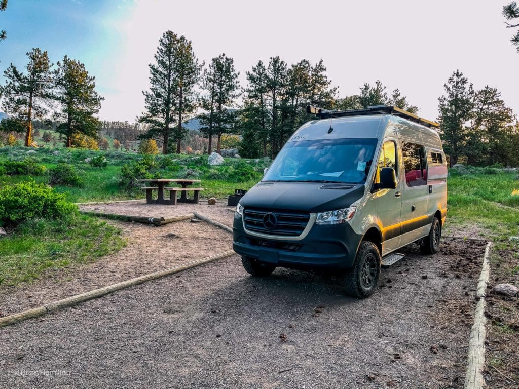
I started my trip to southwestern Colorado in Rocky Mountain National Park. Somehow I was able to score a last minute camping spot at Moraine Park Campground. Moraine Park Campground (8,160 feet) is located in Colorado’s awe-inspiring Rocky Mountain National Park, near the Beaver Meadows Entrance on Highway 36. This is one of my most favorite places on earth, so its probably a fitting location to spend the first night in my new adventure van.
Moraine Park offers beautiful views of the national park and the stunning and awe-inspiring surrounding mountains. I like this campground because of its location. Rocky Mountain National Park has over 350 miles of hiking trails that range from flat lakeside strolls to steep mountain peak climb, offering challenging hikes for any level of hiker!
Moraine Park Campgrounds contains single family tent-only sites, several walk-to tent sites and RV sites. Each campsite is perfectly equipped for a family outing, containing a picnic table, a fire ring with a grate and a tent pad. Also available at the campground are flush toilets and drinking water.

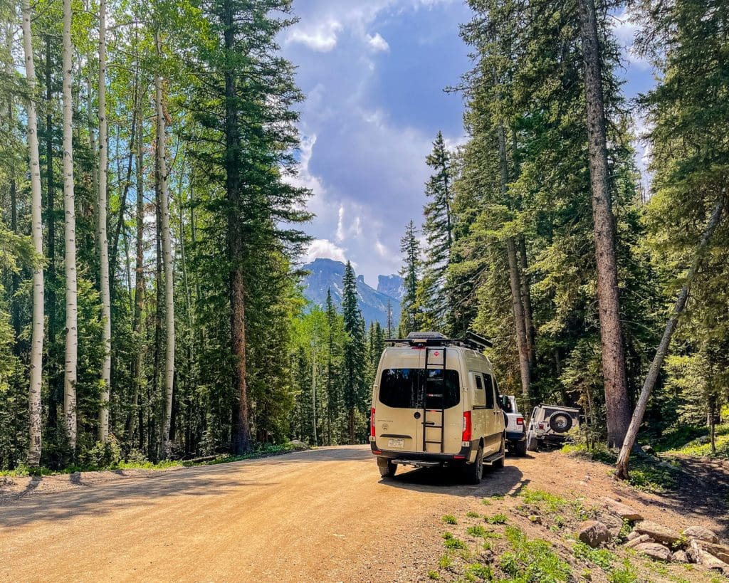
Our 2021 Antero Longs Peak adventure van at the Moraine Park Campground in Rocky Mountain National Park, Colorado.
Hiking on the Moraine Park Loop Trail (3.4 mile loop with a 360 feet elevation gain)
Before nightfall, I took a long walk in Moraine Park to view the sunset. Moraine Park is a lush glacial valley with views of craggy peaks reaching elevations over 14,000 feet. You wouldn’t know if with all the beautiful green vegetation, but this valley burned last fall in the East Troublesome Fire. It’s awesome to see the valley come back so quickly. I love walking along the Big Thompson River when it is fueled by late spring snowmelt and rain.
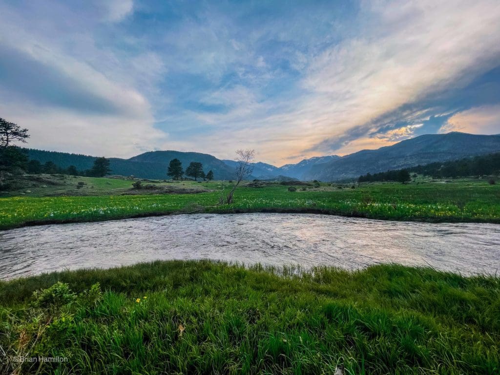
The Big Thompson River at Moraine Park, looking west towards the continental divide.
Day 2: Hiking the Alpine, driving to the South Rim
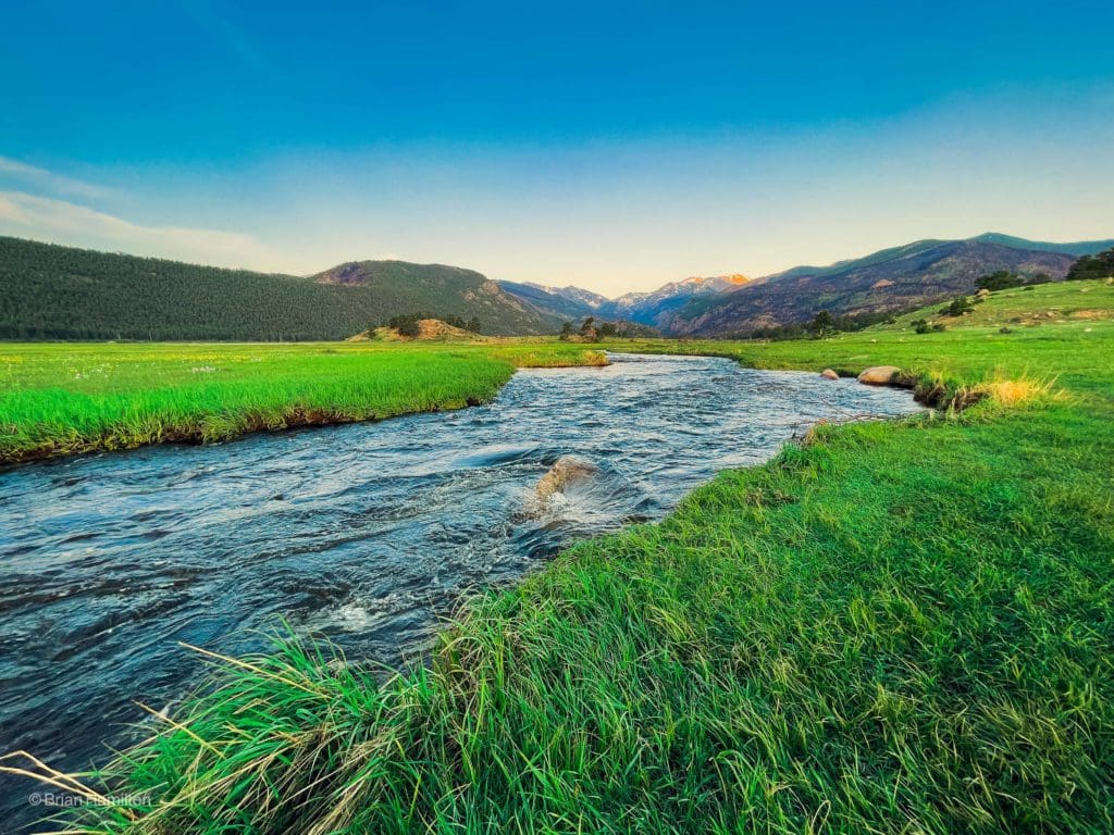
After a sound sleep in my new adventure van, I was up in time to see the sunrise in Rocky. I knew I had several hours of driving in front of me, but I just had to walk down to the Big Thompson River again to see the sunrise over the mountain. The sky was pretty clear, which made for some amazing views. I even saw some elk grazing in the grassland for their breakfast.
Sunrise at the Moraine Park Campground in Rocky Mountain National Park on June 18, 2021.
More Hiking in Moraine Park
Looking west towards Stones Peak with the Big Thompson River in the foreground.
Driving Trail Ridge Road (Iceberg Pass)
Like most people who are new to the park, I decided to utilize Trail Ridge Road, the highest continuous road in the US to start my trip to the Black Canyon of The Gunnison National Park. There are a dozen pull-offs along the road where visitors can stretch their legs and soak up spectacular views.
Trail Ridge Road (U.S. 34) lives up to its reputation, spanning the 48 miles between Estes Park on the eastern side of the park and Grand Lake on the west. The stretch of highway is 11 miles above treeline at 11,500 feet, where the evergreen forest ends. The road climbs to its highest point at 12,183 feet elevation, giving those in their cars unrivaled views of the tundra and wildlife sightings, along with spectacular alpine wildflower displays.
Trail Ridge Road is one of ten America’s Byways in Colorado and a national designated All American Road. Like to see as many byways as you can? On the outskirts of Rocky is the oldest Colorado Scenic Byway, Peak to Peak, and another America’s Byway, the Colorado River Headwaters. To learn more about other Colorado Scenic Byways click here.
My new adventure van parked at the Rock Cut Overlook near Iceberg Pass, Colorado.
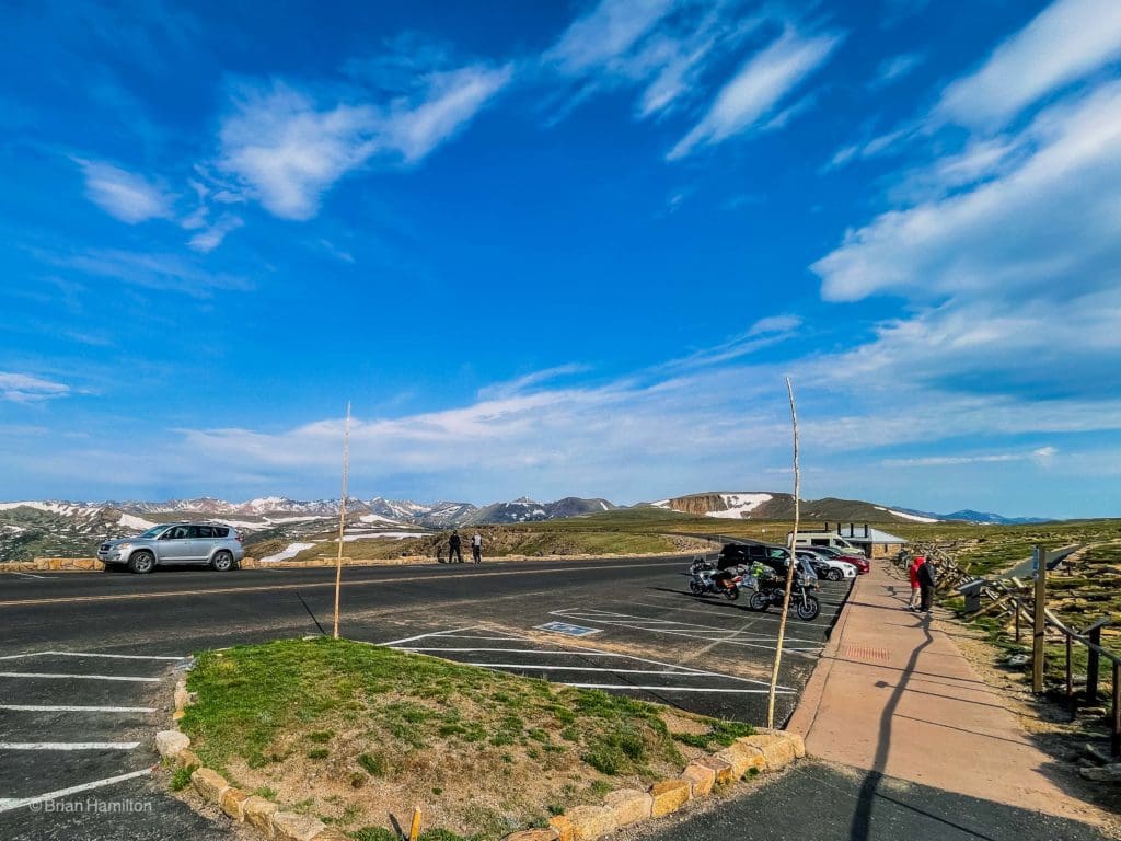
Hiking the Toll Memorial Trail (1.2 mile out-and-back trail with 160 feet elevation gain)
I decided to take a stroll on the Toll Memorial Trail in order to take some more photos for a trail review. The Toll memorial trail is located near the tallest part of Trail Ridge at Iceberg Pass and provides a quick, out-and-back adventure into an environment most people on earth have never been to. It’s the perfect opportunity to enjoy the alpine with relatively little effort. The trail is accessed from the Rock Cut overlook. See our Detailed Trail Review.
This next photo is a view alpine environment with the Never Summer Range in the distance. A few weeks later, I went on a weekend backpacking trip to the Lake of the Clouds in the Never Summers.
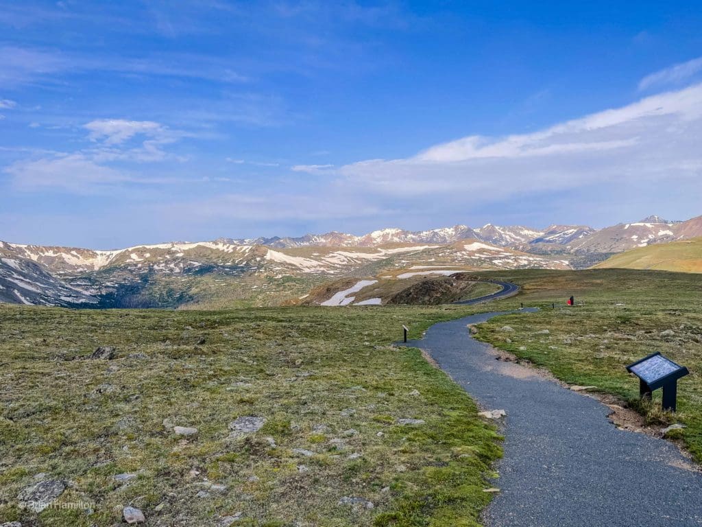
View from the Toll Memorial Trail of the alpine environment with the Never Summer Range in the distance.
Stop at Grand Lake, Colorado
After driving on top of the world, I had to make a quick top in one of my all-time favorite mountain towns, Grand Lake.
Grand Lake is a fantastic, off-the-beaten-path mountain town on the western edge of Rocky Mountain National park. Renowned for its position along the largest natural lake in Colorado (along with two other stunning nearby reservoirs), Grand Lake is a four-season playground. Within minutes, you could be hiking in a national park, taking a pontoon boat onto a series of lakes, or exploring the nearby Indian Peaks and Never Summer Wildernesses.
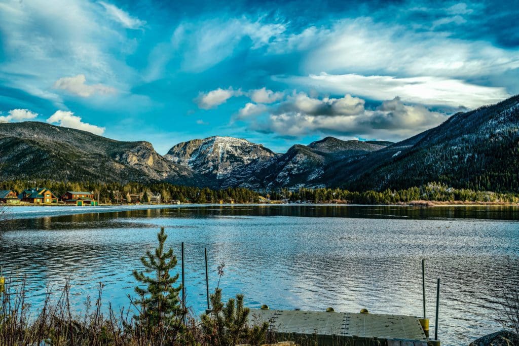
Views of the Rocky Mountains snow covered mountain tops from across a still smooth lake in Grand Lake, Colorado.
To Gore Canyon near Kremmling, Colorado
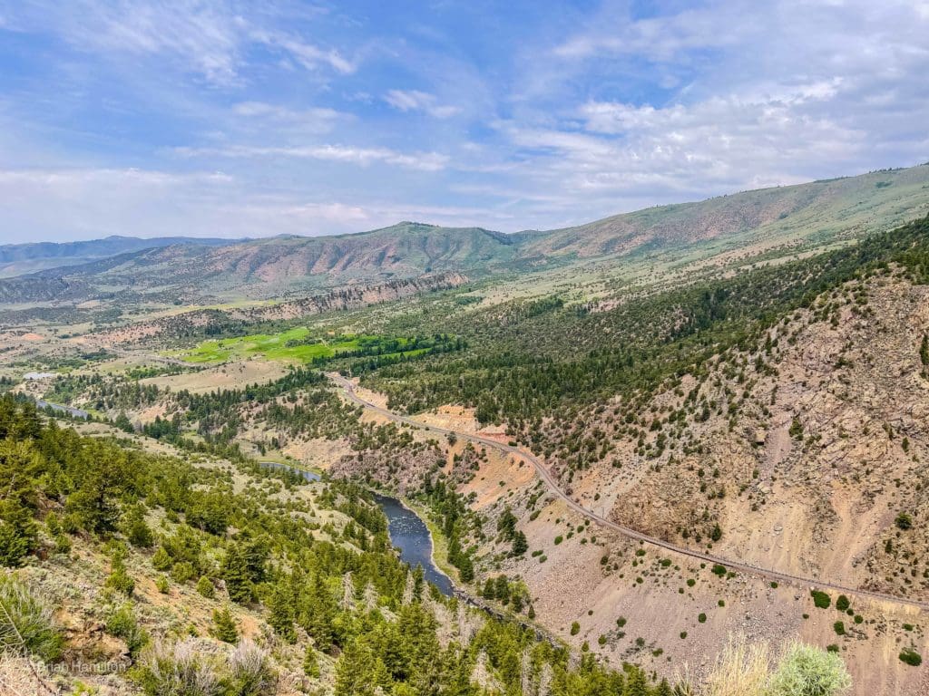
As I continued my day-long journey to the Black Canyon, I decided to stop at an overlook with amazing views of Gore Canyon, which is an isolated 3-mile canyon along the upper Colorado River, just southwest of Kremmling.
Gore Canyon, set at an altitude of 6,985 feet (2,129 m), is a narrow and secluded canyon on the upper Colorado River in Grand County, Colorado. It stretches for about 3 miles (5 km) and was created by the force of the river as it passed by the northern end of the Gore Mountain Range, close to Kremmling. The Colorado River drops from approximately 7,300 feet (2,200 m) to approximately 7,000 feet (2,100 m) through the canyon. Its walls are about 1,000 feet (300 m) high on each side. The canyon stands at the southwestern edge of Middle Park basin in north central Colorado. The canyon is road-less and is inaccessible by most traffic. Although Amtrak’s California Zephyr travels through the canyon, if you would like to take a unique train adventure.
In the early 1990’s, I spent nearly a year working as a field geologist with railroad maintenance-of-way crews from the Denver and Rio Grande Western Railroad (now Union Pacific) to stabilize loose rock slopes that were slowing down the train traffic. During the summer of 1992, we spent several days working in Gore Canyon. It was a unique opportunity to see the beautiful, rugged canyon in a way few people do.
Gore Canyon
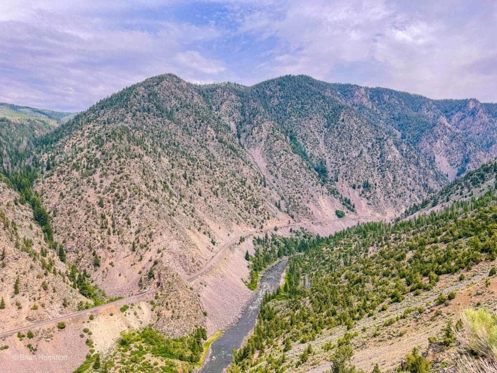
View looking toward Gore Canyon near Kremmling, Colorado.
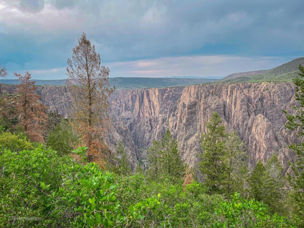
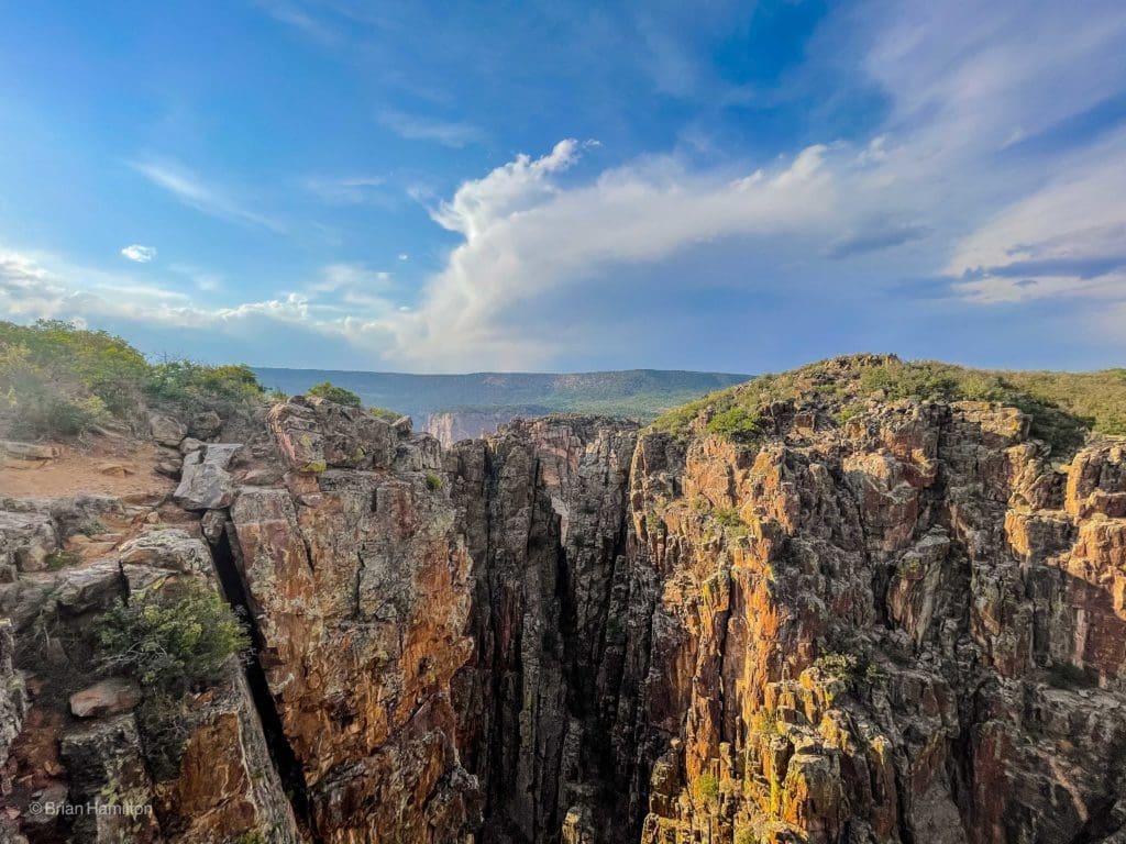
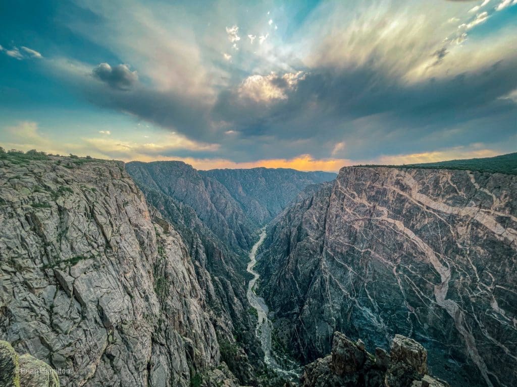
Exploring the South Rim at Black Canyon of the Gunnison National Park, Colorado
As a geologist, I’ve always wanted to visit the Black Canyon of the Gunnison. The rugged canyon was formed over the course of millions of years. Around 60 million years ago land uplifted rock that dates back to 1.8 billion years ago, and formed the Gunnison Lift. Skyblue Overland has already published an Adventurer’s Guide to the Black Canyon National Park, but I’m always eager to enhance article and the photography.
I spent the night at the South Rim Campground, which offers some of the most impressive views within the National Park. Its located near the 2,250-foot Painted Wall, which happens to be the highest cliff in the entire state of Colorado. The largest attraction to the Black Canyon of the Gunnison National Park is the scenic drive along the top of the rim. There are several overlooks, each with short trails with amazing views of the canyon.
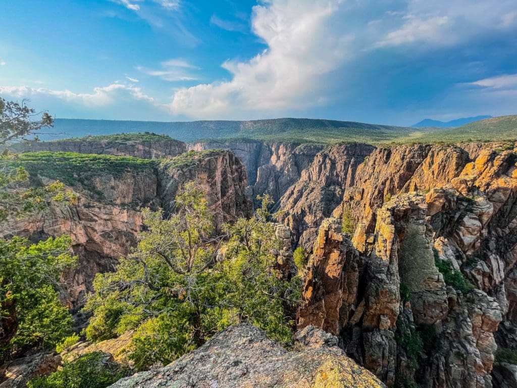
Hiking the Oak Flat Loop Trail (1.3 mile loop trail with an elevation gain of 315 feet)
One of the park rangers at the South Rim Visitor’s Center recommended the Oak Flat Loop Trail, which is a 1.3 mile heavily trafficked loop trail. This moderate trail has great views of the canyon and its vegetation. There were tons of spring wild flowers. The big secret to this trail are the songs of the many birds that live in the forest. This trail doesn’t take you all the way down to the bottom of the canyon, which requires a special permit. No permits are needed for the Oak Flat Loop.
The Oak Flat Loop Trail provides awesome South Rim views of Black Canyon.
Hiking the Pulpit Rock Overlook Trail (0.2 miles, out-and-back, 32 feet elevation gain)
Time to step up to the pulpit.
The east view from Pulpit Rock.
Cross Fissures at Pulpit Rock Overlook.
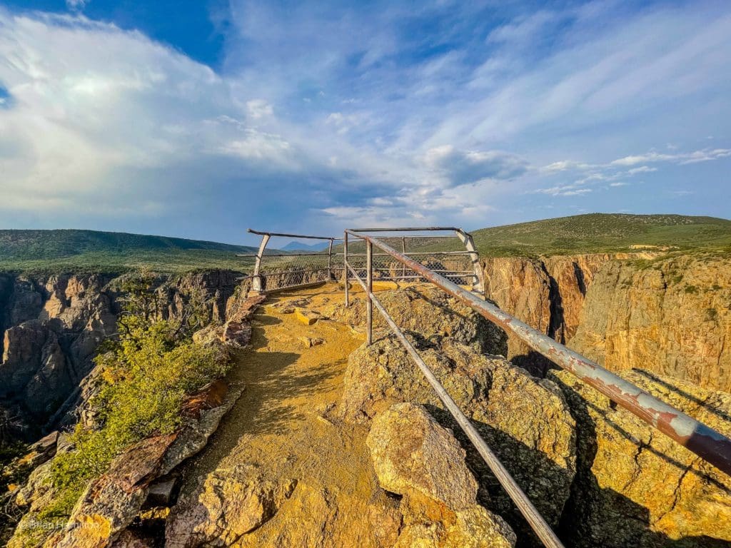
Rock Point Overlook
Devil’s Overlook

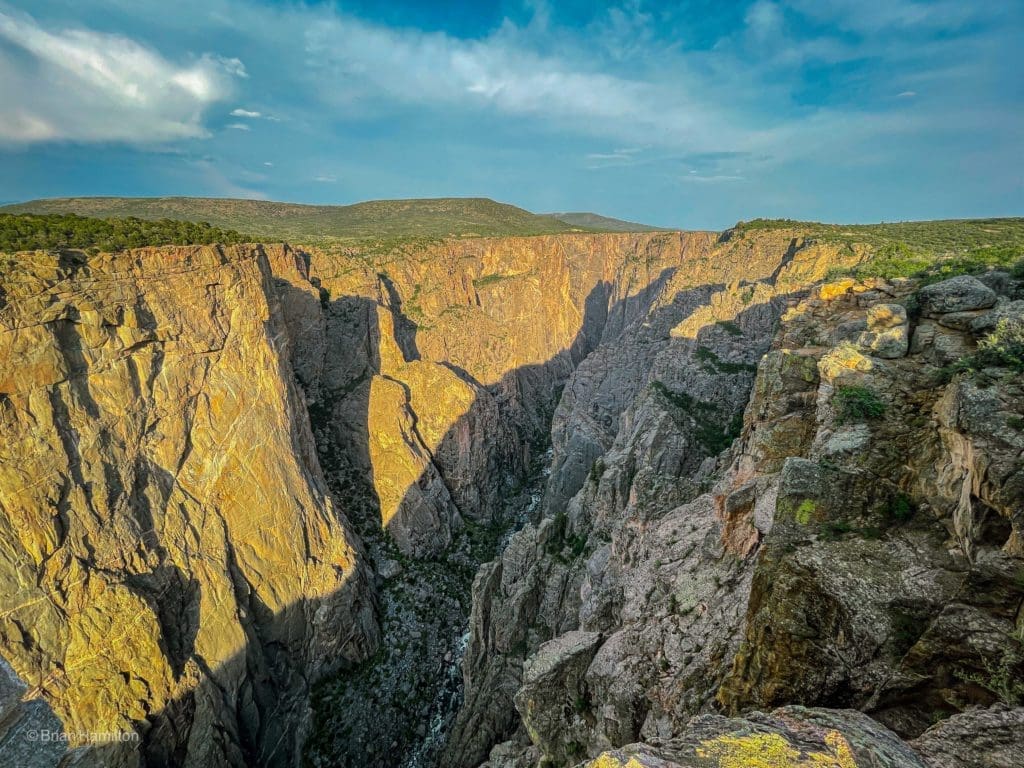
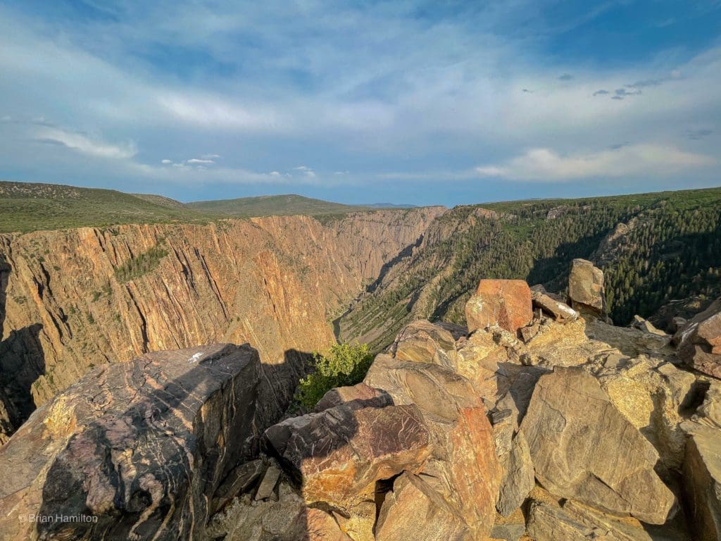
Painted Wall Overlook
The Painted Wall at sunset.
Cedar Point Overlook
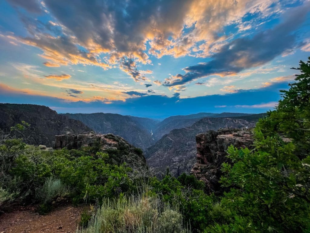
A beautiful sunset at Cedar Point Overlook.
Day 3: Hiking the South Rim, driving to Ridgeway
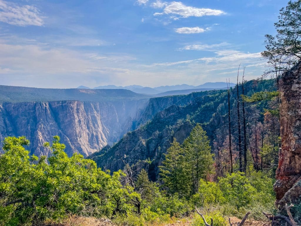
Hiking the Warner Point Nature Trail (1.5 mile out-and-back trail with a 420 feet elevation gain)
After another great sleep in my new van, I woke up early and hiked the 1.5 mile Warner Point Nature Trail at the South Rim of the Black Canyon of the Gunnison. The rolling trail eventually meanders to Warner Point, but along the way there are plenty of pleasant places to stop to take in the views.
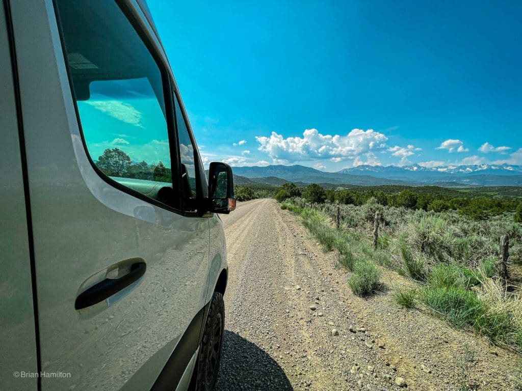
To Uncompahgre National Forest via Owl Creek Pass
In general, make your way to US 50 and head into Montrose. There are two options from here; the first is to head east on US 50 as if heading to Gunnison. Look for County Road 858 and head south on it towards Silver Jack Reservoir. It will be a right turn off US 50 if you’re coming from Montrose, and left if you’re coming from Gunnison. The road turns into Forest Service 858 and continues south past the reservoir. The road will eventually come to a junction with FS860, do not head up Owl Creek Pass; instead, head south on FS 860. The trailhead will be a couple of miles to the south and on the right side of the road. When dry, no 4X4 or all-wheel drive is necessary via this route. From US 50, this approach is almost 28 miles and will cost you about an hour and a half.
San Juan Mountains near Ridgeway, Colorado.
The Cimarrons subrange of the San Juan Mountains are some of the top camping destinations in the region. There are plenty of free dispersed camping options available in the East Fork, Middle Fork, and West Fork areas, as well as the road leading up to Owl Creek Pass. I found an amazing camping spot along the along the West Fork Cimarron River. Here’s a few photos in the valley.
Owl Creek Pass (Elevation 10,114 feet)
There are good camping options all along the approach routes south of Silver Jack Reservoir that don’t require a campsite fee. If you are visiting the area, please follow all forest service guidelines, ESPECIALLY if there is a fire ban in the area. This is a pristine and wonderful part of Colorado’s Western Slope; let’s keep it that way, leave no trace.
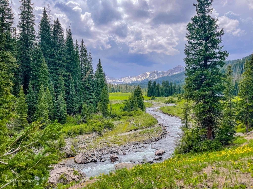
The last bit of the drive to the trailhead is along the gorgeous West Fork of the Cimarron River.
Dispersed camping exists all up and down the West Fork of the Cimarron River. This is easily the best free option for attempts up Courthouse Mountain and any of the surrounding peaks. Click here to link to a USFS brochure on the area. The prices for established campgrounds displayed in the brochure are out of date, but the information regarding dispersed camping is invaluable.
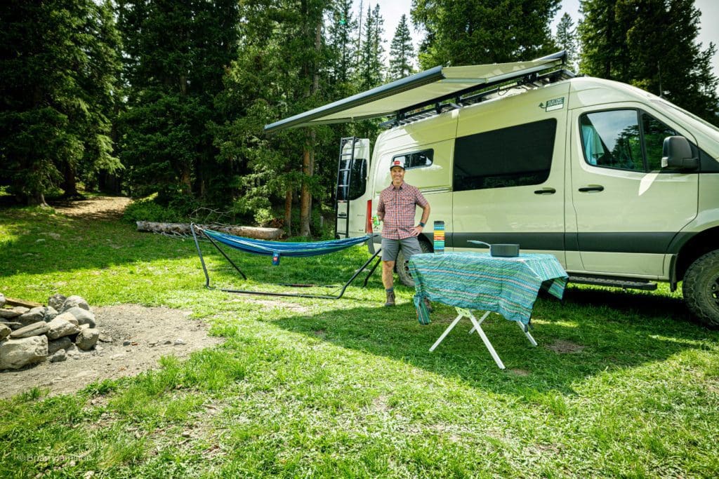
Setting up camp with the awning deployed for shade.
Day 4: Hiking Courthouse Mountain, driving home to Boulder
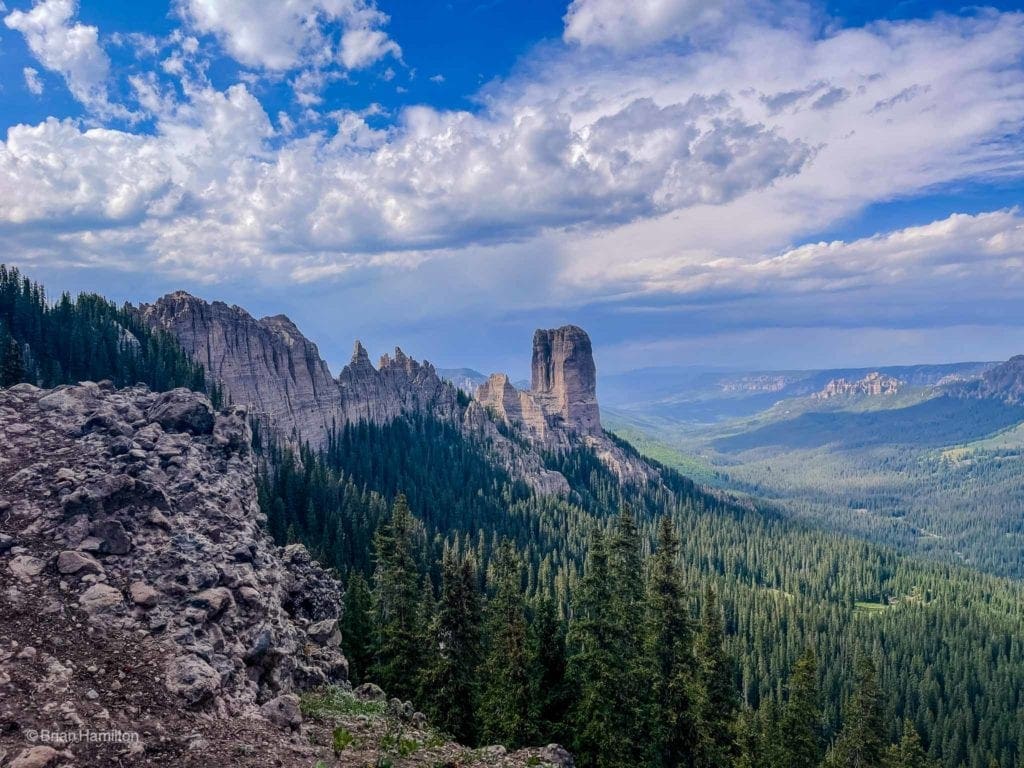
Hiking the Courthouse Mountain Trail
With more summits over 13,000 feet than any range in Colorado, the San Juan Mountains of southwest Colorado are seriously impressive. Given the huge variety in peak bagging options, a smaller summit like Courthouse Mountain may fall to the wayside. However, the stunning profile and absolutely stellar views from the summit set this peak apart.
Located in the Cimarron sub-range, the mountain benefits from a short trail (less than 4 miles roundtrip) and a commanding position just north of the main bulk of the San Juan’s. From the summit, views of the fourteener Mt. Sneffels and countless thirteeners grace the southern skyline. To the north: the mountains give way to the Black Canyon of the Gunnison while the Grand Mesa looks on from afar. You may even be able to glimpse the La Sal mountains of Eastern Utah. Despite its distance from larger Front-Range cities, Courthouse Mountain is among the best and most rewarding summits in Colorado.
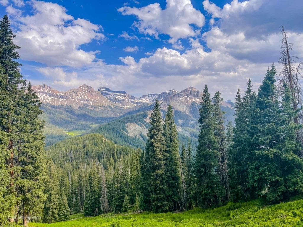
Further up the valley with Redcliff and the horizontal snow bands on Coxcomb Mountain.
Courthouse Mountain may look small when compared to other peaks in the area, which can reach heights up to 14,000 feet or more. But, for its size, it stands tall over Ridgway, boasting animpressive 1,000 feet of vertical prominence. The peak may look unclimbable from a distance, but there is an easy-to-followroute that leads to the peak’s exposed summit.
At the top, you have a bird’s-eye view of Ridgway to the west, Chimney Rock and Silver Jack Reservoir to the northeast,the Uncompahgre Valley to the northwest, and the West Fork Cimarron River Valley to the southeast—trapped by Dunsinane Mountain, Precipice Peak, Redcliffe, and Coxcomb. See our Detailed Trail Review!
Connected to Courthouse Mountain via a serrated and crumbly ridge, Chimney Rock bookends the entire massif.
The 1969 film, True Grit, was filmed in various locations around Montrose, Telluride, and Ouray, including Courthouse Mountain and Chimney Rock. These landmarks are volcanic in origin, built from layers of compacted ash. The rock is quite soft and easily erodible, so it’s important to stay on the trail when exploring this area.
In 1970, John Wayne took home an Academy Award for his larger-than-life performance as the rough and tumble one-eyed U.S. Marshall, Rooster Cogburn. A headstrong young girl (Kim Darby) hired Cogburn to capture the man who killed her father and ran away with the family fortune, and insisted on joining him in this mission. However, things quickly went downhill when an inexperienced yet eager Texas Ranger (Glen Campbell) enters the picture, resulting in plenty of laughs and tears along this wild journey. Robert Duvall and Strother Martin also star in this extraordinary Western.
Popular Articles:
Adventurer’s Guide To Black Canyon Of The Gunnison National Park
Adventurer’s Guide To Rocky Mountain National Park
Toll Memorial Trail, Rocky Mountain National Park, Colorado
Courthouse Mountain Trail, Uncompahgre Wilderness, Colorado
Top Adventure Sports Towns: Crested Butte, Colorado


