


High Point:
~12,152 feet

Total Ascent:
~1900 feet

Difficulty:
Hard

Distance:
3.7 miles

Waypoints:
38.13319, -107.55933

Route Type:
Out and back
Courthouse Mountain is a breathtaking peak located south of Owl Creek Pass in the Cimarron Mountains sub-range of the San Juan Mountains in Colorado.
With its unique shape and over 1,000 feet of vertical prominence, Courthouse Mountain commands attention on the skyline and can easily be distinguished from other peaks around it.
Overview
With more summits over 13,000 feet than any range in Colorado, the San Juan Mountains of southwest Colorado are seriously impressive. Given the huge variety in peak bagging options, a smaller summit like Courthouse Mountain may fall to the wayside. However, the stunning profile and absolutely stellar views from the summit set this peak apart.
Located in the Cimarron sub-range, the mountain benefits from a short trail (less than 4 miles roundtrip) and a commanding position just north of the main bulk of the San Juan’s. From the summit, views of the fourteener Mt. Sneffels and countless thirteeners grace the southern skyline. To the north: the mountains give way to the Black Canyon of the Gunnison while the Grand Mesa looks on from afar. You may even be able to glimpse the La Sal mountains of Eastern Utah. Despite its distance from larger Front-Range cities, Courthouse Mountain is among the best and most rewarding summits in Colorado.
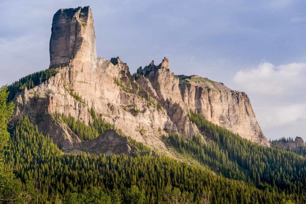
Courthouse Mountain from the north, with Chimney Rock the obvious hoodoo on the left. Photo by Don Grall / Jaynes Gallery / DanitaDelimont.com
Table of Contents:
Article Navigation: Click on any of the listed items in the table of contents below to jump to that section of the article. Similarly, clicking on any large, white section header will jump you back to the Table of Contents.
The Ultimate Offline GPS Hiking & Ski Maps
See why onX Backcountry is the ultimate GPS navigation app for your outdoor pursuits. Try Today for Free. No credit card required.
Directions to Trailhead:
There are a few ways of getting to Courthouse Mountain. Located on the northern edge of the San Juans, access is fairly straightforward from points north like Montrose, Grand Junction, or even Carbondale once you pop over McClure Pass. If you’re coming from Denver, expect a one-way drive of six hours.
In general, make your way to US 50 and head into Montrose. There are two options from here; the first is to head east on US 50 as if heading to Gunnison. Look for County Road 858 and head south on it towards Silver Jack Reservoir. It will be a right turn off US 50 if you’re coming from Montrose, and left if you’re coming from Gunnison. The road turns into Forest Service 858 and continues south past the reservoir. The road will eventually come to a junction with FS860, do not head up Owl Creek Pass; instead, head south on FS 860. The trailhead will be a couple of miles to the south and on the right side of the road. When dry, no 4X4 or all-wheel drive is necessary via this route. From US 50, this approach is almost 28 miles and will cost you about an hour and a half.
If coming from the south or west, make your way to the town of Ridgway. Continue north on US550 until you see the dirt county road 10. Take a right on it and immediately spot the obvious profile of Courthouse Mountain to the west, flanked by Chimney Rock and Precipice Peak. (Photo 6: The mountain from outside Ridgway). This option is nice because you’ll be able to see your destination as soon as you pop off of US550. Continue west on County Road 10, taking a slight left to stay on it as it heads toward the Cimarron Range. The road will take a northward jaunt to connect with County Road 8. At the junction, take a right and make your way to Owl Creek Pass. On the other side of Owl Creek Pass, continue south on FS 860 until finding the trailhead on your right. From the start of County Road 10, it’s a little under 17 miles.
Both routes should be traversable by two-wheel drive vehicles in dry conditions, though the Silver Jack reservoir route has less overall elevation gain and loss.
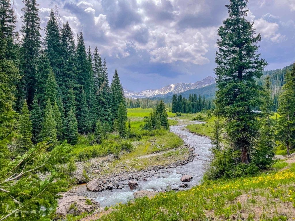
The last bit of the drive to the trailhead is along the gorgeous West Fork of the Cimarron River.
Field Notes:
Courthouse Mountain is fairly out there if you’re coming over from the Front Range, and the long dirt road approaches may cause you to question if you’re on the right path. Stick with it. Despite its remote location, the mountain is a superb example of dramatic Colorado scenery and provides a relatively simple way to get stupendous views of the San Juan Mountains.
Because you’ll be hiking over 12,000 feet, it’s a good idea to bring layers, extra water and keep the signs and symptoms of altitude sickness at the forefront of your thoughts. When checking the weather, start with the town of Ridgway, which is relatively close as the crow flies. You can also check the mountain forecast for Wetterhorn, the sharp 14er a few miles south of Courthouse Mountain. Keep an eye on temperatures, precipitation, and wind predictions.
There are good camping options all along the approach routes south of Silver Jack Reservoir that don’t require a campsite fee. Follow all forest service guidelines, ESPECIALLY if there is a fire ban in the area. This is a pristine and wonderful part of Colorado’s Western Slope; let’s keep it that way, leave no trace.
Be aware: this trail rises nearly 2,000 feet in under two miles, which makes for a fairly relentless climb. Because you gain nearly a thousand feet per mile of effort, it will feel like a tough hike. Pace yourself and know that at least the distance to the top is short.
Places to Stay
For those looking to stay indoors, your best bets for lodging are going to be in the towns of Ouray,Ridgway, Montrose and maybe Telluride if you’re ok with a longer commute. Camping in the area is most likely the way to go, with a few stellar options to pick from.
- Silver Jack Campground is a good option. Just remember to bring everything you need because it is far from civilization. $16.00 per night per camping unit.
- The KOA outside of Ouray is also nice with good tent sites, a small general store and a place to eat onsite. Depending on popularity, site prices can fluctuate pretty wildly though.
- Dispersed camping exists all up and down the West Fork of the Cimarron River. This is easily the best free option for attempts up Courthouse Mountain and any of the surrounding peaks. Click here to link to a USFS brochure on the area. The prices for established campgrounds displayed in the brochure are out of date, but the information regarding dispersed camping is invaluable.
Journal:
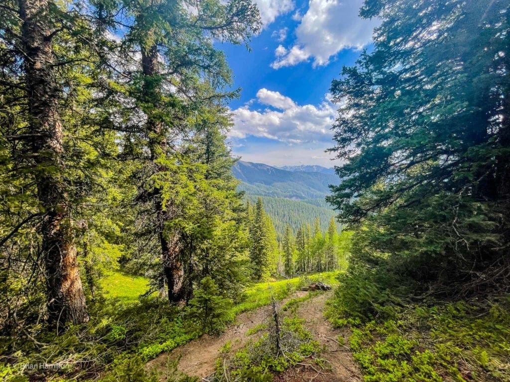
From the trailhead, pick up the obvious path and begin your short but fairly relentless hike uphill.
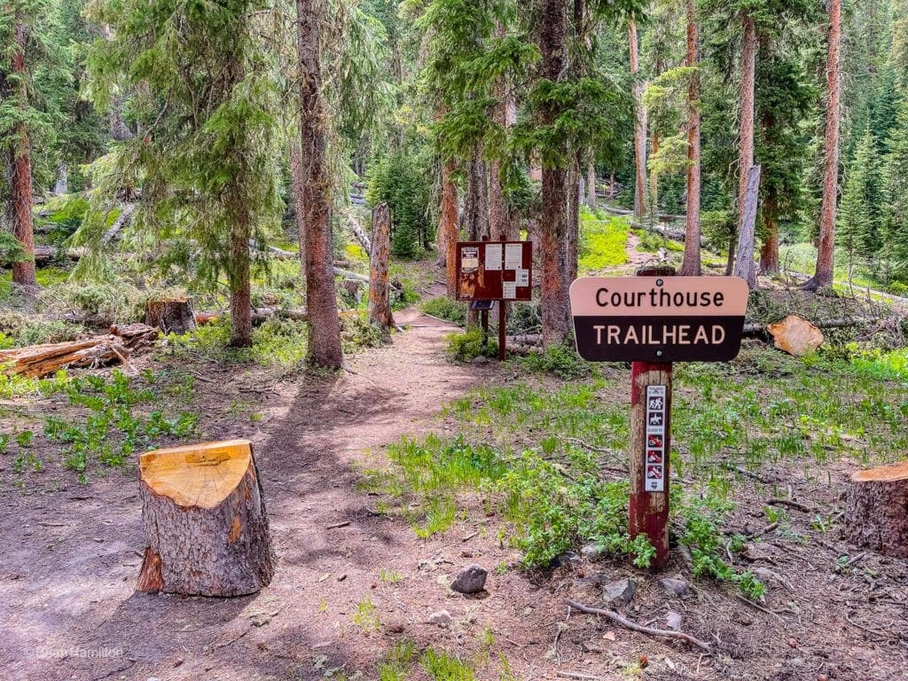
Courthouse Mountain Trailhead sign.
You’ll pass through pine forests as the trail winds up and across various drainages.
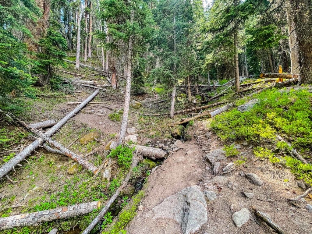
Crossing one of a few drainages on the way up.
As you ascend, views will start to open up between the trees, though the most dramatic parts of the hike still remain.
Glimpses of the surround.
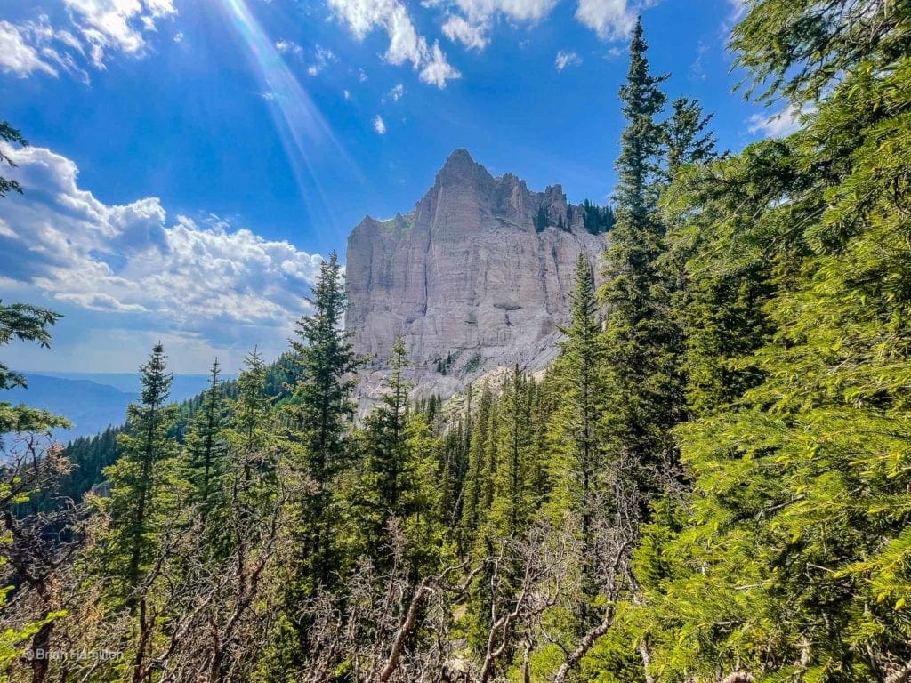
Eventually, the trail will attack a ridge crest and you’ll be able to see the edge of the dramatic Courthouse summit block.
Looking to higher ground as the trail grinds on.
At various points, you’ll be able to stare east across the West Fork of the Cimarron River to neighboring peaks.
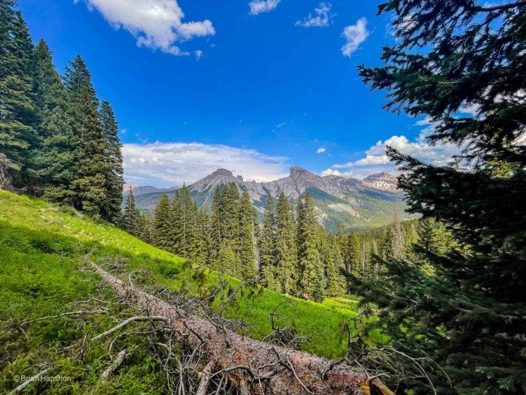
Mount Dunsinane and Precipice Peak.
Further up the valley with Redcliff and the horizontal snow bands on Coxcomb Mountain.
The trail, while relentless, threads around some of the interesting rock features on Courthouse.
Passing rock formations that resemble Termite mounds.
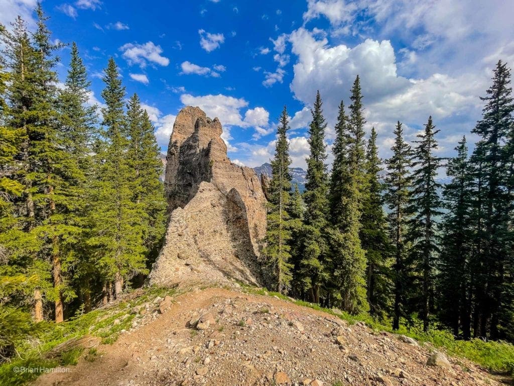
While beautiful, the rock quality in the San Juan’s is of volcanic origin, meaning loose and sandy. Use extra caution when exploring some of the formations near the trail. When the trail hits a ridgeline, and the trees peel away, you’ll be given fantastic views to the striking Chimney Rock tower to the north.
Connected to Courthouse Mountain via a serrated and crumbly ridge, Chimney Rock bookends the entire massif.
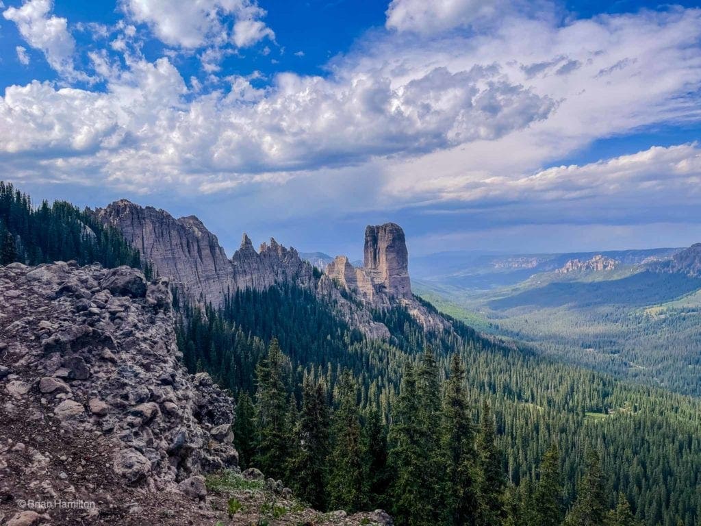
The trail winds its way back into the trees briefly before connecting to the alpine portion of the summit block. The summit block is a spectacular area poking its head above the trees and granting unparalleled 360-degree views.
Looking north to Chimney Rock and the serrated ridges of the Cimarron.
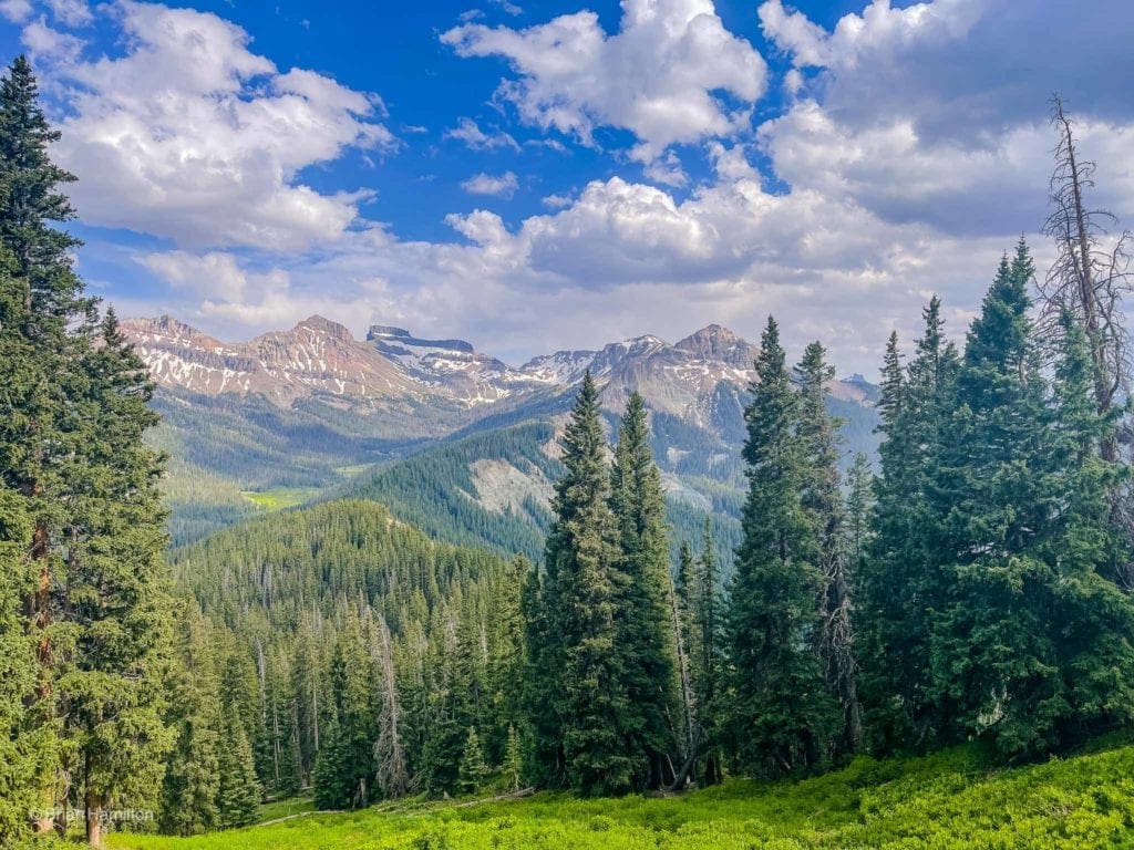
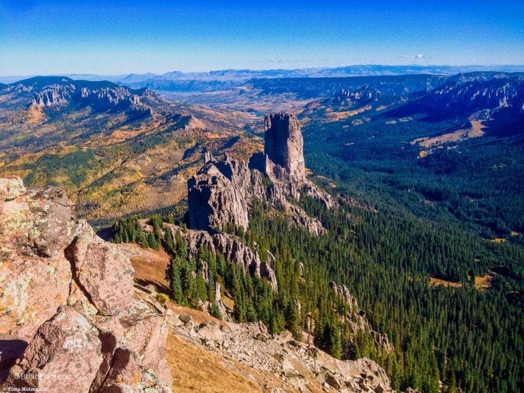
There is some Class 2 scrambling available on the rock rib at the very top of the block, but it isn’t necessary to enjoy the views. Keep an eye on any incoming clouds and retreat to below the trees should weather threaten. If the skies are clear, enjoy views of the Dallas Divide and Mt. Sneffels to the southwest.
The Dallas Divide is the abrupt northern ridgeline of the San Juans. Mt. Sneffels is the farther right of two peaks that appear higher than the rest.
This is an especially pretty hike in autumn when yellow aspens blanket the lower slopes of the mountain. When exploring the summit area, remember that the trail and surrounding environment is sensitive and crumbly. If your hikers or shoes do not have good tread, it’s much better to stick with the trail. A fall up here could become serious very quickly.
When you’ve had your fill, retrace your steps and carefully make your way down to treeline. While relatively obscure by Colorado mountain standards, Courthouse offers one of the top views in the entire state with dramatic rocky ridge, sky-scraping mountains, and verdant valleys as far as the eye can see.
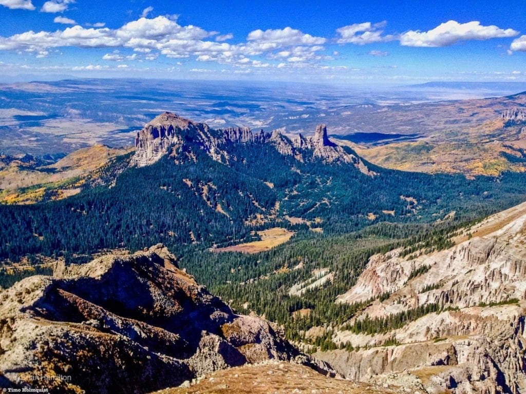
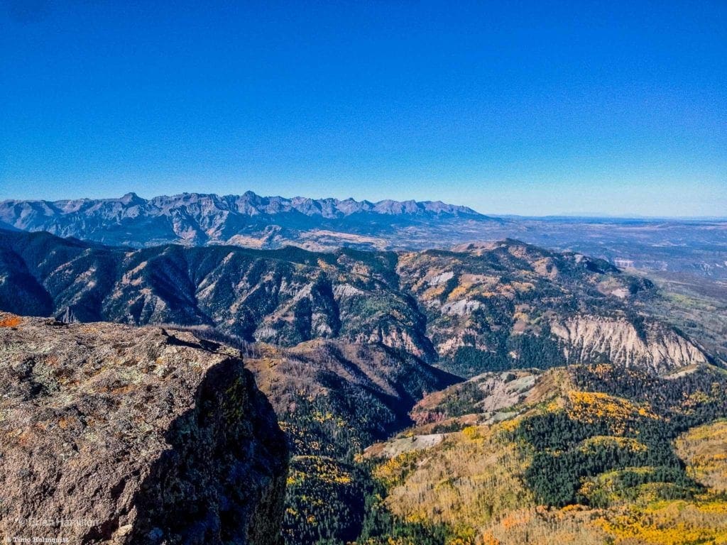
Courthouse Mountain and Chimney Rock from neighboring Precipice Peak. The Grand Mesa is the dark flat line against the upper right horizon. The La Sal Mountains of eastern Utah are visible as a ridgeline against the upper left horizon.
Final Thoughts:
Colorado is a state full of mountains and stunning vistas. The mountaineering challenges are nearly endless, but if you want a sense of just how massive these ranges are, it helps to find a peak with a good vantage point. The best views are usually on peaks that are a little off-center from the main ranges because they often provide the most sweeping and panoramic scenes; Courthouse Mountain enthusiastically checks that box.
The views from the summit are nothing short of spectacular, helping to paint a beautiful image of the San Juan Mountains while showcasing the diverse terrain typical of Colorado’s Western Slope. It’s in these unique positions, where geography, topography, and differing environments collide, that the most memorable views are obtained. Aim for a good weather day when climbing Courthouse because, despite its short length, it’s a long approach drive, and you’re going to want to hang on the summit for a while to let your eyes absorb all they can see.
Photography for this article provided by Brian Hamilton, who hiked this trail on June 19, 2021. Skyblue Overland uses SmugMug, a paid image sharing, image hosting service, and online video platform on which users can upload photos and videos. The SmugMug also facilitates the sale of digital and print media for amateur and professional photographers. See Skyblue Overland’s Adventure Photo Galleries from the Best Trails in Colorado at SmugMug.com. Here is the entire Courthouse Mountain Trail Gallery:
Popular Articles:
- Guide to the Best Hiking Trails in Rocky Mountain National Park, Colorado
- The Dyrt: The 10 Best Campgrounds In Colorado
- Top Adventure Sports Towns 2021: Boulder, Colorado
- Epic Adventures with the Best Guides In Colorado
- Bear Lake Nature Trail, Rocky Mountain National Park, Colorado
- Mills Lake via Glacier Gorge Trail, Rocky Mountain National Park, Colorado
- Black Lake Via Glacier Gorge Trail, Rocky Mountain National Park, Colorado
- Lake Haiyaha Trail, Rocky Mountain National Park, Colorado
- Sky Pond via Glacier Gorge Trail, Rocky Mountain National Park, Colorado

Skyblue Overland Strongly Recommends That You Enroll With Global Rescue Prior To Embarking On Your Next Adventure.
With more people outside now more than ever, Global Rescue expanded services to include field rescue within 100 miles of home. With Local Field Rescue — automatically included in any travel protection services membership — Global Rescue is there whether you’re hiking, kayaking, snowmobiling, fishing or simply enjoying the outdoors and get ill or injured and you’re unable to get to safety on your own. Purchase a Global Rescue membership for your next adventure and travel with peace of mind. Single trip, annual and family options are available.
Memberships start at $119.
Terms of Use:
As with each guide published on SKYBLUEOVERLAND.com, should you choose to this route, do so at your own risk. Prior to setting out check current local weather, conditions, and land/road closures. While taking a trail, obey all public and private land use restrictions and rules, carry proper safety and navigational equipment, and of course, follow the #leavenotrace guidelines. The information found herein is simply a planning resource to be used as a point of inspiration in conjunction with your own due-diligence. In spite of the fact that this route, associated GPS track (GPX and maps), and all route guidelines were prepared under diligent research by the specified contributor and/or contributors, the accuracy of such and judgement of the author is not guaranteed. SKYBLUE OVERLAND LLC, its partners, associates, and contributors are in no way liable for personal injury, damage to personal property, or any other such situation that might happen to individuals following this route.


