


High Point:
~12,289 feet

Total Ascent:
~160 feet

Difficulty:
Easy

Distance:
1.2 miles roundtrip

Waypoints:
40.41217, -105.73299

Route Type:
Out and Back

Table of Contents:
Article Navigation: Click on any of the listed items in the table of contents below to jump to that section of the article. Similarly, clicking on any large, white section header will jump you back to the Table of Contents.
Overview:
Despite Rocky Mountain National Park’s reputation as a hikers paradise, there are ways to get prime views without the added burden of a long hike. Most people who are new to the park utilize Trail Ridge Road, the highest continuous road in the US. There are a dozen pull-offs along the road where visitors can stretch their legs and soak up spectacular views.
Toll memorial trail is located near the tallest part of Trail Ridge and provides a quick, out-and-back adventure into an environment most people on earth have never been to. It’s the perfect opportunity to enjoy the alpine with relatively little effort. The trail is accessed from the Rock Cut overlook.
Tundra strolling on the Toll Memorial Trail.
The Ultimate Offline GPS Hiking & Ski Maps
See why onX Backcountry is the ultimate GPS navigation app for your outdoor pursuits. Try Today for Free. No credit card required.
Directions to Trailhead:
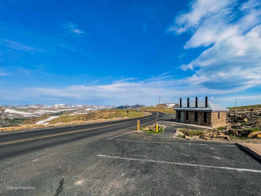
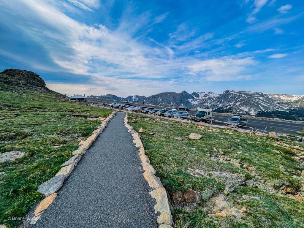
From the east, enter Rocky Mountain National Park on one of two roads: US34 or US36. Both roads head through Estes Park before splitting to their respective park entrances (Fall River and Beaver Meadows). Regardless of which route you use, the roads converge at the Tundra Communities trailhead for Deer Mountain and continue as US34 west. Continue driving until the Rock Cut overlook, in the middle of the alpine section of the road. There is ample parking, but due to the popularity of the trail, earlier is always better.
From the west, make your way to the town of Grand Lake and enter the park on US34. Once in the park, you’ll pass the picturesque Kawuneeche Valley before the road begins climbing up the mountainside. Drive by the Alpine Visitor Center and the Lava Tubes Overlook on your way to the Rock Cut. Find a place to park and take the well-signed, paved trail as it meanders north and then east atop a windswept ridge with 360-degree views.
Remember that Trail Ridge is a seasonal road, usually opening around Memorial Day each year and closing down after the first significant snowfall of the season, usually in September or October. Check the Trail Ridge road status here, or by calling 970 586-1222.
Endless skies above the trees.
Field Notes:
One of the most popular areas of Trail Ridge, the Toll Memorial Trail offers a quick, paved adventure into the alpine. The trail takes off from the Rock Cut overlook, very near the highest road point of Trail Ridge as it winds its way across Rocky Mountain National Park. Due to its short length and the wide variety of views in all directions, expect to share this trail with many people.
Because it is so high up in the park, the best weather option is to look at the Trail Ridge Alpine Center extended forecast. Another option is to check the forecast for Mt. Chiquita, one of three mountains lined up just north of the trail. Expect variable conditions (including snow in early June) and keep an eye out for afternoon thunderstorms. Although short, there is no good place to hide from lightning up here. Toll Memorial Trail is also notoriously windy, so make sure you have a warmer shell with you.
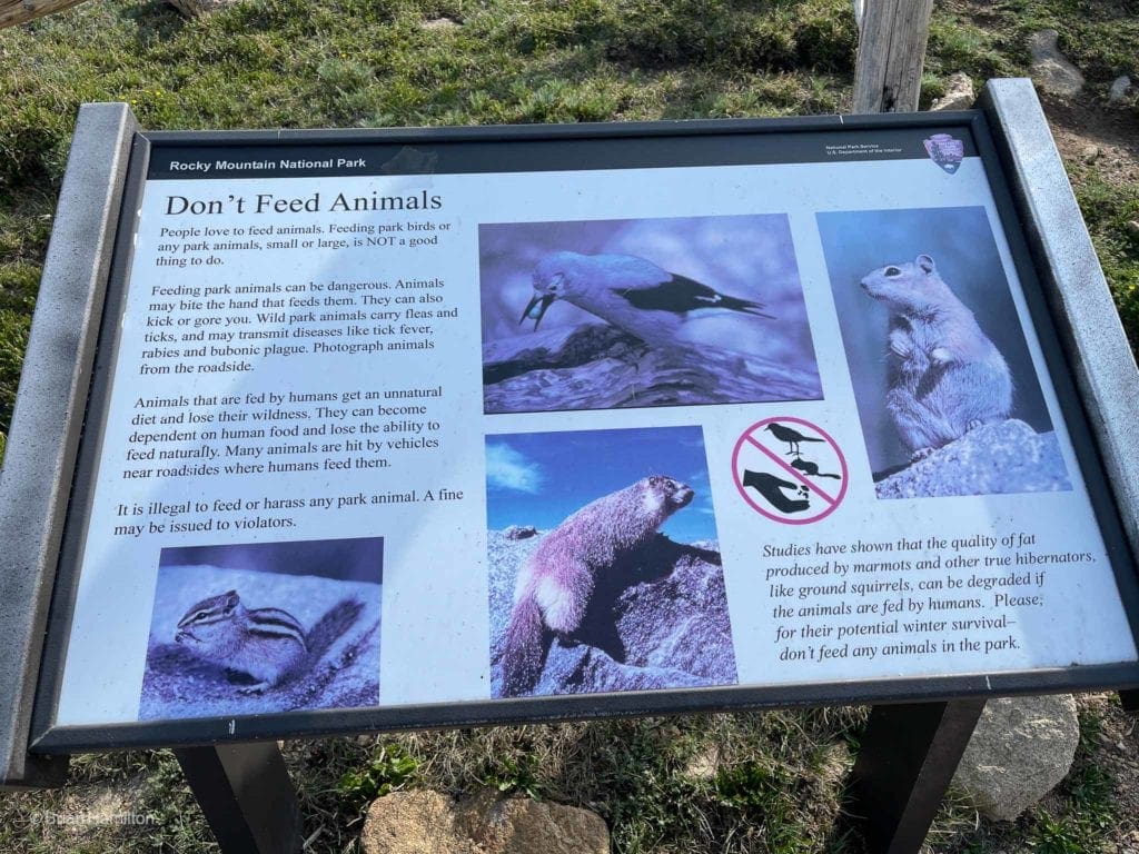
For people arriving from much lower home elevations, it’s also wise to check for the signs and symptoms of altitude sickness. While generally mild, altitude sickness can zap your strength, leave it hard to breathe, and give you a splitting headache. Since Colorado is also a fairly dry state, drinking more water than you usually do is always a good move.
The trail and the plaque at the end are named after Roger Toll. Born in Denver in 1883, Toll joined the National Park Service in 1919 and died in 1936. His legacy lies in superb firsthand investigations and reports on proposed areas to the park system. He was described by Horace Albright as having, “explored, photographed and described in reports most of the canyons of the Colorado from the headwaters in the Rockies to the California line.” Toll was instrumental in the creation of many stunning public lands that Americans enjoy today and remains a seminal figure in the early history of the National Parks and wildlands of the west.
Interesting rock formations grace the south side of the trail.
Places to Stay:
Camping near Rocky Mountain National Park will cost you. The options for free area camping are limited. On a positive note, there are plenty of options, and the National Park is within driving distance of Fort Collins, Boulder, and Denver.
- Estes Park: Known as the gateway to Rocky Mountain National Park, Estes sees nearly 80% of park traffic as opposed to the much quieter western entrance near Grand Lake. The town has a ton of lodging options.
- Grand Lake: Located near the sleepier western entrance, Grand Lake sits on the edge of the deepest natural lake in Colorado and within half an hour of two more lakes (Shadow Mountain and Lake Granby).
- Rocky Mountain National Park Camping
- Moraine Park Campground: $30 per site. $20 in winter. Established campground with perks, facilities, campfire grate, wood for sale in summer, and bear boxes to store food. Only loop B is open in the winter, and it’s first-come, first-serve.
- For summer, a reservation is needed way in advance to secure a spot.
- Glacier Basin Campground: $30 per site. Established campground with the same perks as Moraine Park. Reservation required.
- Backcountry Campsites: Rocky Mountain National Park has backcountry sites that you could book in advance. There is no open camping in the backcountry; it must be at designated backcountry sites. Please check the park website for more details. Backcountry sites require an overnight permit of $30.
- Camping near Estes Park
- Estes Park Campground at Mary’s Lake: Established campground, pricey $45-55. Good backup if other campgrounds are full.
- Hermit Park Open Space: $30 for a tent site, price increases if towing a trailer or for group spots.
- Estes Park Koa: Rates dependent on what you’re bringing with you but will run more than $50 a night in the busy season.
- Free or close to free: but a little farther (if you’re willing to drive)
- Ceran St. Vrain Trail Dispersed Camping ($1)
- County Road 47. Users have reported trash and ATV noise at this location, but it is free.
Journal:
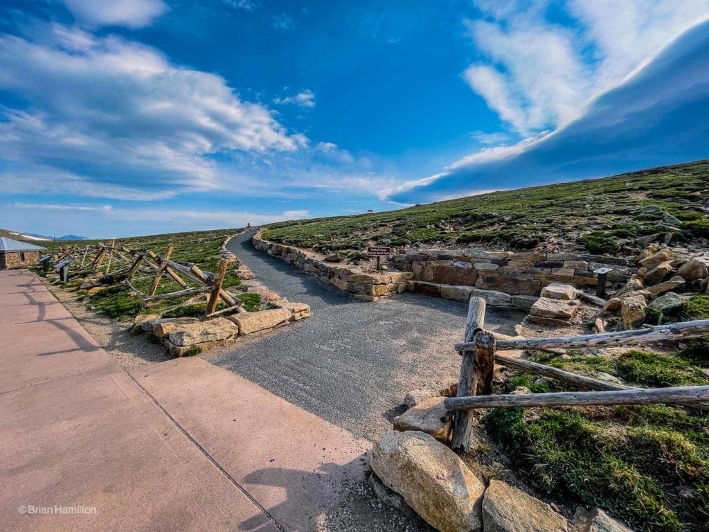
Once you’ve parked, find the well-marked trail and head north.
The parking lot alongside Trail Ridge.
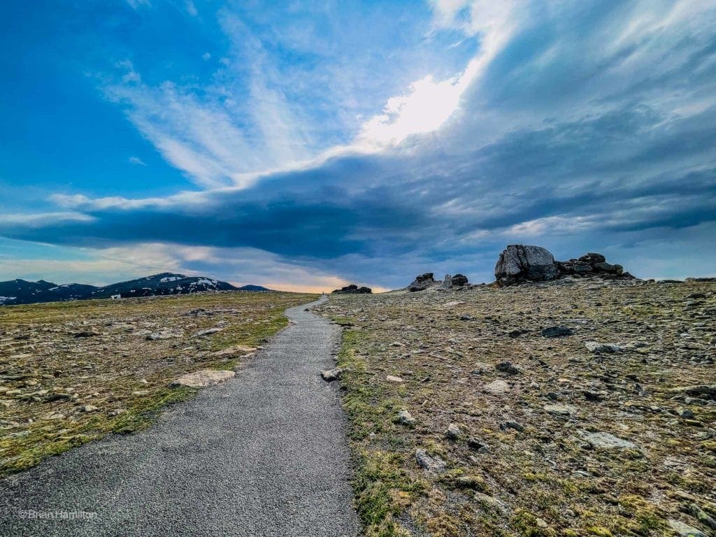
The path is easy to follow, and when snow-covered, contains hundreds of recognizable tracks, making it hard to lose. For most of the summer, it’s a paved path with oscillating retaining walls, wooden fences, and many informative signs about the alpine.
One of the many informative signs along Toll Memorial Trail.
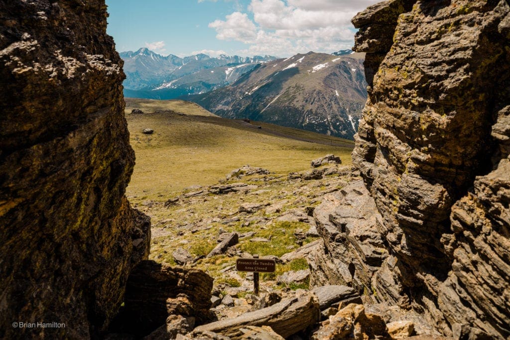
Make sure you stay on the path when able; the environment up here is very sensitive.
The start of the trail.
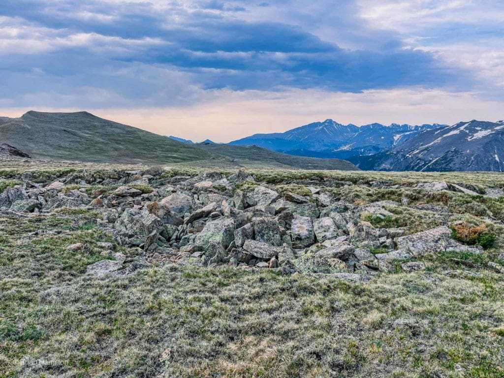
The trail is entirely above treeline and walks along a broad ridge with photo opportunities in all directions.
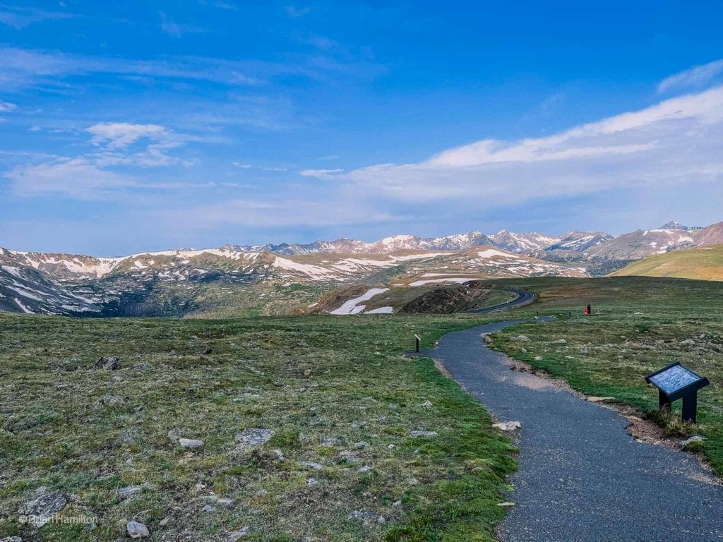
High alpine environment with the Never Summer Range in the far back.
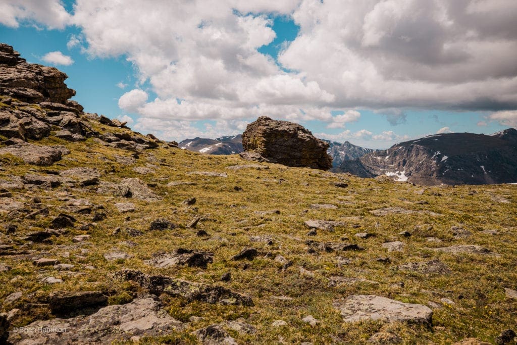
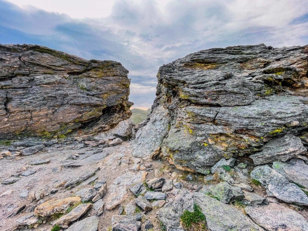
A little more than halfway into the walk, you’ll pass a cluster of rocks that look like mushrooms. There is a small spur trail leading up to them.
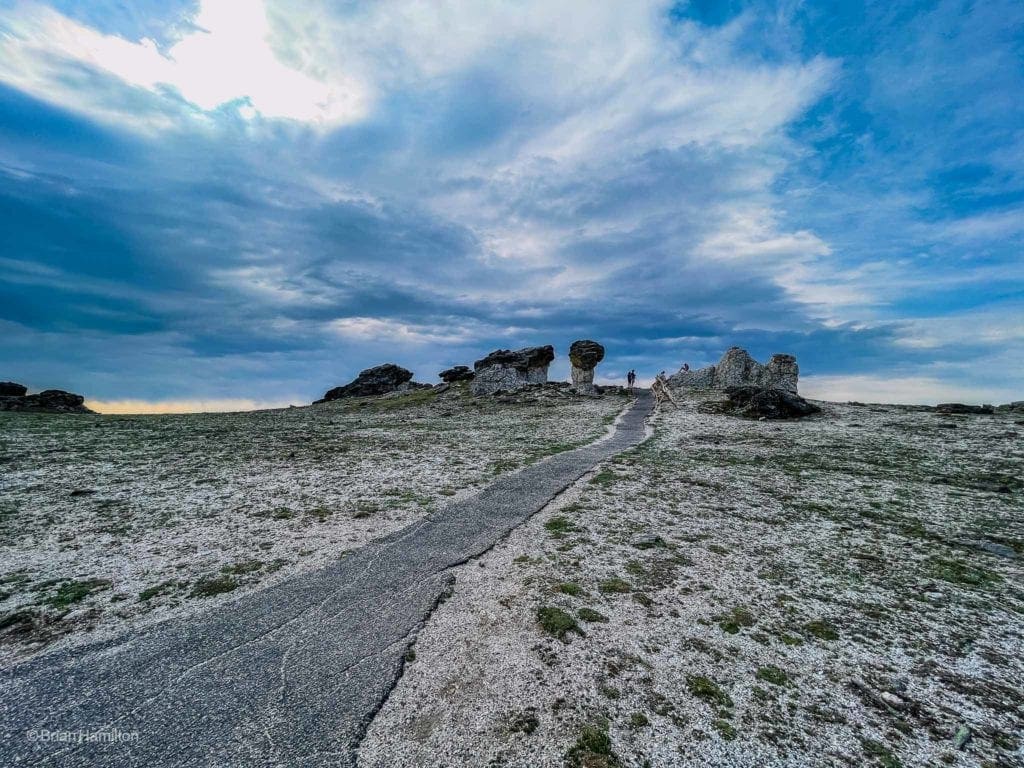
The Mushroom Rocks.
Once you pass this first cluster of rocks, the trail makes for a second cluster while offering beautiful views north to the Mummy Range
The Mummy Range poking out from behind the second cluster of rocks.
Views extend to the southeast as well, where the iconic shape of Longs Peak is hard to miss.
Longs Peak is the dominant summit to the southeast, dwarfing its lower neighbors.
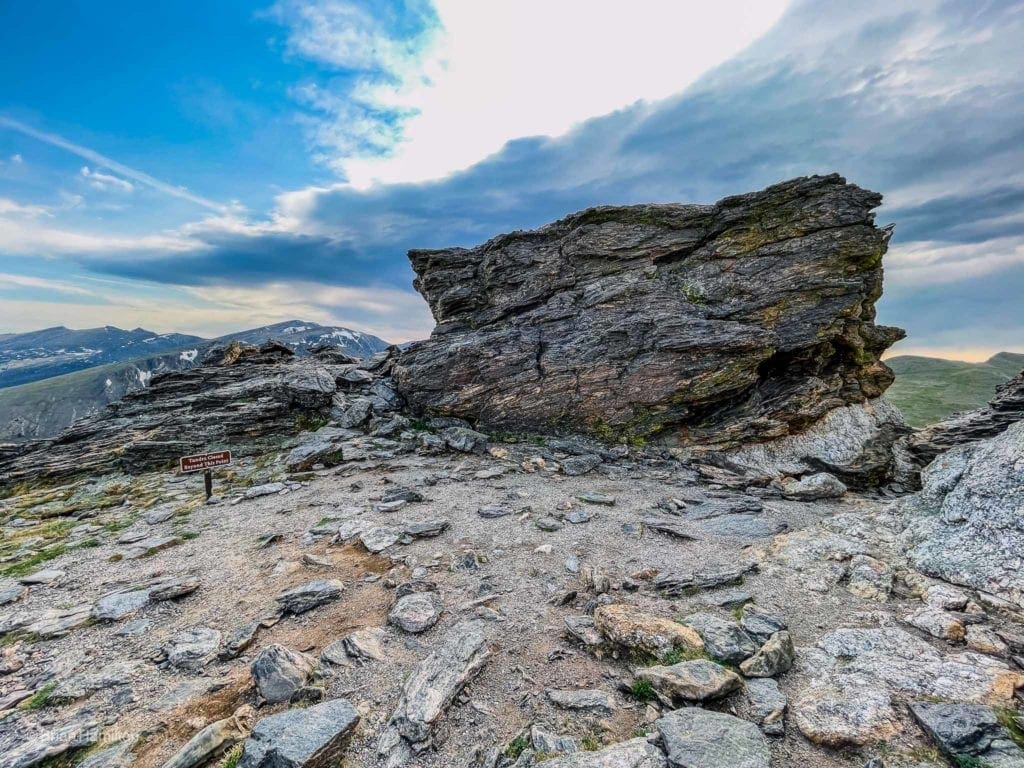
The paved path heads straight for the rocks and ends abruptly at their feet. If you’re ok with a bit of scrambling, once the trail approaches the rocks, the stack to your right has a Dial-looking plaque at the top with directions and mountain names on it. This is the actual Toll Memorial.
The memorial is on top of the rock to the right.
Take your time and enjoy the views. When the weather is good, the rocks at the end of the trail are a great place to soak up some sun. Earlier in the season, you may even see dedicated backcountry skiers ripping down the north face of Sundance Mountain. Retrace your steps to get back to your car.
Back to the parking lot with Mt. Ida and its Gorge Lake Neighbors in the distance.
Final Thoughts:
Located near the highest elevation of Trail Ridge road, the Toll Memorial Trail is a great alpine outing for individuals and families. The views are absolutely expansive, and keen eyes will be able to spot the Mummy Range to the north, the Never Summer Range to the west, Mt. Ida and the Gorge Lakes Peaks to the south, and Longs Peak to the southeast. Not only is the hike short in length and offers fantastic views, but it’s also paved, making it generally accessible to all. Remember to bring water and layers; altitude-sensitive people may also want to keep the signs and symptoms of altitude sickness in mind.
Popular Articles:
- Guide to the Best Hiking Trails in Rocky Mountain National Park, Colorado
- Skyblue Overland on Trail Ridge Road in Rocky Mountain National Park, Colorado.
- The Dyrt: The 10 Best Campgrounds In Colorado
- Top Adventure Sports Towns 2021: Boulder, Colorado
- Epic Adventures with the Best Guides In Colorado
- Bear Lake Nature Trail, Rocky Mountain National Park, Colorado
- Mills Lake via Glacier Gorge Trail, Rocky Mountain National Park, Colorado
- Black Lake Via Glacier Gorge Trail, Rocky Mountain National Park, Colorado
- Lake Haiyaha Trail, Rocky Mountain National Park, Colorado
- Sky Pond via Glacier Gorge Trail, Rocky Mountain National Park, Colorado

Skyblue Overland Strongly Recommends That You Enroll With Global Rescue Prior To Embarking On Your Next Adventure.
With more people outside now more than ever, Global Rescue expanded services to include field rescue within 100 miles of home. With Local Field Rescue — automatically included in any travel protection services membership — Global Rescue is there whether you’re hiking, kayaking, snowmobiling, fishing or simply enjoying the outdoors and get ill or injured and you’re unable to get to safety on your own. Purchase a Global Rescue membership for your next adventure and travel with peace of mind. Single trip, annual and family options are available.
Memberships start at $119.
Terms of Use:
As with each guide published on SKYBLUEOVERLAND.com, should you choose to this route, do so at your own risk. Prior to setting out check current local weather, conditions, and land/road closures. While taking a trail, obey all public and private land use restrictions and rules, carry proper safety and navigational equipment, and of course, follow the #leavenotrace guidelines. The information found herein is simply a planning resource to be used as a point of inspiration in conjunction with your own due-diligence. In spite of the fact that this route, associated GPS track (GPX and maps), and all route guidelines were prepared under diligent research by the specified contributor and/or contributors, the accuracy of such and judgement of the author is not guaranteed. SKYBLUE OVERLAND LLC, its partners, associates, and contributors are in no way liable for personal injury, damage to personal property, or any other such situation that might happen to individuals following this route.


