


|
Getting your Trinity Audio player ready...
|
The San Juan Skyway will take you on a journey through ranch country, Victorian era mining towns and ruins from past Ancient Puebloan settlements. Check out our Explorer’s Guide to the San Juan Scenic Byway, Colorado for all the highlights and places of interest along the way.
Rev up your vehicles and get ready to explore the US with our Explorer’s Guides. Get ready for some amazing road trips, from the rainforests of the Olympic Peninsula to the majestic mountain peaks of Colorado’s San Juan Mountains, all the way down to the Front Range and the desert wonderland featuring vibrantly-hued cliffs in Utah’s Capitol Reef country. For more reasons why you should hit the pavement, plus handy tips and interviews, be sure to check out our adventure travel coverage here.
Overview
The San Juan Skyway Scenic and Historic Byway is a 236-mile (380 km) All-American Road and National Forest Scenic Byway, running through Dolores, La Plata, Montezuma, San Juan, and San Miguel counties in Colorado. It circles the San Juan Mountains up to Red Mountain Pass at 11,018 feet (3,358 m). This area of southwestern Colorado includes Mesa Verde National Park, a UNESCO World Heritage Site, as well as two National Historic Landmarks: the Silverton Historic District and the Telluride Historic District.
The road follows closely the paths of the Rio Grande Southern (on US 160, SH 145 and SH 62) and the Denver & Rio Grande’s Ouray and Silverton Branches (US 550), connected by the Silverton Railroad. Its origin can be traced back to the “Around the Circle Route” planned by the D&RG.
The San Juan Skyway, a Colorado State Highway 145, overlaps with the Trail of the Ancients Scenic and Historic Byway between U.S. Highway 160 and Colorado State Highway 184. At Durango, this route connects with Tracks Across Borders Scenic and Historic Byway, while it crosses with Alpine Loop Back Country Byway at Silverton and Ouray and Unaweep Tabeguache Scenic Byway at Placerville.
The San Juan Skyway loop offers a combination of magnificent landscapes, thrill-inducing motorists routes, centuries-old communities and ruins that make it an essential drive for fans of the American Road. You could begin your journey at any of the places I’ve listed here, or you could travel in reverse. I recommend driving clockwise starting from Durango; however, if you would prefer to have a less thrilling experience on the Million Dollar Road, go counterclockwise.
The San Juan Skyway is a popular destination throughout the year, but it’s especially sought out in the fall when aspen trees are aglow with their stunning golden foliage. The entire route will take you 6 to 7 hours.
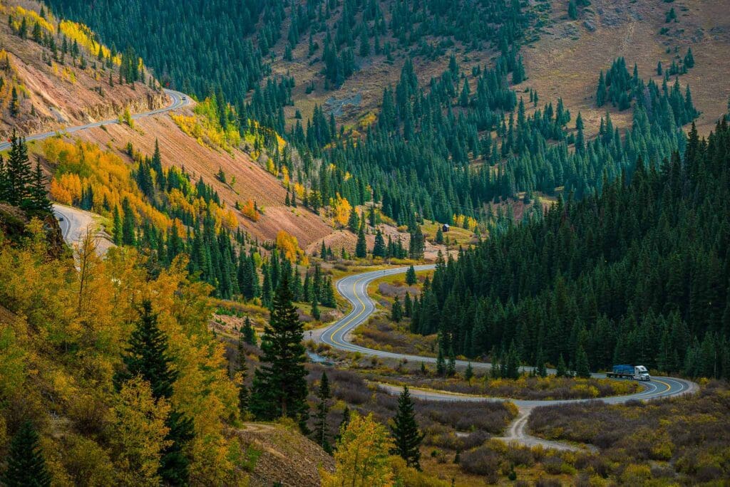
Scenic autumn landscape by Million Dollar Highway near Ouray, Colorado.
Table of Contents:
Article Navigation: Click on any of the listed items in the table of contents below to jump to that section of the article. Similarly, clicking on any large, white section header will jump you back to the Table of Contents.
- Overview
- Durango
- Animas River Valley
- Silverton
- Million Dollar Highway
- Ouray
- Ridgway
- Black Canyon of the Gunnison National Park
- Dallas Divide
- Telluride
- Lizard Head Pass
- Rico
- Dolores
- Mesa Verde National Park
- Mancos
Durango
The Denver and Rio Grande Railroad built Durango, Colorado in 1880-81 to reach Silverton and the San Juan mining district. The city was named after Durango, Mexico at ex-Governor Alexander C. Hunt’s suggestion, as a result of his scouting trip for D&RG President William Jackson Palmer.
Durango’s downtown offers three historic hotels, dozens of restaurants, and plenty of drink options. Steamworks Brewing has a large space with brews and food. Derailed Pour House serves southwest cuisine with live music and outdoor seating. Ore House celebrates Colorado mining with steaks and seafood, while El Moro Tavern’s eclectic menu is served in a warm space. Carver Brewing is the second-oldest brewpub in the state and serves great pub food, and East by Southwest offers sushi and steaks on College Drive. Ska Brewing’s Modus Mandarina beer is brewed with orange peel. Relax outdoors at their container kitchen patio.
The San Juan National Forest’s two million acres of land are just begging to be explored in Durango. With only an hour drive from the historic downtown, you can find superb mountain biking, road biking, hiking and trail running, Class 1-5 whitewater rafting, downhill skiing, backcountry skiing, backpacking and off-roading opportunities. For an unforgettable journey in Durango, consult our helpful travel guide.
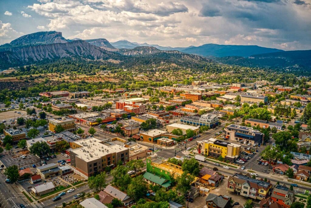
Aerial View of Durango, Colorado in Summer.
Durango is famous for its historic Durango and Silverton Narrow Gauge Railroad, which goes between Durango and Silverton. The locomotive used to transport the valuable minerals, but now it carries travelers. If one wishes to explore the wilderness, they can use the train as a ride both ways to their starting and ending points, leaving their car behind in either Durango or Silverton.
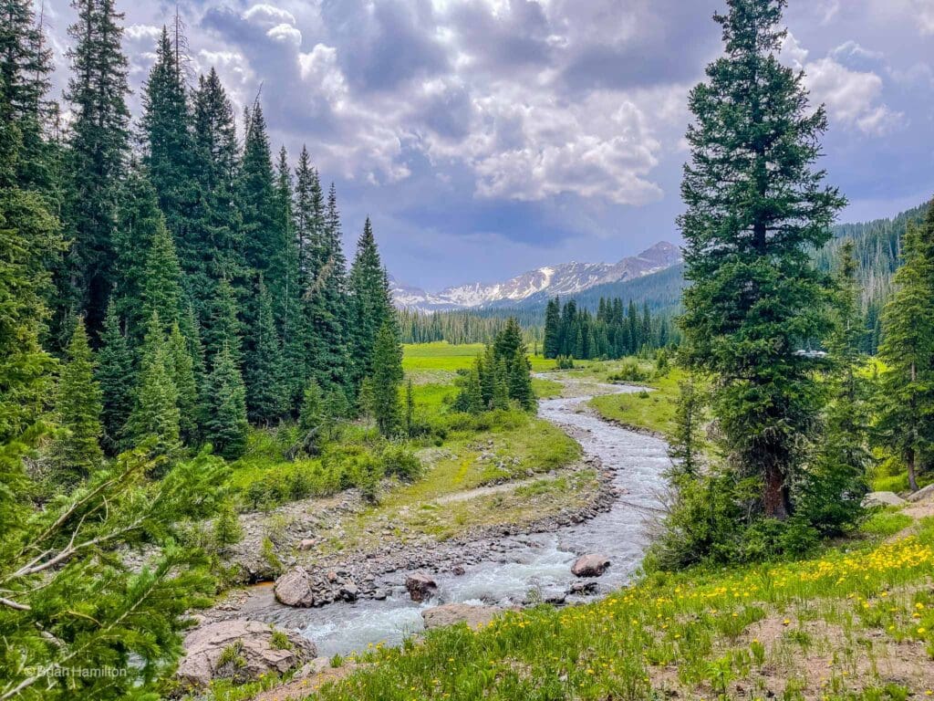
Animas River Valley
As you leave Durango, the state highway (Route 550) follows the same course as the old railway line running from Durango to Silverton. The drive meanders past green meadows shared by cattle and red-rock cliffs that border the valley.
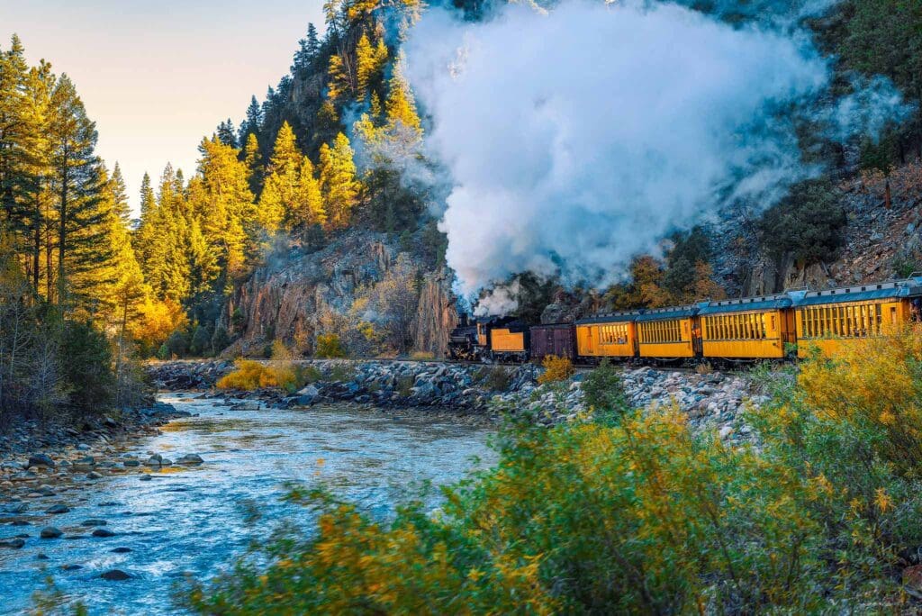
Historic steam engine train travels from Durango to Silverton through the San Juan Mountains along the Animas River in Colorado.
At higher elevations, you arrive at Purgatory, a cozy ski resort where Hollywood stars are rarely found. Its no-frills spirit is summed up in its advertising slogan: “No Movie Stars Here!” The name Purgatory comes from a witty farmer who lived in the area during the late 1800s and adopted the moniker for a nearby creek, a tributary of the Rio de las Anima Perdidas (the River of Lost Souls), dubbed by Spanish explorers for a group who disappeared on the river during Durango’s early history.
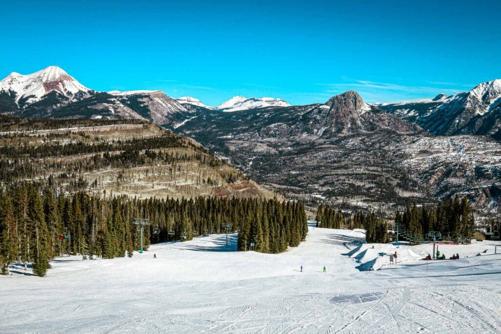
Ski run at Purgatory near Durango, Colorado.
The San Juan Mountains in southwestern Colorado are an impressive sight, with volcanic peaks that reach heights of 13,000 feet. Glaciers carved this landscape over two million years, leaving behind chasms, meadows and tall ridges. Volcanic eruptions had their part in the intricate design as well, pouring out lava and ash throughout the area. Deposits of gold, silver, lead, copper, zinc and other minerals nestled amid the terrain offered a huge financial bounty to those who were brave enough to harvest them.
On the way to Silverton, the road snakes up to Molas Pass at 10,910 feet. The views are spectacular up here, with mountain peaks and ridges spilling down into a canyon bowl and Molas Lake shining like a turquoise gem. This is one of the highest passes in Colorado but luckily still navigable in the winter due to only having a few hairpin turns on the northern approach.
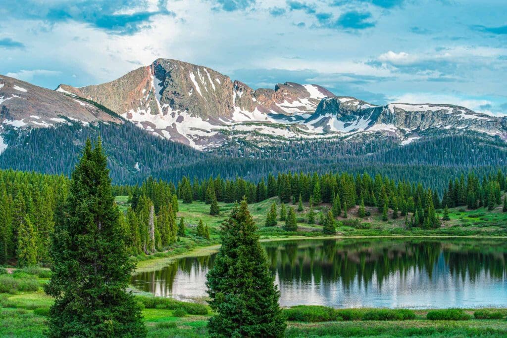
Little Molas Lake in the San Juan Mountains, Colorado.
Silverton
The skyway steeply descends into the aesthetically pleasing town of Silverton, nestled between towering mountain walls. According to local folklore, a miner once declared, “We may not have any gold here, but we do have a ton of silver.” Henceforth, the town was named Silverton.
Originally named “Bakers Park”, the town of Silverton is nestled in a flat stretch of the Animas River valley, surrounded by formidable mountains. The tallest peak, Storm Peak, looms at 13,487 feet, while 7 out of Colorado’s 53 fourteeners lie within 15 miles of the town. Silverton has established itself as one of the main gateways into the Colorado wildlands.
The streets of Silverton are lined with historical monuments, like the gold-domed county courthouse. There are also once grandiose hotels, such as the Grand Imperial, and a former red light district which locals use for mock gunfights during summer nights. On top of Hillside Cemetery nearby, headstones commemorate young men who lost their lives in mining accidents.
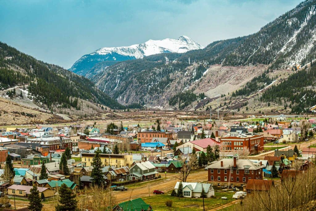
Silverton, Colorado
Million Dollar Highway
The skyway starts in Silverton, and eventually traverses up Red Mountain Pass. This is the highest spot on the skyway, soaring at 11,018 feet above sea level. Red Mountain Pass is the border between Ouray and San Juan counties. It was named for the sloping, iron oxide-ridden Red Mountain nearby. At the same time, it serves as a divider between two watersheds: Uncompahgre and Las Animas Rivers, and two national forests: Uncompahgre and San Juan.
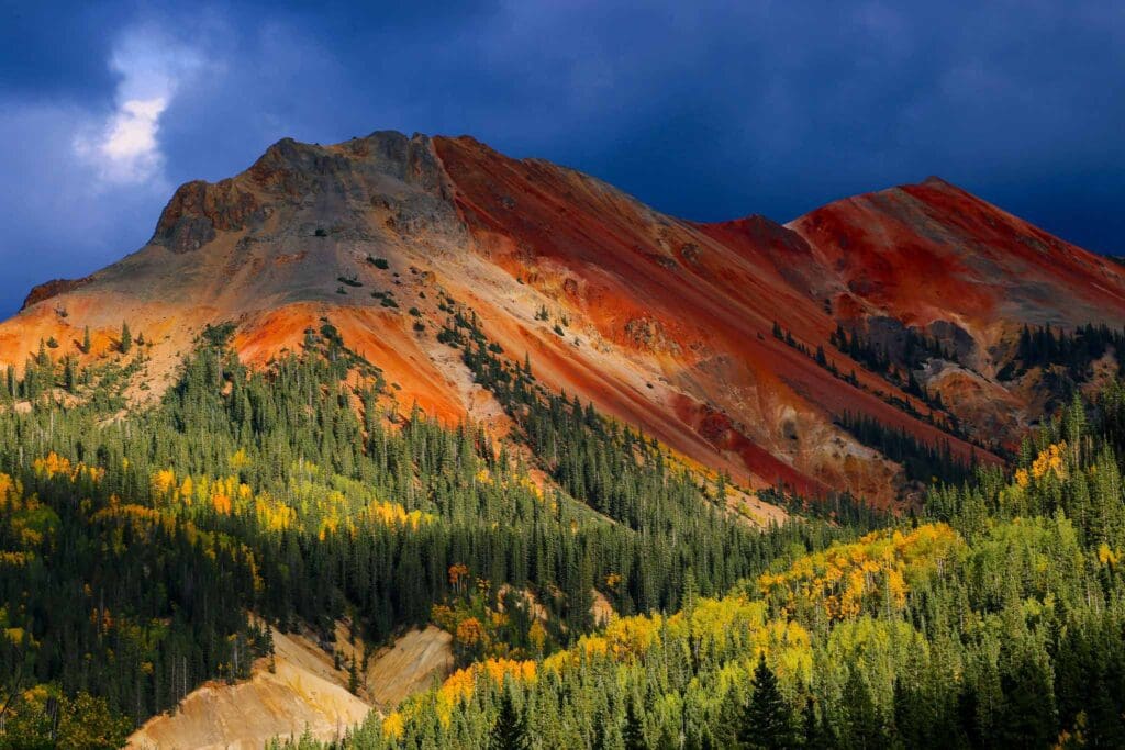
Red Mountain Pass
The road that connects Silverton and Ouray is called the Million Dollar Highway. Built between 1880 and 1920, it was once used for mail, stagecoaches, and freight transportation. Depending on who you ask, the highway got its name from either the wealth of gold and silver mined nearby, the value of the ore tailings used to build the roads, or because of how much it cost to construct. Some even say it’s due to the breathtaking views.
Million Dollar Highway
Drivers should pay close attention while navigating this twisty two-lane highway, surrounded by spectacular mountain views but without the protection of guard rails. From November to May, up to four feet of snow can drop in a single day in what is avalanche country. During extreme weather, the road may be temporarily closed and explosives are used to release the snow buildup. A rumble like thunder signals that an avalanche is happenings somewhere nearby – taking with it anything that gets in its way.
Ouray
As you drive down to Ouray, the highway bends and winds its way through tunnels cut through solid stone, skirting the crumbling remains of ancient mines. Every few moments, you can glimpse waterfalls tumbling from concealed heights.
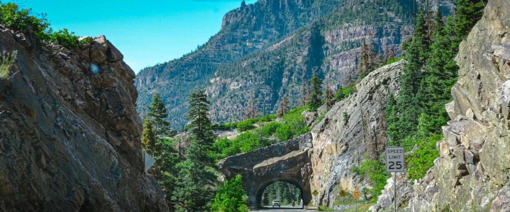
Million Dollar Highway Passes Through a Tunnel in the San Juan Mountain Range just South of Ouray, Colorado.
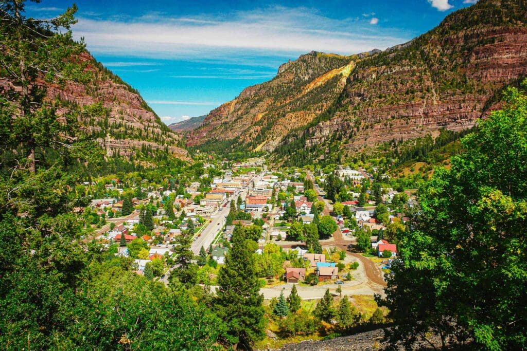
Nestled in a tight, steep-walled valley, Ouray and its surroundings have earned the nickname “America’s Switzerland.” Its narrow streets are lined with hotels and shops that evoke a Victorian charm. Visitors stroll through these cozy lanes on their way to the public hot springs pool, sending plumes of steam into the air as they indulge in the waters healing properties. The snowcapped peaks loom overhead, completing the picturesque view.
Ouray, Colorado.
At Box Canyon Falls and Park, the powerful current of Clear Creek rushes down a deep, narrow ravine for 285 feet. There is a steel suspension bridge spanning the distance, along with clearly marked paths that lead to superb views.
Box Canyon Falls Park in Ouray, Colorado.
Ouray is a paradise for mountain lovers, boasting stunning beauty and plenty of outdoor activities. In summer, hikers and 4x4ers will find countless trails to explore. When winter comes, Ouray becomes a mecca for ice climbers. For a successful adventure in Ouray, read our travel guide.
Good To Know: If you’re heading out for some hiking in the San Juan Mountains, see our guide to the best trails in Colorado for a few of our favorites, including Ice Lake Basin, Columbine Lake, Engineer Mountain, Courthouse Mountain, and Uncompahgre Peak. Coloradans often wax poetic about the San Juan Mountains and it’s easy to see why.
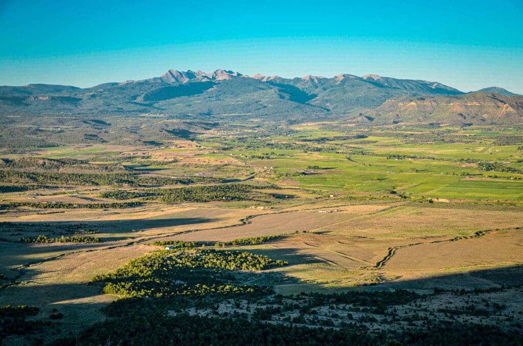
Ridgway
After departing Ouray, the byway curves away from the San Juan Mountains and into a vast valley where deer and elk wander in lush meadows. Turning onto Route 62, the route rolls gently toward Ridgway.
Ridgway is surrounded by steep mountains and cliffs on three sides. The Uncompahgre River and Dallas Creek both flow through the town, with the latter joining the former in Ridgway State Park & Reservoir. It’s home to a variety of wildlife—mountain lions, badgers, deer, elk, bears, coyotes, wild turkey, and bald eagles. The only stoplight is at the intersection of Highways 550 & 62.
Over looking the Ridgway Reservoir and snow-capped San Juan Mountains in Ridgway State Park, Colorado
A while ago, I visited this area and camped for a couple of days at the nearby Owl Creek Pass and did some hiking (see my trip report). there are some great camping spots exist along the West Fork of the Cimarron River, but you need to practice leave no trace principles to keep the area beautiful. Chimney Rock is a pillar that stands at 11,781 feet (3,591 meters) above sea level and is located 10.5 miles east of Ridgway and just south of Owl Creek Pass, which lies within the Uncompahgre Wilderness. See our trail guide to the Courthouse Mountain Trail for epic views of the valley and Chimney Rock. It’s one of the best trails in Colorado.
The gorgeous West Fork of the Cimarron River near Owl Creek Pass, Colorado. Photo: Brian Hamilton
In the 1969 western movie True Grit, starring John Wayne, Chimney Rock was featured in Rooster Cogburn’s grand shootout. It is also seen in How the West Was Won from 1962, when Gregory Peck attempted to pull a wagon stuck in mud.
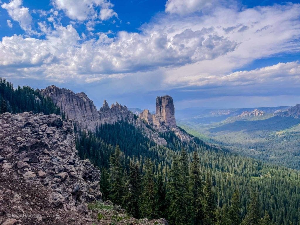
Connected to Courthouse Mountain via a serrated and crumbly ridge, Chimney Rock bookends the entire massif. Photo: Brian Hamilton
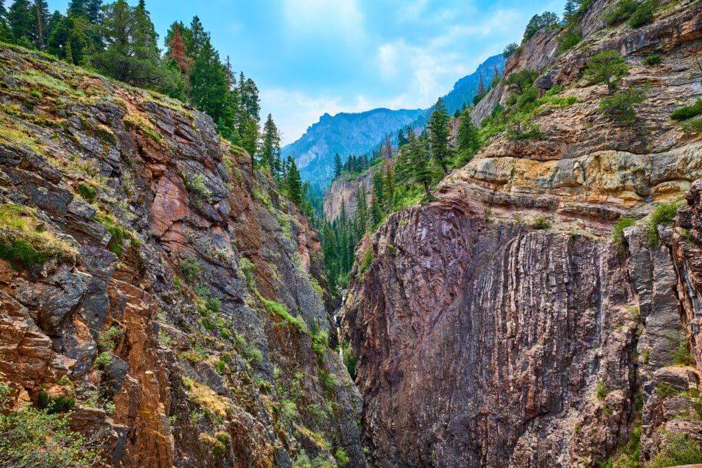
Black Canyon of the Gunnison National Park
If you can manage a side trip, travel north on Route 550 to Montrose and turn east onto the 50 until you reach 347 which will take you straight to Black Canyon of the Gunnison National Park. This mighty gorge was carved over two million years by the unstoppable force of the Gunnison River. The dark, charcoal-gray walls are often cast in shadows from dawn till dusk, hence the name. One of its most impressive features is Painted Wall, a 2,200-foot behemoth that towers above all other cliffs in Colorado. If you’re interested in exploring this area further, we invite you to consult our Adventurer’s Guide to Black Canyon of the Gunnison National Park for more details on all the great spots to visit. See my photo essay from all the overlooks and trails on the south rim.
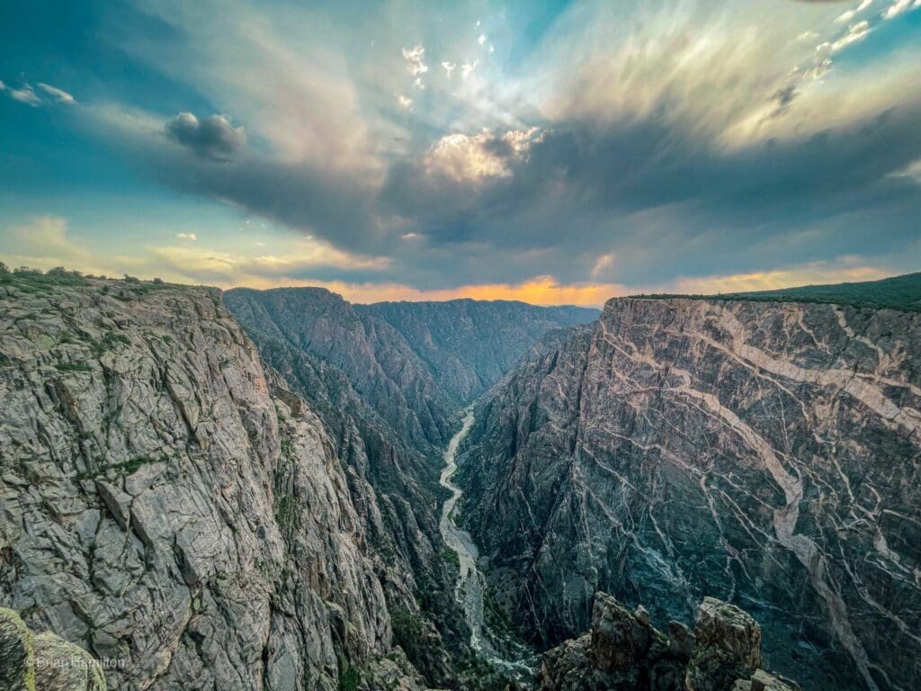
The Painted Wall at sunset. Photo: Brian Hamilton
Dallas Divide
Starting from Ridgeway, Route 62 heads westward across expansive ranch lands dotted with cows and passing by the Double RL ranch, owned by the Ralph Lauren family. As you go along the road it begins to climb up into an area of scrub oaks and aspen trees before entering a land filled with spruce trees on the Dallas Divide. You can admire the view from there of the Mount Sneffels Wilderness, made up of many high jagged peaks topped with snow—all under the gaze of the 14,150-foot Mount Sneffels (named after a mountain in Jules Verne’s novel Journey to the Center of the Earth).
Good To Know: The RRL fashion line, or “Double RL”, created by Ralph Lauren, brings the allure of the Wild West to its stylish clothing. It is named after the Lauren family’s historic ranch near Ridgway, Colorado located along the San Juan Skyway.
Descending from the top of the Dallas Divide, the highway winds its way through cottonwood forests to Placerville, a little town off Route 145. After meandering for several miles, it then curves eastward towards Telluride.
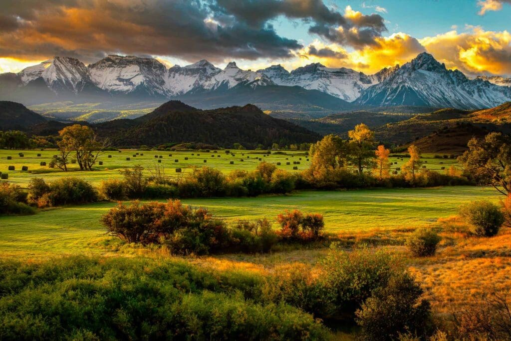
Sunrise on a ranch near Ridgway, Colorado with views of the Dallas Divide and the Mount Sneffels Wilderness.
Telluride
In Telluride, one feels transported to the pages of a fairytale. The cobblestone roads and quaint architecture suggest a turn-of-the-century charm. You will find yourself surrounded by a rainbow of clapboard houses and brick buildings in the center of town, with mountains rising up dramatically just beyond. In springtime, these peaks are especially gorgeous, as they give way to tumbling waterfalls.
Established as a precious-metal mining town in the late 19th century, Telluride is located in a picturesque canyon surrounded by the San Juan mountains. The gondola provides easy access to Mountain Village, which sits just over the mountain top from Telluride. With its breathtaking scenery, Telluride became a popular ski destination for Coloradans and out-of-state visitors alike. A popular phrase sums up the draw of the area: come for the winter, stay for the summer. Indeed, Telluride offers much to do during the warmer months too.
For an unforgettable trip in Telluride during the winter season, check out our winter travel guide for all the details.
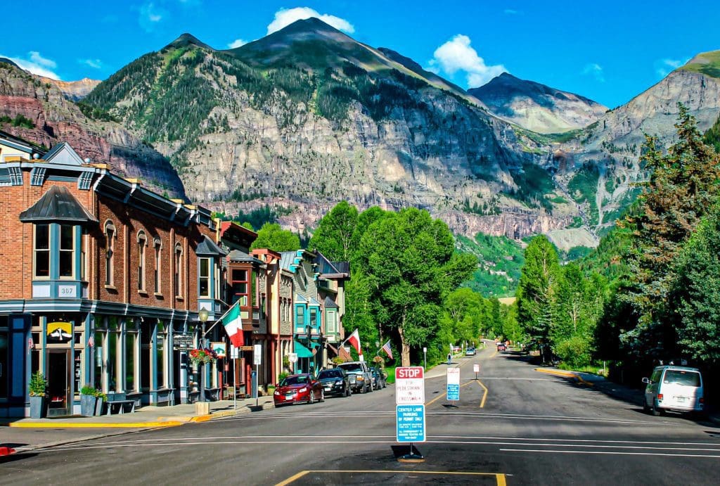
An extremely walkable town, Colorado Avenue – the main street through Telluride is less than a mile long and roughly half a mile wide.
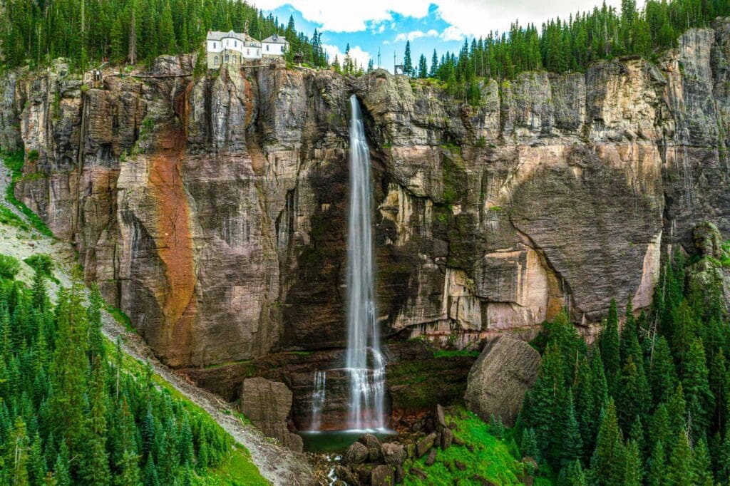
If you’re visiting Telluride and have some free time, a great side trip to make is a two-hour round trip hike to Bridal Veil Falls. The waterfall makes for an incredible sight, just as it tumbles over its 425-foot cliff and creates rainbows along the way—the longest drop of any Colorado waterfall.
Bridal Veil Falls – Telluride Colorado.
Lizard Head Pass
Backtracking the route from Telluride to Route 145 south, you’ll travel over expansive plateau grasslands surrounded by aspen groves. Wilson Peak and Sunshine Mountain lay in the southwest, with patches of blooming lilies scattered all around. Listen closely to the snow, and you may hear the gurgling of trickling mountain streams that periodically pass through.
Further along your journey, you’ll come across the old town of Ophir, picturesque Trout Lake, and a campground with an impressively mountainous name – Matterhorn.
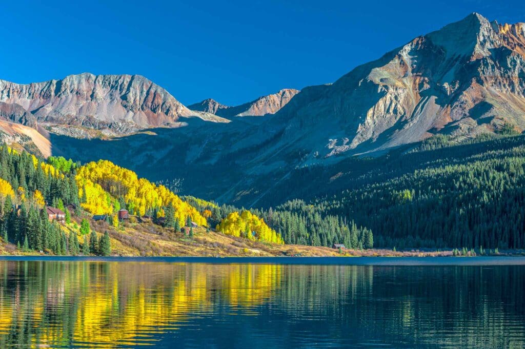
Trout Lake, Colorado.
Rising up from the valley of Ophir, the road begins to climb to Lizard Head Pass – an area 10,222 feet above sea level that was named for a rocky outcropping resembling a lizard head. Like so many other mountain passes, Native Americans have been traversing this stretch of land for thousands of years. Highway markers remind travelers that the Rio Grande Southern Railway used to run through here until 1952.
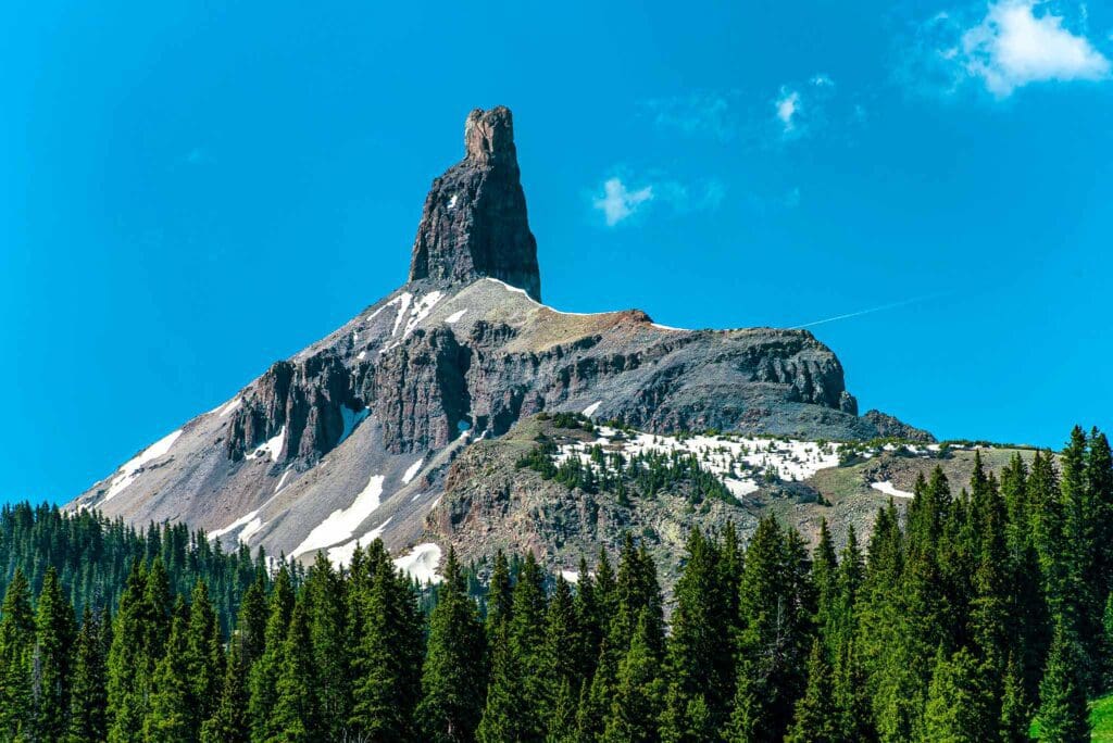
Lizard Head, 13113′ MSL is the landmark of LIzard Head Pass.
The skyway winds its way through a glacier-filled valley, where beaver dams dot the landscape, before reaching the small town of Rico several miles later.
Rico
Named after the Spanish term for “rich,” this once prosperous mining town is populated with old Victorian brick and stone structures from the late nineteenth century. In 1879, it was established as a center of silver mining in the Pioneer Mining District; today those structures attract tourists who come to admire its history.
The next 30 miles or so past Rico, the skyway hugs the banks of the Delores River as it winds its way through a valley dotted with aspens and cottonwoods.
Dolores
Dolores is a picturesque town situated atop McPhee Reservoir, a popular recreation destination as well as the site of historical Anasazi settlements. At the Anasazi Heritage Center, visitors can view artifacts from excavations that were done before the gorge was submerged in water. Located on a hill overlooking Montezuma Valley off Route 145, it also has an open-air museum with 25-room ruins and a reproduction of an Anasazi-style pit house.
As we drive away from the ranches and farms, we come to the bustling town of Cortez. The breathtaking desert landscapes are backed up by the La Plata Mountains and Mesa Verde National Park.
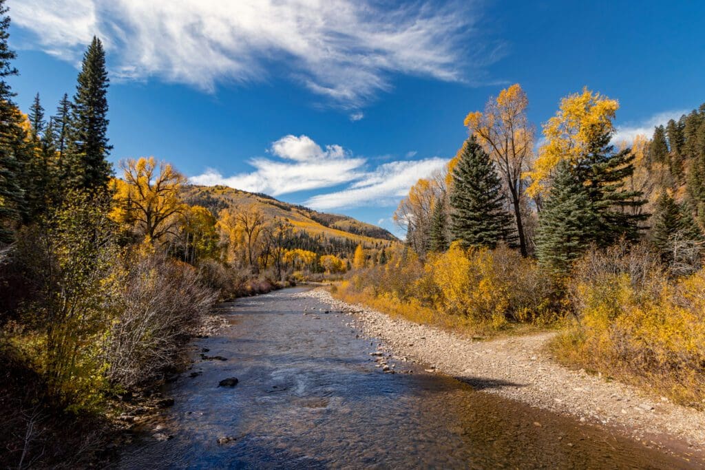
On the Dolores River near Dolores, Colorado in autumn.
Mesa Verde National Park
For more than seven centuries, the Anasazis (“the ancient ones,” which is English for Anasazi, the name given to the Ancient Puebloan people by the Navajos) have inhabited the cliff dwellings in and around Mesa Verde. Even though they are no longer there, when visitors spin away after the autumn chill and snow starts falling on distant mountains, you can almost feel their presence.
Mesa Verde will take you back in time to when the Ancestral Puebloans lived among the cliffs and rocky mesas for 700 years. The Mesa Verde plateau was home to the ancient Pueblo peoples from the 6th to 12th centuries. Researchers have discovered over 4,000 archaeological sites, with many of them being cliff dwellings.
The grandest of all sites is the Cliff Palace, boasting an impressive 150 rooms. It’s breathtaking to admire from a distance, but even more exciting to ascend the wooden ladders and explore its myriad chambers during a guided tour by a knowledgeable ranger. Visitors can also take led tours of Balcony House and Long House. There are also roads and paths leading to other mesa villages-allowing visitors to explore the area up close.
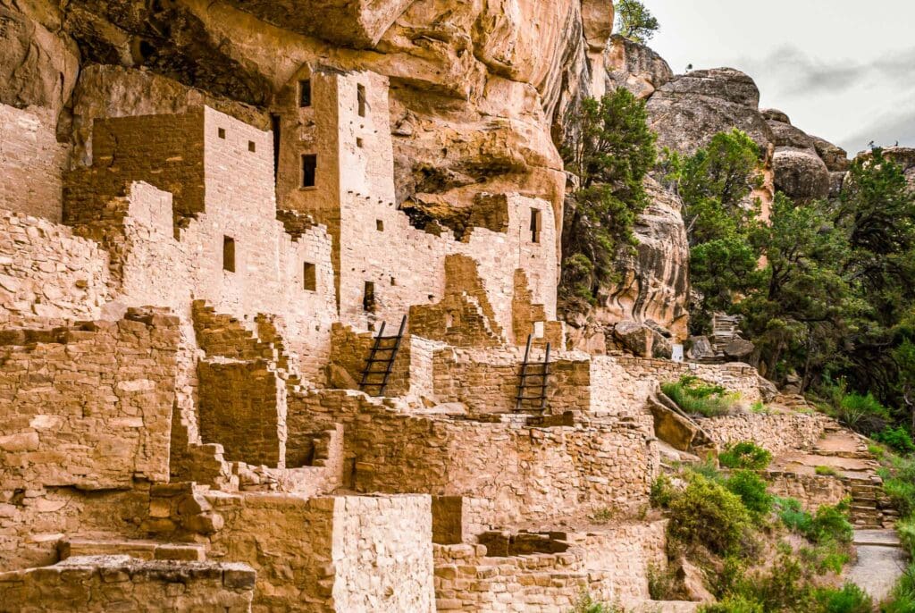
Cliff Palace at Mesa Verde National Park, Colorado.
The sprawling ruins were so remote from any civilization that they weren’t discovered until the 16th Century when the Navajo happened upon the abandoned villages. Later in the 19th Century, Anglo-Americans started to hear about the wonders of the mesa and began entering on their own. Widespread destruction and looting followed.
It was 1888 when two ranchers, Richard Wetherill and Charlie Mason, ventured out on a search for their lost cattle during a snowstorm. To their surprise, they stumbled across an incredibly well-preserved cluster of dwellings, Cliff Palace, which had housed more than 200 people in its prime. The day after that discovery, they stumbled upon Spruce Tree House and Square Tower House. The former was so named for the spruce tree that stood nearby while the latter was distinguished by its towering structure.
The Chapin Mesa Archaeological Museum is built from the same sandstone used to make Cliff House dwellings. Inside, it displays objects that tell stories about how life was lived here in ancient times. The design of the museum takes its cues from Modified Pueblo Revival architecture, which draws inspiration from the descendent communities of Mesa Verde.
The Puebloan people left modern-day Colorado in the late 1280s. The reasons behind the Ancestral Puebloans’ relocation remain a mystery. Some experts believe it was due to climate change during the 13th Century that caused severe drought in the region, leading to crop failure. It is believed that they headed south to join existing Pueblo communities in New Mexico and Arizona, where their descendants live today. The cliff dwellings that were left behind by the Puebloans are some of the most notable and best-preserved in all of North America.
The majestic sandstone cliffs of Mesa Verde, an archeological wonder and UNESCO World Heritage Site, attract visitors from near and far. Its secret dwellings from the ancient Puebloan people await to be discovered. For a truly remarkable pilgrimage to Mesa Verde National Park, consult our Adventurer’s Guide for further information.
Mancos
Heading east from Mesa Verde National Park, you’ll find the town of Mancos nestled in a verdant valley, an oasis that evokes the spirit of the Old West. Not far away stands Mancos State Lake, whose camping ground is surrounded by tall ponderosa pines; it’s a perfect place for boating and fishing.
Mancos Valley.
Journeying east, the highway winds through vast ranch land and fragrant sagebrush fields to Cherry Creek, the area where Louis L’Amour wrote his popular western novels set in southwestern Colorado. These wide open expanses continue until Durango, where the skyway begins. You will be enticed by the panoramic views of the San Juan Mountains, likely tempted to drive the entire route from west to east.

Enroll With Global Rescue Prior To Embarking On Your Next Adventure.
When a travel emergency arises, traditional travel insurance may not come to your aid, and a medical evacuation can cost up to $300,000.
The cost when you have a Global Rescue membership? $0. That’s why when the unexpected happens, you want the leader in rescue, evacuation and medical advisory behind you. You want Global Rescue.
Popular Articles:
Guide to the Best Hiking Trails in Rocky Mountain National Park, Colorado
The Dyrt: The 10 Best Campgrounds In Colorado
Top Adventure Sports Towns 2021: Boulder, Colorado
Epic Adventures with the Best Guides In Colorado
The Dyrt: The Best Camping Near North Cascades National Park
Terms of Use:
As with each guide published on SKYBLUEOVERLAND.com, should you choose to explore one of these routes, do so at your own risk. Prior to setting out check current local weather, conditions, and land/road closures. While taking a trail, obey all public and private land use restrictions and rules, carry proper safety and navigational equipment, and of course, follow the #leavenotrace guidelines. The information found herein is simply a planning resource to be used as a point of inspiration in conjunction with your own due-diligence. In spite of the fact that this route, associated GPS track (GPX and maps), and all route guidelines were prepared under diligent research by the specified contributor and/or contributors, the accuracy of such and judgement of the author is not guaranteed. SKYBLUE OVERLAND LLC, its partners, associates, and contributors are in no way liable for personal injury, damage to personal property, or any other such situation that might happen to individuals following this route.


