


|
Getting your Trinity Audio player ready...
|
With a breathtaking elevation, venture on Trail Ridge Road, America’s highest paved road. With nearby peaks towering over 14,000 feet, buckle up for a wild ride through the alpine tundra!
Buckle up and embark on thrilling road trips through the US with our Explorer’s Guides. Discover lush rainforests in the Olympic Peninsula, towering peaks in Colorado’s San Juan Mountains, and vibrant desert landscapes in Utah’s Capitol Reef country. Unleash your inner adventurer and check out our coverage for tips and interviews.
Overview
Experience the thrill of a lifetime on Trail Ridge Road and Beaver Meadow Road, where the untamed beauty of Rocky Mountain National Park unfolds before your eyes. Brace yourself for the highest paved road in America as you journey through rugged alpine landscapes and catch glimpses of majestic peaks and abundant wildlife. With an elevation reaching 12,183 feet, this All-American Road and Colorado Scenic Byway is not for the faint of heart. And for those seeking even more excitement, the connecting 6.9-mile Beaver Meadow Road will provide an unforgettable adventure.
This winding byway stretches 110 miles through Larimer and Grand counties in Colorado, beginning in Estes Park and ending at the headwaters of the Colorado River in Grand Lake.
Experience the stunning alpine landscape of Rocky Mountain National Park on this short but epic route. During summer, colorful wildflowers cover the ground, while winter brings a blanket of snow over the majestic peaks visible in every direction. And with various wildlife roaming through meadows and scaling cliffs, there’s no telling what animals you may spot along the way. So buckle up and get ready for endless vistas of towering mountains, serene valleys, and shimmering lakes on this exhilarating cliffside highway. Just be sure to plan your trip wisely, as the higher portion of Trail Ridge Road is closed from October to May due to treacherous winter conditions.
The scenic route begins in Estes Park and crosses over the Continental Divide, ending at the headwaters of the Colorado River in Grand Lake. One notable stop along the way is Longs Peak Flat, standing at an impressive 14,259 feet and serving as the highest peak in Rocky Mountain National Park. A small nature trail leads to Enos Mills Cabin Museum where visitors can learn about the naturalist who played a key role in establishing the park. Nearby is the Stanley Museum, dedicated to showcasing revolutionary steam cars and honoring F.O. Stanley, inventor of the Stanley Steamer automobile. As you continue through the area towards the park, take a moment to visit Fall River Visitor Center for useful information about the surrounding wildlife.
Further into Rocky Mountain National Park lies West Horseshoe Park, known for its diverse array of wildlife, and Old Fall River Road, the first road that crossed over the Continental Divide. This scenic route takes you through Chasm Falls and Fall River Pass. After passing Horseshoe Park Overlook, the road winds up through a series of turns and viewpoints. Along the way, there is a boardwalk where beavers can be spotted in their natural habitat.

View of the Alpine Visitor Center at Fall River Pass from the old Fall River Road in Rocky Mountain National Park, Colorado.
In addition, efforts to reintroduce greenback cutthroat trout have saved the lakes from near extinction. As you continue to ascend above sea level, sub alpine forests start to dominate the landscape with aspen and ponderosa pine trees scattered throughout. Approaching the treeline, you’ll notice stunted trees clinging to rocks before giving way to a picturesque alpine tundra full of rolling hills covered in grass and flowers. Don’t miss Rainbow Curve Overlook for stunning views of a large canyon and some of the park’s most famous peaks. Continuing northward, Forest Canyon Overlook provides a spectacular view of a U-shaped glacial valley known as Forest Canyon.

View from Forest Canyon Overlook in Rocky Mountain National Park, Colorado.
The air becomes increasingly thin as the road reaches its peak height of 12,183 feet. At this point, visitors can take a break at the Alpine Visitor Center to gather information about hiking trails and observe local wildlife. As the road continues, it swiftly descends back into an alpine forest and passes by tranquil trout lakes. Just two miles past the Continental Divide is the Fairview Curve Overlook, providing a stunning view of the Kawuneeche Valley and Never Summer Mountains.
As the road begins to slope downward, it passes by various trailheads, picnic areas, and abandoned mining towns. Just before exiting the park, one can visit the Holzwarth Historic Site, which resembles a 1920s dude ranch and is known as Never Summer Ranch. A stop at the Rocky Mountain National Park Visitor Center at Kawuneeche allows for an exploration of the local wildlife and plant life. The scenic byway ends after the park and continues towards Grand Lake, Tabernash, and Winter Park. You’ll cross the Continental Divide again at Berthoud Pass before arriving at the Victorian-era mining town of Georgetown.
Embark on an unforgettable adventure on Trail Ridge Road and Beaver Meadow Road through Rocky Mountain National Park today!
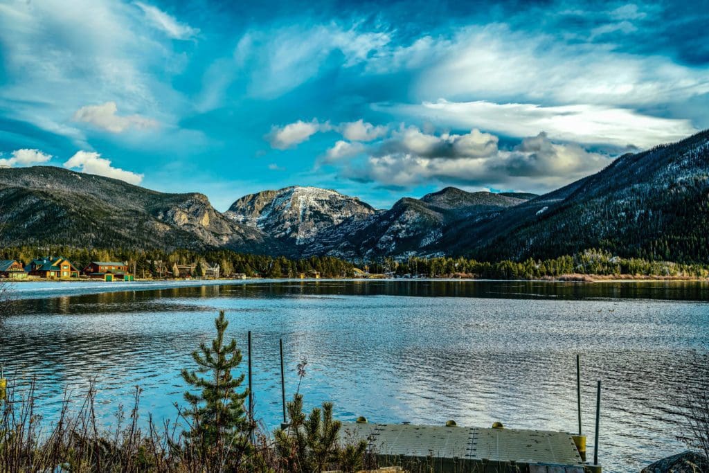
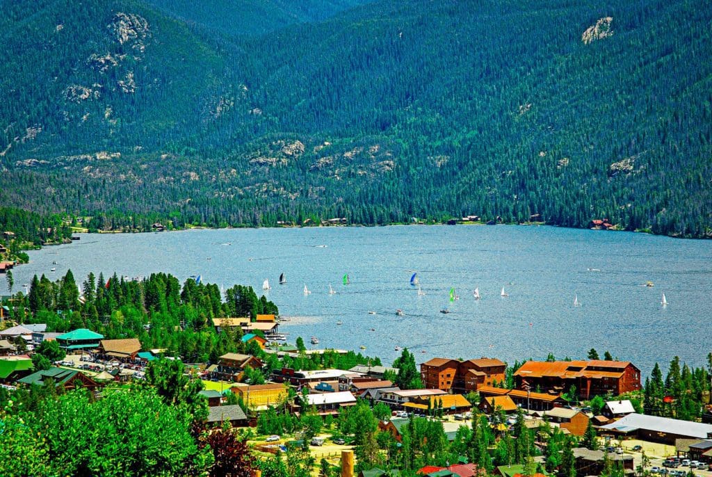
Views of the Rocky Mountains snow covered mountain tops from across a still smooth lake with majestic clouds overhead in Grand Lake, Colorado.
Altitude Warning: Remember that altitude sickness can affect visitors due to the high elevation. Symptoms include headache, nausea, fatigue, and dizziness. Take your time, stay hydrated, and be mindful of any pre-existing health conditions, like heart and lung disease. The only cure for altitude sickness is to go down to a lower altitude.
Table of Contents:
Article Navigation: Click on any of the listed items in the table of contents below to jump to that section of the article. Similarly, clicking on any large, white section header will jump you back to the Table of Contents.
- Overview
- Beaver Meadows Visitor Center
- Deer Ridge Junction
- Forest Canyon Overlook
- Roger Toll Memorial (Tundra Communities) Trail
- Lava Cliffs Overlook
- Trail Ridge Road Summit
- Gore Range Overlook
- Alpine Visitor Center
- Milner Pass
- Farview Curve
- Grand Lake
- Tabernash
- Winter Park
- Berthoud Pass
- Georgetown
Good To Know: Drive safely! When driving on mountain roads, please be cautious and take necessary precautions. It’s always a good idea to have a map downloaded before you start your journey in case you enter areas with no cell service. In the winter, make sure your vehicle is equipped with snow tires or chains. And if you want to take a moment to appreciate the beautiful scenery or check your map, find a safe spot to pull over out of the way of other drivers. The wildlife tends to be very active and the afternoon rains may or may not fall. Dress in layers and pack your binoculars.
Beaver Meadows Visitor Center
A tranquil introduction to the majestic landscapes that await, Route 36 curves effortlessly westward from the charming town of Estes Park towards the towering heights of Rocky Mountain National Park. After stopping by the Beaver Meadows Visitor Center for a brief overview, explorers enter a world where over 70 peaks stretch above 12,000 feet into the alpine wonderland beyond the tree line. Within this vast park lie 150 glittering lakes and 350 miles of trails ranging from leisurely strolls along glacier-fed streams to challenging hikes along the Continental Divide. For daring adventurers, September is the perfect time to visit as the summer crowds have dispersed, allowing for intimate encounters with elk grazing in lush meadows and quaking aspen leaves ablaze in shimmering gold hues.

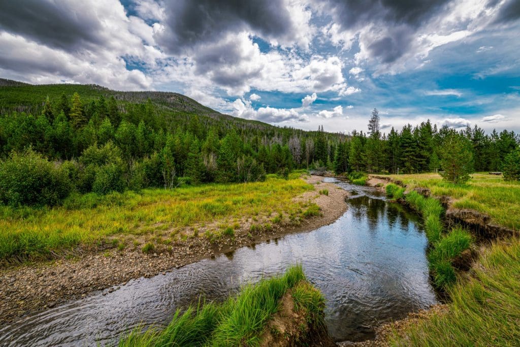
Fly fishing on the Big Thompson River at Moraine Park, Rocky Mountain National Park, Colorado.
Deer Ridge Junction
As Route 36 ascends the side of Deer Mountain, looking back reveals a stunning vista of towering peaks tightly packed together. The tallest and most prominent among them is Longs Peak, standing at an impressive height of 14,255 feet above the others.
At Deer Ridge Junction, the real adventure begins as the drive merges with Route 34 and continues onto the legendary Trail Ridge Road. This 45-mile journey cuts through the heart of the national park, ascending over 12,000 feet above sea level. The winding road leads you through an 11-mile stretch of rugged alpine tundra that will make you feel like you’ve been transported to the wilds of Alaska.
Many Parks Curve
Back in the days of Colorado pioneers, a “park” was any flat meadow surrounded by mountains. These areas were ideal for homesteading in an otherwise rugged landscape. From the observation point at Many Parks Curve, visitors can see Horseshoe and Moraine parks sprawling below. In the distance lies Estes Park, a popular mountain town where the drive begins.
As the road snakes its way through forests of Engelmann spruce and subalpine fir, a sign appears, indicating that we have reached an elevation of two miles above sea level. Soon after, we come across Rainbow Curve, offering another breathtaking view of the vast mountains and valleys. An early explorer believed that the peaks on the northern horizon resembled a figure lying down, earning it the name “Mummy Range”. As we continue on, we pass by a long scar on the hillside, a reminder of the catastrophic flood that occurred on July 15, 1982. The Lawn Lake Dam broke and sent massive amounts of water down Roaring River into Horseshoe Park, hurling boulders as if they were small dice.

Longs Peak viewed from Lawn Lake Trail, Rocky Mountain National Park, Colorado. A natural scar of boulders, downed timber are from a breach of Lawn Lake Dam, July 15, 1982.
Forest Canyon Overlook
Past Rainbow Curve, the road is lined with stunted pine trees, their shapes twisted by the unrelenting wind. Among them are “banner trees,” with branches that grow like flags on the side away from the wind. As the elevation increases, even the trees disappear, giving way to a tundra world of short grasses and wildflowers. Despite its short growing season in midsummer, this land puts on a beautiful display of blooming plants such as sky pilot, clover, moss campion, and phlox, adding color to an otherwise desolate alpine landscape.
Looking out from the overlook high above Forest Canyon, it’s clear to see the recognizable U shape of this glacial valley. Evidence of the glacial era can also be found in the Gorge Lakes, nestled in ice-carved basins known as cirques on the far wall of the canyon. These lakes remain frozen until deep into the summer months.

View from Forest Canyon Overlook in Rocky Mountains, Colorado. Photo:Nataliya Hora/Adobe Stock
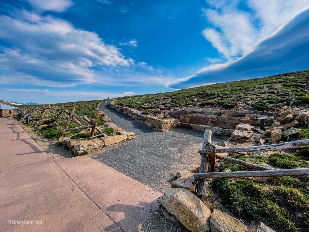
Roger Toll Memorial (Tundra Communities) Trail
It’s about time Rocky Mountain National Park settles on a definitive name for this trail! In the past, it has been known as the Tundra Trail and then renamed as the Roger Toll Memorial Trail. I’ve also come across references to it as the Tundra Nature Trail, but its official name is now the Tundra Communities Trail.
The path serves as a tribute to Roger Wolcott Toll, who served as superintendent of Mount Rainer National Park from 1919-1921, Rocky Mountain National Park from 1921-1928, and Yellowstone National Park from 1929-1935. He was not only a civil engineer but also a naturalist and mountaineer, and his passion for the mountains is evident in his efforts to make them more accessible for visitors.
The Toll Memorial is on top of the rock to the right.
Beneath the bright sun, bucktoothed marmots bask on rocks or dart across the terrain. However, this rugged landscape is less welcoming to human visitors, who often struggle to catch their breath at such a high altitude of 12,000 feet. While the summer climate may seem harsh, it pales in comparison to the winter conditions that are truly unforgiving. Powerful gusts of wind race up to 200 miles per hour, temperatures plummet to an unbearable -60 degrees, and massive snowdrifts tower up to 30 feet tall.
See our detailed review of the Roger Toll Memorial trail.
The start of the Toll Memorial trail.
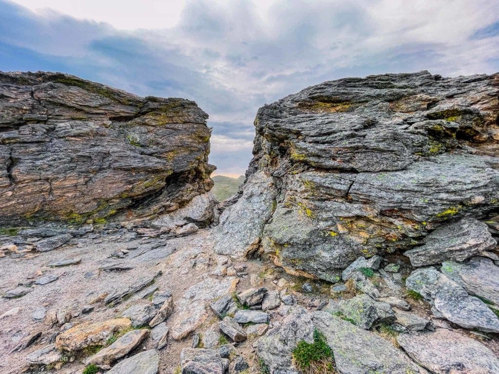
Just a few hundred feet after the Toll Memorial Trail travelers pass over a high mountain pass called Iceberg Pass, reaching an elevation of 11,827 feet.
Lava Cliffs Overlook
The molten “lava” that covers the ground is actually ancient volcanic ash that was deposited 26 million years ago and eventually compressed into a type of rock known as tuff. As the glaciers carved out the Rocky Mountains, they revealed this enduring relic from the region’s volcanic history.
In approximately one mile, the road reaches its peak at a staggering elevation of 12,183 feet above sea level. On the western horizon, stand majestic mountains that have earned the poetic nickname “Never Summer Mountains” due to their snow-capped peaks that remain visible throughout the year.
Trail Ridge Road Summit
Sitting at an elevation of 12,183 feet, the Trail Ridge Road Summit reigns as the highest point on the scenic highway that traverses Rocky Mountain National Park in Colorado. From this point, visitors are treated to breathtaking views of the alpine tundra, the Continental Divide, and the surrounding peaks. The summit is also a prime spot to observe the wide array of wildlife and flora that call this rugged terrain home. Accessible by car during late May through October, depending on the ever-changing weather conditions.
Gore Range Overlook
Experience breathtaking views of Rocky Mountain National Park at Gore Range Overlook. Gaze upon the majestic Never Summer Mountains, formed by volcanic activity over 24 million years ago. The Arapaho Indians named them “Ni-chebe-chii,” meaning “Never No Summer.”
The Gore Range, named after Irish aristocrat St. George Gore, is a rugged range with serrated ridges and impressive spires. Sir St. George Gore was an Irish aristocrat who went on a hunting expedition in the Gore Range that was led by mountain man Jim Bridger in 1854.
At an elevation of 12,048 feet, this overlook provides a lofty vantage point to take in the stunning landscape.

Gore Range Overlook in Rocky Mountain National Park in Colorado.
Alpine Visitor Center
Although it may appear empty and desolate, the tundra is home to a captivating array of creatures. From elusive pocket gophers that scurry beneath the surface to energetic rosy finches who thrive on frozen insects atop glaciers. Displays at the Alpine Visitor Center showcase the diverse wildlife that inhabits this treeless terrain, which makes up almost one-third of the park. The intricate network of sturdy logs on the roof of the center serves as reinforcement during harsh winter storms with hurricane-like winds.
Located at 11,796 feet above sea level, the Alpine Visitor Center in Rocky Mountain National Park is a popular attraction. It is open from Memorial Day to mid-October, offering restrooms, exhibits on the alpine tundra ecosystem, and a gift shop operated by the Rocky Mountain Conservancy.
Visitors can enjoy spectacular views of the Never Summer Mountains, the Continental Divide, and the Mummy Range. This center provides valuable information on the park’s history, geology, wildlife, and challenges of living at high altitude. Many hiking trails start here, including the Alpine Ridge Trail and Ute Trail.
Remember to come prepared with warm clothing, sunscreen, water, and snacks for your visit to this highest visitor center in the National Park System.

Alpine Visitor Center in Late May. Photo by Dbenbenn, CC BY-SA 3.0, via Wikimedia Commons
As Trail Ridge Road winds its way downward, it eventually reaches Medicine Bow Curve, a sharp turn that offers stunning views of the Medicine Bow Mountains, also known as the Never Summers. From this vantage point, you can see the Cache la Powder River far below, a name given by French trappers who used to store their gunpowder in the area.

Medicine Bow Curve in Rocky Mountain National Park.
Milner Pass
Sitting at an elevation of 10,759 ft (3,279 m), Milner Pass lies along the continental divide in the Front Range of Rocky Mountain National Park. It marks the boundary between Larimer and Grand counties and serves as a crucial passage for US 34.
Despite its significance, Milner Pass is not the highest point on Trail Ridge Road; that title belongs to a spot east of the pass at an elevation of 12,183 ft (3,713 m) within Rocky Mountain National Park. The gentle terrain of the pass divides the headwaters of the Cache la Poudre River and several creeks near the source of the Colorado River to the west. Visitors can enjoy a breathtaking view of the Never Summer Mountains from this route. The pass was named after T.J. Milner, who surveyed a potential railroad path through this area, although it was never constructed.

Milner Pass
Nestled in Larimer County, Colorado, Poudre Lake is a high-altitude lake that serves as one of the primary sources for the Poudre River. Located just east of the Continental Divide, it can be accessed via U.S. Route 34 which also crosses the Divide at Milner Pass on the southwest side of the lake. Known as a “dead lake,” it is unable to support fish due to freezing over completely during harsh winter months.

Poudre Lake
As drivers pass Pourdre Lake, whose waters eventually drain into the Mississippi River, we’re reminded of my geography lessons about the Continental Divide at Milner Pass. Beyond this point, raindrops from a summer shower join the Colorado River and flow through the Grand Canyon before reaching the Gulf of California. It’s amazing to think about the journey these waters take.

Sign at Milner Pass.
Farview Curve
From the overlook at Fairview Curve, one can see the breathtaking view of the Kawuneeche Valley, formed by a glacier that spanned 20 miles along the current west side of Rocky Mountain National Park.

Farview Overlook
Below, Trail Ridge Road begins its winding descent towards the flat and swampy valley floor, where the Colorado River meanders through braided channels. As you take in the scenery, keep an eye out for coyotes, as this area is known as “valley of the coyote” in Arapaho language. Their distinctive howls can be heard frequently, although sightings are not as common. And don’t forget to watch for majestic moose grazing in the nearby meadows.
The Coyote Valley trail is a wide, wheelchair and stroller accessible trail that follows the mighty Colorado River in Kawuneeche Valley.
Grand Lake
Exiting the national park, Route 34 leads to the end of Trail Ridge Road, just past the Kawuneeche Visitor Center. To the east lies Grand Lake, the largest natural lake in Colorado, although it pales in comparison to its man-made counterparts, Shadow Mountain and Granby Lakes nearby.
Founded for the wealthy in the early 1900s, Grand Lake was one of Colorado’s premier mountain resorts. Its yacht club, situated at a high altitude, still attracts sailors every August for the annual Lippton Cup competition. The cup was first awarded in 1912 by Thomas Lipton, the renowned tea mogul who owned a vacation house in the town. The rustic design of Grand Lake, with its abundant use of lodgepole pine logs, serves as a reminder of its genteel origins.
Grand Lake is a four-season playground. Within minutes, you could be hiking in a national park, taking a pontoon boat onto a series of lakes, or exploring the nearby Indian Peaks and Never Summer Wildernesses. For those seeking an adventure in Grand Lake, check out our guide to Planning The Perfect Adventure Trip To Grand Lake, Colorado.
The scenic view of Grand Lake, Colorado.
Colorado Headwaters Scenic and Historic Byway: The road from Granby to Kremmling spans about 29 miles along Route 40 and is a picturesque part of the Colorado Headwaters Scenic and Historic Byway. As you travel, you’ll pass through canyons, mountains, and pastures while following the winding path of the Colorado River. Along the way, be sure to check out the Grand County Museum in Hot Sulphur Springs for an interesting glimpse into daily life during the Old West era.
Tabernash
As it winds along Shadow Mountain Lake, Route 34 takes us past Lake Granby on one side and Table Mountain, known for its abundance of jasper used by Native Americans for tools and arrowheads, on the other.
We then turn south onto Route 40 and drive through the town of Granby before reaching the Fraser River valley, a popular spot for ranching. Just outside the small community of Tabernash, we are treated to breathtaking views of the peaks of the Continental Divide, less than 10 miles away to the east. The iconic rock formation known as Devil’s Thumb rises above the ridgeline, marking the way for hikers traversing the mountains.
The Devil’s Thumb is a jagged formation perched high on the Continental Divide. Its name was given by the Ute and Arapahoe tribes, who, after years of feuding, made peace and buried their differences along with the devil himself, leaving only his thumb exposed as a constant reminder of the horrors of war. This area still carries a strong Native American presence, evident in the use of Ute and Arapahoe names throughout the Indian Peaks Wilderness and Rocky Mountain National Park. An example of this is the town of Tabernash, named after a Ute chief who was killed nearby in 1878.
Winter Park
Winter Park, situated in the midst of towering mountains and alongside the Fraser River and Route 40, has undergone significant transformations since it was first settled by pioneers in the late 1800s. The lure of ranching and timber initially drew people to the area, but soon railroad workers arrived to construct the famous Moffat Tunnel, spanning over six miles beneath the Continental Divide. Completed in 1927, this tunnel remains one of the longest in the world, and visitors can catch a glimpse of its western entrance from an overlook in Winter Park.
Winter Park, once a humble ski area inaugurated by Denver in January 1940, has now transformed into one of Colorado’s most sought after resorts. The luxurious lodges and state-of-the-art lifts were unimaginable back then. Lift tickets, which were only $1 on opening day, have now significantly increased in price. As the winding trails on the mountainside come to a halt, it’s clear how much Winter Park has evolved over the years.
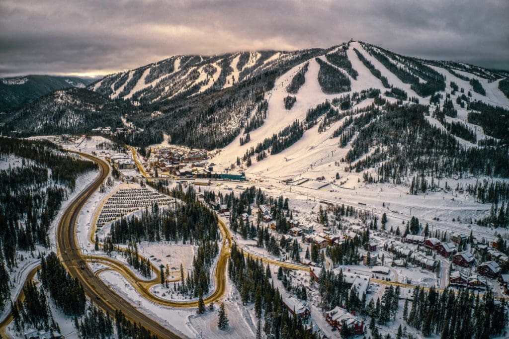
Aerial View of popular Ski Town of Winter Park, Colorado
Berthoud Pass
Winding its way up the steep inclines of the mountains, Route 40 eventually reaches 11,307-foot Berthoud Pass, crossing back to the Atlantic side of the Continental Divide. It was charted in 1861 by a survey party that included legendary mountain man Jim Bridger. Take a moment here to pause and enjoy the breathtaking view before continuing on the roller-coaster-like curves down to Interstate 70.

View of Route 40 from the Continental Divide at Berthoud Pass in autumn.
Georgetown
A single twist of economic fate, the decline in value of silver after the United States adopted the gold standard in 1893, inadvertently preserved the historic mining village of Georgetown. The once booming town fell on hard times and its beautiful Queen Anne, Gothic Revival, and Italianate buildings were spared from modernization. Today, over 200 of these original structures still stand, many having been lovingly restored. One such structure is the Hamill House, belonging to the town’s wealthiest silver miner, now a museum that delights visitors with its ornate walnut woodwork, gaslights, original wall coverings, and Renaissance Revival furnishings.

Georgetown, Colorado
The nearby Georgetown Loop Railroad offers stunning vistas of the narrow mountain valley, especially from Devil’s Gate Bridge, standing tall on stilts 100 feet above Clear Creek. As the steam locomotive chugs along and passengers enjoy the open-air excursion cars, it’s easy to imagine the days when miners flocked here in search of riches. In the distance, nestled against the forested mountainside, sits Georgetown – still known as the Silver Queen of the Rockies, a testament to its past era of glory.
Established in 1884, the Georgetown Loop Railroad was among Colorado’s first tourist attractions and a feat of engineering. Connecting the bustling mining towns of Georgetown and Silver Plume, it traversed a steep and narrow canyon along Clear Creek in the Rocky Mountains, spanning over 2 miles but gaining an elevation of 600 feet through its winding route. With horseshoe curves, grades as high as 4%, and four bridges across Clear Creek, including the impressive Devil’s Gate High Bridge, this 3 ft (914 mm) narrow gauge railroad was hailed as a marvel for its time by the Georgetown, Breckenridge and Leadville Railway which built it.

Georgetown Loop Railroad on the Devil’s Gate Bridge near Georgetown, Colorado.
From Georgetown, you can return to Estes Park via the legendary Peak to Peak Scenic Byway.
Skyblue Featured Video: Skyblue Overland on Trail Ridge Road
Popular Articles:
Planning The Perfect Adventure Trip To Grand Lake, Colorado
Ultimate Adventurer’s Guide to Rocky Mountain National Park
Best Hiking Trails in Rocky Mountain National Park, Colorado


