


High Point:
8,549 feet

Total Ascent:
~2970 feet

Difficulty:
Difficult

Distance:
7.8 miles

Waypoints:
39.93883, -105.25822

Route Type:
Point to point, loop options available
South Boulder Peak is the tallest of five mountains that guard Boulder. On clear days, its summit reveals Pikes Peak over 100 miles away. Shadow Canyon is a rewarding route to the summit, with stunning rock formations like the Devils Thumb and Maiden nearby. It’s a great way to gain nearly 3,000 feet of vertical rise within 30 minutes of Boulder.
Overview:
South Boulder Peak is the tallest of the five mountains that guard Boulder’s western flanks. It is highly visible from points east and southeast, but its summit hides behind the sharp pinnacle of Bear Peak when viewed from Boulder. On clear days it’s possible to stare south from the summit and spot the solitary behemoth of Pikes Peak over 100 miles away.
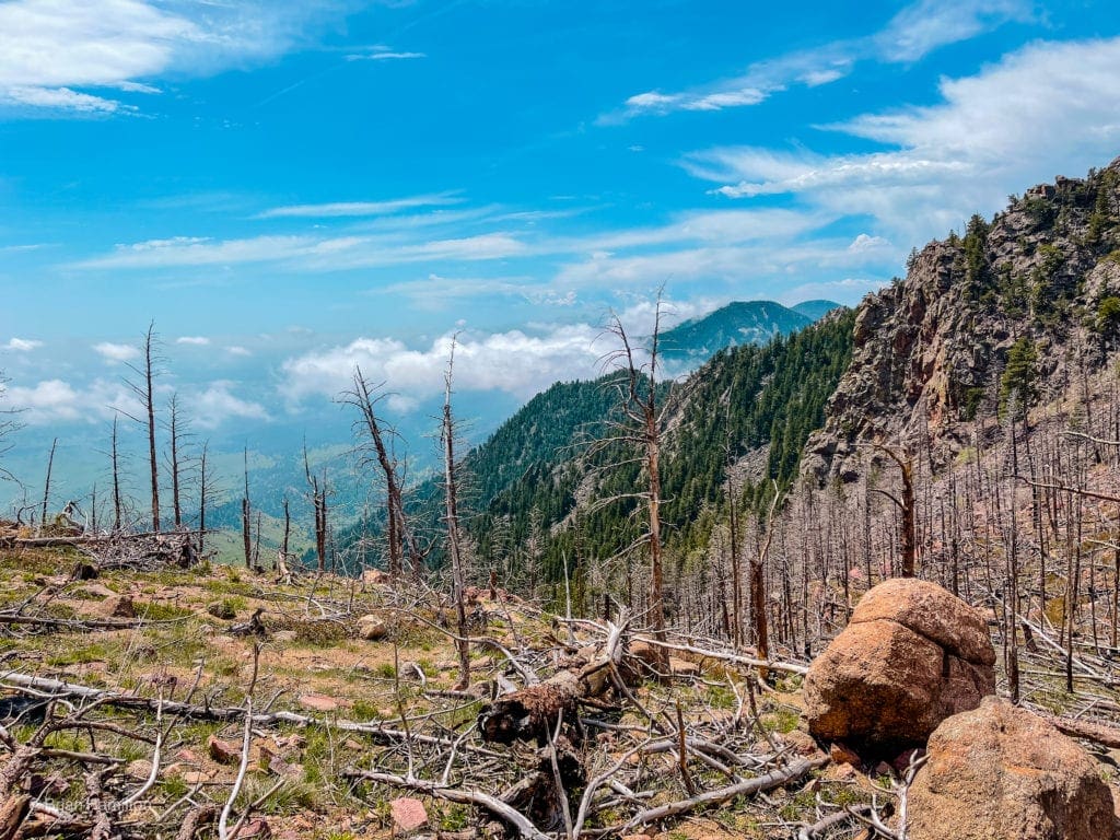
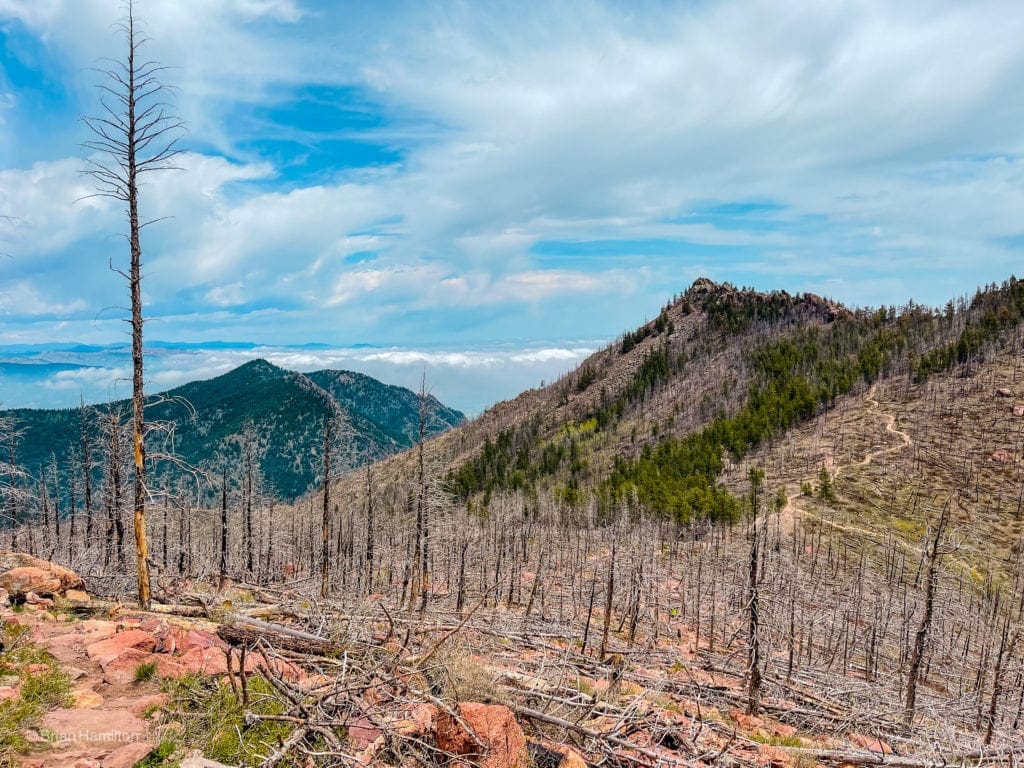
The main way to ascend South Boulder Peak is up Shadow Canyon, a tough but very rewarding route bordered by stunning rock formations with names like the Devils Thumb and Maiden. The ridges around Shadow Canyon are popular for climbing but also experience seasonal closures because they are a favorite nesting area for birds of prey. A fire in 2012 has impacted the summit area and western slopes of both South Boulder and Bear Peak. Despite the damage, it’s interesting to note the regeneration of plants, providing a nice example of how forests recover from wildfires and how long it takes for the environment to truly heal.
If you’re looking for a way to grab nearly 3,000 feet of vertical rise on a peak within thirty minutes of Boulder, this is the mountain you want.
Looking southwest from the South Boulder’s summit ridge.
Table of Contents:
Article Navigation: Click on any of the listed items in the table of contents below to jump to that section of the article. Similarly, clicking on any large, white section header will jump you back to the Table of Contents.
- Overview
- Scales and Criteria
- Directions to Trailhead
- Field Notes
- Places to Stay
- Journal
- Final Thoughts
Scales and Criteria:
South Boulder Peak is accessible via trail, which takes away any concentrated scrambling or off-trail exploration. This review describes a snow-free ascent (typically June-September). When snow is in play, a host of other safety issues become relevant. If you’re planning on hiking this trail in the snow, get ready for a lot of orientation. Once a good snowfall covers the trail, it will be very difficult to follow.
Difficulty Ratings:
- Easy: less than 5 miles, less than 500 ft. of elevation gain
- Moderate: 5-10 miles, 500-2000 ft. of elevation gain
- Difficult: 5-15 miles, more than 2000 ft. of elevation gain
- Very Difficult: 10+ miles, more than 3,500 ft. of elevation gain
The Ultimate Offline GPS Hiking & Ski Maps
See why onX Backcountry is the ultimate GPS navigation app for your outdoor pursuits. Try Today for Free. No credit card required.
Directions to Trailhead:
This is one of a few different trailheads that lead to South Boulder Peak and its neighbor, Bear Peak. Of them, South Mesa accesses some of the quieter trails around Boulder. That isn’t to say the trailhead doesn’t get packed; as always, get there early and on weekdays if possible. South Mesa Trailhead is also a pay-to-play area; the cost is currently $5.00. You can find out which trailheads in the area require a fee through this link.
From downtown Boulder, make your way south on CO93 to the intersection with CO170. Take a right (west) leading towards Eldorado Canyon. From the south, proceed north on CO93 and take a left onto CO170. From the east, either find CO93 or take CO170 (Marshall Road) and drive west until sighting the trailhead on the roads north side (right) before you get to Eldorado Canyon State Park.
The Ten Essentials: How to Equip Yourself for the Backcountry
Packing the “Ten Essentials” whenever you step into the backcountry, even on day hikes, is a good habit. When something goes awry, you’ll truly appreciate the value of carrying these items that could be essential to your survival.
Field Notes:
Boulder is an attractive city for various reasons, one of them being the dramatic presentation of the area if you’re coming from the east or south. The impressive rocky ramparts of South Boulder Peak and Bear Peak rise thousands of feet from local trailheads and capture the attention of anyone passing by. Of the two, South Boulder is less popular and can on occasion provide long stretches of solitude, a rarity for being so close to populated areas.
Regrowth in the fire area near South Boulder Peaks summit.
For your weather forecasts, start with Boulder’s extended weather forecast, which will give you the best details for the lower elevations of the hike. Since South Boulder Peak rises nearly 3,000 feet above Boulder, summit temperatures could be noticeably different than at the trailhead. Use Opensummit to get a better idea of the top part of the route. Please note, two-day forecasts on Opensummit are free to access, but longer-range forecasts are only accessible via paid membership. Mountain forecasts are notoriously inaccurate three or more days out; make sure to check the forecast right before you head out for the best results.
Support Skyblue Overland™ on Patreon!
If you’d like to support our efforts for a few dollars a month, please subscribe to our Patreon page. Every donation energizes our team to keep writing detailed trail reviews, gear reviews and adventure guides. Thank you!
Places to Stay:
Like most hikes in the area, staying in Boulder is your best bet. The town has a ton of options. South Boulder Peak is also within an hour of most of the northern Denver metro area, Longmont, Golden, Lyons, Berthoud, Loveland, and the southern reaches of Fort Collins.
From rustic campgrounds to five-star hotels, Boulder meets all accommodation needs. Some of the more well-known places include the Hotel Boulderado, St. Julien Hotel and Spa, Briar Rose Bed and Breakfast, and Basecamp Boulder. Here’s a more complete list.
Campgrounds and Dispersed Camping:
Camping is possible in some places near Boulder, but they would all require a bit of a drive. Some OK options include Gross Reservoir sites, Gordon Gulch Dispersed Area, and near Switzerland Trail. As a general rule, options increase the further west you travel.
Gross Reservoir/Winiger Ridge. This fun campground is located on the west side of Gross Reservoir, accessible via Magnolia Road. Being close to the city, the campground does attract college students and can be loud on occasion.
Rainbow Lake Campground and West Magnolia Campground. Both campgrounds are near the town of Nederland, which is located at the top of Boulder Canyon, 15 miles west of Boulder.
Brainard Lake Recreation Area. Pawnee Campground at Brainard Lake Recreation Area has excellent sites in a wonderful alpine setting. Make sure to book a site ahead of time as they are popular, and please abide by local fire ordinances.
We Fell Down The Mountain
In June of 2020, Courtney Henderson and Gavin Caruso had a frightening accident. They slipped and fell more than fifty feet down a mountainside while hiking on the trail to South Boulder Peak during a terrible thunderstorm. The storm was raging overhead, and they were trapped and bleeding. But help was on the way.
Read More!
Journal
Once you’ve found a place to park and paid the fee, locate the main trailhead and begin your journey.
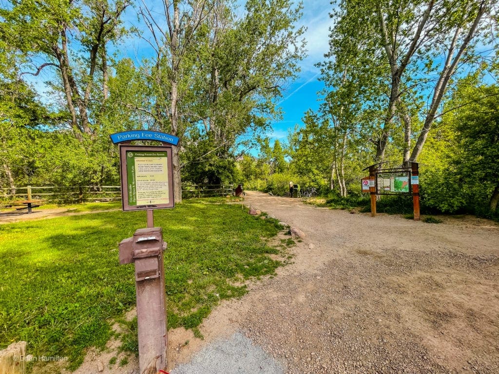
Parking fee station and trail start at the South Mesa Trailhead.
You’ll cross South Boulder Creek pretty immediately.
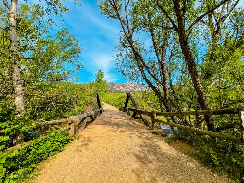
A nice bridge across the creek.
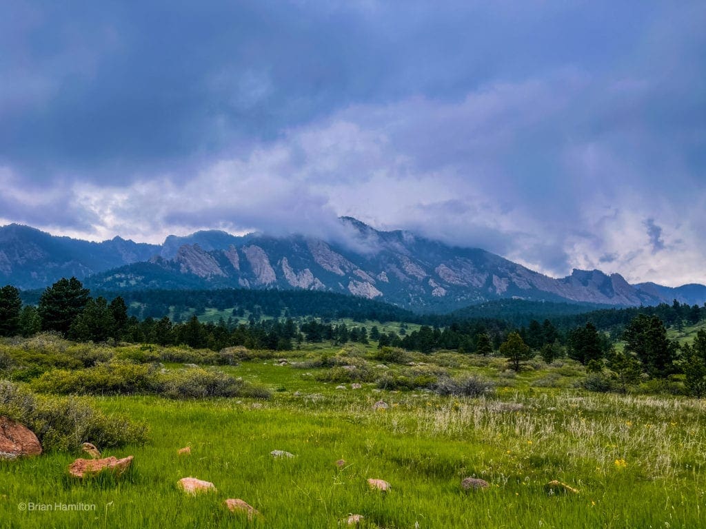
Once you break out of the few trees lining the creek, views towards South Boulder Peak and the rocky ridges become obvious.
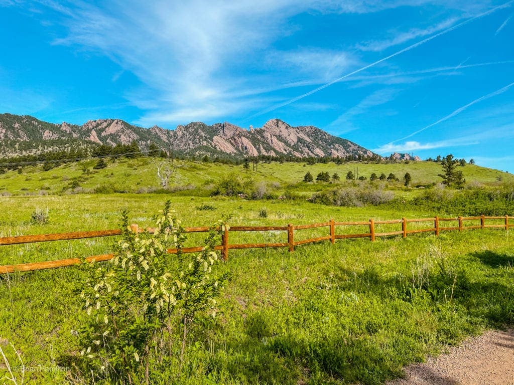
Looking west towards your ultimate destination.
For the first part of this hike, take a left on Homestead Trail, about 0.2 miles from the trailhead.
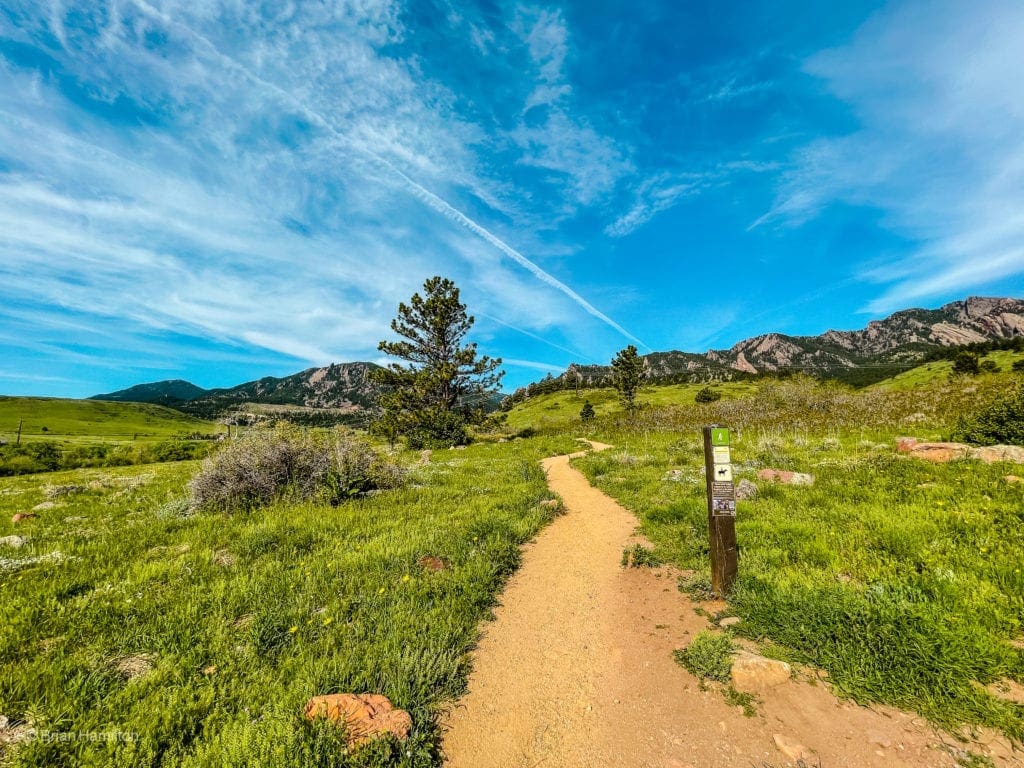
Start of the Homestead Trail.
The trail will hug the south side of a set of hills, offering views west and south.
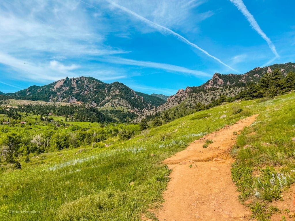
Looking towards Eldorado Canyon from the Homestead Trail.
The fields you’ll be crossing can get quite hot in the spring/summer sun so make sure you are putting on sunscreen or wearing a hat. As the Homestead Trail begins to climb, you’ll enter a mixed forest with a little more sun cover before hiking back into more fields.
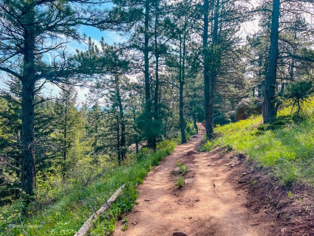
Tree cover starts once you gain enough initial elevation.
After ~1.3 miles, you’ll run into a junction with the Mesa Trail; take a left here.
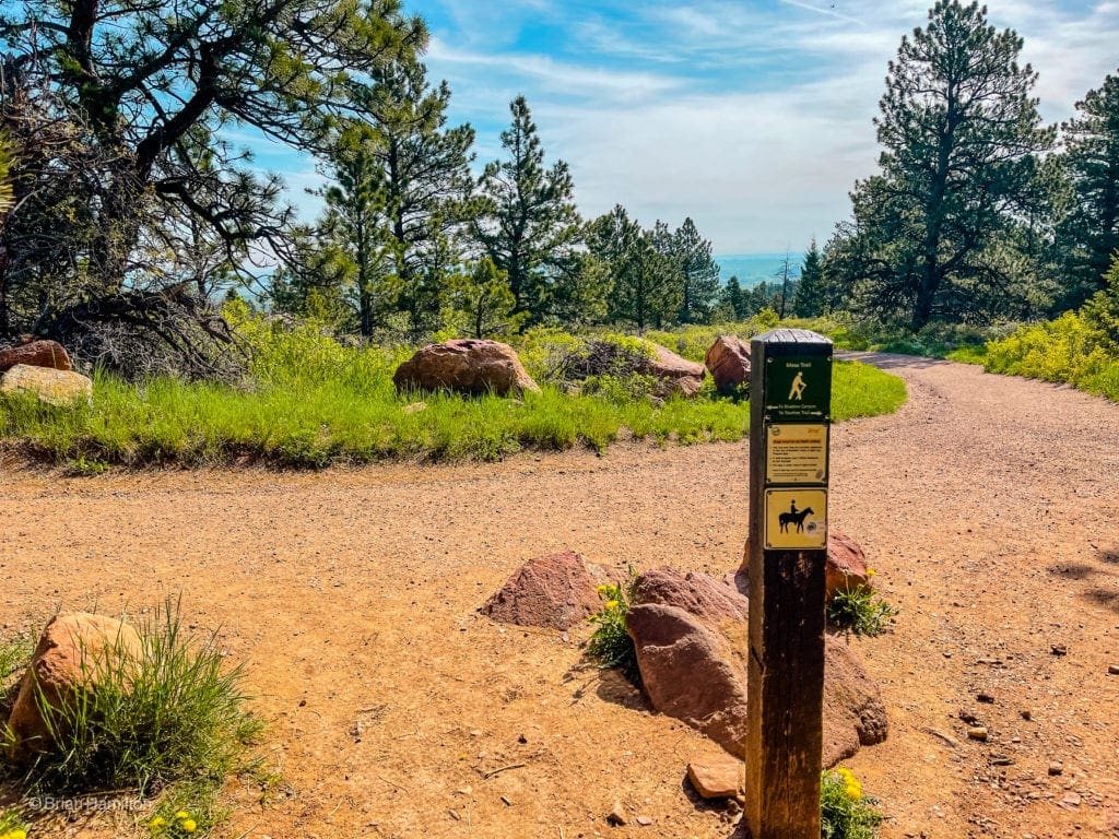
Junction with Mesa Trail.
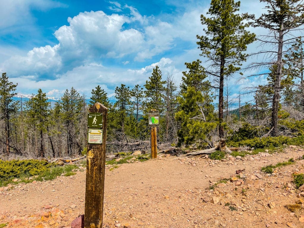
The Mesa Trail will head west initially before making a northward directional change and hugging the edge of the mountains. Keep an eye out for the junction that’ll give you access to Shadow Canyon.
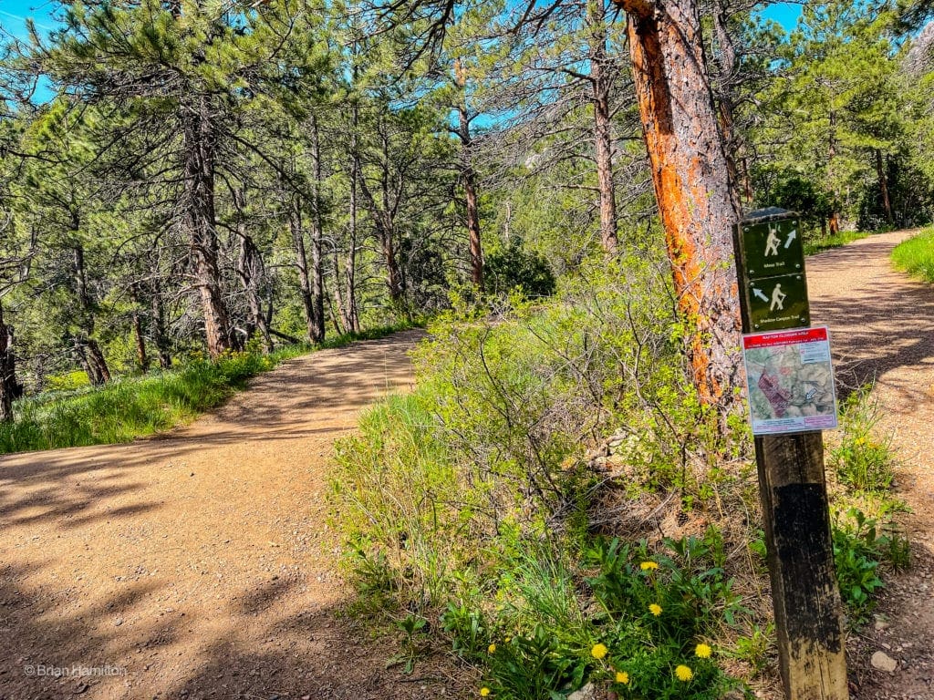
Take another left here to get to Shadow Canyon.
As the trail approaches the canyon, tree cover increases once more, and you’ll be offered beautiful glimpses of the interesting rock formations that grace these mountains.
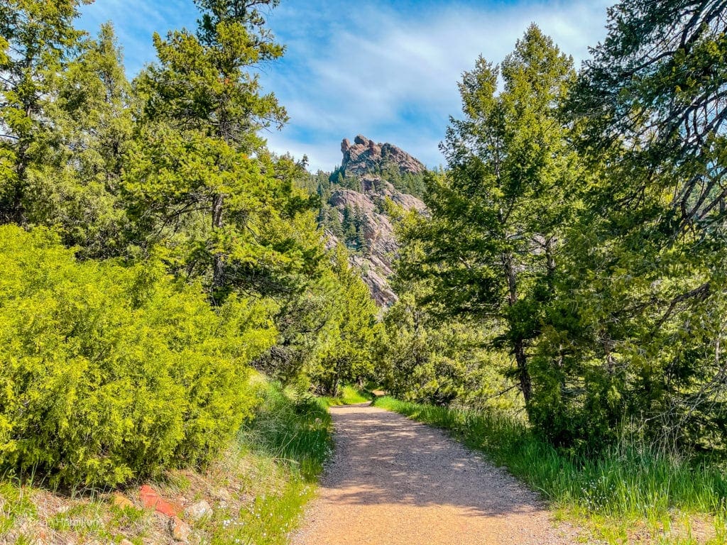
Looking up at the Maiden and Devil’s Thumb rock formations.
Once you finally enter Shadow Canyon, following signs as you pass, the trail width reduces significantly, and the hike takes on more of a wilderness character.
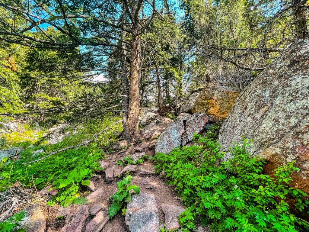
Shadow Canyon Trail.
A seasonal creek runs down the canyon, and you’ll share much of the journey with it. The rocky trail will continue rising through the treed landscape for 1.2 miles.
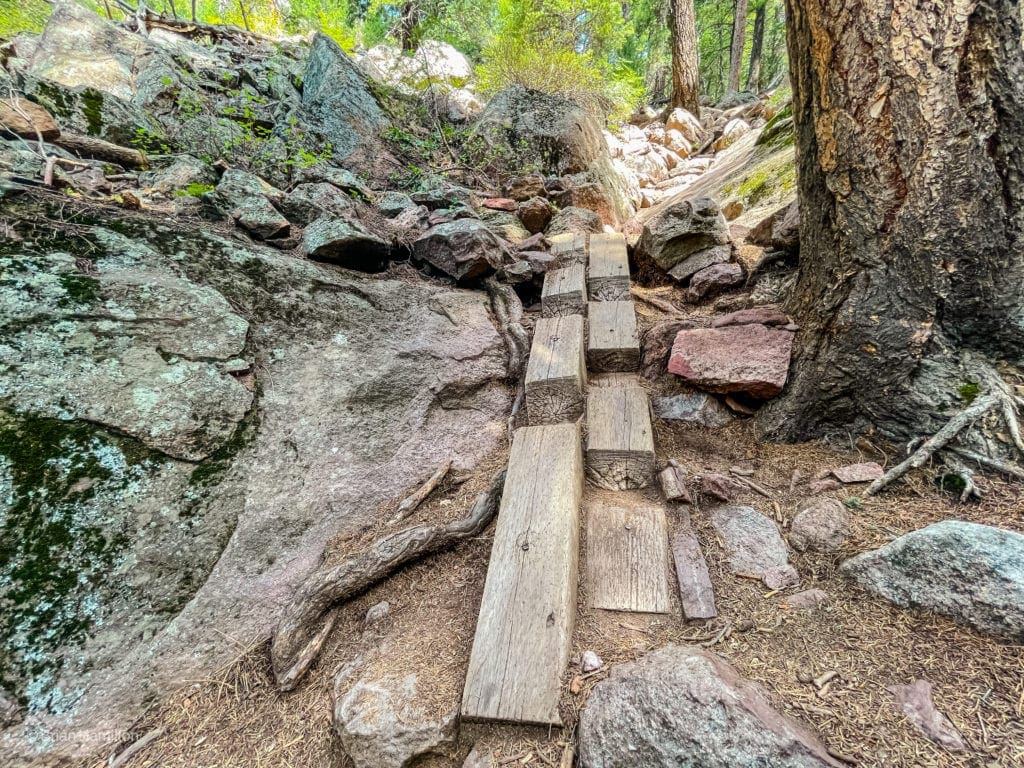
An interesting trail work project along the way.
Most of your elevation gain happens on this part of the trail, but long-distance views are limited.
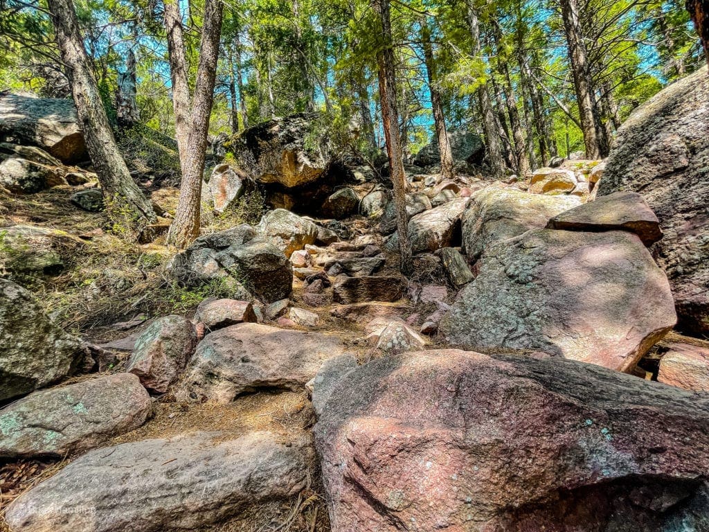
Rock steps on the way up.
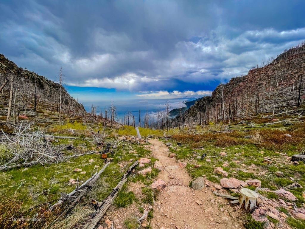
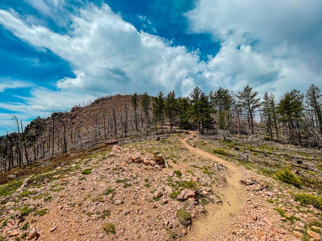
As you ascend towards the saddle between South Boulder Peak and Bear Peak, views increase. The Flagstaff Fire in 2012 scorched Bear Peak and South Boulder Peak, and you’ll pass evidence of it the higher you climb.
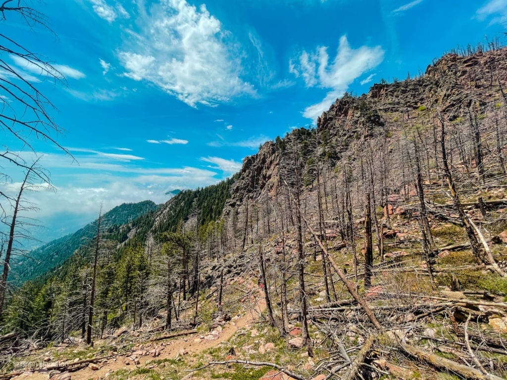
Charred trees as you near the saddle.
Views back down Shadow Canyon to the fields near South Mesa Trailhead.
At long last, you’ll find the junction between South Boulder and Bear Peak.
At the junction, take a left to climb South Boulder Peak.
Once on the last bit of trail, South Boulder’s fire-damaged summit will appear obvious as the height of land in front of you.
Almost there! The top of South Boulder Peak is only 0.3 miles from the junction.
As you conquer this last push, views behind you show the sharp summit of Bear Peak, Green Mountain, and the trail junction below.
View looking north toward Bear Peak from just shy of South Boulder Peak summit.
The true summit lies atop a slanted rib of rock that requires a few easy boulder hopping moves to get to.
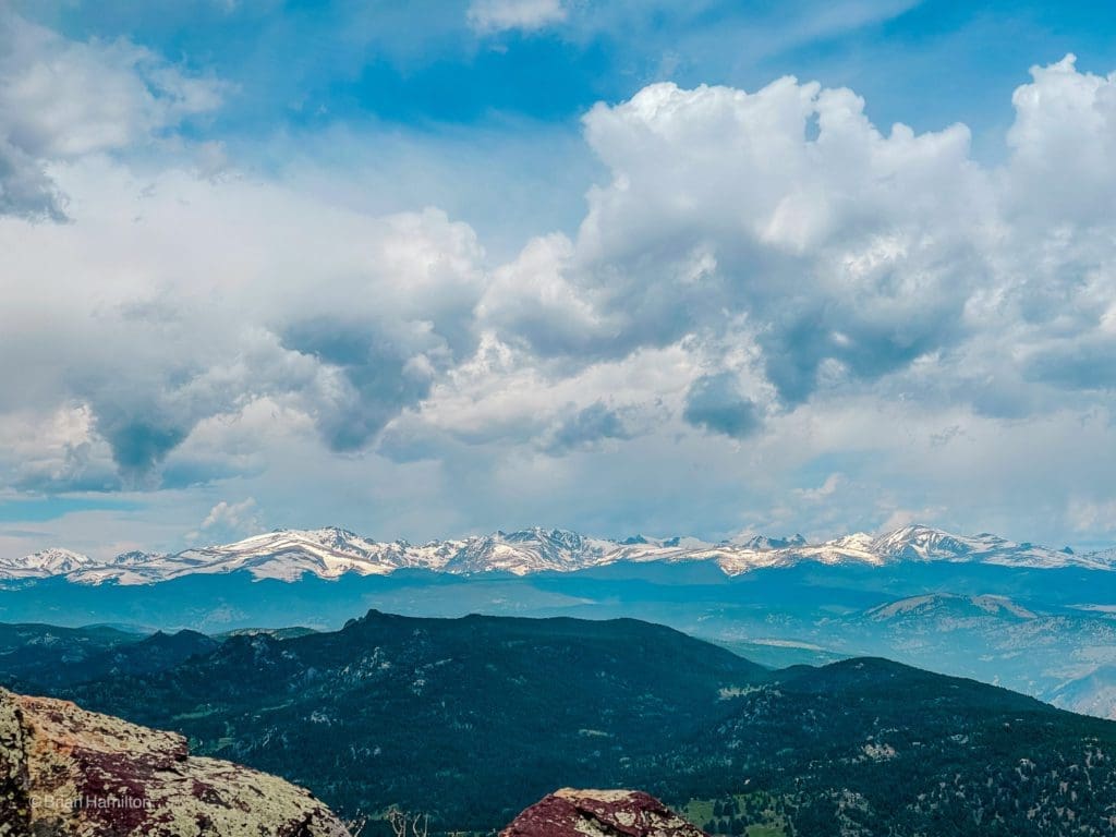
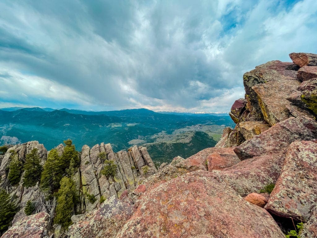
Views West from the South Boulder Peak summit ridge.
Take some time to enjoy the fantastic views before heading down the same way you came.
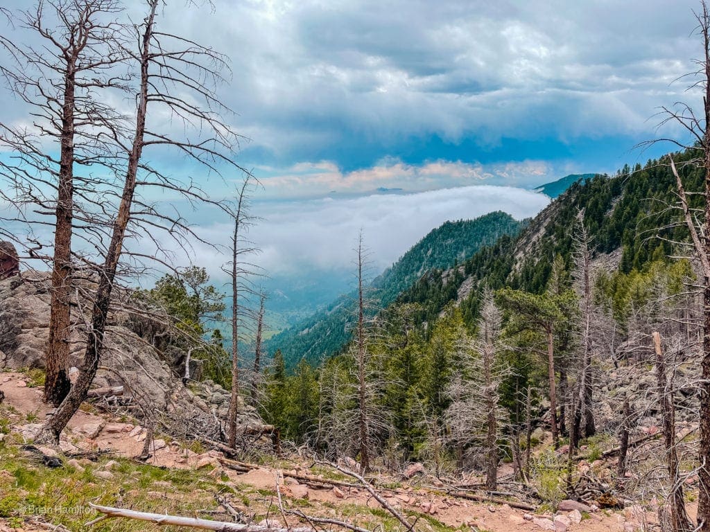
Low lying clouds crashing into the ridges near South Boulder Peak.
Take Shadow Canyon Trail back down to the mesas below.
Once you connect with Mesa Trail (taking a right onto it), a few lower loop options become available. If you want some variety, instead of retracing the Homestead Trail section, continue following Mesa Trail east as it takes a more circuitous path back to South Mesa Trailhead. Don’t forget to look back at where you were.
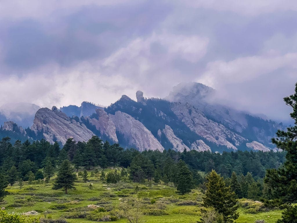
Looking back to the Devil’s Thumb rock formation.
The north ridges of South Boulder Peak as storm clouds build.
While a beautiful hike, South Boulder Peak is quite strenuous. Make sure you aren’t racing weather. Storms can form quickly, and the last mile and a half of the hike traverses some very open fields, places you don’t want to be if lightning strikes.
One last look to South Boulder Peak from near the parking lot.

Enroll With Global Rescue Prior To Embarking On Your Next Adventure.
When a travel emergency arises, traditional travel insurance may not come to your aid, and a medical evacuation can cost up to $300,000.
The cost when you have a Global Rescue membership? $0. That’s why when the unexpected happens, you want the leader in rescue, evacuation and medical advisory behind you. You want Global Rescue.


