


|
Getting your Trinity Audio player ready...
|
Nestled between rugged peaks in Colorado, lies a paradise for adventure junkies. The roaring Arkansas River invites white-water rafting and kayaking, while the majestic mountains offer endless challenges like hiking, mountain biking, camping, and skiing. This is truly heaven for those who crave outdoor adventure.
Overview:
Nestled between the rugged peaks of Buena Vista and Salida, Colorado lies a haven for adrenaline junkies. The roaring Arkansas River carves through town, daring white-water rafters and kayakers to conquer its treacherous currents. And if that’s not enough, the majestic mountains offer endless challenges – from heart-pumping hikes and intense mountain biking trails to rugged camping grounds and world-class skiing slopes. For those who crave the thrill of the great outdoors, this is truly a paradise on earth.
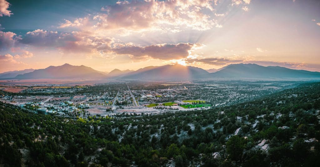
Sunset over the Sawatch Mountain Range in Buena Vista, Colorado.
Table of Contents:
Article Navigation: Click on any of the listed items in the table of contents below to jump to that section of the article. Similarly, clicking on any large, white section header will jump you back to the Table of Contents.
- Overview
- Geography
- Unique History
- Local Adventure Vibe
- Food and Drink
- Best Places to Stay
- Camping
- Summer Activities
- Winter Activities
- Conclusion
Geography
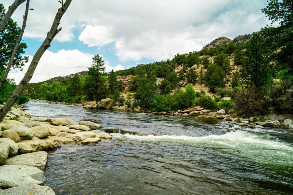
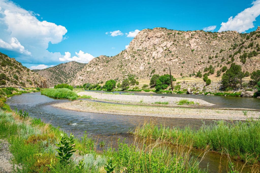
Salida and Buena Vista are located on the upper Arkansas River and surrounded by outdoor recreation. The Arkansas River starts north of Leadville, flows south through Buena Vista, then Salida before exiting the high-country via Bighorn Sheep Canyon, and eventually, the Royal Gorge.
The river valley and its surrounding ranges are the most prominent geographic features of the region. The terrain between Salida and Buena Vista is relatively flat and arid as it’s between mountain ranges. There are canyons separating Buena Vista (7,965 ft.) from a higher area around Leadville (10,151 ft.), and there are canyons separating Salida (7,083 ft.) from Cañon City downriver (5,331 ft.).
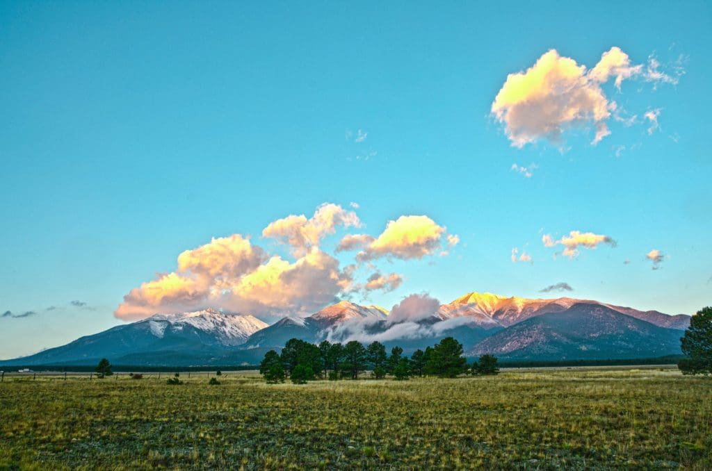
The largest mountains in the area by far are the peaks of the Sawatch Range to the west. Mt. Princeton (14,196 ft.) is especially prominent from the area around Buena Vista, while Mt. Shavano (14,231 ft.) dominates the area around Salida.
Mount Shavano, Mount White, and Mount Antero are three peaks in the southern section of the Collegiate Peaks Range near Nathrop, Colorado.
In-between BV and Salida, near the town of Nathrop, Browns Canyon National Recreation Area entices visitors. To the east, the Arkansas Hills and Buffalo Peaks Wilderness await. To the west/southwest, Cottonwood Pass (seasonal road) and Monarch Pass Ski Resort await.
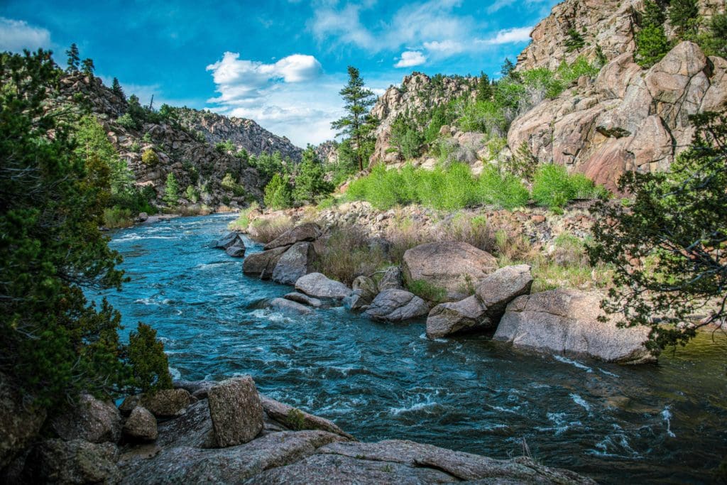
The Arkansas River flows through Brown’s Canyon, Colorado.
South of Salida, the gnarly Sangre De Cristo Mountains begin their 400-mile march to Santa Fe, New Mexico. To the southeast, the Arkansas river cuts through Bighorn Sheep Canyon and emerges near the Royal Gorge and Cañon City. To the north, the Upper Arkansas River around Leadville.
Arkansas River rapids near Buena Vista, Colorado.
Unique History
The first natives of the area around Buena Vista were the Ute Indians, but the valley was eventually settled by pioneers in the late 1800s. The fertile valley around Buena Vista made it especially attractive for agriculture.
Buena Vista’s biggest controversy might be its name. Spelled like the Spanish words for “good view,” it’s pronounced “Bewna Vista.” This Americanized pronunciation was cemented at the town’s incorporation. Nowadays, many residents simply call it BV.
Salida was first reached in 1880 by the Denver and Rio Grande Railroad. It was named “South Arkansas” but renamed to Salida to represent the place where the upper Arkansas River left the high country and began thundering through the Arkansas River Canyon (aka Bighorn Sheep Canyon & the Royal Gorge).
Arkansas River in Bighorn Sheep Canyon, Colorado.
Salida’s downtown has burned twice, once in 1886 and again in 1888. After both fires, most of the buildings in the town were rebuilt with brick. Many famous people rolled through town on the railroad. Theodore Roosevelt even gave a speech in 1905 after vacationing in the area.
Salida is home to the oldest whitewater festival in America, FIBArk. The festival and races have run since 1949; see the events section for more information.
Tourists enjoying the Arkansas River in Salida, Colorado.
Local Adventure Vibe
Buena Vista and Salida get their cool mountain town status from the Arkansas River. The residents love the outdoors, the towns are surrounded by mountain magic, and because of their semi-arid and relatively low elevation (in relation to the peaks around them), they enjoy a much more temperate climate than nearby towns like Leadville.
Fear not, winter lovers; backcountry lines exist in excess in the Sawatch range to the west, and resort skiers can get their fill at Monarch Ski Resort. Salida also has a very well-laid-out set of mountain bike paths near town and tons of recreational opportunities along the Arkansas River.
The Mt. Princeton Hot Springs just west of BV draw crowds all year long for its relaxing mineral water and access to bountiful recreation opportunities. Browns Canyon National Monument, just south of BV, is most likely the busiest rafting stretch of the whole upper Arkansas River.
Food and Drink
Both Salida and BV have excellent food and drink options. Below are some of the best options to slake your hunger and thirst!
- Currents Restaurant: Surf and turf at a relaxed location only two blocks from the banks of the Arkansas River in Salida.
- Moonlight Pizza & Brewpub: A delicious pizza joint that, on Mondays, donates 10% of sales to community programs in Salida.
- Eddyline Brewing: A local brewery serving up refreshing beer for those warm summer days. Located in BV.
- House Rock Kitchen: Per their website, “We’re making healthy eating fun, and we’re doing it on Main Street!” Located in Buena Vista, this place has great food and a large outside patio.
- The Fritz: A really engaging and unique menu shaped by the world travels of their chefs. Absolutely worth a visit. Located in Salida.
- The Biker & The Baker: Delicious treats and desserts in Salida.
- Deerhammer Distillery: A local Buena Vista distillery specializing in fine whiskey and the spirit of exploration imbued within the region.
- Soulcraft Brewing: A fun local Salida brewery with good beer and a relaxed atmosphere.
Click here for additional options in BV.
Afternoon on the Arkansas River in Salida, Colorado.
Best Places to Stay
The region’s eclectic lodging offerings do their best to take in the scenic grandeur of the mountainous terrain while supplying a comfortable night’s sleep.
- Browns Canyon Inn: Budget options with great décor.
- Salida Inn & Monarch Suites: Catering to the outdoor adventurer in all of us, this is a friendly place to come back to after a day of mountain recreation.
- Mountain Goat Lodge: A unique lodging option on a working farm with yoga classes, farm-fresh breakfast, and a chance to hang out with some goats.
- Thomas House Bed & Breakfast: A cool bed and breakfast built in an 1880s railroad boarding house.
- Surf Chateau: Classy lodgings on the river in BV.
- Best Western Vista Inn: Comfortable, clean, and convenient with mountain décor.
- Mt. Princeton Hot Springs: You can pay to soak, or stay the night at this great hot spring retreat west of Buena Vista and open all year (conditions permitting).
- Monarch Mountain Lodge: The closest lodging to Monarch Ski Resort, with a complimentary shuttle to the resort.
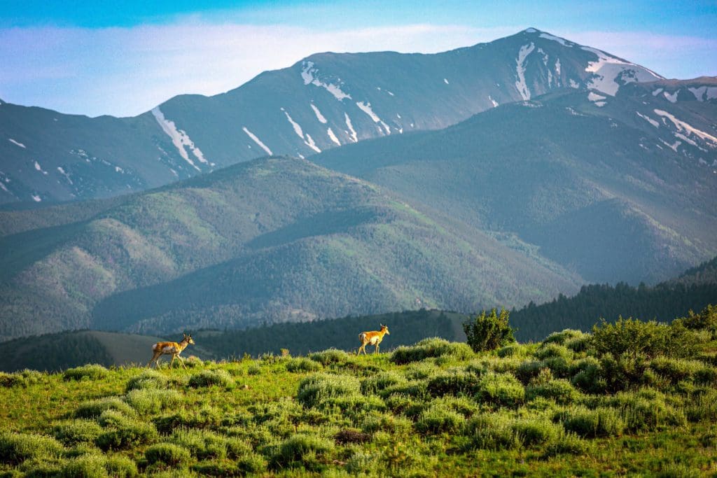
Female Pronghorns climbing Mount Shavano.
Camping
With nature in all directions, the Salida/Buena Vista region is ripe with scenic camping options. Check out some of the options below.
- Chalk Creek Campground & RV Park: (South of Buena Vista)
- BV Overlook: (Southeast of Buena Vista)
- Angel of Shavano: (West northwest of Salida)
- Collegiate Peaks Wilderness Campground: (West of Buena Vista)
- O’Haver Lake Campground (Southwest of Salida)
- Mount Princeton Campground (Southwest of Buena Vista)
- Cascade Campground (Southwest of Buena Vista)
- Chalk Lake Campground: (Southwest of Buena Vista)
- Ruby Mountain Campground:
- Hecla Junction Campground (On the Arkansas river, between Salida and Buena Vista.)
- Iron City Campground: (Southwest of Buena Vista)
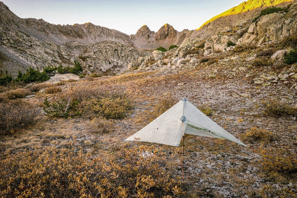
Camping shelter in the Collegiate Wilderness near Buena Vista, Colorado.
USFS Cabins in the region:
Unknown to many, you can rent a USFS cabin throughout the national forests in Colorado. The BV/Salida area is ripe with options worth checking out.
Crescent Mining Camp: Check out this article by Skyblue creator Brian Hamilton on his experience renting the Crescent Mining Camp. This article is a guide for anyone interested in renting a USFS Fire Lookout Tower or Backcountry Cabin.
Other area USFS cabins:
- Dawson Cabin
- Bassam Guardstation/Cabin
- Lake Isabelle Cabin
- Mingus Ranch Cabin
- Boreas Pass Section House
- Robert’s Cabin
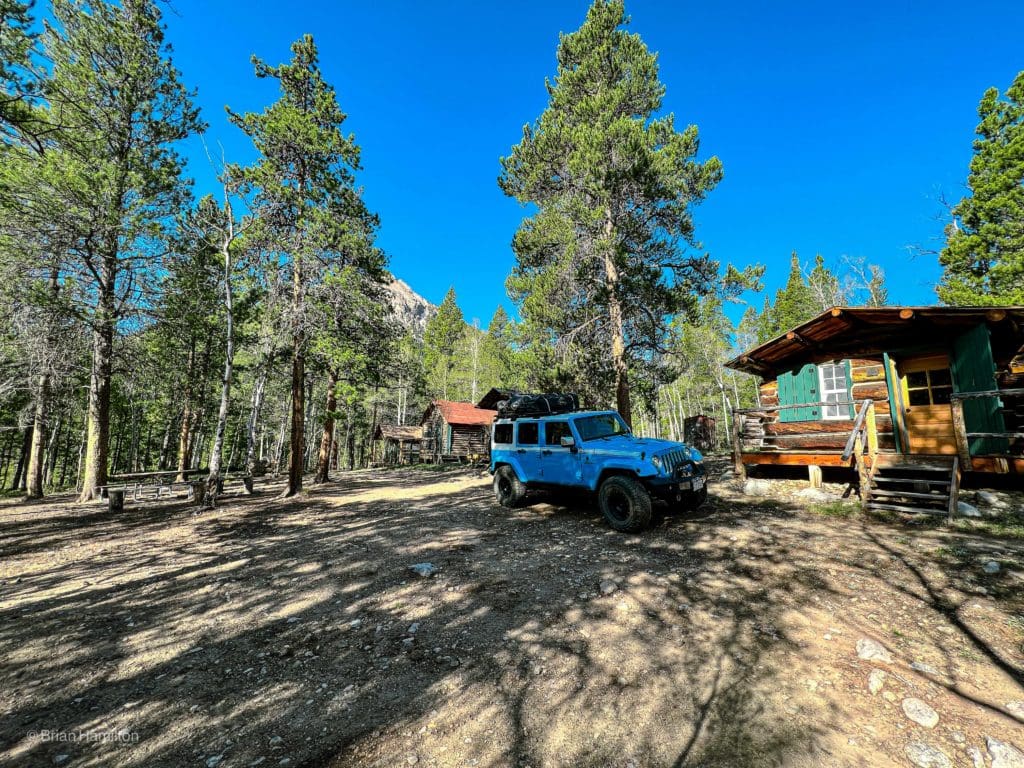
USFS’ Crescent Mining Camp near Buena Vista, Colorado.
Events/Festivals
The Salida and Buena Vista areas have a great slate of events throughout the year, but spring and summer are when the festivals shine brightest.
- Kayaks on snow: A crazy event that takes place at Monarch Mountain at the end of their ski season. Kayakers face off in head-to-head races down a snow course built with obstacles that eventually ends in an icy pond.
- Bluegrass on the Arkansas: Two days of bluegrass bands on the banks of the Arkansas River.
- Salida Artwalk: A great showcase of the area’s artists and their dynamic work.
- FibARk: The festival highlights the river and features beer, parades, and food. Many events occur on the river, including the nation’s oldest, longest, and one of the most prestigious whitewater races: The Downriver Race.
- Colorado Brewers Rendezvous: A standout beer fest with tons of variety.
- Salida Bike Festival: A mid-September festival with bike races, bike-in movies, and costumes.
- River on the River: Upstream in Buena Vista, this multiday music festival features bands, booze, and the scenic Arkansas River.
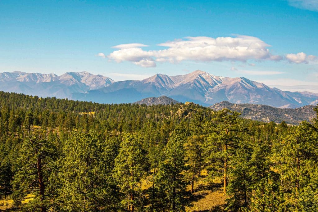
Autumn in Buena Vista, Colorado.
Summer Activities
While the region certainly has some historical quirkiness, it’s really the mountains and outdoor opportunities that make both Salida and BV such attractive places to visit.
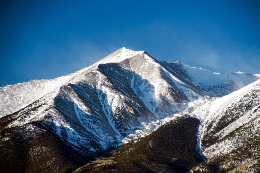
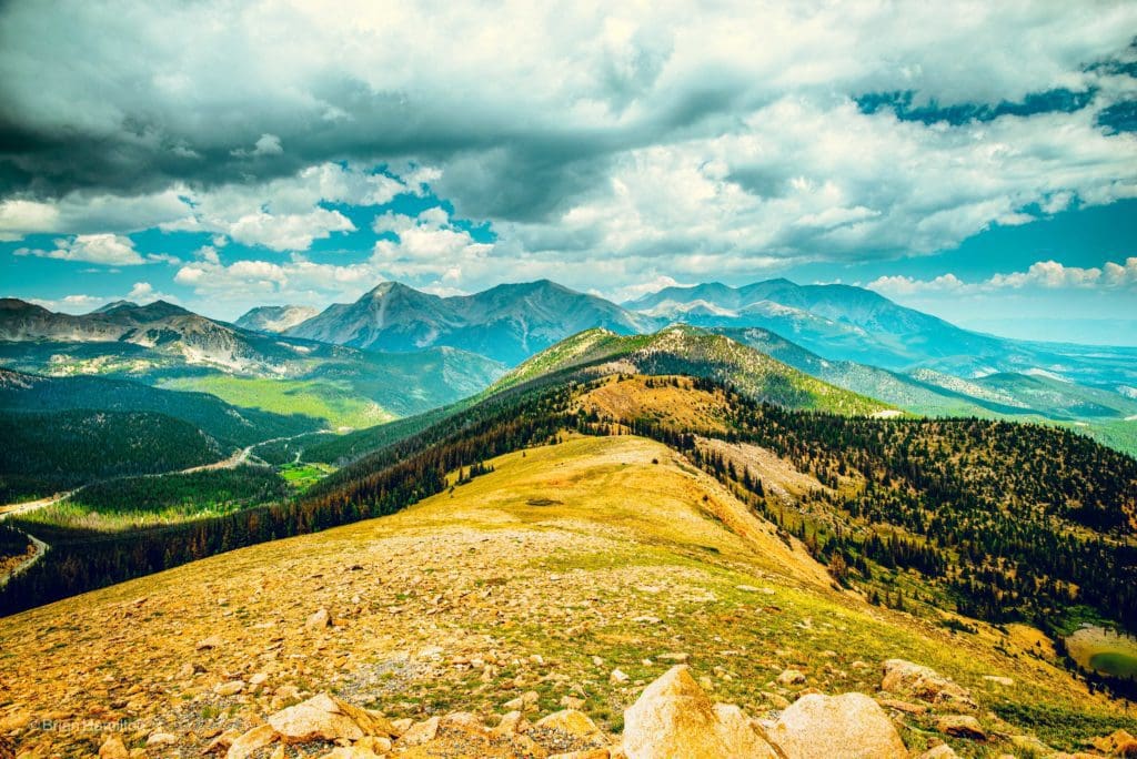
Hiking/14ers
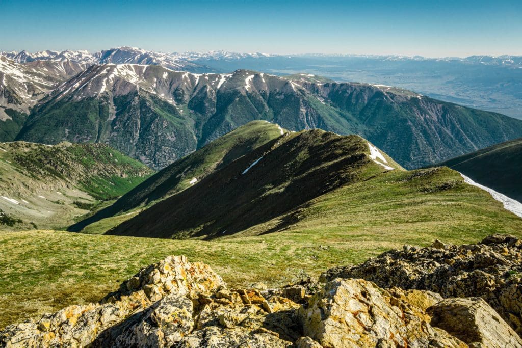
- Shavano/Tabeguache: These two large mountains are visible from Salida and easy to get to. Just because they’re close to town doesn’t mean they are easy, however. As with all 14,000-foot mountains, take appropriate caution, dress for the weather, bring lots of water and watch for signs of altitude sickness. Total Length: ~10.5-11 miles. Elevation gain: 5,600 ft.
- Mt. Antero: This is kind of a wild fourteener. There are gnarly dirt roads that get within a few hundred feet of the summit, but you’re going to need a lifted 4WD vehicle to make it (see the off-roading section below). For hikers, you can make it partway up the road and hike the rest of the way. Be aware; Mt. Antero has a lot of natural Aquamarine and many active mining claims on it. You may see folks with pickaxes hoping to grab some of the precious gems, it is allowed and adds to the unusual atmosphere around the peak. 2WD trailhead: 15.5 miles, 5,200 ft. From the top of the 4WD road: ~0.5 miles, ~565 ft.
- Mt. Princeton: This mountain is highly visible west of Buena Vista, commanding the surrounding landscape. A dirt road leads to a high trail on the shoulder of the pack and should be passable by most cars with a little lift. Sedans and smaller shouldn’t push their luck, but anything from a Subaru up will make it easy as long as there isn’t a lot of snow. From the top of 4WD drive: ~7 miles, ~3,340 ft.
Mt. Princeton, a Colorado 14er.
- Yale: Often grouped together with the easiest 14ers, Mt. Yale offers a big payout for much less effort than some of its neighbors. To reiterate, all 14ers are difficult endeavors, but Yale is a good candidate for newer hikers.
- Harvard: Mt. Harvard is the third-highest peak in Colorado and a great example of the Sawatch Range at large. The approach is long, the elevation gain is substantial, but the scenic beauty and summit perch make it one of the best mountains near Salida.
- Mt. Oxford & Belford: Usually combined, these two 14ers are approached via the same trailhead off CR 390, the same road that passed Clear Creek Reservoir. In fact, you can access a third 14er from the same trailhead (Missouri) and a fourth if you continue on CR 390 to its end (Huron).
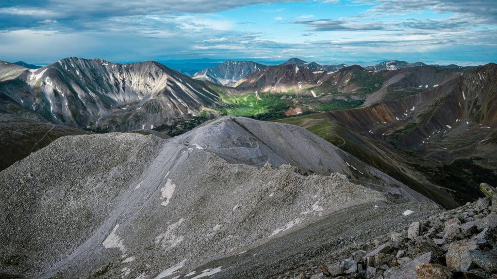
Looking to the North from the Mount Belford summit, you can see Mount Elbert as well as the Arkansas River Valley below.
- Missouri Mt.: Approached via the same approach trail as Belford, Missouri is higher up the valley and on its western side. There are one or two sections near the top that are more exposed and sandier than neighboring peaks, but with careful foot selection, it should be manageable. The views from the top are stunning.
- Huron Peak: This hidden 14er has one of the best summit views in the Sawatch. The road to it is rougher than most and requires careful navigation, but should be passable by most cars with a little lift like a Crosstrek, etc. What’s nice about Huron is that it doesn’t mess around, and the trail is pretty short and steep. You’ll be working, but you’ll reap the benefits a lot faster than other Sawatch 14ers.
Views from the Summit of Mount Antero, San Isabel National Forest, Colorado.
More Great Hikes
- Cottonwood South aka Cottonwood Pass Peak: This relatively easy alpine point-to-point hike takes off from Cottonwood Pass and heads southwest over a high point and up to the next one. You can stop between the two summits as the route on alltrails suggests, or continent on to the next high point for more stunning views. Total length: 4.2 miles. Elevation Gain: +1,1015 ft.
- Hunt Lake Trail (Monarch Pass Area): This pleasant hike tackles the ridges on the eastern side of Monarch pass and passes two lakes en route. Total Length: ~6 miles (~7 if walking around the lake). Elevation Gain: +~1600 ft. For an extra 2.5 miles and another 1,000 ft., you can climb the ridge up to the continental divide.
- Old Monarch Pass Loop: Located just to the west of the Monarch pass summit (the best place to park), this trail is an easy way to enjoy the fantastic scenery of the area. It’s also a great snowshoe or cross-country ski. Total length: ~3.2 miles. Elevation gain: ~500 ft.
- Colorado Trail Segment 15: You can access this section from Marshal Pass (dirt road in the summer, closed in winter) or from US 50 northeast of Monarch pass. It’s a wonderful section of high alpine travel and doubles as part of the famous Monarch Crest bike trail. Total distance: ~14 miles. From Marshall Pass to US 50: Elevation gain: ~1550 ft. From US 50 to Marshall pass: ~3500 ft.
Epic Clouds Gather over Monarch Pass.
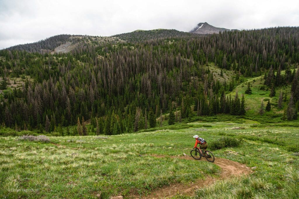
Mountain Biking
Salida has done a great job building mountain bike trails and elevating the sport. The geography is conducive, and there are many fantastic rides near town. If you want to do one of the alpine rides, remember that the alpine trails won’t be snow free until June/July and may experience snow as early as late September.
- Arkansas Hills Mountain Bike Area: This is the closest option to Salida, taking off from downtown. There are a series of stacked loop options that generally get harder the higher up in elevation you go. The system is slowly expanding, and trail options are diverse. It’s a high desert climate meaning hot in the summer but often snow-free in the colder months.
- Monarch Crest: This route is routinely placed among the top 5 mountain biking rides in the whole state. Be warned, it is quite long, 38 miles, and at a high altitude for most of it. Train up for this one.
- Bear Creek – Rainbow – Columbine Loop: A great loop option on the west side of the Sangres and just south of Salida proper.
- Vitamin B: A challenging and flowy ride; for experts only.
- CDT Alpine Tunnel: Historic structures, high alpine single-track, and fantastic views make this a standout loop.
Mountain biker on the Monarch Crest section of the Colorado Trail and Continental Divide Trail.
Off-Roading
- Aspen Ridge OHV Trail: This moderate dirt road is a nearly 30-mile point-to-point trail that runs from highway 285 to just outside of Salida (or vice versa). The views are lovely, and it’s a great way to see the aspens turn in the fall. Make sure you have some off-roading experience; the middle third of the trail is the hardest.
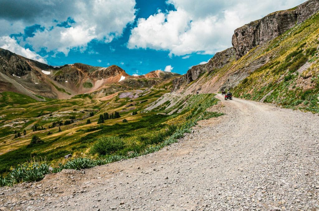
- Mt. Antero: While many people will be attracted to Antero for its status as a fourteener, you can make the journey up it a lot easier with a burly rig. Lifted 4WD vehicles will find Baldwin Gulch Road a fine challenge. If you can manage the whole road, it’ll lead to within a few hundred feet of the actual summit. For experienced off-road drivers, this is a really fun way to experience the area. This first video is a nice overview of the ride up, focusing on a few sections of the road near and above treeline. This second video is a time-lapse from the very top all the way down to the bottom. Both offer great visual interpretations of what you’re getting into.
- Tin Cup Pass: This moderate dirt road pass is an area staple. Most people agree that the route is better from west to east. So, start by hitting the paved Cottonwood Pass over the divide from Salida, head to the town of Tin Cup, and start the trail heading back east over the Continental Divide and down to the outskirts of Buena Vista.
- Chinaman Gulch & Carnage Canyon: This is a difficult and popular trail. Because it is located on a lower set of hills to the northwest of Salida, it doesn’t often fill with snow. Winter is a nice time to try it out with fewer crowds.
Tin Cup Pass
Rock Climbing
The majority of the rock climbing options exist just to the north of Salida, centering on the Fourmile recreation area near Buena Vista. The vast majority of routes in the area exist on a drier set of hills opposite the Sawatch Range. The relatively drier weather means a longer climbing season and stunning views of the highest mountain range in the state across the valley.
Best Buena Vista Options
Trail Running
There are quite a few trail-running options near Salida. Many of them tackle areas already referenced before. The best areas are just east and north of town, along with the western areas near the Continental Divide. Check out this page on Trail Run Project to start planning your next area trail run!
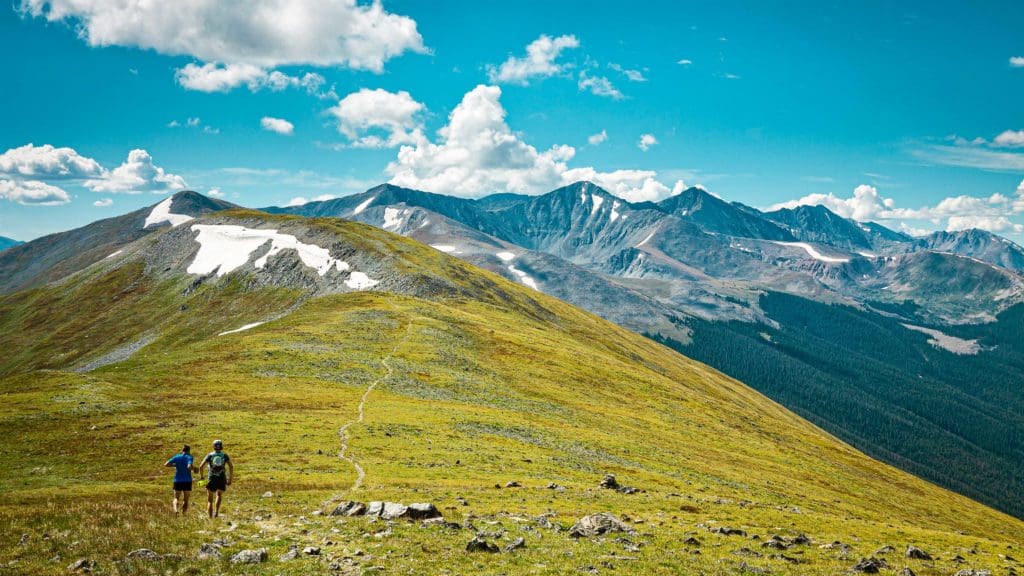
Trail running near the Continental Divide.
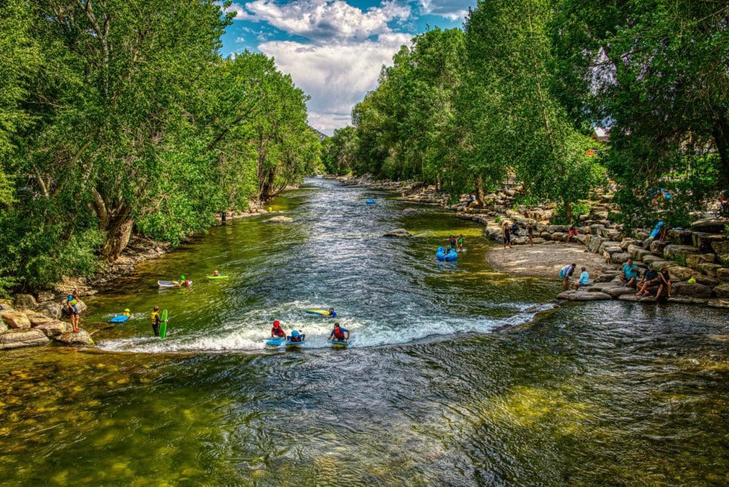
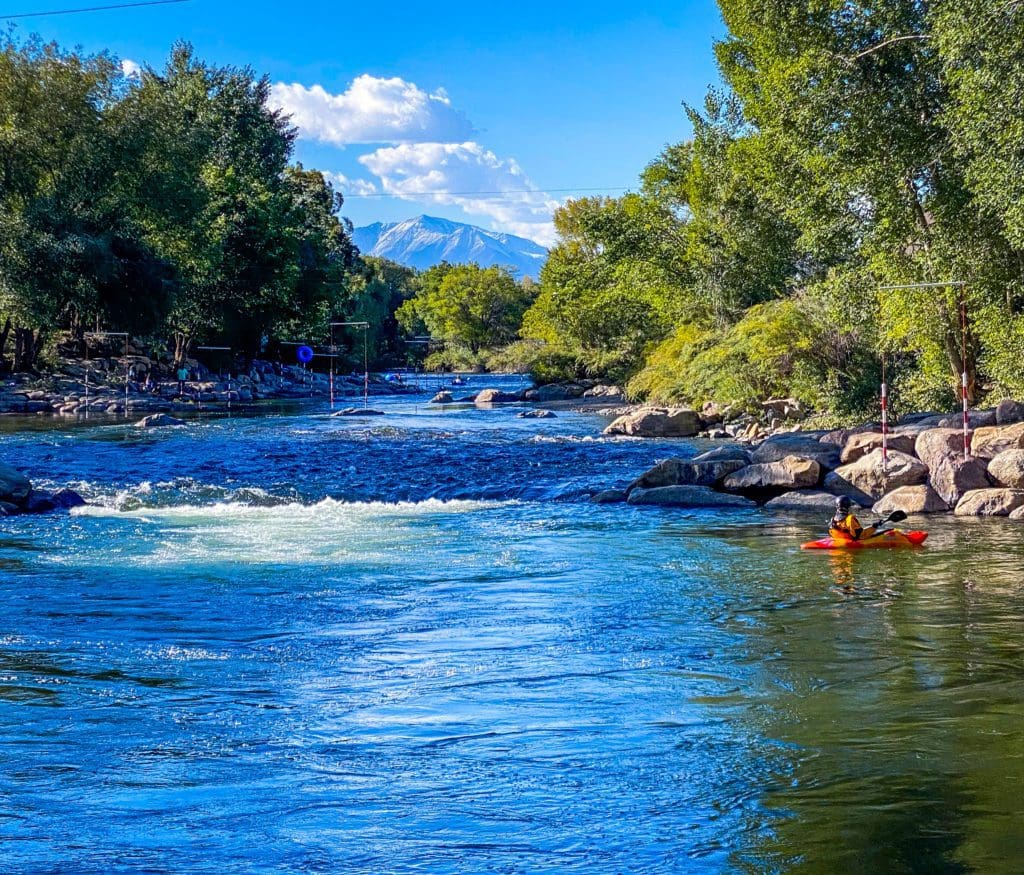
Water Sports
The Arkansas River: The river is the lifeblood of the area and runs for 148 miles through the mountains before depositing into Pueblo Reservoir and continuing through the great plains until meeting the Mississippi River in Arkansas. If you’re interested in paddling or rafting down stretches of the river, Salida and BV are the perfect places to test out the Arkansas.
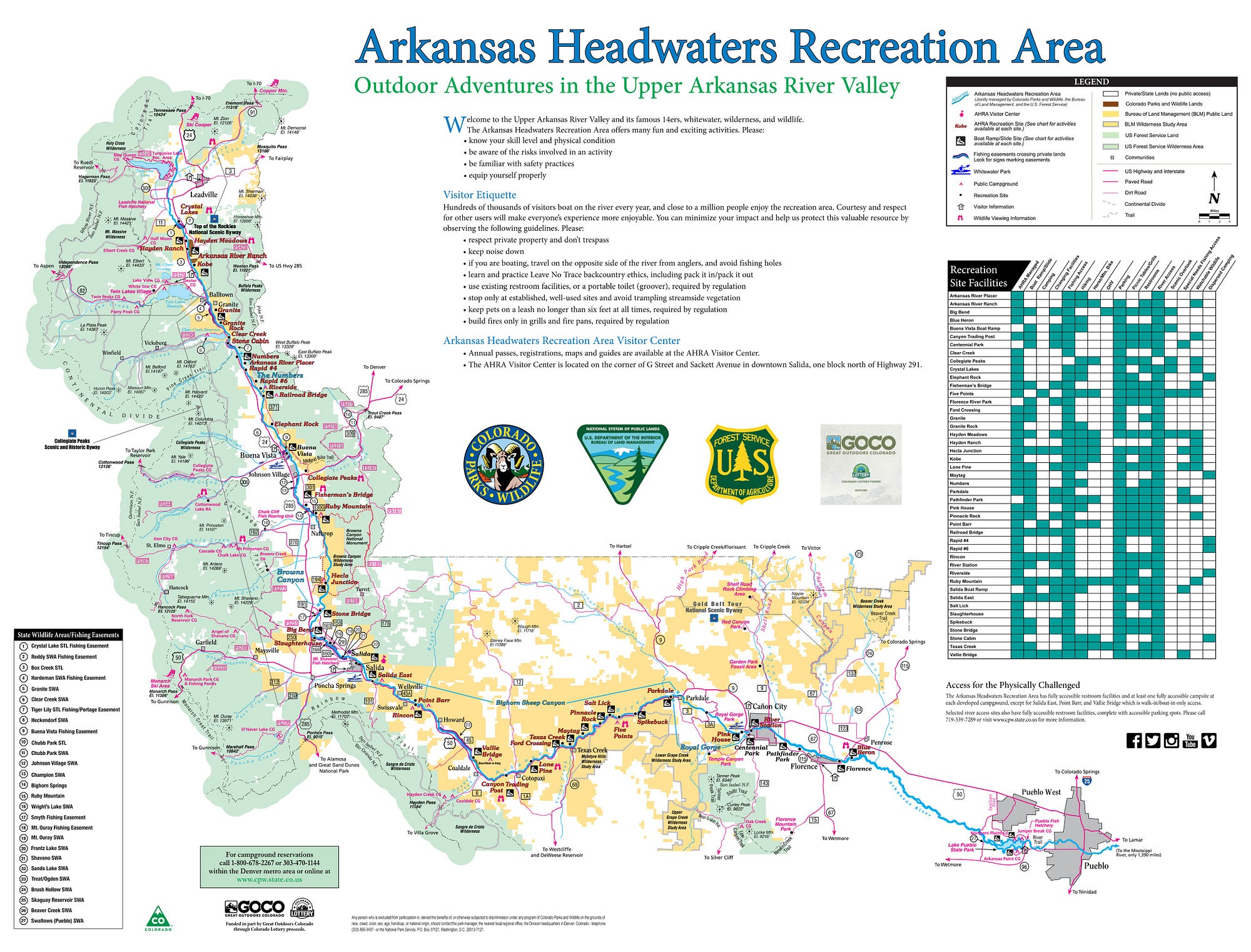
The River presents in various segments along its winding course through the mountains.
- Leadville to Granite: Class I-II fast-moving mountain water.
- Granite to Buena Vista: Pine Creek Rapids and the “Numbers” Rapids. Fast and sustained rapids ranging from Class III-VI, true whitewater sections.
- Buena Vista to Salida: Browns Canyon National Monument, many famous rapids. This section is run a lot by commercial rafting companies. Class III-IV rapids. There are a few calmer sections beyond Browns Canyon.
- Salida to Cotopaxi: Pretty relaxed section. Class II water.
- Cotopaxi to Parkdale: Bighorn Sheep Canyon. Class II-IV rapids.
- Royal Gorge: Very difficult rapids, class IV-V.
- Cañon City to Pueblo: Slower and meandering, heads into Pueblo Reservoir.
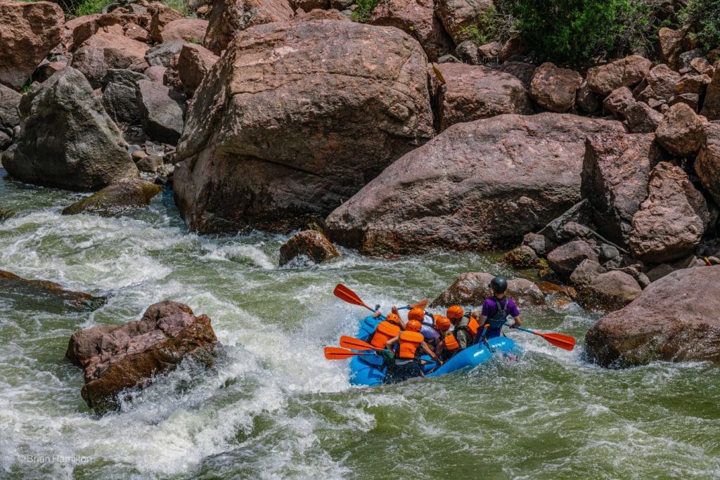
Royal Gorge Whitewater Rafting.
Boating:
Clear Creek Reservoir: This reservoir is located north of Buena Vista and has a series of campgrounds around it. You can bring use motorized boats on the lake, along with kayaks, stand-up paddleboards, and other non-motorized vessels.
Fishing
- Clear Creek Reservoir
- Various sections of the Arkansas River. Good access exists near Buena Vista and Salida. The calmest sections of water are north and south of Salida, between the bottom of Browns Canyon and the top of Bighorn Sheep Canyon.
- Check out our Leadville Adventure Town Article to explore fishing opportunities on the Upper Arkansas River and a few excellent bodies of water like Twin Lakes and Turquoise Lake.
Winter Activities
Despite its mountainous location, Salida only experiences an average of 43 inches of snow and a generally mild climate. Having said that, the surrounding terrain is ripe for snowy exploration, especially to the west in the mighty Sawatch Range.
Backcountry Skiing
- The Angel of Shavano: This is a moderate ski descent and fairly difficult approach. It’s best skied in the spring under a consolidated snowpack and with little to no avalanche danger. Skiing mid-winter brings a host of additional challenges. Do not attempt unless you have relevant experience.
- Monarch Pass: Located right next to Monarch Ski Mountain, the pass has a few solids (albeit short) runs that make for a fun day in the backcountry. If you have the time and effort, combining a few can stretch out the fun. Always be cognizant of other recreationists, avalanche conditions and hazardous terrain features.
- Waterdog Lakes: On the east side of Monarch pass, this trail, which sees both skier and snowshoe traffic, heads up to a series of pristine lakes. Many possible backcountry lines exist there. Exercise extreme caution during the winter season.
Cross-Country Skiing
There are quite a few cross-country and snowshoe routes in the area that are worth exploring. Take a look at this comprehensive guide to get a good idea of the various options.
Resort Skiing at Monarch Mountain
Monarch is a family-friendly mountain with some superb cat skiing and glades. It’s situated on the Continental Divide between the Gunnison River Watershed and Arkansas and sees much less traffic than the I-70 resorts.
- Total Acreage: 800
- Base Elevation: 10,790 ft.
- Top Elevation: 11,952 ft.
- Vertical: 1,162 ft.
- Number of runs: 67
- Beginner runs: 15
- Intermediate runs: 19
- Expert runs: 8
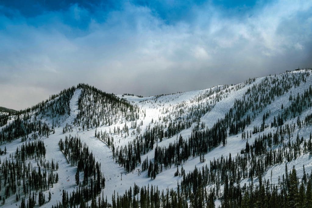
Monarch Mountain Ski Area, Colorado
Resort Skiing at Ski Cooper
A little farther north near Leadville lies Ski Cooper, first brought to life in 1942 as a training ground for the 10thMountain Division. They are a smaller resort but have the excellent Chicago Ridge, which is accessible to uphill skiers (followings specific paths) and snowcat skiing.
- Total acreage: 480
- Base Elevation: 10,500 ft.
- Top Elevation: 11,700 ft.
- Vertical: 1,200 ft.
- Number of runs: 64
- Beginner runs: 31% (~20 runs)
- Intermediate runs: 35% (~22 runs)
- Expert runs: 34% (~22 runs)
Conclusion
Between BV and Salida lies a world of outdoor adventure for those who want it. Soak in hot springs, climb mountains, ski pow, and shred single-track or off-road to your heart’s content in one of the adventure capitals of Colorado.
Popular Articles:
Go Heli-Skiing in British Columbia
Best Hiking Trails in Rocky Mountain National Park


