


High Point:
13,294 ft. on the Citadel

Total Ascent:
3,100 ft.

Difficulty:
Very Difficult (Class 3-4 scrambling)

Distance:
~8.2-8.5 miles

Route Type:
Out and Back
The Citadel stands tall amongst the mountains around I-70. It requires scrambling in summer or mountaineering gear in winter to reach its summits. Hagar Mountain, its neighbor along the Continental Divide, is a wilderness area with Class 3 scrambling and ski mountaineers’ delight in the winter. This guide will describe both targets, as well as the option of climbing Citadel separately from Herman Gulch trailhead.
Overview
The Citadel is unlike a lot of the lumpy mountains around I-70 between Georgetown and the tunnels. Its steep and rocky profile makes it easy to spot from the ridgelines at Loveland Ski Resort and neighboring peaks. The peak feels very alpine and sports decent rock to scramble on. There are various ways to climb the east and west summit, but both require scrambling in the summer or mountaineering gear in the winter. Seen from the south and west, the two summits resemble the profile of Snoopy from the cartoon Peanuts sitting on his house with his nose to the sky. That image has earned the Citadel its most common nickname, Snoopy.
Hagar Mountain is The Citadel’s neighbor to the west along the Continental Divide. Most of the mountain is unremarkable, although its placement along the divide and at the head of two trailless basins gives it prominence and a wilderness character. The joys of Hagar are found along its summit block, where an abrupt rise demands Class 3 scrambling and an exposed knife-edge to traverse. Like Citadel, Hagar is a superb ski mountaineering target in the winter as well. This guide will describe a combination of both targets that utilizes the best scrambling options on each one. It is also possible to climb Citadel by itself from the very popular Herman Gulch trailhead.
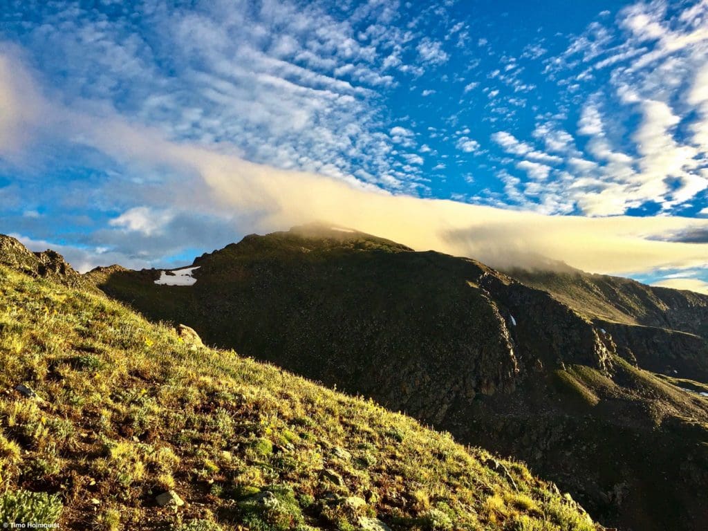
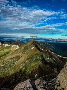
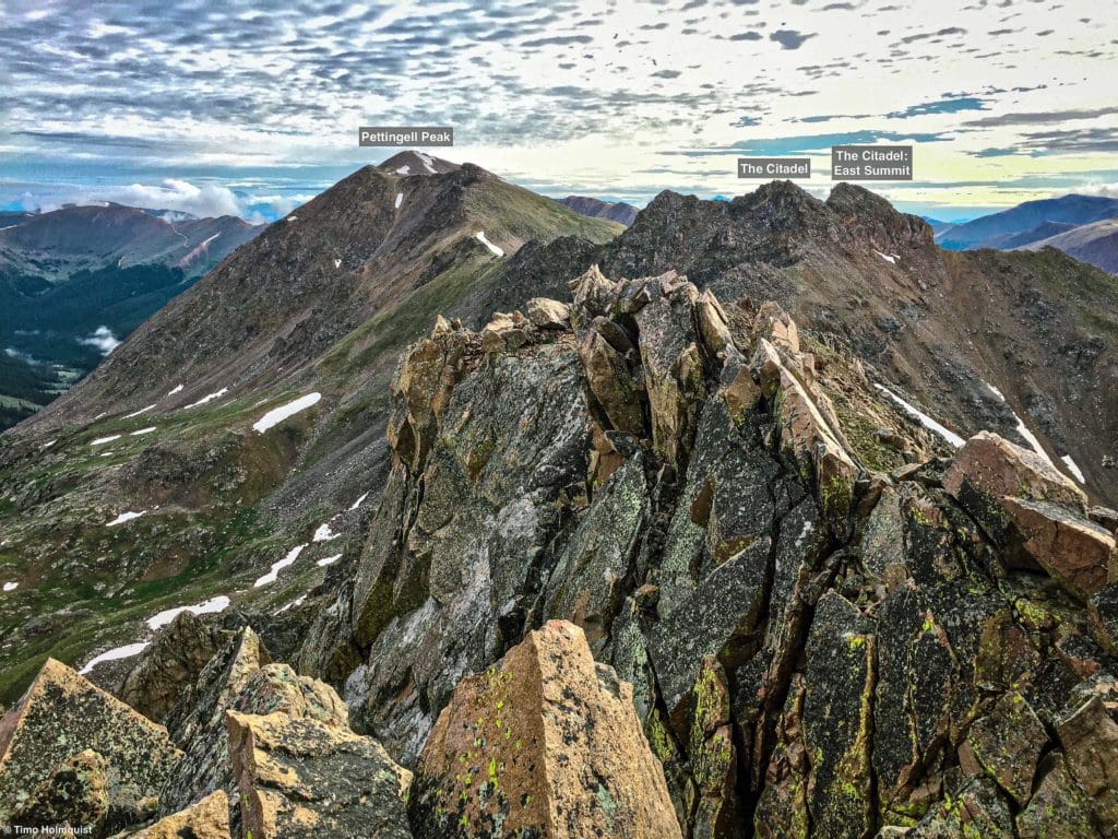
Striking clouds above Pettingell Peak, seen from the ridge to the Citadel.
Table of Contents
Article Navigation: Click on any of the listed items in the table of contents below to jump to that section of the article. Similarly, clicking on any large, white section header will jump you back to the Table of Contents.
- Overview
- Scales and Criteria
- Directions to Trailhead
- Field Notes
- Journal: The Citadel (Standard routes)
- Journal: The Citadel – East Summit (East Slab Route)
- Journal: Mt. Hagar
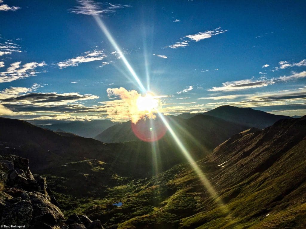
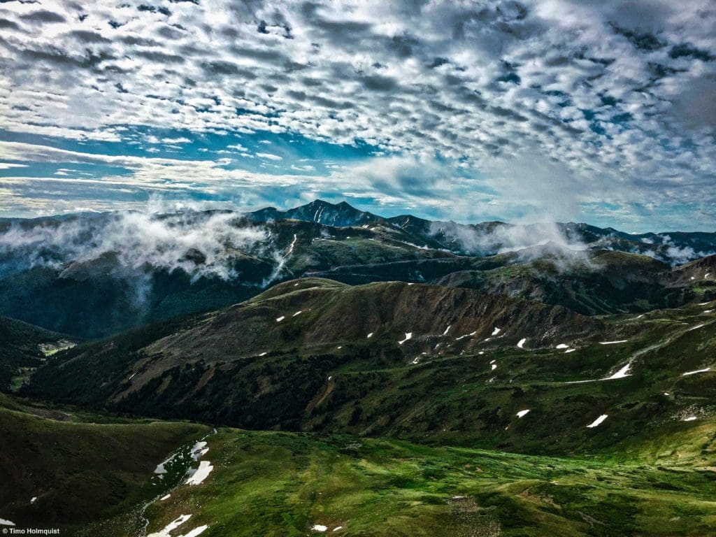
Morning sunlight above Herman Gulch.
Enroll With Global Rescue Prior To Embarking On Your Next Adventure
Global Rescue has expanded services to include local field rescue within 100 miles of home. Global Rescue is there whether you’re hiking, kayaking, snowmobiling, fishing or simply enjoying the outdoors and get ill or injured and you’re unable to get to safety on your own. Global Rescue is the red button you push in an emergency. Their team of medical and security experts come through for you when it matters most.
Scales and Criteria
This article uses two metrics to calculate difficulty: overall distance and elevation gain. For winter ascents, a snow rating may be used, but this review covers the basic loop during snow-free summer and autumn months, so snow shouldn’t be more of a factor than a few isolated patches up high. Seeing as there are multiple places where scrambling is required, a technical rating is also employed, which uses the Yosemite Decimal System to calculate the difficulty of the moves required.
Difficulty Ratings:
- Easy: less than 5 miles, less than 500 ft. of elevation gain
- Moderate: 5-10 miles, 500-2000 ft. of elevation gain
- Difficult: 5-15 miles, more than 2000 ft. of elevation gain
- Very Difficult: 10+ miles, more than 3,500 ft. of elevation gain
Technical Rating:
- Class 1: Established hiking trail the entire length of the adventure. Low chance for injury.
- Class 2: Typically involves cross-country navigation, possibly using hands for balance but not required, steeper than Class 1.
- Class 3: Hands and feet used to scale areas; must use hands to proceed (either for balance or to help pull you up a section), increased exposure, a fall could be fatal. Helmet recommended, along with grippy hikers.
- Class 4: Climbing on very steep terrain just shy of vertical, falls could be fatal, hands employed for grip and balance continuously, ropes advised but scalable without. Helmets are highly recommended, along with grippy hikers.
- Class 5-5.4: Vertical climbing that involves technical rock-climbing moves, exposed, falls likely to be serious or fatal, possible to scale without ropes but only for very experienced veterans. Helmets, grippy hikers, and/or rock-climbing shoes are necessary.
- Class 5.5 and up: Not covered as scrambling, full-on rock climbing with ropes, helmets, etc.
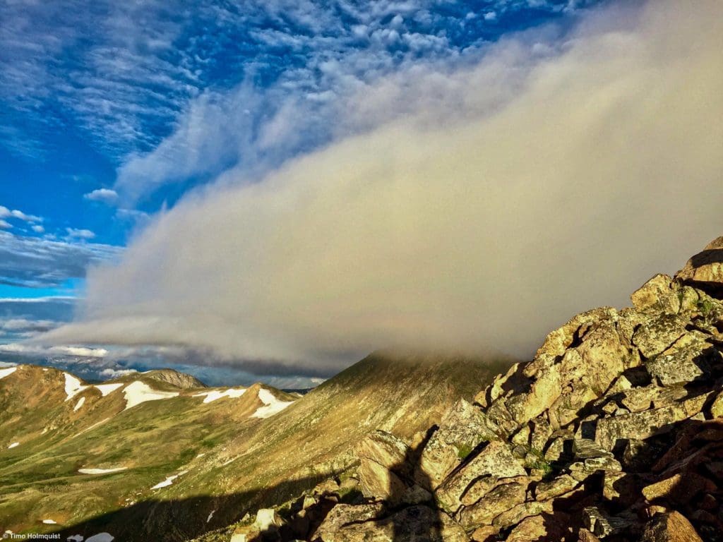
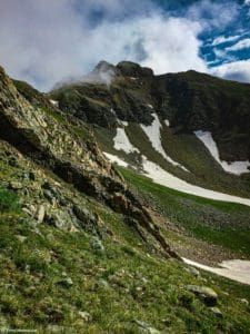
Clouds over Hagar Mountain
The Ultimate Offline GPS Hiking & Ski Maps
See why onX Backcountry is the ultimate GPS navigation app for your outdoor pursuits. Try Today for Free. No credit card required.

Directions to Trailhead
You can start and end the loop from Herman Gulch trailhead, which doesn’t require much trailless hiking, but it’ll take longer. To find the trailhead, take I-70 west from the Front Range until you find exit 218. Once you take the exit, at the end of the off-ramp, take a hard-right turn onto a dirt road to find the parking lot, which lies parallel to the highway. From the west, you’ll have to travel over the tunnels and into Clear Creek County before finding the trailhead.
The best way to start and end the loop is actually from Dry Gulch, an unmarked basin between Herman Gulch and the lifts at Loveland Ski Resort. About half of the gulch is in the special use permit for Loveland Ski Resort, and they have plans to run snowcat operations there on winter weekends. There are currently no plans to install lifts in Dry Gulch, and both Hagar and Citadel lie outside of the special permit area.
To find Dry Gulch, you want to take the I-70 exit to Loveland Ski Resort and Loveland Pass (exit 216). If you’re coming from the east, take the exit ramp, and just like Herman, at the end of the off-ramp, take a hard right onto a small dirt road that parallels the highway. Drive until the gate closure and find a place to park without blocking the gate. From the west, pass under the tunnels. Then, take exit 216, take a left, cross underneath the highway and find the dirt road paralleling the westbound lanes.
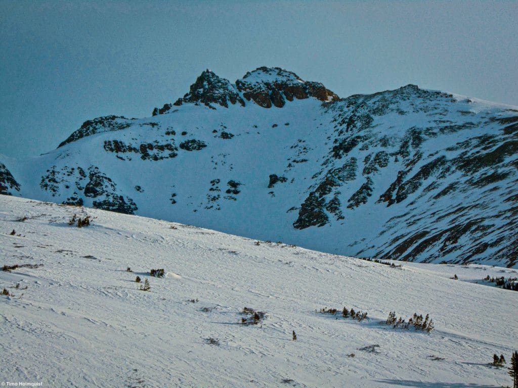
The Citadel from Dry Gulch in early April.
The Ten Essentials: How to Equip Yourself for the Backcountry
Packing the “Ten Essentials” whenever you step into the backcountry, even on day hikes, is a good habit. When something goes awry, you’ll truly appreciate the value of carrying these items that could be essential to your survival.
Field Notes
A ton of micro-climates exist in this part of Colorado, and the wind may be fierce. While I-70 goes up the most prominent canyon in the area, its elevation is markedly lower than the various gulches and peaks around it, meaning you may want 2-3 forecasts to get an accurate picture of what the weather is doing.
Start with a forecast for Loveland Pass and Loveland Ski Resort. Even though the resort is likely closed when you hike here, the weather forecast page is fairly accurate all year long. There’s a free forecast for Torreys Peak as well; the 14er is just across the highway from Dry Gulch, so you can pull some useful data from that.
If you can pay for a yearly subscription, I recommend getting Opensummit. The forecasts have a lot of details and breakdowns (air quality, precipitation, wind, lightning chances, etc.), and the subscription gets you access to their site Opensnow, which has winter reports for resort and backcountry skiing. Opensummit has forecasts for Pettingell Peak (Citadels neighbor to the northeast), the tunnels on I-70, and Mt. Bethel, which sits between Herman Gulch and Dry Gulch.
Keep in mind that these are the Rocky Mountains; no weather forecasting site is going to get the details right 100% of the time. Mountain weather is often characterized by extremes, which include last-minute changes to forecasts. Always prepare for the worst possibility.
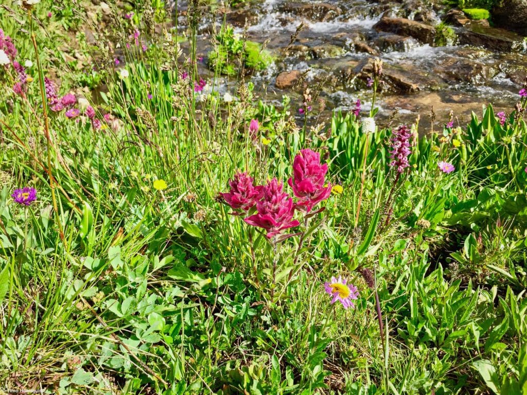
Alpine flowers in Dry Gulch.
Journal: The Citadel (Standard Route to Both Summits)
Most people who climb the Citadel make use of the easy-to-follow and well-laid-out Herman Gulch approach. This guide will describe an approach from Dry Gulch, which requires some basic navigational skills but allows you to make a more coherent loop out of both targets. While it’s certainly possible to climb both from Herman Gulch, it would require you to descend Hagar and climb back over the ridge separating Dry from Herman Gulch. You could also retrace your route from Hagar all the way back to the slopes of Citadel.
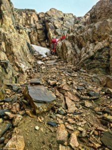
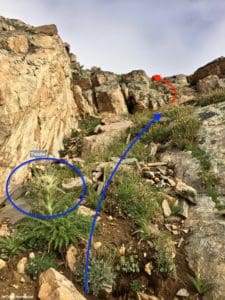
You’ll start from near the gate on the dirt road into Dry Gulch. Pass around the gate, which usually has a few signs about backcountry travel, and continue on the well-defined dirt road as it begins to meander higher. After gaining a little elevation, the road begins angling left (northwest); continue following it until you cross Dry Creek and pass by a fenced-off area to your right. The road ends shortly after but leads into a social trail that is initially easy to follow. This section can be surprisingly difficult after a heavy downpour. Follow the drainage, staying mainly to the right of the creek until you get to roughly 11,200 feet (~1.8 miles into your journey.) During this time, you’ll pass through at least two groves of trees and a few meadows. Keep an eye open to the right for numerous social trail options, or find an agreeable angle and create switchbacks up the initially steep slope. It is not prudent or effective to walk straight up; it’ll tire your legs, increase erosion and increase your chances of slipping or tripping.
Once you break out of the trees, it’ll become a lot easier to see.
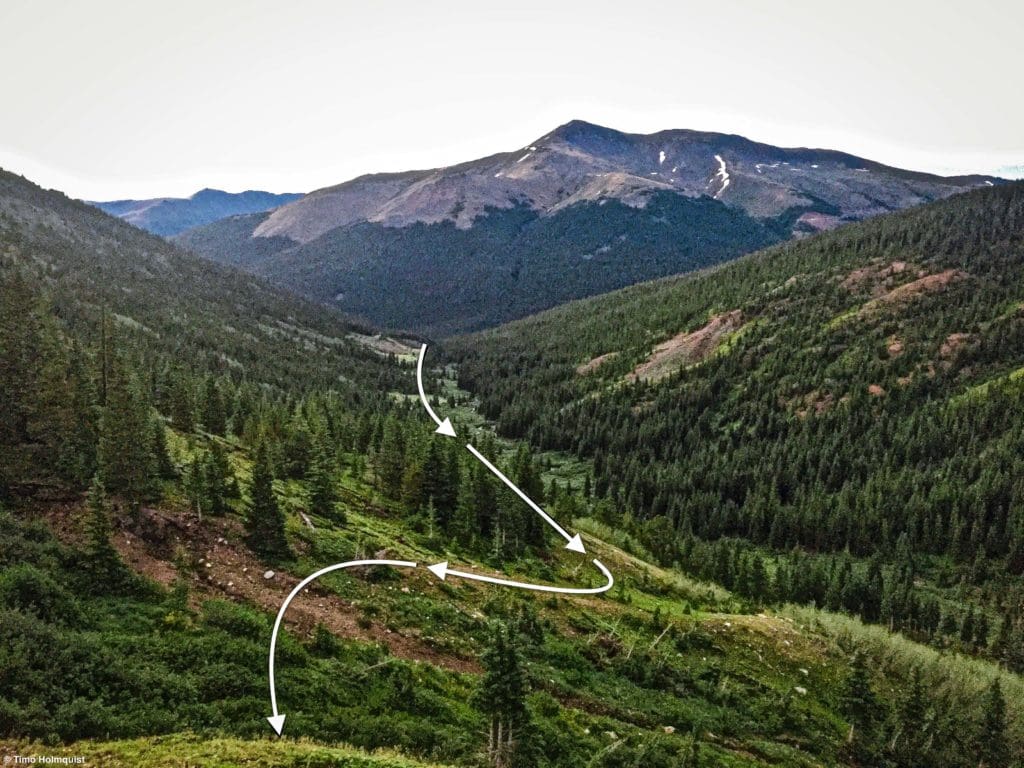
Looking back down the Dry Gulch drainage from one of a few ascent options.
Your goal is to make it to a low point in the ridge between Mt. Bethel (defined by a set of cliffs to your right) and a larger lump of land to its left. The larger lump is part of the Citadel, but its position blocks initial views of the craggy summit block.
The low saddle you’re shooting for.
This part of the hike is nice and oscillates between a few areas of scree, alpine grasses, and flowers. Take care to avoid stepping on sensitive alpine vegetation. After you crest the ridge, a much more popular social trail from the Herman Gulch side comes in to meet your path. From here, take a left and continue rising.
On the ridge, looking back down into Dry Gulch.
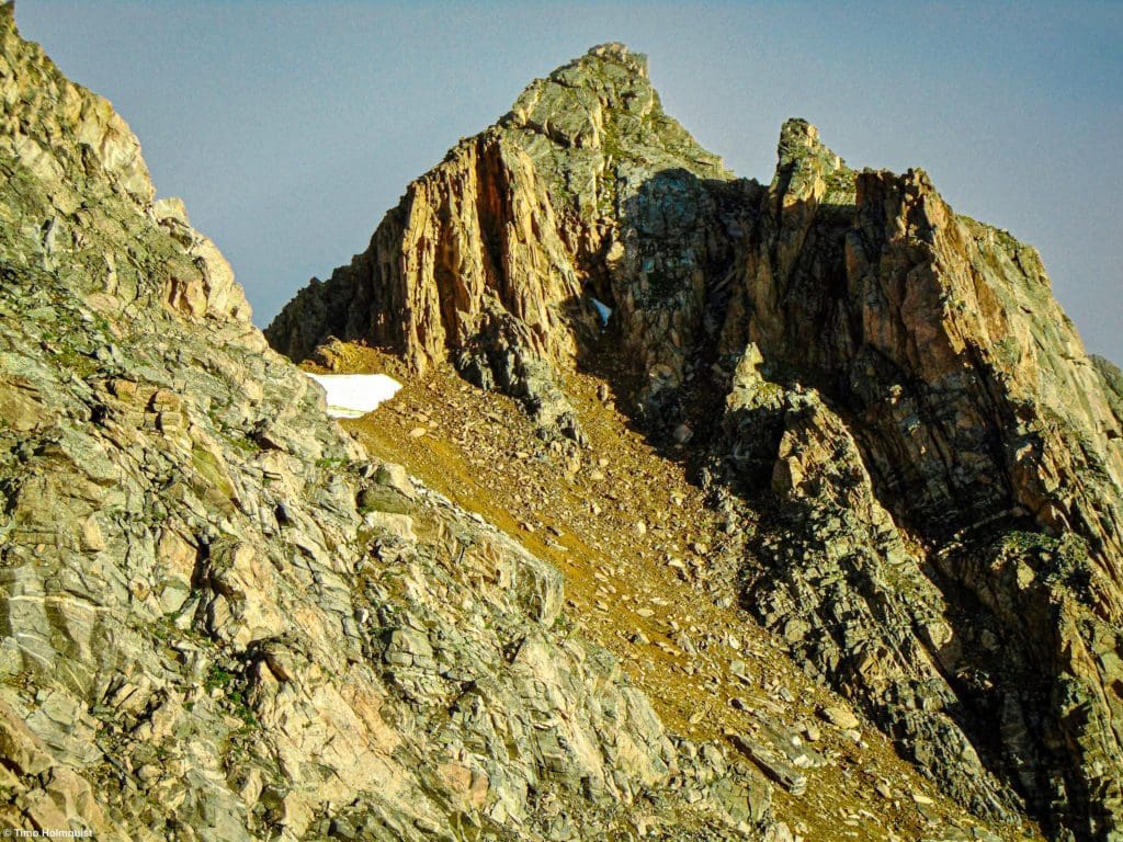
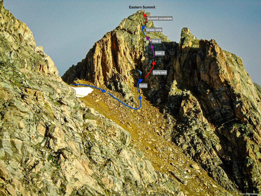
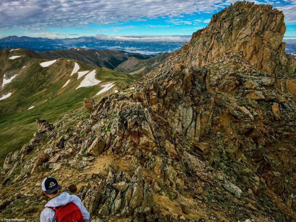
The social trail that you’re following now is easy to stay on and continues up the ridge, avoiding obstacles and cliffs until you approach the summit block of the Citadel. The intimidating Eastern summit of the Citadel blocks the higher western one but harbors some truly exceptional routes. Two possibilities are discussed below.
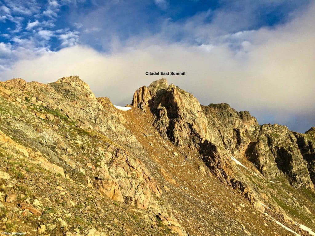
The East Citadel Summit.
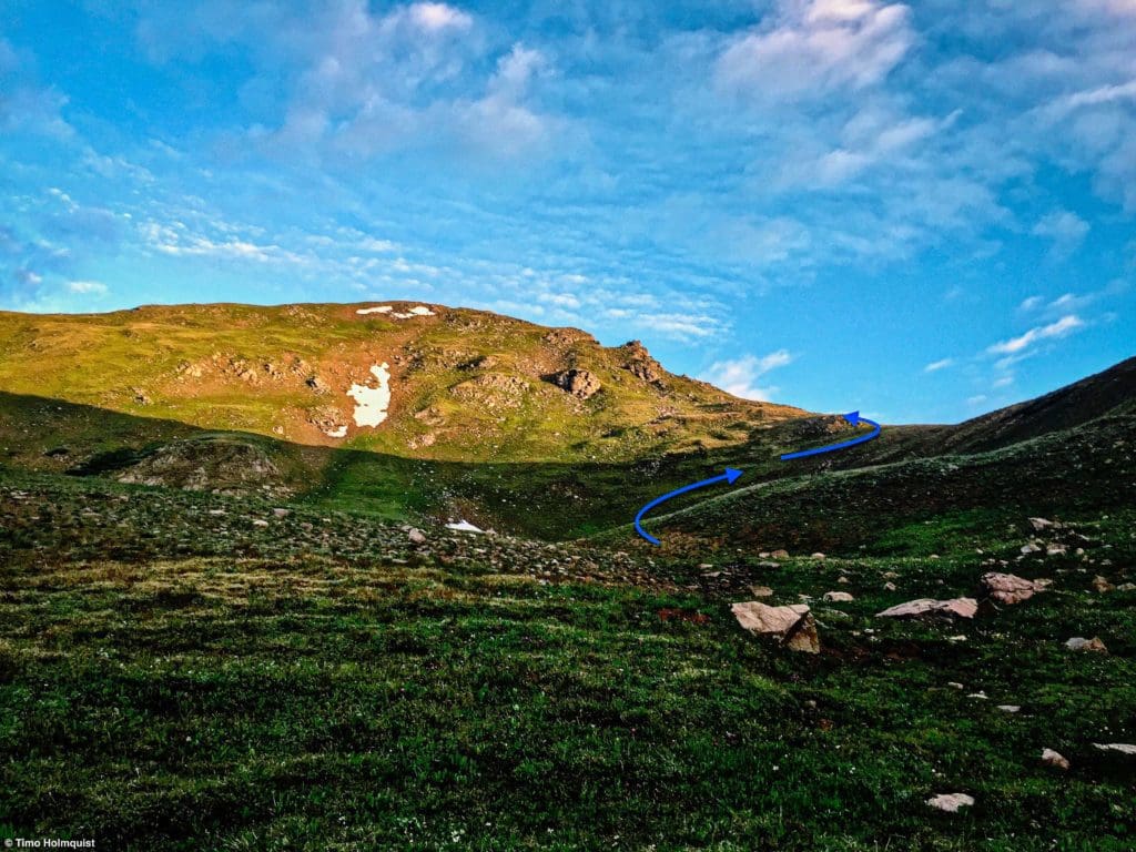
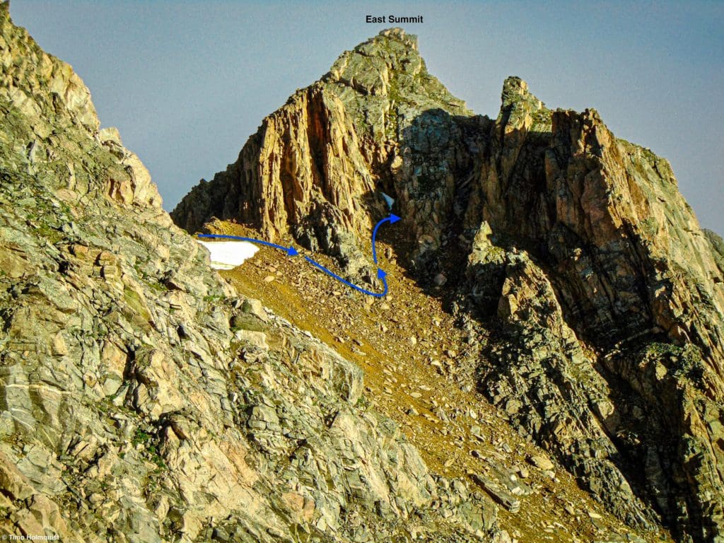
For those looking to simply tag the highest point of the Citadel, keep on the social trail as it holds the ridge and walk up to the cliffs underneath the East Summit. The trail will wrap around the cliffs to the left until finding a gully that separates the two summits.
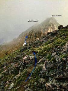
General trajectory to find the gully that splits the two summits.
Ascend into the gully and find a sometimes-cairned route up the left (west) side, which will leave the gully and attack the western summit block.
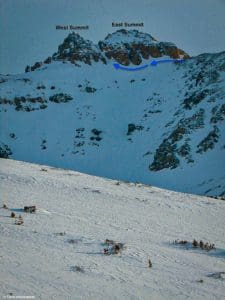
The gully seen from Dry Gulch with fresh snow.
This ascent will force a few Class 3 moves but is easier than the Class 4 East summit. Scramble as high as you can, touch the top rock, and you’ve climbed the Citadel!
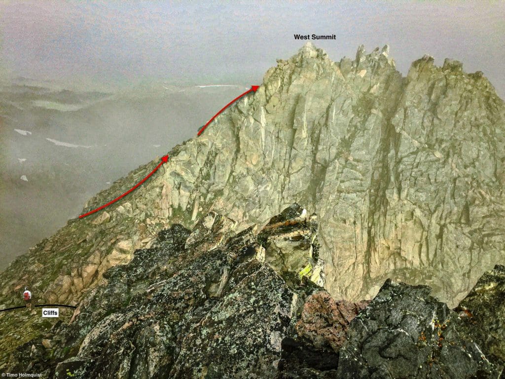
Scrambling route up Citadel west.
There are two main ways to climb the eastern summit, and both require Class 4 scrambling. The first and easiest way is to ascend into the gully between the two peaks and climb up to the top of the gully. Descend a few steps down the other side and then hook right to face a 10-12 Class 4 step.
The Class 4 section up the East summit.
Use a variety of moves to top out above the step. Then use a series of Class 2+ and Class 3 moves to scramble up to the top of the summit. Nicely done!
The East Summit from on top of the West Summit.
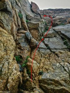
Journal: The Citadel – East Summit (East Slab Route)
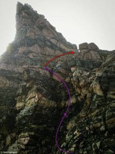
The harder but more spectacular East Slab Route is visible from lower on the ridge when you first glimpse the eastern summit.
The East Summit block from lower down the ridge.
This variation, instead of hugging the cliffs and heading west, dives to the right (east) and underneath them until finding a loose gully that leads into the cliffs.
First few moves on the East Slab variation.
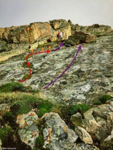
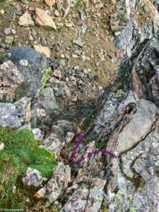
At the head of this loose gully is a solid Class 5 wall; before you get there, take a right and look for a Class 3+ exit that leads out of this area.
Where the gully exit is located.
Once you find the exit, scramble up until you reach the top.
The exit.
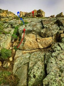
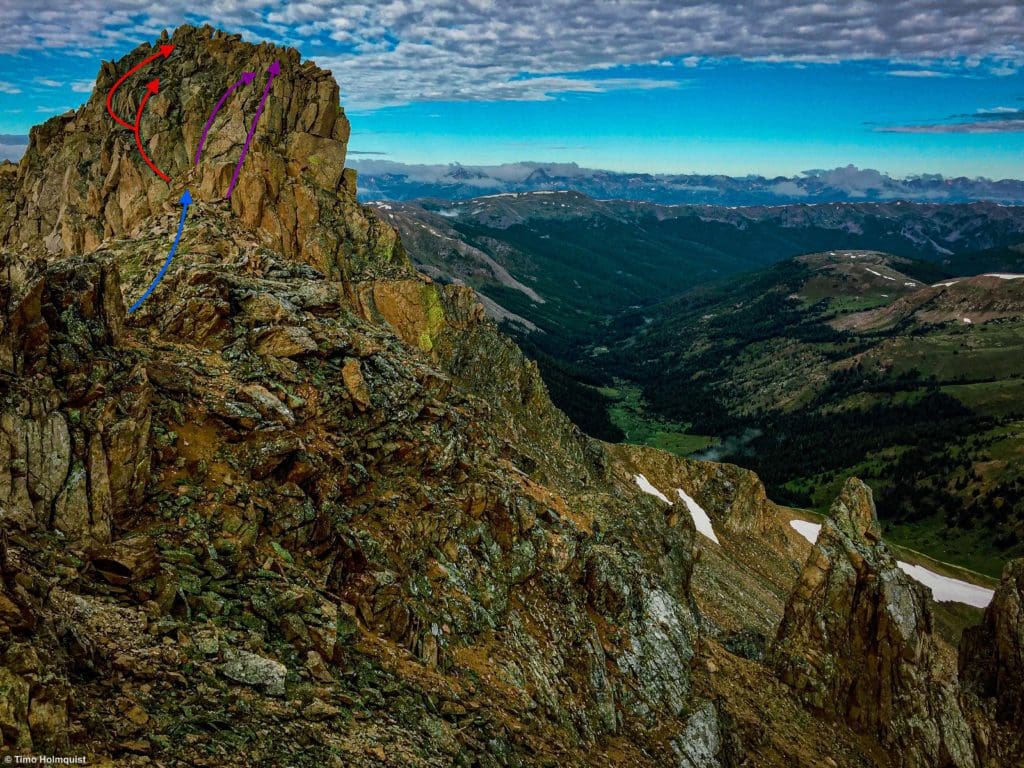
The gully exit will deposit you at the bottom of your first Class 4 slab. The scrambling is altogether fairly short but enjoys steep exposure and certainly gets the adrenaline pumping. The scrambling is also much tougher if any part of the rock is wet, so choose your day wisely!
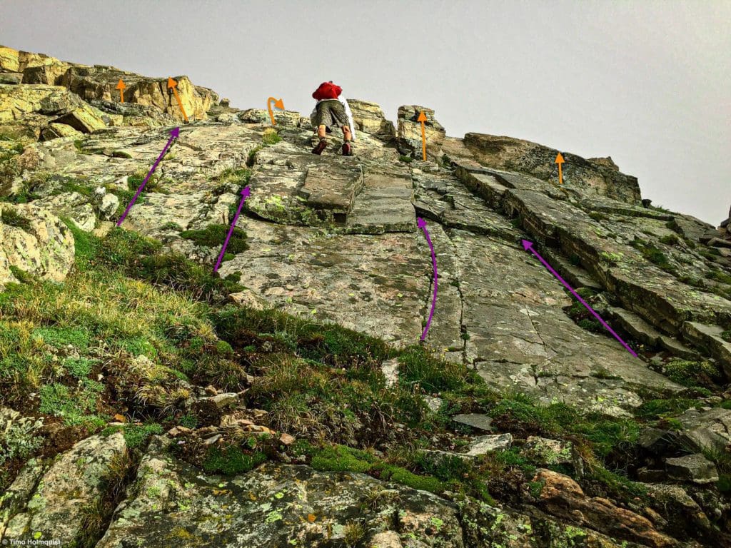
The first Slab. The purple arrows indicate Class 4 scrambling, while the orange arrows indicate low Class 5.
What isn’t clear until you scale the first slab is that there is a little vegetation bench above it where you can scout the next section of the scramble. From afar, this is all one slab, but when you’re scrambling, the vegetation bench is significant enough to break the slab into two parts.
Slab 2 above the bench.
There are likely a few different variations you can use on this face, but the slab climbing is superb, and traversing left or right will increase the difficulty. What looks like a suitable route from some perspectives looks unsafe from others; use your best judgment when you’re up there.
After you climb up the second and shorter slab, you’re given a brief reprieve where you can follow a grass and dirt strip up higher (watch out for the spiky thistle plant). This reprieve lasts until you get toward the summit. Once the grass options end, some short Class 3 scrambling awaits.
The grass strip and some scrambling above it.
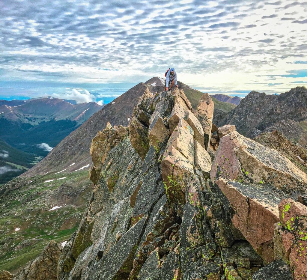
Soon, all that’s left is a crown of rock below the summit which you can easily scramble up with a few final Class 3 moves, or you can circumvent the scrambling to the left and come up the summit via Class 2+ rock steps.
The last moves up to the top.
Congratulations! You climbed up the demanding and stunning Class 4 no-matter-what-way-you-go East Summit of the Citadel!
The entire East Slab route from below the summit block.
From the top of the East summit, the easiest descent option is to head towards the gully separating the two summits and lower yourself down the 10-12-foot Class 4 step into the gully.
Looking down the Class 4 step to get off the East Summit.
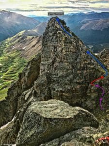
While there are certainly more ways to explore the Citadel, including a Class 5 traverse between it and neighboring Pettingell Peak, if you want to combine with Hagar, head west from the gully between the summits until you are on the ridgeline. From the Citadel, Hagar looks like the picture below.
Hagar from the West summit block of the Citadel.
Journal: Mt. Hagar
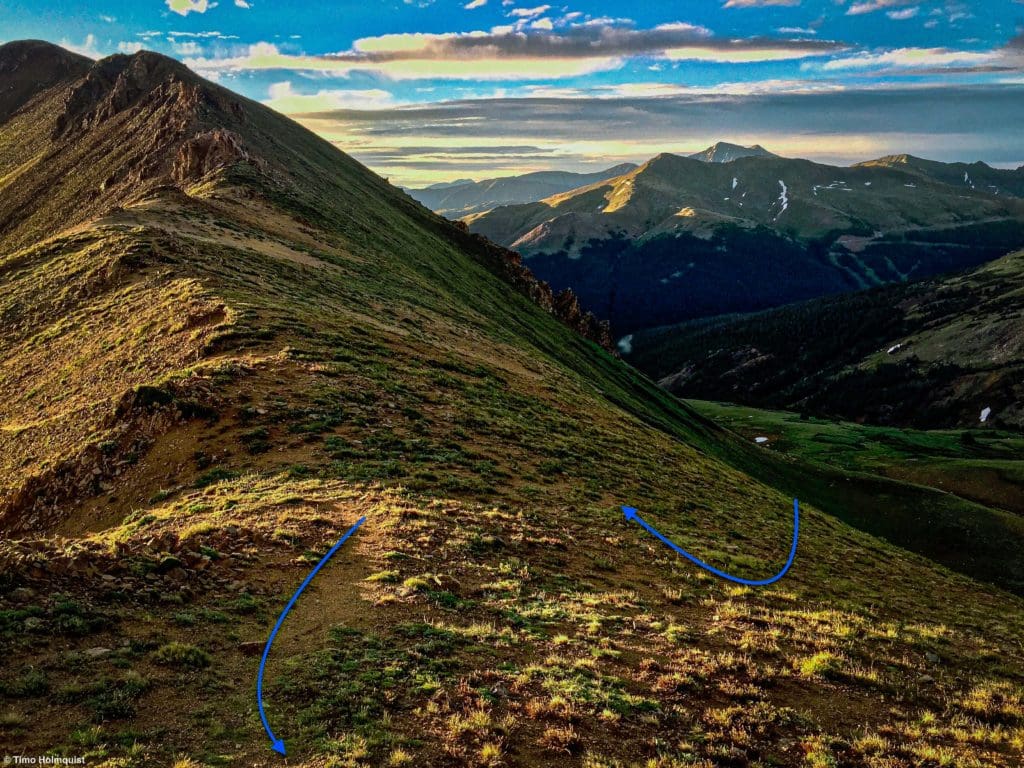
Once you find the ridgeline below the Citadel, you can take it all the way to Hagar, employing a few Class 2+ moves but generally finding easy footing along the way. Once you draw up to the summit block after a little more than half a mile of traversing, more interesting scrambling options come into play.
From the west, you can scramble up to Hagar’s summit fairly easily, but the best way to do it is a combo with Citadel because then you get a great Class 3 climb up the initial summit rise, followed by an airy knife-edge before the actual summit appears behind it.
Approaching the scrambling on Hagar.
There are a variety of ways to climb the summit block, with harder Class 4 variations to the right and solid Class 3 options in the middle. You could also try circumventing the block by veering all the way to the left, but that takes the fun out of the scrambling.
Some variations to consider.
Once you settle on a route up the block, enjoy the solid rock and scrambling. When you top out on the ridge, you’ll navigate along until coming to the knife-edge portion.
The Knife Edge on Hagar.
The exposure to the north is certainly nothing to scoff at, but there are ways to get around the top of the ridge to the south side if you’re not feeling brave. The individual moves themselves are tough Class 3 but not as hard as the East Summit of the Citadel.
From just beyond the Knife Edge, looking back at the Citadel’s summits.
Once you get beyond the Knife Edge, only a few minutes separate you from the actual summit. Bound up to the top and claim your second mountain and possibly third summit of the day!
Looking south from the summit of Hagar Mountain. Grays and Torreys Peaks are the tallest mountains in the background.
While you can certainly retrace your steps across the knife edge and head down from below the summit block, if you hiked in through Dry Gulch, it makes more sense to continue beyond the summit and drop down to the ridge to the west. From below the summit block, angle a descent down into Dry Gulch, creating your own switchbacks to lessen the risk of slips and trips.
Looking back to the Citadel as you descend off of Hagar.
You can either descend down into the Dry Gulch drainage and follow it back to the road or stay a little higher and parallel the drainage until finding a more agreeable slope down into it. Once you’re back below the tree line, try to find the social trail you came in on and thread your way back east. While the orientation is fairly easy, if the gulch is wet, the journey can be quite tedious.
Looking back down Dry Gulch as you make your way to the bottom of the drainage.
You’ll know you’re in the home stretch when the social trail turns back into the dirt road and heads toward the highway.


