


High Point:
11,200 feet at top

Total Ascent:
~800 feet

Difficulty:
Moderate

Distance:
2 miles

Route Type:
Out and Back
St. Mary’s Glacier is a beautiful snowfield near Idaho Springs, Colorado. The two mile roundtrip to reach the glacier is one of the most popular hikes, being moderately difficult but with rocky terrain and an altitude of 11,200 feet.
Overview:
St. Mary’s is a lovely half-day mountain outing easily reached from most major metro areas along the Front Range. It is particularly popular with families due to the variety of terrain encountered for only a few miles of effort.
Located near Idaho Springs, St. Mary’s Glacier Trail is a moderate hike in a beautiful mountain setting. The alpine scenery, summer flowers, lakes, and snowfield make it a fantastic destination for families. Due to the moderate terrain and straightforward access, the area can be great for sledding during the winter. The trail is easy to follow and leads up to St. Mary’s lake after a little more than half a mile. The snowfield is north of the lake.
Fun fact: St. Mary’s is not actually a glacier: it is instead a semi-permanent snowfield. The difference between the two has to do with icepack and movement. Glaciers are essentially compressed rivers of ice that change shape as they move. A snowfield doesn’t change shape as one unit; it gets smaller and larger depending on weather, not because of compact ice underneath. Although rare, St. Mary’s has completely melted before.
St. Mary’s Glacier, Colorado.
Support Skyblue Overland™ on Patreon!
If you’d like to support our efforts for a few dollars a month, please subscribe to our Patreon page. Every donation energizes our team to keep writing detailed trail reviews, gear reviews and adventure guides. Thank you!
Scales and Criteria:
This review describes a snow-free ascent (typically June-September). When snow is in play, a host of other safety issues become relevant. If you’re planning on hiking this trail in the snow, get ready for a lot of orientation. The trail is long and most popular with summer backpackers. Once a good snowfall covers the trail, it will be very difficult to follow.
Difficulty Ratings:
- Easy: less than 5 miles, less than 500 ft. of elevation gain
- Moderate: 5-10 miles, 500-2000 ft. of elevation gain
- Difficult: 5-15 miles, more than 2000 ft. of elevation gain
- Very Difficult: 10+ miles, more than 3,500 ft. of elevation gain
Directions to Trailhead:
The easiest way to get to St. Mary’s is to make your way to Idaho springs. Regardless of whether you approach from the East or West, at exit 223 on I-70, take Fall River Road north. You’ll follow Fall River Road for 9 miles as it climbs away from the highway, and then take a left on St Mary’s Drive to the parking lots. Be sure to check out the Lake Quivira viewing platform near the trailhead for additional views.
There are two parking lots, one below the trailhead and one above. Each lot costs $5 to park in, cash only. Display a permit on your dash to show that you’ve paid, and bring a pen to write down your license plate number. Heavy fines are given out if you park alongside the road. There are restrooms at the trailhead.
St. Mary’s Lake.
Places To Stay:
Idaho springs is the closest town with accommodations to St. Mary’s, although the hike is easily accessible from Denver, Boulder and many Front Range communities. A good day out would be hiking around St. Mary’s, descending to Idaho Springs and grabbing some delicious mountain pizza at Beau Jo’s.
Camping is difficult nearby because of private property. The closest option is Chinns Lake Dispersed Camping, though users report a NEED for high-clearance vehicles in order to reach the lakes. No facilities.
Guanella Pass has camping in the summer months but it is almost an hour away via winding mountain roads. There are 18 sites at $21. Reservations need to be made here.
Squaw Mountain Fire Lookout: This one’s a little pricey but for $80 you could spend the night in a fire tower. Reservations required and only open in the summer. There is also a mile hike to get there. Like Guanella Pass above, the distance to St. Mary’s is about an hour.
Field Notes:
People have been enjoying St. Mary’s since at least the 1950s. There was also a ski resort built alongside Fall River Road that operated until the mid-1980s. Because Fall River Road is paved and plowed, the trailhead is often used in the winter as a launch point for mellow backcountry laps near the snowfield. For the more ambitious backcountry skier, the trailhead is the best access point to more technical terrain off James Peak in the wilderness above the snowfield.
Another interesting aspect to this hike is the private property. The first part of the hike is not on public land. The landowners have been allowing people to hike there for decades but be respectful of private property. Public land begins to the north of St. Mary’s Lake, including the bluffs guarding the snowfield and the snowfield itself.
Although lower in elevation than many hikes in Colorado, St. Mary’s is still over 10,000 feet. If you are coming from lower elevations, take your time and drink lots of water. Checking weather beforehand can also help you avoid nasty conditions up high. The weather in Denver is often very different than the weather in the mountains. Here are the best local weather reports to aid in trip planning: James Peak weather, St. Marys weather.
Journal:
The trail/roadbed begins by heading northwest from in-between the parking areas. Stay on the main trail as most offshoots lead to private homes.
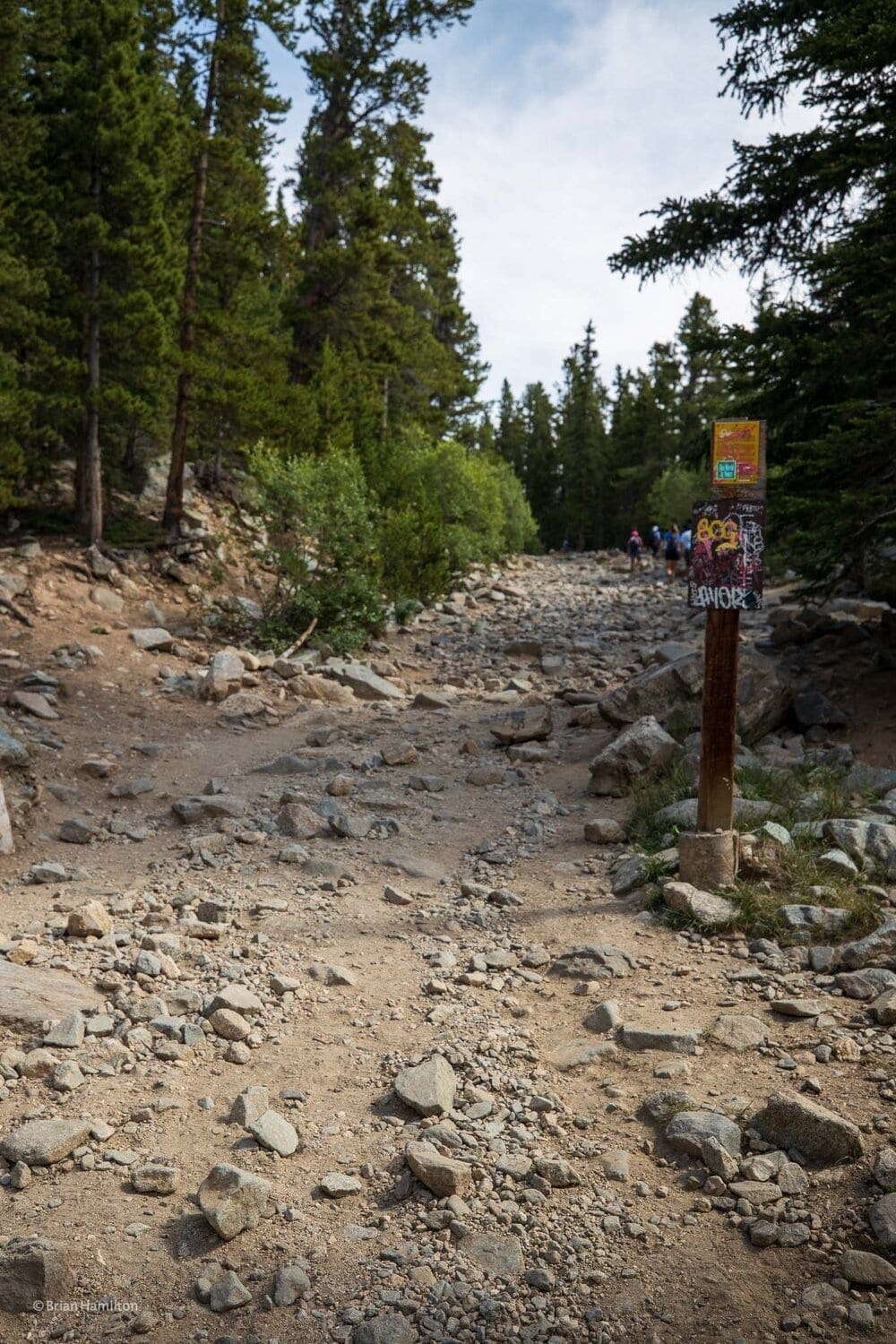
Photo 2: The St. Mary’s Glacier trail is easy to navigate.
The trail is wide and rocky: rising through a subalpine forest with a smattering of Bristlecone present. As you rise in elevation, you’ll be afforded views behind you to Mt. Evans, the closest 14er to St. Mary’s.
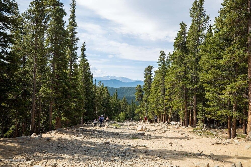
Photo 3: View looking down the St. Mary’s Glacier Trail towards Mt. Evans. Photo by Brian Hamilton.
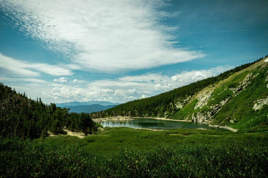
The first part of the trail ends when you reach St. Mary’s Lake.
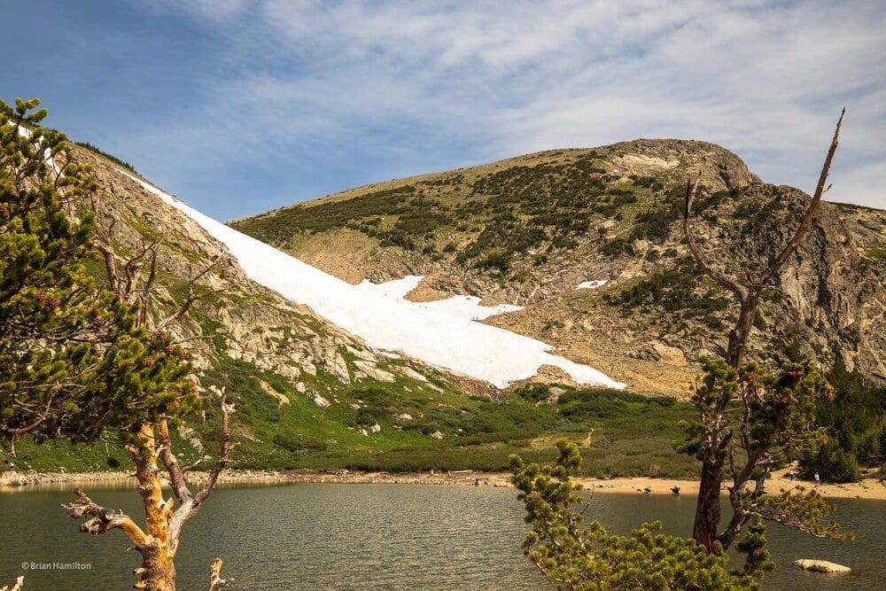
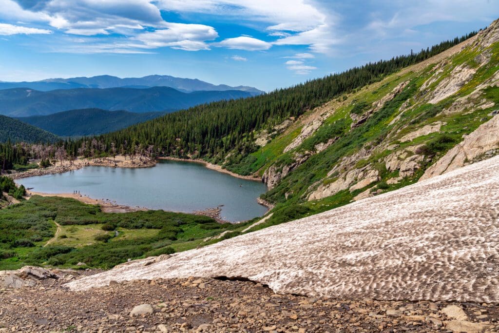
Photo 4: St. Mary’s Lake and the Snowfield behind.
The lake is beautiful and a worthy destination to relax. Some even jump into the water in summer, but it is very cold.
If continuing, the trail will travel northeast around the lake.
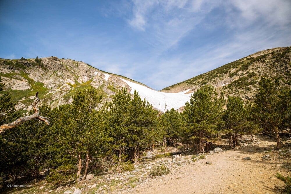
Photo 5: Eyes on the “glacier” the trail passes around the northeast side of the lake. Photo by Brian Hamilton.
Eventually, you’ll ascend above tree line and pass through thick willows before reaching the snow.
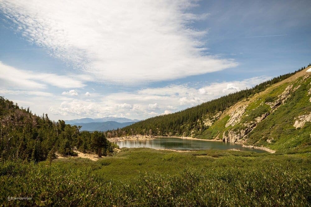
Photo 6: Willows at the north end of the lake. Photo by Brian Hamilton.
The sub-alpine terrain in this area offers fantastic views. The snowfield lies to the north of the lake, and the trail will approach it fairly directly.
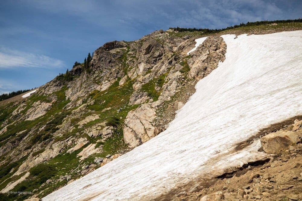
Photo 7: Alongside the snowfield. Photo by Brian Hamilton.
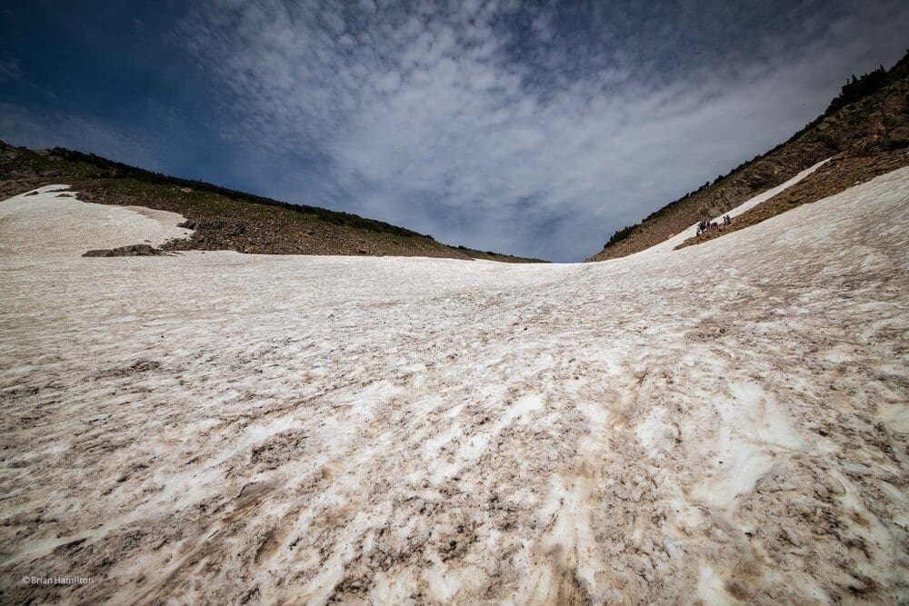
Photo 8: On the St. Mary’s “glacier.” Photo by Brian Hamilton.
As the width of the snow melts out deeper into the summer, it’s better to ascend alongside the steeper lower parts of the snowfield.
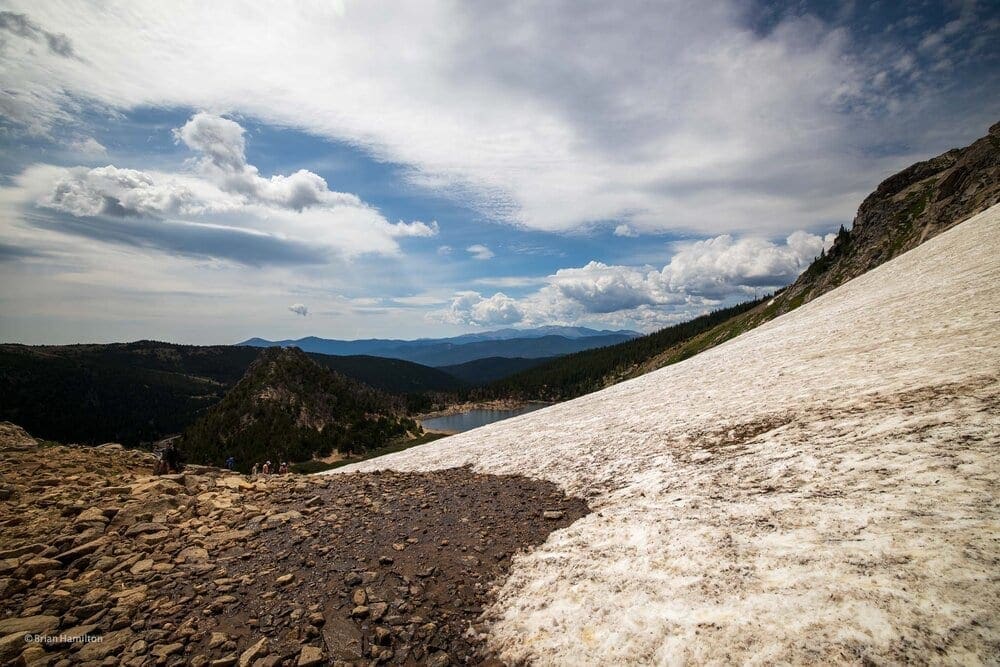
Photo 9: The views open up the higher you climb. Photo by Brian Hamilton.
Extra Credit: Above the glacier, the terrain blossoms out into a vast alpine plain. The views increase the higher you go. For mountaineers: this is the standard approach to James Peak and Mt. Bancroft: both prominent 13,000-foot mountains on the Continental Divide.
As you descend, take your time admiring the landscape and be wary of loose rocks. If descending on the snow, wear traction devices, or take time to kick your heels into each step to mitigate the risk of sliding. At a manageable two miles of roundtrip effort, St. Mary’s is a great way to explore unique Colorado terrain without committing to a full day of adventure.
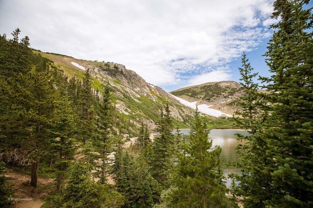
Photo 10: Looking back to the snowfield from the shores of St. Mary’s Lake. Photo by Brian Hamilton.
Terms of Use: As with each guide published on SKYBLUEOVERLAND.com, should you choose to this route, do so at your own risk. Prior to setting out check current local weather, conditions, and land/road closures. While taking a trail, obey all public and private land use restrictions and rules, carry proper safety and navigational equipment, and of course, follow the #leavenotrace guidelines. The information found herein is simply a planning resource to be used as a point of inspiration in conjunction with your own due-diligence. In spite of the fact that this route, associated GPS track (GPX and maps), and all route guidelines were prepared under diligent research by the specified contributor and/or contributors, the accuracy of such and judgement of the author is not guaranteed. SKYBLUE OVERLAND LLC, its partners, associates, and contributors are in no way liable for personal injury, damage to personal property, or any other such situation that might happen to individuals following this route.


