


High Point:
10,245 feet

Total Ascent:
2,194 feet

Difficulty:
Difficult

Distance:
13.4 miles

Waypoints:
N40 14.358 W105 47.991

Route Type:
Out and Back
The East Inlet Trail near Grand Lake, Colorado, leads to five alpine lakes, including Lake Verna, with stunning western views of Rocky Mountain National Park along the way. It’s a 13.4-mile roundtrip hike—a great one-day challenge.

Table of Contents
Article Navigation: Click on any of the listed items in the table of contents below to jump to that section of the article. Similarly, clicking on any large, white section header will jump you back to the Table of Contents.
Overview
This challenging out-and-back hiking trail near Allenspark, Colorado is 13.4 miles long. Hikers enjoy this route in the spring, summer, and fall, but the best times to visit are from May through September. The trail is popular for backpacking and camping and offers some solitude during quieter times.
Scales and Criteria
This article uses two metrics to calculate difficulty: overall distance and elevation gain. This review covers snow-free ascents, although you may be dealing with leftover snow through the first half of June. The approach is all trailed, but it’s a long journey with a significant climb and a meandering descent into Hell Canyon. As long as you stay on the trail and make it to the two lakes, there should be no scrambling involved.
If you’re camping for a few days, there are day adventure possibilities that could involve some scrambling (Ogallala Peak, Cooper or Marten), but those destinations require extra research and preparation.
Difficulty Ratings:
- Easy: less than 5 miles, less than 500 ft. of elevation gain
- Moderate: 5-10 miles, 500-2,000 ft. of elevation gain
- Difficult: 5-15 miles, more than 2,000 ft. of elevation gain
- Very Difficult: 10+ miles, more than 3,500 ft. of elevation gain
Directions To Trailhead
To reach Lake Verna from the East Inlet Trailhead near the town of Grand Lake on the west side of Rocky Mountain National Park, start by driving three-tenths of a mile from Highway 34 / Trail Ridge Road. Drive down on West Portal Road for about 2.35 miles to the East Inlet Trailhead.
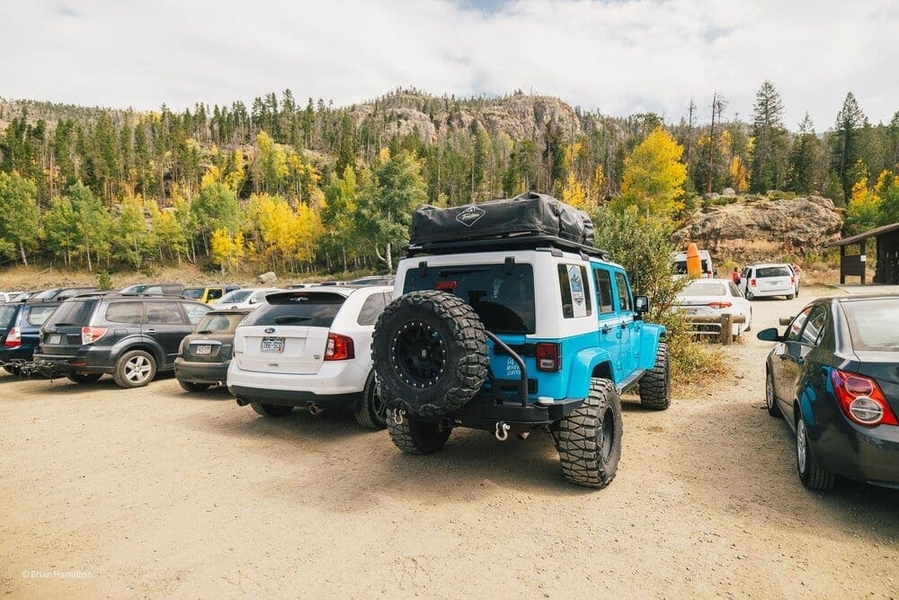
The East Inlet Trailhead has a large parking area with a comfort station.
The trailhead is just across from the boat launch on Grand Lake. Since this is located within Rocky Mountain National Park you are required to pay the access fee of $20 for the day, or for 7 days a fee of $30. Unlike many other trailheads in Rocky, the East Inlet Trailhead has a large parking area with a comfort station.
East Inlet Trail Wilderness Camping Guide:
In order to camp in the Backcountry at Rocky Mountain National Park (Or any National Park for that matter) you are required to secure a permit that will allow for backcountry camping. For more information on how to obtain a Wilderness Permit in Rocky Mountain National Park, see the National Park Service Wilderness Camping Guide. It’s a great resource and provides current information on road and trail closures.
The East Inlet Trail is a well established trail that has good signage to all backcountry campsites. It can be noted to camp safely away from dead trees, as close as possible to the metal arrowhead posted at each site. Look for the Red flags on trees for direction to each campsite off the main trail. Furthermore, fires are not permitted (only use gas stoves).
There are a number of awesome destinations for backpackers and hikers on the East Inlet Trail. Here is a listing of those destinations and wilderness campsites:
- Adams Falls (0.3 miles)
- East Meadow (0.6 miles)
- Lower East Inlet backcountry campsite (2.35 miles)
- Cats Lair backcountry campsite (3.8 miles)
- Gray Jay Group backcountry campsite (5.1 miles)
- Lone Pine Lake (5.4 miles)
- Slick Rock backcountry campsite (5.7 miles)
- Solitaire backcountry campsite (6.0 miles)
- Upper Inlet backcountry campsite (6.6 miles)
- Lake Verna backcountry campsite (7 miles)
- Spirit Lake (8.0 miles)
- Boulder-Grand Pass (9.5 miles)
Field Notes
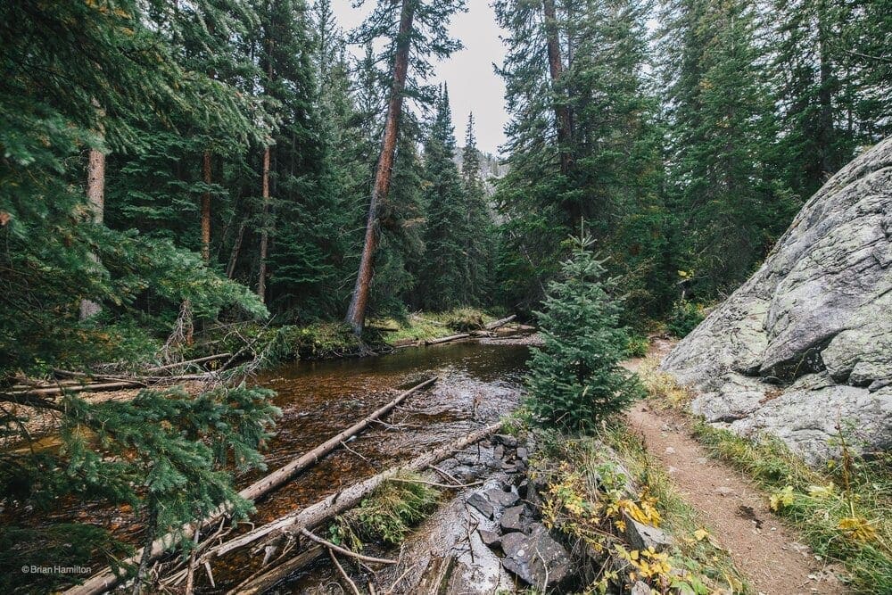
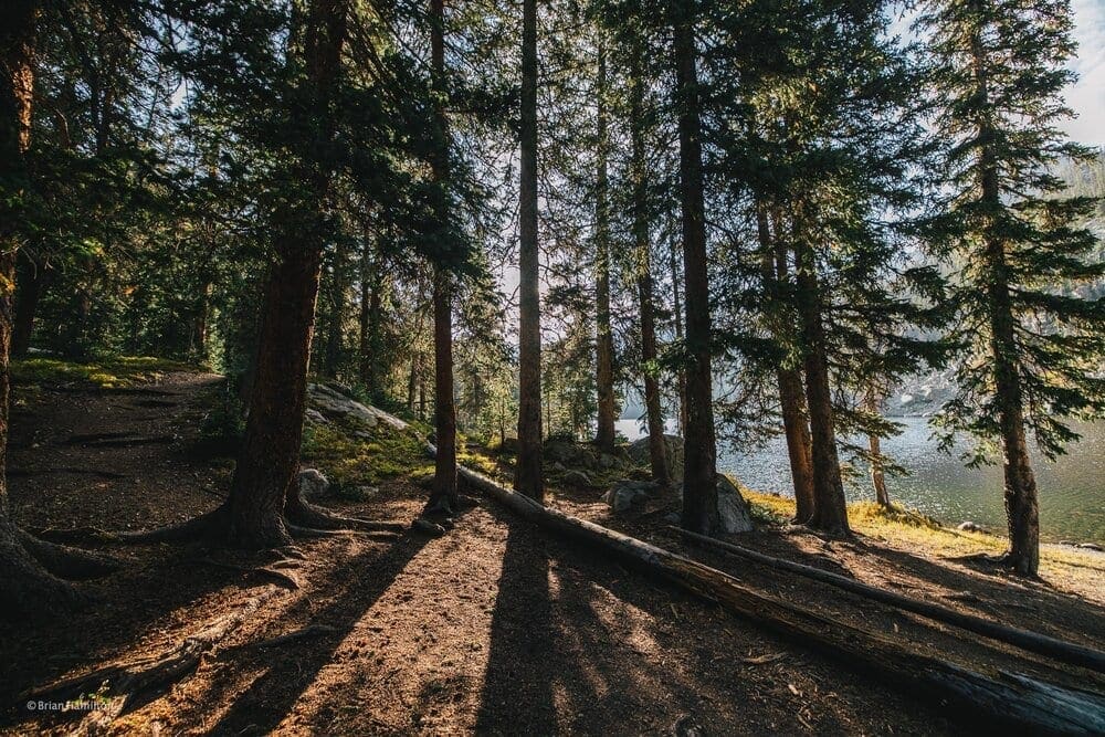
The East Inlet trail has tranquil pine forests and beautiful wetlands that are home to a variety of animals including moose, elk, moose, mule deer, and white-tailed deer. There are a number of small sub-alpine lakes, streams and waterfalls that lead up to Lake Verna.
After making this wonderful trip, I will encourage everyone to hike to Lake Verna (or one of the many backcountry campsites along the East Inlet Trail) for the weekend to enjoy life along the peaceful lakeside. These are amazing places to chill out, use as a basecamp for additional day-hikes, photography, or fishing (*with a valid Colorado fishing license).
This is a beautiful hike and nice place for backpacking with many water sources along the way. Be aware that it is a pretty strenuous hike with a full backpack. I would not rate it as a beginner trip….more like intermediate due to the long, steep climb up to Lake Verna.
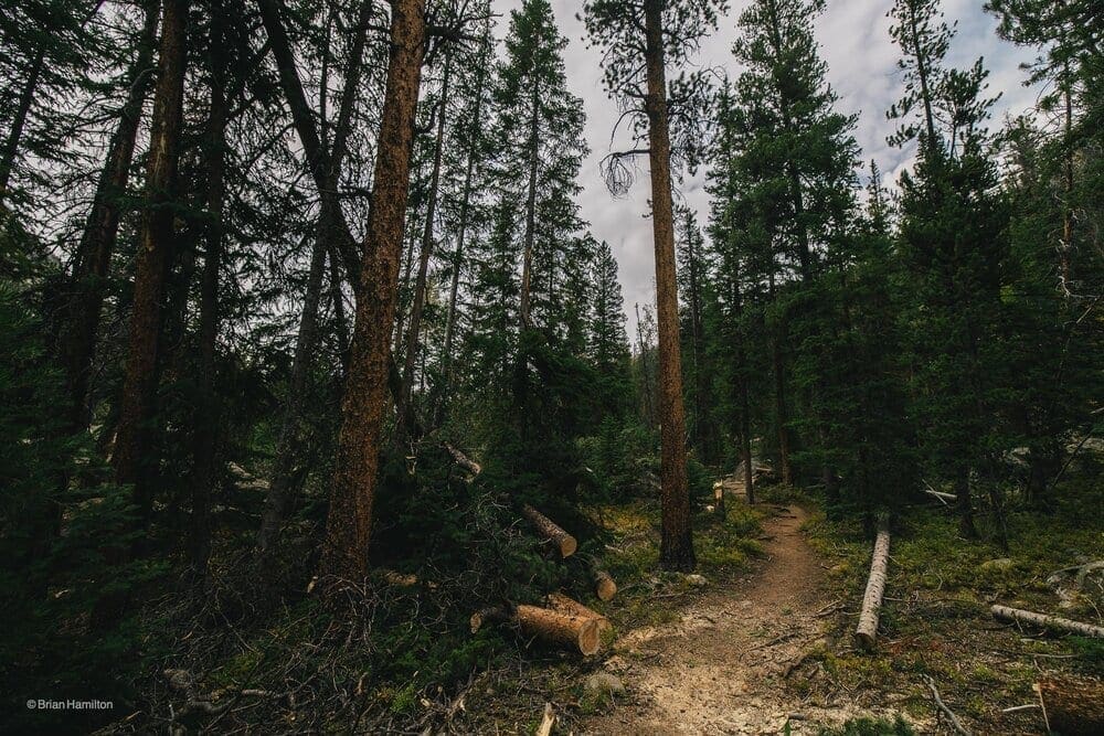
It should also be noted that there are lots of downed trees along this trail. Many of which were downed during the late summer winter storm that occurred just a couple of weeks prior to my hike. These trees were still fallen across the trail with National Park Service crews just starting to cut them off the trail.
<img src=”https://www.skyblueoverland.com/wp-content/uploads/2021/02/20200919-AFF73D48-E5D5-4D95-B6D0-C1D93C1C8418.jpg” alt=”Photo Waypoint: 40.227467,-105.711656. Photo taken along the northern shore of Lake Verna on the East Inlet Trail. Looking towards Boulder-Grand Pass and the Continental Divide, which is just 2.25 miles to the east. Apple iPhone 11 Pro Max, ISO 32, 1.54 mm, f/2.4, 1/120 seconds.” />
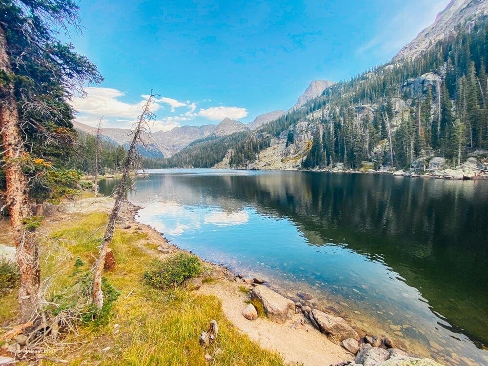
Photo Waypoint: 40.227467,-105.711656. Photo taken along the northern shore of Lake Verna on the East Inlet Trail. Looking towards Boulder-Grand Pass and the Continental Divide, which is just 2.25 miles to the east.
Journal: The Climb to Lake Verna Wilderness Campsite – September 19, 2020:
The trail begins with stops at Adams Falls and the East Meadow. Then the trail climbs steadily up 6.9 miles with an elevation gain of more than 2,100 feet through the East Inlet Creek valley to Lake Verna. Thankfully, it’s a much lower grade close to the trailhead.
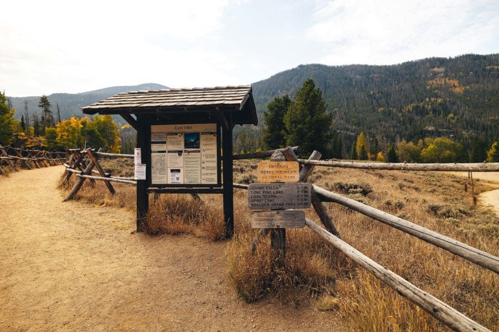
Photo taken at entrance to the East Inlet Trail near Grand Lake, Colorado.
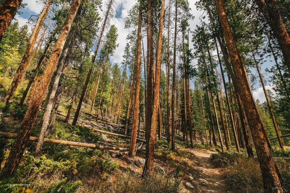
The start of my hike yielded some spectacular views of fall in its full glory. The leaves were changing and the Rocky Mountains were showing off her “true” colors. The climb up to Adams Falls starts a few hundred feet from the trailhead.
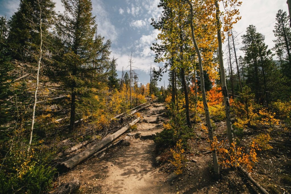
The trail proceeds through a mixed forest of pine and aspens, which were very colorful on this late September day in 2020.
Follow the trail from the parking area through a forest of pine and aspens. After a hike of roughly two-tenths of a mile, you’ll reach the Adams Falls Trail. A narrow footpath heads off to the right, which reconnects with the East Inlet Trail in less than two-tenths of a mile. To visit the falls, turn right at this junction and proceed down the steep path to an overlook of Adams Falls. The water drops approximately 55 feet in a series of steps through a narrow rock gorge.
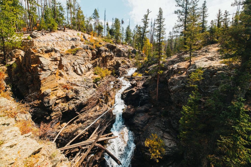
Photo Waypoint: 40.23655, -105.79803. Photo taken at the Adams Falls overlook on the East Inlet Trail.
From the overlook the trail climbs to the top of the falls where you’ll have another outstanding view from above. Looking off into the distance to the west, I can see Grand Lake. From the top of the falls the loop portion of the hike continues for a very short distance before linking up with the East Inlet Trail once again. Turn left at this junction to return back to the parking area. Adventurers turn right towards Lake Verna, of course.
After about 0.6 miles from the trailhead, I encounter the outskirts of East Meadow, which is another nice view point. The trail above the falls turns into a meadow, wide open and flanked on both sides by the splendor of an early fall. Here you’ll enjoy outstanding views of East Inlet Creek as it snakes through the valley under the gaze of Mount Cairns (2.5 miles to the east), Mount Craig (10,421 feet; 3.7 miles to the east) and Mount Wescott (10,421 feet; 2.5 miles to the southeast). From these vantage points along the East Meadow, you will have a great opportunity to spot a moose or elk near the creek or grazing in the grass. The slopes along the northern side of the valley feature the vibrant color of the Aspen trees entering their fall transition.
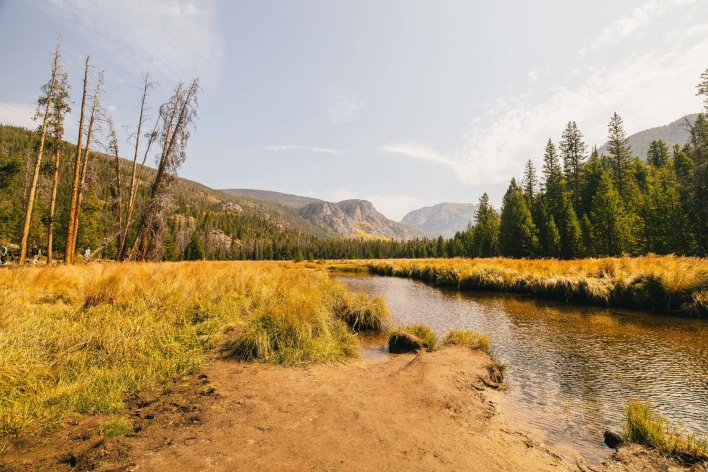
Photo Waypoint: 40.23716, -105.79404. The outskirts of East Meadow is another nice views of East Inlet Creek as it snakes through the valley under the gaze of Mount Cairns, Mount Craig and Mount Wescott.
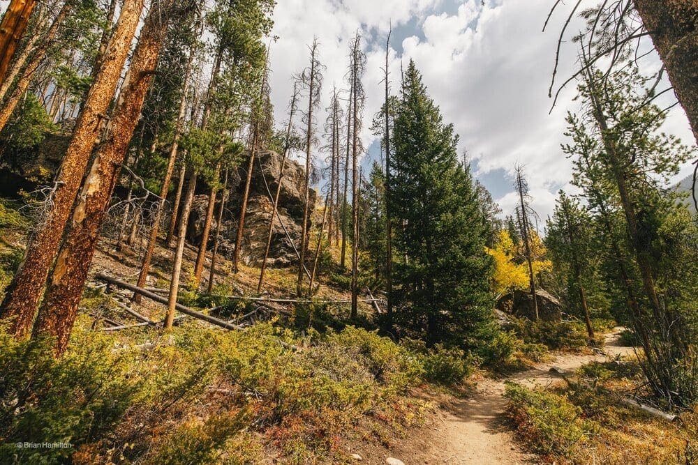
The trail then circles around the northern edge of this immense meadow. As I continued down the trail (which was mostly flat), the incline and climb begins on the slopes on the north side of the valley.
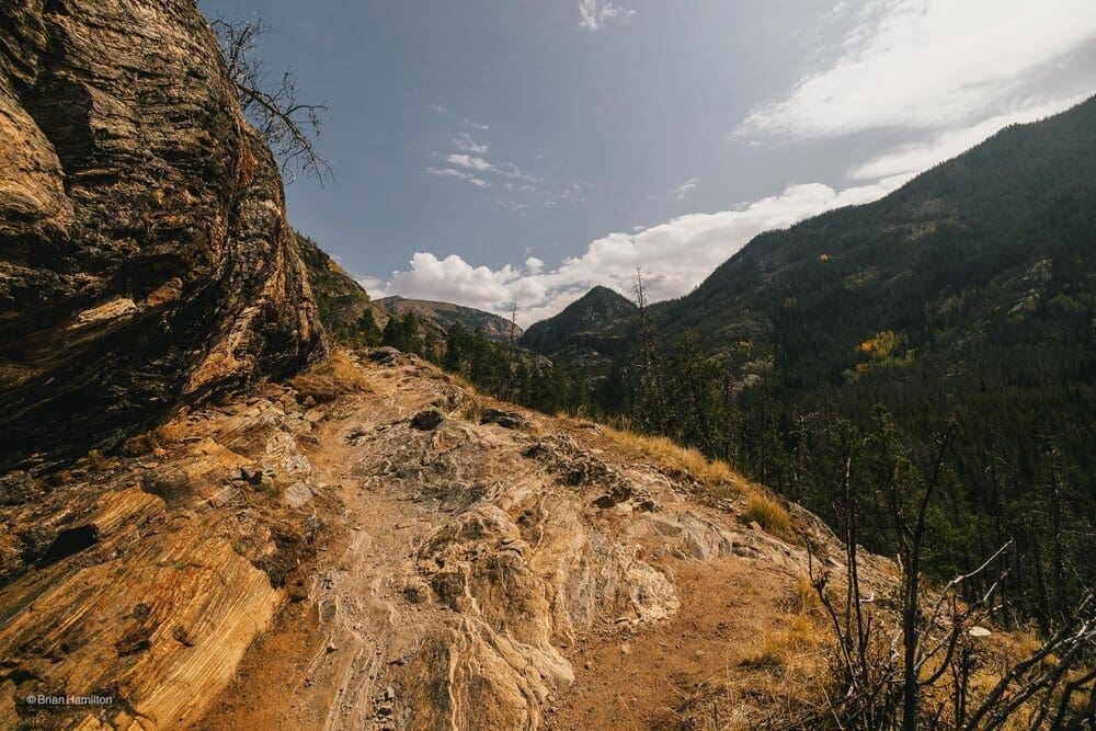
<img src=”https://www.skyblueoverland.com/wp-content/uploads/2021/02/20200919-050A3263.jpg” alt=”Photo Waypoint: 40.238100, -105.790132. Canon EOS R, Canon RF 15-35mm f/2.8L USM Lens, ISO 100, 15 mm, f/6.3, 1/320 seconds.” />
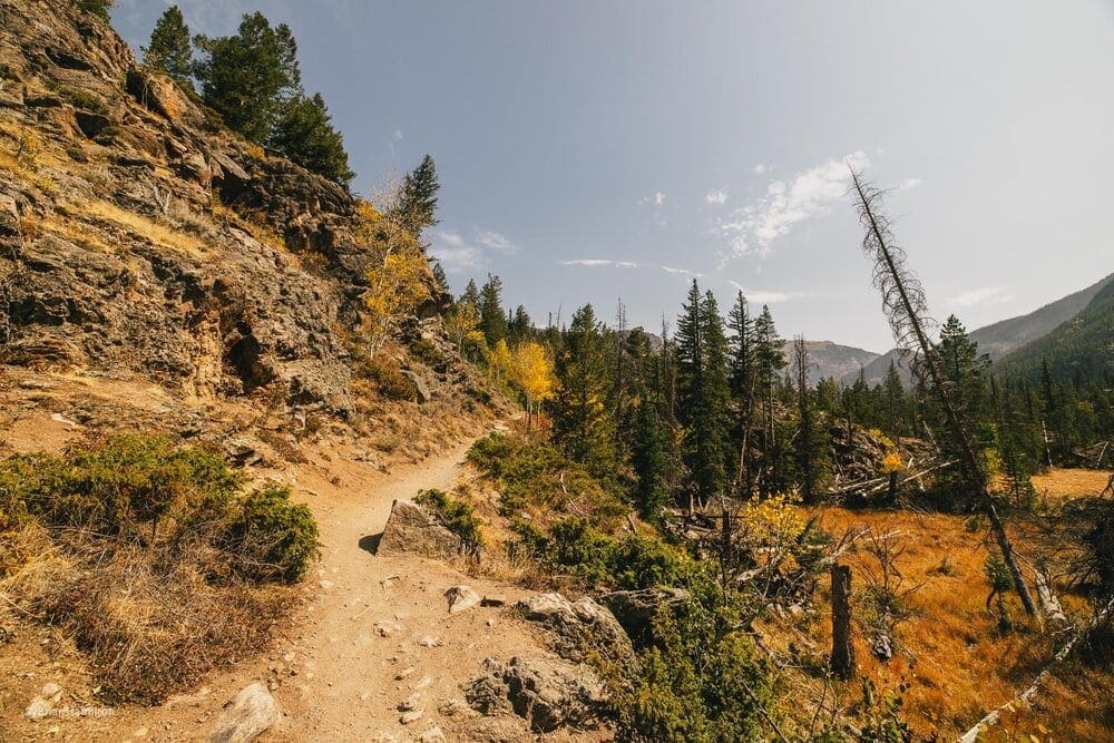
Photo Waypoint: 40.238100, -105.790132. Canon EOS R, Canon RF 15-35mm f/2.8L USM Lens, ISO 100, 15 mm, f/6.3, 1/320 seconds.
After about a 1.25 from the trailhead, there is a rock outcropping that offers expansive views of East Inlet Creek and East Meadow. It is quite the view and worthy of pausing for a picture, the fall colors make for a very photogenic landscape.
<img src=”https://www.skyblueoverland.com/wp-content/uploads/2021/02/20200919-050A3284.jpg” alt=”Photo Waypoint: 40.23744, -105.78447. Standing on a rock outcropping, there are amazing views of the meandering East Inlet Creek, the East Meadow and the mountains to the east. Canon EOS R, Canon RF 15-35mm f/2.8L USM Lens, ISO 100, 15 mm, f/6.3, 1/320 seconds.” />
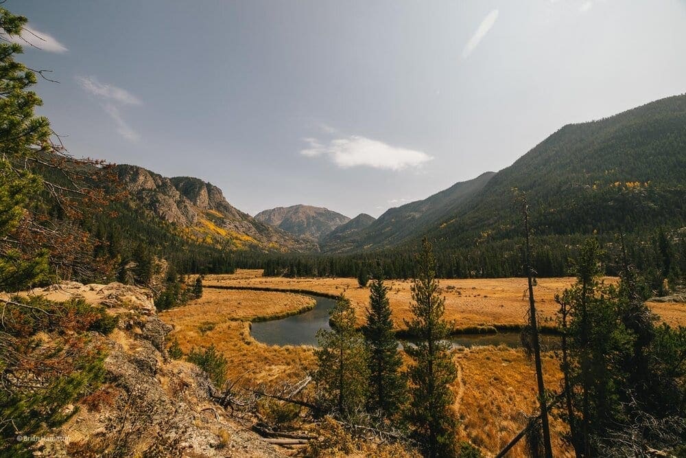
Photo Waypoint: 40.23744, -105.78447. Standing on a rock outcropping, there are amazing views of the meandering East Inlet Creek, the East Meadow and the mountains to the east.
What goes up, must go down. After making my way down the rock outcropping, I stop in the Meadow near East Inlet Creek. Here, I was presented with a wonderful opportunity to view reflections of the surrounding hills on the calm waters of the inlet. Another great location for a few photographs. I’m closer to the Aspen covered slopes on the northern side of the valley. Mount Craig is straight to the southeast about 3.25 miles away.
<img src=”https://www.skyblueoverland.com/wp-content/uploads/2021/02/20200919-050A3292.jpg” alt=”Photo Waypoint: 40.237303,-105.784375. Photo taken from the valley floor after climbing down the rock outcropping. More amazing views of the meandering East Inlet Creek, the East Meadow and the mountains to the east. Canon EOS R, Canon RF 15-35mm f/2.8L USM Lens, ISO 100, 35 mm, f/5.6, 1/320 seconds.” />
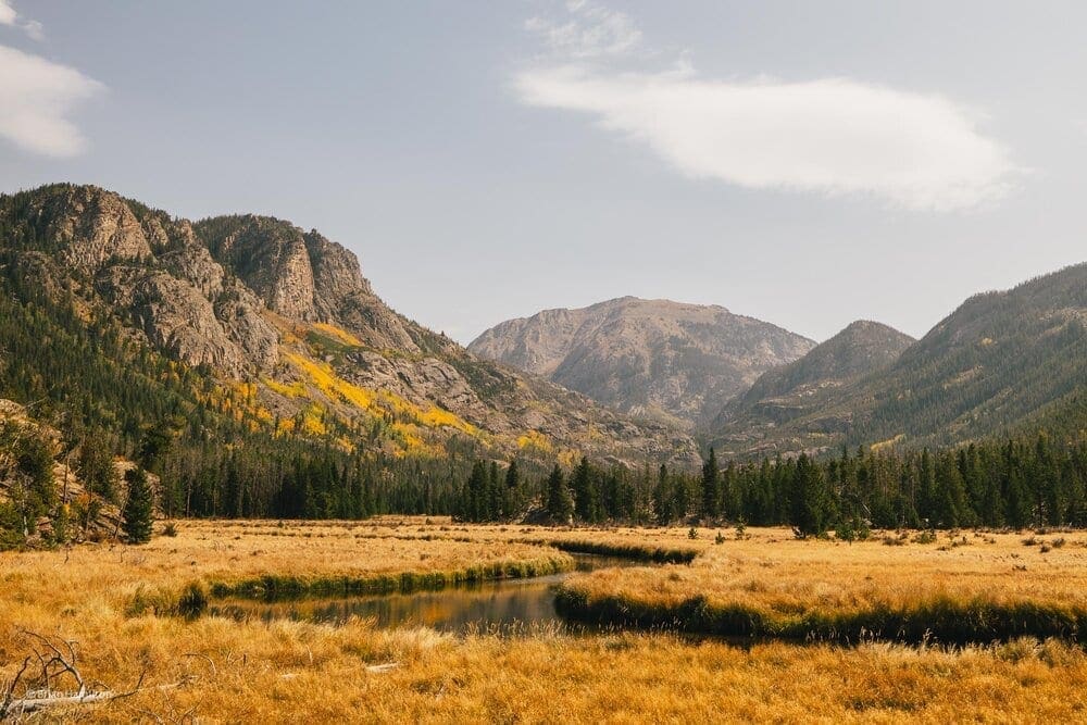
Photo Waypoint: 40.237303,-105.784375. Photo taken from the valley floor after climbing down the rock outcropping. More amazing views of the meandering East Inlet Creek, the East Meadow and the mountains to the east.
I take several photos of the fall colors reflecting in the East Inlet Creek.
<img src=”https://www.skyblueoverland.com/wp-content/uploads/2021/02/20200919-050A3296.jpg” alt=”Photo Waypoint: 40.237230, -105.784115. Photo taken from the valley floor after climbing down the rock outcropping. More amazing views of the meandering East Inlet Creek, the East Meadow and the mountains to the east. Canon EOS R, Canon RF 15-35mm f/2.8L USM Lens, ISO 100, 15 mm, f/5.6, 1/250 seconds.” />
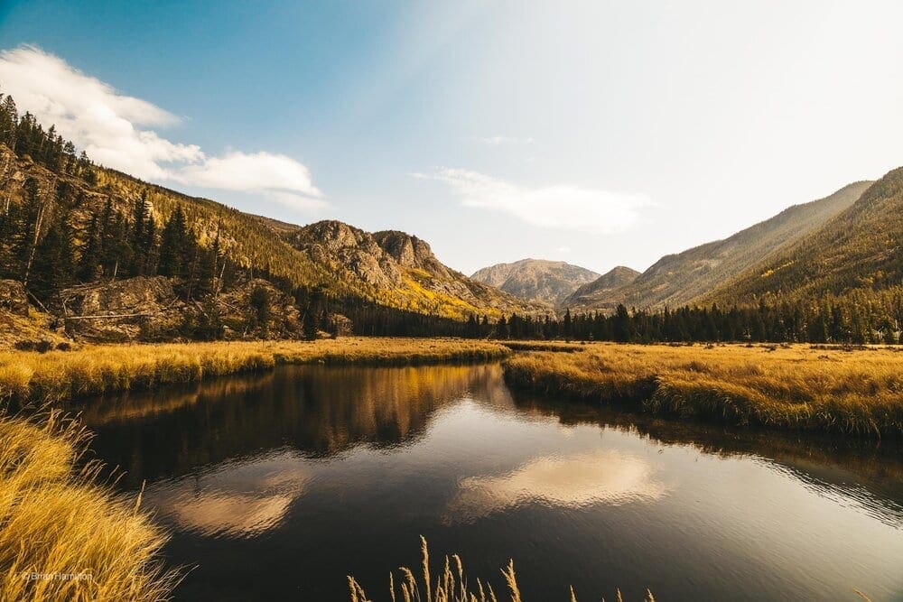
Photo Waypoint: 40.237230, -105.784115. Photo taken from the valley floor after climbing down the rock outcropping. More amazing views of the meandering East Inlet Creek, the East Meadow and the mountains to the east.
Moving further down the trail a Fly Angler was wading out with pole in hand. He had found his spot for the day.
<img src=”https://www.skyblueoverland.com/wp-content/uploads/2021/02/20200919-050A3322-2.jpg” alt=”Photo Waypoint: 40.23778, -105.78176. Photo looking back towards the rock outcropping along the norther edge of East Inlet Creek. A Fly Angler is enjoying his spot for the day. Canon EOS R, Canon RF 15-35mm f/2.8L USM Lens, ISO 100, 15 mm, f/5.6, 1/250 seconds.” />
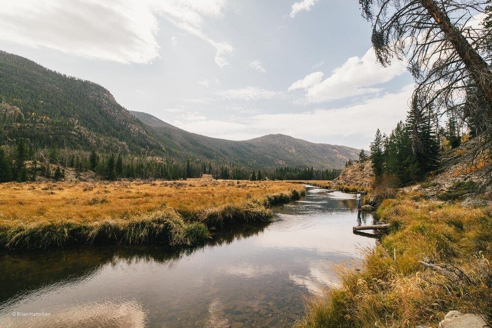
Photo Waypoint: 40.23778, -105.78176. Photo looking back towards the rock outcropping along the norther edge of East Inlet Creek. A Fly Angler is enjoying his spot for the day.
The still waters of East Inlet Creek are reflecting the nearby trees and the golden grassland.
<img src=”https://www.skyblueoverland.com/wp-content/uploads/2021/02/20200919-050A3320.jpg” alt=”Photo Waypoint: 40.23778, -105.78176. Photo taken from the same vantage point, but looking back away the rock outcropping (east) along the northern edge of East Inlet Creek. Canon EOS R, Canon RF 15-35mm f/2.8L USM Lens, ISO 100, 15 mm, f/5.6, 1/320 seconds.” />
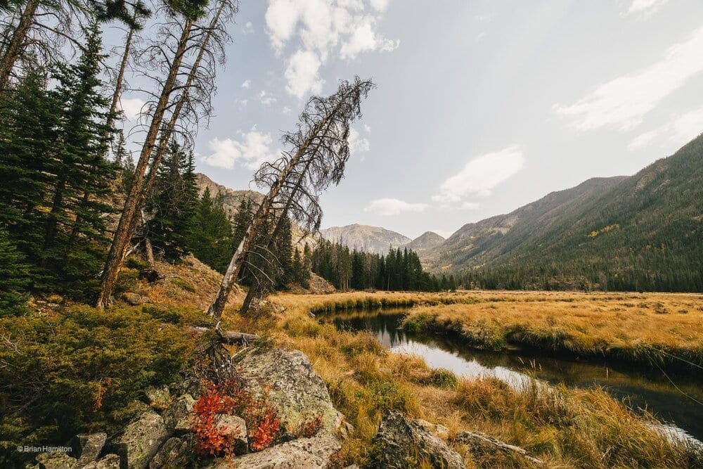
Photo Waypoint: 40.23778, -105.78176. Photo taken from the same vantage point, but looking back away the rock outcropping (east) along the northern edge of East Inlet Creek.
The Climb to Lake Verna
As I exited the meadow I entered a pine forest and began another climb, THE climb.
The climb is pretty gradual at this point. I love the golden brown light on the pine trees.
I’m starting to encounter those rocky outcroppings that I saw in the distance when the meadow first began. They are now right before me and under my feet. There is something special about seeing up-close what you once took in from afar.
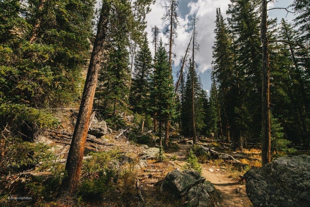
The forest is so peaceful…
I took a moment while on the climb to pause and catch my breath. Looking back to the west, I could see where I had come from and the view of Grand Lake.
<img src=”https://www.skyblueoverland.com/wp-content/uploads/2021/02/20200919-050A3371.jpg” alt=”Photo looking back to the west towards Grand Lake. I’m starting to make some progress on the climb up to Lake Verna. Canon EOS R, Canon RF 15-35mm f/2.8L USM Lens, ISO 100, 15 mm, f/5.6, 1/250 seconds.” />
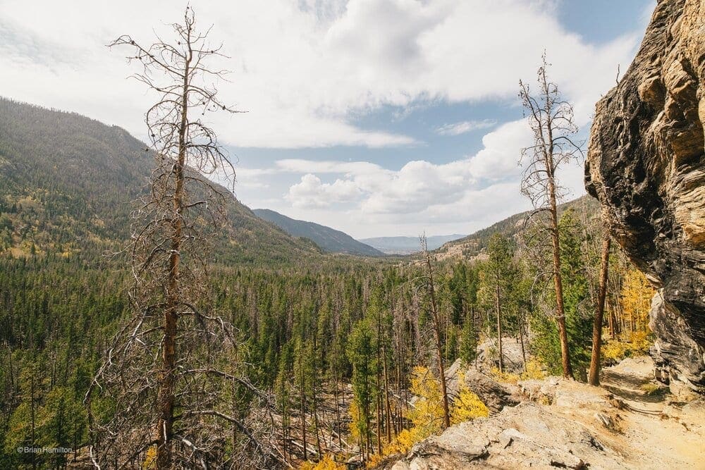
Photo looking back to the west towards Grand Lake. I’m starting to make some progress on the climb up to Lake Verna.
The layers of rock are weathering to make a very interesting outcrop as we skirt the northern edge of the valley.
<img src=”https://www.skyblueoverland.com/wp-content/uploads/2021/02/20200919-050A3386-2.jpg” alt=”Photo Waypoint 40.233583,-105.764537. Canon EOS R, Canon RF 15-35mm f/2.8L USM Lens, ISO 100, 15 mm, f/6.3, 1/320 seconds.” />
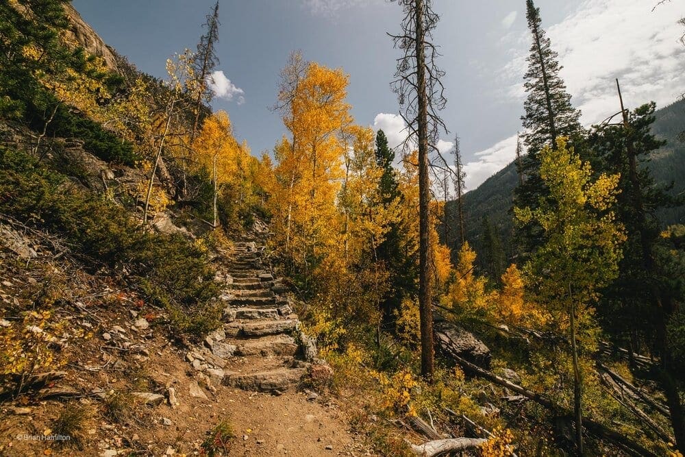
Photo Waypoint 40.233583,-105.764537.
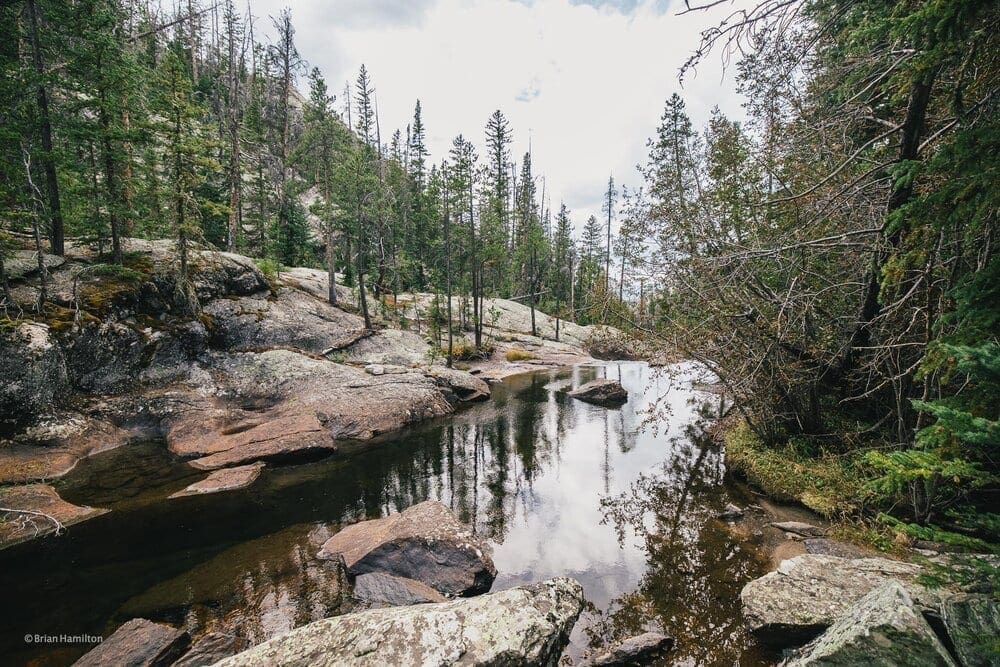
The climb continues and seems to never end. I’m treated again with another look of East Inlet Valley as it moves through carving the rocks. Seeing the valley become a little wider in a much needed flat area as I entered another pine forest. This was a great opportunity to catch my breath and give my now burning legs a chance to relax a little.
More steps…
<img src=”https://www.skyblueoverland.com/wp-content/uploads/2021/02/20200919-050A3446.jpg” alt=”Photo Waypoint 40.230283,-105.758223. Canon EOS R, Canon RF 15-35mm f/2.8L USM Lens, ISO 100, 19 mm, f/4.5, 1/160 seconds.” />
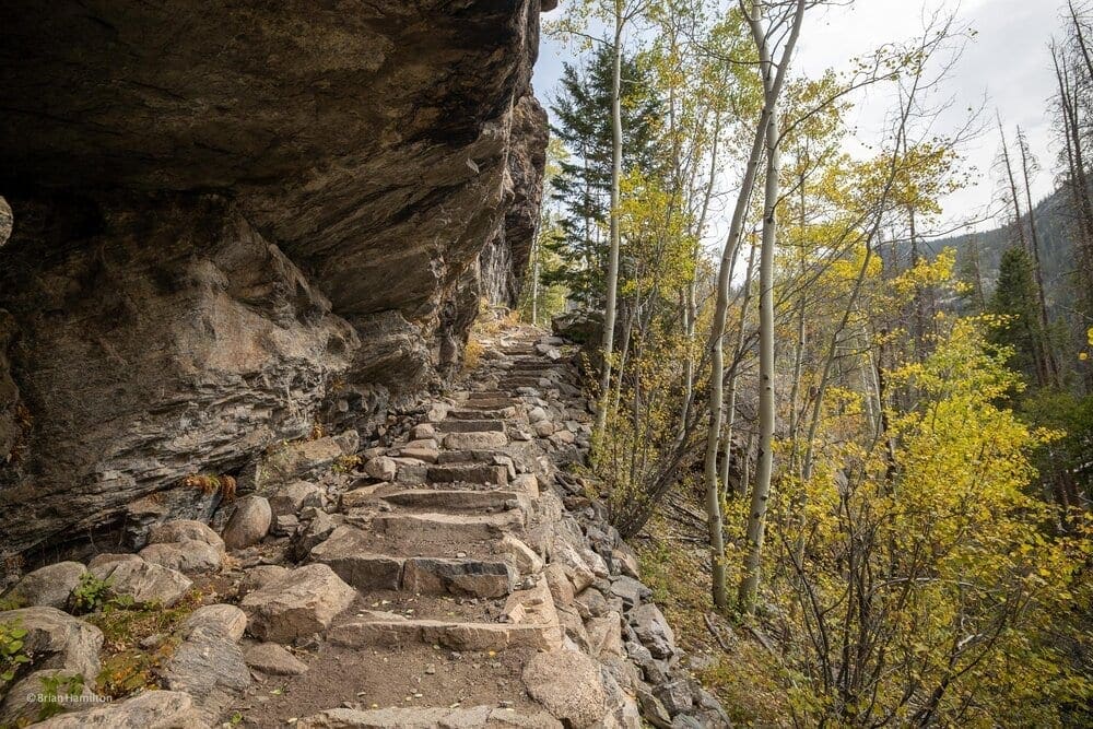
Photo Waypoint 40.230283,-105.758223. More steps.
Another large tree has fallen across the trail.
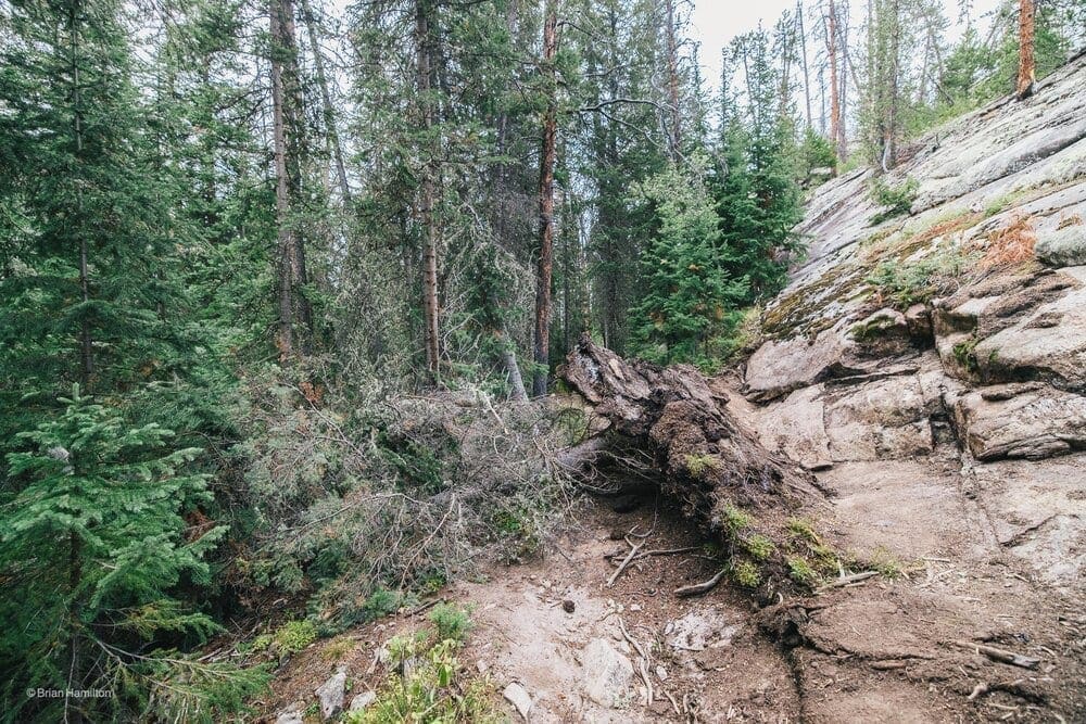
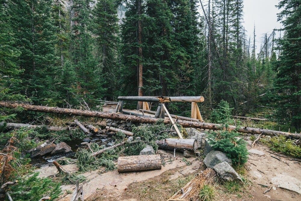
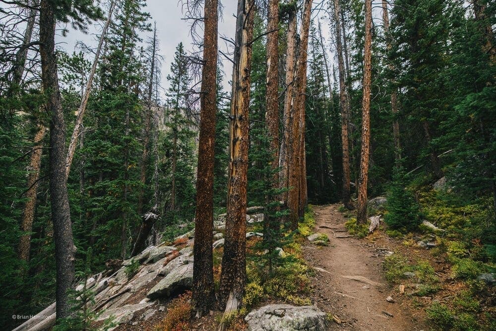
Photo Waypoint 40.22908,-105.737575.
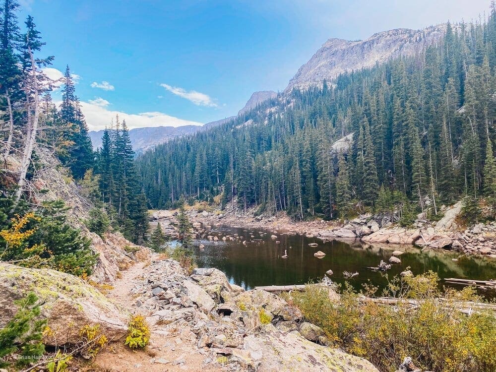
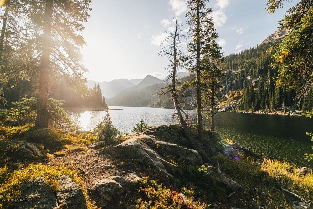
With still more elevation and miles to put behind I continued up, up, and away. The climbing had started again. After 5.4 miles behind and climbing for hours, I set eyes on Lone Pine Lake. The view of the lake made it abundantly clear how badly I wanted to reach Lake Verna. Seeing a beautiful sub-alpine lake while hiking to another beautiful lake really motivates me to press on and get to the final goal.
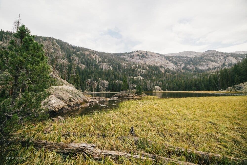
Lone Pine Lake. Photo Waypoint 40.231332,-105.732808.
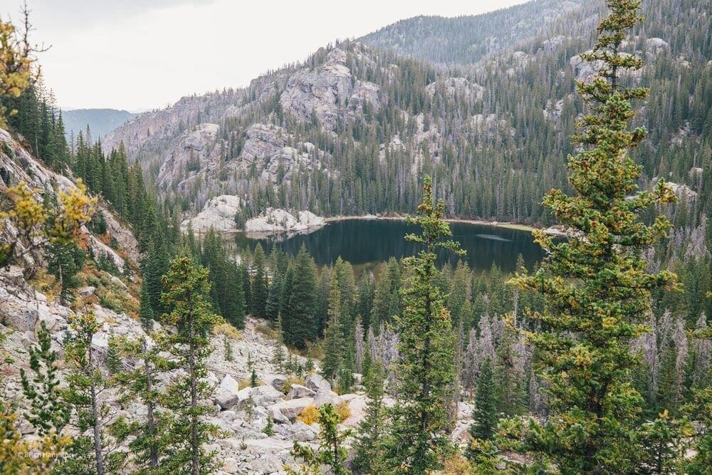
The climb of course is not over, and continues on to Verna lake. Going up a pass I was treated with yet another beautiful view of Lone Pine Lake. Seeing it from above really brings it home how all the effort the trail has been but how much it has been worth every uphill step.
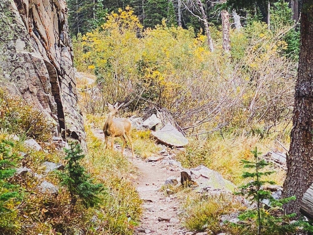
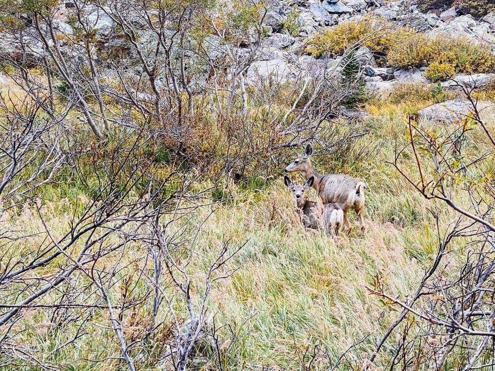
I ended up having a rather close encounter with a deer at this point in the trail. It was clear that she was concerned about something above. While I wanted to keep moving, I quickly realize that it will best to give her some space to sort out whatever was going on with her.
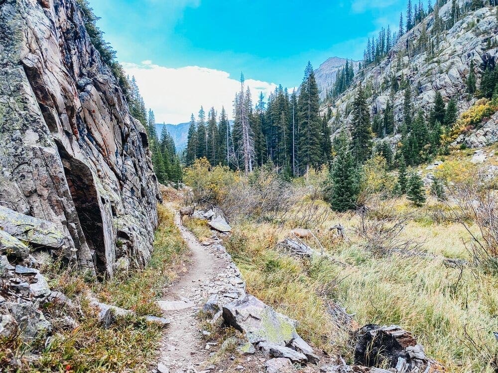
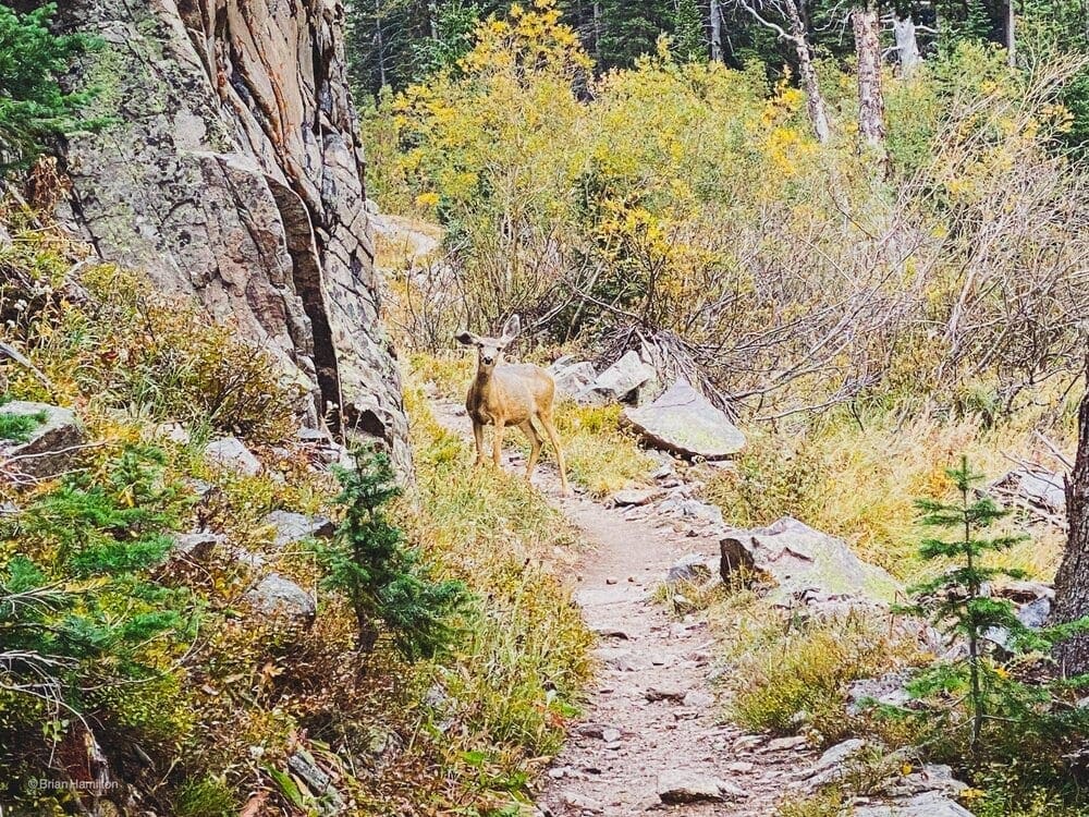
The look she was giving me made it clear she was not sure if I’m friend or foe. She’s quite bothered by my presence. Her look up the northern slope tells me she’s not alone. I wait…
I figure that She’s waiting for her companion to come down the hill to join her.
She looks back at me. I assure her as if she can understand English that I’m being patient and will not rush her and her companion off the trail.
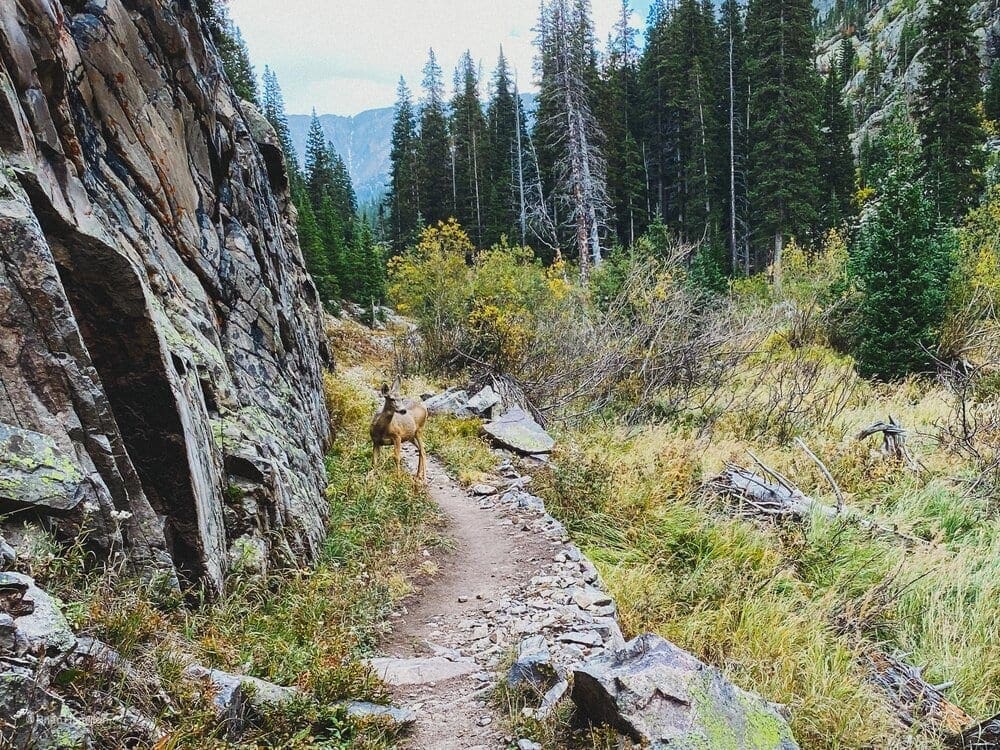
Not long after starting each other down a yearling comes into view. It was just a mamma looking after her baby. All is clear now mamma doe! The doe immediately notices me as he/she follows the mother into the valley towards the creek.
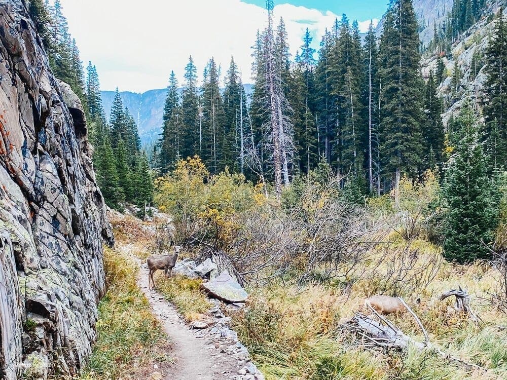
After ensuring that they are well clear of the trail, I continue up the trail. They take a good look at me as I head up the trail towards Lake Verna.
Finally I made my way into my destination, with only an hour before sunset. With the trail behind, and the pack off my shoulders the next phase of work/effort had begun. No rest for the wicked, it was time to set up camp. Of course I still took an opportunity or two to snap a few pictures of Lake Verna before dark.
<img src=”https://www.skyblueoverland.com/wp-content/uploads/2021/02/20200919-AFF73D48-E5D5-4D95-B6D0-C1D93C1C8418-2.jpg” alt=”Photo Waypoint: 40.227467,-105.711656. Photo taken along the northern shore of Lake Verna on the East Inlet Trail. Looking towards Boulder-Grand Pass and the Continental Divide, which is just 2.25 miles to the east. Apple iPhone 11 Pro Max, ISO 32, 1.54 mm, f/2.4, 1/120 seconds.” />

Photo Waypoint: 40.227467,-105.711656. Photo taken along the northern shore of Lake Verna on the East Inlet Trail. Looking towards Boulder-Grand Pass and the Continental Divide, which is just 2.25 miles to the east.
Returning to the Trailhead – September 20, 2020:
After a night of rest I was up and prepared some coffee before sunrise. There is nothing better than enjoying a hot cup of Joe while you take in the morning sunrise as it ascends over the cascading mountains, and starts to reflect off the lake. This is why I am here.
Lake Verna at Sunrise
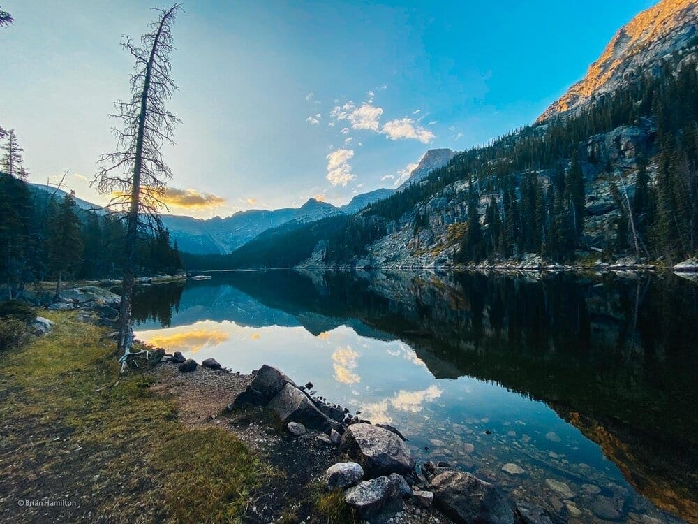
The sun is starting to rise over Boulder Grand Pass. Photo Waypoint: 40.22747, -105.71140. Apple iPhone 11 Pro Max, Triple camera 1.54mm f/2.4 Lens, ISO 20, 1.5 mm, f/2.4, 1/230 seconds.
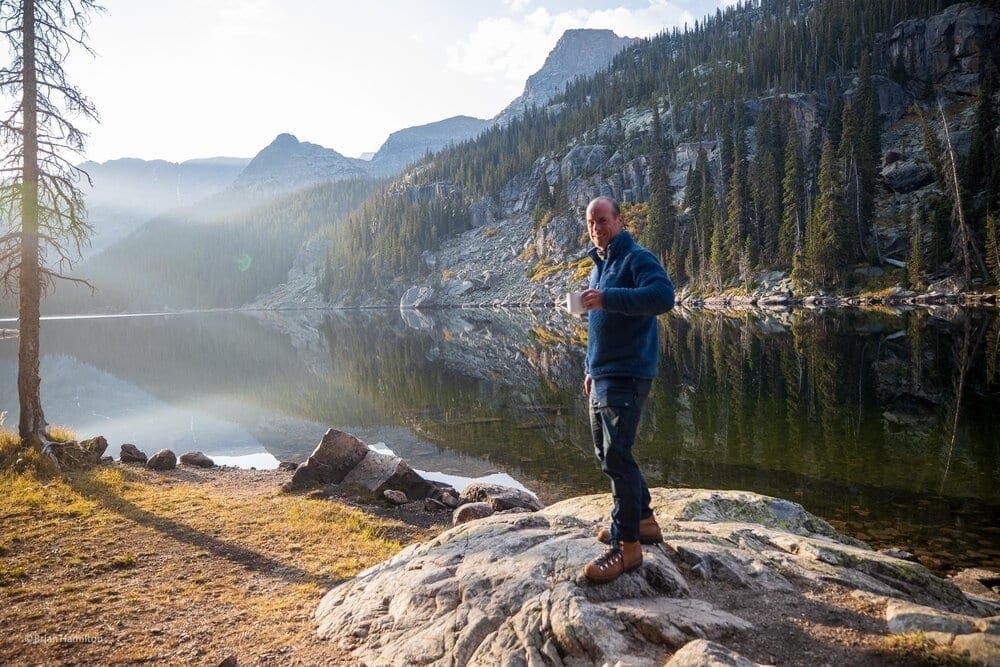
Enjoying a cup of Joe at sunrise on the northern banks of Lake Verna. Canon EOS R, Canon RF 15-35mm f/2.8L USM Lens, ISO 100, 24 mm, f/3.5, 1/100 seconds.
Canon EOS R, Canon RF 15-35mm f/2.8L USM Lens, ISO 100, 15 mm, f/3.2, 1/80 seconds.
Canon EOS R, Canon RF 15-35mm f/2.8L USM Lens, ISO 100, 15 mm, f/5, 1/160 seconds.
Packing up camp and starting back down the trail it was not long for me to have yet another encounter with some wildlife. A cow moose and her little calf feeding along the banks of the inlet fed from Verna Lake.
The Moose Encounter
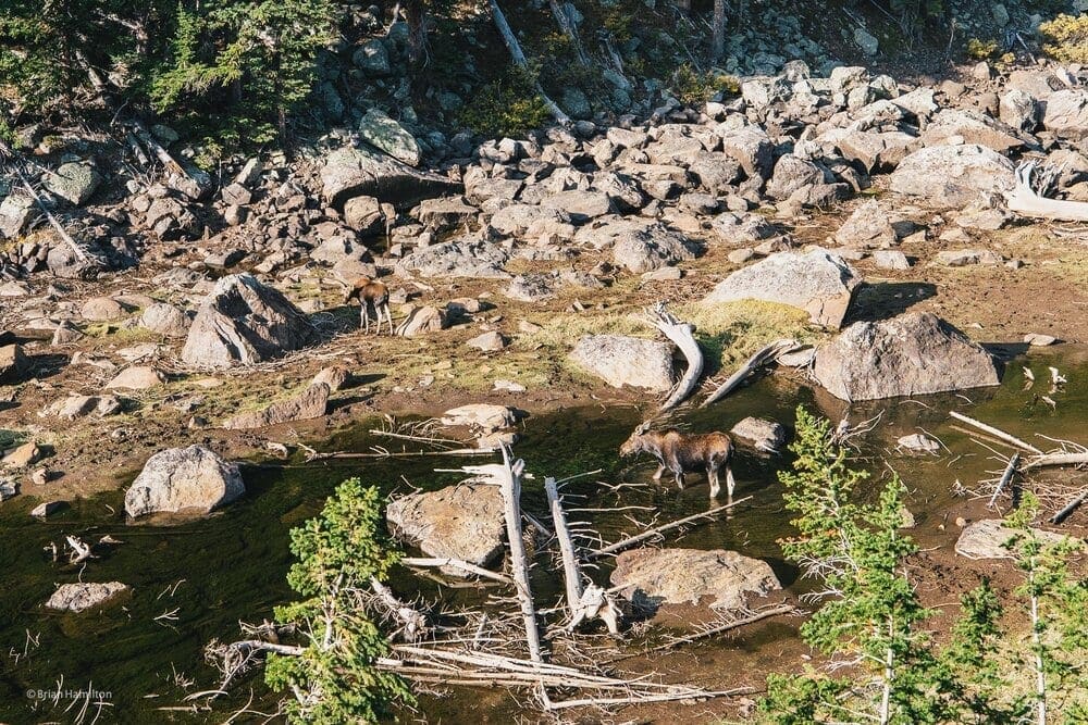
Two moose are enjoying breakfast along the banks of the East Inlet Creek near Lake Verna. Photo Waypoint: 40.22970, -105.72072. Canon EOS R, Canon RF 15-35mm f/2.8L USM Lens, ISO 100, 35 mm, f/4, 1/160 seconds.
Climbing down presents its own set of challenges, especially on the knees under the weight of a pack. With the sun still low I made my way down the trail and was take in by the view of the sun coming into full brightness lighting up the valley below.
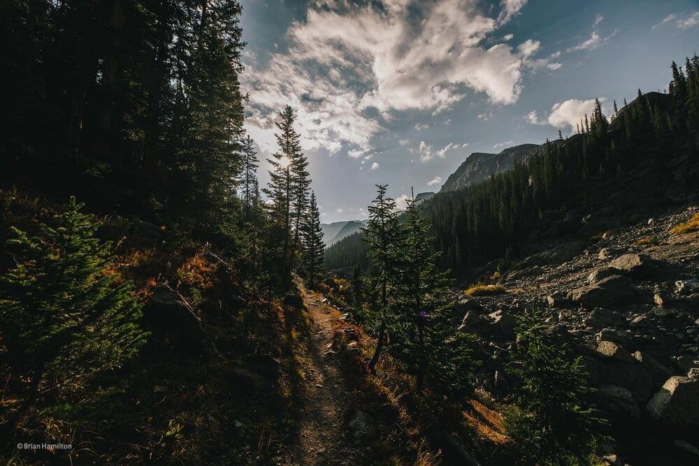
Photo Waypoint: 40.22982, -105.72081. Canon EOS R, Canon RF 15-35mm f/2.8L USM Lens, ISO 100, 15 mm, f/6.3, 1/320 seconds.
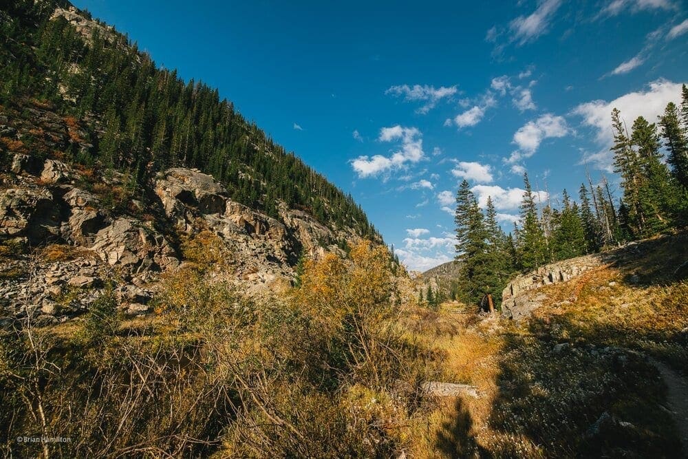
Photo Waypoint: 40.23061, -105.72354. Canon EOS R, Canon RF 15-35mm f/2.8L USM Lens, ISO 100, 15 mm, f/5.6 1/250 seconds.
The view of the pass as I moved forward gave way to stunning views of the reflections off of Lone Pine Lake.
Lone Pine Lake
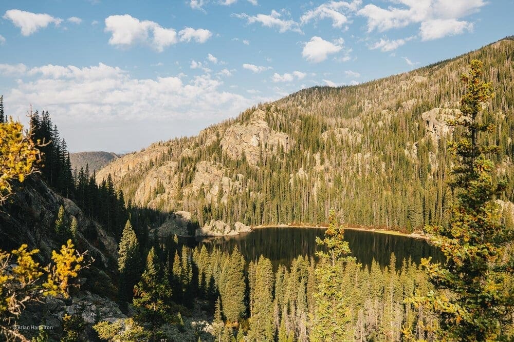
Photo Waypoint: 40.23165, -105.72722. Canon EOS R, Canon RF 15-35mm f/2.8L USM Lens, ISO 100, 15 mm, f/5, 1/200 seconds.
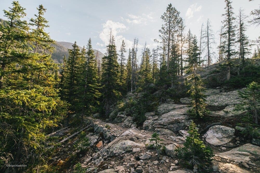
Photo Waypoint: 40.23198, -105.72716. Canon EOS R, Canon RF 15-35mm f/2.8L USM Lens, ISO 100, 15 mm, f/5, 1/200 seconds.
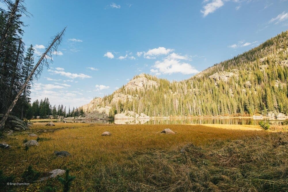
Photo Waypoint: 40.23178, -105.73056. Canon EOS R, Canon RF 15-35mm f/2.8L USM Lens, ISO 100, 15 mm, f/5, 1/200 seconds.
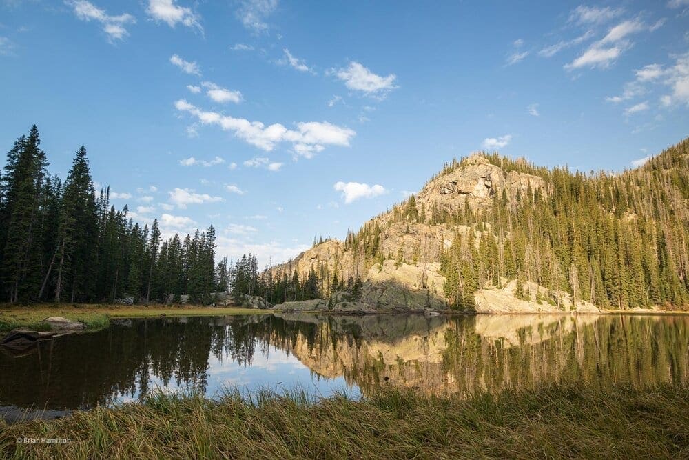
Photo Waypoint: 40.23156, -105.73128. Canon EOS R, Canon RF 15-35mm f/2.8L USM Lens, ISO 100, 17 mm, f/5, 1/200 seconds.
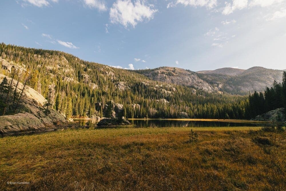
Photo Waypoint: 40.23116, -105.73269. Canon EOS R, Canon RF 15-35mm f/2.8L USM Lens, ISO 100, 15 mm, f/5, 1/200 seconds.
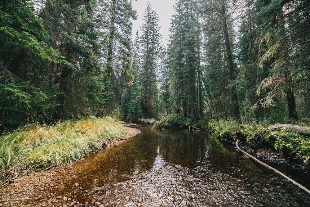
Photo Waypoint: 40.22682, -105.75421. Canon EOS R, Canon RF 15-35mm f/2.8L USM Lens, ISO 100, 15 mm, f/2.8, 1/80 seconds.
Making my way back down the trail the full splendor of the fall colors were out in force. The sun was a little better that day for much more photogenic opportunities. The descending trail made for a much faster pace and allowed for a lot of moments to take in the amazing views from above. Something I notice about Out and Back trails is how different everything looks on the return trip. It might have very well been the exact same trail but seeing it from another direction makes it feel like uncharted waters. I made it back to the parking area and headed home. Leaving behind another wonderful adventure. The mountains were calling, so I went.
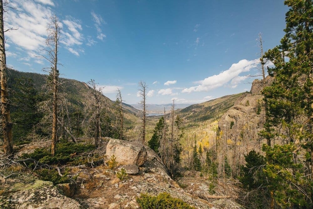
Photo Waypoint: 40.23027, -105.75902. Canon EOS R, Canon RF 15-35mm f/2.8L USM Lens, ISO 100, 15 mm, f/5.6, 1/100 seconds.
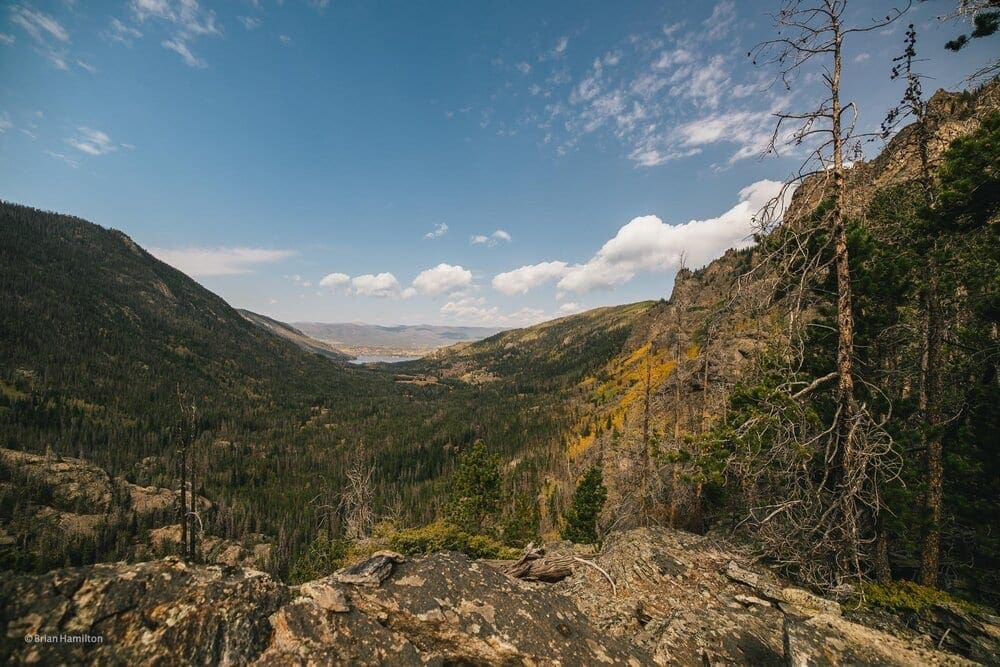
Photo Waypoint: 40.22956, -105.75905. Canon EOS R, Canon RF 15-35mm f/2.8L USM Lens, ISO 100, 15 mm, f/3.2, 1/640 seconds.
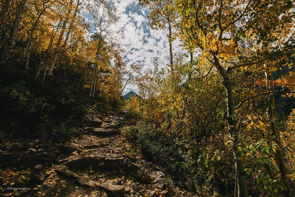
Photo Waypoint: 40.23263, -105.76222. Canon EOS R, Canon RF 15-35mm f/2.8L USM Lens, ISO 100, 15 mm, f/6.3, 1/320 seconds.
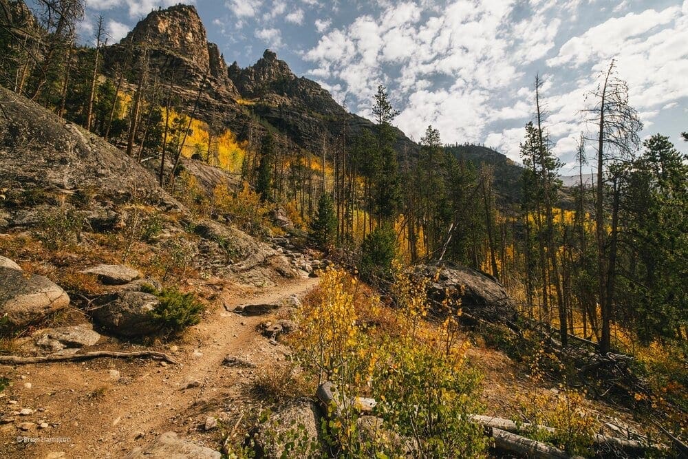
Photo Waypoint: 40.23381, -105.76604. Canon EOS R, Canon RF 15-35mm f/2.8L USM Lens, ISO 100, 15 mm, f/6.3, 1/250 seconds.
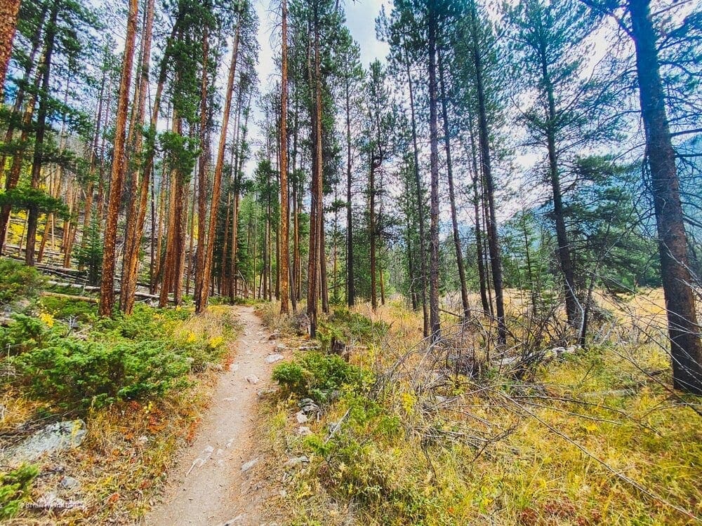
Photo Waypoint: 40.23756, -105.77756 Apple iPhone 11 Pro Max, ISO 32, 1.54 mm, f/2.4, 1/120 seconds.
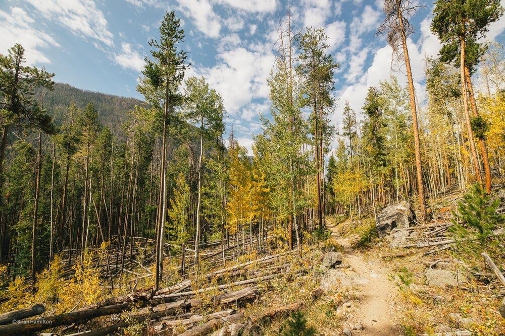
Photo Waypoint: 40.23452, -105.76731. Canon EOS R, Canon RF 15-35mm f/2.8L USM Lens, ISO 100, 15 mm, f/5.6, 1/250 seconds.
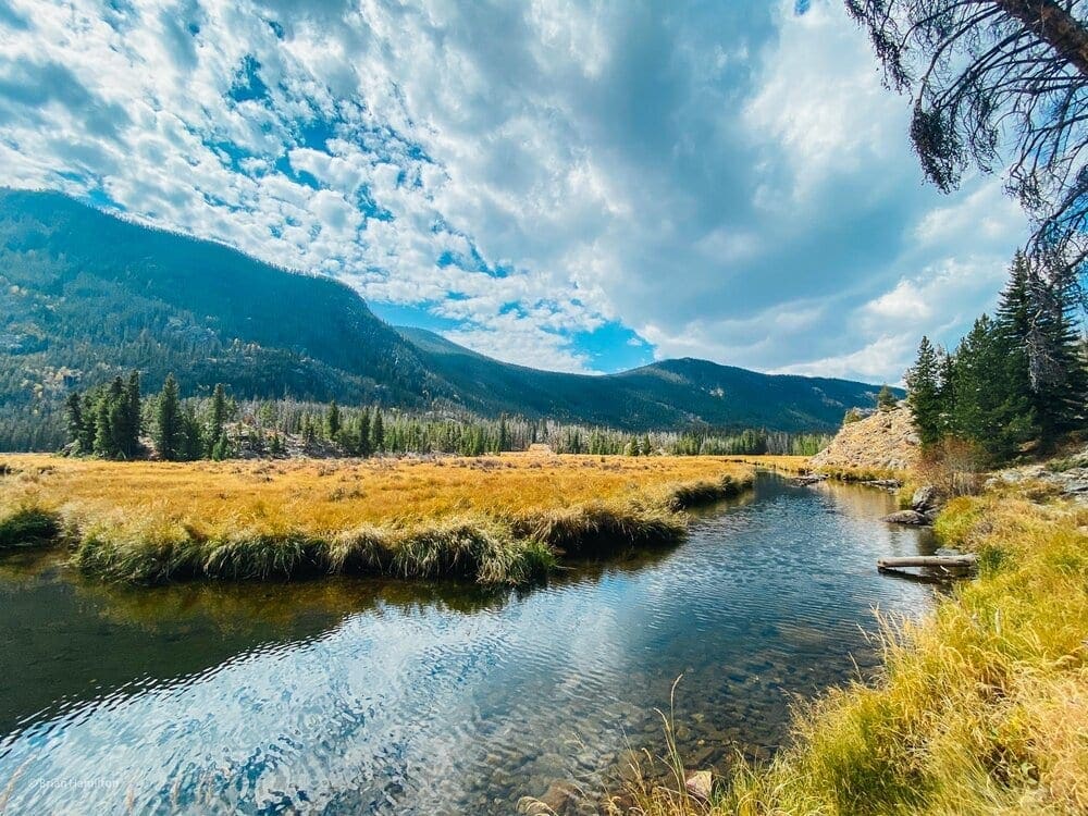
Photo Waypoint: 40.23774, -105.78143. Apple iPhone 11 Pro Max, Triple camera 1.54mm f/2.4 Lens, ISO 20, 1.5 mm, f/2.4, 1/1250 seconds.
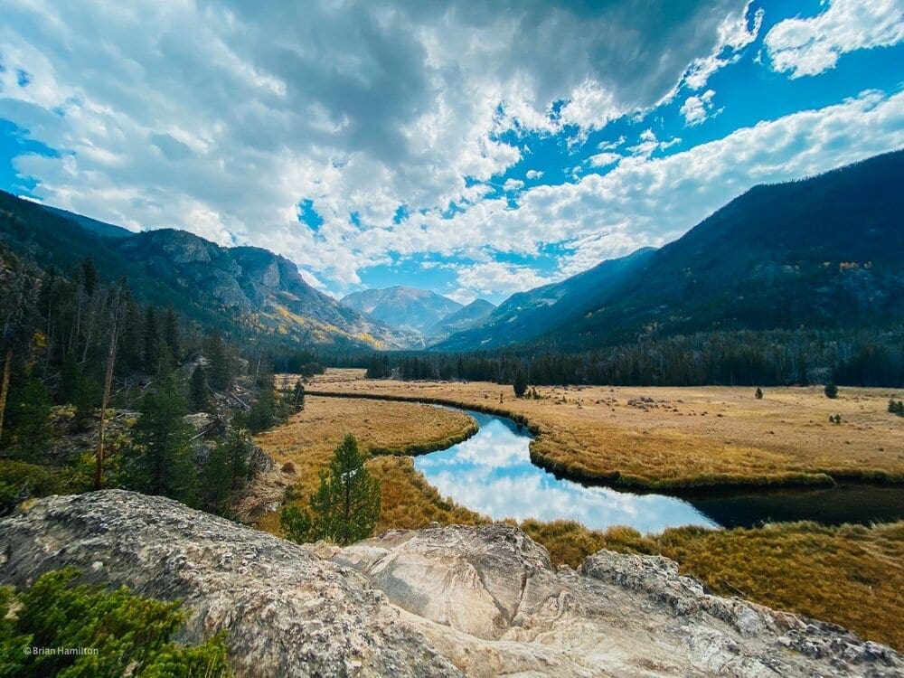
Photo Waypoint: 40.23751, -105.78430. Apple iPhone 11 Pro Max, Triple camera 1.54mm f/2.4 Lens, ISO 20, 1.5 mm, f/2.4, 1/1600 seconds.
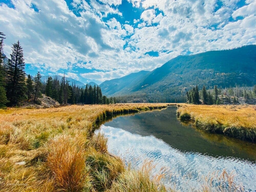
Photo Waypoint: 40.23773, -105.78142. Apple iPhone 11 Pro Max, Triple camera 1.54mm f/2.4 Lens, ISO 20, 1.5 mm, f/2.4, 1/1800 seconds.
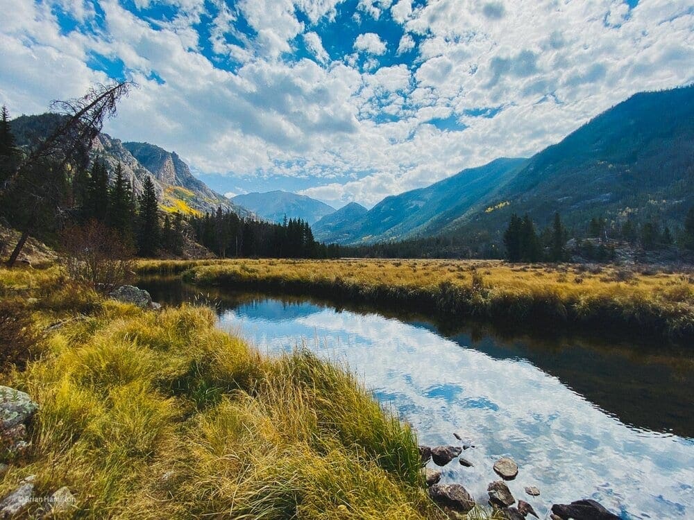
Photo Waypoint: 40.23769, -105.78192. Apple iPhone 11 Pro Max, Triple camera 1.54mm f/2.4 Lens, ISO 20, 1.5 mm, f/2.4, 1/1140 seconds.
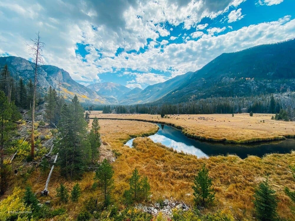
Photo Waypoint: 40.23756, -105.78415. Apple iPhone 11 Pro Max, Triple camera 1.54mm f/2.4 Lens, ISO 20, 1.5 mm, f/2.4, 1/1000 seconds.
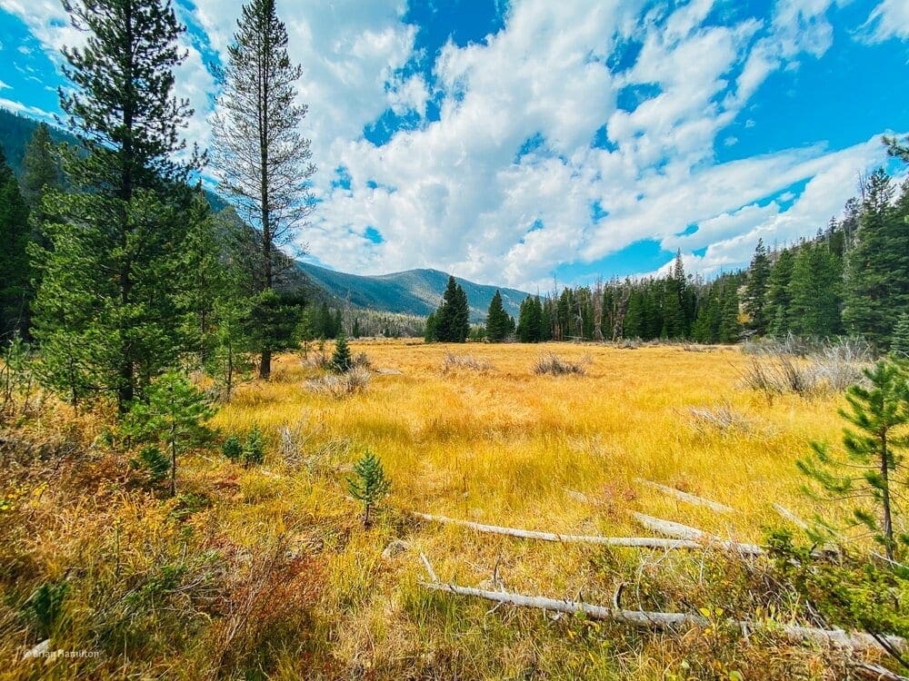
Photo Waypoint: 40.23720, -105.77666. Apple iPhone 11 Pro Max, Triple camera 1.54mm f/2.4 Lens, ISO 20, 1.5 mm, f/2.4, 1/950 seconds.
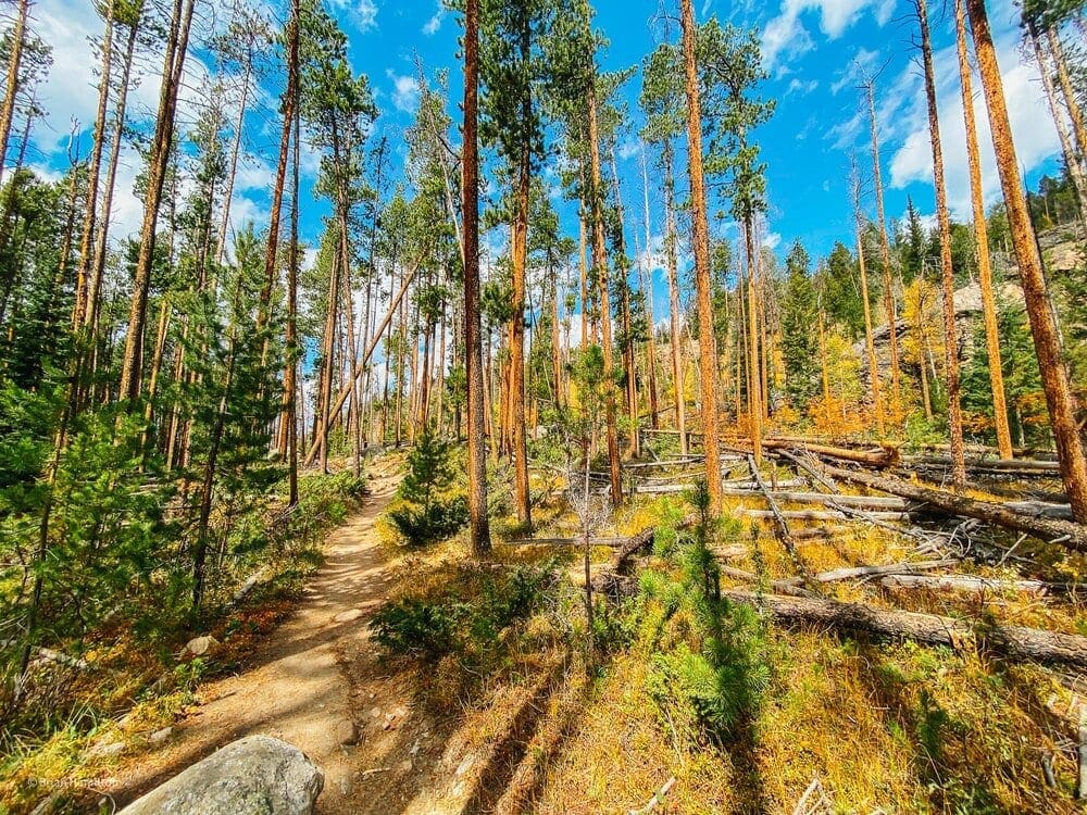
Photo Waypoint: 40.23732, -105.77878. Apple iPhone 11 Pro Max, Triple camera 1.54mm f/2.4 Lens, ISO 20, 1.5 mm, f/2.4, 1/550 seconds.
Terms of Use: As with each guide published on SKYBLUE OVERLAND.com, should you choose to this route, do so at your own risk. Prior to setting out check current local weather, conditions, and land/road closures. While taking a trail, obey all public and private land use restrictions and rules, carry proper safety and navigational equipment, and of course, follow the #leavenotrace guidelines. The information found herein is simply a planning resource to be used as a point of inspiration in conjunction with your own due-diligence. In spite of the fact that this route, associated GPS track (GPX and maps), and all route guidelines were prepared under diligent research by the specified contributor and/or contributors, the accuracy of such and judgement of the author is not guaranteed. SKYBLUE OVERLAND LLC, its partners, associates, and contributors are in no way liable for personal injury, damage to personal property, or any other such situation that might happen to individuals following this route.


