


High Point:
11,350 feet

Total Ascent:
2000 feet

Difficulty:
Hard

Distance:
~9 miles roundtrip

Waypoints:
39.902906 -105.644

Route Type:
Out and Back
East Portal Trailhead is one of the more popular access points to the northern part of James Peak Wilderness. It is reachable from numerous directions, all of which converge near Rollinsville. If coming from…
North (Estes Park area).
-
Take CO7 south into Nederland. At the traffic circle, continue south, now on CO119, for 4.7 miles. Take a right on E. Portal road and follow the signs to the trailhead and Moffat Tunnel.
South (Central City, Blackhawk).
-
The best option is to take CO119 north for 13.6 miles and then take a left onto E. Portal Road.
-
East (Boulder), there are two options.
-
Take 119 (Canyon Boulevard) west from Boulder until reaching Nederland. At the traffic circle, take the south extension to E. Portal Road.
-
Take CO72 west until it dead-ends at CO119. Take a left and look for the right hand turn onto E. Portal road; this is the fastest approach from metro Denver.
-
West (Idaho Springs, Summit County, etc.)
-
Exit 243 on I-70, head north to Central City. In Blackhawk, take a left on CO119, continue north 13.6 miles, take a left on E. Portal Road.
-
Once on East Portal Road (Gilpin County Road 16), follow it for 7.3 miles before reaching the large trailhead.
Even though the trailhead is tucked in next to South Boulder Creek, it experiences the same weather extremes common at high elevations. Like many parts of the Front Range, the area is known for strong and gusty winds. In the summer months, intense afternoon storms can form quickly. Plan to start early and be off any high point or summit by noon. Useful local weather forecast stations include James Peak Weather and Rollinsville area Forecast.
One of the most notable features near the East Portal Trailhead is The Moffat Tunnel, a large, six-mile train tunnel that burrows through the Continental Divide. The eastern entrance to the tunnel is right next to the parking lot. Moffat is the main rail passage through the mountains between Denver and Winter Park and has been in use since 1928. Because it is a high use rail area, the road next to the trailhead is plowed consistently in the winter. Ample winter recreation opportunities exist here. Outside of the winter months, the East Portal trailhead is very popular for its relatively simple approach to the Continental Divide, multiple lake options, and excellent alpine views.
Since many of the destinations from East Portal are in the alpine, make sure to plan accordingly. A good set of items to have include a map (either physical or downloaded), 2-3 liters of water, food, sunscreen, and a first aid kit. If high elevation hiking begins to give you headaches or zaps your thirst and hunger, consider staying at a lower elevation until your body can acclimatize. Despite the popularity of the trailhead, James Peak Wilderness is a wilderness for a reason—help is farther than you think.

Hotels:
Rollinsville is the closest town to East Portal and has a smattering of motels and lodging options. Nederland is another option, only a few miles north. If coming up from the south, Blackhawk has a decent selection of hotels.
Airbnb:
Whether you’re looking for a treehouse for the weekend or an entire home for the whole family, a warm welcome awaits at Airbnb.
Campgrounds:
Discover your New Favorite Camping Spot at The Dyrt. The perfect campsite is waiting for you. Search over 1 million listings, reviews, and tips from campers like you.
Kellie Dahl. This campground is right off the peak to peak highway (CO 119) and costs $23 per site. There are maintained facilities, bear boxes, and fire rings at the sites with plenty of space. Kellie Dahl is only 22 minutes from East Portal.
Winiger Ridge. There are multiple established campsites in the area, and they do not have a site fee. The sites can occasionally be loud because they are a favorite amongst college students from Boulder. Gross Reservoir is visible from many of the sites and is a fun area to fish, although no water recreation is allowed. Winiger Ridge is roughly 40 minutes from East Portal.
Reverends Ridge. A part of Golden Gate State Park, this hard to find campsite offers 97 sites and has maintained facilities. It costs $28 for a basic site and $36 for an electric campsite, in addition to the $10 Golden Gate State Park entrance fee. Reverends Ridge is roughly 30 minutes from East Portal.
Journal:
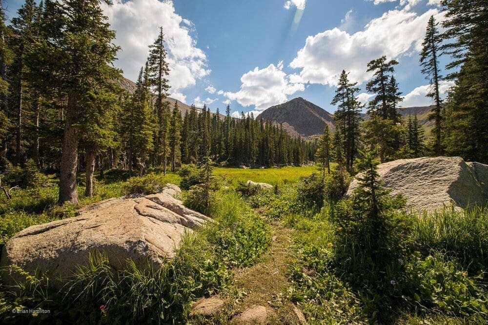
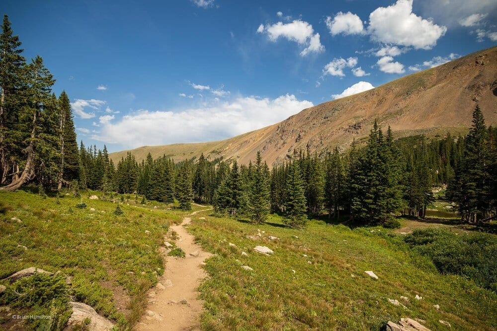
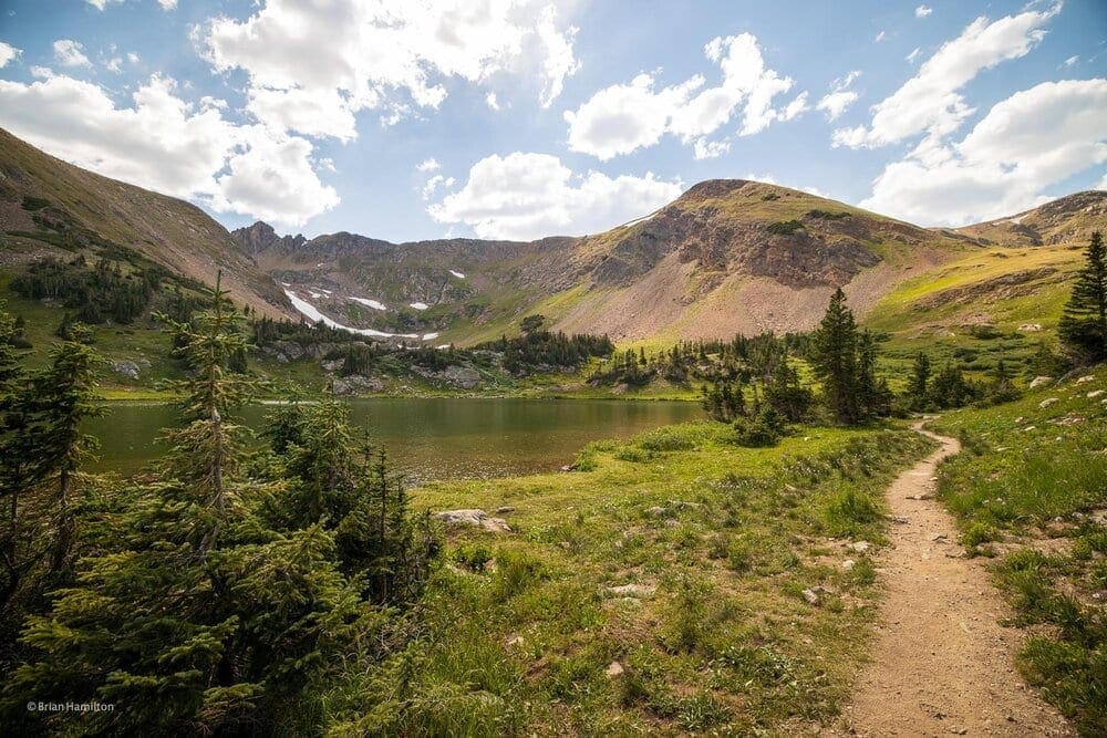
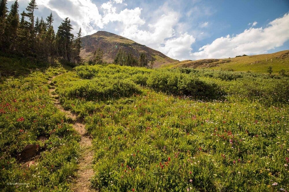
Once you’ve parked, find your way to the northwest corner of the parking lot and pick up South Boulder Creek Trail. This trail is the central node in a wide network. If there’s a destination you fancy from East Portal, chances are you’ll be taking at least part of South Boulder Creek Trail to get there. For Rogers Pass Lake and Heart Lake, you’ll be taking South Boulder Creek Trail west for nearly four miles.
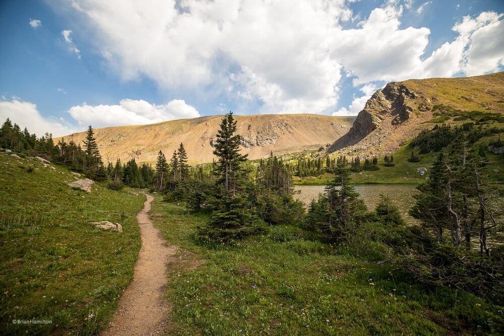
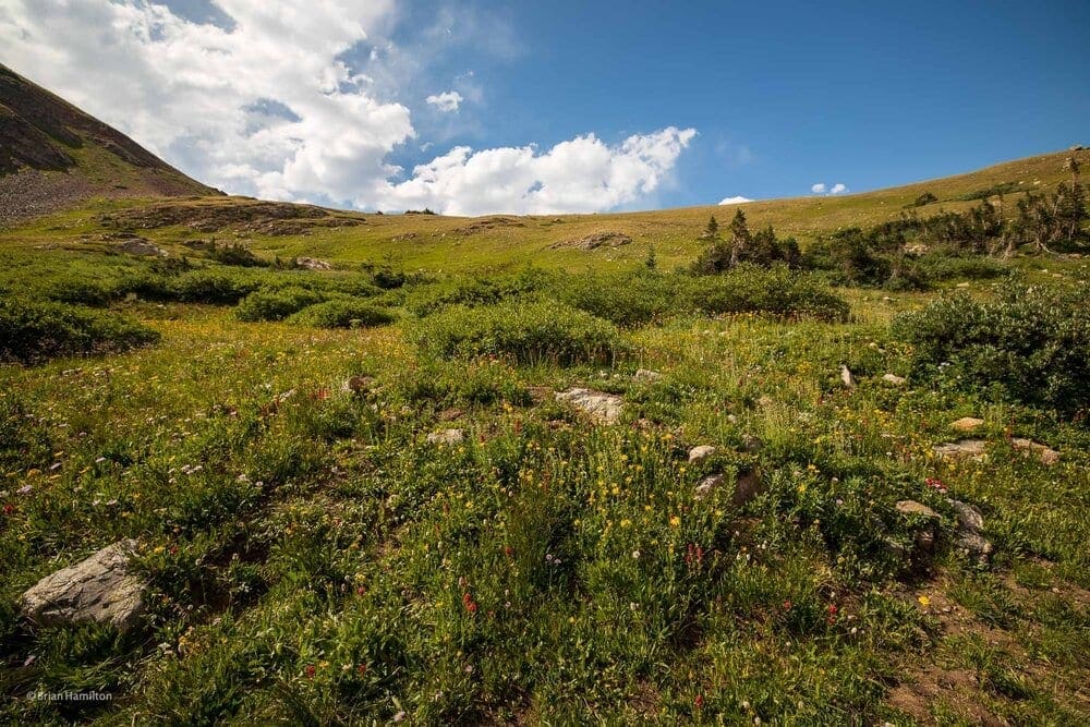
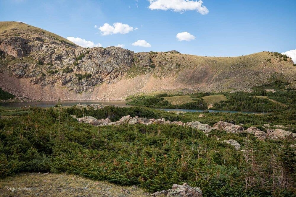
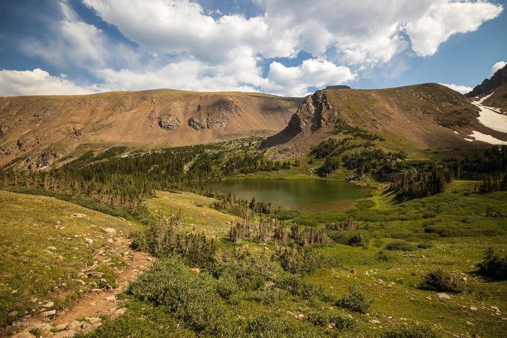
At a little over a mile in (~1.2), you’ll pass the junction for Forest Lakes. Continue straight as the trail begins to ascend. At around 1.8 miles in, you’ll pass the junction to Crater Lakes. Again, continue straight along South Boulder Creek Trail. The next section of the trail takes you over two footbridges while continuing to climb at a moderate pitch. Once you gain some elevation, the trail will cross over one more creek before the forest thins, and you get your first looks at Haystack Mountain.
(Pic. 18/46).
This very obvious mountain sits on the far side of Rogers Pass Lake. After passing by a picturesque small lake.
(Pic 20/46. Unnamed lake before Rogers Pass Lake.)
(Pic21/46: Looking back down the trail)
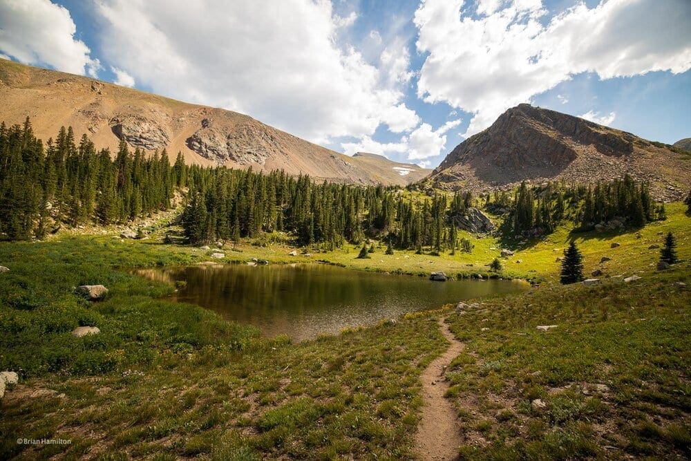
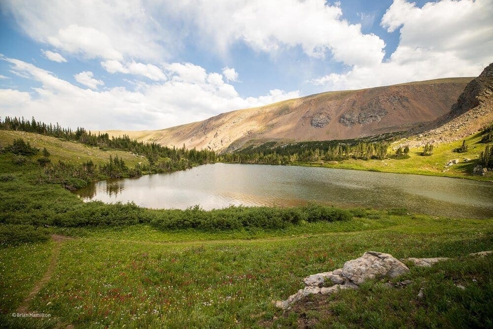
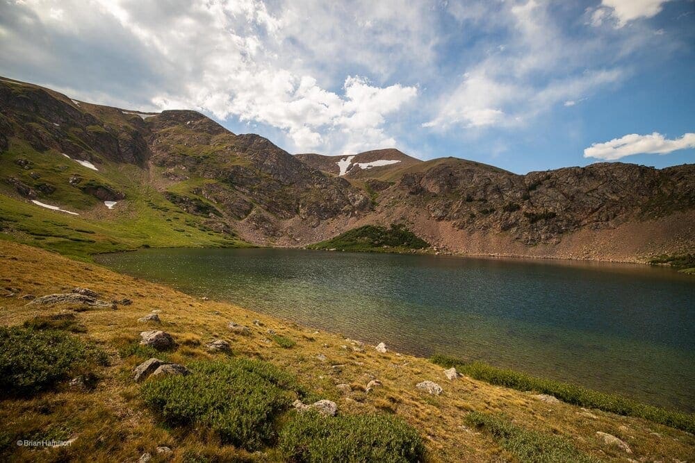
you’ll arrive at the larger Rogers Pass Lake.
(Pic 23/46: Rogers Pass Lake)
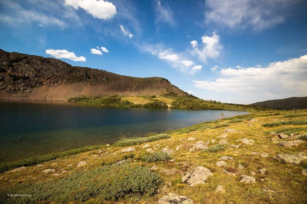
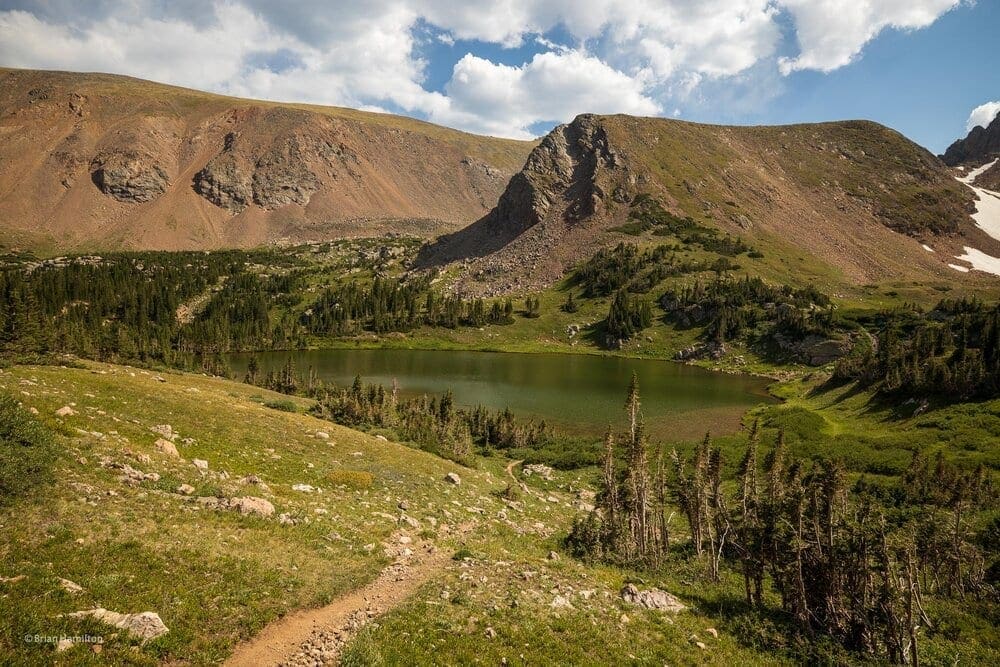
(Pic 26/46: Western side of Rogers Pass Lake)
(Pic 29/46: Looking back down the trail you came in on)
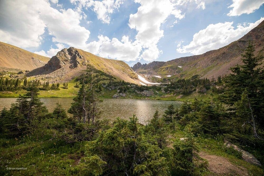
(Pic1/46: Western edge of Rogers Pass Lake).
Take your time to admire the area; it’s quite pretty. While the regular trail continues along the lake’s eastern shore, there is an unofficial trail that circles the lake.
(Pic 34/46: Looking south to the Continental Divide along Rogers Pass Lake)
(Pic 35/46: Looking east across Rogers Pass Lake).
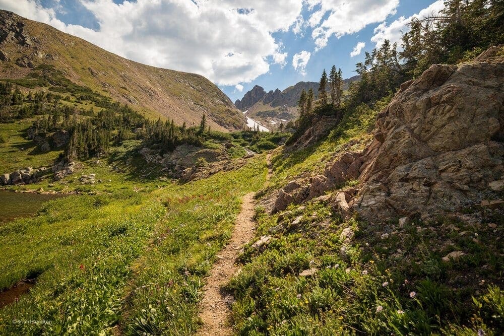
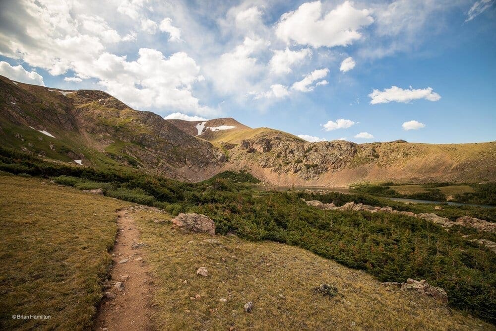
To get to Heart Lake, continue north up a steep rise to a junction with Rogers Pass trail
(Pic 8/46: Climbing away from Rogers Pass Lake)
(Pic 10/46: Alpine scenery near Rogers Pass).
A left will get you up to Rogers Pass after another 550 feet of elevation gain. To get to Heart Lake, continue straight through the junction. The trail will dip down to Heart Lake after a few hundred yards
Approaching Heart Lake.
(Pic 13/46: Approaching Heart Lake)
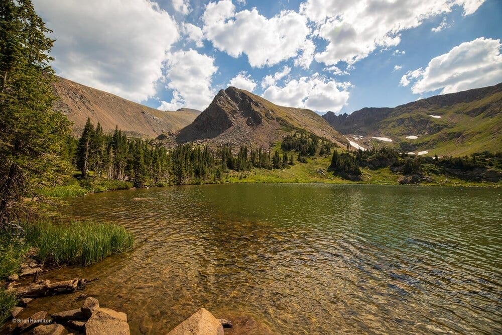
Heart Lake
(Pic 15/46: Heart Lake).
The scenery between both lakes is fantastic, and the area plays host to many backcountry campers.
Once satisfied with Heart Lake, double back to begin your journey out. On the way back from the trail’s highpoint, enjoy the beautiful descent to Rogers Pass Lake
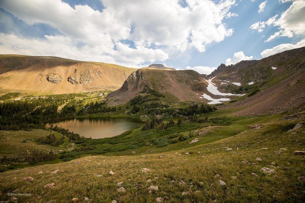
(Pic 44/46: Descending back to Rogers Pass Lake, James Peak poking out from behind Haystack)
(Pic 43/46: Another angle a little lower)
(Pic 42/46: Zoomed in).
Once you pass Rogers Pass Lake for the last time, simply backtrack the South Boulder Creek Trail eastward until arriving at the parking lot.
Final Thoughts:
I hiked this trail on August 8, 2020.


