


High Point:
Micah Lake 10,455 feet

Total Ascent:
~2,130 feet

Difficulty:
Difficult

Distance:
4 miles to the lake

Waypoints:
40.78368, -106.72242

Route Type:
Out and Back (loop options possible)
Micah Lake is both a great day hike destination and a superb camping spot. With exploration possibilities on all sides, Micah Lake is a great launch point for exploration of one of Colorado’s greatest lowkey ranges.
Overview:
Micah lake is a subalpine body of water deep within the Northern Park Range of Colorado. If that area doesn’t sound familiar, it’s because it’s quite remote. More people are at least aware of the Zirkel Wilderness since it’s a large protected mountainous area along the Continental Divide. Micah Lake lies within this wilderness.
The Mt. Zirkel Wilderness and Buffalo Pass areas of the Northern Park Range are likely the snowiest places in Colorado. Despite the tallest peaks barely scraping over 12,000 feet in elevation, the treeline is a lot lower because of the range’s northern latitude, and large swathes of beautiful alpine exist here. The main access to this area is northeast of Steamboat Springs.
Aside from standout areas like Gilpin Lake, Mt. Zirkel, Big Agnes Mountain, and the Mt. Ethel/Lost Ranger area, the range is largely forgotten. If you don’t mind the nearly five-hour drive from parts of the Front Range, the Northern Park Range around Micah Lake can provide an excellent escape from urban sprawl.
Table of Contents
Article Navigation: Click on any of the listed items in the table of contents below to jump to that section of the article. Similarly, clicking on any large, white section header will jump you back to the Table of Contents.
- Overview
- Scales and Criteria
- Directions to Trailhead
- Field Notes
- Journal: Micah Lake
- Journal: Little Agnes and “Middle” Agnes from Micah Basin
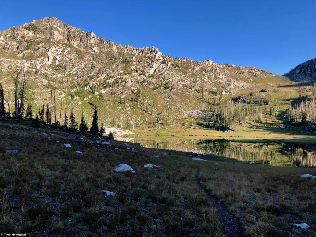
Micah Lake, tucked into Micah Basin underneath Little Agnes Mountain.
Support Skyblue Overland™ on Patreon!
If you’d like to support our efforts for a few dollars a month, please subscribe to our Patreon page. Every donation energizes our team to keep writing detailed trail reviews, gear reviews and adventure guides. Thank you!
Micah Lake from near the low point of the ridge at the head of Micah Basin.
Global Rescue is there whether you’re hiking, kayaking, snowmobiling, fishing or simply enjoying the outdoors and get ill or injured and you’re unable to get to safety on your own. Global Rescue is the red button you push in an emergency. Their team of medical and security experts come through for you when it matters most.
Scales and Criteria:
This article uses two metrics to calculate difficulty: overall distance and elevation gain. Micah Lake is accessible via two well-established trails and shouldn’t involve any off-trail navigation. However, all peaks and destinations from Micah Lake require off-trail navigation and a minimum of a Class 2 rating (all the way up to multiple rock-climbing pitches).
Micah Lake is both a great day hike destination and a superb camping spot. Keep in mind that this isn’t the prettiest part of the Park Range as it is still recovering from a set of devastating fires in 2002. Regardless, for the central location, with exploration possibilities on all sides, Micah Lake is a great launch point for exploration of one of Colorado’s greatest lowkey ranges.
Difficulty Ratings:
- Easy: less than 5 miles, less than 500 ft. of elevation gain
- Moderate: 5-10 miles, 500-2000 ft. of elevation gain
- Difficult: 5-15 miles, more than 2000 ft. of elevation gain
- Very Difficult: 10+ miles, more than 3,500 ft. of elevation gain
Technical Rating:
- Class 1: Established hiking trail the entire length of the adventure. Low chance for injury.
- Class 2: Typically involves cross-country navigation, possibly using hands for balance but not required, steeper than Class 1.
- Class 3: Hands and feet used to scale areas; must use hands to proceed (either for balance or to help pull you up a section), increased exposure, a fall could be fatal. Helmet recommended, along with grippy hikers.
- Class 4: Climbing on very steep terrain just shy of vertical, falls could be fatal, hands employed for grip and balance continuously, ropes advised but scalable without. Helmets are highly recommended, along with grippy hikers.
- Class 5-5.4: Vertical climbing that involves technical rock-climbing moves, exposed, falls likely to be serious or fatal, possible to scale without ropes but only for very experienced veterans. Helmets, grippy hikers, and/or rock-climbing shoes are necessary.
- Class 5.5 and up: Not covered as scrambling, full-on rock climbing with ropes, helmets, etc.
Approaching the shoreline of the lake.
Directions to Trailhead:
Most of the highest locations in Zirkel Wilderness (excluding the Ethel/Lost Ranger area) are reached via the Slavonia Trailhead. This trailhead is roughly an hour outside of Steamboat Springs. Keep in mind that because of the heavy regional snowfall, the trailhead may not be accessible until later June, and even when it is, the high peaks will have connected snow patches (during an average snowfall year) through early/mid-July.
From Boulder, Denver, and Colorado Springs, take I-70 west to Silverthorne, then 9 north to Kremmling. From Kremmling, take US 40 north, continuing up to Muddy Pass, Rabbit Ears Pass, and eventually down to Steamboat. From Fort Collins, take US 14 west through Cameron Pass all the way to Walden. Stay on US 14 as it banks south and then southwest before meeting US 40 at Muddy Pass. Take 40 west to Steamboat from there.
If you’re coming from the southwest (Grand Junction, Glenwood Springs, etc.), take I-70 east to the Wolcott exit (exit 157) and then take 131 north until connecting with 40 just outside Steamboat.
From Steamboat, take 40 through town, 129 (a slight right near the airport) north toward Clark, and a minute or two after passing the Clark Store, take a right on 64, better known as Seedhouse Road. Follow Seedhouse Road northeast until it dead ends into the trailhead (~11 miles).
From the northeast (Laramie or Cheyenne), take 230 southwest through Mountain Home, crossing a low point of the Medicine Bow Mountains. On the other side of the border with Colorado, the road changes to 127 (heading south). Take this road (the number changes again to 125), and follow it until arriving in Walden. From Walden, take 14 south to muddy Pass and 40 over to Steamboat. Lastly, from the northwest (Green River, Jackson Hole), find I-80 and take it to exit 187, where you’ll head south on 789. Right before the Colorado border, take a left on 70 (not the interstate) and continue on this road towards Hahns Peak Village, Steamboat Lake, and, ultimately, the small town of Clark. Find Seedhouse road (a left) before passing the Clark Store and take that all the way to the trailhead.
Seedhouse Road is a long dirt road but passable by most cars; just watch out for a few ruts and washboard sections.
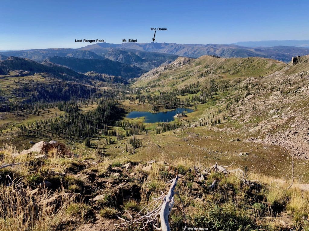
Micah Lake from above, and a cluster of higher peaks to the south.
Field Notes:
Unless you’re a Routt County local, Zirkel Wilderness is pretty far. Any expedition into this part of the state should involve some studious route planning, first-aid kits, a ton of water, sunscreen, and bug spray for monsoon season. Due to the remote nature of this area (there are many unnamed peaks and seldom explored corners in this region), forecasting is an important component. For Micah Lake, you’ll be on easy to follow trails the whole time, but any additional exploration is all wilderness.
For general lower trail conditions, you can use the Clark 7-day forecast. For the higher portion of the hike, Mt. Zirkel is the most reliable forecast. Keep in mind that it lies a few basins to the east and is nearly 2,000 feet higher than the lake. Wind will likely be a bit less at the lake, along with temperatures that are a few degrees higher than Zirkel’s summit. As previously mentioned, this is a remote area with a complete lack of 14ers, 13ers, and only 3 12ers. For the exploration oriented, there’s plenty to love, but forecasting is especially variable, and you should be prepared for typical mountain weather extremes.
Again, if you’re local, you may be used to the typical weather patterns that assault these mountains, but seeing as the Northern Park Range is the snowiest range in the state, it goes without saying that there can be some intense snow/rain/thunderstorms throughout the year. If you’re approaching from far away, leave as detailed a hiking plan as you can with people to let them know where you’ll be along with emergency contact numbers.
- Routt County Sheriff: 970-879-1090 (offices in Steamboat Springs)
- Routt National Forest: 970-723-2700 (offices in Walden)
Better safe than sorry!
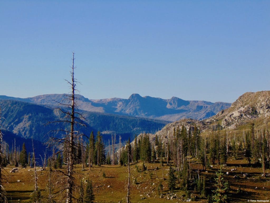
You may also see on maps that there’s an area here known as the “Sawtooth Range”. The perimeters of this subrange are vague but generally extend west to east from Little Agnes to a low pass just to the west of Mt. Zirkel and occupy a few ancillary ridges heading north and south/southeast. The “Sawtooth Range” is one of the gnarliest ranges in the state and requires a lot of scrambling to conquer. Below the description for Micah Lake, there’s a journal section detailing easier ways up Little Agnes and “Middle Agnes” which are two of the easiest peaks to attain in the Sawtooth, affording you the views without the scrambling commitment that comes standard throughout the rest of the range.
Please note that this Sawtooth Range is NOT the Sawtooth Traverse between Mt. Evans and Bierstadt, nor is it the iconic Sawtooth Range in central Idaho. In comparison, this area is much less traveled.
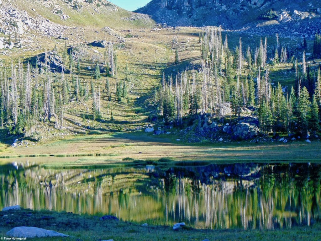
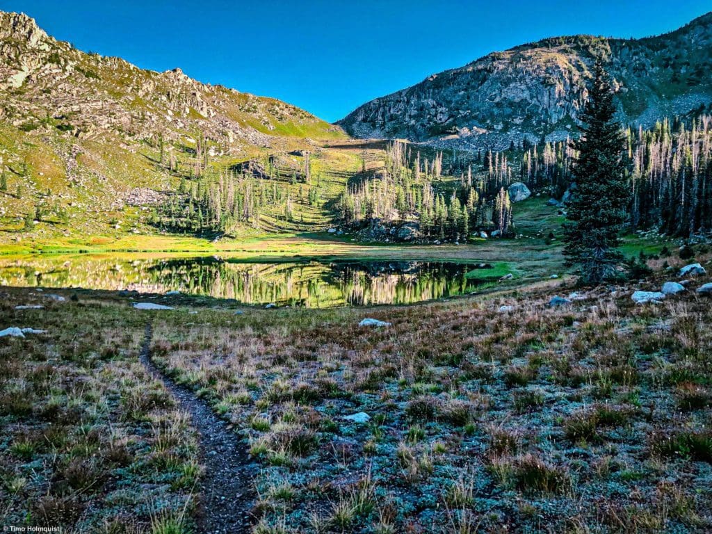
Peaceful reflections in Micah Lake.
Journal: Micah Lake
The Slavonia trailhead can fill up on weekends, forcing you to park further down the road. Navigationally, this isn’t a huge deal (aside from adding some mileage to your overall journey) because you just walk the road to its endpoint and pick up the obvious trail there. There are signs a plenty.
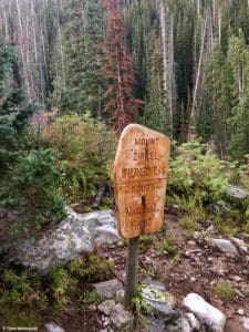
Wilderness sign near the trailhead.
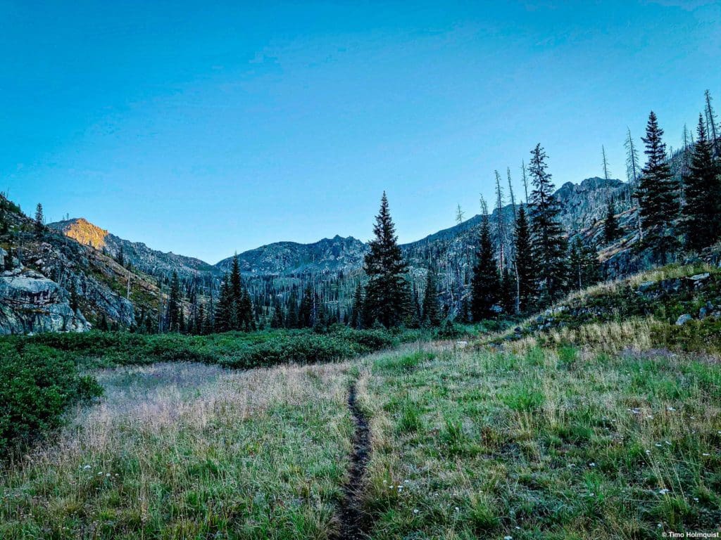
You’ll start by taking the Gilpin Trail. After a few minutes, you’ll encounter your first trail junction, stay on the Gilpin Creek Trail (left). The Gilpin Trail (shockingly) follows Gilpin Creek until eventually reaching (again, shockingly) Gilpin Lake. You won’t get that far, however. After a little more than a mile (~1.25), you’ll come across a second trail junction and take a left, following the Micah Basin Trail.
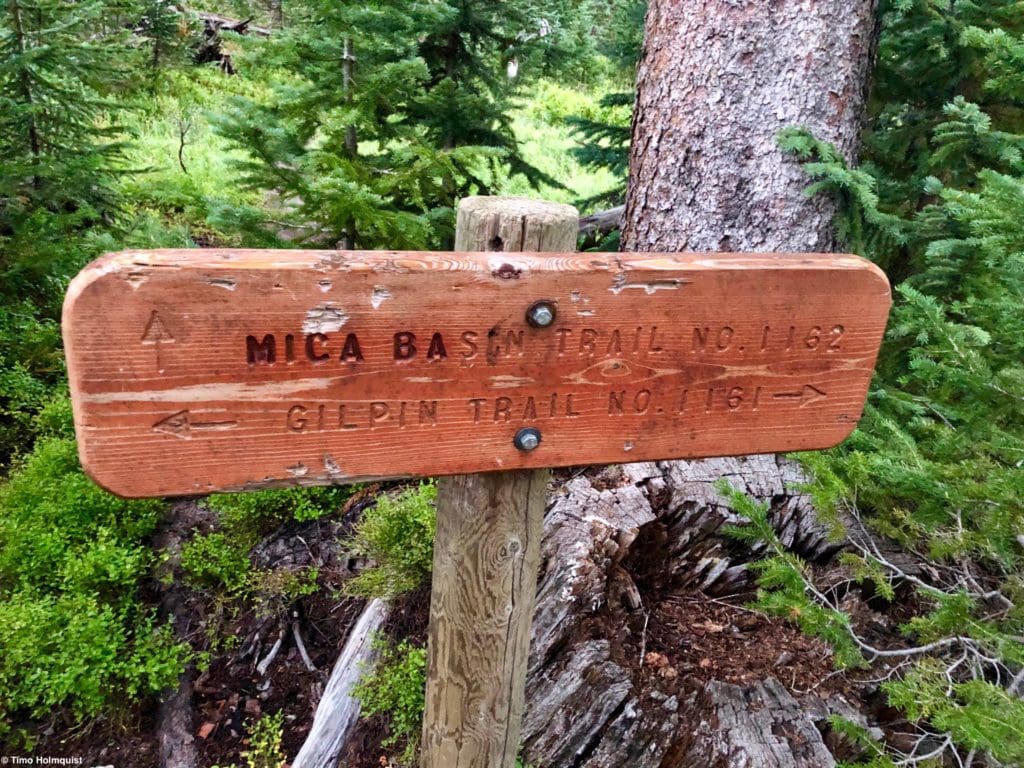
Micah trail sign.
The Micah Basin trail is easy to follow, but there are a few sections through thick willows that may throw off navigation for a few seconds. If you ever feel like you’ve lost the trail, retrace your steps and scout around until finding the correct course. On one or two occasions, the trail disappears into willow thickets but emerges on the other side.
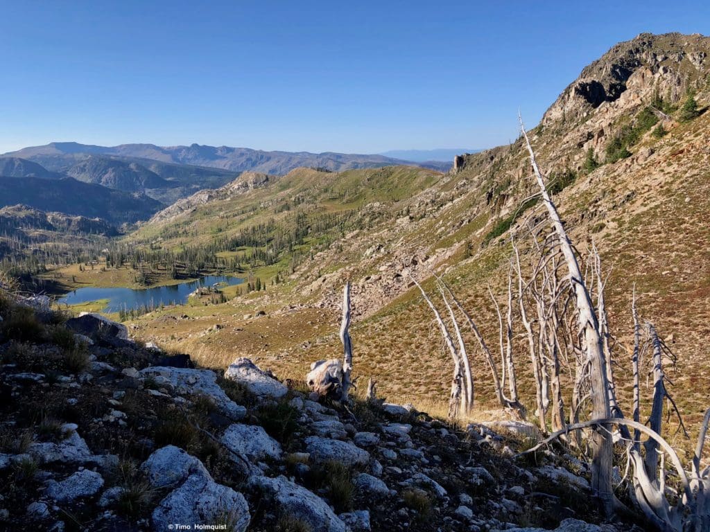
The most concentrated bit of elevation gain happens shortly after the trail intersection when the trail climbs into the long Micah Basin. Even still, this gain is relatively short-lived (~1 mile, ~750 ft. of gain) and ends after you cross Micah Creek. After this point, you’ll still gain elevation until reaching the lake, but the trail takes on a meandering and gentle course, allowing you to stare at the interesting views.
Looking up the basin, Little Agnes is the mountain with a bit of sun on it.
This area was devasted by the Zirkel Complex fires in 2002. Despite the decades since the fire, regrowth has been slow. You can still see the petrified trunks of burnt trees and a healthy but low understory that has yet to fill in completely. Part of the slow regrowth can be attributed to rocky soils and the heavy snowfall that allows for a very short growing season. It’s an interesting case study on how long it takes alpine and subalpine areas to recover from fire and should remind everyone to put all of their campfires out entirely.
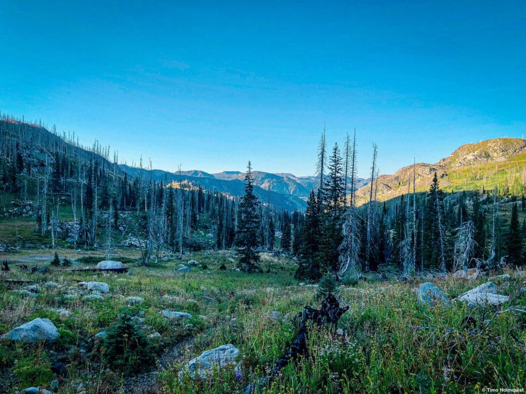
Slow regrowth in Micah Basin, looking south.
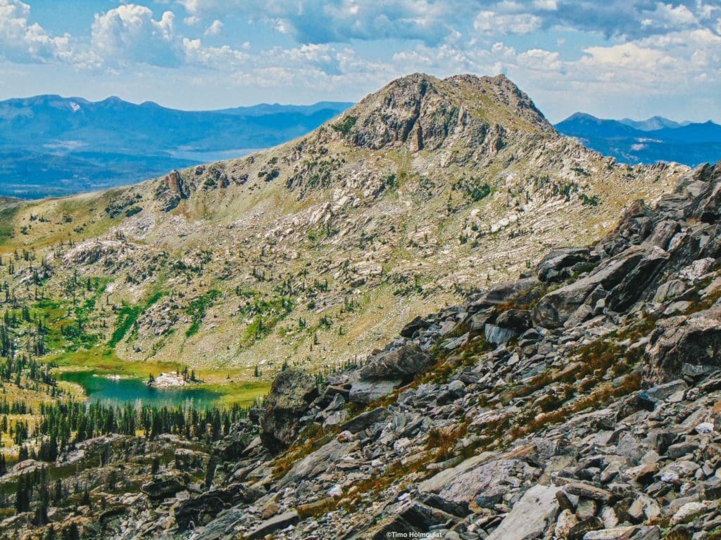
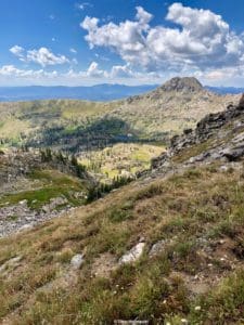
As you ascend, views begin to get more dramatic, especially to the right up toward Pk. 11,777 (called “Exclamation Point Peak” by some but is officially nameless), which has a series of beautiful rocky spires to the south of its true summit.
Pk. 11,777 looking intimidating to the east.
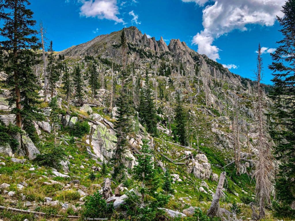
At no point during your rise to the lake do you feel as though the surrounding mountains are as rugged or prominent as other parts of the state. It’s a bit of a perspective issue since the approach to the lake is so gradual. Don’t be fooled, though; the ridges above Mica Lake (Little Agnes’s east ridge and the Spike in particular) have sizable Class 3 and 4 scrambling portions on them.
The upper part of Micah Basin from the slopes of “Middle” Agnes.
You’ll know you’ve arrived at the lake when you cross a low shoulder, and descend gradually to the shoreline. The lake is only about 4 miles from the trailhead, so this is an easy half-day hike or a great launch point for further adventures.
You’ve arrived!
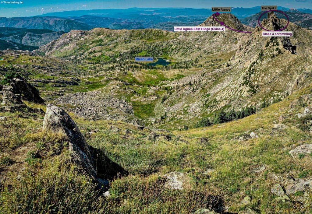
Journal: Little Agnes (11,497 ft.) and “Middle” Agnes (~12,020 ft.) from Micah Basin
If you’re feeling underwhelmed when you get to the lake, fear not! There’s plenty of stuff to explore in the area, and camping here is a worthwhile endeavor. If you only have a day, backtrack from the lake and pick up the trail as it heads west and up to the south shoulder of Little Agnes. Taking the ridge from this southern approach will give you Little Agnes’s summit at a manageable Class 2+ instead of the difficult Class 4 east ridge.
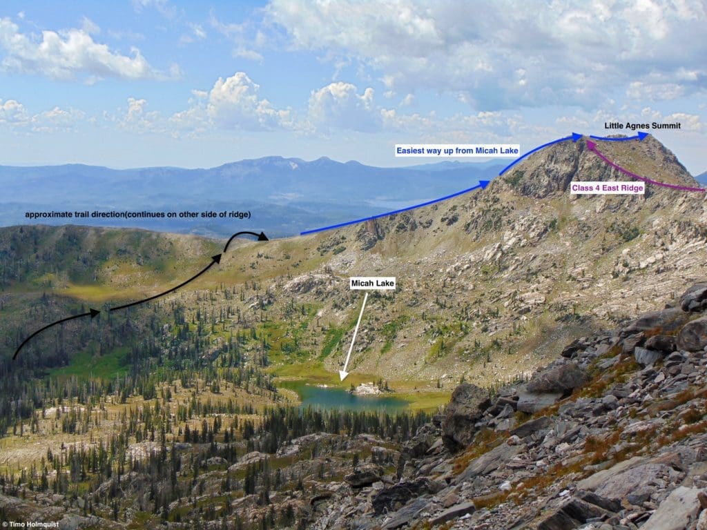
Little Agnes route from near Micah Lake.
“Middle” Agnes is also a Class 2 affair from Micah Lake. It’s not an official peak, which would require a 300-foot-deep saddle between it and neighboring peaks, but from most angles, it stands alone and counts as at least a highpoint or soft ranked summit. You can’t get to Big Agnes from the summit of “Middle” Agnes without serious exposure and some short Class 4 scrambling, but “Middle” Agnes may be the crown jewel of the Micah Basin.
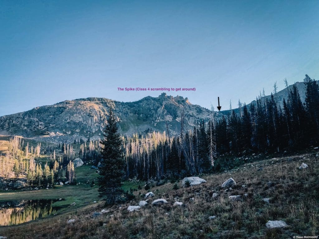
Head for this low point in the ridge (black arrow) to get up to “Middle” Agnes and void the scrambling on the Spike.
To get to “Middle” Agnes, head east from Micah Lake and follow a series of pleasant gullies that veer around the nearly vertical ridges near the Spike. The gully up to the ridgeline should become obvious as you gain elevation.
The beginning of the route.
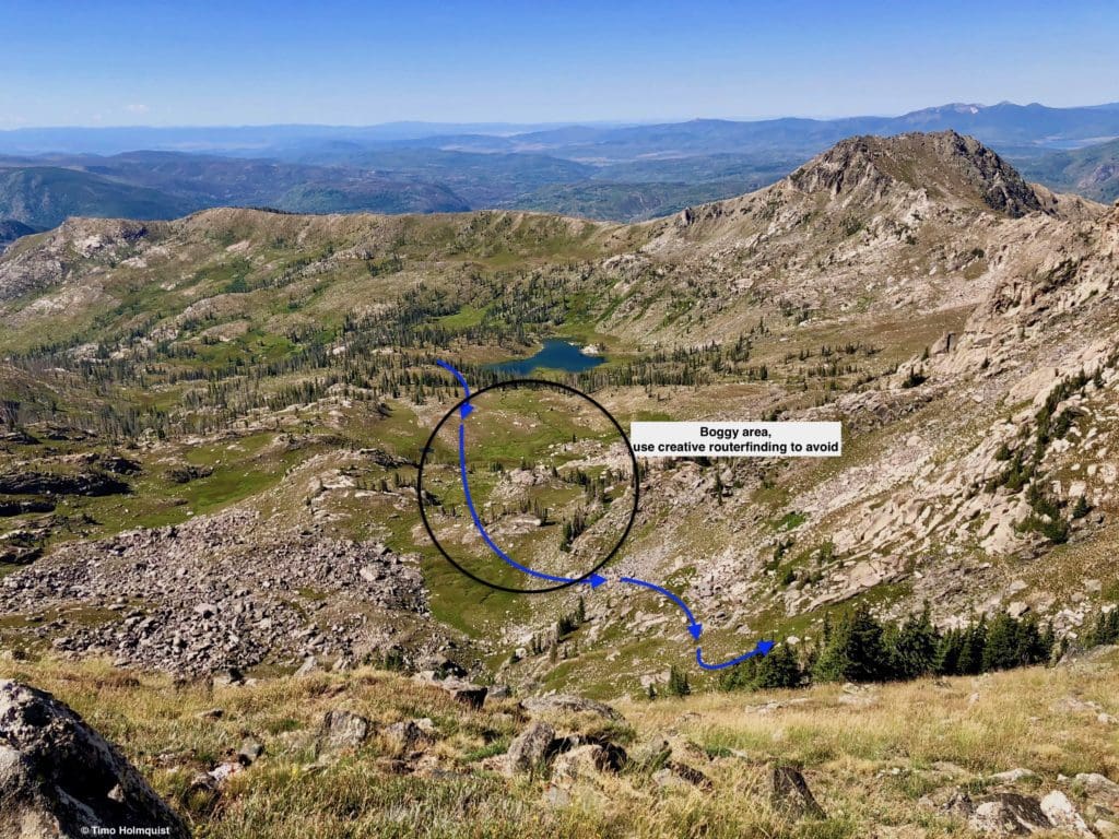
Climbing up to the ridgeline can be kept at Class 2, but it is steeper and looser than anything near Micah Lake. Exercise caution and never ascend directly above anyone else in your party.
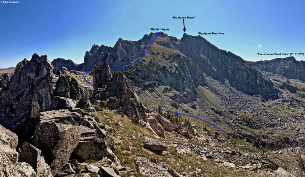
The route from near the Spike.
Middle Agnes is a great place to be, but you are on an island surrounded by gnarly peaks. Any additional exploration will require scrambling and exposure. Retrace your route carefully to avoid all of this. If you think you can easily hop over to Big Agnes, think again. There is a Class 4 sneak to the left of the impressive wall leading toward Big Agnes, but this requires traversing, scrambling, and quite a bit of exposure.
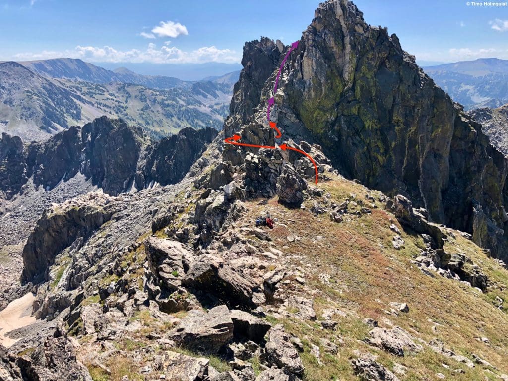
Big Agnes massif from “Middle” Agnes. Complicated scrambling separates you from the true summit of Big Agnes.
You do get superb views of two unnamed lakes on the rugged north side of the range and Mt. Zirkel, watching over everything.
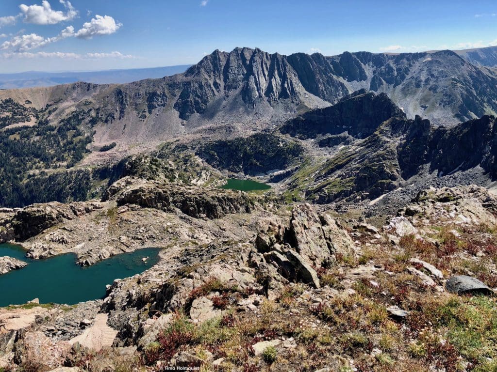
Mt. Zirkel watching over the area.
There is a Class 2 way to get to Big Agnes from Micah Basin but it’s covered in our Big Agnes Mountain guide. The short version is to find a basin between Big Agnes and “Exclamation Point Peak.” Ascend into it (watch for loose rock) and emerge on a small plateau with two high points. The eastern high point requires a bit of Class 3 scrambling, but the true summit doesn’t and can be attained with a few Class 2+ moves.
Another view of Micah Lake from high up on the surrounding ridges.
Skyblue Overland Strongly Recommends That You Enroll With Global Rescue Prior To Embarking On Your Next Adventure.
With more people outside now more than ever, Global Rescue expanded services to include field rescue within 100 miles of home. With Local Field Rescue — automatically included in any travel protection services membership — Global Rescue is there whether you’re hiking, kayaking, snowmobiling, fishing or simply enjoying the outdoors and get ill or injured and you’re unable to get to safety on your own. Purchase a Global Rescue membership for your next adventure and travel with peace of mind. Single trip, annual and family options are available.


