


|
Getting your Trinity Audio player ready...
|
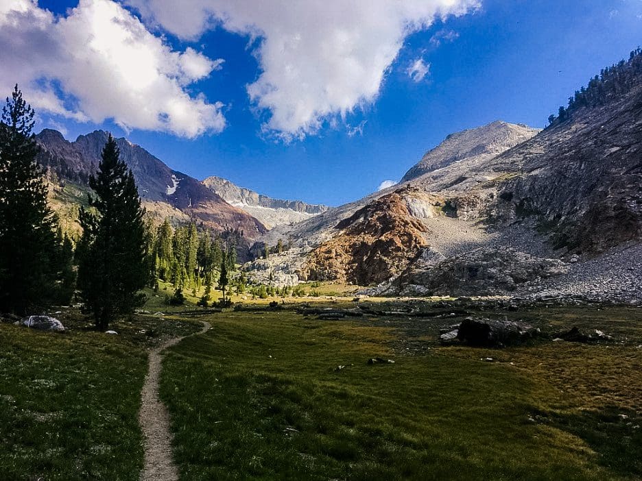
A huge chunk of Sequoia National Park is officially counted as wilderness. This leaves visitors with miles and miles of untouched, peaceful backcountry to explore on foot.
Picture a cool summer day in the forest. Dappled light casts patterns of illumination on the clover and newly sprouted seedlings below. Now picture that same scene, but this time as if you were the size of a mouse—that’s what it feels like to trek through Sequoia National Park.
Hiking
The majority of the land in Sequoia National Park is classified as wilderness. This means miles and miles of trackless, serene backcountry to explore on foot.
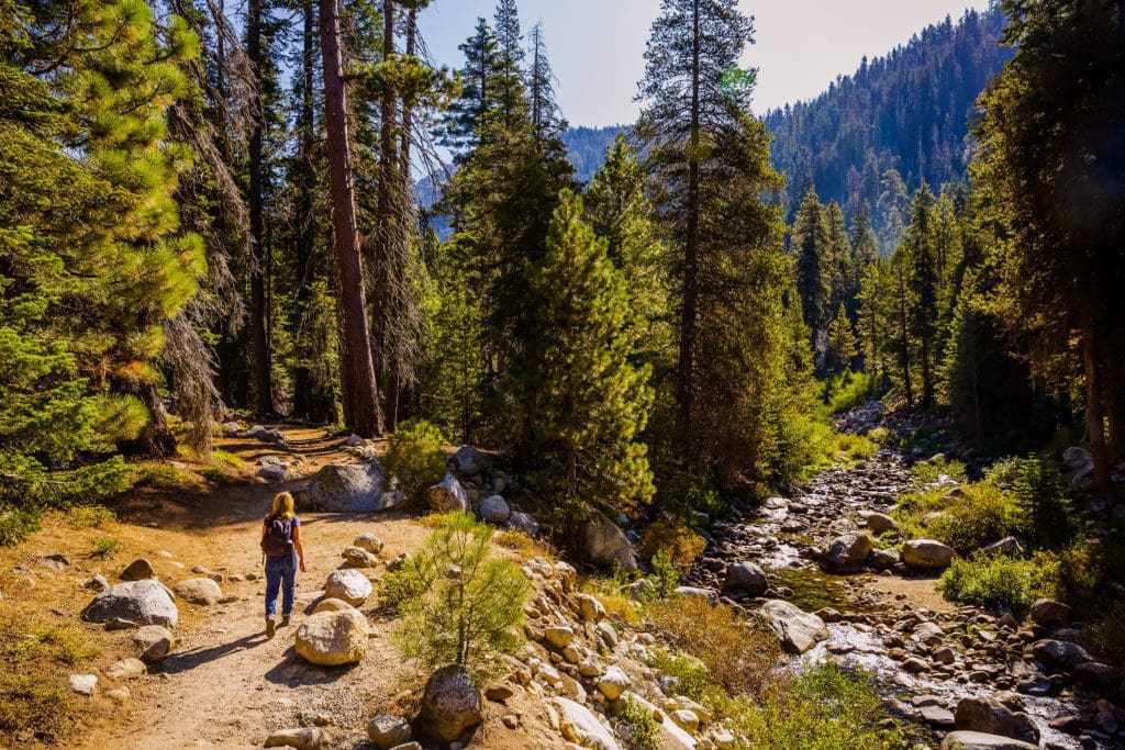
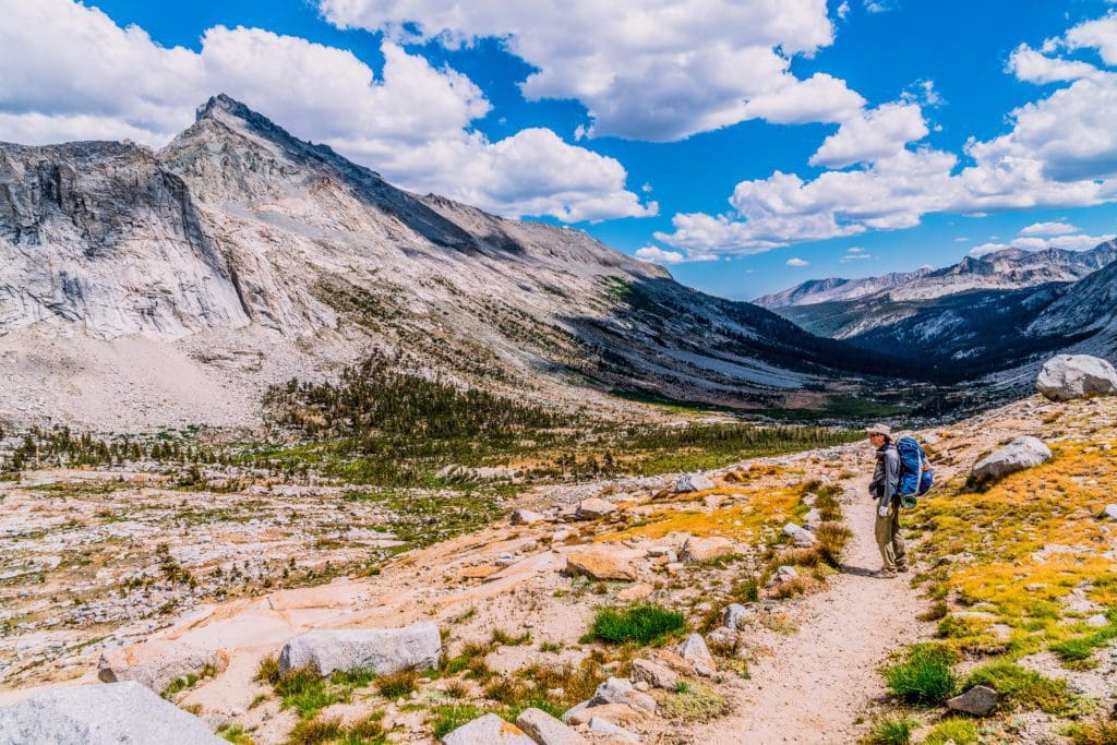
Hiker walking the Tokopah Falls Trail in Sequoia National Park, California.
First is the Tokopah Falls Trail, a four mile out-and-back that begins in Lodgepole Campground and ascends just over 500 feet through lodgepole forests and grassy glades to a waterfall. You’ll follow the Marble Fork of The Kaweah River up into the hills, through polished granite and marble, past glassy cliffsides. It’s an ideal half-day outing if you’re camping at Lodgepole.
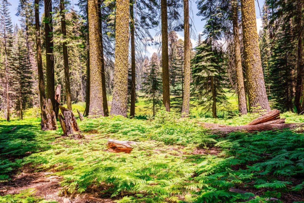
Trees and ferns along Crescent Meadow Loop in Sequoia National Park.
If you’re up for more of a challenge in exchange for more reward, check out Pear Lake Trail. It covers about 13 miles and three thousand feet of gain out and back, but you’ll find yourself suddenly in the high country surrounded by a rolling landscape of granite and peaks.
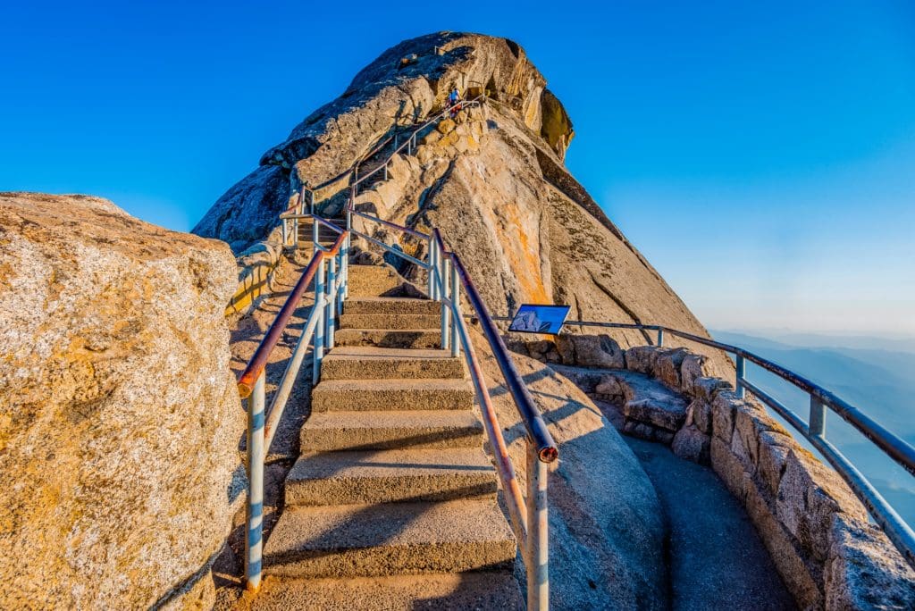
The trail to the top of Moro Rock in Sequoia National Park.
For a slightly different experience, you could enter the park on the Mineral King road. This passes through Atwell Grove and past Atwell Mill Campground. Eventually you’ll arrive at around 8,000 ft in a high alpine paradise. There are many trailheads here that can get you into the 10-11,000 ft range. We recommend White Chief Canyon or Mosquito Lake Trail, both of which are rated hard. But Mineral King has a lot of potential outside of just these two. It’s an important gateway to the backcountry for longer routes (as we’ll see in a minute).
White Chief Peak and Vandever Mountain. Photo credit Conrad Lucas, @canyonconrad
Lastly, you could take the Generals Highway to Dorst Creek Campground and from there hike to Muir Grove. This is a solid short to mid-length hike without much gain that pays off by dropping you right in one of the park’s more secluded sequoia groves. This trail gets a lot less traffic than those that begin around Lodgepole, so it’s a good option for the high season if you want to get away from crowds.
Backpacking
Though there are many gorgeous day hikes in Sequoia, you don’t really get a taste for the country until you spend multiple days in it. There are some serious adventures to be undertaken here. Everything from simple overnighters to multi-week journeys are on the table.
A backpacker hiking along the High Sierra Trail, stopping to admire the view of rugged mountains in Sequoia National Park, California.
Probably the most ambitious of these is the High Sierra Trail, totaling 65 miles and gaining over 15,000 feet of elevation. It’s an epic traverse of the Sierra from the west slope to the east slope. This includes the summit of Mount Whitney, the highest peak in the Lower 48 at 14,505 feet above sea level.
But if you’re not looking to bite off quite that much, you may be better suited to something like the Twin Lakes Trail, which can be done overnight. If you want to tack a second day on you could push further over the pass at Twin Peaks to Ranger Lake for a hearty trek into the high alpine.
Maybe some of the best backpacking routes in the park begin from Mineral King. You could overnight most anything that you could day hike here, taking it easy and soaking up the sun and mountain spring water. But if you wanted to push it further, you could try something like the Little Five Lakes & Big Five Lakes Loop. It’s a circuit of the high country totaling 28 miles and almost 10,000 feet of elevation. If you’ve got four days to a week to spare, it doesn’t get much better than this.
Mountaineering
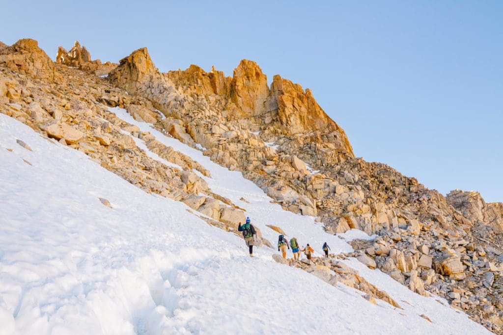
Summiting Mount Whitney – Hikers on their way to the summit of Mount Whitney, the highest peak in the continental United States.
High point enthusiasts, eat your heart out. There’s enough here to tide you over until the end of time. With a slew of 12, 13, and 14,000 foot peaks you’ll be entertained until you get old. The Mineral King area alone is a feast of options, most all of which can be done at Class III or IV. White Chief Peak, Mineral Peak, and Sawtooth Peak would be more than enough to satisfy most adventurous hikers in the summer.
For the most part, it’s easier to get to the higher peaks of the range from the eastern slope of the Sierra. The Whitney Portal services many upper 13 and 14,000 ft peaks, including Mt. Muir, Mt. Mallory, Mt. Russell, and Mt. McAdie. All of these are in the Class II – Class IV range in the summer, with the added bonus of being a little farther off the beaten path.
But of course, the main event is Mount Whitney. This jagged spire of granite is unbelievable to behold and surprisingly easy to take on, depending on your route. Most folks will overnight the peak, beginning at the Whitney Portal from Lone Pine and proceeding by The Whitney Trail, a Class I hike. If that sounds a little tame for you, you might prefer to take the Mountaineer’s Route, first ascended by John Muir himself. There are about 17 routes up the mountain, not counting small variations on established routes. Between them all one thing is certain, you will be astounded at the view.
Conclusion
Whichever option you choose, just remember to plan accordingly and store your food properly. Bears roam wild and free in the subalpine and alpine country, and the Sierras have claimed more than a few lives over the years. This wilderness is untamed. Know your route, know your limits, respect the land.

Enroll With Global Rescue Prior To Embarking On Your Next Adventure.
When a travel emergency arises, traditional travel insurance may not come to your aid, and a medical evacuation can cost up to $300,000.
The cost when you have a Global Rescue membership? $0. That’s why when the unexpected happens, you want the leader in rescue, evacuation and medical advisory behind you. You want Global Rescue.


