


|
Getting your Trinity Audio player ready...
|
Established in 1890
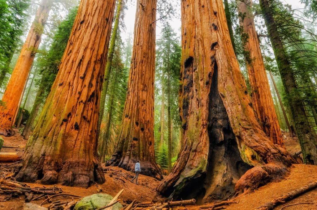
Sequoia National Park is an adventurer’s paradise where one can find the world’s largest living trees, rugged granite mountains, and tranquil lakes. It’s an awe-inspiring destination that beckons to explorers, who can answer its call with a deep breath of fresh air.
Overview
Imagine walking through a forest on a cool summer afternoon. The light filters through the pine needles and leaves overhead, illuminating patches of clover and new seedlings pushing up out of the ground. Now imagine that same landscape, if you were the size of a mouse. That’s what it feels like to explore Sequoia National Park.
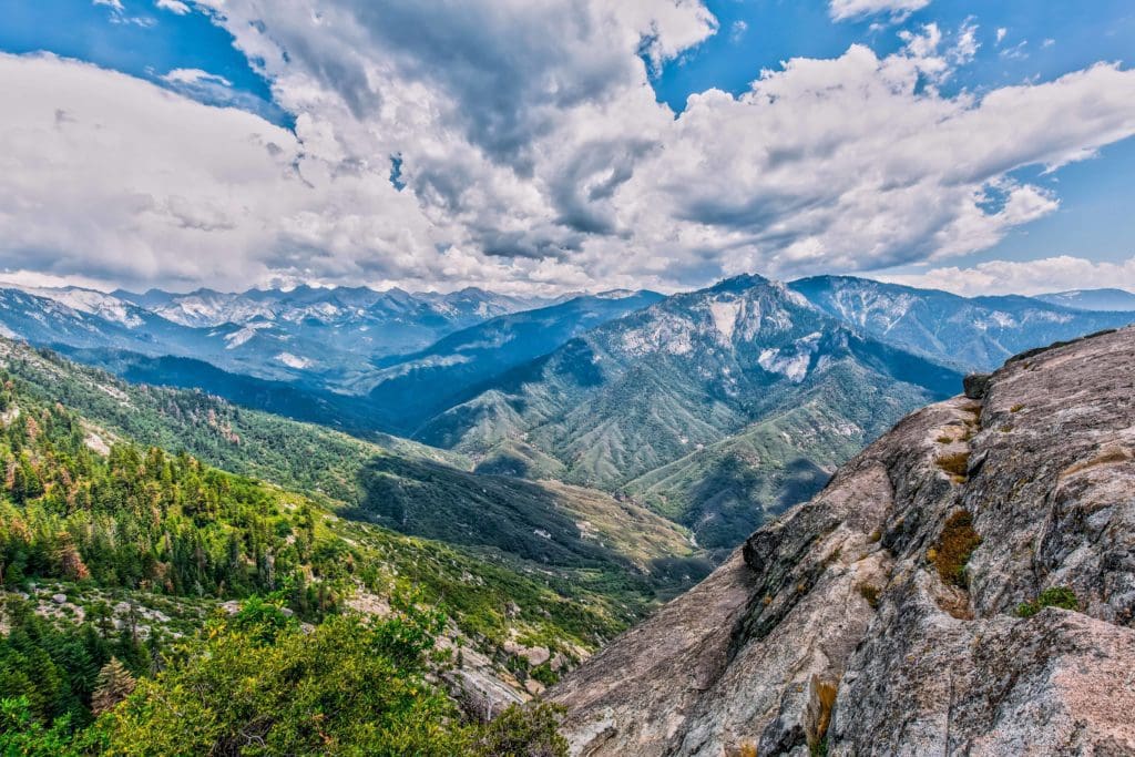
But Sequoia is far more than just home to the world’s largest trees. It is a colossal expanse of mountain wilderness that covers over 13,000 feet in elevation. Spectacular granite cliffs, winding rivers, secret caves, and pleasant meadows teeming with wildlife dot every corner of the map here.
For many, Sequoia National Park can be done in an afternoon. But we know better. That’s why we put together this guide to help you, the prospective adventurer, see the full spectrum of what Sequoia has to offer. If you’re planning a trip to Sequoia or have never even heard of it, you’re in the right place. We’ve compiled all the research you would need to get you started on your next adventure to the Land of The Giants, right here.
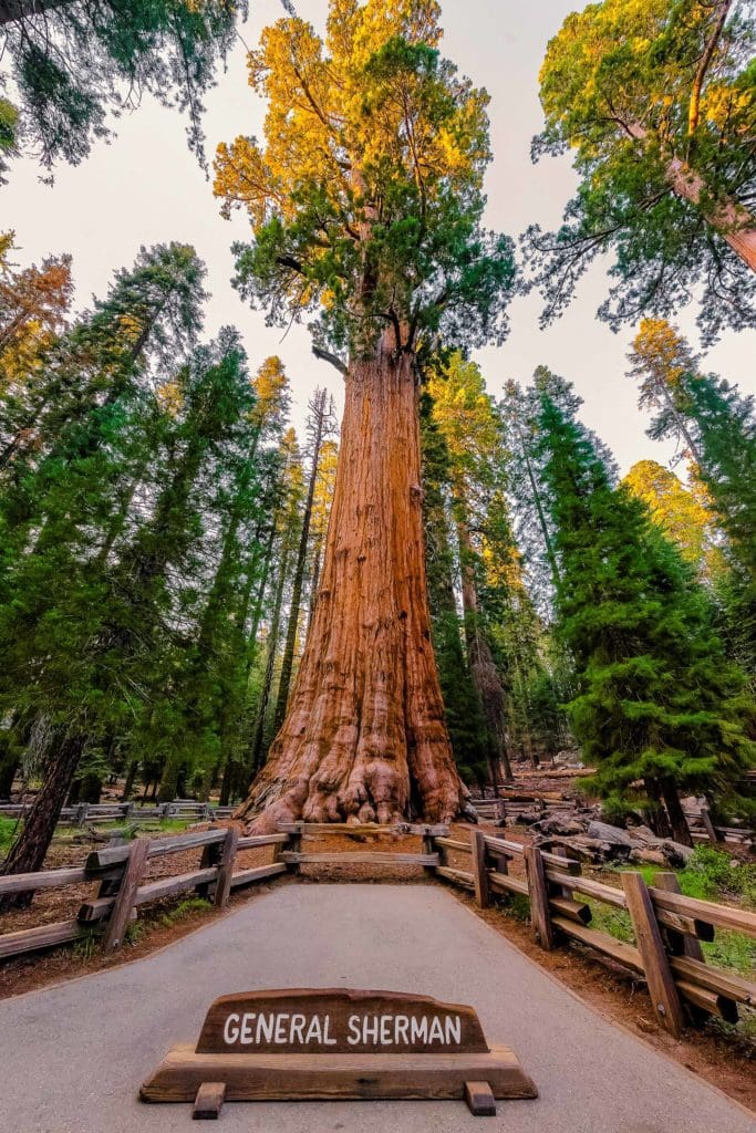
Looking up at General Sherman in Sequoia National Park is like looking up at a six foot tall human, from the perspective of a mouse.
Table of Contents:
Article Navigation: Click on any of the listed items in the table of contents below to jump to that section of the article. Similarly, clicking on any large, white section header will jump you back to the Table of Contents.
Human History
Over the years a vibrant cast of characters has passed through Sequoia. Its original inhabitants were the Western Mono or Monachee people. These people intermixed culturally to some extent with the Foothill Yokuts, resulting in several distinct “bands,” each of which with its own identity within the Mono tribe. Specific to the Sierran foothills that would become Sequoia National Park are the Waksachi and Potwisha, names that have become place names within the park.
We see evidence that Mono natives lived vibrant lives within the park in places like Hospital Rock. Pictographs, stone pestles, and remnants of dwellings called nobi give us hints that the Mono lived happy, colorful lives. Accounts from European explorers report that hundreds of people may have lived at Hospital Rock alone. The Mono people ground acorns into flour, hunted game, and made art and basketry; ultimately carrying out a peaceful, if not idyllic existence in the shelter of the great mountains. When the summer heat rose, they would trek into the high country. When it cooled again, they returned to the foothills. For them, the giant sequoias, including General Sherman, are sacred entities. The remaining descendants of the Mono people now mostly inhabit the town of North Fork.
The first European to ever venture up into the Sierras and lay eyes on giant sequoias was Hale Tharp. Tharp had come to California to seek his fortune during the Gold Rush, but eventually decided to homestead in the mountains. He purchased a herd of cattle and drove them into the hills with the help of the local Yakuts tribe. There, he “discovered” the sequoias, carving out the interior of a fallen tree to make his cabin.
You can visit Tharp’s Log, which has been preserved and maintained roughly in its original condition, on the Log and Crescent Meadow Loop Trail. Tharp grazed his cattle in the meadows surrounding the Giant Forest but would become a proponent of preserving the trees against logging.
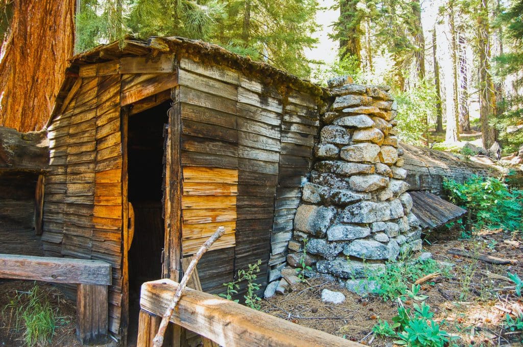
The home of Hale Tharp, a hollowed out giant sequoia log in Sequoia National Park.
Tharp regularly received visits from John Muir in the Giant Forest. Muir would stay in Tharp’s Log while hiking through the vast backcountry of the Sierras, writing and exploring. These two both advocated conserving the trees and surrounding landscape, with mixed success into the late 1800s. In 1890, Sequoia National Park was created. This was done partly to curb logging in the area, which had impacted sequoias in the Giant Forest and Grant Grove in Kings Canyon National Park.
Over the years, Sequoia was enlarged several times. This cause was championed by Susan Thew Parks, an explorer and environmentalist who roamed the high country and advocated for further protection of the High Sierras. The most recent addition to the park’s borders happened in 1978 when Mineral King was incorporated to stop attempts by the Disney Corporation to turn the high alpine valley into a ski resort.
Looking For An Amazing Adventure? Book A Guided Hiking Tour in the Sierra Nevada Mountains
Geology
Geologically speaking, the Sierras are a young range – just ten million years old. The rapid creation of mountain peaks (topping out just over 14,500 feet at the Mount Whitney summit) is due to subduction. This process causes one tectonic plate to be sucked under another advancing plate. In this case, the fault between these two plates lies just off the coast of California.
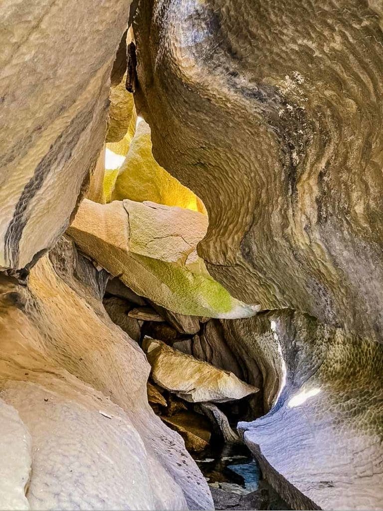
Dissolved marble cave in the High Sierras. Photo credit Conrad Lucas @canyonconrad
The Sierras are primarily made up of granite and its cousins; minerals like marble and diorite. Marble, which shares properties with limestone, can form solutional caves under the right conditions. There are over 270 caves throughout the park, the most accessible being Crystal Cave. Marble caves are something of a geological oddity. As rock is chiseled away by trickles of mineralized glacier water, it forms fantastically smooth rolling curves, appearing almost like ice deep in a crevasse. But you can also spot cave formations (or speleothems) typical of limestone caves in marble caves. Calcification can create stalactites, stalagmites, columns, and flowstone.
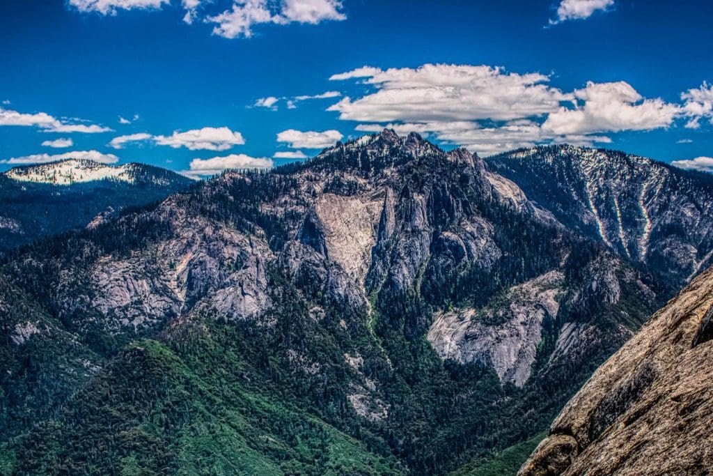
Castle Rocks (center) and Paradise Peak (right) in the Sierra Nevada Mountain Range, Sequoia National Park, California.
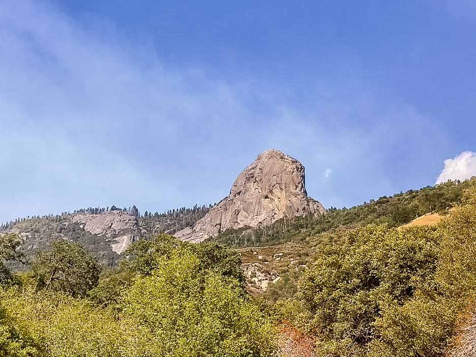
Granite is responsible for the formation of many of the incredible features we see around Sequoia. From the Angel Wings, cliffs that frame the headwaters of the Middle Fork of the Kaweah, to the Castle Rock Spire, a freestanding pinnacle of stone, to Homers Nose, an under-appreciated dome found in South Fork Canyon. Each drainage of the park holds its own surprises and striking views. From the Ash Peaks to Mineral King, every inch of Sequoia is a granite wonderland.
Ecology
The ecology of the Sierra Nevada Mountains is incredibly complex. The range covers a massive gradient of elevation, from 1,500 to over 14,500 ft.
The presence of water also varies wildly, from a semi-mediterranean temperate zone on the western slope to full-blown desert on the eastern slope. The variability of conditions you might see from one hillside to another across the range is huge, creating countless niches for different plants and animals to reside. For simplicity’s sake, it’s easy to think of these niches as bands of elevation going up the mountains.
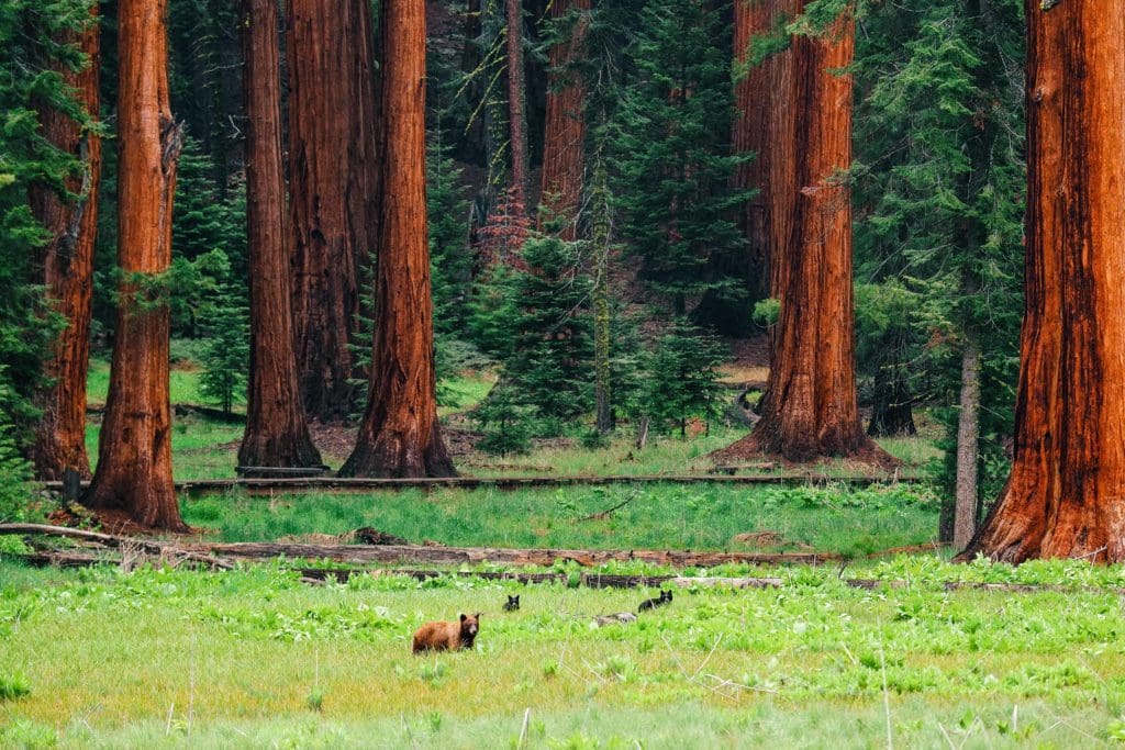
Bear in wild with cubs in Sequoia National Park
In the foothills, we see grassy hillsides dotted with heat-tolerant deciduous trees: live oak, black oak, buckeye, and occasional conifers like ponderosa pine. In the autumn, these oaks provide an important food source for black bears – bushels and bushels of acorns. Nearer to water we see willows, alder, bay laurel, and sycamore. Moving higher, conifers become more dominant. We begin seeing sugar pines, with the biggest cones of any pine tree (picture a regulation-size football), and incense cedars. The forest floor changes as well, to a mosaic of berries (genus Rubus) like the whitebark raspberry, wildflowers, and of course poison oak (always remember, “leaves of three, leave it be!”).
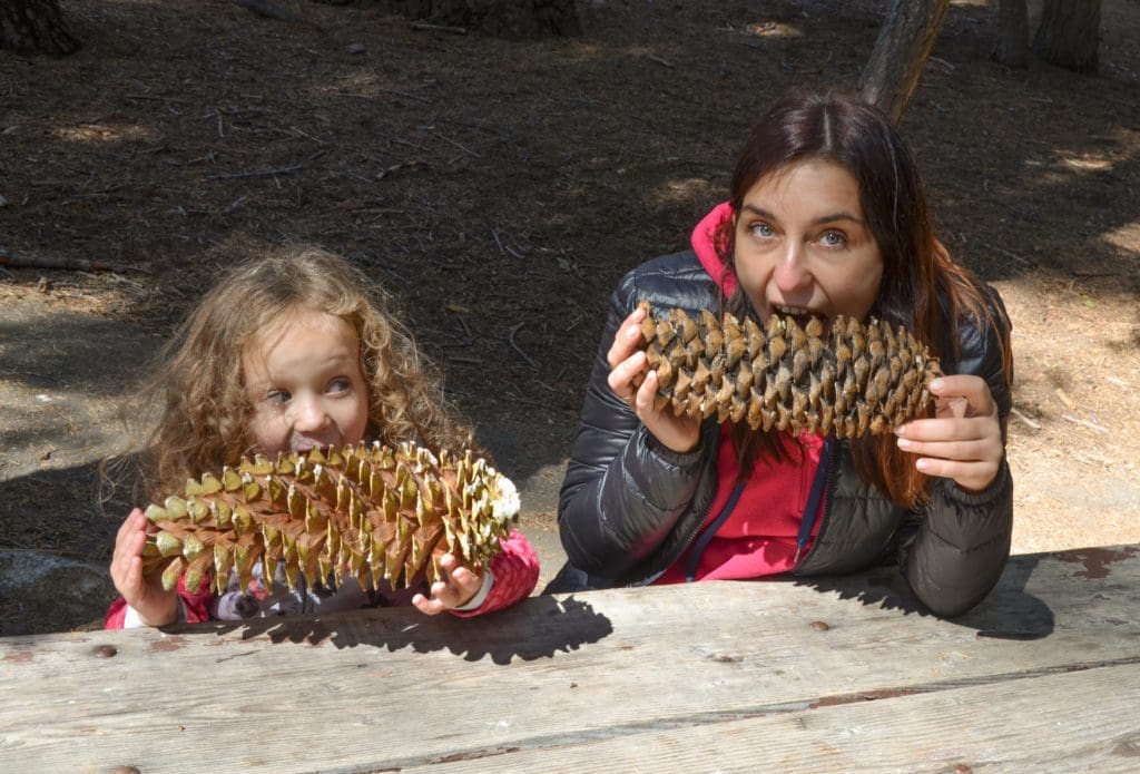
Giant sugar pine cones found in Sequoia National Park.
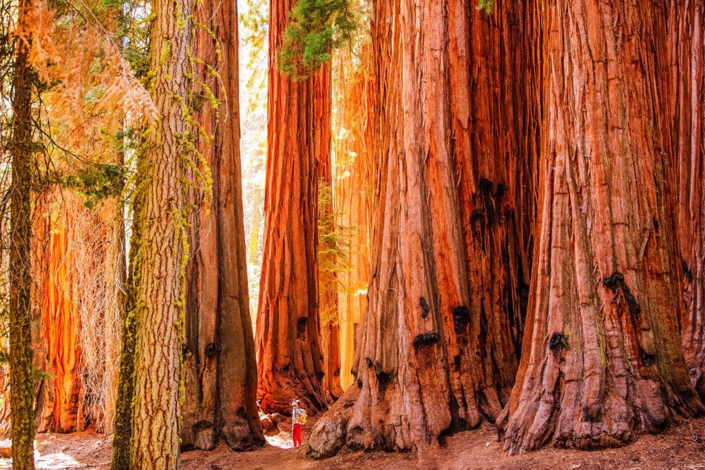
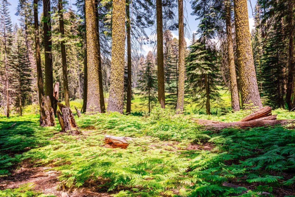
Higher still we finally begin to see giant sequoias. The sequoia thrives under very particular conditions. In order for the trees to grow to “giant” size, they need a special mix of soil nutrients, water, microclimate, shade, aspect, slope, and stimulation from disturbances like wildfire. This band of elevation typically ranges from 6,000 – 7,000 ft. Sequoias prefer flatter slopes and spots where the temperature is consistent in the warmer months. Not too hot, not too cold. Sequoia groves tend to have wide-open forest floors, perfect for hiking around. Looking up, we see a canopy of huge conifers along with the sequoias themselves. Jeffrey pine, red fir, and douglas fir all grow tall and broad, competing against their neighbors for sunlight.
Hiker in Sequoia National Park in California.
Above the sequoia groves we see forests totally dominated by conifers. Hemlock, lodgepole pine, and white pine take over into the high country, growing sparser as you climb higher. On grassy benches below stark granite peaks, you may see Western juniper trees. The highest reaches of the park hold small populations of foxtail pine a rare tree that is endemic to Sequoia and Kings Canyon National Parks, as well as a few spots in Northern California.
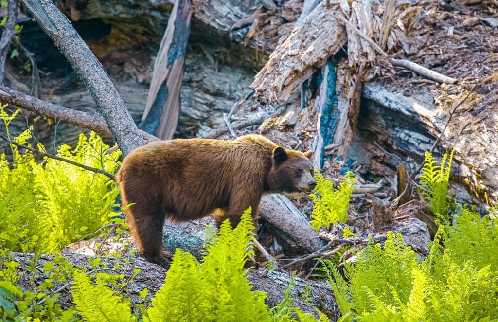
A Black Bear forages In Sequoia National Park.
Within this network of ecosystems lives a whole host of wildlife species. You can find everything from bumbling, curious black bears of five different colors to stoic, solitary bighorn sheep in the park, if you know where to look. Searching the streams and ponds you’ll find amphibians and reptiles, like the Sierra newt and Western pond turtle. Soaring overhead you may see California condors, while tucked high up in firs you might be lucky enough to spot a great grey owl. In the high country, small mammals like marmots and pikas jump from rock to rock, gathering wildflowers to last through the winter.
At dusk, bats emerge from their roosts in trees and rocks to skim still water. Sequoia National Park is home to 18 species of bats, including the pallid bat, which eats scorpions, the Mexican free-tailed bat, and the elusive spotted bat. Bats are highly efficient controllers of the park’s insect populations, providing humans with free organic pest control. In recent years, many of the most common bats in the United States have been threatened by White-nose Syndrome, a disease caused by an invasive cave fungus that can be up to 97% fatal in some species. Parts of California like Sequoia and Kings Canyon National Park are some of the last areas in the United States that have not been affected by the disease, which can be spread by humans.
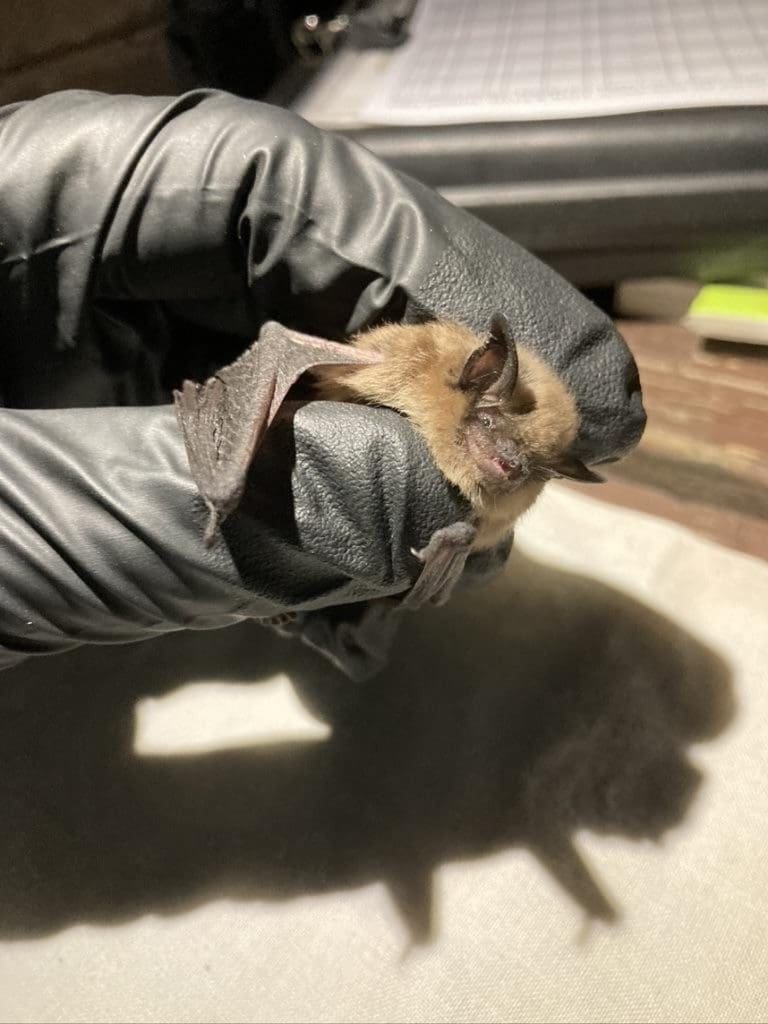
A California myotis, one of Sequoia’s adorable bat species. Photo credit Conrad Lucas @canyonconrad
But all this description hardly does life in the Sierras justice. To understand how extensive and varied the breathing network of plants and creatures in Sequoia National Park is, you have to see it for yourself. Be sure to find yourself a field guide before heading into the park. We recommend John Muir Laws’ Field Guide to the Sierra Nevada. While you explore, take time to learn about the things around you; how they interact, and how they change over time.
Where To Stay
Camping
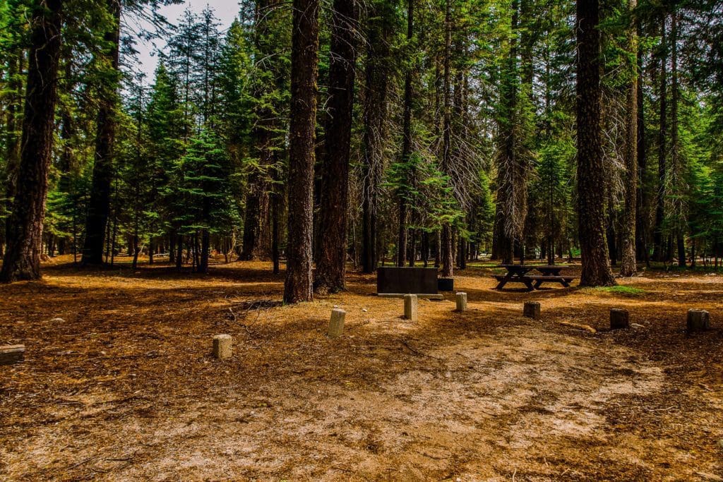
Sequoia National Park offers many different options for camping in terms of scenery and access. What you end up choosing will depend on the time of year you decide to go, how long you plan to stay, and how far ahead you can plan. But assuming you plan to go in the busy season and can plan months in advance, the first choice for most visitors is Lodgepole Campground.
Situated about ten minutes from the Giant Forest and walking distance to the Tokopah Falls Trailhead, Lodgepole Campground is prime real estate. It’s open seasonally from mid-April to December 1st, and includes a total of 214 campsites. There is a dump station and convenience store on site, as well as showers. If you have enough advance notice, it’s probably the best way to see the park.
Stony Creek Campground in Sequoia National Park.
Slightly further away, but arguably an even better setting is Dorst Creek Campground. Dorst Creek is a lush fir forest with more privacy than Lodgepole, at the expense of a few more minutes’ drive into the Giant Forest. However, it is closer to Grant Grove if you also plan to visit Kings Canyon National Park to the north. Complete with 222 campsites, Dorst Creek is open from mid-June to Labor Day.
If you prefer to be closer to town, or closer to a nice cool swimming hole, you might want to check out Potwisha Campground. While further from the main attractions of the park, Potwisha is in a prime location to experience the foothills. It’s walking distance from some of the best swimming holes in the country (trust us) and is a perfect spot for when the weather starts to mellow after the peak season. There are 42 total sites within the campground, which can be reserved year-round.
While camping anywhere in the park, be sure to store your food properly. Bears often visit campsites in search of unsecured coolers and snacks. Always remember: if it’s out of arm’s reach, it needs to be locked up in a bear box!
Main Attractions
There’s enough to do in Sequoia National Park to keep you entertained for any amount of time. But if you only have a day, there’s a short list of must-see items you could knock out along one scenic drive. We’re talking about the Generals Highway, a winding stretch of two-lane road which leads from 1,700 ft at the park’s entrance all the way up to over 7,000 ft. Along the way you’ll ascend out of the foothills, watching the jagged teeth of the High Sierra draw closer and closer.
Moro Rock, viewed from Hospital Rock. Photo credit Conrad Lucas @canyonconrad
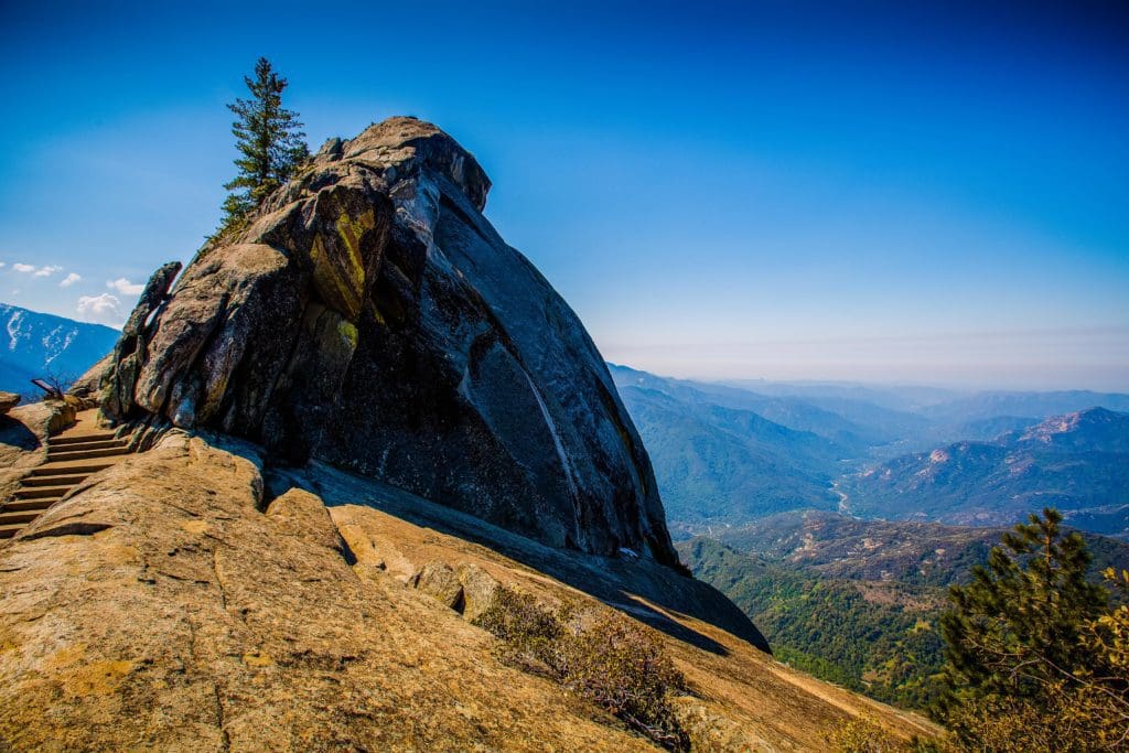
You can stop at Amphitheater Point along the way to appreciate the scenery. Some of the park’s most impressive rock walls are on full display here, including Moro Rock and the Castle Rocks.
Amphitheater Point looking towards Castle Rock Peak in Sequoia National Park on Generals Hwy.
Continuing up, you’ll enter the Giant Forest, where some of the biggest sequoias are, including the General Sherman, the largest tree on earth.
If you only have time for one short hike, be sure to take the short walk down to General Sherman’s base. The trunk measures a staggering 36 ft across, and is 275 ft tall. It is a completely singular experience, something that is unique across the whole world. The General Sherman Trail is connected to a whole network of footpaths that meander through the Giant Forest (collectively called The Big Trees Trail), which passes other impressive sequoias.
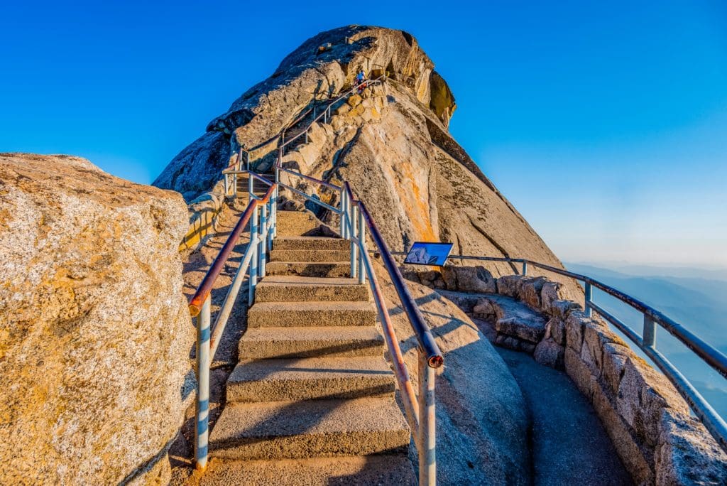
If you’ve still got some gas in the tank, be sure to hike to the top of Moro Rock. The hike is a stairway carved into the side of the granite dome, complete with a handrail, that ascends 300 feet to the rock’s summit. This is a superb spot to watch the sunset, which paints the peaks to the east gold every evening. Be advised this is not recommended during storm weather, as the rock is a major attractant to lightning.
Views from the top of Moro Rock.
As you head back into the foothills, be on the lookout for bears, which are active during the evening. Be sure to maintain a safe distance from bears and secure all food while inside the park. Bears that get a taste for human food can become dangerous and often have to be euthanized to protect visitors. More than anything, the number one goal of visitors should be to protect the park and its resources. Human food is not meant for bears or any other wildlife. Enjoy them from a distance, in their own habitat, just how nature intended.
Swimming
There are more gold standard swimming holes on the Kaweah River than you can shake a stick at. And when it’s 108 degrees in August, there’s nothing better than diving right in. But be warned, every year people drown in the Kaweah River. Swimming holes in the park are unsupervised and can be dangerous. Furthermore, bear activity is always a concern. If you can’t stay right next to any food items, don’t bring them to the river. That said, here are some of the best spots to take a dip in Sequoia National Park.
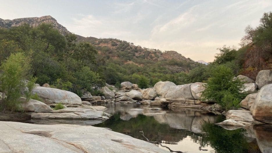
The perfect swimming hole on the Kaweah River. Photo credit Brenda Hawley @brenda.zip
The first swimming hole you’ll see is about a stone’s throw from the park’s entrance, just below the famous “Indian Head” sign. It’s a short jaunt from the parking lot to several pools that are deep enough to dive in, surrounded by ledges of marble.
Continuing up the Generals Highway, you’ll come to Potwisha Campground. Just across the road is a dirt parking lot, and below that is a wonderful flat water section of the river. It’s wide and deep, and stretches back upstream a few hundred feet, offering lots of room to spread out.
Further up, you’ll come to Hospital Rock. This site is home to some of the park’s archaeological history (and some pretty decent rock climbing). But if you take the trail down from the road, you’ll come to a sandy bank and a sparkling pool of water. Further up and down from here you can find more small swimming holes that look almost designed for lounging in.
If all of these spots are full up (which happens often in the summer), you can always try any of the other pull-offs along the Generals Highway. Most of them have trails which lead to the river, and along the river there’s always a secluded spot to splash and play.
Hiking
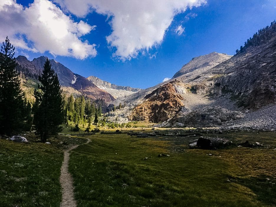
The majority of the land in Sequoia National Park is classified as wilderness. This means miles and miles of trackless, serene backcountry to explore on foot. That is, of course, after you take care of the essential “must-see” items mentioned above.
Hiker walking the Tokopah Falls Trail in Sequoia National Park, California.
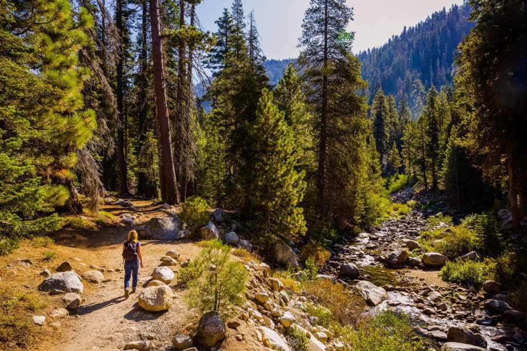
First is the Tokopah Falls Trail, a four mile out-and-back that begins in Lodgepole Campground and ascends just over 500 feet through lodgepole forests and grassy glades to a waterfall. You’ll follow the Marble Fork of The Kaweah River up into the hills, through polished granite and marble, past glassy cliffsides. It’s an ideal half-day outing if you’re camping at Lodgepole.
Trees and ferns along Crescent Meadow Loop in Sequoia National Park.
If you’re up for more of a challenge in exchange for more reward, check out Pear Lake Trail. It covers about 13 miles and three thousand feet of gain out and back, but you’ll find yourself suddenly in the high country surrounded by a rolling landscape of granite and peaks.
The trail to the top of Moro Rock in Sequoia National Park.
For a slightly different experience, you could enter the park on the Mineral King road. This passes through Atwell Grove and past Atwell Mill Campground. Eventually you’ll arrive at around 8,000 ft in a high alpine paradise. There are many trailheads here that can get you into the 10-11,000 ft range. We recommend White Chief Canyon or Mosquito Lake Trail, both of which are rated hard. But Mineral King has a lot of potential outside of just these two. It’s an important gateway to the backcountry for longer routes (as we’ll see in a minute).
White Chief Peak and Vandever Mountain. Photo credit Conrad Lucas, @canyonconrad
Lastly, you could take the Generals Highway to Dorst Creek Campground and from there hike to Muir Grove. This is a solid short to mid-length hike without much gain that pays off by dropping you right in one of the park’s more secluded sequoia groves. This trail gets a lot less traffic than those that begin around Lodgepole, so it’s a good option for the high season if you want to get away from crowds.
Backpacking
Though there are many gorgeous day hikes in Sequoia, you don’t really get a taste for the country until you spend multiple days in it. There are some serious adventures to be undertaken here. Everything from simple overnighters to multi-week journeys are on the table.
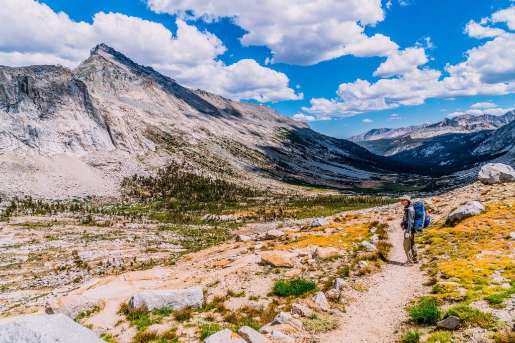
A backpacker hiking along the High Sierra Trail, stopping to admire the view of rugged mountains in Sequoia National Park, California.
Probably the most ambitious of these is the High Sierra Trail, totaling 65 miles and gaining over 15,000 feet of elevation. It’s an epic traverse of the Sierra from the west slope to the east slope. This includes the summit of Mount Whitney, the highest peak in the Lower 48 at 14,505 feet above sea level.
But if you’re not looking to bite off quite that much, you may be better suited to something like the Twin Lakes Trail, which can be done overnight. If you want to tack a second day on you could push further over the pass at Twin Peaks to Ranger Lake for a hearty trek into the high alpine.
Maybe some of the best backpacking routes in the park begin from Mineral King. You could overnight most anything that you could day hike here, taking it easy and soaking up the sun and mountain spring water. But if you wanted to push it further, you could try something like the Little Five Lakes & Big Five Lakes Loop. It’s a circuit of the high country totaling 28 miles and almost 10,000 feet of elevation. If you’ve got four days to a week to spare, it doesn’t get much better than this.
Whichever option you choose, just remember to plan accordingly and store your food properly. Bears roam wild and free in the subalpine and alpine country, and the Sierras have claimed more than a few lives over the years. This wilderness is untamed. Know your route, know your limits, respect the land.
Rock Climbing
Sequoia National Park is home to some truly world-class granite climbing. Whether you like huge multi-pitch trad routes, sport climbing, bouldering, or adventure climbing where the crux is the approach, Sequoia has got something for you.
The Moro Rock granite monolith has a tricky approach, but is a classic climb in Sequoia National Park.
Starting small, every climber passing through the park should check out some of the boulder fields in the Giant Forest. There are mellow classics like One Slip Away and Butter Muffins, but a lot of the fun of bouldering here is working away from the established problems and just seeing what goes! There is a lot of potential in the General Sherman neighborhood, as well as around Wuksachi for awesome bouldering.
Looking For An Amazing Adventure? Book An Alpine Climbing Tour in the High Sierra With A Local Guide
The big kahuna in Sequoia is Moro Rock. Barring its tricky approach, this monolith is a classic. The South Face goes at 5.8 over eight pristine pitches of hand cracks and chimneys. Most folks bring a full rack of cams and nuts each with a single 60m rope to get the job done.
For some shorter routes, Hospital Rock features a few cool options. Lunch Bucket Ledge is a local favorite, rated 5.8+ over two pitches. If you’re more interested in sport, you could also check out Danland Crag along the Mineral King Road. This wall sits in the sun most of the day, so it’s prime for the off-season. There are a ton of neat sport routes here, mostly in the 5.10 neighborhood.
And if you want to throw down the gauntlet, you could always suit up and head for the Castle Rocks. This dramatic cirque is legendary. It’s outstanding multi pitch climbing, sure, but even more so is what it takes to get to the base of the wall. It’s been called the hardest approach in the United States, including miles of crawling through tick and rattlesnake-infested poison oak jungle, without a trail in sight. Because of this, many of the walls have seen very few ascents. For example, the Castle Rock Spire is estimated to have been climbed fewer than 70 times, ever.
Mountaineering
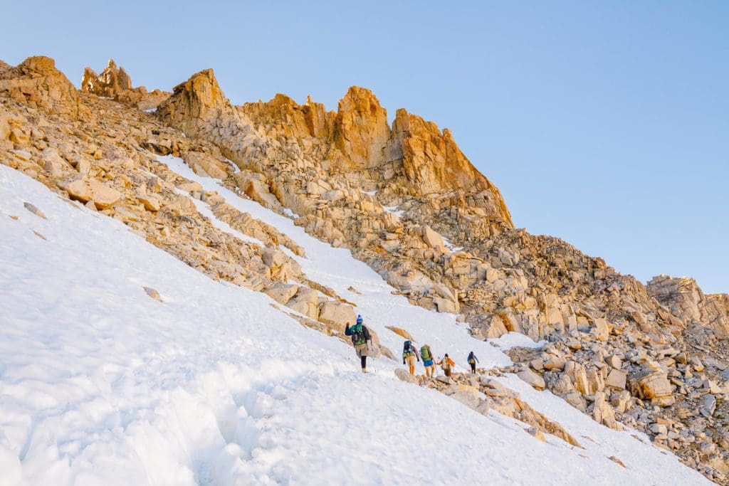
Summiting Mount Whitney – Hikers on their way to the summit of Mount Whitney, the highest peak in the continental United States.
High point enthusiasts, eat your heart out. There’s enough here to tide you over until the end of time. With a slew of 12, 13, and 14,000 foot peaks you’ll be entertained until you get old. The Mineral King area alone is a feast of options, most all of which can be done at Class III or IV. White Chief Peak, Mineral Peak, and Sawtooth Peak would be more than enough to satisfy most adventurous hikers in the summer.
For the most part, it’s easier to get to the higher peaks of the range from the eastern slope of the Sierra. The Whitney Portal services many upper 13 and 14,000 ft peaks, including Mt. Muir, Mt. Mallory, Mt. Russell, and Mt. McAdie. All of these are in the Class II – Class IV range in the summer, with the added bonus of being a little farther off the beaten path.
But of course, the main event is Mount Whitney. This jagged spire of granite is unbelievable to behold and surprisingly easy to take on, depending on your route. Most folks will overnight the peak, beginning at the Whitney Portal from Lone Pine and proceeding by The Whitney Trail, a Class I hike. If that sounds a little tame for you, you might prefer to take the Mountaineer’s Route, first ascended by John Muir himself. There are about 17 routes up the mountain, not counting small variations on established routes. Between them all one thing is certain, you will be astounded at the view.
The Land of Giants
Hiker is walking and looking at the giant sequoia trees in Sequoia National Park.
Conclusion
Everything about Sequoia National Park seems larger than life. From the trees to the peaks to the stretches of trackless wilderness to the challenges of navigating the terrain. It is a place that does not politely ask for your respect. It demands it. Hale Tharp and John Muir both felt this immediately when they peered into the secret places tucked away in the Sierra Nevada Mountains. It doesn’t take much to feel this same sensation for yourself. Just go, look, and listen. When you walk through the ethereal forests and panoramic alpine valleys of Sequoia, you are not the largest or most important part of the picture. Tread lightly. Here there be giants.

Enroll With Global Rescue Prior To Embarking On Your Next Adventure.
When a travel emergency arises, traditional travel insurance may not come to your aid, and a medical evacuation can cost up to $300,000.
The cost when you have a Global Rescue membership? $0. That’s why when the unexpected happens, you want the leader in rescue, evacuation and medical advisory behind you. You want Global Rescue.


