|
Getting your Trinity Audio player ready...
|
Established in 1940
Kings Canyon National Park is home to America’s deepest canyon, color-filled alpine meadows, swiftly flowing rivers and large stands of gigantic sequoias. It is a place where visitors can experience the grandeur of nature in all its glory.
Overview
When we set out to create this adventure guide to Kings Canyon, we had a hard time getting started. Why say anything at all about a place that speaks volumes on its own? We may as well just show you some photos and let the call of nature pull you out the door. But of course, even photos hardly do it justice. And our job is to give you a taste of what it’s like to stand in one of nature’s most incredible amphitheaters, to breathe mountain air, and to stand at the foot of some of the largest trees on Earth. So, we sucked it up and tried anyway.
Kings Canyon National Park is much more than Sequoia’s counterpart to the north. It’s a world of adventures waiting to be had all its own. With the world’s tallest sequoia trees and superb granite cliffs (à la Yosemite) all within a few hours’ drive, you can’t get much more bang for your buck. In a word, these are the reasons you should see Kings Canyon. But we’ve also done the homework to give you all the information you need to actually go do it. So here it is, Kings Canyon National Park, crammed into a nutshell.
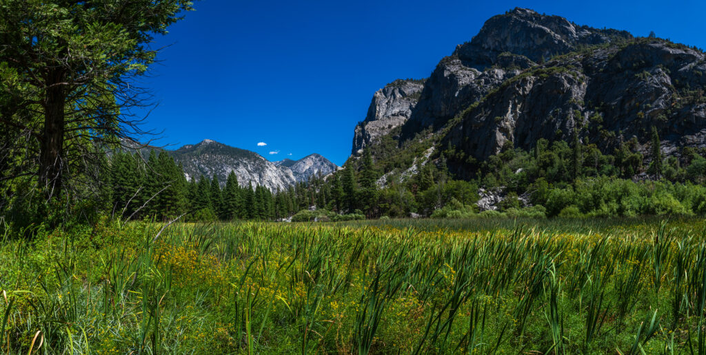
The Zumwalt Meadows area in the heart of the Kings Canyon National Park. Photo: Ondrej Bucek/Adobe Stock.
Table of Contents:
Article Navigation: Click on any of the listed items in the table of contents below to jump to that section of the article. Similarly, clicking on any large, white section header will jump you back to the Table of Contents.
- Overview
- Human History
- Ecology
- Geology
- Where To Stay
- Enjoying The Park
- Conclusion – A Canyon Fit for a King
Human History
Just like any place in the West, the story of human beings in Kings Canyon begins long before European settlers entered the area. The Kings River and surrounding region has been inhabited for 6 or 7,000 years now. It was visited periodically by the Owens Valley Paiute, or Eastern Mono People, whose ancestral home is Mono Lake.
The Eastern Monos created routes through the mountains to the Central Valley on the western slope of the Sierra. Their travels over the peaks led to a cultural and economic exchange with the local Yokuts People. When groups of the Eastern Mono finally made the pilgrimage over the peaks for good, their ancestors were bilingual, speaking both their native tongue and the Yokuts language.
These people became the Monachee, who divided into several bands, each native to a particular area within Sequoia and Kings Canyon National Parks. The Monachee lived peaceful lives, transitioning seasonally between the higher and lower regions of the Sierra. In 1962 they were almost erased completely by a smallpox outbreak, and very few of their kin remain. They primarily live in the town of North Fork today.
The first white people to venture into what is now Kings Canyon were likely Spanish explorers or fur trappers. But it wasn’t until the California Gold Rush of 1847 that serious attempts were made to make an established presence in the area. Prospecting for gold in Kings Canyon was largely a flop.
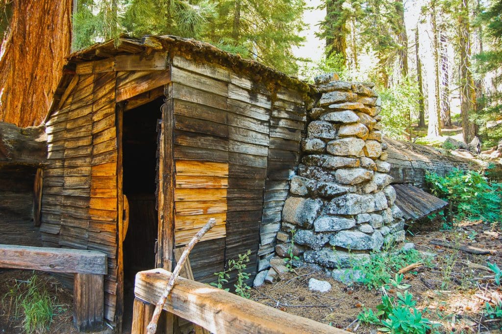
The home of Hale Tharp, a hollowed out giant sequoia log in Sequoia National Park.
But for some, like Hale Tharp, the gold rush was merely a vehicle into the mountains. Tharp was enthralled with the Sierra, and after failing to find gold, he moved higher into the hills. He grazed cattle there, living in a cabin carved into a fallen sequoia, and became a vocal proponent of conserving the area.
Tharp, along with John Muir and Susan Thew Parks would join together in advocating for the protection of the Sierra Nevada Mountains. As human activity had grown in the middle elevations of the mountains, logging had begun to impact the sequoia trees. In the end, the conservationists won, either for the strength of their arguments or the fact that sequoia timber was brittle and had little economic value.
Most who got the chance to see the high country of Kings Canyon didn’t take much convincing to fall in love with it. William Brewer, who conducted the first scientific survey of the high country (failing to summit Mt. Whitney in the process) was awestruck. He compared Kings Canyon to Yosemite, but on a smaller scale, and sung the praises of the high alpine:
“Such a landscape! A hundred peaks in sight over thirteen thousand feet—many very sharp—deep canyons, cliffs in every direction almost rival Yosemite, sharp ridges inaccessible to man, on which human foot has never trod—all combined to produce a view of sublimity of which is rarely equaled, one which few are privileged to behold.”
All of the tales of spectacular natural beauty must have eventually made an impact. In 1890, President Benjamin Harrison enacted General Grant National Park, which exists as Grant Grove today. Over the next fifty or so years the park was expanded several times, blocking the construction of a dam that would have drowned the Kings Canyon valley. The map has been changing ever since, with the most recent addition to the parks being the Mineral King area in 1978.
Looking For An Amazing Adventure? Book A Guided Hiking Tour in the California Wilderness.
Ecology
Like any landscape, when viewed over enough time we can see that Kings Canyon is full of life. In fact, the Sierras are known as one of the most complex ecosystems in the west. Because they cover so much elevation, there are many distinctive ecosystems that can coexist and interact here.
This is dependent mostly on how high you are in the hills, and whether water is present. The foothills are full of oak and buckeye, which thrive in hot and dry climes. Gaining elevation, you’ll notice conifers take over almost entirely. And on top of this are the alpine grasslands: swaths of tufted grass, forbs, and stone.
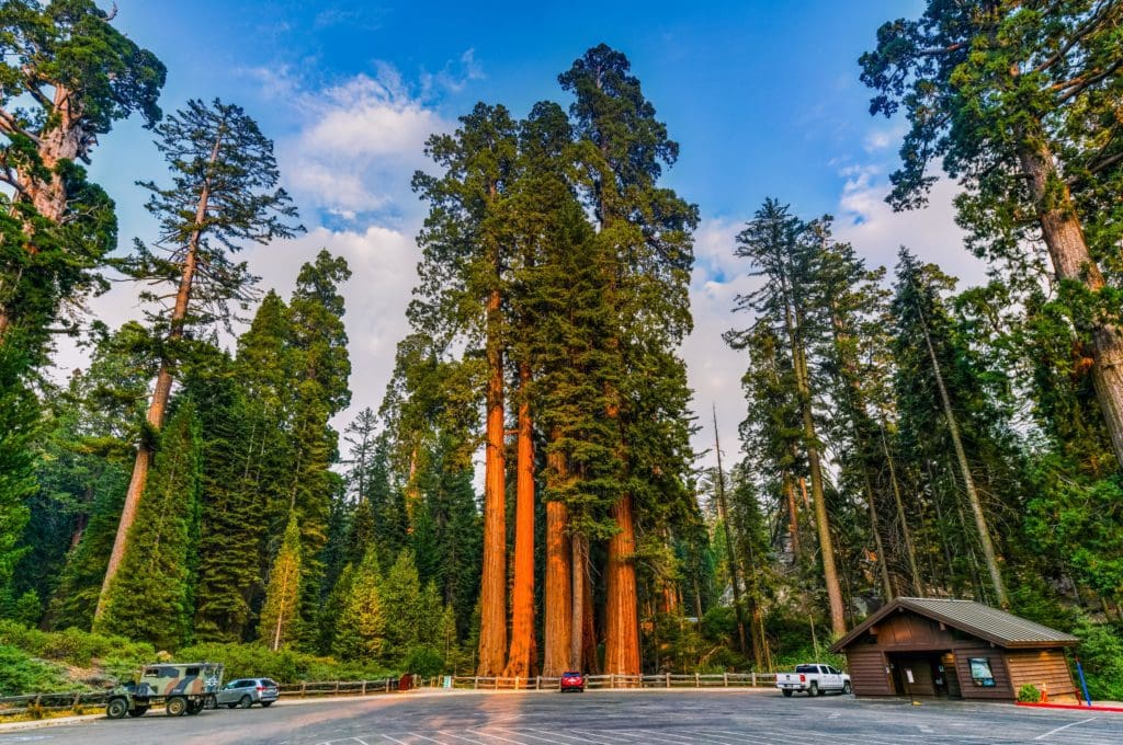
Sequoia Trees in the General Grant Grove in Kings Canyon National Park.
Sequoia groves are like Goldilocks in this situation. They occur at the middle elevations, where it is not too hot or cold. They also need steady access to water; not too wet, not too dry. It’s only under ideal conditions that sequoias can reach massive sizes, like General Grant. General Grant is the tallest sequoia on earth, a whopping 268 feet.
Native peoples had a hand in maintaining the complexity of these ecosystems. They would use fire to create controlled burns, reducing “ladder fuels” to prevent large wildfires. This management practice is carried on by the parks service today. It not only helps to increase the longevity of the large trees in the park, but helps regenerate the forest floor of old growth stands, and promotes biodiversity.
The incredible forests, meadows, and grasslands support a wide variety of animal life in Kings Canyon. This includes, of course, the charismatic black bear, which have been documented to grow up to 500 pounds, although most are much smaller. Bears are commonly seen by park visitors, and should always be treated with respect. Be sure to lock up all food and view wildlife from a safe distance in the park. Bears in Kings Canyon are omnivorous, subsisting primarily on seeds, nuts, roots, and grass. This means they’re not picky. Bears will take whatever they can get their paws on, including your food and trash.
Other photogenic full-time residents of the park include California condors, cougars, kingsnakes, bobcats, spotted skunks, mule deer, and other weasel-like mustelids like the fisher. Some of these species could be spotted easily multiple times in the same day. Others are lifetime sightings, rare and elusive. But if you know where to look, you may just get lucky. The only way to find out is to pack your binoculars and keep your eyes peeled.
Geology
On a large scale, almost all of the things we see and take pictures of in Kings Canyon are there because of how steep the landscape is. The section of the Sierras which includes Kings Canyon National Park is one of the biggest steps up in elevation in North America. In just ten miles, the park skyrockets from 4,500 feet in Cedar Grove to 14,000 feet. If you’re a backpacker, you probably just had a small heart attack. But for geology fanatics, this gradient is what makes the park so special. It means that the snow in the high country (which is abundant) is doing double duty after it melts, weathering the rock into beautiful, rolling swaths.
And it also means the park’s now-extinct glaciers made a lasting impression. Looking upcanyon toward the headwaters of the Kings River, you can tell immediately that it was formed by glaciation. Kings Canyon – that is, the canyon itself, is a classic example of a U-shaped canyon. This shape results from the chiseling force of massive quantities of ice.
As the glacier slides slowly downhill, the sheer weight of it is enough to polish granite smooth until it’s like glass. This process leaves behind glacial till, or rocks and sediments that were picked up and carried along by the ice. Glaciers, being broad and heavy, push steadily downcanyon with tremendous force. This means the force of erosion is happening in a wide band across the bottom of the valley, resulting in a canyon with a flat bottom and nearly vertical walls. Naturally, this process didn’t happen overnight. It took several ice ages, roughly 2.5 million years of ice grinding over stone, to carve the canyon out.
After all that hard work, weathering and erosion, we’re left with some pretty stellar formations. Towering buttresses of smooth, curvaceous stone ring Kings Canyon. These rock faces have been chipped away even more by water, giving us winding channels of marble that can become narrow, like Crown Creek.
Similar processes to these are also going on underground. Water trickles down through the soil, wearing away marble to create amazing caves. Located just outside the park boundary, Boyden Cavern is a prime example. Marble caverns can hold many of the same formations as limestone caverns and reach incredible sizes.
All of this complexity together makes for a landscape which is never boring. No matter which way you turn or where you look, there is always something incredible to look at. And maybe the geologists are right; maybe it’s all because of the way water, ice, and rocks interact.
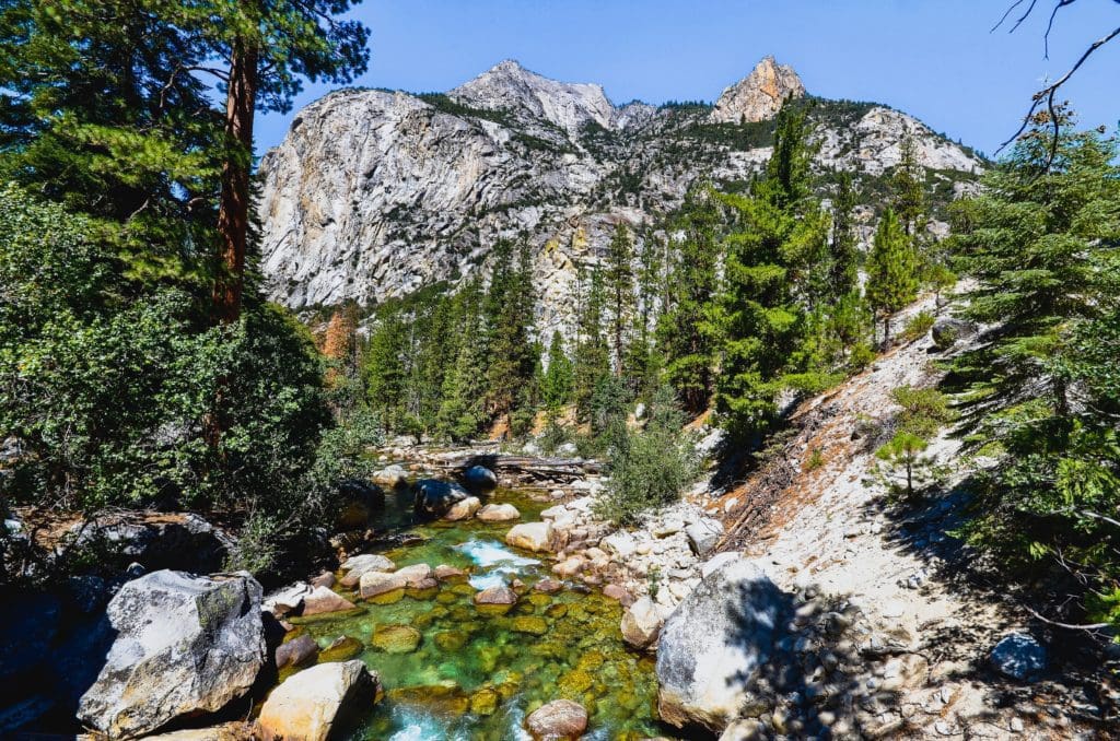
South Fork Kings River near Cedar Grove.
Where to Stay
Hotels & Lodges
-
John Muir Lodge: Located in the Grant Grove area of Kings Canyon National Park, this lodge is the perfect base for exploring the park. Named after the famous naturalist, the John Muir Lodge offers 36 hotel rooms and a restaurant. It’s just a half mile from a sequoia grove, visitor center, market, restaurant, gift shop, and post office.
-
Grant Grove Cabins: Also in the Grant Grove area, these cabins provide a cozy stay amidst the beauty of the park. They are a half mile from the same amenities as the John Muir Lodge, making them a convenient option for those who want to be close to the action.
-
Cedar Grove Lodge: For those looking for a more remote experience, Cedar Grove Lodge is located deep in Kings Canyon at an elevation of 4,600 feet. It offers 21 hotel rooms, a snack bar, market, and gift shop. The lodge is also within walking distance of Cedar Grove’s visitor center.
-
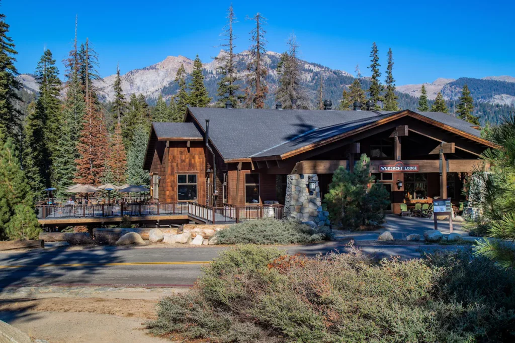
Wuksachi Lodge: Although technically in Sequoia National Park, Wuksachi Lodge is just a short drive from Kings Canyon and offers modern facilities and amenities in a beautiful setting.
- The River Island: This giant vacation rental in Three Rivers has four bedrooms, four bathrooms, and a patio and river access. It’s perfect for larger groups or families looking for more space and privacy.
Camping
As we all know, fresh mountain air only gets better when the sun goes down. Outside the lights of the Central Valley, the stars are stunning. And you really can’t beat waking up with the sun to the sound of canyon wrens, watching a low mist rise off the Kings River. The campgrounds are so good in Kings Canyon, it’s hard to even rank them.
The main thing you need to know when planning a camping trip is which part of the park you’re planning on spending time in. In Grant Grove, your options are Sunset, Azalea, and Crystal Springs Campgrounds. For the busy season, Sunset has the most sites, with 158. For the off-season, Azalea has 19 sites that are open from November to May. And if you want a more secluded site, Crystal Springs is situated further from Grant Grove Village, giving you more privacy.
In Cedar Grove, there are four campgrounds: Sheep Creek, Sentinel, Moraine, and Canyon View. All of these campgrounds are open roughly from April or May to September or November. Sheep Creek, Sentinel, and Moraine are all high-capacity, with 80-120 campsites each. But don’t let that deter you. Kings Canyon features a broad valley bottom, so there is lots of room to spread out and get some alone time. Canyon View Campground is specifically for group sites, and has 16 in total.
At any of these campgrounds you can expect the usual amenities: bathrooms, potable water, hookups, and nearby groceries and showers. Each area has a “village” of sorts with some services. There is also a visitor center in each location for information and maps.
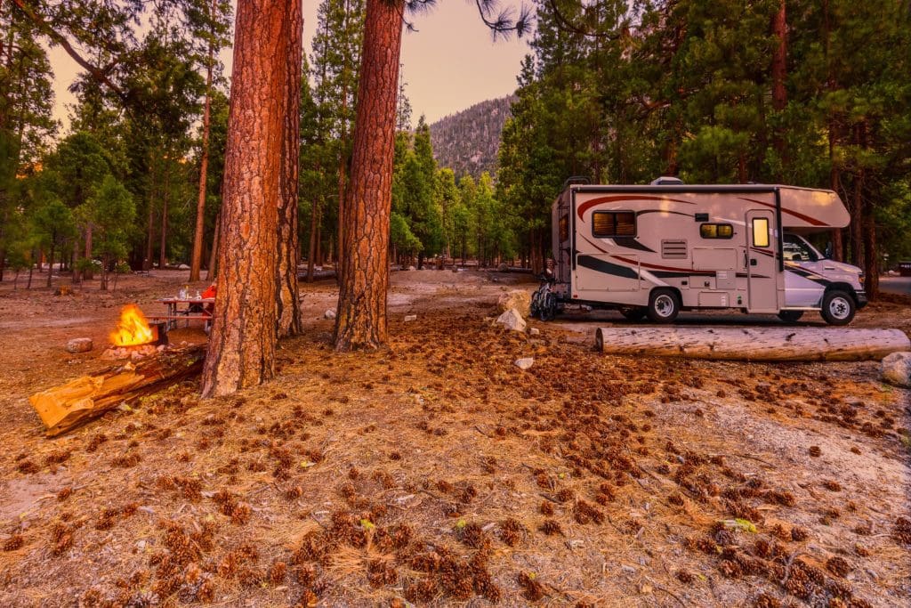
Camping at the Moraine Campground in Kings Canyon National Park’s Cedar Grove.
Enjoying The Park
Kings Canyon can be done in a day, if you want to see only the highlights. In fact, some people visit Sequoia National Park and Kings Canyon in the same day. If you’re on a time crunch, there are a few must-see items that you shouldn’t leave the park without visiting.
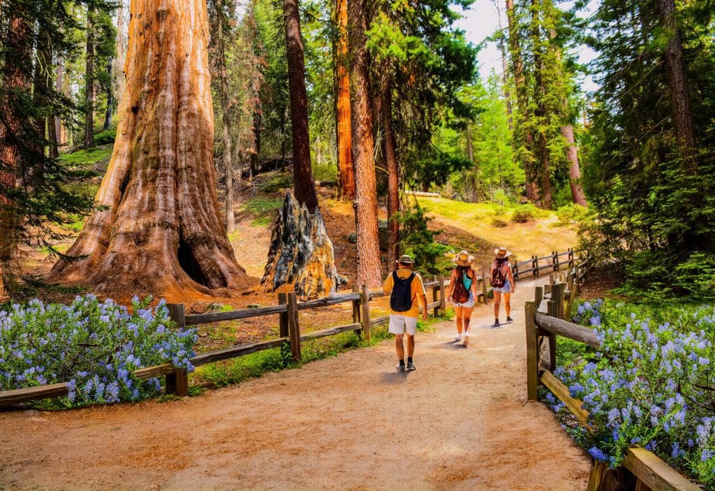
Hikers on the General Grant Tree Trail in Kings Canyon National Park.
The first of these is Grant Grove. This area features some premium camping, easy and rewarding trails, and views of some of the largest living things on earth. In particular, be sure to pay tribute to General Grant while you’re in the area. Grant is located on the General Grant Tree Trail, a 1/3 mile walk that’s suitable for people at all fitness levels.
The next major stop in Kings Canyon is Cedar Grove. This is what we mean when we refer to Kings Canyon, as in the canyon itself. Cedar Grove is accessible by an out-and-back road, which ends at Roads End (go figure). Along the drive there are several places to stop, like Zumwalt Meadow. This is a perfect spot to enjoy views of the soaring granite cliffs or take a leisurely stroll along the Kings River.
You may also want to stop at Roads End. This area is a trailhead for many of the major routes into the park’s backcountry. Any of these can be taken part of the way, to get a taste for what scaling these impressive peaks is like.
Hiking
In order to really get out and see Kings Canyon, you’ve got to sweat for it. If the thought of that makes you excited, then Kings Canyon National Park will be heaven for you. But if you’re not up for a major undertaking, that’s okay. There are still plenty of incredible destinations you can get to without covering a skyscraper’s worth of elevation.
This applies the most to Grant Grove, which is flatter and smaller. As we’ve mentioned already, the Grant Grove Tree Trail is a must. For a more secluded experience, North Grove Trail is just 1.5 miles and receives much less traffic. With slightly more mileage, the Redwood Canyon Trail puts you smack dab in one of the largest sequoia groves on earth.
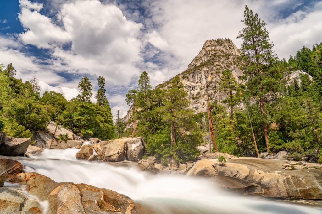
Looking into Kings Canyon along the Rae Lakes Loop hiking trail in Kings Canyon National Park, California
If you’re looking for something mellow in Cedar Grove, the Zumwalt Meadow Trail is a good option. It’s just .8 miles long, mostly flat, and follows the edge of the Kings River as it winds through the valley. If you’d like to cover some more ground, check out Mist Falls Trail, which covers almost nine miles, but is mostly flat. And if this is a little too much time, you can take the Road’s End Trail to Bailey Bridge, just 4.7 miles round trip. Beyond this, almost all the hikes in Kings Canyon will require multi-day commitment.
Yosemite, Sequoia & Kings Canyon Hiking Adventure with REI Adventures
Explore three awe-inspiring national parks—Yosemite, Kings Canyon and Sequoia—on a guided 6-day active adventure with REI.
Backpacking
Which brings us to backpacking. Backpacking Kings Canyon National Park is maybe the best way to dive into what the park has to offer. And with a vast, remote backcountry, there are about a million routes and places to camp. Maybe a million is an exaggeration, but trust us, there are a lot. These trails provide a diverse range of experiences, from challenging climbs to serene valley walks, making them the best backpacking routes in Kings Canyon National Park for adventurers of all levels.
Rae Lakes Loop: The Rae Lakes Loop is a must-do for any avid hiker. This trail is highly regarded in Sequoia and Kings Canyon as one of the best hikes to embark on. With a total length of 41.4 miles, starting at an elevation of 5035 feet (1535m) and peaking at 11,978 feet (3651m) at Glen Pass, it’s no surprise that hikers in the Sierra region flock to this trail. Most people opt to start at either the Wood’s Creek Trailhead (in a clockwise direction) or the Bubb’s Creek Trailhead (counter-clockwise).
However, during May and early June, be prepared for challenging stream crossings due to high water levels. Expect obstacles at Glen Pass until mid to late July, and even later if you have livestock with you. The popularity of this hike means there are specific rules and regulations in place along the way. Typically completed in four to five days, this trek takes you deep into the high country. Prepare for a tough first day or two followed by smooth sailing as you glide through high alpine valleys, gurgling streams, and lush meadows over the next two or three days.
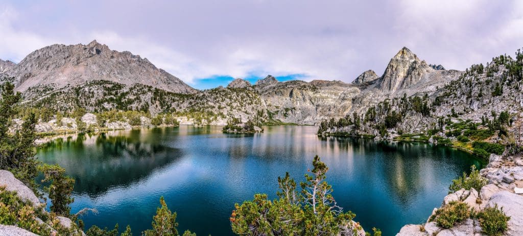
Painted Lady and Rae Lakes, CA
Paradise Valley Trail: The Paradise Valley Trail is a popular option for hikers, although it is shorter than other trails in the area. It spans 18.2 miles round trip with an elevation gain of 2,500 feet and has a moderate difficulty level. The trail takes you through a beautiful granite valley and past Mist Falls before reaching the serene Paradise Valley. This trail is highly regarded for its stunning scenery and is a must-do for adventurers looking for a challenging but worthwhile trek. As you make your way up the trail along the South Fork of the Kings River, prepare to be surrounded by breathtaking views of towering cliffs and verdant forests.
Bubbs Creek Trail: Splitting the difference distance-wise is Bubbs Creek Trail, a 24.6 mile out-and-back jaunt along Bubbs Creek into the alpine under several 11- and 12,000 foot peaks. The trail gains almost 5,000 feet of elevation in 12.3 miles, so not murderous, but consistently strenuous. But your work will most definitely pay off when you arrive at your destination. All of the mountain valleys in Kings Canyon are fantastic, but the more secluded you are, the better it gets.
Mt. Whitney Loop: For the over-achievers in our audience, we can’t leave out the Mt. Whitney Loop. If you’re proud of doing things “the hard way,” this trail was made for you. It totals almost 90 miles, 22,000 feet of gain, and includes the summit of the highest peak in the Continental US. Along the way you’ll see some of the most secluded, rugged nooks and crannies in the country and have untold adventures. We’re already jealous of the fun you’ll have.
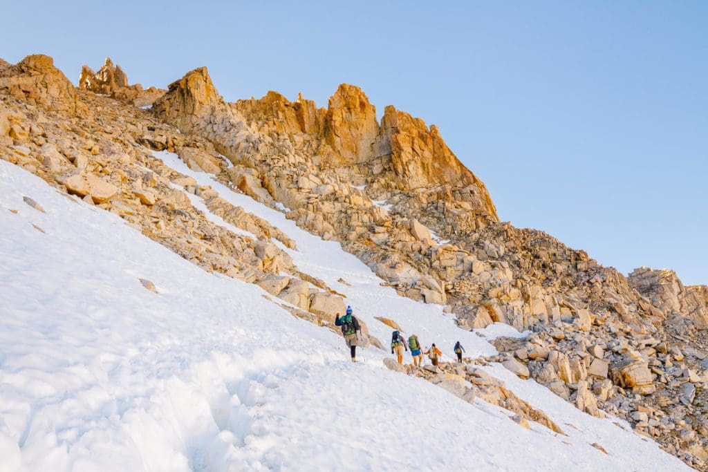
Summiting Mount Whitney – Hikers on their way to the summit of Mount Whitney, the highest peak in the continental United States.
Trail Closures: Due to previous wildfire activity and impacts from 2023 winter storms, some trails are closed or have lost trailhead access. Check NPS’ trail and road closure map on the Maps page for details.
Looking For An Amazing Adventure? Book An Alpine Climbing Tour in the High Sierra With A Local Guide
Climbing
In a place like Kings Canyon National Park, that is, one completely encircled in pristine granite walls, you can’t help but think there’s some pretty amazing climbing to be done. And you’d be right on the money. But that isn’t the only thing going on climbing-wise here. Top to bottom, there is a lot of potential in Kings for rock climbing. Before going, be sure to check out SEKI Climbing, the unofficial compendium of climbing areas in Sequoia and Kings Canyon National Parks.
Beginning closest to the ground, there are some fun boulders around Cedar and Grant Grove. These aren’t the main event, but if you have weird weather days or just want to pass some time warming up on something more laid back, this is a nice option. In Grant, Sheeple Boulder offers a few fun problems. In Cedar Grove, Roadside Boulder and Road’s End Boulder both feature fun, short problems and are easy to access.
For single pitch sport climbs, check out Foolproof Plan Wall and Outhouse Wall. There is also some sport climbing around Boyden Cave. For low-commitment trad routes, there are some high quality, easier climbs on Fern Wall Crag.
But if you want to go big (and who wouldn’t), the spots you should be looking at are North Mountain, North Dome, and Grand Sentinel. These are the major big walls in Kings Canyon National Park. These routes typically run six to nine pitches, ranging from 5.9 to 5.11d. With a little less vertical, Zumwalt Crack in Zumwalt Meadows is a solid three pitches of crack climbing. It’s not quite Yosemite, but then, that’s kind of the point, isn’t it?
Canyoneering
You probably think of red rock when we say “canyoneering,” right? Well, if you’re not picturing smooth walls of marble winding through pine forests, you may be missing out. Kings Canyon has quite a bit of awesome canyoneering, as it turns out. There are some differences in what you should expect when busting out the skinny rope, though.
In Kings, you should come ready to get splashed. Almost all canyons here have swift water in them year-round, meaning wetsuits are recommended. You should also expect rappels in every case. All of the canyons listed here are rated at least 3B III, meaning rope mandatory, a high chance of water, and a solid half to full day required to finish. In short, these are dangerous adventures through nearly untouched backcountry. They demand your respect. Do not attempt anything listed here without the proper know-how, and be kind to the land.
That being said, Tenmile Creek is a nice introduction to what you’re in for when canyoneering in Kings Canyon. It’s got an easy approach and only two mandatory rappels (depending on your ability to downclimb). The upper section is similar, with a longer approach.
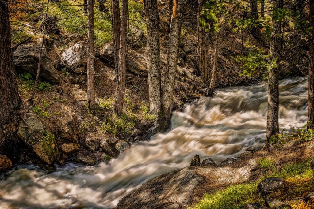
Grizzly Creek in Kings Canyon National Park.
Grizzly Creek is a similar time commitment to Tenmile. The water flows faster here, so be cautious. It also features some sporty moves, so some climbing ability is mandatory. And if that’s not spicy enough for you, Boulder Creek ought to do it. Boulder Creek Canyon covers 3,000 feet of descent over six miles, and is very pretty. It will, however, require a long rope (2-300 feet). This is a big time commitment, a full day on the low end, but it’s a worthy adventure for anyone who wants to see a side of Kings Canyon that most visitors don’t.
There are a few canyons (see: Blue Canyon and Crown Creek) in the park that are more demanding than this. They require multiple days in the backcountry, lots of technical skills, and even more preparation. But you could make the case that they are some of the best adventures you can get yourself into in the park. If you’re in the extreme minority of readers with the equipment and know-how to take these canyons on, more power to you.
A Canyon Fit for a King
Kings Canyon National Park is everything you might picture if you had never seen, but only heard tales of the West. Vast stretches of high mountain peaks, placid valleys, dense forests full of gigantic trees, winding rivers and creeks, secret caves, and all of it teeming with stunning animals. You could spend a day here and see the major sights, or you could spend a lifetime making long trips into the backcountry and not even see half of it. For John Muir, this was life’s greatest calling: to seek out the untouched places guarded by harsh weather and sharp stone. It’s places like these that we find ourselves. The mountains are calling you. Go to them.
Enroll With Global Rescue Prior To Embarking On Your Next Adventure.
When a travel emergency arises, traditional travel insurance may not come to your aid, and a medical evacuation can cost up to $300,000.
The cost when you have a Global Rescue membership? $0. That’s why when the unexpected happens, you want the leader in rescue, evacuation and medical advisory behind you. You want Global Rescue.
Popular Articles:
Adventurer’s Guide to Sequoia National Park, California
The 10 Best National Parks in the USA
Adventurer’s Guide to Grand Canyon National Park, Arizona
Adventurer’s Guide To Black Canyon Of The Gunnison National Park, Colorado
Terms of Use: As with each guide published on SKYBLUEOVERLAND.com, should you choose to this route, do so at your own risk. Prior to setting out check current local weather, conditions, and land/road closures. While taking a trail, obey all public and private land use restrictions and rules, carry proper safety and navigational equipment, and of course, follow the #leavenotrace guidelines. The information found herein is simply a planning resource to be used as a point of inspiration in conjunction with your own due-diligence. In spite of the fact that this route, associated GPS track (GPX and maps), and all route guidelines were prepared under diligent research by the specified contributor and/or contributors, the accuracy of such and judgement of the author is not guaranteed. SKYBLUE OVERLAND LLC, its partners, associates, and contributors are in no way liable for personal injury, damage to personal property, or any other such situation that might happen to individuals following this route.


