


|
Getting your Trinity Audio player ready...
|
Exploring the Capitol Reef Country Scenic Byway takes you on a 450-mile journey through southeast Utah’s wild canyons and plateaus, unseen by travelers from the east until the early 1900s. Bring plenty of water, snacks, and fuel for this year-round trip through some of the most remote regions in the western US.
Rev up your vehicles and get ready to explore the US with our Explorer’s Guides. Get ready for some amazing road trips, from the rainforests of the Olympic Peninsula to Colorado’s San Juan Mountains, all the way down to the Front Range and Utah’s Capitol Reef country. For more reasons why you should hit the pavement, plus handy tips and interviews, be sure to check out our coverage here.
Overview
Exploring the Capitol Reef Country Scenic Byway, I am reminded of the remote beauty of this magical land. As I traverse its hidden gems, it becomes clear that this high and lonesome country is not just a place created by myth and fable, but it truly exists.
Chiseled by the wind and water over eons, the wild canyons and plateaus of southeast Utah were among the most remote regions of the western United States, unseen by travelers from the east until the early 1900s. The area was so isolated that it remained undocumented for much of the century.
This journey is around 450 miles, not including any side trips. It’s a great trip all year round, but make sure to bring along bottled water, snacks, and more fuel. You’ll be driving through Utah’s remote areas.
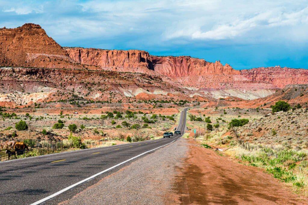
Scenic Route 24 running through Capitol Reef National Park near Torrey, Utah.
Table of Contents:
Article Navigation: Click on any of the listed items in the table of contents below to jump to that section of the article. Similarly, clicking on any large, white section header will jump you back to the Table of Contents.
- Overview
- Fish Lake National Forest
- Torrey
- Capitol Reef National Park
- Hickman Bridge
- Hite Lake Powell Overlook
- Hite Crossing Bridge
- Natural Bridges National Monument
- Mule Canyon
- Comb Wash
- Edge of the Cedars State Park and Museum
- Monticello
- Canyonlands National Park
- Moab
- Arches National Park
Fish Lake National Forest
Driving southeast from Sigurd on Highways 24 and 25, the Fish Lake Scenic Byway traverses several miles of rugged, sagebrush terrain. Soon enough, the land begins to climb skyward, reaching heights of 9,000 feet. Here, you will see aspen trees in their full summer glory or flaunting brilliant colors during fall. The chance to observe wildlife is also very high–deer and squirrels are frequent sights, while moose and elk can also be seen with enough luck. Mountain lions inhabit the area but rarely appear. The journey is 13 miles long and takes roughly 45 minutes.
Nestled among meadows and aspen woods in Fish Lake National Forest, lies the crystalline waters of Fish Lake, teeming with four types of trout. Fish Lake is the largest freshwater mountain lake in Utah.
A pathway along the shoreline and numerous trails for mountain biking offer magnificent views of snow-capped peaks, beautiful wildflowers, and birds like golden and bald eagles, deer, elk, and moose. Fish Lake Loop trail is a 16.2-mile journey, circling the entire lake, is considered to be quite difficult. It will take an average of 6 h 35 min to finish the route. This is an ideal path for backpacking, hiking, and running as it’s unlikely you’ll run into many other adventurers here. Fishlake National Forest has numerous hiking trails too.
Boat rentals, campgrounds, and cabins are available along the journey to explore this region of Utah at leisure. Fish Lake Resorts is running two resorts along the Fish Lake shore. The Fish Lake Lodge resides in the center of the lake, while Lakeside Resort lies at the southern end. Being merely a mile apart makes it simple for visitors to move between them. Not only this, but there are hiking trails and bike tracks to follow around the lake as well. Each resort has a marina, cabins available for rent, and a general store. Additionally, Lakeside Resort also offers a full-hookup RV park. Vrbo has a few nice cabins too.
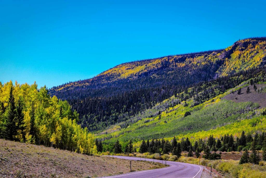
Fall colors near Fish Lake near Richfield Utah.
When it’s time to return to Route 24, head back westward toward Torrey.
Torrey
The southwest is an expanse full of unexpected changes, with lush wooded valleys quickly giving way to otherworldly deserts colored in blazing sunset hues. Route 24 takes you on such a journey next to the Fremont River, as it heads past Thousand Lake Mountain and its high crested cliffs. The red rock spire of Chimney Rock slowly appears from the horizon east of Torrey – a stark reminder of how far away the fragrant pine woods around Fish Lake now seem. You have now arrived at the entrance of Capitol Reef National Park, where nature has used her tools to masterfully carve out this landscape while leaving the gardening to its human inhabitants.
The Torrey area offers some lovely trails, such as the Chimney Rock Loop Trail, a 3.3-mile trek that offers sensational vistas of the Waterpocket Fold. Another good choice is the Hickman Natural Bridge trail, which is 1.7 miles and provides an incredibly tranquil experience. For something a bit more challenging, try the 3.1-mile Cassidy Arch Trail; its most difficult part is at the beginning, where you’ll find yourself ascending a steep incline.
Chimney Rock in Capitol Reef National Park, Utah.
Capitol Reef National Park
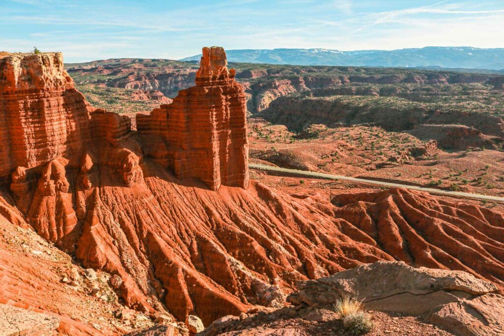
Capitol Reef National Park is an underrated destination in Utah. It boasts 240,000 acres of remarkable geological features that are unique to the state. Of special note is its 100-mile long uplift in the earth’s crust, named The Waterpocket Fold. This area is a one-of-a-kind fortress of sandstone towers containing a wealth of historical and archaeological treasures.
As mentioned, Capitol Reef’s impressive landscape exists because of one geological feature: the Waterpocket Fold. The Fold is an approximately 100-mile-long wrinkle in the earth’s crust that causes a major elevation shift from east to west, which reveals cross sections of different sandstone layers. This kind of formation, called a monocline, can be found in many areas around the world, yet the Waterpocket Fold stands out for its great size and unbroken shape. In fact, seen from space, the park resembles a fiery red wave crashing on a beach made entirely of stone.
Centuries before the white explorers stumbled upon Capitol Reef, it was inhabited by the Fremont people. We don’t know much about their lifestyle, but we do know that they began living in the region around 1000 CE and disappeared in the 1200s. They grew food, made homes from stone, and created beautiful works of art which they chiseled into the red rocks of Capitol Reef. You can still find evidence of this civilization across the Southwest – old dwellings, pottery shard fragments, petroglyphs – and Capitol Reef is no exception. Later, Paiutes and Navajos gave the colorful strata a name translated as ‘land of the sleeping rainbow’.
In the late 1870s and early ‘80s, some towns around the Reef were settled by recently-arrived Mormons. Torrey, Fruita (not Colorado — the other one) and Caineville were established to aid an LDS-backed campaign that aimed to expel the local Indigenous population. Later, the uranium mining business boomed (and then plummeted) in the area, bringing more folks to Capitol Reef for a while. You can still enjoy fruits from the orchards in Fruita–peaches, apricots, cherries, pears and apples—for just a small fee collected by the Park Service; a remnant of the hopes and dreams cultivated by those who planted them so long ago.
We’ve put together a complete guide to Capitol Reef National Park that highlights everything you need to know about this beautiful destination. Explore the park’s treasures, indulge in nature’s grandeur, and experience once-in-a-lifetime activities when visiting.
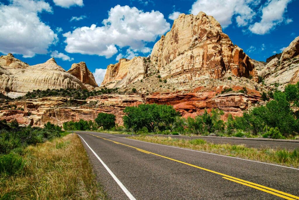
Capitol Dome in Capitol Reef National Park, Utah.
Hickman Bridge
About midway along the main road through Capitol Reef National Park is a trail that follows the lush banks of the Fremont River, then climbs through stands of cottonwood and fragrant juniper to Hickman Bridge, a graceful 133-foot natural span. The sandstone arch leaps from a jumble of rock and makes a grand symmetrical sweep above a streamed, framing Capitol Dome (the signature formation of the national park).
There are three hiking options at the Hickman Bridge and Navajo Knobs trailhead. If you want a short but sweet experience, the 1.8 mile round-trip to Hickman Bridge will take an hour and a half. For a slightly longer hike, you could opt for the 4.6-mile round-trip to the Rim Overlook on the Navajo Knobs trail, which takes three to four hours. Or, if you really want to go all out, you can do the 9.4-mile hike to Navajo Knobs which will take six to eight hours. The route begins by the Fremont River and then descends into a wash offering up stunning views of what many call Capitol Dome — named after its similarity with the U.S. Capitol building in Washington, D.C.
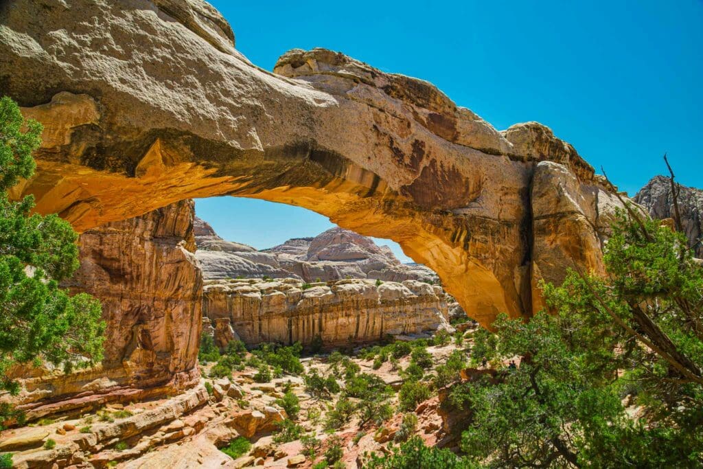
Hickman Bridge
Hite Lake Powell Overlook, Glenn Canyon National Recreation Area
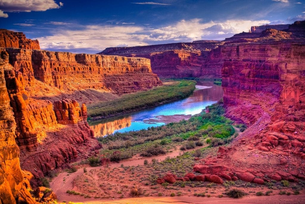
The highway connecting Capitol Reef to Hanksville was a desolate, barren stretch of road. To the south, the Henry Mountains rose in desolation, their peaks sharply defined against the clear sky. Outlaws once took refuge among these weathered peaks and hid rustled cattle within their shadows. Now, bison still roamed the foothills, while prospectors continued to hunt for gold. It was a place of natural beauty and man-made escape alike.
Fifteen miles to the south of Hanksville, on Utah-95, a dirt road will take you to the reddish-colored canyon of the Dirty Devil River–a name given by John Wesley Powell due to its mud and odor. Utah-95, more commonly known as the Bicentennial Highway, is a breathtaking route that goes from Blanding to Hanksville. It passes Lake Powell and it’s surrounded by miles of stunning canyon scenery both north and south of its location.
One can find Utah-95 near the upstream end of Lake Powell, about a mile away from Hite Marina. Continuing north, the road steadily ascends for a few miles before reaching Hite Overlook, an incredible scenic viewpoint. From the overlook, 35 miles south, you can see Lake Powell and the Glen Canyon it filled after the Colorado River was dammed.
It took 17 years for the lake to become 200 miles long, and its shoreline extends for an astonishing 2,000 miles—longer than the West Coast. But what stands out most are the vibrant red walls of the submerged canyons that rise abruptly from the blue-green lake.
Tucked away in remote Glenn Canyon National Recreation Area is the Hite Ranger District, situated on the highest point of Lake Powell near the juncture of the Colorado and Dirty Devil Rivers. For those looking for adventure, there are plenty of activities to take part in. Jeeping, camping, trekking, biking, cycling, paddling, sailing, and fishing are all popular pastimes. Experienced adventurers may also choose to paddle down the famous Cataract Canyon from Moab to Hite—though a permit is required.
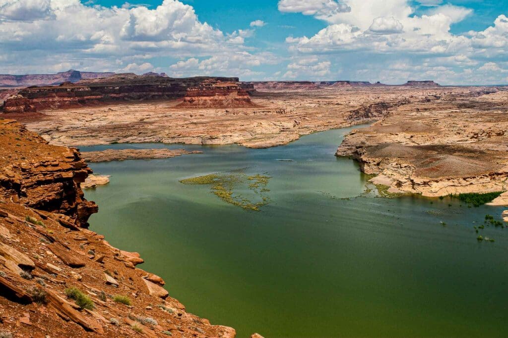
Hite Overlook at Lake Powell in Glen Canyon National Recreation Area, Utah
Hite Crossing Bridge
The Hite Crossing Bridge is an arch bridge that carries Utah State Route 95 across the Colorado River northwest of Blanding, Utah. It marks the furthest point north that Lake Powell can reach and also the beginning of Cataract Canyon on the Colorado River. The bridge is the only one spanning the river between Moab’s US 191 bridge 110 miles (180 km) upstream and Glen Canyon Dam’s 185 mile (298 km) downstream bridge. The bridge lies in proximity to Hite Marina on Lake Powell.
The Colorado River was a major impediment for early settlers and explorers. Cass Hite opened “Dandy Crossing” in 1880, one of the few places around to cross the river. Arthur Chaffin then built an automobile ferry that operated for two decades until Lake Powell flooded the settlement of Hite, which was named after Cass Hite.
Hite Crossing is now situated at the northernmost part of the portion of the river that has become Lake Powell, but instead of a ferry, there is a bridge connecting people across the canyon. For those on Utah-95, this crossing marks the entrance into Glen Canyon National Recreation Area, where visitors can find more than a million acres of untamed landscapes surrounding Lake Powell. The local marina provides houseboats and smaller water vessels so travelers can explore all of the mesmerizing bays, coves, and ravines that extend throughout the lake.
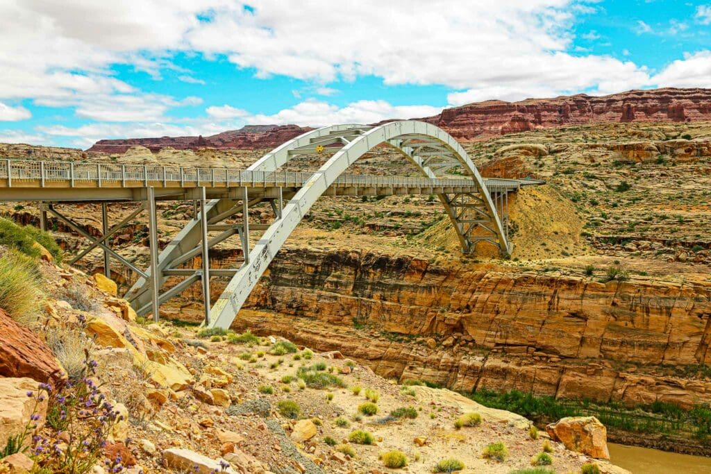
Hite Crossing Bridge, Utah.
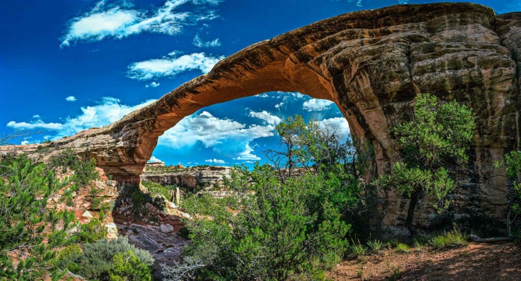
Natural Bridges National Monument
Located 50 miles southeast from the Hite Crossing, Natural Bridges National Monument sits at the junction of White Canyon and Armstrong Canyon, a part of the Colorado River drainage. Here you will find the thirteenth largest natural bridge in the world, crafted from the white Permian sandstone which gives White Canyon its name.
The park houses three natural bridges with Hopi names: Kachina, Owachomo, and Sipapu (the largest). These natural bridges are created by the erosive power of water flowing within the canyon below. During flash flooding or high water levels, the stream bed gets undercut until a bridge is formed. Over time, as erosion and gravity further widen the opening, the bridge eventually collapses from its own weight. There are two collapsed bridges that exist in the Monument as proof.
The first bridge seen along the drive, Sipapu, is second largest in the world. Its height is comparable to a twenty-story structure while its span approaches the distance of an American football field. Compared to the other bridges, Kachina is the least weathered by wind and water. Owachomo (see nearby photo), the oldest of the three, is likely to collapse first due to its comparatively small 9-foot thickness. Though its diameter is 180 feet wide, it’s much thinner than the others.
In 1883, Europeans first discovered the area when gold prospector Cass Hite explored White Canyon and found the bridges near where it meets with Armstrong Canyon. In 1904, the National Geographic Magazine publicized the discovery of this spot, leading to its designation as Utah’s initial National Monument by President Theodore Roosevelt on April 16th, 1908.
It was impossible to get to the Monument for many years, based on the records kept by its caretakers. The journey from Blanding, Utah, the closest town, took three days on horseback. Not many people visited until after uranium mining surged in the 1950s and new roads were built – including Utah-95 which was completed in 1976.
The Sipapu Bridge trail is a 1.2-mile loop with an elevation increase of 403 feet, featuring somewhat difficult terrain, three brief ladders, and magnificent views from the peak. Although the ladders may prohibit younger children from attempting the trail, it is still a popular choice for hikers and rock climbers. The Owachomo Bridge trail takes around 30 minutes to complete its 1.4 mile course that goes up 216 feet in elevation. On the other hand, you can experience Kachina Bridge trail’s 1.3-mile out-and-back path with an elevation gain of 436 feet. From down below, this arch looks even better than from above, and the path is in great condition. At the end, you must hop across the river (which is easy to do without getting your shoes wet) and then go through a herd path to see the majestic arch.
For a moderate 8.2 mile trek, the Natural Bridges loop covers 1,023 ft with its ascent into White Canyon and offers views of all 3 natural bridges.
Owachomo Bridge in Natural Bridges National Monument, Utah.
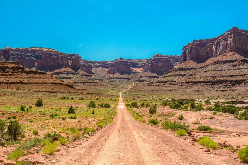
Mule Canyon: House on Fire, Butler Wash and Cave Tower
A deserted ancestral Puebloan settlement is located in the South Fork of Mule Canyon in the Bears Ears National Monument, just a short 15-minute drive from Natural Bridges on Utah-95. It’s thought that a lack of rainfall prompted the 13th century departure of the ancient Puebloans from this region. Take a short detour from Utah-95 to visit two remarkable ancient ruins of Bears Ears National Monument.
Take Utah-95 to the junction with County Road 263/Texas Flat Road. The junction is located between Blanding and Natural Bridges National Monument, near mile marker 102. After reaching the junction, you’ll find a kiosk where you can pay for a permit to hike to House on Fire. The daily rate is $2 per person and the weekly rate is $5 per person. Keep going along the road for another 0.3 miles; you’ll see a BLM exhibit with a kiva, interpretive signage, and a pit toilet on your right. This isn’t the trailhead, though; it’s further down the road on the left side.
After a short hike, you will start to discover the ruins spread throughout the canyon. These ancient remains are usually found in the alcoves that line the northern (right-hand side looking up the canyon) cliff walls. The Cedar Mesa sandstone, which is the main type of rock exposed in South Fork Mule Canyon, is very erodible and has created these south-facing alcoves; making them perfect areas for people to live in.
The entire 4.3-mile trek (one-way) is a relatively easy one through a shallow canyon that contains eight sites to explore. About a mile in, you hit the first major site: the famous House on Fire. It is a set of five granaries built into Cedar Mesa sandstone. The overhang creates a ceiling with an arched pattern that, from certain angles looks like flames. To get the iconic photo of this formation, arrive at 10 or 11 a.m., depending on the time of the year; by noon, direct light will wash out its brilliance.
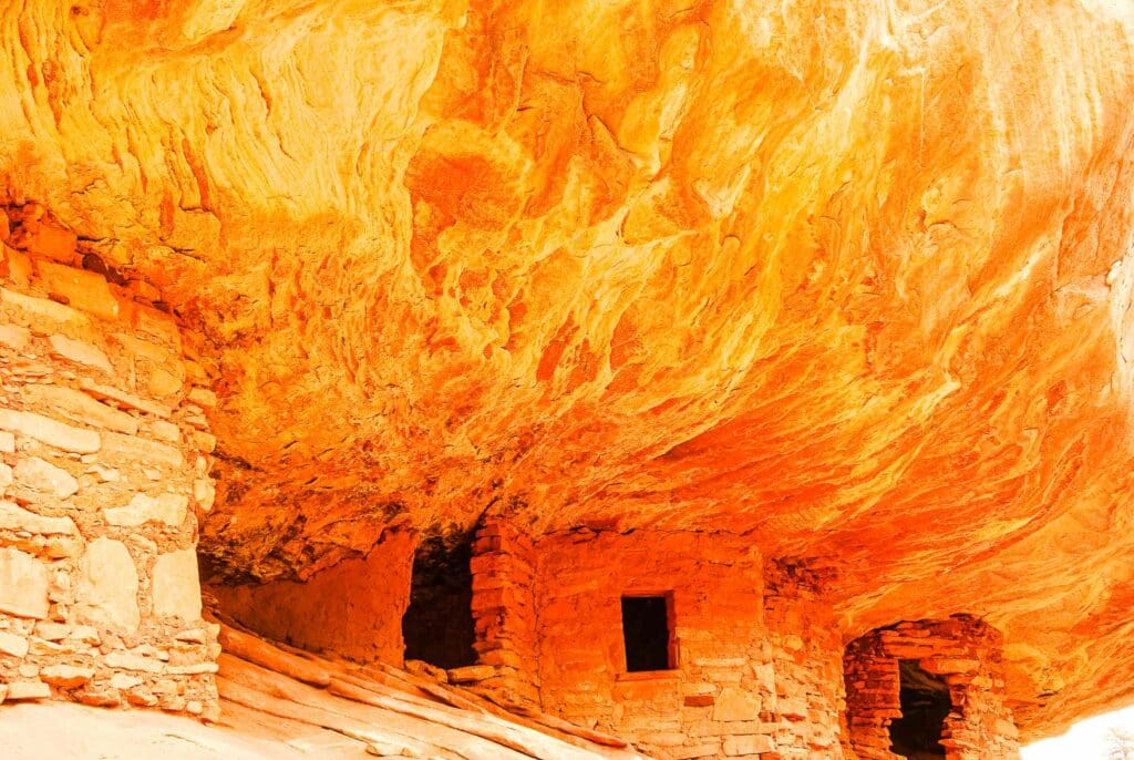
Houses on Fire ruins in Mule Canyon at Bears Ears National Monument, Utah.
Before you proceed further up the canyon, don’t forget to take a look at the rock art situated near the bottom of the wash beneath a large boulder, which most people tend to ignore. Many who visit House on Fire turn back and drive home after, but there are numerous other sites that deserve attention too! A few sit right off the trail while others can only be seen with binoculars or can be reached by climbing up 200 feet.
Toward the end of the canyon stands the Wall Site, with many intact rooms embedded in tiny caves in the craggy cliff face; even some of its roofs preserve the original roof beams. Moreover, there are permanent springs close by as well, making this spot an excellent resting point for those hiking with kids or pets.
The Cave Tower Ruin, a much larger ancient site, can be seen from the Mule Canyon Ruin, just a mile to the south. A dirt road off S.R. 95 leads to the Cave Tower Site at about mile marker 102.5. The short dirt road ends at a parking area and a trail to the east heads to the site. Here, you’ll see remains of some towers still standing in Cedar Mesa. Their purpose is unknown, but it’s clear that they were located near water at Cave Canyon and within sight of Mule Canyon Site.
If you continue driving for 10 miles and reach mile marker 111, you’ll have the chance to explore Butler Wash Ruins cliff dwelling after a brief half-mile stroll through a well-maintained pathway. The view is marvelous with the 800-year-old pueblo framed perfectly for your best morning photos.
Comb Ridge
Comb Ridge is a stunning wall that thrusts up from the floor of Comb Wash, near Mule and Arch Canyons. Utah-95 ascends this 800-foot ridge, offering an unparalleled view of the massive horizontal uplift of the earth’s crust towards the south.
Comb Ridge.
Edge of the Cedars State Park and Museum
Edge of the Cedars State Park is a state park and museum located in Utah in Blanding, off Route 191. It serves as an Ancestral Puebloan archaeological site, a museum, and an archaeological repository. The local cowboys from Bluff referred to this area on the border between a cedar-filled region and treeless terrain to the south as Edge of the Cedars due to its location on the edge of this natural boundary made up of Utah juniper trees.
The ancient Puebloan ruins at Edge of the Cedars State Park tell a lost story. Here, archaeologists have discovered six complexes of buildings used for both residential and ceremonial purposes, along with a wide variety of pottery artifacts now housed in the museum. Each site has its own kiva, with one featuring a “great” kiva, which was the core religious area in this forgotten era.
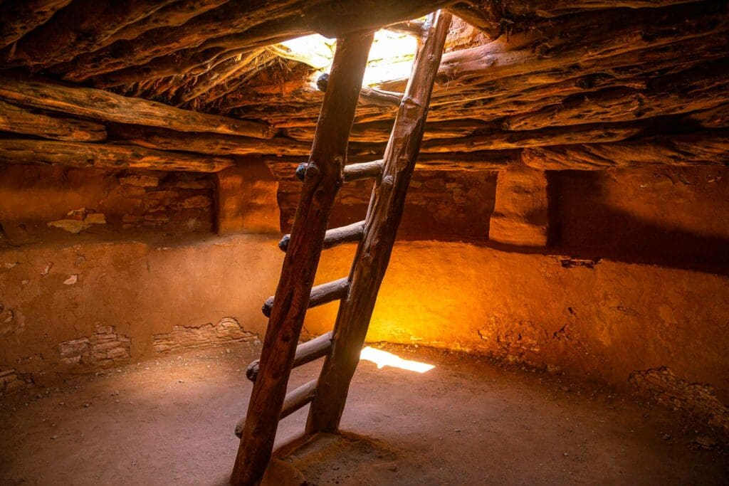
A kiva at Edge of the Cedars State Park in Blanding, Utah
Monticello
A 22-mile trip north of Blanding will take you to the San Juan County seat of Monticello, situated at the base of the Abajo Mountains. It’s thought that Spanish explorers were tricked by a desert mirage when they nicknamed this range Abajo (or low) since Abajo Peak actually rises to 11,000 feet and can be reached either by foot or four-wheel drive vehicle. Now part of the 1.2 million acre Manti-La Sal National Forest, these Blue Mountains are filled with forests of cooling pines in comparison to the sun-scorched plateaus and arid canyons which dominate much of the land. This is an ideal spot for campers as well as a popular destination for winter skiers, showcasing greener sides of a region usually characterized by ochre and vermilion hues.
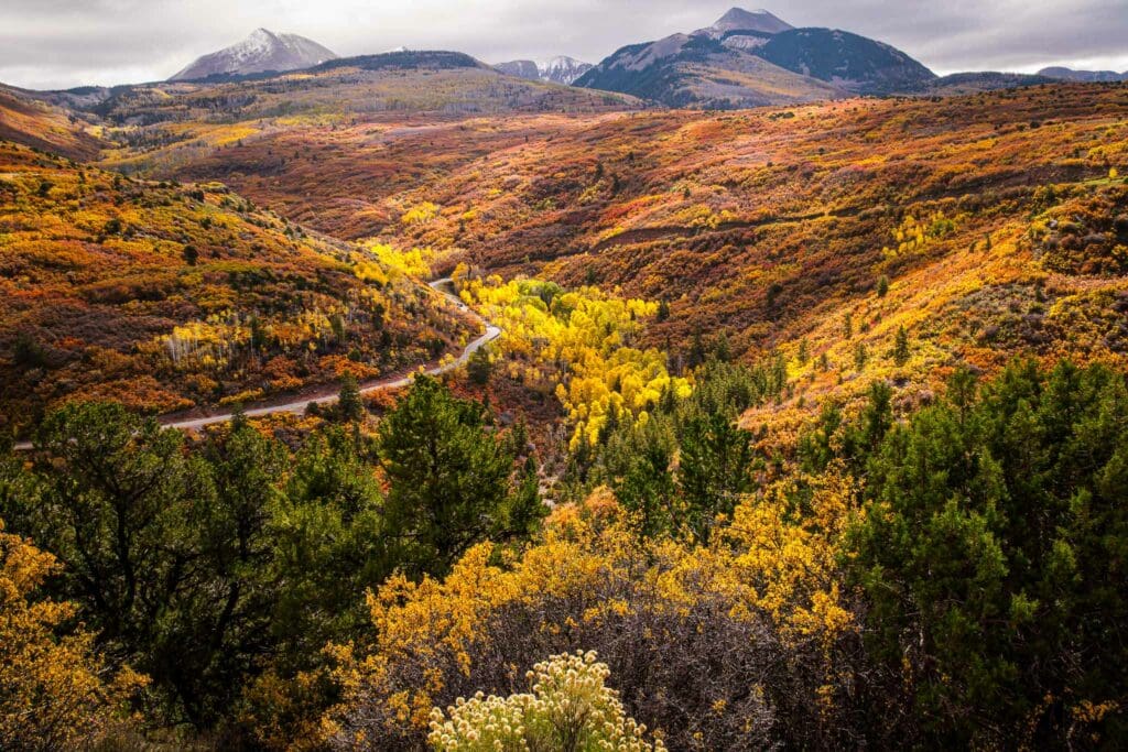
Fall colors in the Manti-La Sal State Forest, with the La Sal Mountains on the horizon.
Canyonlands National Park
Not far from Monticello, located along Routes 191 and 211, is Canyonlands National Park. The largest of Utah’s national parks, it’s the size of the Faroe Islands and receives a rather small share of visitors compared to other parks within the state. A majority of the park goers only view a tiny portion, while barely one percent travel to the Maze District–an area so hard to get to that explorer John Wesley Powell deemed it “a wilderness of rocks…ten thousand strangely carved forms in every direction.” Surrounded by Green and Colorado rivers, this maze of mesas and canyons holds many secrets waiting to be discovered.
The Colorado River that runs through Canyonlands National Park is located near the city of Moab, Utah.
Among the most peculiar of these formations is the Needles, a bizarre arrangement of sandstone towers, turrets and minarets with striking hues of cream and rust. Here astonished travelers gaze upon immense spires that have stood erect for thousands of years, some as tall as 30 stories.
After a few miles of driving on Route 211, one will come across the Wooden Shoe Overlook, Squaw Flat, and Pothole Point. Eventually this route of travel will end at Big Spring Canyon. Those driving with off-road vehicles can go further into the Needles Country to take roads like the Elephant Hill Road, where you require mastery in reversing to make it safely around a corner. There are also several short trails located here, one of which leads to an old granary created by the Puebloan people, and another that goes to an abandoned cowboy camp holding furniture a hundred years old.
We created an Adventurer’s Guide for Canyonlands National Park newcomers, detailing the park’s story, what to find, and how to explore it. Whether you’ve never heard of it or already planning a trip, start here. You may just be enchanted for life.
Shafer Trail Road in Canyonlands National Park, Utah.
Moab
By taking Utah-211 east and then merging onto US-191 heading north for approximately 80 miles, you can reach Moab. Surrounded by the stunning red rock canyons, 12,000-foot peaks of the La Sal Mountains, and perched on the banks of the Colorado River, Moab is picturesque capital of Utah’s high desert. It’s an outdoor enthusiast’s dream with seemingly endless opportunities for recreational activities.
The people of Moab have adopted the orange dirt of the Colorado River Basin like a badge of pride. Those who live for outdoor activities can be recognized by their well-worn techwear. The lifestyle in Moab is not about style or putting on a show; it’s all about getting out and pushing your limits. If you don’t have the passion, you’ll get no approval from others.
We’ve crafted an travel guide to all the outdoor adventure opportunities in Moab, from sand dunes to canyons to river trips. There are tips for foodies and a list of lodging options from luxury resorts to campsites. We asked locals for their favorite restaurants and the best coffee spots in town
Arches National Park
Not far from Moab is the entrance to Arches National Park, where explorers once thought they’d discovered the remnants of a long-lost civilization. The park is home to over two thousand labeled arches as well as other impressive rock carvings like domes, spires, and precariously balanced rocks and figures that look like giant chess pieces.
Whether you’ve viewed a map with Utah’s signature landmark, spotted a Utah license plate on the road, or simply google-searched the Beehive State, you’ve seen a mini-version of Arches National Park. We’re referring to the state’s most iconic natural feature: Delicate Arch. Rising 52 feet tall and perched atop an outcropping overlooking Salt Wash horizon dotted by snow-capped La Sal Mountains, it is not hard to understand why this majestic vision has been representing Utah’s treasured natural landscape for ages.
Arches National Park is more than just a scenic drive to the bottom of Delicate Arch. It boasts an extremely high concentration of natural arches, towers, hoodoos, fins, and other geological wonders. If you spend only a day here, you can witness more unique beauty than almost any other spot in the United States.
If you’re looking to visit Arches National Park, let us show you the ropes. We have put together an Adventurer’s Guide that tells the fascinating story of the park and what to expect when you arrive. Whether this is your very first time or if you are already planning a trip, you will find everything you need to start your exploration right here.
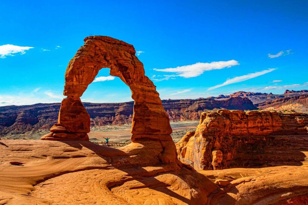
Delicate Arch in Arches National Park near Moab, Utah.
Leaving Arches National Park, you drive south on Highway 191 for a short distance then turn northeast onto Route 128. This 44-mile scenic byway ends at I-70 and provides stunning vistas of the Colorado River and Castle Valley as well as mudstone ramparts of Fisher Towers. Keep your eyes peeled for rafters floating downriver in the summer months. As you continue, you will pass the Dewey Bridge, a one-lane wood and steel suspension bridge built in 1916 but now closed.
Before it was destroyed by a brush fire in 2008, the bridge was the longest suspension bridge in Utah. At the time of its construction, it was the second longest suspension bridge west of the Mississippi. It is one of only three bridges spanning the Colorado River in Utah even though the river runs for four hundred miles through the state.
Viewing this retired structure from the window of your car allows you to recognize the impermanence of man-made objects compared to those crafted by nature.
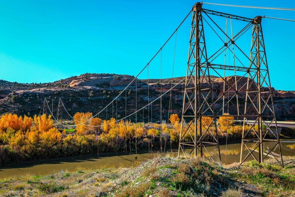
Remnants of Dewey Suspension Bridge Crossing the Colorado River, Utah
Want more Skyblue Overland? Follow us on Instagram and Twitter
Popular Articles:
Adventurer’s Guide To Arches National Park, Utah
Adventurer’s Guide To Capitol Reef National Park, Utah
The New River Gorge National Park and Preserve, West Virginia


