


High Point:
5,920 feet

Total Ascent:
1,522 feet

Difficulty:
Moderate

Distance:
7.5 miles roundtrip

Waypoints:
46.957778, -121.880278

Route Type:
Out and Back
From route 410 at Buckley, turn south onto Route 165 (Mowich Lake Road) and drive to the trailhead at the end of the road.
The Tolmie Peak Trail is a beautiful hike along two subalpine lakes and nearby meadows to a fire lookout with incredible views of the surrounding peaks and an amazing view of Mount Rainier. With one more day in Washington, I hit the trail on Thursday, September 27, 2018 to the Tolmie Peak Lookout on a beautiful fall afternoon. This hike to an historic fire lookout has amazing views of Mount Rainier and the sapphire blue Eunice Lake. This hike was the high point of my trip to Washington State. It was such a beautiful hike with amazing weather with high pressure blowing away all the smoke and clouds. The fall colors were near their peak.
-
This trail has EPIC VIEWS of Mount Rainier and Eunice Lake.
-
Suggest checking NPS Trail Conditions before starting.
-
The National Park Entrance Fee is required.
The view from the Tolmie Peak Lookout.
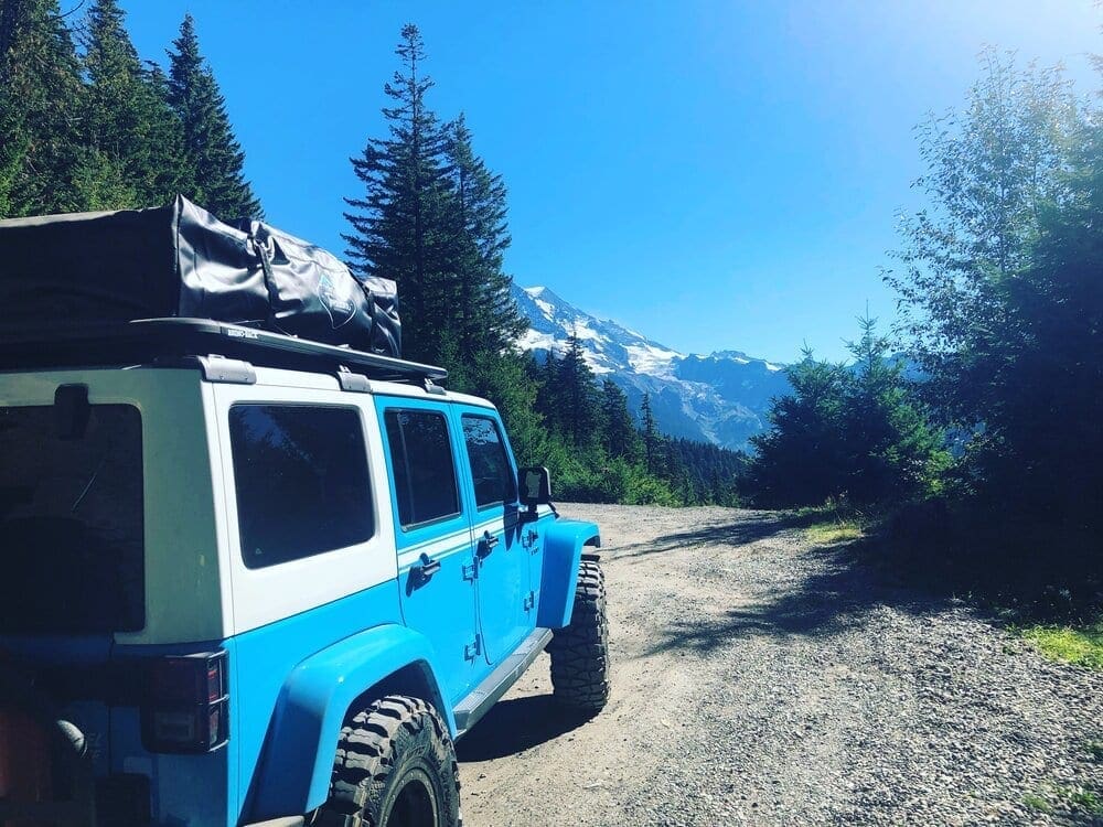
The road up to the trailhead at Mowich Lake is 17 miles long and is a rough, dirt road with some climbing, which was a fun trip for my 2017 skyblue Jeep Wrangler JKU Chief Edition.
After turning onto the Mowich Lake Road, which is beyond the Carbon River Bridge, right outside the town of Carbonado. The road up to the lake is 17 miles long and is a rough, dirt road with some climbing, which was a fun trip for my 2017 sky blue Jeep Wrangler JKU Chief Edition. Although many cars made the trip up to Mowich Lake, I suggest bringing a high clearance vehicle.
The trailhead is located on the left side of the road in the parking area at Mowich campground. The hike starts along the west side of Mowich Lake for about half a mile before turning northward to Ipsut Pass. The Mowich campground is a walk-in only facility along the Wonderland Trail. Many hikers and campers were taking a dip in the lake, probably celebrating the completion of their hike. Remember to check with the Washington Trails Association Hiking Guide or a park ranger before you try this hike. The roads leading to both the Tolmie and Fremont lookout trails typically open in late June/early July.
Views of Mount Raineer and Mowich Lake near the start of the Tolmie Peak Trail.
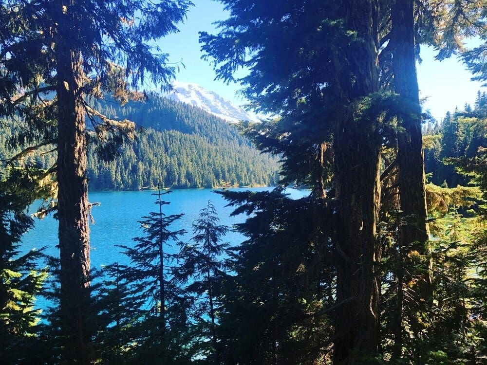
The trail joins part of the Wonderland Trail and goes along the west side of Mowich Lake through an open lowland forest. The trail then starts to gradually gaining elevation, then things get steep as the trail moves away from the lake and after about 2 miles (from trailhead) is Ipsut Pass.
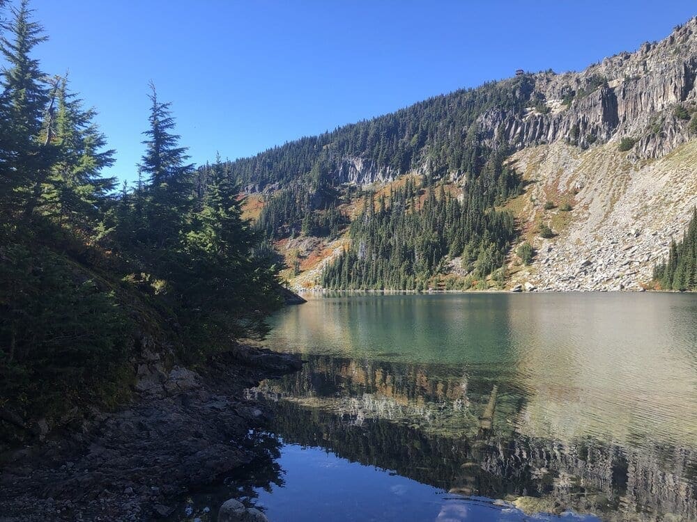
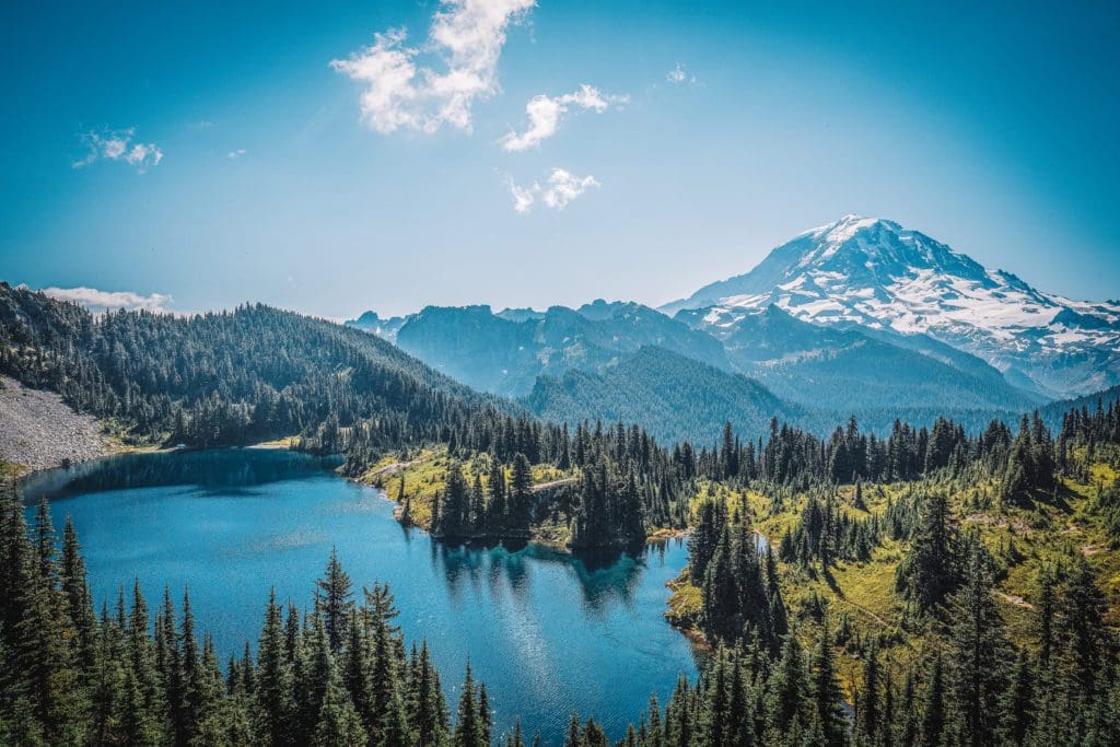
Reflections of the fall colors in Eunice Lake.
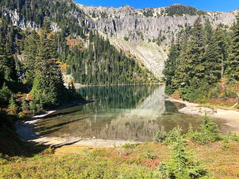
Keep left at the pass and continue another 0.8 miles to big blue Eunice Lake. Just be careful not to trample the fragile meadows around the lake.
Beautiful reflections and fall colors in Eunice Lake from the Tolmie Peak Trail.
The trail continues past Eunice Lake for the final climb up switchbacks to the Tolmie Peak Lookout, about a mile from the lake. This section of trail gets pretty steep during the climb to Tolmie Peak. The trail bends around to the north side of the peak for views of the peaks and valleys north, including the large Carbon River Valley.
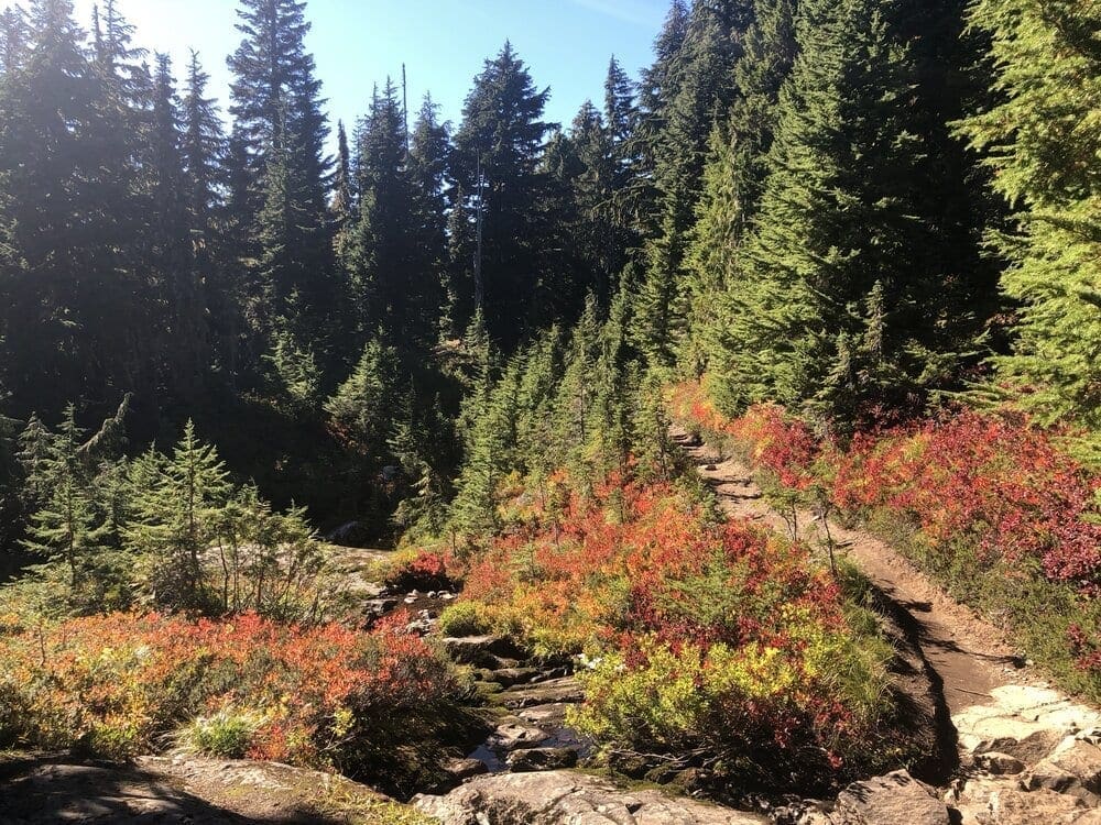
Beautiful fall colors in the foliage along the trail as it continues past Eunice Lake for the final uphill grind to the Tolmie Peak Lookout, about a mile from the lake.
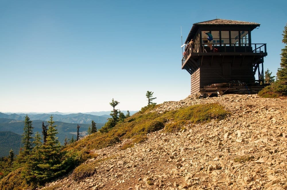
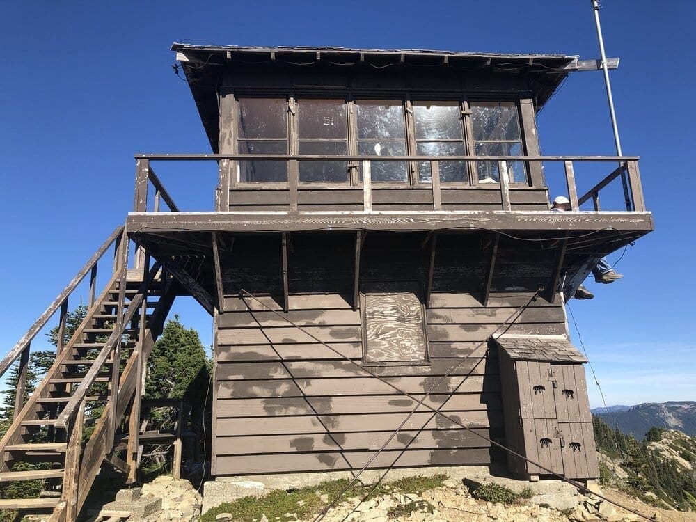
The Tolmie Peak Fire Lookout is one of four fire lookout stations built in Mount Rainier National Park by the United States National Park Service (NPS) between 1932 and 1934. The two-story structure houses a lookout station on the upper level and storage at ground level. The design was prepared under the supervision of Edwin A. Nickel of the NPS Branch of Plans and Designs.
View of the Tolmie Peak Lookout looking to the south.
The Tolmie Peak Lookout was placed on the National Register of Historic Places on March 13, 1991. It is part of the Mount Rainier National Historic Landmark District, which encompasses the entire park and which recognizes the park’s inventory of Park Service-designed rustic architecture. National Register Information System ID #91000195
The Tolmie Peak Lookout was placed on the National Register of Historic Places on March 13, 1991.
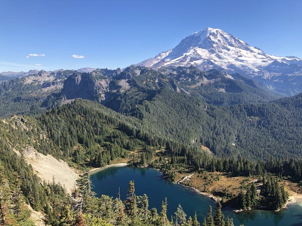
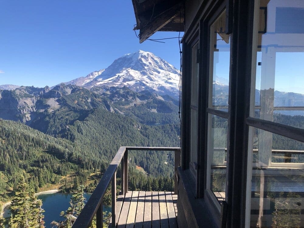
Once arriving at the Tolmie Peak Lookout, turn your attention to the large mountain visible to the south. Rainier is huge from this vantage point, and the sapphire blue Eunice Lake scintillating at the bottom of Tolmie Peak provides an awesome place for a photo.

Looking to the southeast from the Tolmie Peak Lookout, Mount Rainier is the large volcanic mountain with Eunice Lake directly below.
Tolmie Peak is a 5,920-foot (1,800 m) peak in northwestern Mount Rainier National Park, Washington. It is located 2 miles (3.2 km) northwest of Mowich Lake. The two streams that drain the slopes of Tolmie Peak, Tolmie Creek and Ranger Creek, meet up with the Carbon River, which flows into the Puyallup River and Puget Sound. Eunice Lake is just south of Tolmie Peak in a basin carved by glaciers (Beckey, 2000). Howard Peak is northwest of Tolmie Peak.
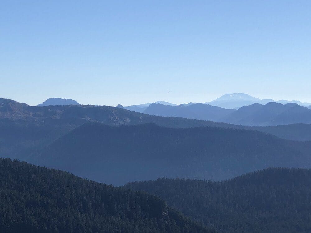
That’s Mount St. Helens and Mount Adams in the distance, looking to the south.
Tolmie Peak is named for Dr. William Fraser Tolmie (Majors, 1975), In August 1833, employed by Hudson’s Bay Company and stationed at the newly built Fort Nisqually, Dr. Tolmie made the first recorded exploration of the Mount Rainier area. Unable to summit Rainier itself, Tolmie and two Indian guides, Lachalet and Nuckalkat, summited one of the snowy peaks near the Mowich River headwaters. Although Tolmie Peak is named for this event, it is not known exactly which peak was climbed (Morgan, 1979).
View of Mount Rainier from the Fire Lookout, looking southeast.
<img src=”https://www.skyblueoverland.com/wp-content/uploads/2021/02/AdobeStock_11589002.jpg” alt=”View of the Tolmie Peak Lookout looking to the north.” />
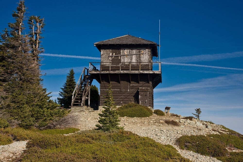
View of the Tolmie Peak Lookout looking to the north.
Tolmie Peak Trail Hoodie
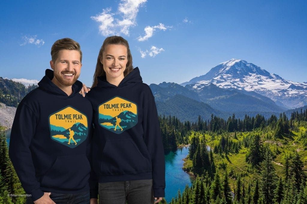
Get the hoodie that was inspired by the Tolmie Peak Trail!
Guidebooks, Maps and References
USGS Golden Lakes and Mowich Lake Quadrangle Maps
Trails Illustrated Mount Rainier National Park; Earthwalk Press Hiking Map & Guide
Washington Trails Association Hiking Guide
Edlerkin, Susan. (2018). “Best Hikes with Kids: Western Washington.” Mountaineers Books.
Harvey, David (September 30, 1982). “Pacific Northwest Regional Office Inventory: Tolmie Peak Fire Lookout“. National Park Service.
Majors, Harry M. (1975). Exploring Washington. Van Winkle Publishing Co. p. 125. ISBN 9780918664006.
“National Register Information System”. National Register of Historic Places. National Park Service. March 13, 2009.
Popular Articles:
- Adventure Guide To Mount Rainier National Park, Washington
- Top Adventure Sports Towns 2021: Seattle, Washington
- Skyblue Overland Tolmie Peak Unisex Hoodie
- How To Spend 57 Hours In Bellingham, Washington As A Mountain Biker
- 57 Hours Of Adventure In Methow Valley, Washington
- Adventure Guide to North Cascades National Park, Washington
- The Dyrt: The Best Camping Near North Cascades National Park

Skyblue Overland Strongly Recommends That You Enroll With Global Rescue Prior To Embarking On Your Next Adventure.
Purchase a Global Rescue membership for your next adventure and travel with peace of mind. Single trip, annual and family options are available.
Memberships start at $119.
Terms of Use: As with each guide published on SKYBLUEOVERLAND.com, should you choose to this route, do so at your own risk. Prior to setting out check current local weather, conditions, and land/road closures. While taking a trail, obey all public and private land use restrictions and rules, carry proper safety and navigational equipment, and of course, follow the #leavenotrace guidelines. The information found herein is simply a planning resource to be used as a point of inspiration in conjunction with your own due-diligence. In spite of the fact that this route, associated GPS track (GPX and maps), and all route guidelines were prepared under diligent research by the specified contributor and/or contributors, the accuracy of such and judgement of the author is not guaranteed. SKYBLUE OVERLAND LLC, its partners, associates, and contributors are in no way liable for personal injury, damage to personal property, or any other such situation that might happen to individuals following this route.
The photos in this blog post can be viewed and purchased on SmugMug.com in the Tolmie Peak Lookout Gallery.


