


High Point:
11,844 feet

Total Ascent:
Eastern Approach (+2,042-3190 ft. depending on trailhead), Western Approach (+3700 ft.)

Difficulty:
Difficult

Distance:
Eastern Approach (3.35-7.5 miles depending on trailhead), Western Approach (9 miles)

Route Type:
Out and Back, backpacking loop options available
The Indian Peaks Wilderness contains three main passes across the Continental Divide, and Buchanan Pass is one of them. Here we will discuss both the East and West approach, destinations near the pass, as well as worthwhile areas to camp.
Overview
Buchanan Pass is one of three main passes across the Continental Divide in the Indian Peaks Wilderness. The other two are the popular Arapaho Pass and Pawnee Pass (Rollins Pass is just outside the wilderness area to the south). Buchanan is the northernmost of these passes and sees generally less traffic. However, due to the popularity of the Pawnee-Buchanan Pass Loop and access to iconic mountains like Sawtooth, Buchanan Pass can see a decent amount of summer traffic.
This article will talk about both an East and West approach, along with details about destinations near Buchanan Pass and some areas that are worth camping in. For camping, please note that the Indian Peaks are very popular, and a reservation system is in place where you can reserve permits. A backcountry permit is mandatory for anyone who wants to spend a night or two out here unless you’re camping during the late Autumn, Winter or early Spring. Information about permits can be found in the Field Notes section.
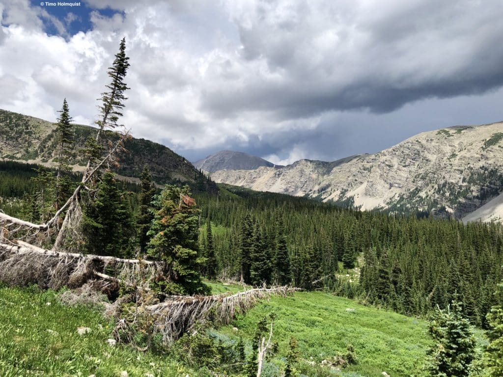
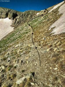
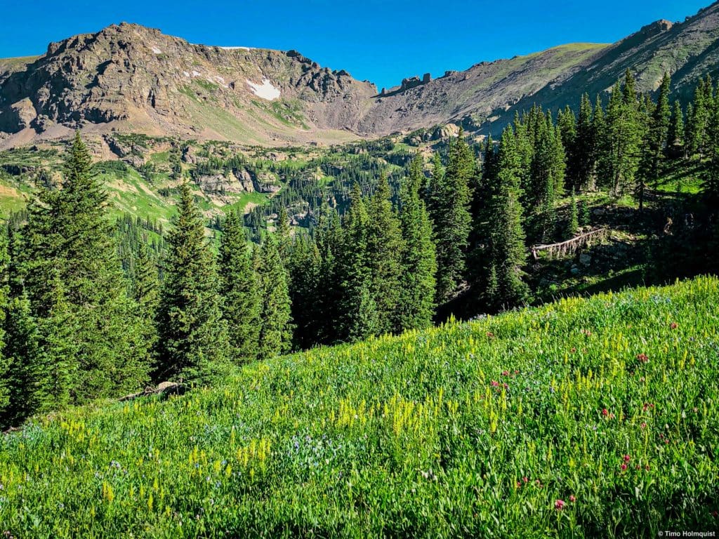
Working your way up to the pass from the Eastern side.
Table of Contents
Article Navigation: Click on any of the listed items in the table of contents below to jump to that section of the article. Similarly, clicking on any large, white section header will jump you back to the Table of Contents.
- Overview
- Scales and Criteria
- Directions to Trailhead
- Field Notes
- Journal: Eastern Approach
- Journal: Western Approach
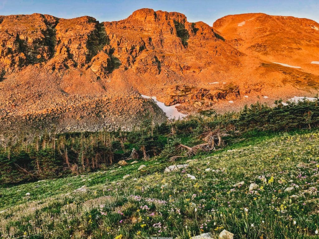
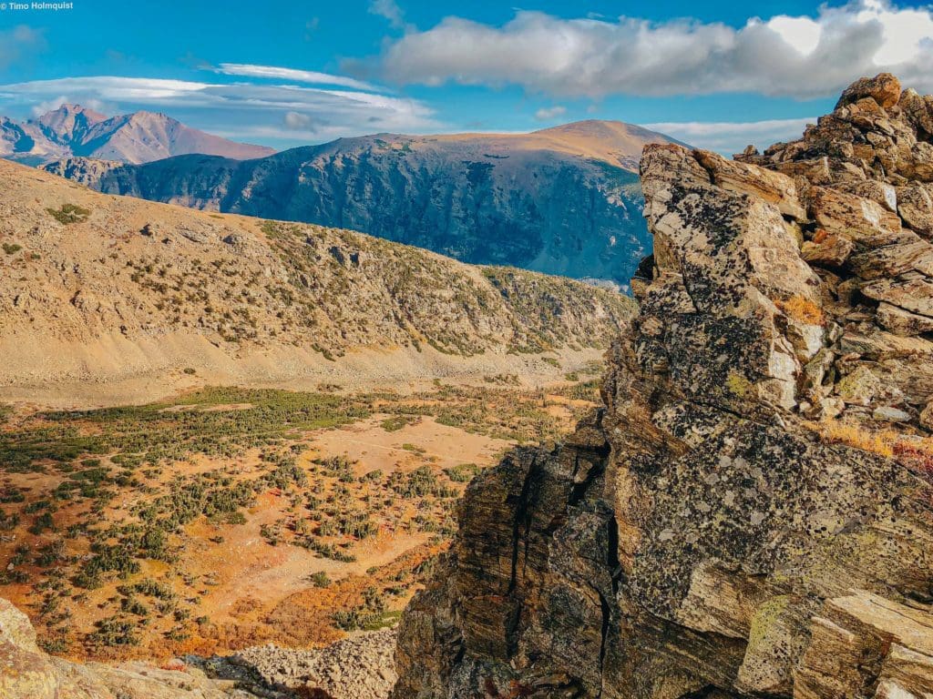
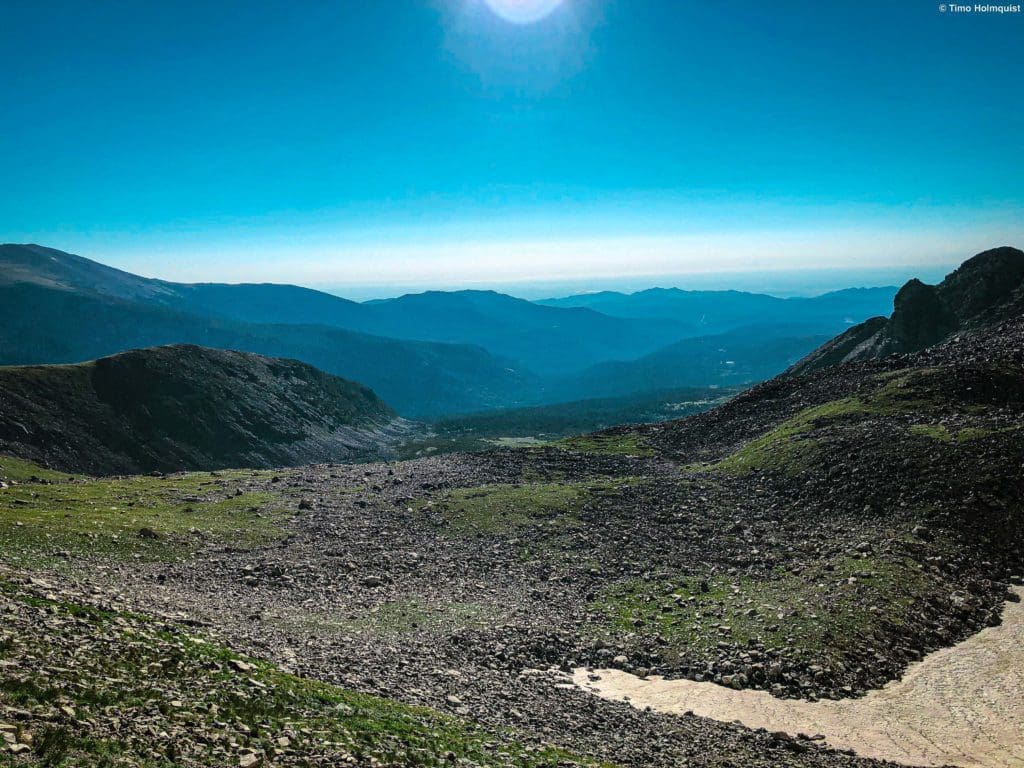
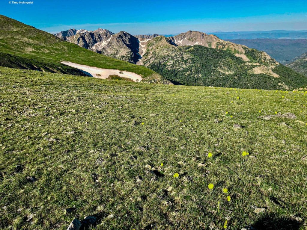
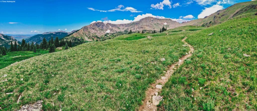
Looking southwest from near the summit of Buchanan Pass.
Support Skyblue Overland™ on Patreon!
If you’d like to support our efforts for a few dollars a month, please subscribe to our Patreon page. Every donation energizes our team to keep writing detailed trail reviews and adventure guides. Thank you!
Scales and Criteria
This article uses two metrics to calculate difficulty: overall distance and elevation gain. Buchanan Pass is trailed on both sides, so there won’t be any scrambling involved. However, the distance to the pass is substantial. From the Monarch Lake Trailhead to the pass is roughly 9 miles and +3700 ft. in elevation gain. Approaching from the East is slightly better if you have a high-clearance 4WD rig that can get you to Cony Flats (3.35 miles, +2042). For the rest of us mere mortals, the best eastern access is either via Camp Dick (7.5 miles, +3190 ft.) or via Beaver Reservoir (6.8 miles, +2748 ft.).
Please note that if you don’t have a 4WD rig, both eastern approaches will involve walking on dirt roads for the most expedient route. This can be a bit of a downer if you’re looking for a gorgeous wilderness experience. If that’s the case, eat the extra miles and take off from Monarch Lake on the western side, it’s a well-traveled and scenic approach.
Difficulty Ratings:
- Easy: less than 5 miles, less than 500 ft. of elevation gain
- Moderate: 5-10 miles, 500-2000 ft. of elevation gain
- Difficult: 5-15 miles, more than 2000 ft. of elevation gain
- Very Difficult: 10+ miles, more than 3,500 ft. of elevation gain
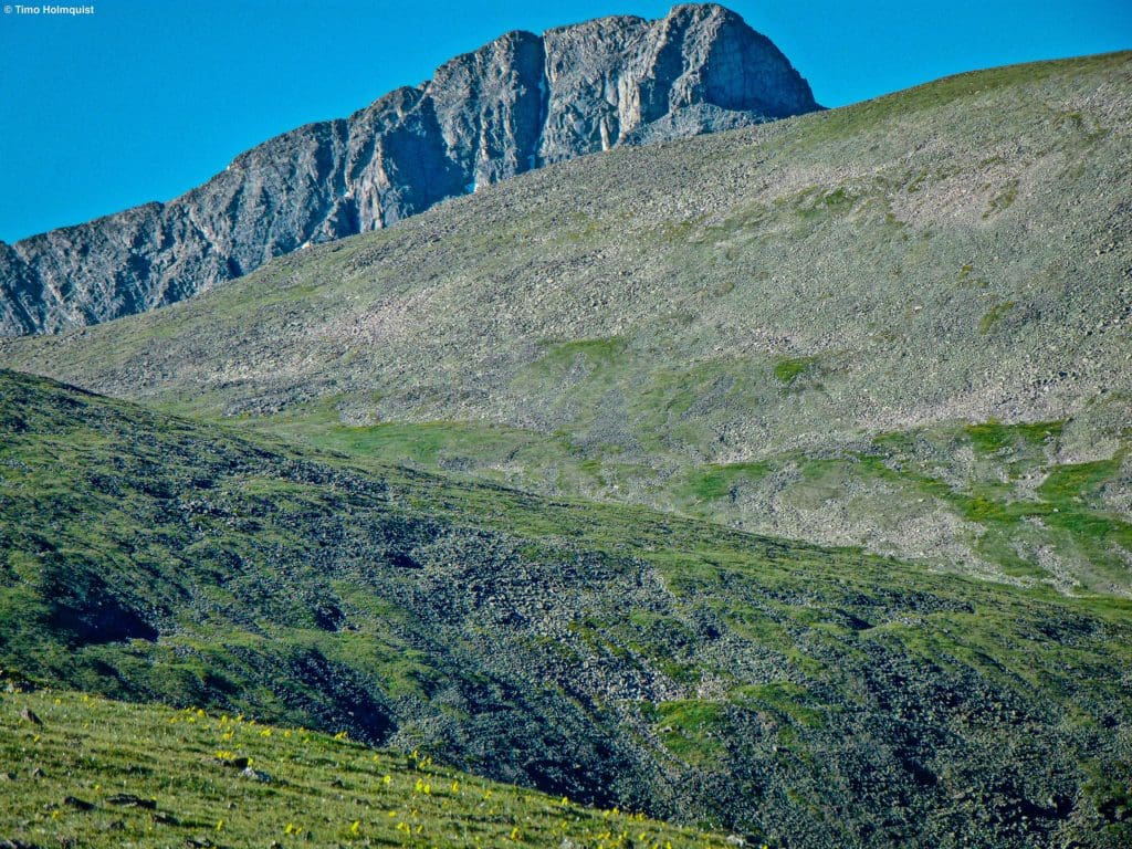
Paiute Peak seen just above the lay of the land to the south of Buchanan Pass.
Global Rescue is there whether you’re hiking, kayaking, snowmobiling, fishing or simply enjoying the outdoors and get ill or injured and you’re unable to get to safety on your own. Global Rescue is the red button you push in an emergency. Their team of medical and security experts come through for you when it matters most.
Directions to Trailhead
There are three day-hike approaches to Buchanan Pass. If you’re doing the Pawnee-Buchanan Loop, you can also approach via Brainard Recreation Area (fees and reservations apply, see Field Notes section for more information).
The Western Approach:
Parking at Monarch Lake requires a small fee, as it’s in the Arapaho National Recreation Area. You can use an interagency pass to circumvent the fee or pay 5$. Click here for more information. Take I-70 to exit 232. Exit and head toward Winter Park on US 40. The road will pass through the small town of Empire before winding up and over Berthoud Pass. Drive down the other side and pass through the towns of Winter Park, Frasier, and Tabernash. When you get to the town of Granby, take a right on US 34 to continue north toward Lake Granby. The turn-off for Monarch Lake is at the end of a quick rise and right before you get to your first views of the lake. If you start to pass the shoreline of Lake Granby, you’ve gone too far. The road you want is Colorado 6; it passes along the southern shoreline of Lake Granby and turns to dirt after a minute. You’ll pass over a few dams and the picturesque shore of Lake Granby until crossing the lake at its eastern mouth. There will be a three-way intersection, where a left will lead to more trails and Arapaho Bay Campground. Keep going straight until the road dead-ends into the Monarch Lake parking area. The approximate time from Denver is anywhere from 2 hours and 15 minutes to nearly 3 hours, depending on traffic.
Eastern Approaches:
The easiest trailhead to find on the Eastern Side is the well-signed Camp Dick. The trailhead is off of the Peak-to-Peak Highway between Peaceful Valley and Allenspark. You can get to it from the Front Range by taking US34 west up Thompson Canyon to Estes Park and turning south on the Peak-to-Peak, i.e. CO 7, and then a right onto CO 72 for a few minutes before finding the turn-off on your right. You can also approach from Boulder Canyon (CO 119) and take CO72 north, or CO 7 from Lyons and then take a left on CO72 at the top of St. Vrain Canyon. An alternate approach is to use a dirt road a bit south of Camp Dick that leads to Beaver Reservoir. There are a few places to park at Beaver Reservoir, but the lake is private, and the first 3 miles of the hike from this trailhead are on a heavily rutted 4WD road. Lifted 4WD vehicles can take the road from beaver reservoir (aka Coney Flats Road) or Middle St. Vrain Road from Camp Dick and make it all the way to Cony Flats.
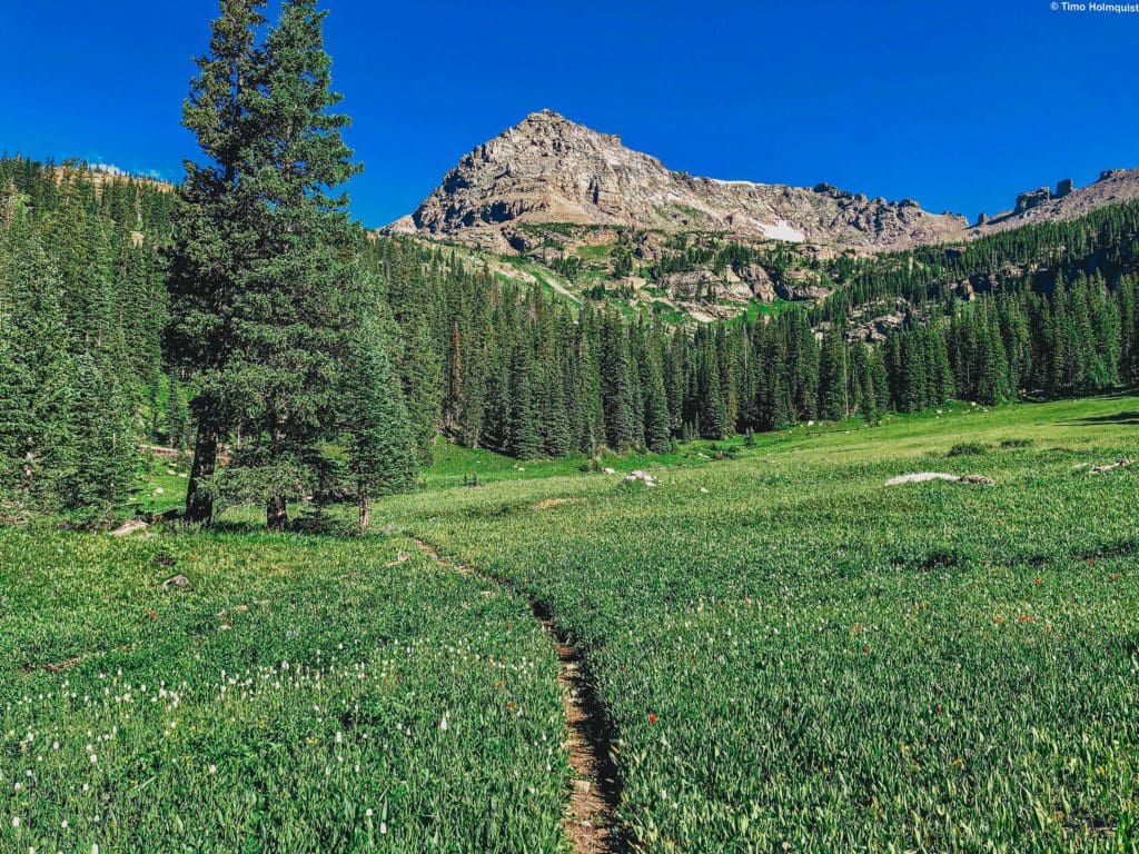
An unnamed shoulder of “Blackfoot Mountain” frames the lower part of Fox Park as you head west.
Field Notes
Weather forecasting is an important component of planning, and you should always check the weather before heading out into the mountains. Buchanan Pass isn’t in the most popular part of the Indian Peaks Wilderness, but there are still several pertinent resources you can use.
If you’re starting the hike from one of the eastern approaches, a good trailhead weather forecast would be one for Peaceful Valley. If you’re starting from the western side, a more accurate starting forecast would be from Grand Lake. Once you’ve established trailhead conditions, then move on to relevant reporting stations near your ultimate destination.
If you’re starting from Brainard Lake Recreation Area, visit this link to figure out what fees and scheduling restrictions apply for parking/overnight parking.
There are plenty of forecasts out there, but one of my favorites is through opensummit. You need an account to access all the details, but they report wind, precipitation, cloud cover, lightning chances, fire smoke and a host of other factors that may impact your hike. Their forecast for Sawtooth Mountain is a good one.
If you don’t want to spring for the paid service and don’t mind sticking with slightly less accurate but still usable free stuff, mountain-forecast has a weather reporting location for Mt. Audubon. The mountain is almost 1,400 feet higher than the pass and two basins to the south so just expect macro trends to be right (will it rain in the area) and micro trends to be more inaccurate (will there be a specific cell over Buchanan Pass, how long will it last, lightning chances etc.). Mountain weather is fickle, so even with the most accurate forecasting services, take everything with a grain of salt. If you see big storm clouds building, make sure you have an escape route out of the alpine.
While the trails coming out of Monarch lake are generally much prettier than those from the east (no road walking, good tread, mountain streams, and good tree coverage), they do take longer, and Monarch lake trailhead is subject to fees. Click here for more information. There aren’t fees on the eastern side, but unless you have a 4WD, you’ll be hiking near or on some dirt roads for a few miles.
Alpenglow on the East Ridge of Sawtooth as you approach the eastern side of Buchanan Pass.
Journal: Eastern Side
I’ll start this description from Coney Flats Trailhead, which is the closest trailhead to Buchanan Pass but is also unreachable by car if you don’t have a 4WD/AWD capable vehicle with good lift. There are multiple sections with puncture-the-undercarriage-of-your-ride sized rocks and a few creek/mud crossings that are deeper than they appear. Here’s a video of the Middle St. Vrain Road, which is the road that continues beyond Camp Dick. And here’s the companion piece from the Coney Flats Road, which takes off from Beaver Reservoir. Both roads make a loop and connect at the Coney Flats Trailhead. If you’re into off-roading, this is a fantastic and difficult route. For hikers in smaller vehicles, either hike the road from Beaver Reservoir or take the Buchanan Pass trail along Middle St. Vrain creek from Camp dick to Middle St. Vrain Trailhead and then a connector trail up to Coney Flats.
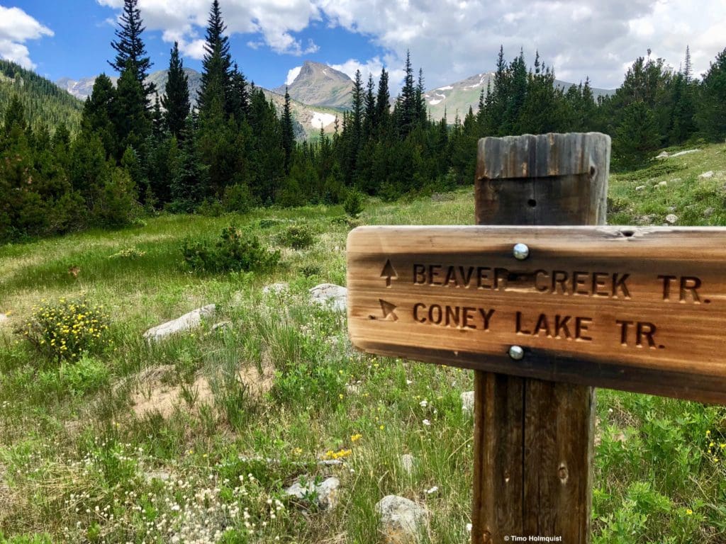
From the Coney Flats Trailhead, the directions are much easier; head west. If you’re coming up from Beaver Reservoir, walk the dirt road for a while, then take the hiker/skier cut-off, which is well-signed and shaves off half a mile. When the road opens up into the Coney Flats area, find a boardwalk to get through the water crossing (left side). After that, hunt for the trailhead sign bordering the road on your left as it begins to curve north. Follow the Beaver Creek Trail from there.
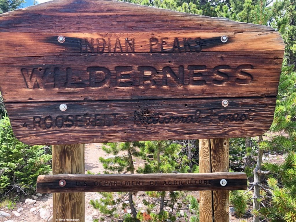
Indian Peaks Wilderness sign.
You’ll enter the Indian Peaks Wilderness shortly after leaving the trailhead, where keen eyes can also spot Sawtooth Mountain. After a few points of a mile, the trees bend back, and you reach a meadow where a trail junction appears.
Stay on Beaver Creek Trail, Sawtooth Mountain is in the background.
Beyond this meadow, the trail begins to rise modestly. You’ll pass by your second trail junction roughly 1.35 miles after the first one. A right here will take you to Red Deere Lake. For Buchanan Pass, continue on.
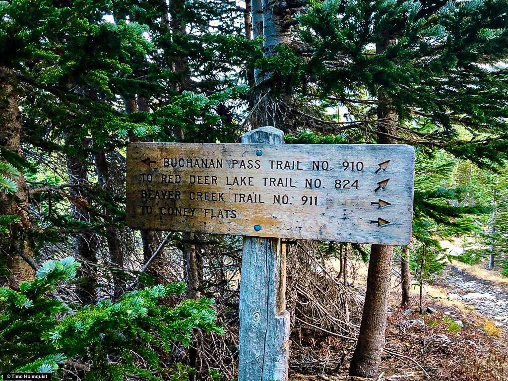
Second trail junction after Coney Flats.
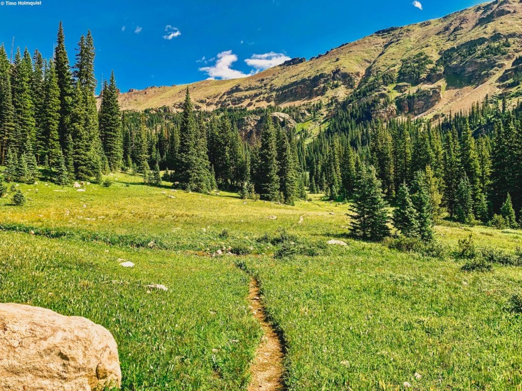
Beyond this intersection, the trail begins to head into and out of a few meadows while the tree coverage starts dwindling.
This photo is looking west northwest into the St. Vrain Glacier area from one of the mentioned meadows. The prominent ridge running across the photo forms the border between the Indian Peaks and Rocky Mountain National Park.
After some time meandering through the foliage, you pop up on a rounded hogback. To either side, the terrain sharpens dramatically, with the East Ridge of Sawtooth Mountain rising up quite obviously. For a report on that scramble, click here.
The now lower and more mountainous-looking vegetation will stick with you for a while, but you’ll be able to see the mountain landscapes shooting above it quite clearly.
Keen eyes can spot the Buchanan Pass trail below, heading left to the pass. This is taken from one of a few ridge points on the way up Sawtooth.
Sporting an agreeable gradient, the trail continues, finally shedding the last of the vegetation after it negotiates a more prominent mound of talus and grasses.
Beyond this, you enter an alpine basin, the first of two before you hit the pass.
The terrain opening up after you pass by the prominent mound.
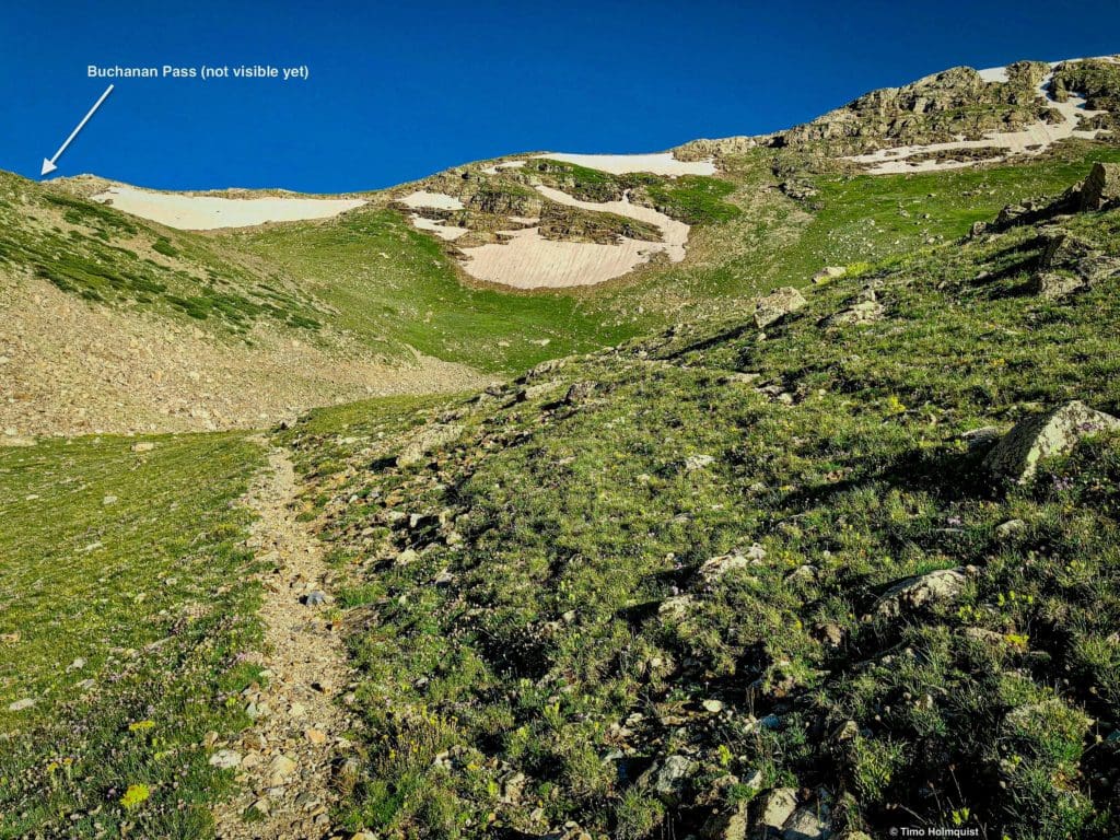
In this basin, you can see that a higher one exists above you. The old trail takes a more direct approach, cutting left and ascending a steeper slope. A newer, more sustainably built option employs a long switchback to cut down trail erosion. The old trail is blocked by a gathering of rocks; please stick with the new trail.
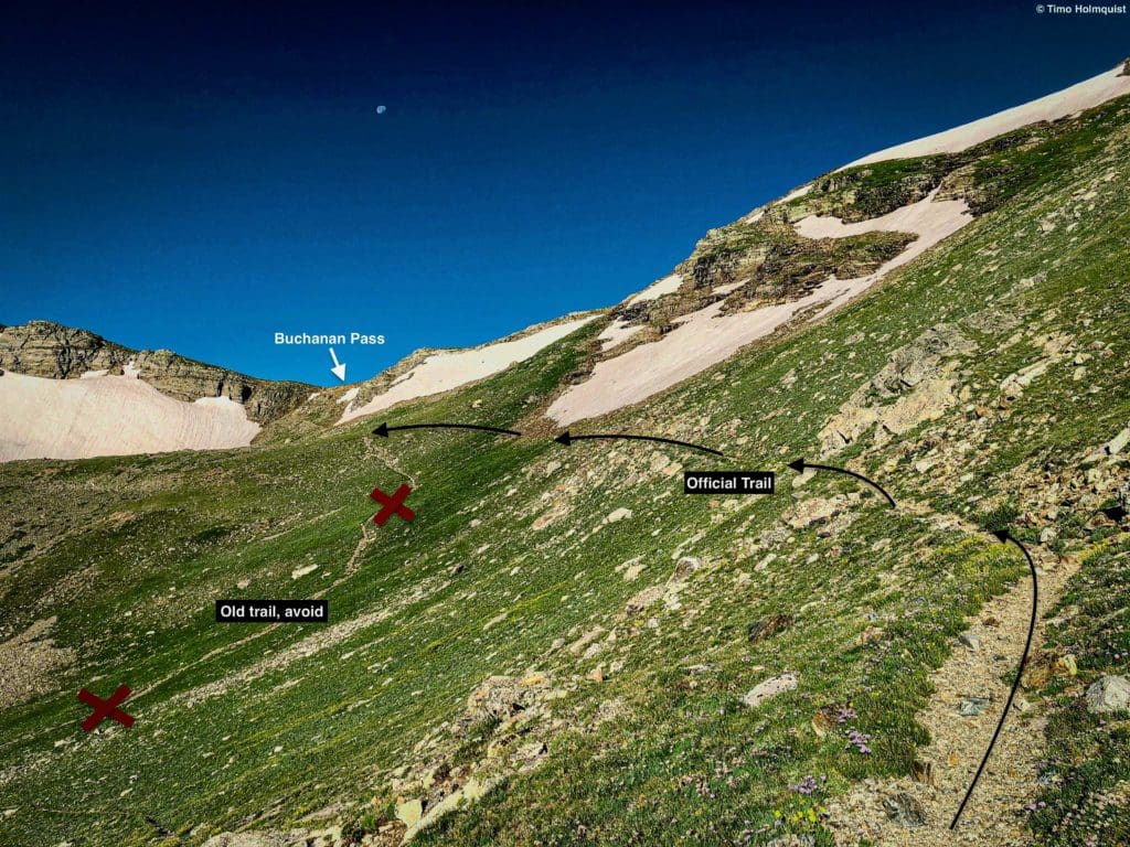
Looking up at the pass from the curve of the switchback on the new trail.
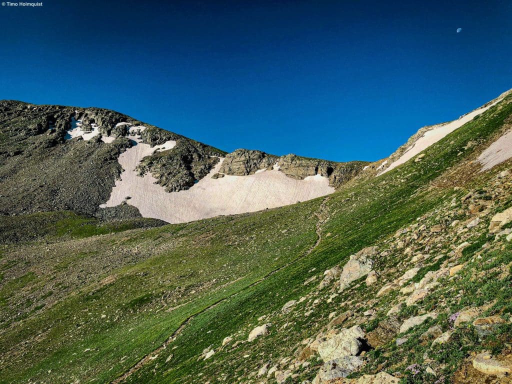
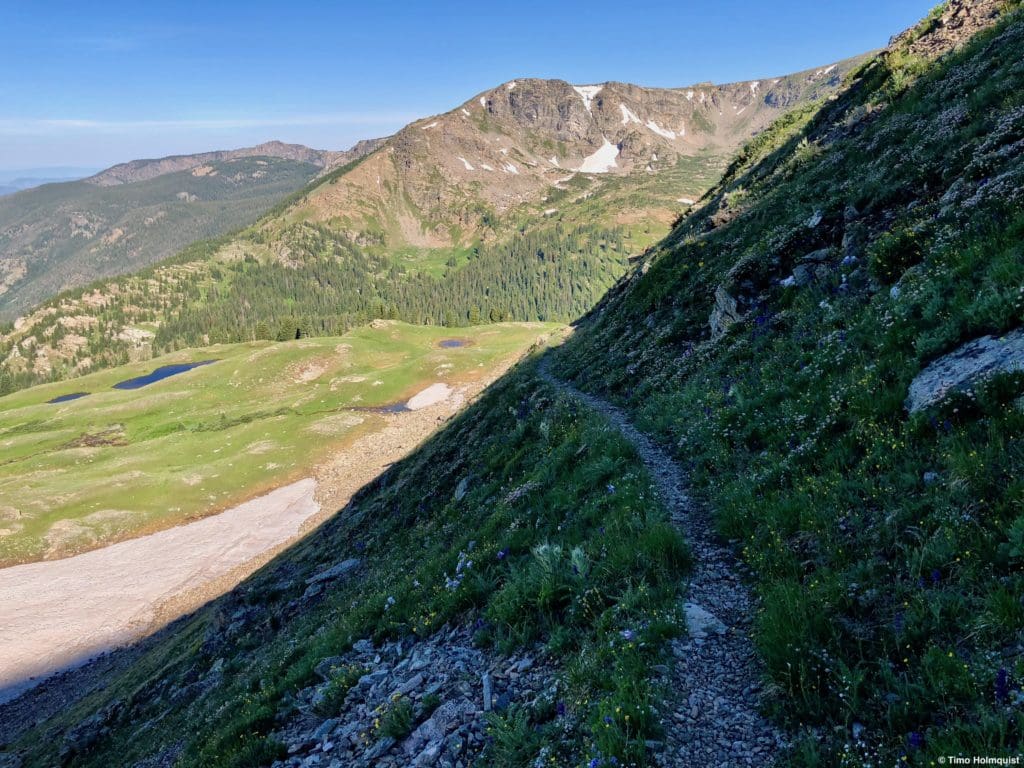
As you approach Buchanan Pass, you may notice a big snowfield to the left of the trail. To the best of my knowledge, this patch sticks around all year. The trail threads to the right of this patch. Up until mid-late June, the top of the trail could be snow-covered, especially on the eastern side. Prevailing winter winds tend to throw a bunch of snow from the west side of the pass to the east, meaning the snow melts on this side last.
The last part before reaching Buchanan Pass.
The trail has about 50 vertical feet of steeper than previously encountered gain, a slow moderation and a big cairn at the top to mark the pass.
Looking east from the top of the pass.
Armed with good weather and long-range views, you’ll be able to see all the way back to the great plains, i.e. the Front Range urban corridor.
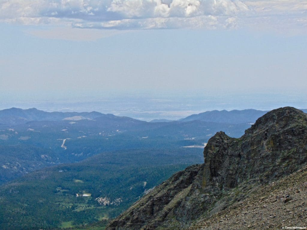
The edge of the mountains, looking east.
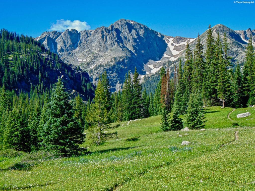
From the top of Buchanan Pass, you have a few options. You can take the divide both north and south for some peak exploration. To the south, a quick jaunt up Sawtooth makes for a fun adventure. Continuing further south to the unofficially named “Algonquin” is another great excursion.
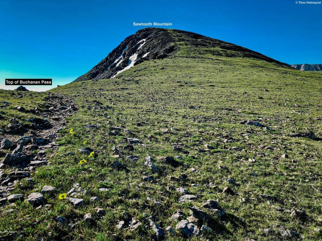
The easy ascent from Buchanan to Sawtooth makes it a logical choice.
To the north, you can tag the unofficially named summit of “Red Deere Peak” and continue on to Ogallala Peak if you have the energy. This is a longer ridge traverse that requires some scrambling.
If you want to use Buchanan Pass as a launching pad for finding campsites, the best places to do that are on the western side of the pass. You’ll lose some elevation in the process, but there’s a bench at treeline that looks delightful and a lower meadowed area called Fox Park that makes for phenomenal camping as well.
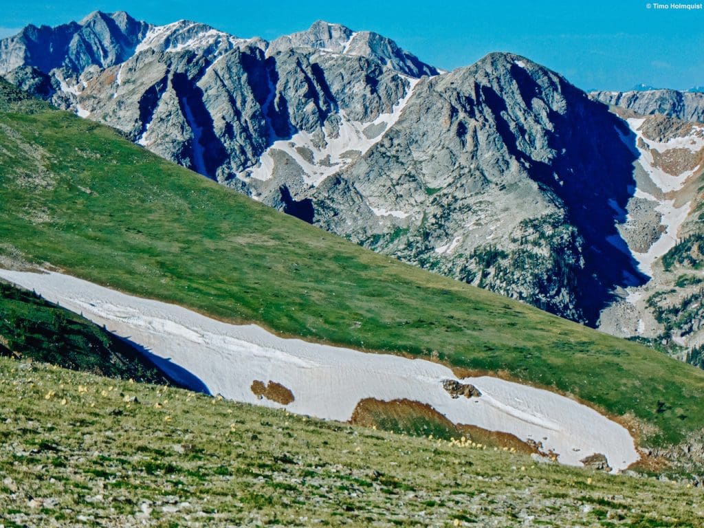
Dramatic peaks of the western Indian Peaks Wilderness.
Exit the area the same way you entered unless you’re doing a longer backpacking trip, loop or car positioning hike.
Journal: Western Side
While the eastern side benefits from quicker access (even without 4WD), the scenery is less dramatic. The western approach makes use of a popular and well-maintained trail system that, while longer, will give you more of the quintessential Colorado wilderness feeling. Making a two-day trek to Fox Park or Buchanan Pass and returning is a great way to experience a large chunk of the Western IPW, you can also combine a camp night at Gourd Lake or peel off to the perma-popular Crater Lake area (overnight reservations required for all areas of the IPW, click here for more info).
At the Monarch Lake Trailhead, pick up the well-used trail system and hike up Buchanan Creek Trail as it rounds the north shore of the lake. On the other side, you’ll pass a trail junction. Follow signs for Gourd Lake and Crater Lake.
First big trail junction.
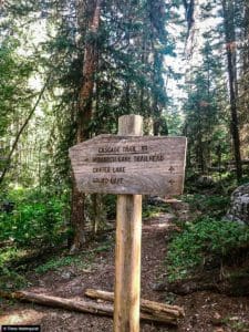
The next section of the trail features a few rises in elevation followed by longer stretches of fairly flat travel. The tree cover is fairly cohesive, and you get many views down to Buchanan Creek as it thunders west. Once you’ve hiked a total of about 3.2 miles, another trial junction will appear. Stay on the Buchanan Creek Trail, as opposed to Cascade Creek, which will get you into the Crater Lake/Pawnee Pass area. For information on that area, visit our Crater Lake article.
Second junction.
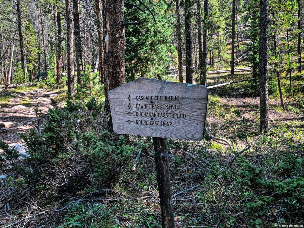
You’ll continue west along Buchanan Creek as you gain more elevation. The tree cover is still relatively good, although you will pass through some open sections, so make sure sunscreen is handy. Enjoy the comfort of this lightly trafficked part of the trail until running into your third trail junction. This one is quite small and only features one tiny sign indicating the way to Gourd Lake. If you want to know about that area, visit our article on Gourd Lake.
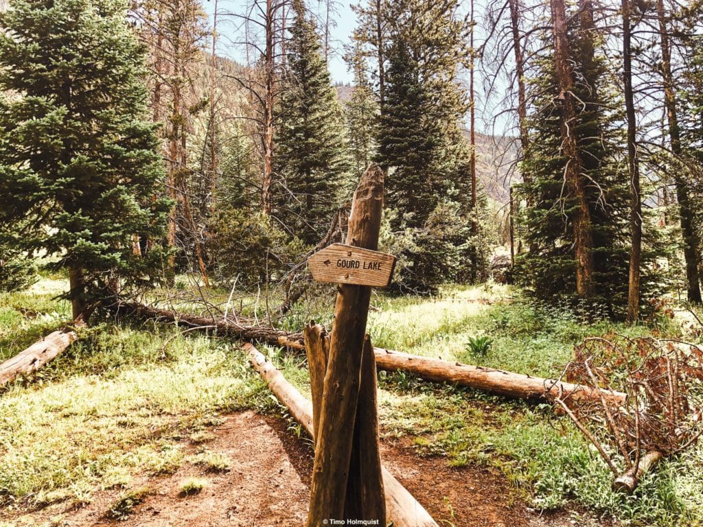
Third junction.
Keep in mind the distances. Though my description is brief, it’s nearly 5.5 miles from Monarch Lake Trailhead to the junction with Gourd Lake. Right after passing this junction, you’ll enter another meadow, this one created by an old avalanche. After re-entering the forest on the other side, there will be a brief section of flatter trail and greater tree coverage. This section ends when the trail draws close to the creek and crosses it. There is no bridge here, so note that early summer travel may feature some wading.
The first crossing ~mid-July.
Following the crossing, the trail will gain a significant bit of elevation as a steep and rocky canyon takes shape to your left. Buchanan Stream passes through the canyon, and the trail attacks the most agreeable slopes to get above it.
Once you clear the canyon after ~0.57 of a mile and ~530 ft. of elevation gain, you’ll have to cross Buchannan Creek again.
The second crossing.
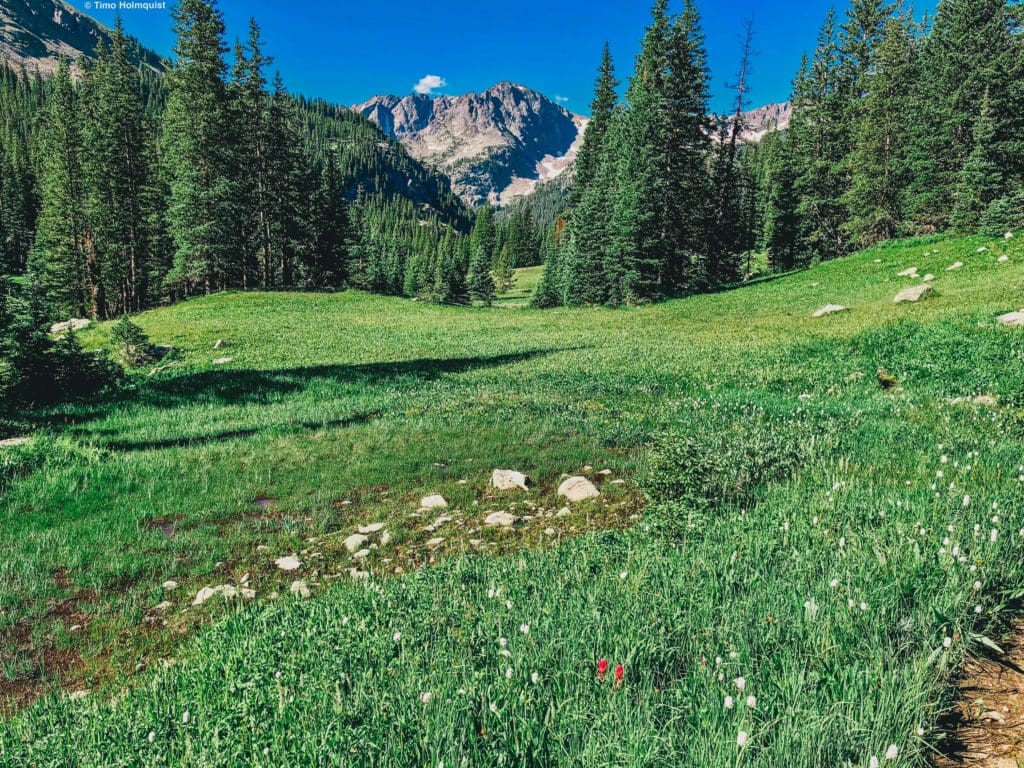
After this crossing, you enter the idyllic Fox Park.
First stretch of Fox Park.
This high elevation grassy meadowed area is ripe with campsites, great access to water and beautiful scenery.
Fox Park, looking northeast.
If camping is your goal, take some time to explore the area, there’s a lot to take in.
Looking back to the southwest.
Due to its location right off of the main trail, in July/August, campsites may be taken throughout the park. If that’s the case and you don’t mind trundling up some more elevation, continue taking the trail beyond Fox Park.
Once the trail leaves the park, it’ll side wind up a treed slope where you’ll gain some elevation quickly. After roughly 0.6 miles and ~600 ft. of gain, you should pop out of the trees on a lovely bench. The alpine vegetation is thick and healthy here. There are also great camp spots right before the tree line ends.

Camping exists along the diagonal line of trees. Anything too much higher, and you won’t have the protection of the trees.
If you find a spot here and drop off your heavy gear or just want to muscle up to the pass, continue on the trail as it threads along this lovely alpine bench.
Open, sweeping and very stereotypically alpine. A really lovely place to be.
The trail eventually attacks a slope above this alpine bench and begins a long switchback series up the steepest parts.
Gaining elevation above the alpine bench.
The steepness will moderate somewhat after nearly 400 feet of vertical rise, but you still have a little bit to go before reaching the top of the pass. It’s fun to touch the big cairn at the top as a marker. Aesthetically though, the western side of the pass is the prettiest. If you’re camping in the area, enjoy the wide sweep of the alpine bowls and have fun exploring the area. If this is a day hike, Buchanan Pass is the highest point, turn around and head down.
How you view Buchanan Pass is entirely up to the scope of your adventures. If it’s a day hike, it’s an important marker on the Continental Divide. If it’s a potential camp area, the best sites are on the west side between the unnamed alpine bench and Fox park. If Buchanan Pass is just part of a larger backcountry loop with destinations like Gourd Lake or Crater Lake, it may not be the prettiest part of the adventure, but its understated sweep and bonanza of alpine flowers in June/July make it a worthwhile destination.
Skyblue Overland Strongly Recommends That You Enroll With Global Rescue Prior To Embarking On Your Next Adventure.
With more people outside now more than ever, Global Rescue expanded services to include field rescue within 100 miles of home. With Local Field Rescue — automatically included in any travel protection services membership — Global Rescue is there whether you’re hiking, kayaking, snowmobiling, fishing or simply enjoying the outdoors and get ill or injured and you’re unable to get to safety on your own. Purchase a Global Rescue membership for your next adventure and travel with peace of mind. Single trip, annual and family options are available.


